Download as PDF, PPTX

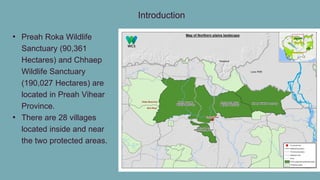
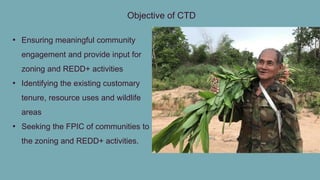
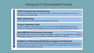
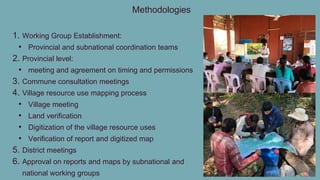
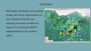

The document summarizes the customary tenure documentation and zoning practices for the Preah Roka Wildlife Sanctuary and Chhaep Wildlife Sanctuary in Cambodia. The objectives of the customary tenure documentation were to ensure community engagement and input for zoning and REDD+ activities, and to identify existing customary land tenure and resource uses. The methodology involved establishing working groups, holding provincial, commune, and village meetings to map resource uses, and obtaining approvals from working groups. The conclusion states that meaningful participation and collaboration with stakeholders is important for resource mapping, zoning, and REDD+ implementation in the region.


