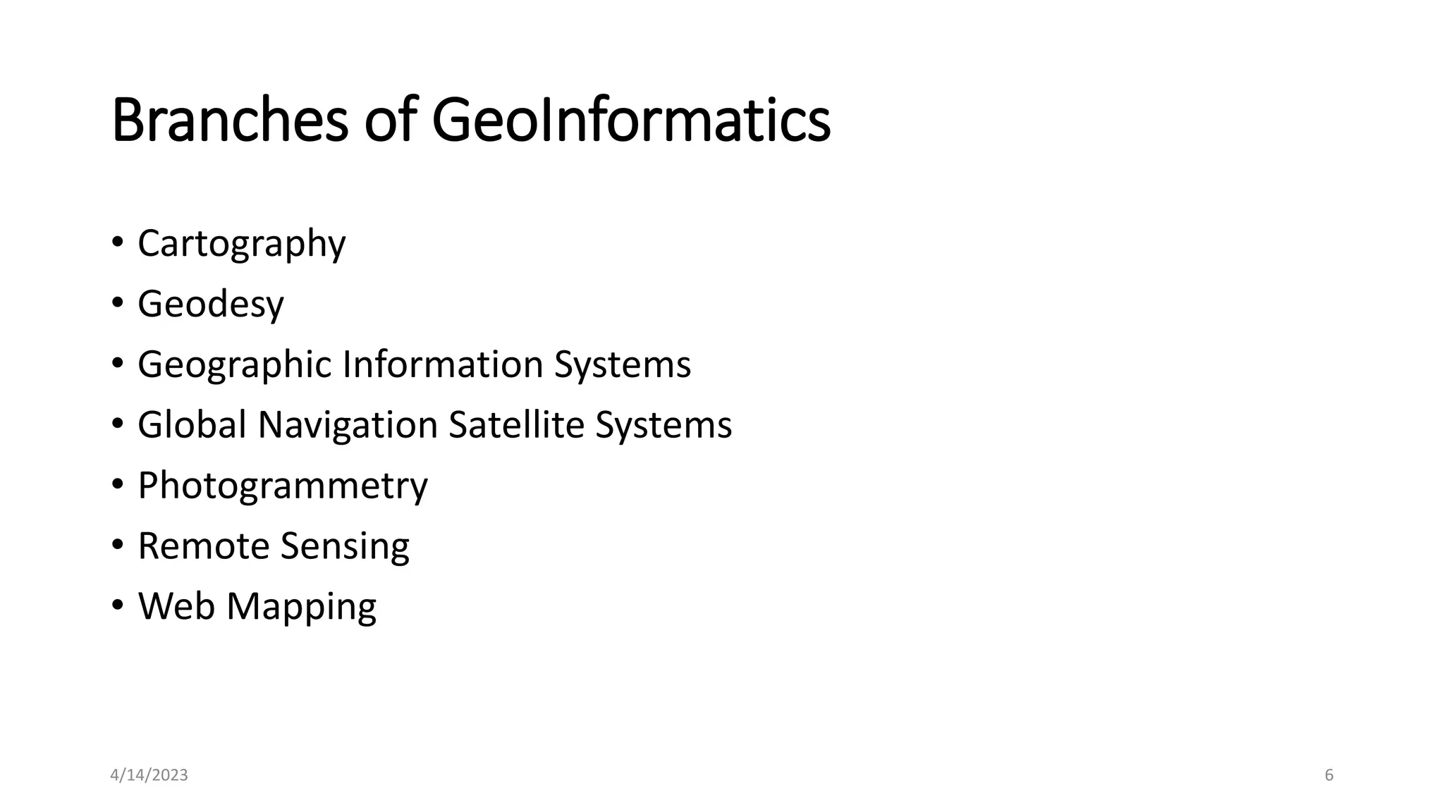
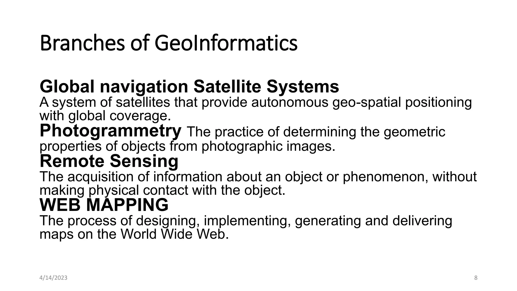
GeoInformatics
CE 421
4/14/2023 1
Geoinformatics
• Geoinformatics is the science and technology dealing with the
structure and character of spatial information, its capture, its
classification and qualification, its storage, processing, portrayal and
dissemination, including the infrastructure necessary to secure
optimal use of this information.
4/14/2023 2
• In simpler terms, it deals with the tools and technology used to
acquire, analyse and visualise our planet and its resources from space
– like the geographic location of Earth's boundaries, oceans, natural
features, man made structures, etc.
• This geospatial information (along with geographic information
systems) is used to tackle varied problems of geography, geosciences
and related branches of engineering.
• It includes remote sensing of images, mapping, modelling,
development of geospatial databases, information systems design,
and uses geocomputation and geo visualisation for analysing the
geoinformation.
4/14/2023 3
• The derived results are disseminated in user friendly formats that are
regularly updated.
• Geoinformatics is an interdisciplinary field with wide-ranging
applications in almost all walks of life.
• It is most useful for government planning like urban and rural
planning, land use management, agriculture, forestry, public health,
natural resource management, infrastructure development and even
the defence sector. For transport, it proves nifty for in-car navigation
systems, automatic vehicle location systems, aviation, maritime
transport and traffic network planning and management.
4/14/2023 4
• Meteorology, oceanography, criminology and crime simulation also
benefit from geoinformatics. It holds great promise in climate change
studies, environmental modelling and analysis, disaster management
and preparedness and telecommunications. Business location
planning, architecture and archaeological reconstruction are also
hugely improved by the use of geoinformatics. Geography and Earth
Sciences rely on geoinformatic data as well.
4/14/2023 5
Branches of GeoInformatics
• Cartography
• Geodesy
• Geographic Information Systems
• Global Navigation Satellite Systems
• Photogrammetry
• Remote Sensing
• Web Mapping
4/14/2023 6
Branches of GeoInformatics
Cartography
Study and Practice of making maps
Geodesy
The scientific discipline that deals with the measurement and
representation of the Earth.
Geographic Information Systems
A system that captures, stores, analyzes, manages and presents
data with reference to geographic location data
4/14/2023 7
Branches of GeoInformatics
Global navigation Satellite Systems
A system of satellites that provide autonomous geo-spatial positioning
with global coverage.
Photogrammetry The practice of determining the geometric
properties of objects from photographic images.
Remote Sensing
The acquisition of information about an object or phenomenon, without
making physical contact with the object.
WEB MAPPING
The process of designing, implementing, generating and delivering
maps on the World Wide Web.
4/14/2023 8
ArcGIS
• It is a suite consisting of a group of Geographic Information Systems
(GIS) software products produced by ESRI (Environmental Systems
Research Institute)
• ESRI (Environmental Systems Research Institute)
• It is a software development and services company providing
Geographic Information System (GIS) software and Geo-database
management applications. The headquarters of ESRI is in Redlands,
California. ESRI uses the name ArcGIS to refer to its suite of GIS
software products, which operate on desktop, server, and mobile
platforms.
4/14/2023 9
ArcGIS
• ArcGIS
• ArcGIS includes the following Windows desktop software:
• Arc Reader
• ArcGIS Desktop
• ArcView
• Arc Editor
• Arc Info
4/14/2023 10
ArcGIS
Arc Reader
It is software providing some basic tools for
•Map viewing
•Printing
•Querying of spatial data
ArcView
It is software providing some basic tools for
•Map viewing
•Printing
•Querying
•Editing of spatial data
Arc Editor & Arc Info
•Arc Editor is used for mid-level editingArc Info is for high-level editing
• of spatial data
4/14/2023 11

0aba6a_L1 GIS (1).pptx

  • 1.
  • 2.
    Geoinformatics • Geoinformatics isthe science and technology dealing with the structure and character of spatial information, its capture, its classification and qualification, its storage, processing, portrayal and dissemination, including the infrastructure necessary to secure optimal use of this information. 4/14/2023 2
  • 3.
    • In simplerterms, it deals with the tools and technology used to acquire, analyse and visualise our planet and its resources from space – like the geographic location of Earth's boundaries, oceans, natural features, man made structures, etc. • This geospatial information (along with geographic information systems) is used to tackle varied problems of geography, geosciences and related branches of engineering. • It includes remote sensing of images, mapping, modelling, development of geospatial databases, information systems design, and uses geocomputation and geo visualisation for analysing the geoinformation. 4/14/2023 3
  • 4.
    • The derivedresults are disseminated in user friendly formats that are regularly updated. • Geoinformatics is an interdisciplinary field with wide-ranging applications in almost all walks of life. • It is most useful for government planning like urban and rural planning, land use management, agriculture, forestry, public health, natural resource management, infrastructure development and even the defence sector. For transport, it proves nifty for in-car navigation systems, automatic vehicle location systems, aviation, maritime transport and traffic network planning and management. 4/14/2023 4
  • 5.
    • Meteorology, oceanography,criminology and crime simulation also benefit from geoinformatics. It holds great promise in climate change studies, environmental modelling and analysis, disaster management and preparedness and telecommunications. Business location planning, architecture and archaeological reconstruction are also hugely improved by the use of geoinformatics. Geography and Earth Sciences rely on geoinformatic data as well. 4/14/2023 5
  • 6.
    Branches of GeoInformatics •Cartography • Geodesy • Geographic Information Systems • Global Navigation Satellite Systems • Photogrammetry • Remote Sensing • Web Mapping 4/14/2023 6
  • 7.
    Branches of GeoInformatics Cartography Studyand Practice of making maps Geodesy The scientific discipline that deals with the measurement and representation of the Earth. Geographic Information Systems A system that captures, stores, analyzes, manages and presents data with reference to geographic location data 4/14/2023 7
  • 8.
    Branches of GeoInformatics Globalnavigation Satellite Systems A system of satellites that provide autonomous geo-spatial positioning with global coverage. Photogrammetry The practice of determining the geometric properties of objects from photographic images. Remote Sensing The acquisition of information about an object or phenomenon, without making physical contact with the object. WEB MAPPING The process of designing, implementing, generating and delivering maps on the World Wide Web. 4/14/2023 8
  • 9.
    ArcGIS • It isa suite consisting of a group of Geographic Information Systems (GIS) software products produced by ESRI (Environmental Systems Research Institute) • ESRI (Environmental Systems Research Institute) • It is a software development and services company providing Geographic Information System (GIS) software and Geo-database management applications. The headquarters of ESRI is in Redlands, California. ESRI uses the name ArcGIS to refer to its suite of GIS software products, which operate on desktop, server, and mobile platforms. 4/14/2023 9
  • 10.
    ArcGIS • ArcGIS • ArcGISincludes the following Windows desktop software: • Arc Reader • ArcGIS Desktop • ArcView • Arc Editor • Arc Info 4/14/2023 10
  • 11.
    ArcGIS Arc Reader It issoftware providing some basic tools for •Map viewing •Printing •Querying of spatial data ArcView It is software providing some basic tools for •Map viewing •Printing •Querying •Editing of spatial data Arc Editor & Arc Info •Arc Editor is used for mid-level editingArc Info is for high-level editing • of spatial data 4/14/2023 11