Catchment-based Flood Risk Assessment & Management, CFRAM, programme. John Martin, Office of Public Works.
•
0 likes•134 views

This presentation will cover the extensive application of hydraulic modelling on the national Catchment-based Flood Risk Assessment & Management (CFRAM) programme, as well as discussing the likely future modelling requirements for the detailed development of over 100 flood relief schemes programmed over the coming decade. Presented at the DHI Ireland Symposium 2018.

Recommended
Recommended
More Related Content
What's hot
What's hot (20)
Similar to Catchment-based Flood Risk Assessment & Management, CFRAM, programme. John Martin, Office of Public Works.
Similar to Catchment-based Flood Risk Assessment & Management, CFRAM, programme. John Martin, Office of Public Works. (20)
More from Stephen Flood
More from Stephen Flood (20)
Recently uploaded
Recently uploaded (20)
Catchment-based Flood Risk Assessment & Management, CFRAM, programme. John Martin, Office of Public Works.
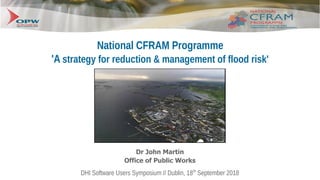
- 1. DHI Software Users Symposium // Dublin, 18th September 2018 National CFRAM Programme 'A strategy for reduction & management of flood risk' Dr John Martin Office of Public Works
- 2. DHI Software Users Symposium // Dublin, 18th September 2018 1. Introduction 'The application of hydraulic modelling on the national CFRAM programme, and the future modelling requirements for detailed development of flood relief schemes programmed over the coming decade.'
- 3. DHI Software Users Symposium // Dublin, 18th September 2018 2. Ireland's Flood Risk Management Strategy ● Catchment-based flood risk assessment & management (CFRAM) programme ● Aligned with the EU 'Floods' Directive (2007/60/EC) and the 'Report of the Flood Policy Review Group' (IE, 2004) ● Systematic sequence of: – 'Preliminary Flood Risk Assessment' [to identify potential flood risk areas] – Developing Flood Hazard & Risk Maps [for those areas] – Preparing Flood Risk Management Plans – Implementation & Review
- 4. DHI Software Users Symposium // Dublin, 18th September 2018 3. National Preliminary Flood Risk Assessment ● Digital Height Model [5m, IfSAR] ● Indicative Flood Region Mapping ● Risk Assessment based on Communities [GeoDirectory] ● Flood Event Archive + Consultation ● = Designation of 300 x 'Areas for Further Assessment'
- 5. DHI Software Users Symposium // Dublin, 18th September 2018
- 6. DHI Software Users Symposium // Dublin, 18th September 2018 3. National Preliminary Flood Risk Assessment ● 300 Communities studied, including ● 90 Coastal communities; ● 80% of the primary flood risk assessed; ● 3 Million people in communities studied; ● 25% with population less than 500 people.
- 7. DHI Software Users Symposium // Dublin, 18th September 2018 4. River, Coastal & Floodplain Geometry ● For all AFA's: – 10,000km2 Digital Surface Modelling [2m LiDAR + filtering] – 7,000km Channel & Structure Cross Section Surveys [GPS based terrestrial surveying at c.50m] Paul Corrigan Associates
- 8. DHI Software Users Symposium // Dublin, 18th September 2018 5. Flow Estimation ● Extensive Hydrometric Network ● Hydrological Flow Estimations – 'Flood Studies Update' (FSU) Web-portal ● 8x Annual Exceedence Probabilities
- 9. DHI Software Users Symposium // Dublin, 18th September 2018
- 10. DHI Software Users Symposium // Dublin, 18th September 2018
- 11. DHI Software Users Symposium // Dublin, 18th September 2018 5. Extreme Sea Level Prediction - ICPSS Outputs ● Combined tide/storm surge extreme WL predictions for Irish Coast using Mike 21 f/m model (published 2013) ● Predictions for following AEP events (referenced to Ordnance Datum, Malin OSGM02): 0.1%, 0.5%, 1%, 2%, 5%, 10%, 20% & 50% ● Currently being updated under Irish Coastal Wave & Water Level Study (ICWWS-2018, OPW)
- 12. DHI Software Users Symposium // Dublin, 18th September 2018 5. Extreme Sea Level Prediction - ICPSS Outputs Development of Surge Prediction Model (WP5) ➢ ICPSS has developed storm surge prediction models and capability for the Coast of Ireland ➢ One such model is the Irish Sea Tidal Surge Model, a Mike 21 flexible mesh model (domain shown) Development of Coastal Flood Forecasting System (WP6) ➢ OPW, in conjunction with RPS Consulting Engineers and Met Éireann, has developed a storm surge forecasting system for the Coast of Ireland that is now used operationally.
- 13. DHI Software Users Symposium // Dublin, 18th September 2018 ● Hydraulic Flow Modelling – Mike11/21/NAM (Mike Flood) ISIS/Tuflow (FloodModellerPro), Infoworks ICM ● Risk & Damage Assessment Tool – NPV Damages ● Detailed Flood Mapping (Consultation) 6. Flood Modelling & Mapping
- 14. DHI Software Users Symposium // Dublin, 18th September 2018 6. Flood Modelling & Mapping ● Hydraulic Flow Modelling – Mike11/21/NAM (Mike Flood) ISIS/Tuflow (FloodModellerPro), Infoworks ICM ● 6,700 km of river channel; ● 9,400 sq.km of floodplain survey/3D models ● 90 Coastal Communities
- 15. DHI Software Users Symposium // Dublin, 18th September 2018
- 16. DHI Software Users Symposium // Dublin, 18th September 2018
- 17. DHI Software Users Symposium // Dublin, 18th September 2018
- 18. DHI Software Users Symposium // Dublin, 18th September 2018
- 19. DHI Software Users Symposium // Dublin, 18th September 2018
- 20. DHI Software Users Symposium // Dublin, 18th September 2018 7. Development of Flood Risk Management Measures ● Development of FRM Measures (Scenario & option testing and modelling) ● Multi-criteria Assessment of Options ● Flood Risk Management Plans Clonmel Flood Relief Scheme, OPW
- 21. DHI Software Users Symposium // Dublin, 18th September 2018 7. Development of Flood Risk Management Measures
- 22. DHI Software Users Symposium // Dublin, 18th September 2018 8. Consultation ● 'Crowd-sourced' Historic Flood Event Database ● Web-based FRMP & Flood Maps Tool ● Floodinfo.ie
- 23. DHI Software Users Symposium // Dublin, 18th September 2018 9. Upcoming Flood Relief Schemes 50 of 118 Schemes Now Progressing to Detailed Design: 5 schemes above €15m • 14 of the 82 schemes between €1m to €15m • 31 schemes each less than €1m
- 24. DHI Software Users Symposium // Dublin, 18th September 2018 9. Upcoming Flood Relief Schemes • OPW & Local Authorities engaging pro-actively on arrangements / structures to be put in place to advance the project-level development and assessment of Flood Relief Schemes, including environmental assessment as necessary, and further public consultation, for refinement and preparation for planning / exhibition and, if and as appropriate, implementation.
- 25. DHI Software Users Symposium // Dublin, 18th September 2018 9. Upcoming Flood Relief Schemes
- 26. DHI Software Users Symposium // Dublin, 18th September 2018 10. Next Cycle of Floods Directive... ● Rural and dispersed risk e.g. for individual homes, farm properties, agricultural risk and access roads to properties; ● Potential impacts of climate change and other future developments; ● Assets critical to normal societal function that may be at risk from flood events; ● Measures with benefits for both WFD and flood risk management objectives, e.g. natural water retention measures.
- 27. DHI Software Users Symposium // Dublin, 18th September 2018 FloodInfo.ie