SlideShare a Scribd company logo
1 of 22
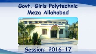
Govt. Girls Polytechnic
Meza Allahabad
Session: 2016-17
Submitted To:-
Er. Rajesh Chandra (HOD of CSE)
Er. Neelam Shrivastava (HOD of PGDCA)
Er. Yashpal Singh (Lect. Of CSE)
Submitted By:-
Shivani Singh Chauhan
Computer Science & Engg.
(Final Year)
Seminar Presentation on
GPS (Global Positioning System)
What is GPS
Architecture of GPS
How does GPS works
GPS Satellite Geometry
Sources of GPS Errors
Other Satellite Navigation
System
Applications
Conclusion
Reference
What is GPS:
 It is a satellite-based navigation system.
 Made up of a network of 24 satellites circulating around
earth orbit by the U.S. department of defense (USDOD).
 The first satellite was developed in 1960 to allow ships in the
U.S. Navy to navigate the oceans more accurately.
 GPS was originally intended for military applications, but in
the 1980, the government made the system available for
civilian use.
 GPS permits land, sea, and airborne user to determine their
three-dimensional position, velocity and time.
Architecture of GPS:
To run all the system of GPS technology properly, highly advance architecture
of GPS has been developed that includes three major segments called the space
segment, control segment and a user segment.
Three Segments of GPS-
 Minimum of 24 satellites
(currently 32) in orbit around
earth at altitude 20,000 km.
 It transmit radio-navigation
signals, and store and
retransmit the navigation
message sent by the control
segment.
a) Space Segment
 combination of a master
control station, four dedicated
ground antennas and six
dedicated monitor stations.
 responsible for the proper
functioning of all the
operation of GPS such as
changing unhealthy satellite
with a healthy one.
b) Control Segment
c) User Segment
 Comprises of thousand of
U.S. and military users who
uses the secure GPS precise
Positioning service, and
millions of civil, commercial
and scientific users .
How does GPS works:
 Each satellites broadcast radio signals with their location and
time.
 GPS receivers receives radio signals, and used these data to
calculate its distance from at least four satellites.
 Distance=Speed * Travel time
 GPS radio signals are travel at the speed of light .
 Both satellites and receiver generate the same psuedocode
signals.
 Difference b/w the 2 signals is the travel time.
 Then the receiver uses Trilateration method to define its exact
location on Earth.
If we know the distance b/w the satellite and the receiver for:
1 satellite, the receiver’s location is known within a sphere.
Trilateration Process
2 satellite, the receiver’s location is known within 3D ring.
3 satellite, the receiver’s location is somewhere on at most two 3D
regions.
4 satellite, the region gets smaller because of the sphere of the new
satellite.
GPS Satellite Geometry:
 Satellite Geometry can affect the quality of GPS signals and
accuracy of receiver trilateration.
 Position Dilution of Precision (PDOP) is the DOP value used
most commonly in GPS to determine the quality of a
receiver’s position.
 It’s usually depend on the GPS receiver to pick satellites
which provides the best position triangulation.
If the satellites are well separated and equally apart from each
other it will form a well sphere and give less intersection point and
receiver can get an accurate result.
Two Types of Satellite Geometry
a) Ideal Satellite Geometry-
Poor satellite geometry are formed when satellites are not equally
apart to each other and provide more intersection area of receiver’s
position resulting inaccurate position.
b) Poor Satellite Geometry-
Sources of GPS Error:
Source Amount Of Errors
Satellite clocks: 1.5 to 3.6 meters
Orbital errors: <1 meter
Ionosphere: 5 to 7 meters
Troposphere: 0.5 to 0.7 meters
Multipath: 0.6 to 1.2 meters
Selective Availability: (depends on USDOD)
User errors: Up to a kilometer or more
Other Satellite Navigation System:
GLONASS- Russia’s global navigation system. Fully operational worldwide.
Galileo- Developed by the European Union and other partner countries,
planned to be operational by 2016 (and fully operated by 2020).
Beidou- People’s Republic of China’s regional system, currently limited to
Asia and west pacific.
COMPASS- People’s Republic of China’s global system, planned to be
operational by 2020.
IRNSS- India’s regional navigation system, covering India and Northern
Indian Ocean: GPS Aided GEO Augmented Navigation (GAGAN).
QZSS- Japanese regional system covering Asia and Oceania.
Applications:
 In-vehicle Navigation (car, boat, aircraft etc.)
 Weather and Traffic Alerts
 Geologic Research and Mining
 Military Navigation (Intelligence and target locations, Weapon Aiming)
 Mapping and Surveying
 Precision Agriculture
 Robotics (Self navigating and Autonomous robots)
 Tectonics (motion measurement of earthquakes)
 Recreation (Geocaching ,Geodashing, way marking and location based
mobile games)
Conclusion:
 The applications using GPS are constantly growing.
 More reliable and accurate measurements.
 The cost of the receiver is dropping.
 More affordable and accessible to consumers.
Reference:
www.google.com
www.wikipedia.org
Any Query?
Thank
You!

More Related Content

What's hot (20)

GLOBAL POSITIONING SYSTEM(GPS)
GLOBAL POSITIONING SYSTEM(GPS)GLOBAL POSITIONING SYSTEM(GPS)
GLOBAL POSITIONING SYSTEM(GPS)
 
Gps ppt
Gps pptGps ppt
Gps ppt
 
Global Positioning System (GPS)
Global Positioning System (GPS) Global Positioning System (GPS)
Global Positioning System (GPS)
 
GPS-errors-1
GPS-errors-1GPS-errors-1
GPS-errors-1
 
Global positioning system ppt
Global positioning system pptGlobal positioning system ppt
Global positioning system ppt
 
Satellite orbits
Satellite orbitsSatellite orbits
Satellite orbits
 
GPS (GLOBAL POSITIONING SYSTEM)
GPS (GLOBAL POSITIONING SYSTEM)GPS (GLOBAL POSITIONING SYSTEM)
GPS (GLOBAL POSITIONING SYSTEM)
 
Gps
GpsGps
Gps
 
Global Positioning System
Global Positioning System Global Positioning System
Global Positioning System
 
GPS ppt.
GPS ppt. GPS ppt.
GPS ppt.
 
Global Positioning System (GPS)
Global Positioning System (GPS) Global Positioning System (GPS)
Global Positioning System (GPS)
 
Introduction to gps [compatibility mode]
Introduction to gps [compatibility mode]Introduction to gps [compatibility mode]
Introduction to gps [compatibility mode]
 
introduction-of-GNSS-1
introduction-of-GNSS-1introduction-of-GNSS-1
introduction-of-GNSS-1
 
GIS & GPS PPt
GIS & GPS PPtGIS & GPS PPt
GIS & GPS PPt
 
How gps works
How gps worksHow gps works
How gps works
 
Introduction to GPS
Introduction to GPSIntroduction to GPS
Introduction to GPS
 
Global positioning System
Global positioning SystemGlobal positioning System
Global positioning System
 
Global positioning system (GPS)
Global positioning system (GPS)Global positioning system (GPS)
Global positioning system (GPS)
 
Gps
GpsGps
Gps
 
Gps
GpsGps
Gps
 

Similar to Presentation on GPS (Global Positioning System)

GPSS ,DEFENITION,TYPE,WORKING,PRINCIPLES
GPSS ,DEFENITION,TYPE,WORKING,PRINCIPLESGPSS ,DEFENITION,TYPE,WORKING,PRINCIPLES
GPSS ,DEFENITION,TYPE,WORKING,PRINCIPLESSALIAALIAS
 
GPS in Planning
GPS in PlanningGPS in Planning
GPS in PlanningKU Leuven
 
Global positioning system (Gps)
Global positioning system (Gps)Global positioning system (Gps)
Global positioning system (Gps)AshishKushwah13
 
Global Positioning System
Global Positioning SystemGlobal Positioning System
Global Positioning SystemGaurav Raj
 
Global Positioning System
Global Positioning SystemGlobal Positioning System
Global Positioning SystemIshwar Bulbule
 
Global positioning system (gps)
Global positioning  system (gps)Global positioning  system (gps)
Global positioning system (gps)Vandana Verma
 
GPS (Global Positioning System)
GPS (Global Positioning System)GPS (Global Positioning System)
GPS (Global Positioning System)TANMAY SHARMA
 
Gps( global positioning system) 2010
Gps( global positioning system) 2010Gps( global positioning system) 2010
Gps( global positioning system) 2010Mohamed _el_shora
 
Electronic Navigations: GPS,GPS terms, GPS use and using Waypoints
Electronic Navigations: GPS,GPS terms, GPS use and using WaypointsElectronic Navigations: GPS,GPS terms, GPS use and using Waypoints
Electronic Navigations: GPS,GPS terms, GPS use and using WaypointsAzad Uddin (Sojib Ahmed)
 
PERFORMANCE TESTING OF TRIMBLE GEOEXPLORER 3 GLOBAL POSITIONING SYSTEM RECEIVER
PERFORMANCE TESTING OF TRIMBLE GEOEXPLORER 3 GLOBAL POSITIONING SYSTEM RECEIVERPERFORMANCE TESTING OF TRIMBLE GEOEXPLORER 3 GLOBAL POSITIONING SYSTEM RECEIVER
PERFORMANCE TESTING OF TRIMBLE GEOEXPLORER 3 GLOBAL POSITIONING SYSTEM RECEIVERSahab Assas Ajaz
 

Similar to Presentation on GPS (Global Positioning System) (20)

GPS ppt Lecture.pdf
GPS ppt Lecture.pdfGPS ppt Lecture.pdf
GPS ppt Lecture.pdf
 
Global positioning system
Global positioning systemGlobal positioning system
Global positioning system
 
Abstract of gps
Abstract of gpsAbstract of gps
Abstract of gps
 
GPSS ,DEFENITION,TYPE,WORKING,PRINCIPLES
GPSS ,DEFENITION,TYPE,WORKING,PRINCIPLESGPSS ,DEFENITION,TYPE,WORKING,PRINCIPLES
GPSS ,DEFENITION,TYPE,WORKING,PRINCIPLES
 
GPS in Planning
GPS in PlanningGPS in Planning
GPS in Planning
 
Global positioning system (Gps)
Global positioning system (Gps)Global positioning system (Gps)
Global positioning system (Gps)
 
Global Positioning System
Global Positioning SystemGlobal Positioning System
Global Positioning System
 
Gps final main
Gps final mainGps final main
Gps final main
 
GPS application soil survey
GPS application soil surveyGPS application soil survey
GPS application soil survey
 
Global Positioning System
Global Positioning SystemGlobal Positioning System
Global Positioning System
 
gps technology
gps technologygps technology
gps technology
 
Global positioning system (gps)
Global positioning  system (gps)Global positioning  system (gps)
Global positioning system (gps)
 
GPS (Global Positioning System)
GPS (Global Positioning System)GPS (Global Positioning System)
GPS (Global Positioning System)
 
Gps and its application
Gps and its applicationGps and its application
Gps and its application
 
Gps( global positioning system) 2010
Gps( global positioning system) 2010Gps( global positioning system) 2010
Gps( global positioning system) 2010
 
Siddu0987 (1)
Siddu0987 (1)Siddu0987 (1)
Siddu0987 (1)
 
Yarab
YarabYarab
Yarab
 
Electronic Navigations: GPS,GPS terms, GPS use and using Waypoints
Electronic Navigations: GPS,GPS terms, GPS use and using WaypointsElectronic Navigations: GPS,GPS terms, GPS use and using Waypoints
Electronic Navigations: GPS,GPS terms, GPS use and using Waypoints
 
Seminar
SeminarSeminar
Seminar
 
PERFORMANCE TESTING OF TRIMBLE GEOEXPLORER 3 GLOBAL POSITIONING SYSTEM RECEIVER
PERFORMANCE TESTING OF TRIMBLE GEOEXPLORER 3 GLOBAL POSITIONING SYSTEM RECEIVERPERFORMANCE TESTING OF TRIMBLE GEOEXPLORER 3 GLOBAL POSITIONING SYSTEM RECEIVER
PERFORMANCE TESTING OF TRIMBLE GEOEXPLORER 3 GLOBAL POSITIONING SYSTEM RECEIVER
 

Recently uploaded

Call Girls in Rohini Delhi 💯Call Us 🔝8264348440🔝
Call Girls in Rohini Delhi 💯Call Us 🔝8264348440🔝Call Girls in Rohini Delhi 💯Call Us 🔝8264348440🔝
Call Girls in Rohini Delhi 💯Call Us 🔝8264348440🔝soniya singh
 
WhatsApp 📞 9892124323 ✅Call Girls In Juhu ( Mumbai )
WhatsApp 📞 9892124323 ✅Call Girls In Juhu ( Mumbai )WhatsApp 📞 9892124323 ✅Call Girls In Juhu ( Mumbai )
WhatsApp 📞 9892124323 ✅Call Girls In Juhu ( Mumbai )Pooja Nehwal
 
Exploring protein-protein interactions by Weak Affinity Chromatography (WAC) ...
Exploring protein-protein interactions by Weak Affinity Chromatography (WAC) ...Exploring protein-protein interactions by Weak Affinity Chromatography (WAC) ...
Exploring protein-protein interactions by Weak Affinity Chromatography (WAC) ...Salam Al-Karadaghi
 
CTAC 2024 Valencia - Henrik Hanke - Reduce to the max - slideshare.pdf
CTAC 2024 Valencia - Henrik Hanke - Reduce to the max - slideshare.pdfCTAC 2024 Valencia - Henrik Hanke - Reduce to the max - slideshare.pdf
CTAC 2024 Valencia - Henrik Hanke - Reduce to the max - slideshare.pdfhenrik385807
 
Open Source Camp Kubernetes 2024 | Running WebAssembly on Kubernetes by Alex ...
Open Source Camp Kubernetes 2024 | Running WebAssembly on Kubernetes by Alex ...Open Source Camp Kubernetes 2024 | Running WebAssembly on Kubernetes by Alex ...
Open Source Camp Kubernetes 2024 | Running WebAssembly on Kubernetes by Alex ...NETWAYS
 
Call Girls in Sarojini Nagar Market Delhi 💯 Call Us 🔝8264348440🔝
Call Girls in Sarojini Nagar Market Delhi 💯 Call Us 🔝8264348440🔝Call Girls in Sarojini Nagar Market Delhi 💯 Call Us 🔝8264348440🔝
Call Girls in Sarojini Nagar Market Delhi 💯 Call Us 🔝8264348440🔝soniya singh
 
call girls in delhi malviya nagar @9811711561@
call girls in delhi malviya nagar @9811711561@call girls in delhi malviya nagar @9811711561@
call girls in delhi malviya nagar @9811711561@vikas rana
 
Genesis part 2 Isaiah Scudder 04-24-2024.pptx
Genesis part 2 Isaiah Scudder 04-24-2024.pptxGenesis part 2 Isaiah Scudder 04-24-2024.pptx
Genesis part 2 Isaiah Scudder 04-24-2024.pptxFamilyWorshipCenterD
 
Work Remotely with Confluence ACE 2.pptx
Work Remotely with Confluence ACE 2.pptxWork Remotely with Confluence ACE 2.pptx
Work Remotely with Confluence ACE 2.pptxmavinoikein
 
SBFT Tool Competition 2024 -- Python Test Case Generation Track
SBFT Tool Competition 2024 -- Python Test Case Generation TrackSBFT Tool Competition 2024 -- Python Test Case Generation Track
SBFT Tool Competition 2024 -- Python Test Case Generation TrackSebastiano Panichella
 
CTAC 2024 Valencia - Sven Zoelle - Most Crucial Invest to Digitalisation_slid...
CTAC 2024 Valencia - Sven Zoelle - Most Crucial Invest to Digitalisation_slid...CTAC 2024 Valencia - Sven Zoelle - Most Crucial Invest to Digitalisation_slid...
CTAC 2024 Valencia - Sven Zoelle - Most Crucial Invest to Digitalisation_slid...henrik385807
 
OSCamp Kubernetes 2024 | Zero-Touch OS-Infrastruktur für Container und Kubern...
OSCamp Kubernetes 2024 | Zero-Touch OS-Infrastruktur für Container und Kubern...OSCamp Kubernetes 2024 | Zero-Touch OS-Infrastruktur für Container und Kubern...
OSCamp Kubernetes 2024 | Zero-Touch OS-Infrastruktur für Container und Kubern...NETWAYS
 
Open Source Camp Kubernetes 2024 | Monitoring Kubernetes With Icinga by Eric ...
Open Source Camp Kubernetes 2024 | Monitoring Kubernetes With Icinga by Eric ...Open Source Camp Kubernetes 2024 | Monitoring Kubernetes With Icinga by Eric ...
Open Source Camp Kubernetes 2024 | Monitoring Kubernetes With Icinga by Eric ...NETWAYS
 
Russian Call Girls in Kolkata Vaishnavi 🤌 8250192130 🚀 Vip Call Girls Kolkata
Russian Call Girls in Kolkata Vaishnavi 🤌  8250192130 🚀 Vip Call Girls KolkataRussian Call Girls in Kolkata Vaishnavi 🤌  8250192130 🚀 Vip Call Girls Kolkata
Russian Call Girls in Kolkata Vaishnavi 🤌 8250192130 🚀 Vip Call Girls Kolkataanamikaraghav4
 
OSCamp Kubernetes 2024 | A Tester's Guide to CI_CD as an Automated Quality Co...
OSCamp Kubernetes 2024 | A Tester's Guide to CI_CD as an Automated Quality Co...OSCamp Kubernetes 2024 | A Tester's Guide to CI_CD as an Automated Quality Co...
OSCamp Kubernetes 2024 | A Tester's Guide to CI_CD as an Automated Quality Co...NETWAYS
 
LANDMARKS AND MONUMENTS IN NIGERIA.pptx
LANDMARKS  AND MONUMENTS IN NIGERIA.pptxLANDMARKS  AND MONUMENTS IN NIGERIA.pptx
LANDMARKS AND MONUMENTS IN NIGERIA.pptxBasil Achie
 
Simulation-based Testing of Unmanned Aerial Vehicles with Aerialist
Simulation-based Testing of Unmanned Aerial Vehicles with AerialistSimulation-based Testing of Unmanned Aerial Vehicles with Aerialist
Simulation-based Testing of Unmanned Aerial Vehicles with AerialistSebastiano Panichella
 
Microsoft Copilot AI for Everyone - created by AI
Microsoft Copilot AI for Everyone - created by AIMicrosoft Copilot AI for Everyone - created by AI
Microsoft Copilot AI for Everyone - created by AITatiana Gurgel
 
Presentation for the Strategic Dialogue on the Future of Agriculture, Brussel...
Presentation for the Strategic Dialogue on the Future of Agriculture, Brussel...Presentation for the Strategic Dialogue on the Future of Agriculture, Brussel...
Presentation for the Strategic Dialogue on the Future of Agriculture, Brussel...Krijn Poppe
 
Philippine History cavite Mutiny Report.ppt
Philippine History cavite Mutiny Report.pptPhilippine History cavite Mutiny Report.ppt
Philippine History cavite Mutiny Report.pptssuser319dad
 

Recently uploaded (20)

Call Girls in Rohini Delhi 💯Call Us 🔝8264348440🔝
Call Girls in Rohini Delhi 💯Call Us 🔝8264348440🔝Call Girls in Rohini Delhi 💯Call Us 🔝8264348440🔝
Call Girls in Rohini Delhi 💯Call Us 🔝8264348440🔝
 
WhatsApp 📞 9892124323 ✅Call Girls In Juhu ( Mumbai )
WhatsApp 📞 9892124323 ✅Call Girls In Juhu ( Mumbai )WhatsApp 📞 9892124323 ✅Call Girls In Juhu ( Mumbai )
WhatsApp 📞 9892124323 ✅Call Girls In Juhu ( Mumbai )
 
Exploring protein-protein interactions by Weak Affinity Chromatography (WAC) ...
Exploring protein-protein interactions by Weak Affinity Chromatography (WAC) ...Exploring protein-protein interactions by Weak Affinity Chromatography (WAC) ...
Exploring protein-protein interactions by Weak Affinity Chromatography (WAC) ...
 
CTAC 2024 Valencia - Henrik Hanke - Reduce to the max - slideshare.pdf
CTAC 2024 Valencia - Henrik Hanke - Reduce to the max - slideshare.pdfCTAC 2024 Valencia - Henrik Hanke - Reduce to the max - slideshare.pdf
CTAC 2024 Valencia - Henrik Hanke - Reduce to the max - slideshare.pdf
 
Open Source Camp Kubernetes 2024 | Running WebAssembly on Kubernetes by Alex ...
Open Source Camp Kubernetes 2024 | Running WebAssembly on Kubernetes by Alex ...Open Source Camp Kubernetes 2024 | Running WebAssembly on Kubernetes by Alex ...
Open Source Camp Kubernetes 2024 | Running WebAssembly on Kubernetes by Alex ...
 
Call Girls in Sarojini Nagar Market Delhi 💯 Call Us 🔝8264348440🔝
Call Girls in Sarojini Nagar Market Delhi 💯 Call Us 🔝8264348440🔝Call Girls in Sarojini Nagar Market Delhi 💯 Call Us 🔝8264348440🔝
Call Girls in Sarojini Nagar Market Delhi 💯 Call Us 🔝8264348440🔝
 
call girls in delhi malviya nagar @9811711561@
call girls in delhi malviya nagar @9811711561@call girls in delhi malviya nagar @9811711561@
call girls in delhi malviya nagar @9811711561@
 
Genesis part 2 Isaiah Scudder 04-24-2024.pptx
Genesis part 2 Isaiah Scudder 04-24-2024.pptxGenesis part 2 Isaiah Scudder 04-24-2024.pptx
Genesis part 2 Isaiah Scudder 04-24-2024.pptx
 
Work Remotely with Confluence ACE 2.pptx
Work Remotely with Confluence ACE 2.pptxWork Remotely with Confluence ACE 2.pptx
Work Remotely with Confluence ACE 2.pptx
 
SBFT Tool Competition 2024 -- Python Test Case Generation Track
SBFT Tool Competition 2024 -- Python Test Case Generation TrackSBFT Tool Competition 2024 -- Python Test Case Generation Track
SBFT Tool Competition 2024 -- Python Test Case Generation Track
 
CTAC 2024 Valencia - Sven Zoelle - Most Crucial Invest to Digitalisation_slid...
CTAC 2024 Valencia - Sven Zoelle - Most Crucial Invest to Digitalisation_slid...CTAC 2024 Valencia - Sven Zoelle - Most Crucial Invest to Digitalisation_slid...
CTAC 2024 Valencia - Sven Zoelle - Most Crucial Invest to Digitalisation_slid...
 
OSCamp Kubernetes 2024 | Zero-Touch OS-Infrastruktur für Container und Kubern...
OSCamp Kubernetes 2024 | Zero-Touch OS-Infrastruktur für Container und Kubern...OSCamp Kubernetes 2024 | Zero-Touch OS-Infrastruktur für Container und Kubern...
OSCamp Kubernetes 2024 | Zero-Touch OS-Infrastruktur für Container und Kubern...
 
Open Source Camp Kubernetes 2024 | Monitoring Kubernetes With Icinga by Eric ...
Open Source Camp Kubernetes 2024 | Monitoring Kubernetes With Icinga by Eric ...Open Source Camp Kubernetes 2024 | Monitoring Kubernetes With Icinga by Eric ...
Open Source Camp Kubernetes 2024 | Monitoring Kubernetes With Icinga by Eric ...
 
Russian Call Girls in Kolkata Vaishnavi 🤌 8250192130 🚀 Vip Call Girls Kolkata
Russian Call Girls in Kolkata Vaishnavi 🤌  8250192130 🚀 Vip Call Girls KolkataRussian Call Girls in Kolkata Vaishnavi 🤌  8250192130 🚀 Vip Call Girls Kolkata
Russian Call Girls in Kolkata Vaishnavi 🤌 8250192130 🚀 Vip Call Girls Kolkata
 
OSCamp Kubernetes 2024 | A Tester's Guide to CI_CD as an Automated Quality Co...
OSCamp Kubernetes 2024 | A Tester's Guide to CI_CD as an Automated Quality Co...OSCamp Kubernetes 2024 | A Tester's Guide to CI_CD as an Automated Quality Co...
OSCamp Kubernetes 2024 | A Tester's Guide to CI_CD as an Automated Quality Co...
 
LANDMARKS AND MONUMENTS IN NIGERIA.pptx
LANDMARKS  AND MONUMENTS IN NIGERIA.pptxLANDMARKS  AND MONUMENTS IN NIGERIA.pptx
LANDMARKS AND MONUMENTS IN NIGERIA.pptx
 
Simulation-based Testing of Unmanned Aerial Vehicles with Aerialist
Simulation-based Testing of Unmanned Aerial Vehicles with AerialistSimulation-based Testing of Unmanned Aerial Vehicles with Aerialist
Simulation-based Testing of Unmanned Aerial Vehicles with Aerialist
 
Microsoft Copilot AI for Everyone - created by AI
Microsoft Copilot AI for Everyone - created by AIMicrosoft Copilot AI for Everyone - created by AI
Microsoft Copilot AI for Everyone - created by AI
 
Presentation for the Strategic Dialogue on the Future of Agriculture, Brussel...
Presentation for the Strategic Dialogue on the Future of Agriculture, Brussel...Presentation for the Strategic Dialogue on the Future of Agriculture, Brussel...
Presentation for the Strategic Dialogue on the Future of Agriculture, Brussel...
 
Philippine History cavite Mutiny Report.ppt
Philippine History cavite Mutiny Report.pptPhilippine History cavite Mutiny Report.ppt
Philippine History cavite Mutiny Report.ppt
 

Presentation on GPS (Global Positioning System)

  • 1. Govt. Girls Polytechnic Meza Allahabad Session: 2016-17
  • 2. Submitted To:- Er. Rajesh Chandra (HOD of CSE) Er. Neelam Shrivastava (HOD of PGDCA) Er. Yashpal Singh (Lect. Of CSE) Submitted By:- Shivani Singh Chauhan Computer Science & Engg. (Final Year) Seminar Presentation on GPS (Global Positioning System)
  • 3. What is GPS Architecture of GPS How does GPS works GPS Satellite Geometry Sources of GPS Errors Other Satellite Navigation System Applications Conclusion Reference
  • 4. What is GPS:  It is a satellite-based navigation system.  Made up of a network of 24 satellites circulating around earth orbit by the U.S. department of defense (USDOD).  The first satellite was developed in 1960 to allow ships in the U.S. Navy to navigate the oceans more accurately.  GPS was originally intended for military applications, but in the 1980, the government made the system available for civilian use.  GPS permits land, sea, and airborne user to determine their three-dimensional position, velocity and time.
  • 5. Architecture of GPS: To run all the system of GPS technology properly, highly advance architecture of GPS has been developed that includes three major segments called the space segment, control segment and a user segment.
  • 6. Three Segments of GPS-  Minimum of 24 satellites (currently 32) in orbit around earth at altitude 20,000 km.  It transmit radio-navigation signals, and store and retransmit the navigation message sent by the control segment. a) Space Segment
  • 7.  combination of a master control station, four dedicated ground antennas and six dedicated monitor stations.  responsible for the proper functioning of all the operation of GPS such as changing unhealthy satellite with a healthy one. b) Control Segment
  • 8. c) User Segment  Comprises of thousand of U.S. and military users who uses the secure GPS precise Positioning service, and millions of civil, commercial and scientific users .
  • 9. How does GPS works:  Each satellites broadcast radio signals with their location and time.  GPS receivers receives radio signals, and used these data to calculate its distance from at least four satellites.  Distance=Speed * Travel time  GPS radio signals are travel at the speed of light .  Both satellites and receiver generate the same psuedocode signals.  Difference b/w the 2 signals is the travel time.  Then the receiver uses Trilateration method to define its exact location on Earth.
  • 10. If we know the distance b/w the satellite and the receiver for: 1 satellite, the receiver’s location is known within a sphere. Trilateration Process
  • 11. 2 satellite, the receiver’s location is known within 3D ring.
  • 12. 3 satellite, the receiver’s location is somewhere on at most two 3D regions.
  • 13. 4 satellite, the region gets smaller because of the sphere of the new satellite.
  • 14. GPS Satellite Geometry:  Satellite Geometry can affect the quality of GPS signals and accuracy of receiver trilateration.  Position Dilution of Precision (PDOP) is the DOP value used most commonly in GPS to determine the quality of a receiver’s position.  It’s usually depend on the GPS receiver to pick satellites which provides the best position triangulation.
  • 15. If the satellites are well separated and equally apart from each other it will form a well sphere and give less intersection point and receiver can get an accurate result. Two Types of Satellite Geometry a) Ideal Satellite Geometry-
  • 16. Poor satellite geometry are formed when satellites are not equally apart to each other and provide more intersection area of receiver’s position resulting inaccurate position. b) Poor Satellite Geometry-
  • 17. Sources of GPS Error: Source Amount Of Errors Satellite clocks: 1.5 to 3.6 meters Orbital errors: <1 meter Ionosphere: 5 to 7 meters Troposphere: 0.5 to 0.7 meters Multipath: 0.6 to 1.2 meters Selective Availability: (depends on USDOD) User errors: Up to a kilometer or more
  • 18. Other Satellite Navigation System: GLONASS- Russia’s global navigation system. Fully operational worldwide. Galileo- Developed by the European Union and other partner countries, planned to be operational by 2016 (and fully operated by 2020). Beidou- People’s Republic of China’s regional system, currently limited to Asia and west pacific. COMPASS- People’s Republic of China’s global system, planned to be operational by 2020. IRNSS- India’s regional navigation system, covering India and Northern Indian Ocean: GPS Aided GEO Augmented Navigation (GAGAN). QZSS- Japanese regional system covering Asia and Oceania.
  • 19. Applications:  In-vehicle Navigation (car, boat, aircraft etc.)  Weather and Traffic Alerts  Geologic Research and Mining  Military Navigation (Intelligence and target locations, Weapon Aiming)  Mapping and Surveying  Precision Agriculture  Robotics (Self navigating and Autonomous robots)  Tectonics (motion measurement of earthquakes)  Recreation (Geocaching ,Geodashing, way marking and location based mobile games)
  • 20. Conclusion:  The applications using GPS are constantly growing.  More reliable and accurate measurements.  The cost of the receiver is dropping.  More affordable and accessible to consumers.