
Recommended
More Related Content
What's hot
What's hot (20)
Viewers also liked
Viewers also liked (18)
Similar to Geography 5 digital photo journal
Similar to Geography 5 digital photo journal (20)
Recently uploaded
Recently uploaded (20)
Geography 5 digital photo journal
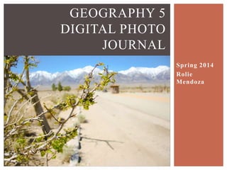
- 1. GEOGRAPHY 5 DIGITAL PHOTO JOURNAL PROJECT DATE STUDENT MARCH 8, APRIL 4-6 2014 ROLIE MENDOZA Mormon Rocks, Cinder Hill, Fossil Falls, Mt. Whitney Interagency Visitors Center, Diaz Lake, Manzanar, Mammoth Area and Rest Stop, Mono Lake, Keoughs Hot Springs, Convict Lake, June Lake Loop, East California Museum, Erratic Boulder, Crowley Lake
- 2. The granular structure (left) of Mormon Rocks sandstone Mormon rocks (up top) were formed by powerful earthquakes from San Andreas Fault. DATE 3/8/14 10:16 amMORMON ROCKS
- 3. Stream Bed on San Andreas Rift Zone, separates the Pacific Plate and North American Plate DATE 3/8/14 10:26 amMORMON ROCKS
- 4. Lava Flows made of Basalt formed by rapid cooling of Basaltic lava on surface of planet. DATE 3/8/14 2:18 pmCINDER HILL Cinder Hill (up top) is a cinder cone volcano.
- 5. Metate Holes were formed by rocks that were revolving circular from the running stream DATE 3/8/14 3:11 pmFOSSIL FALLS Fossil Falls formed by basaltic lava flows that were smoothed out by water streams from glaciers.
- 6. Stream bed is named Owen’s Stream Bed, water from Owen’s Lake. DATE 3/8/14 3:16 pmFOSSIL FALLS Obsidian flakes were put there by Native Americans to be near their homes used for arrowheads.
- 7. Petroglyph, rock engravings, were made by Native Americans DATE 3/8/14 3:35 pmFOSSIL FALLS House Rings (encircled) were used as a structural foundation for the Native Americans’ homes
- 8. Lone Pine Fault (left) had major earthquake in 1872 that destroyed about 50 houses and killed 27 people in nearby city of Lone Pine DATE 4/4/14 12:24 pmDIAZ LAKE Diaz Lake was formed from Lone Pine earthquake of 1872, when Owens Lake lowered and opened up a new stream.
- 9. DATE 4/4/14 1:00 pmMT. WHITNEY INTERAGENCY VISITORS CENTER Mt. Whitney, elevation 14,505 feet (4,421 m) is largest mountain in contiguous United States
- 10. Alluvial Fan DATE 4/4/14 12:41 pmMT. WHITNEY INTERAGENCY VISITORS CENTER Orographic effect when mass of air is moved upward, causing precipitation in form of rain or snow Inyo-White Mountains ZOOMED IN
- 11. Keoughs Hot Springs were created by earthquakes and heated by heat from underground volcanic activity. DATE 4/4/14 4:13 pmKEOUGHS HOT SPRINGS
- 12. Crowley Lake is a water supply for Los Angeles. The exposed shoreline was caused by California drought. DATE 4/5/14 9:08 amCROWLEY LAKE
- 13. DATE 4/5/14 9:34 amMAMMOTH REST STOP Trees Cut down due to bark beetle infestation
- 14. Tufa formations are mineral formations that originally were underwater that are now exposed when water levels lowered DATE 4/5/14 11:12 amMONO LAKE Former Shorelines of Mono Lake listed above `6417 feet (pre- diversion) `6392 feet (management level) `6372 feet (historic low) `6378 feet (current)
- 15. DATE 4/5/14 11:41 amMONO LAKE Mono Lake and islands, Paoha and Negit Islands Paoha Island Negit Island
- 16. DATE 4/5/14 2:26 pmJUNE LAKE LOOP Grant Lake above with moraines on each side
- 17. DATE 4/5/14 2:36 pmJUNE LAKE LOOP Silver Lake Waterfall (now frozen)
- 18. DATE 4/5/14 2:56 pmERRATIC BOULDER Erratic Boulder displaying power of glaciers that picked up a different rock and transported it to another location when glacier melted.
- 19. Convict Lake is a lake created by the Glaciers. DATE 4/5/14 3:37 pmCONVICT LAKE The Sevehah Cliff is one of the oldest rock formations in the Sierra, dating back about 500 million years.
- 20. Record Player from Manzanar War Relocation Center Made by Mr. Kay Kinoshita ECM 94.80.159 This record player is part of the Shiro Nomura collection. Shiro, born in 1919 was one of the Japanese Americans sent to the Manzanar internment camps during World War II. DATE 4/6/14 9:11 amEASTERN CALIFORNIA MUSEUM Pictures taken by Taylor George-Forte.
- 21. DATE 4/6/14 10:17 amMANZANAR This is a picture of the south side of First Street in the Manzanar Internment Camp. Buildings on this side included, Town Hall, Post Office, and War Relocation Authority offices.
- 22. DATE 4/6/14 10:22 amMANZANAR Manzanar guard shack . Manzanar was one of multiple internment camp used to evacuate Japanese Americans, out of fear, after the Pearl Harbor attack. Plaque where Japanese Americans also built the camps. Engraved carvings into concrete, above from June 10, 1942
- 23. California Aqueduct IN TRANSIT Joshua Tree Creosote Bush Burroweed Grass DATE 4/4/14 9:47 am DATE 3/8/14 11:12 am
- 24. GARLOCK FAULT DATE 3/8/14 1:36 pm IN TRANSIT Mine Tailings near Red Mountain DATE 4/4/14 10:48 am
- 25. IN TRANSIT Owens Dry Lake is dry because city of Los Angeles drained it around mid twenties DATE 4/4/14 12:03 pm Doppler Radar TowerDATE 4/4/14 10:28 am
- 26. IN TRANSIT SEGS 3-7 Kramer Junction Solar Electric Generating System DATE 4/6/14 1:24 pm The Big Pine Locals say this presentation Needs more cowbell! They also prefer the name “Lake Russell” instead of “Mono Lake”. DATE 4/5/14 9:12 pm THIS IS THE END