REMOTE SENSING
•Download as DOC, PDF•
0 likes•12 views

Lrm 111 assignment 1 (case study-1) 13.12.2016
Recommended

Recommended
More Related Content
What's hot
What's hot (20)
Similar to REMOTE SENSING
Similar to REMOTE SENSING (20)
More from musadoto
More from musadoto (20)
Recently uploaded
Recently uploaded (20)
REMOTE SENSING
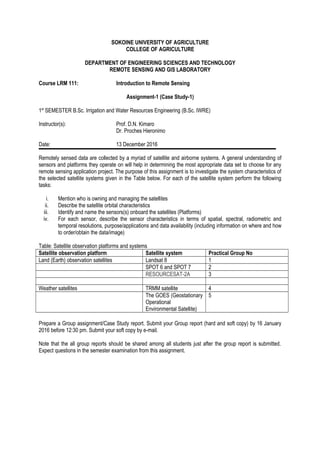
- 1. SOKOINE UNIVERSITY OF AGRICULTURE COLLEGE OF AGRICULTURE DEPARTMENT OF ENGINEERING SCIENCES AND TECHNOLOGY REMOTE SENSING AND GIS LABORATORY Course LRM 111: Introduction to Remote Sensing Assignment-1 (Case Study-1) 1st SEMESTER B.Sc. Irrigation and Water Resources Engineering (B.Sc. IWRE) Instructor(s): Prof. D.N. Kimaro Dr. Proches Hieronimo Date: 13 December 2016 Remotely sensed data are collected by a myriad of satellite and airborne systems. A general understanding of sensors and platforms they operate on will help in determining the most appropriate data set to choose for any remote sensing application project. The purpose of this assignment is to investigate the system characteristics of the selected satellite systems given in the Table below. For each of the satellite system perform the following tasks: i. Mention who is owning and managing the satellites ii. Describe the satellite orbital characteristics iii. Identify and name the sensors(s) onboard the satellites (Platforms) iv. For each sensor, describe the sensor characteristics in terms of spatial, spectral, radiometric and temporal resolutions, purpose/applications and data availability (including information on where and how to order/obtain the data/image) Table: Satellite observation platforms and systems Satellite observation platform Satellite system Practical Group No Land (Earth) observation satellites Landsat 8 1 SPOT 6 and SPOT 7 2 RESOURCESAT-2A 3 Weather satellites TRMM satellite 4 The GOES (Geostationary Operational Environmental Satellite) 5 Prepare a Group assignment/Case Study report. Submit your Group report (hard and soft copy) by 16 January 2016 before 12:30 pm. Submit your soft copy by e-mail. Note that the all group reports should be shared among all students just after the group report is submitted. Expect questions in the semester examination from this assignment.