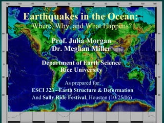
SlideShare a Scribd company logo
1 of 35
Earthquakes in the Ocean:  Where, Why, and What Happens? As prepared for  ESCI 323 - Earth Structure & Deformation And  Sally Ride Festival , Houston (10/25/06)  Prof. Julia Morgan Dr. Meghan Miller Department of Earth Science Rice University
Dale Sawyer’s  Discovering Plate Boundaries  Exercise (http://terra.rice.edu/plateboundary) ,[object Object],[object Object],[object Object],[object Object],An aside:
Seismology Map – Earthquake Locations and Depths
Volcanology Map – Recent Volcanic Activity
Geochronology Map – Seafloor Age
Geography Map – Topography and Bathymetry
Plate Boundary Map
Where do all the earthquakes occur?? (Press et al., Understanding Earth, 4th Ed.)
Kurile Earthquake Nov. 15, 2006 Juli
Tectonic Setting - Kuriles ,[object Object],[object Object],[object Object],Political Setting ,[object Object]
Kurile Earthquake Nov. 15, 2006
Kurile Tsunami - Nov. 15, 2006
Convergent Boundaries: Three Types ,[object Object],[object Object],[object Object],Ocean-continent Chile earthquake! M ~9.5 (1960) Continent-continent  South Asian earthquake! M ~7.5 (2005) In the Oceans (Press et al., Understanding Earth, 4th Ed.)
[object Object],[object Object],[object Object],[object Object],[object Object],[object Object],Chile - 5/22/1960 (Source: Sawyer, Discovering Plate Boundaries)
[object Object],[object Object],[object Object],[object Object],[object Object],[object Object],Alaska - 3/27/1964 (Source: Sawyer, Discovering Plate Boundaries)
Alaska Tsunami (Press et al., Understanding Earth, 4th Ed.)
[object Object],[object Object],[object Object],[object Object],[object Object],[object Object],Southeast Asia - 12/26/2004 (Source: Sawyer, Discovering Plate Boundaries)
Sumatra Earthquake Fault zone rupture ~ 1000 km in length Epicenter Sumatra Indian  Plate (Source: USGS)
What is a tsunami &  How does it form? ,[object Object],[object Object],(Source: Prof. Miho Aoki, U. Alaska Fairbanks)
Tsunami Generation & Propagation ,[object Object],[object Object],[object Object],(http://staff.aist.go.jp/kenji.satake/animation.gif)
What Happens Nearshore? ,[object Object],[object Object],(Press et al., Understanding Earth, 4th Ed.)
What are the Consequences? ,[object Object],(Source: Prof. Miho Aoki, U. Alaska Fairbanks)
Can This Happen in  N. America? Yes!!
[object Object],[object Object],[object Object],[object Object],[object Object],Oregon-Washington - 1/26/1700 (Source: Sawyer, Discovering Plate Boundaries)
January 1700 Cascadia Tsunami (Source: K. Satake, http://www.pgc.nrcan.gc.ca/press/index_e.php)
Where do Great Earthquakes occur? Seismogenic  Zone Coseismic  Slip  Aseismic  Slip  Tsunamigenic  Slip  ,[object Object],Sediments Rocks Why do Great Earthquakes occur?
Where can we study great earthquakes? ,[object Object],[object Object],[object Object],[object Object]
Earthquake Recurrence ,[object Object],[object Object],[object Object],[object Object],(Ando, 1975)
Co-seismic Slip Zone (Bangs et al., 2004) Up-dip limit
Recent Ocean Drilling & Surveys
Toe of Muroto Transect Decollement 1 km Proto-decollement Deformation front Proto- thrusts Frontal thrusts NANKAI TROUGH NANKAI PRISM PROTO-THRUST ZONE Depth (m) Trench Fill turbidites Shikoku Basin Strata hemipelagic sediments Ocean Crust
Prism Architecture (J.C. Moore and  Saffer, 2001) ,[object Object],[object Object],[object Object],Seismogenic Zone Coseismic Zone Aseismic Zone (after G.F. Moore et al., 2001) Up-dip limit
Décollement Amplitude (Bangs et al., 2004) ,[object Object],[object Object]
Pore Fluid Pressures (J.C. Moore and Saffer, 2001) ,[object Object],(after G.F. Moore et al., 2001) Seismogenic Zone Coseismic Zone Updip limit
Seismic-Aseismic Transition -> Onset of Earthquakes ,[object Object],[object Object],[object Object],[object Object],[object Object],[object Object],[object Object],[object Object],[object Object],Future fault zone drilling may tell us….

More Related Content

What's hot

Plate Tectonics 9
Plate  Tectonics 9Plate  Tectonics 9
Plate Tectonics 9
MissWander
 
Lecture20 nov25-bb
Lecture20 nov25-bbLecture20 nov25-bb
Lecture20 nov25-bb
Peter Shiv
 
2013 updated plate tectonics new one use this one
2013 updated plate tectonics new one use this one2013 updated plate tectonics new one use this one
2013 updated plate tectonics new one use this one
harvey09
 

What's hot (20)

9th Grade Chapter 8 Lesson 2
9th Grade Chapter 8 Lesson 29th Grade Chapter 8 Lesson 2
9th Grade Chapter 8 Lesson 2
 
Aaa earthquake engineering2
Aaa earthquake engineering2Aaa earthquake engineering2
Aaa earthquake engineering2
 
Plate Tectonics 9
Plate  Tectonics 9Plate  Tectonics 9
Plate Tectonics 9
 
Activity continentaldrift
Activity continentaldriftActivity continentaldrift
Activity continentaldrift
 
2.2 seafloor spreading
2.2 seafloor spreading2.2 seafloor spreading
2.2 seafloor spreading
 
Sea floor spreading
Sea floor spreadingSea floor spreading
Sea floor spreading
 
Continental drift
Continental driftContinental drift
Continental drift
 
Continental Drift Theory
Continental Drift TheoryContinental Drift Theory
Continental Drift Theory
 
Lecture20 nov25-bb
Lecture20 nov25-bbLecture20 nov25-bb
Lecture20 nov25-bb
 
2.1 2.2 epicenter and focus and magnitude and intensity.pptx
2.1 2.2 epicenter and focus and magnitude and intensity.pptx2.1 2.2 epicenter and focus and magnitude and intensity.pptx
2.1 2.2 epicenter and focus and magnitude and intensity.pptx
 
Continental drift and seafloor spreading
Continental drift and seafloor spreadingContinental drift and seafloor spreading
Continental drift and seafloor spreading
 
continental theory and plate tectonic
continental theory and plate tectoniccontinental theory and plate tectonic
continental theory and plate tectonic
 
Continental Drift theory suitable for online class
Continental Drift theory suitable for online classContinental Drift theory suitable for online class
Continental Drift theory suitable for online class
 
Island arc
Island arcIsland arc
Island arc
 
Alfred wegener presentation
Alfred wegener presentation Alfred wegener presentation
Alfred wegener presentation
 
Plate tectonics by Rayhanie Pangcoga
Plate tectonics by Rayhanie PangcogaPlate tectonics by Rayhanie Pangcoga
Plate tectonics by Rayhanie Pangcoga
 
2013 updated plate tectonics new one use this one
2013 updated plate tectonics new one use this one2013 updated plate tectonics new one use this one
2013 updated plate tectonics new one use this one
 
The Continental Drift and Seafloor Spreading Theory
The Continental Drift and Seafloor Spreading TheoryThe Continental Drift and Seafloor Spreading Theory
The Continental Drift and Seafloor Spreading Theory
 
Continental drift- Yalizet
Continental drift- YalizetContinental drift- Yalizet
Continental drift- Yalizet
 
Layers of the earth
Layers of the earthLayers of the earth
Layers of the earth
 

Viewers also liked

Anticlines and synclines
Anticlines and synclines Anticlines and synclines
Anticlines and synclines
GP10
 
Earth Science 4.3 : The Theory of Plate Tectonics
Earth Science 4.3 : The Theory of Plate TectonicsEarth Science 4.3 : The Theory of Plate Tectonics
Earth Science 4.3 : The Theory of Plate Tectonics
Chris Foltz
 
Plate Tectonics - Chapter 5
Plate Tectonics - Chapter 5Plate Tectonics - Chapter 5
Plate Tectonics - Chapter 5
nilsona
 
Unit 5 2014 South Napa earthquake presentation
Unit 5 2014 South Napa earthquake presentationUnit 5 2014 South Napa earthquake presentation
Unit 5 2014 South Napa earthquake presentation
SERC at Carleton College
 
Earth Science 4.1 : Inside the Earth
Earth Science 4.1 : Inside the EarthEarth Science 4.1 : Inside the Earth
Earth Science 4.1 : Inside the Earth
Chris Foltz
 
Earth Science 4.4 : Deforming the Earth's Crust
Earth Science 4.4 : Deforming the Earth's CrustEarth Science 4.4 : Deforming the Earth's Crust
Earth Science 4.4 : Deforming the Earth's Crust
Chris Foltz
 

Viewers also liked (7)

4 4 Deformation
4 4 Deformation4 4 Deformation
4 4 Deformation
 
Anticlines and synclines
Anticlines and synclines Anticlines and synclines
Anticlines and synclines
 
Earth Science 4.3 : The Theory of Plate Tectonics
Earth Science 4.3 : The Theory of Plate TectonicsEarth Science 4.3 : The Theory of Plate Tectonics
Earth Science 4.3 : The Theory of Plate Tectonics
 
Plate Tectonics - Chapter 5
Plate Tectonics - Chapter 5Plate Tectonics - Chapter 5
Plate Tectonics - Chapter 5
 
Unit 5 2014 South Napa earthquake presentation
Unit 5 2014 South Napa earthquake presentationUnit 5 2014 South Napa earthquake presentation
Unit 5 2014 South Napa earthquake presentation
 
Earth Science 4.1 : Inside the Earth
Earth Science 4.1 : Inside the EarthEarth Science 4.1 : Inside the Earth
Earth Science 4.1 : Inside the Earth
 
Earth Science 4.4 : Deforming the Earth's Crust
Earth Science 4.4 : Deforming the Earth's CrustEarth Science 4.4 : Deforming the Earth's Crust
Earth Science 4.4 : Deforming the Earth's Crust
 

Similar to Plate tectonic activity with maps

Intro to Oceanography
Intro to OceanographyIntro to Oceanography
Intro to Oceanography
capjjj
 
Plate tectonicsslideshow
Plate tectonicsslideshowPlate tectonicsslideshow
Plate tectonicsslideshow
LynnCorliss
 
RUNNING HEAD Rough Draft-Peer reviewPage 1PEER REVIEW.docx
RUNNING HEAD Rough Draft-Peer reviewPage 1PEER REVIEW.docxRUNNING HEAD Rough Draft-Peer reviewPage 1PEER REVIEW.docx
RUNNING HEAD Rough Draft-Peer reviewPage 1PEER REVIEW.docx
toltonkendal
 
Forces within earth
Forces within earthForces within earth
Forces within earth
saugusto
 
that is associated with broad upwarping of the overlying litho.docx
that is associated with broad upwarping of the overlying litho.docxthat is associated with broad upwarping of the overlying litho.docx
that is associated with broad upwarping of the overlying litho.docx
mattinsonjanel
 

Similar to Plate tectonic activity with maps (20)

Tectonics, tectonophysics
Tectonics, tectonophysicsTectonics, tectonophysics
Tectonics, tectonophysics
 
Earthquakes
EarthquakesEarthquakes
Earthquakes
 
Intro to Oceanography
Intro to OceanographyIntro to Oceanography
Intro to Oceanography
 
The Great Motion of the Oceans
The Great Motion of the OceansThe Great Motion of the Oceans
The Great Motion of the Oceans
 
Earthquake
Earthquake Earthquake
Earthquake
 
Plate tectonicsslideshow
Plate tectonicsslideshowPlate tectonicsslideshow
Plate tectonicsslideshow
 
RUNNING HEAD Rough Draft-Peer reviewPage 1PEER REVIEW.docx
RUNNING HEAD Rough Draft-Peer reviewPage 1PEER REVIEW.docxRUNNING HEAD Rough Draft-Peer reviewPage 1PEER REVIEW.docx
RUNNING HEAD Rough Draft-Peer reviewPage 1PEER REVIEW.docx
 
Earthquakes 101
Earthquakes 101Earthquakes 101
Earthquakes 101
 
Unit 5 - Disaster Management
Unit 5 - Disaster ManagementUnit 5 - Disaster Management
Unit 5 - Disaster Management
 
Plate Tectonics
Plate TectonicsPlate Tectonics
Plate Tectonics
 
Earth quake
Earth quakeEarth quake
Earth quake
 
The earth’s interior
The earth’s interiorThe earth’s interior
The earth’s interior
 
Pacific ring of fire
Pacific ring of firePacific ring of fire
Pacific ring of fire
 
lecture1-seismology.ppt
lecture1-seismology.pptlecture1-seismology.ppt
lecture1-seismology.ppt
 
Earth quake
Earth quakeEarth quake
Earth quake
 
Forces within earth
Forces within earthForces within earth
Forces within earth
 
Clase historia tierra
Clase historia tierraClase historia tierra
Clase historia tierra
 
plate tectonic 2.pptx
plate tectonic 2.pptxplate tectonic 2.pptx
plate tectonic 2.pptx
 
that is associated with broad upwarping of the overlying litho.docx
that is associated with broad upwarping of the overlying litho.docxthat is associated with broad upwarping of the overlying litho.docx
that is associated with broad upwarping of the overlying litho.docx
 
Continental drift Presentation.pptx
Continental drift Presentation.pptxContinental drift Presentation.pptx
Continental drift Presentation.pptx
 

More from Lori Welsh

Distance vs time chart with questions 2
Distance vs time chart with questions 2Distance vs time chart with questions 2
Distance vs time chart with questions 2
Lori Welsh
 
10.1 reinf ditstance_time%20_graph
10.1 reinf ditstance_time%20_graph10.1 reinf ditstance_time%20_graph
10.1 reinf ditstance_time%20_graph
Lori Welsh
 
Motion diagrams, data charts, graphs
Motion diagrams, data charts, graphsMotion diagrams, data charts, graphs
Motion diagrams, data charts, graphs
Lori Welsh
 
Motion diagrams, data charts, graphs
Motion diagrams, data charts, graphsMotion diagrams, data charts, graphs
Motion diagrams, data charts, graphs
Lori Welsh
 
Motion diagrams, data charts, graphs
Motion diagrams, data charts, graphsMotion diagrams, data charts, graphs
Motion diagrams, data charts, graphs
Lori Welsh
 
Motion diagrams, data charts, graphs
Motion diagrams, data charts, graphsMotion diagrams, data charts, graphs
Motion diagrams, data charts, graphs
Lori Welsh
 
Motion diagrams
Motion diagramsMotion diagrams
Motion diagrams
Lori Welsh
 
Motion diagrams
Motion diagramsMotion diagrams
Motion diagrams
Lori Welsh
 
Motion diagrams
Motion diagramsMotion diagrams
Motion diagrams
Lori Welsh
 
Motion diagrams
Motion diagramsMotion diagrams
Motion diagrams
Lori Welsh
 
Motion diagrams
Motion diagramsMotion diagrams
Motion diagrams
Lori Welsh
 
Perspective written report
Perspective written reportPerspective written report
Perspective written report
Lori Welsh
 
Process skills quiz 12 13
Process skills quiz 12 13Process skills quiz 12 13
Process skills quiz 12 13
Lori Welsh
 
Parents and students first day homework
Parents and students first day homeworkParents and students first day homework
Parents and students first day homework
Lori Welsh
 
Student directions for poster lab
Student directions for poster labStudent directions for poster lab
Student directions for poster lab
Lori Welsh
 
Lab for plate boundaries
Lab for plate boundariesLab for plate boundaries
Lab for plate boundaries
Lori Welsh
 
Plate tectonic activity with maps
Plate tectonic activity with mapsPlate tectonic activity with maps
Plate tectonic activity with maps
Lori Welsh
 
Lab for plate boundaries
Lab for plate boundariesLab for plate boundaries
Lab for plate boundaries
Lori Welsh
 
Volcanology terms
Volcanology termsVolcanology terms
Volcanology terms
Lori Welsh
 
Seismology terms
Seismology termsSeismology terms
Seismology terms
Lori Welsh
 

More from Lori Welsh (20)

Distance vs time chart with questions 2
Distance vs time chart with questions 2Distance vs time chart with questions 2
Distance vs time chart with questions 2
 
10.1 reinf ditstance_time%20_graph
10.1 reinf ditstance_time%20_graph10.1 reinf ditstance_time%20_graph
10.1 reinf ditstance_time%20_graph
 
Motion diagrams, data charts, graphs
Motion diagrams, data charts, graphsMotion diagrams, data charts, graphs
Motion diagrams, data charts, graphs
 
Motion diagrams, data charts, graphs
Motion diagrams, data charts, graphsMotion diagrams, data charts, graphs
Motion diagrams, data charts, graphs
 
Motion diagrams, data charts, graphs
Motion diagrams, data charts, graphsMotion diagrams, data charts, graphs
Motion diagrams, data charts, graphs
 
Motion diagrams, data charts, graphs
Motion diagrams, data charts, graphsMotion diagrams, data charts, graphs
Motion diagrams, data charts, graphs
 
Motion diagrams
Motion diagramsMotion diagrams
Motion diagrams
 
Motion diagrams
Motion diagramsMotion diagrams
Motion diagrams
 
Motion diagrams
Motion diagramsMotion diagrams
Motion diagrams
 
Motion diagrams
Motion diagramsMotion diagrams
Motion diagrams
 
Motion diagrams
Motion diagramsMotion diagrams
Motion diagrams
 
Perspective written report
Perspective written reportPerspective written report
Perspective written report
 
Process skills quiz 12 13
Process skills quiz 12 13Process skills quiz 12 13
Process skills quiz 12 13
 
Parents and students first day homework
Parents and students first day homeworkParents and students first day homework
Parents and students first day homework
 
Student directions for poster lab
Student directions for poster labStudent directions for poster lab
Student directions for poster lab
 
Lab for plate boundaries
Lab for plate boundariesLab for plate boundaries
Lab for plate boundaries
 
Plate tectonic activity with maps
Plate tectonic activity with mapsPlate tectonic activity with maps
Plate tectonic activity with maps
 
Lab for plate boundaries
Lab for plate boundariesLab for plate boundaries
Lab for plate boundaries
 
Volcanology terms
Volcanology termsVolcanology terms
Volcanology terms
 
Seismology terms
Seismology termsSeismology terms
Seismology terms
 

Recently uploaded

The basics of sentences session 3pptx.pptx
The basics of sentences session 3pptx.pptxThe basics of sentences session 3pptx.pptx
The basics of sentences session 3pptx.pptx
heathfieldcps1
 
Salient Features of India constitution especially power and functions
Salient Features of India constitution especially power and functionsSalient Features of India constitution especially power and functions
Salient Features of India constitution especially power and functions
KarakKing
 

Recently uploaded (20)

Jamworks pilot and AI at Jisc (20/03/2024)
Jamworks pilot and AI at Jisc (20/03/2024)Jamworks pilot and AI at Jisc (20/03/2024)
Jamworks pilot and AI at Jisc (20/03/2024)
 
Sociology 101 Demonstration of Learning Exhibit
Sociology 101 Demonstration of Learning ExhibitSociology 101 Demonstration of Learning Exhibit
Sociology 101 Demonstration of Learning Exhibit
 
Fostering Friendships - Enhancing Social Bonds in the Classroom
Fostering Friendships - Enhancing Social Bonds  in the ClassroomFostering Friendships - Enhancing Social Bonds  in the Classroom
Fostering Friendships - Enhancing Social Bonds in the Classroom
 
The basics of sentences session 3pptx.pptx
The basics of sentences session 3pptx.pptxThe basics of sentences session 3pptx.pptx
The basics of sentences session 3pptx.pptx
 
Google Gemini An AI Revolution in Education.pptx
Google Gemini An AI Revolution in Education.pptxGoogle Gemini An AI Revolution in Education.pptx
Google Gemini An AI Revolution in Education.pptx
 
How to Manage Global Discount in Odoo 17 POS
How to Manage Global Discount in Odoo 17 POSHow to Manage Global Discount in Odoo 17 POS
How to Manage Global Discount in Odoo 17 POS
 
ICT role in 21st century education and it's challenges.
ICT role in 21st century education and it's challenges.ICT role in 21st century education and it's challenges.
ICT role in 21st century education and it's challenges.
 
Exploring_the_Narrative_Style_of_Amitav_Ghoshs_Gun_Island.pptx
Exploring_the_Narrative_Style_of_Amitav_Ghoshs_Gun_Island.pptxExploring_the_Narrative_Style_of_Amitav_Ghoshs_Gun_Island.pptx
Exploring_the_Narrative_Style_of_Amitav_Ghoshs_Gun_Island.pptx
 
Salient Features of India constitution especially power and functions
Salient Features of India constitution especially power and functionsSalient Features of India constitution especially power and functions
Salient Features of India constitution especially power and functions
 
Plant propagation: Sexual and Asexual propapagation.pptx
Plant propagation: Sexual and Asexual propapagation.pptxPlant propagation: Sexual and Asexual propapagation.pptx
Plant propagation: Sexual and Asexual propapagation.pptx
 
Food safety_Challenges food safety laboratories_.pdf
Food safety_Challenges food safety laboratories_.pdfFood safety_Challenges food safety laboratories_.pdf
Food safety_Challenges food safety laboratories_.pdf
 
Beyond_Borders_Understanding_Anime_and_Manga_Fandom_A_Comprehensive_Audience_...
Beyond_Borders_Understanding_Anime_and_Manga_Fandom_A_Comprehensive_Audience_...Beyond_Borders_Understanding_Anime_and_Manga_Fandom_A_Comprehensive_Audience_...
Beyond_Borders_Understanding_Anime_and_Manga_Fandom_A_Comprehensive_Audience_...
 
How to Create and Manage Wizard in Odoo 17
How to Create and Manage Wizard in Odoo 17How to Create and Manage Wizard in Odoo 17
How to Create and Manage Wizard in Odoo 17
 
ICT Role in 21st Century Education & its Challenges.pptx
ICT Role in 21st Century Education & its Challenges.pptxICT Role in 21st Century Education & its Challenges.pptx
ICT Role in 21st Century Education & its Challenges.pptx
 
OSCM Unit 2_Operations Processes & Systems
OSCM Unit 2_Operations Processes & SystemsOSCM Unit 2_Operations Processes & Systems
OSCM Unit 2_Operations Processes & Systems
 
General Principles of Intellectual Property: Concepts of Intellectual Proper...
General Principles of Intellectual Property: Concepts of Intellectual  Proper...General Principles of Intellectual Property: Concepts of Intellectual  Proper...
General Principles of Intellectual Property: Concepts of Intellectual Proper...
 
Basic Civil Engineering first year Notes- Chapter 4 Building.pptx
Basic Civil Engineering first year Notes- Chapter 4 Building.pptxBasic Civil Engineering first year Notes- Chapter 4 Building.pptx
Basic Civil Engineering first year Notes- Chapter 4 Building.pptx
 
Kodo Millet PPT made by Ghanshyam bairwa college of Agriculture kumher bhara...
Kodo Millet  PPT made by Ghanshyam bairwa college of Agriculture kumher bhara...Kodo Millet  PPT made by Ghanshyam bairwa college of Agriculture kumher bhara...
Kodo Millet PPT made by Ghanshyam bairwa college of Agriculture kumher bhara...
 
Unit 3 Emotional Intelligence and Spiritual Intelligence.pdf
Unit 3 Emotional Intelligence and Spiritual Intelligence.pdfUnit 3 Emotional Intelligence and Spiritual Intelligence.pdf
Unit 3 Emotional Intelligence and Spiritual Intelligence.pdf
 
Graduate Outcomes Presentation Slides - English
Graduate Outcomes Presentation Slides - EnglishGraduate Outcomes Presentation Slides - English
Graduate Outcomes Presentation Slides - English
 

Plate tectonic activity with maps

Editor's Notes

  1. Add JOI and ODP logos, and Rice logo. And thanks for JOI,USSSP, etc.
  2. The fourth, and perhaps the richest of the data maps, shows the topography and bathymetry of the Earth. This is the elevation of the land surface and the depth of the oceans. The map uses color to indicate varying elevation and depth and simulates sun shading to add a sense of 3-dimensionality to the map. The scale bar on the right shows how colors on the map correspond to elevation in meters.
  3. An exercise based on observing, describing, and classifying data must be built on some rich and well displayed data. I use 4 data maps that contain an amazing amount of information about large scale plate tectonic processes on the Earth. These data have been acquired over many years by many scientists. When examined together, most of the basic tenets of plate tectonics are laid bare and seem irrefutable. Scientists developing the key ideas of plate tectonics over the past 40 years had only fragments of these data to work with as they tried to describe, classify, and interpret what they saw. In Discovering Plate Boundaries, you will be asking your students to walk the same path, but with the advantage of more complete, although not perfect, data. The first map shows earthquake locations and depths. The location of each earthquake is indicated by a small dot and its depth is indicated by the color of the dot. Red dots indicate earthquakes having depths between zero and 33 km. We refer to these as shallow earthquakes. The yellow or orange dots indicate earthquakes having depths between 33 and 70 km. We call these intermediate depth earthquakes. The green dots indicate earthquakes having depths between 70 and 300 km We call these deep earthquakes. The blue dots indicate earthquakes having depths between 300 and 700 km. We call these ultra-deep earthquakes.
  4. The second map shows the locations of recent volcanic or thermal features on the Earth. In this dataset, recent refers to the past 10,000 years. The dots represent volcanoes, geysers, hot springs, and similar features. In these slides, the maps are not shown in a way that you can see all the detail. The second part of the Teachers Guide, called A Tour of the Maps, shows the maps in much more detail. It is also possible to download the maps in several high resolution formats from the DPB website so that you can see the details.
  5. The third map shows the age of the oceanic crust under most of the world’s oceans. This map really highlights divergent plate boundaries, also known as mid-ocean ridges or spreading centers. The scale bar on the right shows how the colors correspond to age of the seafloor in millions of years. Red signifies the youngest crust. Blue signifies the oldest known oceanic crust. An important feature of the maps used in this exercise is that they are all displayed at the same scale and projection, and use the same coastline data. Uniformity of the map base makes it easy for students to compare data from map to map. This is an important aspect of the exercise. It is possible to obtain excellent maps (better than mine!) of each of these data from other sources, but they are unlikely to be displayed in the same way. I have found inconsistent display to be a source of frustration for students.
  6. The fourth, and perhaps the richest of the data maps, shows the topography and bathymetry of the Earth. This is the elevation of the land surface and the depth of the oceans. The map uses color to indicate varying elevation and depth and simulates sun shading to add a sense of 3-dimensionality to the map. The scale bar on the right shows how colors on the map correspond to elevation in meters.
  7. When the students arrive for the first period of the class, I hand out the Student Instruction sheet, and a plate boundary map. I use 11 by 17 in black and white maps that I make on a copying machine. They are displayed at the same projection and base as the data maps, although to a smaller scale. I also hand each student a slip of paper with a Scientific specialty (Seismology, Geochronology, Volcanology, or Geography) and a Plate Name (Pacific Plate, North American Plate, African Plate, and etc.). My goal is to have each student have a different combination of specialty and plate, and for all four scientific specialties to be covered for each plate used in the exercise. Therefore, if you have 24 students, I would use 6 plates and have all four specialties for each. Numbers that are not multiples of four can be handled by having 1-3 plates with only 3 specialties. If I have to do this, I drop a different specialty from each, but never Seismology. I bet you can guess that I am a Seismologist! I mix the specialties and plates up randomly among students because I think this exercise works best if they are not self arranged into their usual social groupings.
  8. The fourth, and perhaps the richest of the data maps, shows the topography and bathymetry of the Earth. This is the elevation of the land surface and the depth of the oceans. The map uses color to indicate varying elevation and depth and simulates sun shading to add a sense of 3-dimensionality to the map. The scale bar on the right shows how colors on the map correspond to elevation in meters.