
Recommended
More Related Content
What's hot
What's hot (20)
Similar to Cordillera administrative region
Similar to Cordillera administrative region (20)
Recently uploaded
Recently uploaded (20)
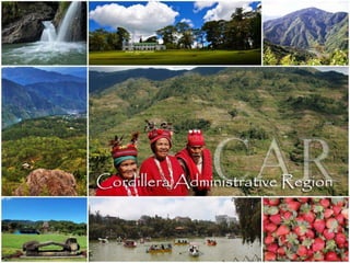
Cordillera administrative region
- 2. CORDILLERA ADMINISTRATIVE REGION Location: North Central Part of Luzon Geographic Location: Bounded on the North by the province of Cagayan, on the West by Ilocos Norte and Ilocos Sur on the East by Isabela and on the South by the province of Pangasinan and Neuva Vizcaya. Regional Center: Baguio Religion: Roman Catholic,Protestants Language: Ilocano
- 5. Location: Northernmost tip of the Luzon Geographic Location: Borders by Cagayan to the north and east, Abra and Ilocos North to the west, and Kalinga to the south Capital Town: Kabugao 7 Municipalities 133 Barangays Language: Isnag
- 9. AGRICULTURE Industrial crops Palay Corn Coffee Root crops Vegetables Fruits produced Lanzones Citrus Banana Pineapple Durian Santol Rambutan Coconut mangosteen Economic Activity Lives Stock and Poultry Swine Carabao Cattle Goat sheep Additional Investment Manufacturing Food Processing Furniture Craft and House wares making
- 11. Pinaltit
- 12. Duck Pinikpikan
- 13. Real Cobra Drink
- 14. Handicrafts
- 15. Music and Dance
- 19. END OF APAYAO!!!
- 21. Location: Western side of the massive Cordillera in Northern Luzon Geographic Location: bordered by Ilocos Norte on the northwest, Apayao on the northeast, Kalinga on the mid- east, Mountain Provinceon the southeast, and Ilocos Sur on the southwest. Capital Town: Bangued Language: Itneg
- 23. Casa Real Bucay
- 24. Mother Mary Statue Casamata Hill
- 25. Existing Industries Bamboocraft & Furnishings E-Bamboo Wood Furniture & Furnishings Processed Food (Fruit, sugarcane-based, rice-based, veggie noodles, meat) Coffee Industry Corn Industry Tobacco Industry Furniture making Small-scale mining Blacksmithing Weaving industry (basket, handicraft and loom weaving)
- 26. FOODS and DRINKS CASCARON
- 27. Lechon De Abra
- 28. Sinuman Patupat
- 30. HANDICRAFTS
- 31. LOOMWEAVING
- 32. Music and Dance
- 36. End of Abra!!!
- 38. Location: Southern tip of Cordillera Administrative Region in the island of Luzon Capital Town: La Trinidad Language: kankanaey, kalanguya, ibaloi Nickname: Salad Bowl of the Philippines Strawberry Capital of the Philippines Geographic Location: bordered on the Northeast by Mt. Province and Ifugao, southeast by Nueva Vizcaya, on the south by the Pangasinan, and northwest by Ilocos Sur
- 40. La Trinidad Strawberry
- 41. Mt. Pulag
- 43. Agriculture monggo processing fruit preservation peanut brittle manufacturing broom making basket weaving.
- 47. Handicrafts
- 49. Benguet dance
- 51. Nickname: Home of the Last “Mambabatok” Location: situated within the central part of Cordillera Administrative Region Geographic Location: bordered by Mt. Province to the south, Abra to the west, Isabela to the East, Cagayan to the Northeast and Apayao to the north Capital Town: Tabuk Language: Kalinga, Ilocano,Gaddang, Tagalog, English Location: situated within the central part of Cordillera Administrative Region Geographic Location: bordered by Mt. Province to the south, Abra to the west, Isabela to the East, Cagayan to the Northeast and Apayao to the north
- 53. Tabuk, Kalinga
- 55. Lubuagan Kalinga
- 56. AGRICULTURE rice corn coffee bananas.
- 57. Foods and Drinks Inandila
- 59. Pinalatan
- 60. Music and Dance
- 63. End of Kalinga
- 64. Nickname: The site of the UNESCO World Heritage Site, the Batad Rice Terraces and Bangaan Rice Terraces Capital Town: Lagawe Language: Ifugao, tuwaii, Kalanguya Ilocano, English Location: situated within the southern part of Cordillera Administrative Region Geographic Location: bordered by Nueva Vizcaya to the south, Benguet to the west, Isabela to the East, and Mt. Province to the north Language: Ifugao, tuwaii, Kalanguya Ilocano, English Location: situated within the southern part of Cordillera Administrative Region Geographic Location: bordered by Nueva Vizcaya to the south, Benguet to the west, Isabela to the East, and Mt. Province to the north
- 66. tappiya falls
- 67. Tam-an Village
- 70. Inlagim
- 71. Binaod
- 72. Ifugao Festival
- 73. Ifugao Dance
- 74. Native dance in Ifugao
- 75. END!!!
- 76. NICKNAME:Home of the world famous hanging coffins Capital Town: Bontoc Language: Bontoc, Kankana-ey, Ilocano, Pangasinan, Tagalog, English Location: Situated within the Cordillera Central Geographic Locationbordered on the north by Kalinga, south by Ifugao, southwest by Benguet, west by Ilocos Sur, and northwest by Abra.
- 77. Sagada
- 78. Sumaguing Cave
- 79. bomod-ok falls
- 80. Foods and Drinks ETAG
- 81. Lemon Pie
- 82. Tapey
- 83. Agriculture is the major source of livelihood of the people where about 90% of the population are engaged in. About 2,346 hectares or 15% of the total land area of the municipality are utilized for crop production. • The main crops are rice of different varieties and root crops that include camote and cassava. • Legumes of different varieties, peanuts, coffee, sugarcane, corn and vegetables such as eggplant, pechay, squash, and onions are also grown in the area. • Fruit trees like mango, avocado, coconut, bananas, star apple, guyabano and jackfruit are grown in the warmer barangays along the river.
- 84. Lang ay festival