SlideShare a Scribd company logo
1 of 147
Download to read offline
U.S. Department of the Interior
U.S. Geological Survey
Circular 1325
The Landslide Handbook—
A Guide to Understanding Landslides
Cover: The threat of landslides like this have made the long drive to Wenchuan a risky affair for rescuers
and aid delivery teams as they tried to reach the epicenter of the Wenchuan, China, earthquake of
May 12, 2008. This photograph shows a landslide that sealed the entrance and exit to Wenchuan on
May 23, 2008. (Photograph by Chua Chin Hon, Straits Times, Singapore.)
The Landslide Handbook—
A Guide to Understanding Landslides
By Lynn M. Highland, United States Geological Survey, and
Peter Bobrowsky, Geological Survey of Canada
Circular 1325
U.S. Department of the Interior
U.S. Geological Survey
U.S. Department of the Interior
DIRK KEMPTHORNE, Secretary
U.S. Geological Survey
Mark D. Myers, Director
U.S. Geological Survey, Reston, Virginia: 2008
For product and ordering information:
World Wide Web: http://www.usgs.gov/pubprod
Telephone: 1-888-ASK-USGS
For more information on the USGS--the Federal source for science about the Earth, its natural and living resources,
natural hazards, and the environment:
World Wide Web: http://www.usgs.gov
Telephone: 1-888-ASK-USGS
Any use of trade, product, or firm names is for descriptive purposes only and does not imply endorsement by the
U.S. Government.
Although this report is in the public domain, permission must be secured from the individual copyright owners to
reproduce any copyrighted materials contained within this report.
Suggested citation:
Highland, L.M., and Bobrowsky, Peter, 2008, The landslide handbook—A guide to understanding landslides: Reston,
Virginia, U.S. Geological Survey Circular 1325, 129 p.
iii
Acknowledgments
The authors thank the International Consortium on Landslides for sponsoring this project
and the many reviewers who spent much of their time and effort on the careful review of
this book. Thanks also to those who gave permission to use their previously published text,
photographs and graphics and to those authors of landslide research and information whose
painstaking work was crucial to its completion. We thank the Geological Survey of Canada, and
especially Jan Aylsworth for her valuable review and suggestions. In addition, we acknowledge
the U.S. Geological Survey, especially Paula Gori who supported the entire handbook process
and provided advice and encouragement. This is Geological Survey of Canada Contribution
Number 20080377.
iv
Earthquake-induced landslides,
Sichuan Province, China, May 12, 2008.
Photograph courtesy of Dr. Yin Yueping,
China Geological Survey,
Ministry of Land and Resources, China.
v
Contents
Acknowledgments............................................................................................................................................ iii
How to read this guide................................................................................................................................... xiii
Please note............................................................................................................................................. xiii
Introduction........................................................................................................................................................ 1
For more information......................................................................................................................................... 2
Section I.  Basic Information About Landslides....................................................................................... 3
Part A.  What is a Landslide?........................................................................................................................ 4
Part B.  Basic Landslide Types.................................................................................................................... 5
Falls............................................................................................................................................................. 6
Rockfall............................................................................................................................................. 6
Occurrence and relative size/range................................................................................... 6
Velocity of travel.................................................................................................................... 6
Triggering mechanism.......................................................................................................... 6
Effects (direct/indirect)......................................................................................................... 6
Corrective measures/mitigation.......................................................................................... 6
Predictability........................................................................................................................... 7
Topple......................................................................................................................................................... 8
Occurrence............................................................................................................................. 8
Velocity of travel.................................................................................................................... 8
Triggering mechanism.......................................................................................................... 8
Effects (direct/indirect)......................................................................................................... 8
Corrective measures/mitigation.......................................................................................... 8
Predictability........................................................................................................................... 8
Slides........................................................................................................................................................ 10
Rotational Landslide..................................................................................................................... 10
Occurrence........................................................................................................................... 10
Relative size/range.............................................................................................................. 10
Velocity of travel (rate of movement)............................................................................... 10
Triggering mechanism........................................................................................................ 10
Effects (direct/indirect)....................................................................................................... 10
Mitigation measures........................................................................................................... 10
Predictability......................................................................................................................... 11
Translational Landslide................................................................................................................ 12
Occurrence........................................................................................................................... 12
Relative size/range.............................................................................................................. 12
Velocity of travel.................................................................................................................. 12
Triggering mechanism........................................................................................................ 12
Effects (direct/indirect)....................................................................................................... 12
Mitigation measures........................................................................................................... 12
Predictability......................................................................................................................... 13
Spreads.................................................................................................................................................... 14
Lateral Spreads.................................................................................................................... 14
Occurrence........................................................................................................................... 14
Relative size/range.............................................................................................................. 14
vi
Velocity of travel.................................................................................................................. 14
Triggering mechanism........................................................................................................ 14
Effects (direct/indirect)....................................................................................................... 14
Mitigation measures........................................................................................................... 15
Predictability......................................................................................................................... 15
Flows......................................................................................................................................................16
Debris Flows................................................................................................................................... 16
Occurrence........................................................................................................................... 16
Relative size/range.............................................................................................................. 16
Velocity of travel.................................................................................................................. 16
Triggering mechanisms...................................................................................................... 16
Effects (direct/indirect)....................................................................................................... 16
Mitigation measures........................................................................................................... 17
Predictability......................................................................................................................... 17
Lahars (Volcanic Debris Flows).................................................................................................. 18
Occurrence........................................................................................................................... 18
Relative size/range.............................................................................................................. 18
Velocity of travel.................................................................................................................. 18
Triggering mechanism........................................................................................................ 18
Effects (direct/indirect)....................................................................................................... 18
Mitigation measures........................................................................................................... 18
Predictability......................................................................................................................... 19
Debris Avalanche.......................................................................................................................... 20
Occurrence........................................................................................................................... 20
Relative size/range.............................................................................................................. 20
Velocity of travel.................................................................................................................. 20
Triggering mechanism........................................................................................................ 20
Effects (direct/indirect)....................................................................................................... 20
Corrective measures/mitigation........................................................................................ 20
Predictability......................................................................................................................... 21
Earthflow......................................................................................................................................... 22
Occurrence........................................................................................................................... 22
Relative (size/range)............................................................................................................ 22
Velocity of travel.................................................................................................................. 22
Triggering mechanisms...................................................................................................... 22
Effects (direct/indirect)....................................................................................................... 22
Corrective measures/mitigation........................................................................................ 22
Predictability......................................................................................................................... 23
Slow Earthflow (Creep)................................................................................................................ 24
Occurrence........................................................................................................................... 24
Relative size/range.............................................................................................................. 24
Velocity of travel.................................................................................................................. 24
Triggering mechanism........................................................................................................ 24
Effects..................................................................................................................................24
Corrective measures/mitigation........................................................................................ 24
Predictability......................................................................................................................... 25
vii
Flows in Permafrost...................................................................................................................... 26
Occurrence........................................................................................................................... 26
Relative size/range.............................................................................................................. 26
Velocity of travel.................................................................................................................. 26
Triggering mechanisms...................................................................................................... 26
Effects (direct/indirect)....................................................................................................... 26
Corrective measures/mitigation........................................................................................ 26
Predictability......................................................................................................................... 26
Part C.  Where Do Landslides Occur?....................................................................................................... 29
Part D.  What Causes Landslides?............................................................................................................. 30
Natural Occurrences............................................................................................................................. 30
Landslides and Water.................................................................................................................. 30
Landslides and Seismic Activity................................................................................................. 32
Landslides and Volcanic Activity............................................................................................... 33
Human Activities.................................................................................................................................... 33
Part E.  What are the Effects and Consequences of Landslides?........................................................ 34
Effects of Landslides on the Built Environment................................................................................ 34
Effects of Landslides on the Natural Environment........................................................................... 36
Part F.  Interrelationship of Landslides with Other Natural Hazards—
	 The Multiple Hazard Effect.............................................................................................................. 40
Section II.  Evaluating and Communicating Landslide Hazard........................................................... 43
Part A.  Evaluating Landslide Hazards...................................................................................................... 44
Observation and (or) inspection by local experts and (or) municipal officials,
	 and property owners................................................................................................................ 44
Features that might indicate landslide movement.................................................................. 44
Technological Tools for Evaluation of Landslides—Mapping, Remote Sensing,
	 and Monitoring.......................................................................................................................... 46
Map Analysis................................................................................................................................. 46
Aerial Reconnaissance................................................................................................................ 46
Field Reconnaissance.................................................................................................................. 46
Drilling...........................................................................................................................................47
Instrumentation............................................................................................................................. 47
Geophysical Studies..................................................................................................................... 47
Acoustic Imagery and Profiles................................................................................................... 47
Computerized Landslide Terrain Analysis................................................................................ 47
Part B.  Communicating Landslide Hazard............................................................................................... 48
Safety Information.................................................................................................................................. 48
Building and Construction Information.............................................................................................. 48
Suggested Local Government Outreach for Landslide Hazard..................................................... 49
Examples of Hazard Warning Signs.................................................................................................... 50
Section III.  Mitigation Concepts and Approaches............................................................................... 51
Part A.  Overview of Mitigation Methods for Various Types of Landslide Hazards.......................... 52
Soil Slope Stabilization.......................................................................................................................... 52
Rockfall Hazard Mitigation................................................................................................................... 53
Debris-Flow Hazard Mitigation............................................................................................................ 53
Landslide Dam Mitigation..................................................................................................................... 53
Methods of Biotechnical Landslide Mitigation................................................................................. 55
viii
Part B.  Simple Mitigation Techniques for Home and Businesses, Managers, and Citizens......... 56
Part C.  List of Works Consulted/Cited/Quoted and for Further Reading............................................ 57
Appendix A.  Basic Information about Landslides................................................................................ 59
Part 1.  Glossary of Landslide Terms......................................................................................................... 60
References for Glossary.............................................................................................................. 62
Sources of information on nomenclature................................................................................. 63
Part 2.  Parts of a Landslide—Description of Features/Glossary........................................................ 63
Part 3.  Landslide Causes and Triggering Mechanisms......................................................................... 64
Natural Causes....................................................................................................................................... 64
Geological causes........................................................................................................................ 64
Morphological causes................................................................................................................. 64
Physical Causes—Triggers.................................................................................................................. 64
Human Causes........................................................................................................................................ 64
Appendix B.  Introduction to Landslide Evaluation Tools—Mapping, Remote Sensing, and
Monitoring of Landslides................................................................................................................. 65
Part 1.  Mapping............................................................................................................................................ 66
Regional mapping................................................................................................................................... 66
Community-level mapping.................................................................................................................... 66
Site-specific mapping............................................................................................................................ 66
Three Important Criteria for Landslide Maps.................................................................................... 67
Landslide inventory maps............................................................................................................ 67
Landslide susceptibility maps..................................................................................................... 68
Landslide hazard maps................................................................................................................ 69
Part 2.  Remote Sensing and Other Tools that Show Features of Landslide Activity....................... 70
Part 3.  Real-Time Monitoring of Landslides and Landslide Instrumentation.................................... 74
Appendix C.  Introduction to Landslide Stabilization and Mitigation............................................... 75
Part 1.  Earth Slope Stabilization/Mitigation............................................................................................ 76
Excavation............................................................................................................................................... 76
Removal of soil from the head of a slide................................................................................... 76
Reducing the height of the slope............................................................................................... 76
Backfilling with lightweight material......................................................................................... 78
Benches.......................................................................................................................................... 79
Flattening or reducing slope angle, or other slope modification......................................... 79
When not to excavate a slide mass........................................................................................... 79
Strengthening Slopes............................................................................................................................ 80
Plastic mesh reinforcement........................................................................................................ 80
Rock-fill buttresses....................................................................................................................... 80
Stream channel linings................................................................................................................ 82
Check Dams.......................................................................................................................... 83
To prevent check dam failure............................................................................................ 83
Drainage Techniques............................................................................................................................. 86
Site leveling.................................................................................................................................... 86
Ditches and drains........................................................................................................................ 86
Drainpipes...................................................................................................................................... 88
Straw wattles and straw bales................................................................................................... 89
Retaining Walls.............................................................................................................................. 90
ix
Timber crib ........................................................................................................................... 90
Steel bin wall ....................................................................................................................... 91
Reinforced earth wall......................................................................................................... 92
Gabion walls ........................................................................................................................ 93
Piles....................................................................................................................................... 94
Slope Stabilization Using Vegetation........................................................................................ 95
Types of seeds..................................................................................................................... 95
Mulching............................................................................................................................... 95
Biotechnical Slope Protection................................................................................................... 96
Part 2. Rock Slope Stabilization/Mitigation Techniques...................................................................... 99
Safe Catching Techniques................................................................................................................. 100
Catch Ditches.............................................................................................................................. 100
Cable, Mesh, Fencing, and Rock Curtains............................................................................ 100
Retaining Walls........................................................................................................................... 102
Rock Sheds/Shelters................................................................................................................. 102
Rock Ledge Reinforcement...................................................................................................... 102
Excavation of Rock.............................................................................................................................. 104
Benches....................................................................................................................................... 104
Scaling and Trimming................................................................................................................ 105
Reinforcing Potential Rockfall Areas............................................................................................... 107
Shotcrete and Gunite ................................................................................................................ 107
Anchors, Bolts, and Dowels..................................................................................................... 108
Part 3. Debris-Flow Mitigation................................................................................................................ 109
Strengthening Slopes for Erosion/Debris Flows............................................................................ 109
Strengthening the soil to resist erosion................................................................................. 110
Proper planting of vegetation on slopes can prevent erosion .......................................... 110
Keeping slopes free from fuel for wildfires........................................................................... 110
Structures for Mitigating Debris Flows........................................................................................... 111
Debris-flow basins..................................................................................................................... 111
Check dams................................................................................................................................. 111
Debris-flow retaining walls...................................................................................................... 112
Box Debris-Flow Mitigation for the Homeowner.................................................................. 113
Box Basic Things to Remember Concerning Mitigation and Response to
Debris-Flow and Other Landslide Hazards/Emergency Response ............. 122
Landslide Dam Mitigation......................................................................................................... 123
Diversion of inflow water before it reaches the lake formed by
the landslide dam................................................................................................ 123
Temporary drainage from the impoundment by pumps or siphons......................... 123
Construction of an erosion-resistant spillway............................................................. 124
Drainage tunnel through an abutment.......................................................................... 124
Appendix D. Sample Safety Information for Landslides/Debris Flows......................................... 127
What Can You Do If You Live Near Steep Hills?...................................................................................... 128
Prior to Intense Storms ...................................................................................................................... 128
During Intense Storms........................................................................................................................ 128
What to do if you suspect imminent landslide danger................................................................. 128
After landslides occur........................................................................................................................ 128
Index ............................................................................................................................................................129
x
Figures
	 1.  This landslide occurred at La Conchita, California, USA, in 2005..........................................4
	 2.  A simple illustration of a rotational landslide that has evolved into an earthflow.............5
	 3.  Schematic of a rockfall.................................................................................................................7
	 4.  A rockfall/slide that occurred in Clear Creek Canyon, Colorado, USA, in 2005..................7
	 5.  Schematic of a topple...................................................................................................................9
	 6.  Photograph of block toppling at Fort St. John, British Columbia, Canada...........................9
	 7.  Schematic of a rotational landslide..........................................................................................11
	 8.  Photograph of a rotational landslide which occurred in New Zealand.............................11
	 9.  Schematic of a translational landslide....................................................................................13
	 10.  A translational landslide that occurred in 2001 in the Beatton River Valley, British
Columbia, Canada........................................................................................................................13
	 11.  Schematic of a lateral spread...................................................................................................15
	 12.  Photograph of lateral spread damage to a roadway as a result of the 1989 Loma
Prieta, California, USA, earthquake..........................................................................................15
	 13.  Schematic of a debris flow........................................................................................................17
	 14.  Debris-flow damage to the city of Caraballeda......................................................................17
	 15.  Schematic of a lahar...................................................................................................................19
	 16.  Photograph of a lahar.................................................................................................................19
	 17.  Schematic of a debris avalanche.............................................................................................21
	 18.  A debris avalanche that buried the village of Guinsaugon, Southern Leyte,
Philippines.....................................................................................................................................21
	 19.  Schematic of an earthflow.........................................................................................................23
	 20.  The 1993 Lemieux landslide.......................................................................................................23
	 21.  Schematic of a slow earthflow.................................................................................................25
	 22.  The effects of creep, in an area near East Sussex, United Kingdom.................................25
	 23.  Schematic of a retrogressive thaw flow slide........................................................................27
	 24.  Photograph of a retrogressive thaw flow in the Northwest Territories, Canada..............28
	 25.  Photograph showing lateral spreading damage....................................................................29
	 26.  Photograph showing the Mameyes, Puerto Rico, landslide, 1985......................................31
	 27.  Earthquake-induced landslide damage to a house built on artificial fill............................32
	 28.  Photograph showing the side of Casita Volcano in Nicaragua, Central America............33
	 29.  A landslide on the Pan American Highway in El Salvador, Central America....................35
	 30.   The active volcano, Mount Shasta in California, USA.........................................................37
	 31.  View looking downstream at the confluence of the Río Malo.............................................38
	 32.  The Slumgullion landslide, Colorado, USA..............................................................................39
	 33.  An example of a multi-hazard event.........................................................................................41
	 34.  The 1999 multi-hazard event in Tanaguarena, in coastal Venezuela, South America.....42
	 35.  Photograph showing the aftereffects of a multi-hazard event............................................42
	 36.  Ground cracks..............................................................................................................................45
	 37.  Sidewalk pulling away from house...........................................................................................45
	 38.  Cracking of the foundation of a structure...............................................................................45
	 39.  Example of a rockfall hazard sign.............................................................................................50
	 41.  Sign along a highway in Virginia, USA.....................................................................................50
	 40.  A notice for cliff hazards, city of Wanneroo, Australia.........................................................50
xi
	 42.  The Thistle landslide in Utah, USA...........................................................................................54
	 43.  Extensive damage in the mountainous terrain of Beichuan County...................................55
	 A1.  Parts of a landslide......................................................................................................................63
	 B1.  Example of a landslide inventory map.....................................................................................67
	 B2.  An example of a landslide susceptibility map........................................................................68
	 B3.  Portion of shallow landslide hazard map................................................................................69
	 B4.  An example of an aerial photograph........................................................................................71
	 B5.  Schematic showing satellite passes over an area of the Earth’s surface.........................71
	 B6.  Interferogram from InSAR imaging process...........................................................................72
	 B7.  An oblique LiDAR image.............................................................................................................73
	 B8.  Measuring landslide movement using an extensometer......................................................74
	 B9.  Testing a solar-powered radiotelemetry system....................................................................74
	 B10.  Example of a network for measurement and transmission of real-time
landslide data...............................................................................................................................74
	 C1.  Illustration of the differences in stability resulting in excavation at
the head and toe surfaces of a slope.......................................................................................77
	 C2.  Illustration of the difference in stability of loading either the head or
the toe of a slope.........................................................................................................................77
	 C3.  Illustration of the importance of water in the stability of a slope........................................77
	 C4.  Schematic and photograph of a lightweight backfill.............................................................78
	 C5.  Schematic and photograph of a Rockfill buttress..................................................................81
	 C6.  Example of creek channel lining using rock...........................................................................82
	 C7.  Schematic and photograph of a crib wall check dam..........................................................84
	 C8.  Upstream view of concrete crib-type check dam.................................................................85
	 C9.  Schematic and photograph of a drain trench.........................................................................87
	 C10.  Schematic and photograph of drainpipes...............................................................................88
	 C11.  Straw wattles on the side of a road.........................................................................................89
	 C12.  Straw bales at a mine site..........................................................................................................89
	 C13.  Schematic and photograph of a timber crib...........................................................................90
	 C14.  Schematic and photograph of a steel bin wall.......................................................................91
	 C15.  Schematic and photograph of a reinforced earth wall.........................................................92
	 C16.  Schematic and photograph of a gabion wall..........................................................................93
	 C17.  A concrete-filled pile wall..........................................................................................................94
	 C18.  A Vetiver grass system...............................................................................................................97
	 C19.  Worldwide distribution of active Vetiver grass programs....................................................98
	 C20.  Rockfall countermeasures.........................................................................................................99
	 C21.  Example of wire mesh placed over a rocky slope...............................................................100
	 C22.  Protective rock barrier fencing...............................................................................................101
	 C23.  Example of a “rock curtain”....................................................................................................101
	 C24.  Pitquah rock sheds....................................................................................................................102
	 C25.  An open rock shed.....................................................................................................................103
	 C26.  A rock avalanche shelter.........................................................................................................103
	 C27.  A reinforced rock ledge............................................................................................................103
	 C28.  Schematic and photograph of rock benches.......................................................................104
	 C29.  Rocks dislodged by scaling and blasting..............................................................................105
	 C30.  A hydraulic rock hammer in action........................................................................................106
xii
	 C31.  Shotcrete operation..................................................................................................................107
	 C32.  Closeup photograph of a rock anchor...................................................................................108
	 C33.  A rock bolting operation...........................................................................................................108
	 C34.  Wildfire-burned slopes and debris flow................................................................................109
	 C35.  Aerial photograph of a debris-flow basin..............................................................................111
	 C36.  A steel-and-timber retaining wall...........................................................................................112
	 C37.  A debris-flow retaining wall....................................................................................................112
	 C38.  Schematic of an unprotected home.......................................................................................113
	 C39.  Schematic example of a house with protective structures in place................................113
	 C40.  Schematic of typical materials for helping to reduce damage from flood/
debris-flow events.....................................................................................................................114
	 C41.  Sandbags are basically for low-flow protection..................................................................115
	 C42.  Schematic of a typical placement of sandbags for home protection...............................116
	 C43.  Sandbags help in directing debris away from buildings.....................................................116
	 C44.  Controlling debris or stormflows in streets with sandbags................................................117
	 C45.  Directing flows between buildings by using sandbags......................................................117
	 C46.  Sliding glass door sealing........................................................................................................118
	 C47.  Typical window and door protection......................................................................................119
	 C48.  Nailing up plywood or lumber for window and door protection........................................119
	 C49.  A timber deflector......................................................................................................................120
	 C50.  Closeup schematic of a timber deflector installation technique.......................................120
	 C51.  An alternative to timber deflectors.........................................................................................121
	 C52.  Removable driveway barrier...................................................................................................121
	 C53.  The Thistle landslide, in Utah, USA, 1983..............................................................................125
	 C54.  Closeup view of mitigation measures taken to reduce the impact of the
Thistle landslide dam................................................................................................................126
	 C55.  Photograph with annotations showing the reactivation and enlargement
of the Thistle landslide dam.....................................................................................................126
xiii
How to read this guide
This guide consists of three primary sections with a series of extensive appendixes and
an index. This style provides the most flexibility for users with considerable differences of
interest and level of detail. Much of the detailed and expanded explanatory information can
be found in the appendixes, including a Glossary of Landslide Terms. References are pro-
vided for more information.
Please note
For ease of reading, references are numbered at the end of sections and are not•	
embedded within the text. The user may also contact either the United States Geolog-
ical Survey or the Geological Survey of Canada for further guidance and assistance.
Web sites are used as references for this book; however, Web site addresses (URLs)•	
can change over time, and the Internet links given in this publication may become
inactive or erroneous. It is suggested that users consult a Web-based keyword search
engine if links are no longer accessible.
xiv
The Donghekou landslide, caused by the May 2008 Wenchuan Earthquake
in Sichuan County, China. This extremely large landslide buried hundreds of
people and caused a landslide dam to form in the Dong He River. Photograph
by Lynn Highland, U.S. Geological Survey.
Introduction
This handbook is intended to be a resource for people affected by landslides to
acquire further knowledge, especially about the conditions that are unique to their
neighborhoods and communities. Considerable literature and research are available
concerning landslides, but unfortunately little of it is synthesized and integrated
to address the geographically unique geologic and climatic conditions around the
globe. Landslides occur throughout the world, under all climatic conditions and
terrains, cost billions in monetary losses, and are responsible for thousands of deaths
and injuries each year. Often, they cause long-term economic disruption, population
displacement, and negative effects on the natural environment.
Outdated land-use policies may not always reflect the best planning for use of
land that is vulnerable to landslides. The reasons for poor or nonexistent land-use
policies that minimize the perceived or actual danger and damage potential from
geologic hazards are many and encompass the political, cultural, and financial com-
plexities and intricacies of communities. Landslides often are characterized as local
problems, but their effects and costs frequently cross local jurisdictions and may
become State or Provincial or national problems.
Growing populations may be limited in their geographic expansion, except to
occupy unstable, steep, or remote areas. Often, stabilizing landslide-scarred areas
is too costly, and some inhabitants have no other places to relocate. Fortunately,
simple, “low-tech” precautions and actions can be adopted to at least ensure an
individual’s immediate safety, and this handbook gives a brief overview of many of
these options. We strongly suggest that, where possible, the assistance of profes-
sional engineers/geologists or those experienced in the successful mitigation of
unstable slopes be consulted before actions are taken. This handbook helps home-
owners, community and emergency managers, and decisionmakers to take the
positive step of encouraging awareness of available options and recourse in regard to
landslide hazard.
The Landslide Handbook—
A Guide to Understanding Landslides
By Lynn M. Highland, United States Geological Survey, and
Peter Bobrowsky, Geological Survey of Canada
2   The Landslide Handbook­—A Guide to Understanding Landslides
We provide a list of references, available in print or on the World Wide Web
(Internet), that can be used for further knowledge about landslides. We recommend
this handbook to managers and decisionmakers in communities in the hope that
the information will be disseminated by such officials to other members of those
communities. In response to the differing levels of literacy around the globe, we
have emphasized visual information through the use of photographs and graphics.
We plan to translate the handbook into additional languages as funding permits to
further facilitate its use.
We welcome comments and critiques and have provided our contact informa-
tion and the names and addresses of our respective agencies.
For more information
For questions on the content of this book or other inquiries regarding landslide
issues, please be aware that the U.S. Geological Survey (USGS) National Landslide
Information Center (NLIC), in Golden, Colorado, USA, is available as a resource to
answer questions, help with interpretations, or otherwise support users of this book
in providing additional information. Please contact the center by telephone, email,
or written inquiry.
United States Geological Survey
Landslide Program and National Landslide Information Center
Mail Stop 966, Box 25046, Denver Federal Center
Denver, Colorado, 80225 USA
Web address: http://landslides.usgs.gov/
Telephone: 1-800-654-4966, or 1-303-273-8586
Highland@usgs.gov
Geological Survey of Canada
Landslides and Geotechnic Section
601 Booth Street
Ottawa, Ontario, Canada KIA 0E8
Web address: http://gsc.nrcan.gc.ca/landslides/index_e.php
Telephone: 1-613-947-0333
pbobrows@nrcan-rncan.gc.ca
Section I.
Basic Information About Landslides
4   The Landslide Handbook­—A Guide to Understanding Landslides
Figure 1.  This landslide occurred at La Conchita, California, USA, in 2005. Ten people
were killed. (Photograph by Mark Reid, U.S. Geological Survey.)
Part A.  What is a Landslide?
Geologists, engineers, and other professionals often rely on unique and slightly
differing definitions of landslides. This diversity in definitions reflects the complex
nature of the many disciplines associated with studying landslide phenomena. For
our purposes, landslide is a general term used to describe the downslope movement
of soil, rock, and organic materials under the effects of gravity and also the landform
that results from such movement (please see figure 1 for an example of one type of
landslide).
Varying classifications of landslides are associated with specific mechanics
of slope failure and the properties and characteristics of failure types; these will be
discussed briefly herein.
There are a number of other phrases/terms that are used interchangeably with
the term “landslide” including mass movement, slope failure, and so on. One com-
monly hears such terms applied to all types and sizes of landslides.
Regardless of the exact definition used or the type of landslide under discus-
sion, understanding the basic parts of a typical landslide is helpful. Figure 2 shows
the position and the most common terms used to describe the unique parts of a land-
slide. These terms and other relevant words are defined in the Glossary of Landslide
Terms included in Appendix A.
Part B.  Basic Landslide Types   5
Part B.  Basic Landslide Types
A landslide is a downslope movement of rock or soil, or both, occurring on
the surface of rupture—either curved (rotational slide) or planar (translational slide)
rupture—in which much of the material often moves as a coherent or semicoherent
mass with little internal deformation. It should be noted that, in some cases, land-
slides may also involve other types of movement, either at the inception of the failure
or later, if properties change as the displaced material moves downslope.
This section provides descriptions and illustrations of the various types of land-
slides. Understanding the characteristics of the specific type of landslide hazard in
your area is vitally important to consider when planning or adopting appropriate miti-
gative action to lessen the risk of loss and damage. The type of landslide will deter-
mine the potential speed of movement, likely volume of displacement, distance of
run-out, as well as the possible effects of the landslide and the appropriate mitigative
measures to be considered.
Landslides can be classified into different types on the basis of the type of move-
ment and the type of material involved (please see References 9 and 39). In brief,
material in a landslide mass is either rock or soil (or both); the latter is described as
earth if mainly composed of sand-sized or finer particles and debris if composed of
coarser fragments. The type of movement describes the actual internal mechanics of
how the landslide mass is displaced: fall, topple, slide, spread, or flow. Thus, land-
slides are described using two terms that refer respectively to material and movement
(that is, rockfall, debris flow, and so forth). Landslides may also form a complex fail-
ure encompassing more than one type of movement (that is, rock slide—debris flow).
For the purposes of this handbook we treat “type of movement” as synonymous
with “landslide type.” Each type of movement can be further subdivided according
to specific properties and characteristics, and the main subcategories of each type are
described elsewhere. Less common subcategories are not discussed in this handbook
but are referred to in the source reference.
Direct citations and identification of sources and references for text are avoided
in the body of this handbook, but all source materials are duly recognized and given
in the accompanying reference lists.
Figure 2.  A simple illustration of a rotational landslide that has evolved into an earthflow.
Image illustrates commonly used labels for the parts of a landslide (from Varnes, 1978,
Reference 43).
Transverse cracks
Minor scarp
Head
Main scarp
Crown cracks
Crown
Surface of rupture
Main body
Toe of surface of ruptureFoot
Surface of separation
Toe
Radial
cracks
Transverse ridges
Right flank
Original
ground
surface
For further reading:
References 9, 39, 43, and 45
6   The Landslide Handbook­—A Guide to Understanding Landslides
Falls
A fall begins with the detachment of soil or rock, or both, from a steep slope
along a surface on which little or no shear displacement has occurred. The material
subsequently descends mainly by falling, bouncing, or rolling.
Rockfall
Falls are abrupt, downward movements of rock or earth, or both, that detach
from steep slopes or cliffs. The falling material usually strikes the lower slope at
angles less than the angle of fall, causing bouncing. The falling mass may break
on impact, may begin rolling on steeper slopes, and may continue until the terrain
flattens.
Occurrence and relative size/range
Common worldwide on steep or vertical slopes—also in coastal areas,
and along rocky banks of rivers and streams. The volume of material in
a fall can vary substantially, from individual rocks or clumps of soil to
massive blocks thousands of cubic meters in size.
Velocity of travel
Very rapid to extremely rapid, free-fall; bouncing and rolling of detached
soil, rock, and boulders. The rolling velocity depends on slope steepness.
Triggering mechanism
Undercutting of slope by natural processes such as streams and rivers or
differential weathering (such as the freeze/thaw cycle), human activities
such as excavation during road building and (or) maintenance, and earth-
quake shaking or other intense vibration.
Effects (direct/indirect)
Falling material can be life-threatening. Falls can damage property
beneath the fall-line of large rocks. Boulders can bounce or roll great
distances and damage structures or kill people. Damage to roads and
railroads is particularly high: rockfalls can cause deaths in vehicles hit
by rocks and can block highways and railroads.
Corrective measures/mitigation
Rock curtains or other slope covers, protective covers over roadways,
retaining walls to prevent rolling or bouncing, explosive blasting of
hazardous target areas to remove the source, removal of rocks or other
materials from highways and railroads can be used. Rock bolts or other
similar types of anchoring used to stabilize cliffs, as well as scaling, can
lessen the hazard. Warning signs are recommended in hazardous areas
for awareness. Stopping or parking under hazardous cliffs should be
warned against.
Part B.  Basic Landslide Types   7
Figure 4.  A rockfall/slide that occurred in Clear Creek Canyon, Colorado, USA,
in 2005, closing the canyon to traffic for a number of weeks. The photograph
also shows an example of a rock curtain, a barrier commonly applied over
hazardous rock faces (right center of photograph). (Photograph by Colorado
Geological Survey.)
Predictability
Mapping of hazardous rockfall areas has been completed in a few areas
around the world. Rock-bounce calculations and estimation methods for
delineating the perimeter of rockall zones have also been determined
and the information widely published. Indicators of imminent rockfall
include terrain with overhanging rock or fractured or jointed rock
along steep slopes, particularly in areas subject to frequent freeze-thaw
cycles. Also, cut faces in gravel pits may be particularly subject to falls.
Figures 3 and 4 show a schematic and an image of rockfall.
Figure 3.  Schematic of a rockfall. (Schematic modified from Reference 9.)
For further reading:
References 9, 39, 43, and 45
8   The Landslide Handbook­—A Guide to Understanding Landslides
Topple
A topple is recognized as the forward rotation out of a slope of a mass of soil
or rock around a point or axis below the center of gravity of the displaced mass.
Toppling is sometimes driven by gravity exerted by the weight of material upslope
from the displaced mass. Sometimes toppling is due to water or ice in cracks in the
mass. Topples can consist of rock, debris (coarse material), or earth materials (fine-
grained material). Topples can be complex and composite.
Occurrence
Known to occur globally, often prevalent in columnar-jointed volcanic
terrain, as well as along stream and river courses where the banks
are steep.
Velocity of travel
Extremely slow to extremely rapid, sometimes accelerating throughout
the movement depending on distance of travel.
Triggering mechanism
Sometimes driven by gravity exerted by material located upslope from
the displaced mass and sometimes by water or ice occurring in cracks
within the mass; also, vibration, undercutting, differential weathering,
excavation, or stream erosion.
Effects (direct/indirect)
Can be extremely destructive, especially when failure is sudden and (or)
the velocity is rapid.
Corrective measures/mitigation
In rock there are many options for the stabilization of topple-prone
areas. Some examples for reinforcement of these slopes include rock
bolts and mechanical and other types of anchors. Seepage is also a
contributing factor to rock instability, and drainage should be considered
and addressed as a corrective means.
Predictability
Not generally mapped for susceptibility; some inventory of occurrence
exists for certain areas. Monitoring of topple-prone areas is useful; for
example, the use of tiltmeters. Tiltmeters are used to record changes in
slope inclination near cracks and areas of greatest vertical movements.
Warning systems based on movement measured by tiltmeters could be
effective. Figures 5 and 6 show a schematic and an image of topple.
Part B.  Basic Landslide Types   9
Figure 5.  Schematic of a topple. (Schematic from Reference 9.)
Figure 6.  Photograph of block toppling at Fort St. John, British Columbia, Canada.
(Photograph by G. Bianchi Fasani.)
10   The Landslide Handbook­—A Guide to Understanding Landslides
Slides
A slide is a downslope movement of a soil or rock mass occurring on surfaces
of rupture or on relatively thin zones of intense shear strain. Movement does not ini-
tially occur simultaneously over the whole of what eventually becomes the surface
of rupture; the volume of displacing material enlarges from an area of local failure.
Rotational Landslide
A landslide on which the surface of rupture is curved upward (spoon-shaped)
and the slide movement is more or less rotational about an axis that is parallel to the
contour of the slope. The displaced mass may, under certain circumstances, move as a
relatively coherent mass along the rupture surface with little internal deformation. The
head of the displaced material may move almost vertically downward, and the upper
surface of the displaced material may tilt backwards toward the scarp. If the slide is
rotational and has several parallel curved planes of movement, it is called a slump.
Occurrence
Because rotational slides occur most frequently in homogeneous materials,
they are the most common landslide occurring in “fill” materials.
Relative size/range
Associated with slopes ranging from about 20 to 40 degrees. In soils, the
surface of rupture generally has a depth-to-length ratio between 0.3 to 0.1.
Velocity of travel (rate of movement)
Extremely slow (less than 0.3 meter or 1 foot every 5 years) to moder-
ately fast (1.5 meters or 5 feet per month) to rapid.
Triggering mechanism
Intense and (or) sustained rainfall or rapid snowmelt can lead to the
saturation of slopes and increased groundwater levels within the mass;
rapid drops in river level following floods, ground-water levels rising
as a result of filling reservoirs, or the rise in level of streams, lakes, and
rivers, which cause erosion at the base of slopes. These types of slides
can also be earthquake-induced.
Effects (direct/indirect)
Can be extremely damaging to structures, roads, and lifelines but are
not usually life-threatening if movement is slow. Structures situated on
the moving mass also can be severely damaged as the mass tilts and
deforms. The large volume of material that is displaced is difficult to
permanently stabilize. Such failures can dam rivers, causing flooding.
Mitigation measures
Instrumental monitoring to detect movement and the rate of movement
can be implemented. Disrupted drainage pathways should be restored or
reengineered to prevent future water buildup in the slide mass. Proper
grading and engineering of slopes, where possible, will reduce the
hazard considerably. Construction of retaining walls at the toe may be
effective to slow or deflect the moving soil; however, the slide may over-
top such retaining structures despite good construction.
For further reading:
References 9, 39, 43, and 45
Part B.  Basic Landslide Types   11
Rotationallandslide
Figure 7.  Schematic of a rotational landslide. (Schematic modified from Reference 9.)
Figure 8.  Photograph of a rotational landslide which occurred in New Zealand. The
green curve at center left is the scarp (the area where the ground has failed). The
hummocky ground at bottom right (in shadow) is the toe of the landslide (red line). This is
called a rotational landslide as the earth has moved from left to right on a curved sliding
surface. The direction and axis of rotation are also depicted. (Photograph by Michael J.
Crozier, Encyclopedia of New Zealand, updated September 21, 2007.)
Predictability
Historical slides can be reactivated; cracks at tops (heads) of slopes
are good indicators of the initiation of failure. Figures 7 and 8 show a
schematic and an image of a rotational landslide.
12   The Landslide Handbook­—A Guide to Understanding Landslides
Translational Landslide
The mass in a translational landslide moves out, or down and outward, along
a relatively planar surface with little rotational movement or backward tilting. This
type of slide may progress over considerable distances if the surface of rupture
is sufficiently inclined, in contrast to rotational slides, which tend to restore the
slide equilibrium. The material in the slide may range from loose, unconsolidated
soils to extensive slabs of rock, or both. Translational slides commonly fail along
geologic discontinuities such as faults, joints, bedding surfaces, or the contact
between rock and soil. In northern environments the slide may also move along the
permafrost layer.
Occurrence
One of the most common types of landslides, worldwide. They are found
globally in all types of environments and conditions.
Relative size/range
Generally shallower than rotational slides. The surface of rupture has
a distance-to-length ratio of less than 0.1 and can range from small
(residential lot size) failures to very large, regional landslides that are
kilometers wide.
Velocity of travel
Movement may initially be slow (5 feet per month or 1.5 meters per
month) but many are moderate in velocity (5 feet per day or 1.5 meters
per day) to extremely rapid. With increased velocity, the landslide mass
of translational failures may disintegrate and develop into a debris flow.
Triggering mechanism
Primarily intense rainfall, rise in ground water within the slide due to
rainfall, snowmelt, flooding, or other inundation of water resulting from
irrigation, or leakage from pipes or human-related disturbances such as
undercutting. These types of landslides can be earthquake-induced.
Effects (direct/indirect)
Translational slides may initially be slow, damaging property and (or)
lifelines; in some cases they can gain speed and become life-threatening.
They also can dam rivers, causing flooding.
Mitigation measures
Adequate drainage is necessary to prevent sliding or, in the case of an
existing failure, to prevent a reactivation of the movement. Common
corrective measures include leveling, proper grading and drainage, and
retaining walls. More sophisticated remedies in rock include anchors,
bolts, and dowels, which in all situations are best implemented by
professionals. Translational slides on moderate to steep slopes are very
difficult to stabilize permanently.
Part B.  Basic Landslide Types   13
Surface
of
rupture
Toe
Figure 9.  Schematic of a translational landslide. (Schematic modified from Reference 9.)
Figure 10.  A translational landslide that occurred in 2001 in the Beatton River Valley,
British Columbia, Canada. (Photograph by Réjean Couture, Canada Geological Survey.)
Predictability
High probability of occurring repetitively in areas where they have
occurred in the past, including areas subject to frequent strong earth-
quakes. Widening cracks at the head or toe bulge may be an indicator of
imminent failure. Figures 9 and 10 show a schematic and an image of a
translational landslide.
For further reading:
References 9, 39, 43, and 45
14   The Landslide Handbook­—A Guide to Understanding Landslides
Spreads
An extension of a cohesive soil or rock mass combined with the general sub-
sidence of the fractured mass of cohesive material into softer underlying material.
Spreads may result from liquefaction or flow (and extrusion) of the softer under-
lying material. Types of spreads include block spreads, liquefaction spreads, and
lateral spreads.
Lateral Spreads
Lateral spreads usually occur on very gentle slopes or essentially flat terrain,
especially where a stronger upper layer of rock or soil undergoes extension and
moves above an underlying softer, weaker layer. Such failures commonly are accom-
panied by some general subsidence into the weaker underlying unit. In rock spreads,
solid ground extends and fractures, pulling away slowly from stable ground and
moving over the weaker layer without necessarily forming a recognizable surface of
rupture. The softer, weaker unit may, under certain conditions, squeeze upward into
fractures that divide the extending layer into blocks. In earth spreads, the upper stable
layer extends along a weaker underlying unit that has flowed following liquefaction
or plastic deformation. If the weaker unit is relatively thick, the overriding fractured
blocks may subside into it, translate, rotate, disintegrate, liquefy, or even flow.
Occurrence
Worldwide and known to occur where there are liquefiable soils.
Common, but not restricted, to areas of seismic activity.
Relative size/range
The area affected may start small in size and have a few cracks that may
spread quickly, affecting areas of hundreds of meters in width.
Velocity of travel
May be slow to moderate and sometimes rapid after certain triggering
mechanisms, such as an earthquake. Ground may then slowly spread
over time from a few millimeters per day to tens of square meters
per day.
Triggering mechanism
Triggers that destabilize the weak layer include:
Liquefaction of lower weak layer by earthquake shaking•	
Natural or anthropogenic overloading of the ground above an unstable slope•	
Saturation of underlying weaker layer due to precipitation, snowmelt, and•	
(or) ground-water changes
Liquefaction of underlying sensitive marine clay following an erosional•	
disturbance at base of a riverbank/slope
Plastic deformation of unstable material at depth (for example, salt)•	
Effects (direct/indirect)
Can cause extensive property damage to buildings, roads, railroads, and
lifelines. Can spread slowly or quickly, depending on the extent of water
saturation of the various soil layers. Lateral spreads may be a precursor
to earthflows.
Part B.  Basic Landslide Types   15
Mitigation measures
Liquefaction-potential maps exist for some places but are not widely
available. Areas with potentially liquefiable soils can be avoided as
construction sites, particularly in regions that are known to experience
frequent earthquakes. If high ground-water levels are involved, sites can
be drained or other water-diversion efforts can be added.
Predictability
High probability of recurring in areas that have experienced previous
problems. Most prevalent in areas that have an extreme earthquake
hazard as well as liquefiable soils. Lateral spreads are also associated
with susceptible marine clays and are a common problem throughout the
St. Lawrence Lowlands of eastern Canada. Figures 11 and 12 show a
schematic and an image of a lateral spread.
Firm clay
Bedrock
Soft clay with
water-bearing silt
and sand layers
Figure 11.  Schematic of a lateral spread. A liquefiable layer underlies the surface layer.
(Schematic modified from Reference 9.)
Figure 12.  Photograph of lateral spread damage to a roadway as a result of the 1989 Loma
Prieta, California, USA, earthquake. (Photograph by Steve Ellen, U.S. Geological Survey.)
For further reading:
References 9, 39, 43, and 45
16   The Landslide Handbook­—A Guide to Understanding Landslides
Flows
A flow is a spatially continuous movement in which the surfaces of shear are
short-lived, closely spaced, and usually not preserved. The component velocities in
the displacing mass of a flow resemble those in a viscous liquid. Often, there is a
gradation of change from slides to flows, depending on the water content, mobility,
and evolution of the movement.
Debris Flows
A form of rapid mass movement in which loose soil, rock and sometimes organic
matter combine with water to form a slurry that flows downslope. They have been
informally and inappropriately called “mudslides” due to the large quantity of fine
material that may be present in the flow. Occasionally, as a rotational or translational
slide gains velocity and the internal mass loses cohesion or gains water, it may evolve
into a debris flow. Dry flows can sometimes occur in cohesionless sand (sand flows).
Debris flows can be deadly as they can be extremely rapid and may occur without any
warning.
Occurrence
Debris flows occur around the world and are prevalent in steep gullies
and canyons; they can be intensified when occurring on slopes or in
gullies that have been denuded of vegetation due to wildfires or forest
logging. They are common in volcanic areas with weak soil.
Relative size/range
These types of flows can be thin and watery or thick with sediment and
debris and are usually confined to the dimensions of the steep gullies
that facilitate their downward movement. Generally the movement is
relatively shallow and the runout is both long and narrow, sometimes
extending for kilometers in steep terrain. The debris and mud usually
terminate at the base of the slopes and create fanlike, triangular deposits
called debris fans, which may also be unstable.
Velocity of travel
Can be rapid to extremely rapid (35 miles per hour or 56 km per hour)
depending on consistency and slope angle.
Triggering mechanisms
Debris flows are commonly caused by intense surface-water flow, due to
heavy precipitation or rapid snowmelt, that erodes and mobilizes loose
soil or rock on steep slopes. Debris flows also commonly mobilize from
other types of landslides that occur on steep slopes, are nearly saturated,
and consist of a large proportion of silt- and sand-sized material.
Effects (direct/indirect)
Debris flows can be lethal because of their rapid onset, high speed of
movement, and the fact that they can incorporate large boulders and
other pieces of debris. They can move objects as large as houses in
their downslope flow or can fill structures with a rapid accumulation
of sediment and organic matter. They can affect the quality of water by
depositing large amounts of silt and debris.
Part B.  Basic Landslide Types   17
Mitigation measures
Flows usually cannot be prevented; thus, homes should not be built in
steep-walled gullies that have a history of debris flows or are otherwise
susceptible due to wildfires, soil type, or other related factors. New flows
can be directed away from structures by means of deflection, debris-flow
basins can be built to contain flow, and warning systems can be put in
place in areas where it is known at what rainfall thresholds debris flows
are triggered. Evacuation, avoidance, and (or) relocation are the best
methods to prevent injury and life loss.
Predictability
Maps of potential debris-flow hazards exist for some areas. Debris flows
can be frequent in any area of steep slopes and heavy rainfall, either sea-
sonally or intermittently, and especially in areas that have been recently
burned or the vegetation removed by other means. Figures 13 and 14
show a schematic and an image of a debris flow.
Figure 13.  Schematic of a debris flow. (Schematic modified from Reference 9.)
Figure 14.  Debris-flow damage to the
city of Caraballeda, located at the base of
the Cordillera de la Costan, on the north
coast of Venezuela. In December 1999, this
area was hit by Venezuela’s worst natural
disaster of the 20th century; several days
of torrential rain triggered flows of mud,
boulders, water, and trees that killed as
many as 30,000 people. (Photograph by
L.M. Smith, Waterways Experiment Station,
U.S. Army Corps of Engineers.)
For further reading:
References 9, 39, 43, and 45
18   The Landslide Handbook­—A Guide to Understanding Landslides
Lahars (Volcanic Debris Flows)
The word “lahar” is an Indonesian term. Lahars are also known as volcanic
mudflows. These are flows that originate on the slopes of volcanoes and are a type
of debris flow. A lahar mobilizes the loose accumulations of tephra (the airborne
solids erupted from the volcano) and related debris.
Occurrence
Found in nearly all volcanic areas of the world.
Relative size/range
Lahars can be hundreds of square kilometers or miles in area and can
become larger as they gain speed and accumulate debris as they travel
downslope; or, they can be small in volume and affect limited areas of
the volcano and then dissipate downslope.
Velocity of travel
Lahars can be very rapid (more than 35 miles per hour or 50 kilometers
per hour) especially if they mix with a source of water such as melting
snowfields or glaciers. If they are viscous and thick with debris and less
water, the movement will be slow to moderately slow.
Triggering mechanism
Water is the primary triggering mechanism, and it can originate from
crater lakes, condensation of erupted steam on volcano particles, or the
melting of snow and ice at the top of high volcanoes. Some of the largest
and most deadly lahars have originated from eruptions or volcanic vent-
ing which suddenly melts surrounding snow and ice and causes rapid
liquefaction and flow down steep volcanic slopes at catastrophic speeds.
Effects (direct/indirect)
Effects can be extremely large and devastating, especially when trig-
gered by a volcanic eruption and consequent rapid melting of any
snow and ice—the flow can bury human settlements located on the
volcano slopes. Some large flows can also dam rivers, causing flooding
upstream. Subsequent breaching of these weakly cemented dams can
cause catastrophic flooding downstream. This type of landslide often
results in large numbers of human casualties.
Mitigation measures
No corrective measures are known that can be taken to prevent damage
from lahars except for avoidance by not building or locating in their paths
or on the slopes of volcanoes. Warning systems and subsequent evacua-
tion work in some instances may save lives. However, warning systems
require active monitoring, and a reliable evacuation method is essential.
Part B.  Basic Landslide Types   19
Figure 15.  Schematic of a lahar. (Graphic by U.S. Geological Survey.)
Figure 16.  Photograph of a lahar caused by the 1982 eruption of Mount St. Helens in
Washington, USA. (Photograph by Tom Casadevall, U.S. Geological Survey.)
Predictability
Susceptibility maps based on past occurrences of lahars can be con-
structed, as well as runout estimations of potential flows. Such maps are
not readily available for most hazardous areas. Figures 15 and 16 show a
schematic and an image of a lahar.
For further reading:
References 9, 39, 43, and 45
20   The Landslide Handbook­—A Guide to Understanding Landslides
Debris Avalanche
Debris avalanches are essentially large, extremely rapid, often open-slope flows
formed when an unstable slope collapses and the resulting fragmented debris is rap-
idly transported away from the slope. In some cases, snow and ice will contribute to
the movement if sufficient water is present, and the flow may become a debris flow
and (or) a lahar.
Occurrence
Occur worldwide in steep terrain environments. Also common on very
steep volcanoes where they may follow drainage courses.
Relative size/range
Some large avalanches have been known to transport material blocks as
large as 3 kilometers in size, several kilometers from their source.
Velocity of travel
Rapid to extremely rapid; such debris avalanches can travel close to
100 meters/sec.
Triggering mechanism
In general, the two types of debris avalanches are those that are “cold”
and those that are “hot.” A cold debris avalanche usually results from a
slope becoming unstable, such as during collapse of weathered slopes in
steep terrain or through the disintegration of bedrock during a slide-type
landslide as it moves downslope at high velocity. At that point, the mass
can then transform into a debris avalanche. A hot debris avalanche is one
that results from volcanic activity including volcanic earthquakes or the
injection of magma, which causes slope instability.
Effects (direct/indirect)
Debris avalanches may travel several kilometers before stopping, or they
may transform into more water-rich lahars or debris flows that travel
many tens of kilometers farther downstream. Such failures may inun-
date towns and villages and impair stream quality. They move very fast
and thus may prove deadly because there is little chance for warning
and response.
Corrective measures/mitigation
Avoidance of construction in valleys on volcanoes or steep mountain
slopes and real-time warning systems may lessen damages. However,
warning systems may prove difficult due to the speed at which debris
avalanches occur—there may not be enough time after the initiation of
the event for people to evacuate. Debris avalanches cannot be stopped
or prevented by engineering means because the associated triggering
mechanisms are not preventable.
Part B.  Basic Landslide Types   21
Figure 17.  Schematic of a debris avalanche. (Schematic modified from Reference 9.)
Figure 18.  A debris avalanche that buried the village of Guinsaugon, Southern Leyte,
Philippines, in February 2006. (Photograph by University of Tokyo Geotechnical Team.)
Please see figure 30 for an image of another debris avalanche.
Predictability
If evidence of prior debris avalanches exists in an area, and if such
evidence can be dated, a probabilistic recurrence period might be
established. During volcanic eruptions, chances are greater for a debris
avalanche to occur, so appropriate cautionary actions could be adopted.
Figures 17 and 18 show a schematic and an image of a debris avalanche.
For further reading:
References 9, 39, 43, and 45
22   The Landslide Handbook­—A Guide to Understanding Landslides
Earthflow
Earthflows can occur on gentle to moderate slopes, generally in fine-grained
soil, commonly clay or silt, but also in very weathered, clay-bearing bedrock. The
mass in an earthflow moves as a plastic or viscous flow with strong internal defor-
mation. Susceptible marine clay (quick clay) when disturbed is very vulnerable and
may lose all shear strength with a change in its natural moisture content and sud-
denly liquefy, potentially destroying large areas and flowing for several kilometers.
Size commonly increases through headscarp retrogression. Slides or lateral spreads
may also evolve downslope into earthflows. Earthflows can range from very slow
(creep) to rapid and catastrophic. Very slow flows and specialized forms of earthflow
restricted to northern permafrost environments are discussed elsewhere.
Occurrence
Earthflows occur worldwide in regions underlain by fine-grained soil
or very weathered bedrock. Catastrophic rapid earthflows are common
in the susceptible marine clays of the St. Lawrence Lowlands of North
America, coastal Alaska and British Columbia, and in Scandinavia.
Relative (size/range)
Flows can range from small events of 100 square meters in size to large
events encompassing several square kilometers in area. Earthflows in
susceptible marine clays may runout for several kilometers. Depth of the
failure ranges from shallow to many tens of meters.
Velocity of travel
Slow to very rapid.
Triggering mechanisms
Triggers include saturation of soil due to prolonged or intense rainfall
or snowmelt, sudden lowering of adjacent water surfaces causing rapid
drawdown of the ground-water table, stream erosion at the bottom of
a slope, excavation and construction activities, excessive loading on a
slope, earthquakes, or human-induced vibration.
Effects (direct/indirect)
Rapid, retrogressive earthflows in susceptible marine clay may devastate
large areas of flat land lying above the slope and also may runout for
considerable distances, potentially resulting in human fatalities, destruc-
tion of buildings and linear infrastructure, and damming of rivers with
resultant flooding upstream and water siltation problems downstream.
Slower earthflows may damage properties and sever linear infrastructure.
Corrective measures/mitigation
Improved drainage is an important corrective measure, as is grading of
slopes and protecting the base of the slope from erosion or excavation.
Shear strength of clay can be measured, and potential pressure can be
monitored in suspect slopes. However, the best mitigation is to avoid
development activities near such slopes.
Part B.  Basic Landslide Types   23
Predictability
Evidence of past earthflows is the best indication of vulnerability. Dis-
tribution of clay likely to liquefy can in some cases be mapped and has
been mapped in many parts of eastern North America. Cracks opening
near the top of the slope may indicate potential failure. Figures 19 and
20 show a schematic and an image of an earthflow.
Original
position
Earthflow
Figure 19.  Schematic of an earthflow. (Schematic from Geological Survey of Canada.)
Figure 20.  The 1993 Lemieux landslide—a rapid earthflow in sensitive marine clay
near Ottawa, Canada. The headscarp retrogressed 680 meters into level ground above
the riverbank. About 2.8 million tons of clay and silt liquefied and flowed into the South
Nation River valley, damming the river. (Photograph by G.R. Brooks, Geological Survey of
Canada.)
For further reading:
References 9, 39, 43, and 45
24   The Landslide Handbook­—A Guide to Understanding Landslides
Slow Earthflow (Creep)
Creep is the informal name for a slow earthflow and consists of the impercep-
tibly slow, steady downward movement of slope-forming soil or rock. Movement
is caused by internal shear stress sufficient to cause deformation but insufficient to
cause failure. Generally, the three types of creep are: (1) seasonal, where movement
is within the depth of soil affected by seasonal changes in soil moisture and tem-
perature; (2) continuous, where shear stress continuously exceeds the strength of the
material; and (3) progressive, where slopes are reaching the point of failure for other
types of mass movements.
Occurrence
Creep is widespread around the world and is probably the most common
type of landslide, often preceding more rapid and damaging types of
landslides. Solifluction, a specialized form of creep common to perma-
frost environments, occurs in the upper layer of ice-rich, fine-grained
soils during the annual thaw of this layer.
Relative size/range
Creep can be very regional in nature (tens of square kilometers) or
simply confined to small areas. It is difficult to discern the boundaries of
creep since the event itself is so slow and surface features representing
perceptible deformation may be lacking.
Velocity of travel
Very slow to extremely slow. Usually less than 1 meter (0.3 foot)
per decade.
Triggering mechanism
For seasonal creep, rainfall and snowmelt are typical triggers, whereas
for other types of creep there could be numerous causes, such as chemi-
cal or physical weathering, leaking pipes, poor drainage, destabilizing
types of construction, and so on.
Effects
Because it is hard to detect in some places because of the slowness of
movement, creep is sometimes not recognized when assessing the suit-
ability of a building site. Creep can slowly pull apart pipelines, build-
ings, highways, fences, and so forth, and can lead to more drastic ground
failures that are more destructive and faster moving.
Corrective measures/mitigation
The most common mitigation for creep is to ensure proper drainage
of water, especially for the seasonal type of creep. Slope modification
such as flattening or removing all or part of the landslide mass, can be
attempted, as well as the construction of retaining walls.
Part B.  Basic Landslide Types   25
Fence out of alignment
Soil ripples
Tilted pole
Curved tree trunks
Figure 21.  Schematic of a slow earthflow, often called creep. (Schematic modified from
Reference 9.)
Figure 22.  This photograph shows the effects of creep, in an area near East Sussex,
United Kingdom, called the Chalk Grasslands. Steep slopes of thin soil over marine
chalk deposits, develop a ribbed pattern of grass-covered horizontal steps that are
0.3 to 0.6 meter (1 to 2 feet) high. Although subsequently made more distinct by cattle
and sheep walking along them, these terraces (commonly known as sheep tracks)
were formed by the gradual, creeping movement of soil downhill. (Photograph by
Ian Alexander.)
Predictability
Indicated by curved tree trunks, bent fences and (or) retaining walls,
tilted poles or fences, and small soil ripples or ridges on the surface.
Rates of creep can be measured by inclinometers installed in boreholes
or by detailed surface measurements. Figures 21 and 22 show a sche-
matic and an image of creep.
For further reading:
References 9, 39, 43, and 45
26   The Landslide Handbook­—A Guide to Understanding Landslides
Flows in Permafrost
Failures in permafrost conditions involve the movement of fine-grained, previ-
ously ice-rich soil and can occur on gentle slopes. Seasonal thaw of the upper meter
of frozen ground melts ground ice and results in oversaturation of the soil, which in
turn loses shear strength and initiates flows. Solifluction, a form of cold environment
creep, involves very slow deformation of the surface and forms shallow lobes elon-
gated downslope. Active layer detachments, also known as skinflows, involve rapid
flow of a shallow layer of saturated soil and vegetation, forming long, narrow flows
moving on the surface but over the underlying permanently frozen soil. This type of
movement may expose buried ice lenses, which when thawed may develop into ret-
rogressive thaw flows or possibly debris flows. Retrogressive thaw flows are larger
features with a bimodal shape of a steep headwall and low-angle tongue of saturated
soil. This type of feature will continue to expand through headscarp retrogression
until displaced vegetation buries and insulates the ice-rich scarp.
Occurrence
Flows are common in ice-rich permafrost soils in northern latitudes and
high altitudes (cold environments).
Relative size/range
Flows are generally small but can increase in size through headscarp
retrogression. They may evolve into a larger debris flow.
Velocity of travel
Very slow (solifluction); slow (retrogressive thaw flow); rapid (active
layer detachment).
Triggering mechanisms
Above-average summer temperatures, frost wedges, wildfire, and
anthropogenic disturbances to insulating peat layer. Such landslides are
particularly likely in warming climates.
Effects (direct/indirect)
Damage to pipelines and roads and other structures can be severe.
Corrective measures/mitigation
Infrastructure designs that have minimal effect on the surface peat layer
or temperature of the active layer and avoidance, when possible, of ice-
rich soils when planning roads and other infrastructure, can reduce risk.
Ice content of the upper soil can be readily tested.
Predictability
If ice-rich soil thaws, it will flow. In some areas, ice content has been
mapped; in other areas, ice content can be estimated on the basis of
specific mapped units shown on surficial geology maps. Figures 23 and
24 show a schematic and an image of permafrost-related flow.
For further reading:
References 2, 9, 39, 43, and 45
Part B.  Basic Landslide Types   27
A. Original slope
B. Retrogressive thaw flow in progress
Tongue of
flowing mud
Possible
retrogressionOriginal slope
Ice
Segregated ice bodies
Permanently frozen
icy sediment
Active layer
(seasonally thawed)
Retrogression
Figure 23.  Schematic of a retrogressive thaw flow slide. (Schematic by Jan Aylsworth,
Geological Survey of Canada.)
A note about complex landslides:
These are landslides that feature components of two or more of the basic types
of landslides and can occur either simultaneously or at different times during the
onset of slope failure.
28   The Landslide Handbook­—A Guide to Understanding Landslides
Figure 24.  Photograph of a retrogressive thaw flow in the Northwest Territories, Canada. Wildfire has likely contributed to the size of
the flow by means of damage to an insulating moss layer, resulting in the thickening of the active layer, which is thawing permafrost.
(Photograph by Marten Geertsema, Ministry of Forests, British Columbia, Canada.)
Part C.  Where Do Landslides Occur?   29
Part C.  Where Do Landslides Occur?
A surprising fact to many people is that landslides can occur virtually anywhere
in the world. The traditional viewpoint that landslides are restricted to extremely
steep slopes and inhospitable terrain does not accurately reflect the real nature of the
problem. Most countries in the world have been affected in some manner by land-
slides. The reason for such wide geographic coverage has much to do with the many
different triggering mechanisms for landslides.
Excessive precipitation, earthquakes, volcanoes, forest fires and other mecha-
nisms, and more recently, certain dangerous human activities are just some of the
key causes that can trigger landslides. See “Part D. What Causes Landslides?” for
more information on triggering mechanisms. Figure 25 shows an example of lateral
spreading, a type of ground failure often associated with earthquakes.
Similarly, landslides are known to occur both on land and under water; they can
occur in bedrock or on soils; cultivated land, barren slopes and natural forests are all
subject to landslides. Both extremely dry areas and very humid areas can be affected
by slope failures, and most important, steep slopes are not a necessary prerequisite
for landslides to occur. In some cases, gentle slopes as shallow as 1–2 degrees have
been observed to fail.
Bearing in mind that landslides can happen virtually anywhere around the
world, we do, however, recognize certain patterns in their occurrence. At the
national scale in countries such as Canada and the United States, the association of
hilly terrain such as the Rocky Mountains with certain types of landslides is clear.
Other geographic trends in landslide distribution can be linked to natural patterns of
climate and weather, wildfires, and stream/river courses or human patterns involving
the clearing of vegetation, modification to slopes, and other urban and rural prac-
tices. In each of these cases, it is important to recognize that landslide types vary in
relation to the local and regional conditions.
Debris torrents require channels and ravines to occur, whereas rockfalls will
happen only where steep, exposed faces of bedrock or boulder-rich deposits are
present. Geology itself figures prominently in the occurrence of many landslides.
The correlation of seismic and volcanic activity to landslides is of paramount impor-
tance, so specialists often approach the evaluation of hazards from a multi-hazard
perspective, which by definition takes into account most of the factors discussed
previously.
For further reading:
Reference 2
For further reading:
References 8, 16, 19, 25, 30, and 45
Figure 25.  Lateral spreading damage.
Photograph shows the Puget Sound
area in Washington, USA, after the 2001
Nisqually earthquake. (Photograph
courtesy of the Seattle Times.)
C1325 508
C1325 508
C1325 508
C1325 508
C1325 508
C1325 508
C1325 508
C1325 508
C1325 508
C1325 508
C1325 508
C1325 508
C1325 508
C1325 508
C1325 508
C1325 508
C1325 508
C1325 508
C1325 508
C1325 508
C1325 508
C1325 508
C1325 508
C1325 508
C1325 508
C1325 508
C1325 508
C1325 508
C1325 508
C1325 508
C1325 508
C1325 508
C1325 508
C1325 508
C1325 508
C1325 508
C1325 508
C1325 508
C1325 508
C1325 508
C1325 508
C1325 508
C1325 508
C1325 508
C1325 508
C1325 508
C1325 508
C1325 508
C1325 508
C1325 508
C1325 508
C1325 508
C1325 508
C1325 508
C1325 508
C1325 508
C1325 508
C1325 508
C1325 508
C1325 508
C1325 508
C1325 508
C1325 508
C1325 508
C1325 508
C1325 508
C1325 508
C1325 508
C1325 508
C1325 508
C1325 508
C1325 508
C1325 508
C1325 508
C1325 508
C1325 508
C1325 508
C1325 508
C1325 508
C1325 508
C1325 508
C1325 508
C1325 508
C1325 508
C1325 508
C1325 508
C1325 508
C1325 508
C1325 508
C1325 508
C1325 508
C1325 508
C1325 508
C1325 508
C1325 508
C1325 508
C1325 508
C1325 508
C1325 508
C1325 508
C1325 508
C1325 508

More Related Content

Similar to C1325 508

Daufuskie Island Historic Resources Survey
Daufuskie Island Historic Resources SurveyDaufuskie Island Historic Resources Survey
Daufuskie Island Historic Resources SurveyMeg Southern
 
Reporte del monitoreo de recurso de agua subterránea en la isla de Utila, Hon...
Reporte del monitoreo de recurso de agua subterránea en la isla de Utila, Hon...Reporte del monitoreo de recurso de agua subterránea en la isla de Utila, Hon...
Reporte del monitoreo de recurso de agua subterránea en la isla de Utila, Hon...jnicolers
 
Ecological Marine Units: A New Public-Private Partnership for the Global Ocean
Ecological Marine Units: A New Public-Private Partnership for the Global OceanEcological Marine Units: A New Public-Private Partnership for the Global Ocean
Ecological Marine Units: A New Public-Private Partnership for the Global OceanDawn Wright
 
Field Geology Report_R
Field Geology Report_RField Geology Report_R
Field Geology Report_RR. J. Cannata
 
National Geographic society - situational analysis
National Geographic society - situational analysisNational Geographic society - situational analysis
National Geographic society - situational analysisAditi Verma
 
USGS Study Identifying Best Sources for Groundwater for Use in NY Fracking Op...
USGS Study Identifying Best Sources for Groundwater for Use in NY Fracking Op...USGS Study Identifying Best Sources for Groundwater for Use in NY Fracking Op...
USGS Study Identifying Best Sources for Groundwater for Use in NY Fracking Op...Marcellus Drilling News
 
Parris Presentation
Parris PresentationParris Presentation
Parris PresentationNEXTDC
 
introduction-to-karst-aquifers.pdf
introduction-to-karst-aquifers.pdfintroduction-to-karst-aquifers.pdf
introduction-to-karst-aquifers.pdfAndres Jaramillo
 
USGS Study on Affects of Shale Fracking on Water Wells in Fayetteville Shale
USGS Study on Affects of Shale Fracking on Water Wells in Fayetteville ShaleUSGS Study on Affects of Shale Fracking on Water Wells in Fayetteville Shale
USGS Study on Affects of Shale Fracking on Water Wells in Fayetteville ShaleMarcellus Drilling News
 
Plate tectonics the oceans part iiic no text
Plate tectonics the oceans part iiic no textPlate tectonics the oceans part iiic no text
Plate tectonics the oceans part iiic no textWilliam Szary
 
pdfslide.net_caribbean-geology-an-introduction.pdf
pdfslide.net_caribbean-geology-an-introduction.pdfpdfslide.net_caribbean-geology-an-introduction.pdf
pdfslide.net_caribbean-geology-an-introduction.pdfciguti
 
Reporte del monitoreo de recurso de aguas subterráneas de Limón de la cerca, ...
Reporte del monitoreo de recurso de aguas subterráneas de Limón de la cerca, ...Reporte del monitoreo de recurso de aguas subterráneas de Limón de la cerca, ...
Reporte del monitoreo de recurso de aguas subterráneas de Limón de la cerca, ...jnicolers
 
Eastern sichuan earthquake
Eastern sichuan earthquakeEastern sichuan earthquake
Eastern sichuan earthquakemswilsonri
 

Similar to C1325 508 (20)

Climate Impacts Report
Climate Impacts ReportClimate Impacts Report
Climate Impacts Report
 
Daufuskie Island Historic Resources Survey
Daufuskie Island Historic Resources SurveyDaufuskie Island Historic Resources Survey
Daufuskie Island Historic Resources Survey
 
Reporte del monitoreo de recurso de agua subterránea en la isla de Utila, Hon...
Reporte del monitoreo de recurso de agua subterránea en la isla de Utila, Hon...Reporte del monitoreo de recurso de agua subterránea en la isla de Utila, Hon...
Reporte del monitoreo de recurso de agua subterránea en la isla de Utila, Hon...
 
Ecological Marine Units: A New Public-Private Partnership for the Global Ocean
Ecological Marine Units: A New Public-Private Partnership for the Global OceanEcological Marine Units: A New Public-Private Partnership for the Global Ocean
Ecological Marine Units: A New Public-Private Partnership for the Global Ocean
 
Flood Study
Flood StudyFlood Study
Flood Study
 
Field Geology Report_R
Field Geology Report_RField Geology Report_R
Field Geology Report_R
 
National Geographic society - situational analysis
National Geographic society - situational analysisNational Geographic society - situational analysis
National Geographic society - situational analysis
 
USGS Study Identifying Best Sources for Groundwater for Use in NY Fracking Op...
USGS Study Identifying Best Sources for Groundwater for Use in NY Fracking Op...USGS Study Identifying Best Sources for Groundwater for Use in NY Fracking Op...
USGS Study Identifying Best Sources for Groundwater for Use in NY Fracking Op...
 
In the Woods May 2015
In the Woods May 2015In the Woods May 2015
In the Woods May 2015
 
Edu 290 power point, part i
Edu 290 power point, part iEdu 290 power point, part i
Edu 290 power point, part i
 
Parris Presentation
Parris PresentationParris Presentation
Parris Presentation
 
introduction-to-karst-aquifers.pdf
introduction-to-karst-aquifers.pdfintroduction-to-karst-aquifers.pdf
introduction-to-karst-aquifers.pdf
 
Resume_Wisehart_Apex
Resume_Wisehart_ApexResume_Wisehart_Apex
Resume_Wisehart_Apex
 
USGS Study on Affects of Shale Fracking on Water Wells in Fayetteville Shale
USGS Study on Affects of Shale Fracking on Water Wells in Fayetteville ShaleUSGS Study on Affects of Shale Fracking on Water Wells in Fayetteville Shale
USGS Study on Affects of Shale Fracking on Water Wells in Fayetteville Shale
 
Plate tectonics the oceans part iiic no text
Plate tectonics the oceans part iiic no textPlate tectonics the oceans part iiic no text
Plate tectonics the oceans part iiic no text
 
pdfslide.net_caribbean-geology-an-introduction.pdf
pdfslide.net_caribbean-geology-an-introduction.pdfpdfslide.net_caribbean-geology-an-introduction.pdf
pdfslide.net_caribbean-geology-an-introduction.pdf
 
VitaeED
VitaeEDVitaeED
VitaeED
 
Earth changes6 09
Earth changes6 09Earth changes6 09
Earth changes6 09
 
Reporte del monitoreo de recurso de aguas subterráneas de Limón de la cerca, ...
Reporte del monitoreo de recurso de aguas subterráneas de Limón de la cerca, ...Reporte del monitoreo de recurso de aguas subterráneas de Limón de la cerca, ...
Reporte del monitoreo de recurso de aguas subterráneas de Limón de la cerca, ...
 
Eastern sichuan earthquake
Eastern sichuan earthquakeEastern sichuan earthquake
Eastern sichuan earthquake
 

Recently uploaded

Introduction to IEEE STANDARDS and its different types.pptx
Introduction to IEEE STANDARDS and its different types.pptxIntroduction to IEEE STANDARDS and its different types.pptx
Introduction to IEEE STANDARDS and its different types.pptxupamatechverse
 
High Profile Call Girls Nagpur Isha Call 7001035870 Meet With Nagpur Escorts
High Profile Call Girls Nagpur Isha Call 7001035870 Meet With Nagpur EscortsHigh Profile Call Girls Nagpur Isha Call 7001035870 Meet With Nagpur Escorts
High Profile Call Girls Nagpur Isha Call 7001035870 Meet With Nagpur Escortsranjana rawat
 
Processing & Properties of Floor and Wall Tiles.pptx
Processing & Properties of Floor and Wall Tiles.pptxProcessing & Properties of Floor and Wall Tiles.pptx
Processing & Properties of Floor and Wall Tiles.pptxpranjaldaimarysona
 
Introduction and different types of Ethernet.pptx
Introduction and different types of Ethernet.pptxIntroduction and different types of Ethernet.pptx
Introduction and different types of Ethernet.pptxupamatechverse
 
MANUFACTURING PROCESS-II UNIT-5 NC MACHINE TOOLS
MANUFACTURING PROCESS-II UNIT-5 NC MACHINE TOOLSMANUFACTURING PROCESS-II UNIT-5 NC MACHINE TOOLS
MANUFACTURING PROCESS-II UNIT-5 NC MACHINE TOOLSSIVASHANKAR N
 
High Profile Call Girls Nagpur Meera Call 7001035870 Meet With Nagpur Escorts
High Profile Call Girls Nagpur Meera Call 7001035870 Meet With Nagpur EscortsHigh Profile Call Girls Nagpur Meera Call 7001035870 Meet With Nagpur Escorts
High Profile Call Girls Nagpur Meera Call 7001035870 Meet With Nagpur EscortsCall Girls in Nagpur High Profile
 
Coefficient of Thermal Expansion and their Importance.pptx
Coefficient of Thermal Expansion and their Importance.pptxCoefficient of Thermal Expansion and their Importance.pptx
Coefficient of Thermal Expansion and their Importance.pptxAsutosh Ranjan
 
GDSC ASEB Gen AI study jams presentation
GDSC ASEB Gen AI study jams presentationGDSC ASEB Gen AI study jams presentation
GDSC ASEB Gen AI study jams presentationGDSCAESB
 
OSVC_Meta-Data based Simulation Automation to overcome Verification Challenge...
OSVC_Meta-Data based Simulation Automation to overcome Verification Challenge...OSVC_Meta-Data based Simulation Automation to overcome Verification Challenge...
OSVC_Meta-Data based Simulation Automation to overcome Verification Challenge...Soham Mondal
 
(PRIYA) Rajgurunagar Call Girls Just Call 7001035870 [ Cash on Delivery ] Pun...
(PRIYA) Rajgurunagar Call Girls Just Call 7001035870 [ Cash on Delivery ] Pun...(PRIYA) Rajgurunagar Call Girls Just Call 7001035870 [ Cash on Delivery ] Pun...
(PRIYA) Rajgurunagar Call Girls Just Call 7001035870 [ Cash on Delivery ] Pun...ranjana rawat
 
Current Transformer Drawing and GTP for MSETCL
Current Transformer Drawing and GTP for MSETCLCurrent Transformer Drawing and GTP for MSETCL
Current Transformer Drawing and GTP for MSETCLDeelipZope
 
Call Girls Delhi {Jodhpur} 9711199012 high profile service
Call Girls Delhi {Jodhpur} 9711199012 high profile serviceCall Girls Delhi {Jodhpur} 9711199012 high profile service
Call Girls Delhi {Jodhpur} 9711199012 high profile servicerehmti665
 
SPICE PARK APR2024 ( 6,793 SPICE Models )
SPICE PARK APR2024 ( 6,793 SPICE Models )SPICE PARK APR2024 ( 6,793 SPICE Models )
SPICE PARK APR2024 ( 6,793 SPICE Models )Tsuyoshi Horigome
 
High Profile Call Girls Nashik Megha 7001305949 Independent Escort Service Na...
High Profile Call Girls Nashik Megha 7001305949 Independent Escort Service Na...High Profile Call Girls Nashik Megha 7001305949 Independent Escort Service Na...
High Profile Call Girls Nashik Megha 7001305949 Independent Escort Service Na...Call Girls in Nagpur High Profile
 
Internship report on mechanical engineering
Internship report on mechanical engineeringInternship report on mechanical engineering
Internship report on mechanical engineeringmalavadedarshan25
 
Microscopic Analysis of Ceramic Materials.pptx
Microscopic Analysis of Ceramic Materials.pptxMicroscopic Analysis of Ceramic Materials.pptx
Microscopic Analysis of Ceramic Materials.pptxpurnimasatapathy1234
 
Porous Ceramics seminar and technical writing
Porous Ceramics seminar and technical writingPorous Ceramics seminar and technical writing
Porous Ceramics seminar and technical writingrakeshbaidya232001
 
Analog to Digital and Digital to Analog Converter
Analog to Digital and Digital to Analog ConverterAnalog to Digital and Digital to Analog Converter
Analog to Digital and Digital to Analog ConverterAbhinavSharma374939
 

Recently uploaded (20)

Introduction to IEEE STANDARDS and its different types.pptx
Introduction to IEEE STANDARDS and its different types.pptxIntroduction to IEEE STANDARDS and its different types.pptx
Introduction to IEEE STANDARDS and its different types.pptx
 
High Profile Call Girls Nagpur Isha Call 7001035870 Meet With Nagpur Escorts
High Profile Call Girls Nagpur Isha Call 7001035870 Meet With Nagpur EscortsHigh Profile Call Girls Nagpur Isha Call 7001035870 Meet With Nagpur Escorts
High Profile Call Girls Nagpur Isha Call 7001035870 Meet With Nagpur Escorts
 
Processing & Properties of Floor and Wall Tiles.pptx
Processing & Properties of Floor and Wall Tiles.pptxProcessing & Properties of Floor and Wall Tiles.pptx
Processing & Properties of Floor and Wall Tiles.pptx
 
Introduction and different types of Ethernet.pptx
Introduction and different types of Ethernet.pptxIntroduction and different types of Ethernet.pptx
Introduction and different types of Ethernet.pptx
 
MANUFACTURING PROCESS-II UNIT-5 NC MACHINE TOOLS
MANUFACTURING PROCESS-II UNIT-5 NC MACHINE TOOLSMANUFACTURING PROCESS-II UNIT-5 NC MACHINE TOOLS
MANUFACTURING PROCESS-II UNIT-5 NC MACHINE TOOLS
 
High Profile Call Girls Nagpur Meera Call 7001035870 Meet With Nagpur Escorts
High Profile Call Girls Nagpur Meera Call 7001035870 Meet With Nagpur EscortsHigh Profile Call Girls Nagpur Meera Call 7001035870 Meet With Nagpur Escorts
High Profile Call Girls Nagpur Meera Call 7001035870 Meet With Nagpur Escorts
 
Coefficient of Thermal Expansion and their Importance.pptx
Coefficient of Thermal Expansion and their Importance.pptxCoefficient of Thermal Expansion and their Importance.pptx
Coefficient of Thermal Expansion and their Importance.pptx
 
GDSC ASEB Gen AI study jams presentation
GDSC ASEB Gen AI study jams presentationGDSC ASEB Gen AI study jams presentation
GDSC ASEB Gen AI study jams presentation
 
OSVC_Meta-Data based Simulation Automation to overcome Verification Challenge...
OSVC_Meta-Data based Simulation Automation to overcome Verification Challenge...OSVC_Meta-Data based Simulation Automation to overcome Verification Challenge...
OSVC_Meta-Data based Simulation Automation to overcome Verification Challenge...
 
(PRIYA) Rajgurunagar Call Girls Just Call 7001035870 [ Cash on Delivery ] Pun...
(PRIYA) Rajgurunagar Call Girls Just Call 7001035870 [ Cash on Delivery ] Pun...(PRIYA) Rajgurunagar Call Girls Just Call 7001035870 [ Cash on Delivery ] Pun...
(PRIYA) Rajgurunagar Call Girls Just Call 7001035870 [ Cash on Delivery ] Pun...
 
Current Transformer Drawing and GTP for MSETCL
Current Transformer Drawing and GTP for MSETCLCurrent Transformer Drawing and GTP for MSETCL
Current Transformer Drawing and GTP for MSETCL
 
Call Girls Delhi {Jodhpur} 9711199012 high profile service
Call Girls Delhi {Jodhpur} 9711199012 high profile serviceCall Girls Delhi {Jodhpur} 9711199012 high profile service
Call Girls Delhi {Jodhpur} 9711199012 high profile service
 
SPICE PARK APR2024 ( 6,793 SPICE Models )
SPICE PARK APR2024 ( 6,793 SPICE Models )SPICE PARK APR2024 ( 6,793 SPICE Models )
SPICE PARK APR2024 ( 6,793 SPICE Models )
 
High Profile Call Girls Nashik Megha 7001305949 Independent Escort Service Na...
High Profile Call Girls Nashik Megha 7001305949 Independent Escort Service Na...High Profile Call Girls Nashik Megha 7001305949 Independent Escort Service Na...
High Profile Call Girls Nashik Megha 7001305949 Independent Escort Service Na...
 
Internship report on mechanical engineering
Internship report on mechanical engineeringInternship report on mechanical engineering
Internship report on mechanical engineering
 
Microscopic Analysis of Ceramic Materials.pptx
Microscopic Analysis of Ceramic Materials.pptxMicroscopic Analysis of Ceramic Materials.pptx
Microscopic Analysis of Ceramic Materials.pptx
 
Exploring_Network_Security_with_JA3_by_Rakesh Seal.pptx
Exploring_Network_Security_with_JA3_by_Rakesh Seal.pptxExploring_Network_Security_with_JA3_by_Rakesh Seal.pptx
Exploring_Network_Security_with_JA3_by_Rakesh Seal.pptx
 
★ CALL US 9953330565 ( HOT Young Call Girls In Badarpur delhi NCR
★ CALL US 9953330565 ( HOT Young Call Girls In Badarpur delhi NCR★ CALL US 9953330565 ( HOT Young Call Girls In Badarpur delhi NCR
★ CALL US 9953330565 ( HOT Young Call Girls In Badarpur delhi NCR
 
Porous Ceramics seminar and technical writing
Porous Ceramics seminar and technical writingPorous Ceramics seminar and technical writing
Porous Ceramics seminar and technical writing
 
Analog to Digital and Digital to Analog Converter
Analog to Digital and Digital to Analog ConverterAnalog to Digital and Digital to Analog Converter
Analog to Digital and Digital to Analog Converter
 

C1325 508

  • 1. U.S. Department of the Interior U.S. Geological Survey Circular 1325 The Landslide Handbook— A Guide to Understanding Landslides
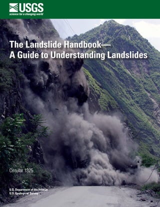
  • 2. Cover: The threat of landslides like this have made the long drive to Wenchuan a risky affair for rescuers and aid delivery teams as they tried to reach the epicenter of the Wenchuan, China, earthquake of May 12, 2008. This photograph shows a landslide that sealed the entrance and exit to Wenchuan on May 23, 2008. (Photograph by Chua Chin Hon, Straits Times, Singapore.)
  • 3. The Landslide Handbook— A Guide to Understanding Landslides By Lynn M. Highland, United States Geological Survey, and Peter Bobrowsky, Geological Survey of Canada Circular 1325 U.S. Department of the Interior U.S. Geological Survey
  • 4. U.S. Department of the Interior DIRK KEMPTHORNE, Secretary U.S. Geological Survey Mark D. Myers, Director U.S. Geological Survey, Reston, Virginia: 2008 For product and ordering information: World Wide Web: http://www.usgs.gov/pubprod Telephone: 1-888-ASK-USGS For more information on the USGS--the Federal source for science about the Earth, its natural and living resources, natural hazards, and the environment: World Wide Web: http://www.usgs.gov Telephone: 1-888-ASK-USGS Any use of trade, product, or firm names is for descriptive purposes only and does not imply endorsement by the U.S. Government. Although this report is in the public domain, permission must be secured from the individual copyright owners to reproduce any copyrighted materials contained within this report. Suggested citation: Highland, L.M., and Bobrowsky, Peter, 2008, The landslide handbook—A guide to understanding landslides: Reston, Virginia, U.S. Geological Survey Circular 1325, 129 p.
  • 5. iii Acknowledgments The authors thank the International Consortium on Landslides for sponsoring this project and the many reviewers who spent much of their time and effort on the careful review of this book. Thanks also to those who gave permission to use their previously published text, photographs and graphics and to those authors of landslide research and information whose painstaking work was crucial to its completion. We thank the Geological Survey of Canada, and especially Jan Aylsworth for her valuable review and suggestions. In addition, we acknowledge the U.S. Geological Survey, especially Paula Gori who supported the entire handbook process and provided advice and encouragement. This is Geological Survey of Canada Contribution Number 20080377.
  • 6. iv Earthquake-induced landslides, Sichuan Province, China, May 12, 2008. Photograph courtesy of Dr. Yin Yueping, China Geological Survey, Ministry of Land and Resources, China.
  • 7. v Contents Acknowledgments............................................................................................................................................ iii How to read this guide................................................................................................................................... xiii Please note............................................................................................................................................. xiii Introduction........................................................................................................................................................ 1 For more information......................................................................................................................................... 2 Section I.  Basic Information About Landslides....................................................................................... 3 Part A.  What is a Landslide?........................................................................................................................ 4 Part B.  Basic Landslide Types.................................................................................................................... 5 Falls............................................................................................................................................................. 6 Rockfall............................................................................................................................................. 6 Occurrence and relative size/range................................................................................... 6 Velocity of travel.................................................................................................................... 6 Triggering mechanism.......................................................................................................... 6 Effects (direct/indirect)......................................................................................................... 6 Corrective measures/mitigation.......................................................................................... 6 Predictability........................................................................................................................... 7 Topple......................................................................................................................................................... 8 Occurrence............................................................................................................................. 8 Velocity of travel.................................................................................................................... 8 Triggering mechanism.......................................................................................................... 8 Effects (direct/indirect)......................................................................................................... 8 Corrective measures/mitigation.......................................................................................... 8 Predictability........................................................................................................................... 8 Slides........................................................................................................................................................ 10 Rotational Landslide..................................................................................................................... 10 Occurrence........................................................................................................................... 10 Relative size/range.............................................................................................................. 10 Velocity of travel (rate of movement)............................................................................... 10 Triggering mechanism........................................................................................................ 10 Effects (direct/indirect)....................................................................................................... 10 Mitigation measures........................................................................................................... 10 Predictability......................................................................................................................... 11 Translational Landslide................................................................................................................ 12 Occurrence........................................................................................................................... 12 Relative size/range.............................................................................................................. 12 Velocity of travel.................................................................................................................. 12 Triggering mechanism........................................................................................................ 12 Effects (direct/indirect)....................................................................................................... 12 Mitigation measures........................................................................................................... 12 Predictability......................................................................................................................... 13 Spreads.................................................................................................................................................... 14 Lateral Spreads.................................................................................................................... 14 Occurrence........................................................................................................................... 14 Relative size/range.............................................................................................................. 14
  • 8. vi Velocity of travel.................................................................................................................. 14 Triggering mechanism........................................................................................................ 14 Effects (direct/indirect)....................................................................................................... 14 Mitigation measures........................................................................................................... 15 Predictability......................................................................................................................... 15 Flows......................................................................................................................................................16 Debris Flows................................................................................................................................... 16 Occurrence........................................................................................................................... 16 Relative size/range.............................................................................................................. 16 Velocity of travel.................................................................................................................. 16 Triggering mechanisms...................................................................................................... 16 Effects (direct/indirect)....................................................................................................... 16 Mitigation measures........................................................................................................... 17 Predictability......................................................................................................................... 17 Lahars (Volcanic Debris Flows).................................................................................................. 18 Occurrence........................................................................................................................... 18 Relative size/range.............................................................................................................. 18 Velocity of travel.................................................................................................................. 18 Triggering mechanism........................................................................................................ 18 Effects (direct/indirect)....................................................................................................... 18 Mitigation measures........................................................................................................... 18 Predictability......................................................................................................................... 19 Debris Avalanche.......................................................................................................................... 20 Occurrence........................................................................................................................... 20 Relative size/range.............................................................................................................. 20 Velocity of travel.................................................................................................................. 20 Triggering mechanism........................................................................................................ 20 Effects (direct/indirect)....................................................................................................... 20 Corrective measures/mitigation........................................................................................ 20 Predictability......................................................................................................................... 21 Earthflow......................................................................................................................................... 22 Occurrence........................................................................................................................... 22 Relative (size/range)............................................................................................................ 22 Velocity of travel.................................................................................................................. 22 Triggering mechanisms...................................................................................................... 22 Effects (direct/indirect)....................................................................................................... 22 Corrective measures/mitigation........................................................................................ 22 Predictability......................................................................................................................... 23 Slow Earthflow (Creep)................................................................................................................ 24 Occurrence........................................................................................................................... 24 Relative size/range.............................................................................................................. 24 Velocity of travel.................................................................................................................. 24 Triggering mechanism........................................................................................................ 24 Effects..................................................................................................................................24 Corrective measures/mitigation........................................................................................ 24 Predictability......................................................................................................................... 25
  • 9. vii Flows in Permafrost...................................................................................................................... 26 Occurrence........................................................................................................................... 26 Relative size/range.............................................................................................................. 26 Velocity of travel.................................................................................................................. 26 Triggering mechanisms...................................................................................................... 26 Effects (direct/indirect)....................................................................................................... 26 Corrective measures/mitigation........................................................................................ 26 Predictability......................................................................................................................... 26 Part C.  Where Do Landslides Occur?....................................................................................................... 29 Part D.  What Causes Landslides?............................................................................................................. 30 Natural Occurrences............................................................................................................................. 30 Landslides and Water.................................................................................................................. 30 Landslides and Seismic Activity................................................................................................. 32 Landslides and Volcanic Activity............................................................................................... 33 Human Activities.................................................................................................................................... 33 Part E.  What are the Effects and Consequences of Landslides?........................................................ 34 Effects of Landslides on the Built Environment................................................................................ 34 Effects of Landslides on the Natural Environment........................................................................... 36 Part F.  Interrelationship of Landslides with Other Natural Hazards— The Multiple Hazard Effect.............................................................................................................. 40 Section II.  Evaluating and Communicating Landslide Hazard........................................................... 43 Part A.  Evaluating Landslide Hazards...................................................................................................... 44 Observation and (or) inspection by local experts and (or) municipal officials, and property owners................................................................................................................ 44 Features that might indicate landslide movement.................................................................. 44 Technological Tools for Evaluation of Landslides—Mapping, Remote Sensing, and Monitoring.......................................................................................................................... 46 Map Analysis................................................................................................................................. 46 Aerial Reconnaissance................................................................................................................ 46 Field Reconnaissance.................................................................................................................. 46 Drilling...........................................................................................................................................47 Instrumentation............................................................................................................................. 47 Geophysical Studies..................................................................................................................... 47 Acoustic Imagery and Profiles................................................................................................... 47 Computerized Landslide Terrain Analysis................................................................................ 47 Part B.  Communicating Landslide Hazard............................................................................................... 48 Safety Information.................................................................................................................................. 48 Building and Construction Information.............................................................................................. 48 Suggested Local Government Outreach for Landslide Hazard..................................................... 49 Examples of Hazard Warning Signs.................................................................................................... 50 Section III.  Mitigation Concepts and Approaches............................................................................... 51 Part A.  Overview of Mitigation Methods for Various Types of Landslide Hazards.......................... 52 Soil Slope Stabilization.......................................................................................................................... 52 Rockfall Hazard Mitigation................................................................................................................... 53 Debris-Flow Hazard Mitigation............................................................................................................ 53 Landslide Dam Mitigation..................................................................................................................... 53 Methods of Biotechnical Landslide Mitigation................................................................................. 55
  • 10. viii Part B.  Simple Mitigation Techniques for Home and Businesses, Managers, and Citizens......... 56 Part C.  List of Works Consulted/Cited/Quoted and for Further Reading............................................ 57 Appendix A.  Basic Information about Landslides................................................................................ 59 Part 1.  Glossary of Landslide Terms......................................................................................................... 60 References for Glossary.............................................................................................................. 62 Sources of information on nomenclature................................................................................. 63 Part 2.  Parts of a Landslide—Description of Features/Glossary........................................................ 63 Part 3.  Landslide Causes and Triggering Mechanisms......................................................................... 64 Natural Causes....................................................................................................................................... 64 Geological causes........................................................................................................................ 64 Morphological causes................................................................................................................. 64 Physical Causes—Triggers.................................................................................................................. 64 Human Causes........................................................................................................................................ 64 Appendix B.  Introduction to Landslide Evaluation Tools—Mapping, Remote Sensing, and Monitoring of Landslides................................................................................................................. 65 Part 1.  Mapping............................................................................................................................................ 66 Regional mapping................................................................................................................................... 66 Community-level mapping.................................................................................................................... 66 Site-specific mapping............................................................................................................................ 66 Three Important Criteria for Landslide Maps.................................................................................... 67 Landslide inventory maps............................................................................................................ 67 Landslide susceptibility maps..................................................................................................... 68 Landslide hazard maps................................................................................................................ 69 Part 2.  Remote Sensing and Other Tools that Show Features of Landslide Activity....................... 70 Part 3.  Real-Time Monitoring of Landslides and Landslide Instrumentation.................................... 74 Appendix C.  Introduction to Landslide Stabilization and Mitigation............................................... 75 Part 1.  Earth Slope Stabilization/Mitigation............................................................................................ 76 Excavation............................................................................................................................................... 76 Removal of soil from the head of a slide................................................................................... 76 Reducing the height of the slope............................................................................................... 76 Backfilling with lightweight material......................................................................................... 78 Benches.......................................................................................................................................... 79 Flattening or reducing slope angle, or other slope modification......................................... 79 When not to excavate a slide mass........................................................................................... 79 Strengthening Slopes............................................................................................................................ 80 Plastic mesh reinforcement........................................................................................................ 80 Rock-fill buttresses....................................................................................................................... 80 Stream channel linings................................................................................................................ 82 Check Dams.......................................................................................................................... 83 To prevent check dam failure............................................................................................ 83 Drainage Techniques............................................................................................................................. 86 Site leveling.................................................................................................................................... 86 Ditches and drains........................................................................................................................ 86 Drainpipes...................................................................................................................................... 88 Straw wattles and straw bales................................................................................................... 89 Retaining Walls.............................................................................................................................. 90
  • 11. ix Timber crib ........................................................................................................................... 90 Steel bin wall ....................................................................................................................... 91 Reinforced earth wall......................................................................................................... 92 Gabion walls ........................................................................................................................ 93 Piles....................................................................................................................................... 94 Slope Stabilization Using Vegetation........................................................................................ 95 Types of seeds..................................................................................................................... 95 Mulching............................................................................................................................... 95 Biotechnical Slope Protection................................................................................................... 96 Part 2. Rock Slope Stabilization/Mitigation Techniques...................................................................... 99 Safe Catching Techniques................................................................................................................. 100 Catch Ditches.............................................................................................................................. 100 Cable, Mesh, Fencing, and Rock Curtains............................................................................ 100 Retaining Walls........................................................................................................................... 102 Rock Sheds/Shelters................................................................................................................. 102 Rock Ledge Reinforcement...................................................................................................... 102 Excavation of Rock.............................................................................................................................. 104 Benches....................................................................................................................................... 104 Scaling and Trimming................................................................................................................ 105 Reinforcing Potential Rockfall Areas............................................................................................... 107 Shotcrete and Gunite ................................................................................................................ 107 Anchors, Bolts, and Dowels..................................................................................................... 108 Part 3. Debris-Flow Mitigation................................................................................................................ 109 Strengthening Slopes for Erosion/Debris Flows............................................................................ 109 Strengthening the soil to resist erosion................................................................................. 110 Proper planting of vegetation on slopes can prevent erosion .......................................... 110 Keeping slopes free from fuel for wildfires........................................................................... 110 Structures for Mitigating Debris Flows........................................................................................... 111 Debris-flow basins..................................................................................................................... 111 Check dams................................................................................................................................. 111 Debris-flow retaining walls...................................................................................................... 112 Box Debris-Flow Mitigation for the Homeowner.................................................................. 113 Box Basic Things to Remember Concerning Mitigation and Response to Debris-Flow and Other Landslide Hazards/Emergency Response ............. 122 Landslide Dam Mitigation......................................................................................................... 123 Diversion of inflow water before it reaches the lake formed by the landslide dam................................................................................................ 123 Temporary drainage from the impoundment by pumps or siphons......................... 123 Construction of an erosion-resistant spillway............................................................. 124 Drainage tunnel through an abutment.......................................................................... 124 Appendix D. Sample Safety Information for Landslides/Debris Flows......................................... 127 What Can You Do If You Live Near Steep Hills?...................................................................................... 128 Prior to Intense Storms ...................................................................................................................... 128 During Intense Storms........................................................................................................................ 128 What to do if you suspect imminent landslide danger................................................................. 128 After landslides occur........................................................................................................................ 128 Index ............................................................................................................................................................129
  • 12. x Figures 1.  This landslide occurred at La Conchita, California, USA, in 2005..........................................4 2.  A simple illustration of a rotational landslide that has evolved into an earthflow.............5 3.  Schematic of a rockfall.................................................................................................................7 4.  A rockfall/slide that occurred in Clear Creek Canyon, Colorado, USA, in 2005..................7 5.  Schematic of a topple...................................................................................................................9 6.  Photograph of block toppling at Fort St. John, British Columbia, Canada...........................9 7.  Schematic of a rotational landslide..........................................................................................11 8.  Photograph of a rotational landslide which occurred in New Zealand.............................11 9.  Schematic of a translational landslide....................................................................................13 10.  A translational landslide that occurred in 2001 in the Beatton River Valley, British Columbia, Canada........................................................................................................................13 11.  Schematic of a lateral spread...................................................................................................15 12.  Photograph of lateral spread damage to a roadway as a result of the 1989 Loma Prieta, California, USA, earthquake..........................................................................................15 13.  Schematic of a debris flow........................................................................................................17 14.  Debris-flow damage to the city of Caraballeda......................................................................17 15.  Schematic of a lahar...................................................................................................................19 16.  Photograph of a lahar.................................................................................................................19 17.  Schematic of a debris avalanche.............................................................................................21 18.  A debris avalanche that buried the village of Guinsaugon, Southern Leyte, Philippines.....................................................................................................................................21 19.  Schematic of an earthflow.........................................................................................................23 20.  The 1993 Lemieux landslide.......................................................................................................23 21.  Schematic of a slow earthflow.................................................................................................25 22.  The effects of creep, in an area near East Sussex, United Kingdom.................................25 23.  Schematic of a retrogressive thaw flow slide........................................................................27 24.  Photograph of a retrogressive thaw flow in the Northwest Territories, Canada..............28 25.  Photograph showing lateral spreading damage....................................................................29 26.  Photograph showing the Mameyes, Puerto Rico, landslide, 1985......................................31 27.  Earthquake-induced landslide damage to a house built on artificial fill............................32 28.  Photograph showing the side of Casita Volcano in Nicaragua, Central America............33 29.  A landslide on the Pan American Highway in El Salvador, Central America....................35 30.   The active volcano, Mount Shasta in California, USA.........................................................37 31.  View looking downstream at the confluence of the Río Malo.............................................38 32.  The Slumgullion landslide, Colorado, USA..............................................................................39 33.  An example of a multi-hazard event.........................................................................................41 34.  The 1999 multi-hazard event in Tanaguarena, in coastal Venezuela, South America.....42 35.  Photograph showing the aftereffects of a multi-hazard event............................................42 36.  Ground cracks..............................................................................................................................45 37.  Sidewalk pulling away from house...........................................................................................45 38.  Cracking of the foundation of a structure...............................................................................45 39.  Example of a rockfall hazard sign.............................................................................................50 41.  Sign along a highway in Virginia, USA.....................................................................................50 40.  A notice for cliff hazards, city of Wanneroo, Australia.........................................................50
  • 13. xi 42.  The Thistle landslide in Utah, USA...........................................................................................54 43.  Extensive damage in the mountainous terrain of Beichuan County...................................55 A1.  Parts of a landslide......................................................................................................................63 B1.  Example of a landslide inventory map.....................................................................................67 B2.  An example of a landslide susceptibility map........................................................................68 B3.  Portion of shallow landslide hazard map................................................................................69 B4.  An example of an aerial photograph........................................................................................71 B5.  Schematic showing satellite passes over an area of the Earth’s surface.........................71 B6.  Interferogram from InSAR imaging process...........................................................................72 B7.  An oblique LiDAR image.............................................................................................................73 B8.  Measuring landslide movement using an extensometer......................................................74 B9.  Testing a solar-powered radiotelemetry system....................................................................74 B10.  Example of a network for measurement and transmission of real-time landslide data...............................................................................................................................74 C1.  Illustration of the differences in stability resulting in excavation at the head and toe surfaces of a slope.......................................................................................77 C2.  Illustration of the difference in stability of loading either the head or the toe of a slope.........................................................................................................................77 C3.  Illustration of the importance of water in the stability of a slope........................................77 C4.  Schematic and photograph of a lightweight backfill.............................................................78 C5.  Schematic and photograph of a Rockfill buttress..................................................................81 C6.  Example of creek channel lining using rock...........................................................................82 C7.  Schematic and photograph of a crib wall check dam..........................................................84 C8.  Upstream view of concrete crib-type check dam.................................................................85 C9.  Schematic and photograph of a drain trench.........................................................................87 C10.  Schematic and photograph of drainpipes...............................................................................88 C11.  Straw wattles on the side of a road.........................................................................................89 C12.  Straw bales at a mine site..........................................................................................................89 C13.  Schematic and photograph of a timber crib...........................................................................90 C14.  Schematic and photograph of a steel bin wall.......................................................................91 C15.  Schematic and photograph of a reinforced earth wall.........................................................92 C16.  Schematic and photograph of a gabion wall..........................................................................93 C17.  A concrete-filled pile wall..........................................................................................................94 C18.  A Vetiver grass system...............................................................................................................97 C19.  Worldwide distribution of active Vetiver grass programs....................................................98 C20.  Rockfall countermeasures.........................................................................................................99 C21.  Example of wire mesh placed over a rocky slope...............................................................100 C22.  Protective rock barrier fencing...............................................................................................101 C23.  Example of a “rock curtain”....................................................................................................101 C24.  Pitquah rock sheds....................................................................................................................102 C25.  An open rock shed.....................................................................................................................103 C26.  A rock avalanche shelter.........................................................................................................103 C27.  A reinforced rock ledge............................................................................................................103 C28.  Schematic and photograph of rock benches.......................................................................104 C29.  Rocks dislodged by scaling and blasting..............................................................................105 C30.  A hydraulic rock hammer in action........................................................................................106
  • 14. xii C31.  Shotcrete operation..................................................................................................................107 C32.  Closeup photograph of a rock anchor...................................................................................108 C33.  A rock bolting operation...........................................................................................................108 C34.  Wildfire-burned slopes and debris flow................................................................................109 C35.  Aerial photograph of a debris-flow basin..............................................................................111 C36.  A steel-and-timber retaining wall...........................................................................................112 C37.  A debris-flow retaining wall....................................................................................................112 C38.  Schematic of an unprotected home.......................................................................................113 C39.  Schematic example of a house with protective structures in place................................113 C40.  Schematic of typical materials for helping to reduce damage from flood/ debris-flow events.....................................................................................................................114 C41.  Sandbags are basically for low-flow protection..................................................................115 C42.  Schematic of a typical placement of sandbags for home protection...............................116 C43.  Sandbags help in directing debris away from buildings.....................................................116 C44.  Controlling debris or stormflows in streets with sandbags................................................117 C45.  Directing flows between buildings by using sandbags......................................................117 C46.  Sliding glass door sealing........................................................................................................118 C47.  Typical window and door protection......................................................................................119 C48.  Nailing up plywood or lumber for window and door protection........................................119 C49.  A timber deflector......................................................................................................................120 C50.  Closeup schematic of a timber deflector installation technique.......................................120 C51.  An alternative to timber deflectors.........................................................................................121 C52.  Removable driveway barrier...................................................................................................121 C53.  The Thistle landslide, in Utah, USA, 1983..............................................................................125 C54.  Closeup view of mitigation measures taken to reduce the impact of the Thistle landslide dam................................................................................................................126 C55.  Photograph with annotations showing the reactivation and enlargement of the Thistle landslide dam.....................................................................................................126
  • 15. xiii How to read this guide This guide consists of three primary sections with a series of extensive appendixes and an index. This style provides the most flexibility for users with considerable differences of interest and level of detail. Much of the detailed and expanded explanatory information can be found in the appendixes, including a Glossary of Landslide Terms. References are pro- vided for more information. Please note For ease of reading, references are numbered at the end of sections and are not• embedded within the text. The user may also contact either the United States Geolog- ical Survey or the Geological Survey of Canada for further guidance and assistance. Web sites are used as references for this book; however, Web site addresses (URLs)• can change over time, and the Internet links given in this publication may become inactive or erroneous. It is suggested that users consult a Web-based keyword search engine if links are no longer accessible.
  • 16. xiv The Donghekou landslide, caused by the May 2008 Wenchuan Earthquake in Sichuan County, China. This extremely large landslide buried hundreds of people and caused a landslide dam to form in the Dong He River. Photograph by Lynn Highland, U.S. Geological Survey.
  • 17. Introduction This handbook is intended to be a resource for people affected by landslides to acquire further knowledge, especially about the conditions that are unique to their neighborhoods and communities. Considerable literature and research are available concerning landslides, but unfortunately little of it is synthesized and integrated to address the geographically unique geologic and climatic conditions around the globe. Landslides occur throughout the world, under all climatic conditions and terrains, cost billions in monetary losses, and are responsible for thousands of deaths and injuries each year. Often, they cause long-term economic disruption, population displacement, and negative effects on the natural environment. Outdated land-use policies may not always reflect the best planning for use of land that is vulnerable to landslides. The reasons for poor or nonexistent land-use policies that minimize the perceived or actual danger and damage potential from geologic hazards are many and encompass the political, cultural, and financial com- plexities and intricacies of communities. Landslides often are characterized as local problems, but their effects and costs frequently cross local jurisdictions and may become State or Provincial or national problems. Growing populations may be limited in their geographic expansion, except to occupy unstable, steep, or remote areas. Often, stabilizing landslide-scarred areas is too costly, and some inhabitants have no other places to relocate. Fortunately, simple, “low-tech” precautions and actions can be adopted to at least ensure an individual’s immediate safety, and this handbook gives a brief overview of many of these options. We strongly suggest that, where possible, the assistance of profes- sional engineers/geologists or those experienced in the successful mitigation of unstable slopes be consulted before actions are taken. This handbook helps home- owners, community and emergency managers, and decisionmakers to take the positive step of encouraging awareness of available options and recourse in regard to landslide hazard. The Landslide Handbook— A Guide to Understanding Landslides By Lynn M. Highland, United States Geological Survey, and Peter Bobrowsky, Geological Survey of Canada
  • 18. 2   The Landslide Handbook­—A Guide to Understanding Landslides We provide a list of references, available in print or on the World Wide Web (Internet), that can be used for further knowledge about landslides. We recommend this handbook to managers and decisionmakers in communities in the hope that the information will be disseminated by such officials to other members of those communities. In response to the differing levels of literacy around the globe, we have emphasized visual information through the use of photographs and graphics. We plan to translate the handbook into additional languages as funding permits to further facilitate its use. We welcome comments and critiques and have provided our contact informa- tion and the names and addresses of our respective agencies. For more information For questions on the content of this book or other inquiries regarding landslide issues, please be aware that the U.S. Geological Survey (USGS) National Landslide Information Center (NLIC), in Golden, Colorado, USA, is available as a resource to answer questions, help with interpretations, or otherwise support users of this book in providing additional information. Please contact the center by telephone, email, or written inquiry. United States Geological Survey Landslide Program and National Landslide Information Center Mail Stop 966, Box 25046, Denver Federal Center Denver, Colorado, 80225 USA Web address: http://landslides.usgs.gov/ Telephone: 1-800-654-4966, or 1-303-273-8586 Highland@usgs.gov Geological Survey of Canada Landslides and Geotechnic Section 601 Booth Street Ottawa, Ontario, Canada KIA 0E8 Web address: http://gsc.nrcan.gc.ca/landslides/index_e.php Telephone: 1-613-947-0333 pbobrows@nrcan-rncan.gc.ca
  • 19. Section I. Basic Information About Landslides
  • 20. 4   The Landslide Handbook­—A Guide to Understanding Landslides Figure 1.  This landslide occurred at La Conchita, California, USA, in 2005. Ten people were killed. (Photograph by Mark Reid, U.S. Geological Survey.) Part A.  What is a Landslide? Geologists, engineers, and other professionals often rely on unique and slightly differing definitions of landslides. This diversity in definitions reflects the complex nature of the many disciplines associated with studying landslide phenomena. For our purposes, landslide is a general term used to describe the downslope movement of soil, rock, and organic materials under the effects of gravity and also the landform that results from such movement (please see figure 1 for an example of one type of landslide). Varying classifications of landslides are associated with specific mechanics of slope failure and the properties and characteristics of failure types; these will be discussed briefly herein. There are a number of other phrases/terms that are used interchangeably with the term “landslide” including mass movement, slope failure, and so on. One com- monly hears such terms applied to all types and sizes of landslides. Regardless of the exact definition used or the type of landslide under discus- sion, understanding the basic parts of a typical landslide is helpful. Figure 2 shows the position and the most common terms used to describe the unique parts of a land- slide. These terms and other relevant words are defined in the Glossary of Landslide Terms included in Appendix A.
  • 21. Part B.  Basic Landslide Types   5 Part B.  Basic Landslide Types A landslide is a downslope movement of rock or soil, or both, occurring on the surface of rupture—either curved (rotational slide) or planar (translational slide) rupture—in which much of the material often moves as a coherent or semicoherent mass with little internal deformation. It should be noted that, in some cases, land- slides may also involve other types of movement, either at the inception of the failure or later, if properties change as the displaced material moves downslope. This section provides descriptions and illustrations of the various types of land- slides. Understanding the characteristics of the specific type of landslide hazard in your area is vitally important to consider when planning or adopting appropriate miti- gative action to lessen the risk of loss and damage. The type of landslide will deter- mine the potential speed of movement, likely volume of displacement, distance of run-out, as well as the possible effects of the landslide and the appropriate mitigative measures to be considered. Landslides can be classified into different types on the basis of the type of move- ment and the type of material involved (please see References 9 and 39). In brief, material in a landslide mass is either rock or soil (or both); the latter is described as earth if mainly composed of sand-sized or finer particles and debris if composed of coarser fragments. The type of movement describes the actual internal mechanics of how the landslide mass is displaced: fall, topple, slide, spread, or flow. Thus, land- slides are described using two terms that refer respectively to material and movement (that is, rockfall, debris flow, and so forth). Landslides may also form a complex fail- ure encompassing more than one type of movement (that is, rock slide—debris flow). For the purposes of this handbook we treat “type of movement” as synonymous with “landslide type.” Each type of movement can be further subdivided according to specific properties and characteristics, and the main subcategories of each type are described elsewhere. Less common subcategories are not discussed in this handbook but are referred to in the source reference. Direct citations and identification of sources and references for text are avoided in the body of this handbook, but all source materials are duly recognized and given in the accompanying reference lists. Figure 2.  A simple illustration of a rotational landslide that has evolved into an earthflow. Image illustrates commonly used labels for the parts of a landslide (from Varnes, 1978, Reference 43). Transverse cracks Minor scarp Head Main scarp Crown cracks Crown Surface of rupture Main body Toe of surface of ruptureFoot Surface of separation Toe Radial cracks Transverse ridges Right flank Original ground surface
  • 22. For further reading: References 9, 39, 43, and 45 6   The Landslide Handbook­—A Guide to Understanding Landslides Falls A fall begins with the detachment of soil or rock, or both, from a steep slope along a surface on which little or no shear displacement has occurred. The material subsequently descends mainly by falling, bouncing, or rolling. Rockfall Falls are abrupt, downward movements of rock or earth, or both, that detach from steep slopes or cliffs. The falling material usually strikes the lower slope at angles less than the angle of fall, causing bouncing. The falling mass may break on impact, may begin rolling on steeper slopes, and may continue until the terrain flattens. Occurrence and relative size/range Common worldwide on steep or vertical slopes—also in coastal areas, and along rocky banks of rivers and streams. The volume of material in a fall can vary substantially, from individual rocks or clumps of soil to massive blocks thousands of cubic meters in size. Velocity of travel Very rapid to extremely rapid, free-fall; bouncing and rolling of detached soil, rock, and boulders. The rolling velocity depends on slope steepness. Triggering mechanism Undercutting of slope by natural processes such as streams and rivers or differential weathering (such as the freeze/thaw cycle), human activities such as excavation during road building and (or) maintenance, and earth- quake shaking or other intense vibration. Effects (direct/indirect) Falling material can be life-threatening. Falls can damage property beneath the fall-line of large rocks. Boulders can bounce or roll great distances and damage structures or kill people. Damage to roads and railroads is particularly high: rockfalls can cause deaths in vehicles hit by rocks and can block highways and railroads. Corrective measures/mitigation Rock curtains or other slope covers, protective covers over roadways, retaining walls to prevent rolling or bouncing, explosive blasting of hazardous target areas to remove the source, removal of rocks or other materials from highways and railroads can be used. Rock bolts or other similar types of anchoring used to stabilize cliffs, as well as scaling, can lessen the hazard. Warning signs are recommended in hazardous areas for awareness. Stopping or parking under hazardous cliffs should be warned against.
  • 23. Part B.  Basic Landslide Types   7 Figure 4.  A rockfall/slide that occurred in Clear Creek Canyon, Colorado, USA, in 2005, closing the canyon to traffic for a number of weeks. The photograph also shows an example of a rock curtain, a barrier commonly applied over hazardous rock faces (right center of photograph). (Photograph by Colorado Geological Survey.) Predictability Mapping of hazardous rockfall areas has been completed in a few areas around the world. Rock-bounce calculations and estimation methods for delineating the perimeter of rockall zones have also been determined and the information widely published. Indicators of imminent rockfall include terrain with overhanging rock or fractured or jointed rock along steep slopes, particularly in areas subject to frequent freeze-thaw cycles. Also, cut faces in gravel pits may be particularly subject to falls. Figures 3 and 4 show a schematic and an image of rockfall. Figure 3.  Schematic of a rockfall. (Schematic modified from Reference 9.)
  • 24. For further reading: References 9, 39, 43, and 45 8   The Landslide Handbook­—A Guide to Understanding Landslides Topple A topple is recognized as the forward rotation out of a slope of a mass of soil or rock around a point or axis below the center of gravity of the displaced mass. Toppling is sometimes driven by gravity exerted by the weight of material upslope from the displaced mass. Sometimes toppling is due to water or ice in cracks in the mass. Topples can consist of rock, debris (coarse material), or earth materials (fine- grained material). Topples can be complex and composite. Occurrence Known to occur globally, often prevalent in columnar-jointed volcanic terrain, as well as along stream and river courses where the banks are steep. Velocity of travel Extremely slow to extremely rapid, sometimes accelerating throughout the movement depending on distance of travel. Triggering mechanism Sometimes driven by gravity exerted by material located upslope from the displaced mass and sometimes by water or ice occurring in cracks within the mass; also, vibration, undercutting, differential weathering, excavation, or stream erosion. Effects (direct/indirect) Can be extremely destructive, especially when failure is sudden and (or) the velocity is rapid. Corrective measures/mitigation In rock there are many options for the stabilization of topple-prone areas. Some examples for reinforcement of these slopes include rock bolts and mechanical and other types of anchors. Seepage is also a contributing factor to rock instability, and drainage should be considered and addressed as a corrective means. Predictability Not generally mapped for susceptibility; some inventory of occurrence exists for certain areas. Monitoring of topple-prone areas is useful; for example, the use of tiltmeters. Tiltmeters are used to record changes in slope inclination near cracks and areas of greatest vertical movements. Warning systems based on movement measured by tiltmeters could be effective. Figures 5 and 6 show a schematic and an image of topple.
  • 25. Part B.  Basic Landslide Types   9 Figure 5.  Schematic of a topple. (Schematic from Reference 9.) Figure 6.  Photograph of block toppling at Fort St. John, British Columbia, Canada. (Photograph by G. Bianchi Fasani.)
  • 26. 10   The Landslide Handbook­—A Guide to Understanding Landslides Slides A slide is a downslope movement of a soil or rock mass occurring on surfaces of rupture or on relatively thin zones of intense shear strain. Movement does not ini- tially occur simultaneously over the whole of what eventually becomes the surface of rupture; the volume of displacing material enlarges from an area of local failure. Rotational Landslide A landslide on which the surface of rupture is curved upward (spoon-shaped) and the slide movement is more or less rotational about an axis that is parallel to the contour of the slope. The displaced mass may, under certain circumstances, move as a relatively coherent mass along the rupture surface with little internal deformation. The head of the displaced material may move almost vertically downward, and the upper surface of the displaced material may tilt backwards toward the scarp. If the slide is rotational and has several parallel curved planes of movement, it is called a slump. Occurrence Because rotational slides occur most frequently in homogeneous materials, they are the most common landslide occurring in “fill” materials. Relative size/range Associated with slopes ranging from about 20 to 40 degrees. In soils, the surface of rupture generally has a depth-to-length ratio between 0.3 to 0.1. Velocity of travel (rate of movement) Extremely slow (less than 0.3 meter or 1 foot every 5 years) to moder- ately fast (1.5 meters or 5 feet per month) to rapid. Triggering mechanism Intense and (or) sustained rainfall or rapid snowmelt can lead to the saturation of slopes and increased groundwater levels within the mass; rapid drops in river level following floods, ground-water levels rising as a result of filling reservoirs, or the rise in level of streams, lakes, and rivers, which cause erosion at the base of slopes. These types of slides can also be earthquake-induced. Effects (direct/indirect) Can be extremely damaging to structures, roads, and lifelines but are not usually life-threatening if movement is slow. Structures situated on the moving mass also can be severely damaged as the mass tilts and deforms. The large volume of material that is displaced is difficult to permanently stabilize. Such failures can dam rivers, causing flooding. Mitigation measures Instrumental monitoring to detect movement and the rate of movement can be implemented. Disrupted drainage pathways should be restored or reengineered to prevent future water buildup in the slide mass. Proper grading and engineering of slopes, where possible, will reduce the hazard considerably. Construction of retaining walls at the toe may be effective to slow or deflect the moving soil; however, the slide may over- top such retaining structures despite good construction.
  • 27. For further reading: References 9, 39, 43, and 45 Part B.  Basic Landslide Types   11 Rotationallandslide Figure 7.  Schematic of a rotational landslide. (Schematic modified from Reference 9.) Figure 8.  Photograph of a rotational landslide which occurred in New Zealand. The green curve at center left is the scarp (the area where the ground has failed). The hummocky ground at bottom right (in shadow) is the toe of the landslide (red line). This is called a rotational landslide as the earth has moved from left to right on a curved sliding surface. The direction and axis of rotation are also depicted. (Photograph by Michael J. Crozier, Encyclopedia of New Zealand, updated September 21, 2007.) Predictability Historical slides can be reactivated; cracks at tops (heads) of slopes are good indicators of the initiation of failure. Figures 7 and 8 show a schematic and an image of a rotational landslide.
  • 28. 12   The Landslide Handbook­—A Guide to Understanding Landslides Translational Landslide The mass in a translational landslide moves out, or down and outward, along a relatively planar surface with little rotational movement or backward tilting. This type of slide may progress over considerable distances if the surface of rupture is sufficiently inclined, in contrast to rotational slides, which tend to restore the slide equilibrium. The material in the slide may range from loose, unconsolidated soils to extensive slabs of rock, or both. Translational slides commonly fail along geologic discontinuities such as faults, joints, bedding surfaces, or the contact between rock and soil. In northern environments the slide may also move along the permafrost layer. Occurrence One of the most common types of landslides, worldwide. They are found globally in all types of environments and conditions. Relative size/range Generally shallower than rotational slides. The surface of rupture has a distance-to-length ratio of less than 0.1 and can range from small (residential lot size) failures to very large, regional landslides that are kilometers wide. Velocity of travel Movement may initially be slow (5 feet per month or 1.5 meters per month) but many are moderate in velocity (5 feet per day or 1.5 meters per day) to extremely rapid. With increased velocity, the landslide mass of translational failures may disintegrate and develop into a debris flow. Triggering mechanism Primarily intense rainfall, rise in ground water within the slide due to rainfall, snowmelt, flooding, or other inundation of water resulting from irrigation, or leakage from pipes or human-related disturbances such as undercutting. These types of landslides can be earthquake-induced. Effects (direct/indirect) Translational slides may initially be slow, damaging property and (or) lifelines; in some cases they can gain speed and become life-threatening. They also can dam rivers, causing flooding. Mitigation measures Adequate drainage is necessary to prevent sliding or, in the case of an existing failure, to prevent a reactivation of the movement. Common corrective measures include leveling, proper grading and drainage, and retaining walls. More sophisticated remedies in rock include anchors, bolts, and dowels, which in all situations are best implemented by professionals. Translational slides on moderate to steep slopes are very difficult to stabilize permanently.
  • 29. Part B.  Basic Landslide Types   13 Surface of rupture Toe Figure 9.  Schematic of a translational landslide. (Schematic modified from Reference 9.) Figure 10.  A translational landslide that occurred in 2001 in the Beatton River Valley, British Columbia, Canada. (Photograph by Réjean Couture, Canada Geological Survey.) Predictability High probability of occurring repetitively in areas where they have occurred in the past, including areas subject to frequent strong earth- quakes. Widening cracks at the head or toe bulge may be an indicator of imminent failure. Figures 9 and 10 show a schematic and an image of a translational landslide. For further reading: References 9, 39, 43, and 45
  • 30. 14   The Landslide Handbook­—A Guide to Understanding Landslides Spreads An extension of a cohesive soil or rock mass combined with the general sub- sidence of the fractured mass of cohesive material into softer underlying material. Spreads may result from liquefaction or flow (and extrusion) of the softer under- lying material. Types of spreads include block spreads, liquefaction spreads, and lateral spreads. Lateral Spreads Lateral spreads usually occur on very gentle slopes or essentially flat terrain, especially where a stronger upper layer of rock or soil undergoes extension and moves above an underlying softer, weaker layer. Such failures commonly are accom- panied by some general subsidence into the weaker underlying unit. In rock spreads, solid ground extends and fractures, pulling away slowly from stable ground and moving over the weaker layer without necessarily forming a recognizable surface of rupture. The softer, weaker unit may, under certain conditions, squeeze upward into fractures that divide the extending layer into blocks. In earth spreads, the upper stable layer extends along a weaker underlying unit that has flowed following liquefaction or plastic deformation. If the weaker unit is relatively thick, the overriding fractured blocks may subside into it, translate, rotate, disintegrate, liquefy, or even flow. Occurrence Worldwide and known to occur where there are liquefiable soils. Common, but not restricted, to areas of seismic activity. Relative size/range The area affected may start small in size and have a few cracks that may spread quickly, affecting areas of hundreds of meters in width. Velocity of travel May be slow to moderate and sometimes rapid after certain triggering mechanisms, such as an earthquake. Ground may then slowly spread over time from a few millimeters per day to tens of square meters per day. Triggering mechanism Triggers that destabilize the weak layer include: Liquefaction of lower weak layer by earthquake shaking• Natural or anthropogenic overloading of the ground above an unstable slope• Saturation of underlying weaker layer due to precipitation, snowmelt, and• (or) ground-water changes Liquefaction of underlying sensitive marine clay following an erosional• disturbance at base of a riverbank/slope Plastic deformation of unstable material at depth (for example, salt)• Effects (direct/indirect) Can cause extensive property damage to buildings, roads, railroads, and lifelines. Can spread slowly or quickly, depending on the extent of water saturation of the various soil layers. Lateral spreads may be a precursor to earthflows.
  • 31. Part B.  Basic Landslide Types   15 Mitigation measures Liquefaction-potential maps exist for some places but are not widely available. Areas with potentially liquefiable soils can be avoided as construction sites, particularly in regions that are known to experience frequent earthquakes. If high ground-water levels are involved, sites can be drained or other water-diversion efforts can be added. Predictability High probability of recurring in areas that have experienced previous problems. Most prevalent in areas that have an extreme earthquake hazard as well as liquefiable soils. Lateral spreads are also associated with susceptible marine clays and are a common problem throughout the St. Lawrence Lowlands of eastern Canada. Figures 11 and 12 show a schematic and an image of a lateral spread. Firm clay Bedrock Soft clay with water-bearing silt and sand layers Figure 11.  Schematic of a lateral spread. A liquefiable layer underlies the surface layer. (Schematic modified from Reference 9.) Figure 12.  Photograph of lateral spread damage to a roadway as a result of the 1989 Loma Prieta, California, USA, earthquake. (Photograph by Steve Ellen, U.S. Geological Survey.) For further reading: References 9, 39, 43, and 45
  • 32. 16   The Landslide Handbook­—A Guide to Understanding Landslides Flows A flow is a spatially continuous movement in which the surfaces of shear are short-lived, closely spaced, and usually not preserved. The component velocities in the displacing mass of a flow resemble those in a viscous liquid. Often, there is a gradation of change from slides to flows, depending on the water content, mobility, and evolution of the movement. Debris Flows A form of rapid mass movement in which loose soil, rock and sometimes organic matter combine with water to form a slurry that flows downslope. They have been informally and inappropriately called “mudslides” due to the large quantity of fine material that may be present in the flow. Occasionally, as a rotational or translational slide gains velocity and the internal mass loses cohesion or gains water, it may evolve into a debris flow. Dry flows can sometimes occur in cohesionless sand (sand flows). Debris flows can be deadly as they can be extremely rapid and may occur without any warning. Occurrence Debris flows occur around the world and are prevalent in steep gullies and canyons; they can be intensified when occurring on slopes or in gullies that have been denuded of vegetation due to wildfires or forest logging. They are common in volcanic areas with weak soil. Relative size/range These types of flows can be thin and watery or thick with sediment and debris and are usually confined to the dimensions of the steep gullies that facilitate their downward movement. Generally the movement is relatively shallow and the runout is both long and narrow, sometimes extending for kilometers in steep terrain. The debris and mud usually terminate at the base of the slopes and create fanlike, triangular deposits called debris fans, which may also be unstable. Velocity of travel Can be rapid to extremely rapid (35 miles per hour or 56 km per hour) depending on consistency and slope angle. Triggering mechanisms Debris flows are commonly caused by intense surface-water flow, due to heavy precipitation or rapid snowmelt, that erodes and mobilizes loose soil or rock on steep slopes. Debris flows also commonly mobilize from other types of landslides that occur on steep slopes, are nearly saturated, and consist of a large proportion of silt- and sand-sized material. Effects (direct/indirect) Debris flows can be lethal because of their rapid onset, high speed of movement, and the fact that they can incorporate large boulders and other pieces of debris. They can move objects as large as houses in their downslope flow or can fill structures with a rapid accumulation of sediment and organic matter. They can affect the quality of water by depositing large amounts of silt and debris.
  • 33. Part B.  Basic Landslide Types   17 Mitigation measures Flows usually cannot be prevented; thus, homes should not be built in steep-walled gullies that have a history of debris flows or are otherwise susceptible due to wildfires, soil type, or other related factors. New flows can be directed away from structures by means of deflection, debris-flow basins can be built to contain flow, and warning systems can be put in place in areas where it is known at what rainfall thresholds debris flows are triggered. Evacuation, avoidance, and (or) relocation are the best methods to prevent injury and life loss. Predictability Maps of potential debris-flow hazards exist for some areas. Debris flows can be frequent in any area of steep slopes and heavy rainfall, either sea- sonally or intermittently, and especially in areas that have been recently burned or the vegetation removed by other means. Figures 13 and 14 show a schematic and an image of a debris flow. Figure 13.  Schematic of a debris flow. (Schematic modified from Reference 9.) Figure 14.  Debris-flow damage to the city of Caraballeda, located at the base of the Cordillera de la Costan, on the north coast of Venezuela. In December 1999, this area was hit by Venezuela’s worst natural disaster of the 20th century; several days of torrential rain triggered flows of mud, boulders, water, and trees that killed as many as 30,000 people. (Photograph by L.M. Smith, Waterways Experiment Station, U.S. Army Corps of Engineers.) For further reading: References 9, 39, 43, and 45
  • 34. 18   The Landslide Handbook­—A Guide to Understanding Landslides Lahars (Volcanic Debris Flows) The word “lahar” is an Indonesian term. Lahars are also known as volcanic mudflows. These are flows that originate on the slopes of volcanoes and are a type of debris flow. A lahar mobilizes the loose accumulations of tephra (the airborne solids erupted from the volcano) and related debris. Occurrence Found in nearly all volcanic areas of the world. Relative size/range Lahars can be hundreds of square kilometers or miles in area and can become larger as they gain speed and accumulate debris as they travel downslope; or, they can be small in volume and affect limited areas of the volcano and then dissipate downslope. Velocity of travel Lahars can be very rapid (more than 35 miles per hour or 50 kilometers per hour) especially if they mix with a source of water such as melting snowfields or glaciers. If they are viscous and thick with debris and less water, the movement will be slow to moderately slow. Triggering mechanism Water is the primary triggering mechanism, and it can originate from crater lakes, condensation of erupted steam on volcano particles, or the melting of snow and ice at the top of high volcanoes. Some of the largest and most deadly lahars have originated from eruptions or volcanic vent- ing which suddenly melts surrounding snow and ice and causes rapid liquefaction and flow down steep volcanic slopes at catastrophic speeds. Effects (direct/indirect) Effects can be extremely large and devastating, especially when trig- gered by a volcanic eruption and consequent rapid melting of any snow and ice—the flow can bury human settlements located on the volcano slopes. Some large flows can also dam rivers, causing flooding upstream. Subsequent breaching of these weakly cemented dams can cause catastrophic flooding downstream. This type of landslide often results in large numbers of human casualties. Mitigation measures No corrective measures are known that can be taken to prevent damage from lahars except for avoidance by not building or locating in their paths or on the slopes of volcanoes. Warning systems and subsequent evacua- tion work in some instances may save lives. However, warning systems require active monitoring, and a reliable evacuation method is essential.
  • 35. Part B.  Basic Landslide Types   19 Figure 15.  Schematic of a lahar. (Graphic by U.S. Geological Survey.) Figure 16.  Photograph of a lahar caused by the 1982 eruption of Mount St. Helens in Washington, USA. (Photograph by Tom Casadevall, U.S. Geological Survey.) Predictability Susceptibility maps based on past occurrences of lahars can be con- structed, as well as runout estimations of potential flows. Such maps are not readily available for most hazardous areas. Figures 15 and 16 show a schematic and an image of a lahar. For further reading: References 9, 39, 43, and 45
  • 36. 20   The Landslide Handbook­—A Guide to Understanding Landslides Debris Avalanche Debris avalanches are essentially large, extremely rapid, often open-slope flows formed when an unstable slope collapses and the resulting fragmented debris is rap- idly transported away from the slope. In some cases, snow and ice will contribute to the movement if sufficient water is present, and the flow may become a debris flow and (or) a lahar. Occurrence Occur worldwide in steep terrain environments. Also common on very steep volcanoes where they may follow drainage courses. Relative size/range Some large avalanches have been known to transport material blocks as large as 3 kilometers in size, several kilometers from their source. Velocity of travel Rapid to extremely rapid; such debris avalanches can travel close to 100 meters/sec. Triggering mechanism In general, the two types of debris avalanches are those that are “cold” and those that are “hot.” A cold debris avalanche usually results from a slope becoming unstable, such as during collapse of weathered slopes in steep terrain or through the disintegration of bedrock during a slide-type landslide as it moves downslope at high velocity. At that point, the mass can then transform into a debris avalanche. A hot debris avalanche is one that results from volcanic activity including volcanic earthquakes or the injection of magma, which causes slope instability. Effects (direct/indirect) Debris avalanches may travel several kilometers before stopping, or they may transform into more water-rich lahars or debris flows that travel many tens of kilometers farther downstream. Such failures may inun- date towns and villages and impair stream quality. They move very fast and thus may prove deadly because there is little chance for warning and response. Corrective measures/mitigation Avoidance of construction in valleys on volcanoes or steep mountain slopes and real-time warning systems may lessen damages. However, warning systems may prove difficult due to the speed at which debris avalanches occur—there may not be enough time after the initiation of the event for people to evacuate. Debris avalanches cannot be stopped or prevented by engineering means because the associated triggering mechanisms are not preventable.
  • 37. Part B.  Basic Landslide Types   21 Figure 17.  Schematic of a debris avalanche. (Schematic modified from Reference 9.) Figure 18.  A debris avalanche that buried the village of Guinsaugon, Southern Leyte, Philippines, in February 2006. (Photograph by University of Tokyo Geotechnical Team.) Please see figure 30 for an image of another debris avalanche. Predictability If evidence of prior debris avalanches exists in an area, and if such evidence can be dated, a probabilistic recurrence period might be established. During volcanic eruptions, chances are greater for a debris avalanche to occur, so appropriate cautionary actions could be adopted. Figures 17 and 18 show a schematic and an image of a debris avalanche. For further reading: References 9, 39, 43, and 45
  • 38. 22   The Landslide Handbook­—A Guide to Understanding Landslides Earthflow Earthflows can occur on gentle to moderate slopes, generally in fine-grained soil, commonly clay or silt, but also in very weathered, clay-bearing bedrock. The mass in an earthflow moves as a plastic or viscous flow with strong internal defor- mation. Susceptible marine clay (quick clay) when disturbed is very vulnerable and may lose all shear strength with a change in its natural moisture content and sud- denly liquefy, potentially destroying large areas and flowing for several kilometers. Size commonly increases through headscarp retrogression. Slides or lateral spreads may also evolve downslope into earthflows. Earthflows can range from very slow (creep) to rapid and catastrophic. Very slow flows and specialized forms of earthflow restricted to northern permafrost environments are discussed elsewhere. Occurrence Earthflows occur worldwide in regions underlain by fine-grained soil or very weathered bedrock. Catastrophic rapid earthflows are common in the susceptible marine clays of the St. Lawrence Lowlands of North America, coastal Alaska and British Columbia, and in Scandinavia. Relative (size/range) Flows can range from small events of 100 square meters in size to large events encompassing several square kilometers in area. Earthflows in susceptible marine clays may runout for several kilometers. Depth of the failure ranges from shallow to many tens of meters. Velocity of travel Slow to very rapid. Triggering mechanisms Triggers include saturation of soil due to prolonged or intense rainfall or snowmelt, sudden lowering of adjacent water surfaces causing rapid drawdown of the ground-water table, stream erosion at the bottom of a slope, excavation and construction activities, excessive loading on a slope, earthquakes, or human-induced vibration. Effects (direct/indirect) Rapid, retrogressive earthflows in susceptible marine clay may devastate large areas of flat land lying above the slope and also may runout for considerable distances, potentially resulting in human fatalities, destruc- tion of buildings and linear infrastructure, and damming of rivers with resultant flooding upstream and water siltation problems downstream. Slower earthflows may damage properties and sever linear infrastructure. Corrective measures/mitigation Improved drainage is an important corrective measure, as is grading of slopes and protecting the base of the slope from erosion or excavation. Shear strength of clay can be measured, and potential pressure can be monitored in suspect slopes. However, the best mitigation is to avoid development activities near such slopes.
  • 39. Part B.  Basic Landslide Types   23 Predictability Evidence of past earthflows is the best indication of vulnerability. Dis- tribution of clay likely to liquefy can in some cases be mapped and has been mapped in many parts of eastern North America. Cracks opening near the top of the slope may indicate potential failure. Figures 19 and 20 show a schematic and an image of an earthflow. Original position Earthflow Figure 19.  Schematic of an earthflow. (Schematic from Geological Survey of Canada.) Figure 20.  The 1993 Lemieux landslide—a rapid earthflow in sensitive marine clay near Ottawa, Canada. The headscarp retrogressed 680 meters into level ground above the riverbank. About 2.8 million tons of clay and silt liquefied and flowed into the South Nation River valley, damming the river. (Photograph by G.R. Brooks, Geological Survey of Canada.) For further reading: References 9, 39, 43, and 45
  • 40. 24   The Landslide Handbook­—A Guide to Understanding Landslides Slow Earthflow (Creep) Creep is the informal name for a slow earthflow and consists of the impercep- tibly slow, steady downward movement of slope-forming soil or rock. Movement is caused by internal shear stress sufficient to cause deformation but insufficient to cause failure. Generally, the three types of creep are: (1) seasonal, where movement is within the depth of soil affected by seasonal changes in soil moisture and tem- perature; (2) continuous, where shear stress continuously exceeds the strength of the material; and (3) progressive, where slopes are reaching the point of failure for other types of mass movements. Occurrence Creep is widespread around the world and is probably the most common type of landslide, often preceding more rapid and damaging types of landslides. Solifluction, a specialized form of creep common to perma- frost environments, occurs in the upper layer of ice-rich, fine-grained soils during the annual thaw of this layer. Relative size/range Creep can be very regional in nature (tens of square kilometers) or simply confined to small areas. It is difficult to discern the boundaries of creep since the event itself is so slow and surface features representing perceptible deformation may be lacking. Velocity of travel Very slow to extremely slow. Usually less than 1 meter (0.3 foot) per decade. Triggering mechanism For seasonal creep, rainfall and snowmelt are typical triggers, whereas for other types of creep there could be numerous causes, such as chemi- cal or physical weathering, leaking pipes, poor drainage, destabilizing types of construction, and so on. Effects Because it is hard to detect in some places because of the slowness of movement, creep is sometimes not recognized when assessing the suit- ability of a building site. Creep can slowly pull apart pipelines, build- ings, highways, fences, and so forth, and can lead to more drastic ground failures that are more destructive and faster moving. Corrective measures/mitigation The most common mitigation for creep is to ensure proper drainage of water, especially for the seasonal type of creep. Slope modification such as flattening or removing all or part of the landslide mass, can be attempted, as well as the construction of retaining walls.
  • 41. Part B.  Basic Landslide Types   25 Fence out of alignment Soil ripples Tilted pole Curved tree trunks Figure 21.  Schematic of a slow earthflow, often called creep. (Schematic modified from Reference 9.) Figure 22.  This photograph shows the effects of creep, in an area near East Sussex, United Kingdom, called the Chalk Grasslands. Steep slopes of thin soil over marine chalk deposits, develop a ribbed pattern of grass-covered horizontal steps that are 0.3 to 0.6 meter (1 to 2 feet) high. Although subsequently made more distinct by cattle and sheep walking along them, these terraces (commonly known as sheep tracks) were formed by the gradual, creeping movement of soil downhill. (Photograph by Ian Alexander.) Predictability Indicated by curved tree trunks, bent fences and (or) retaining walls, tilted poles or fences, and small soil ripples or ridges on the surface. Rates of creep can be measured by inclinometers installed in boreholes or by detailed surface measurements. Figures 21 and 22 show a sche- matic and an image of creep. For further reading: References 9, 39, 43, and 45
  • 42. 26   The Landslide Handbook­—A Guide to Understanding Landslides Flows in Permafrost Failures in permafrost conditions involve the movement of fine-grained, previ- ously ice-rich soil and can occur on gentle slopes. Seasonal thaw of the upper meter of frozen ground melts ground ice and results in oversaturation of the soil, which in turn loses shear strength and initiates flows. Solifluction, a form of cold environment creep, involves very slow deformation of the surface and forms shallow lobes elon- gated downslope. Active layer detachments, also known as skinflows, involve rapid flow of a shallow layer of saturated soil and vegetation, forming long, narrow flows moving on the surface but over the underlying permanently frozen soil. This type of movement may expose buried ice lenses, which when thawed may develop into ret- rogressive thaw flows or possibly debris flows. Retrogressive thaw flows are larger features with a bimodal shape of a steep headwall and low-angle tongue of saturated soil. This type of feature will continue to expand through headscarp retrogression until displaced vegetation buries and insulates the ice-rich scarp. Occurrence Flows are common in ice-rich permafrost soils in northern latitudes and high altitudes (cold environments). Relative size/range Flows are generally small but can increase in size through headscarp retrogression. They may evolve into a larger debris flow. Velocity of travel Very slow (solifluction); slow (retrogressive thaw flow); rapid (active layer detachment). Triggering mechanisms Above-average summer temperatures, frost wedges, wildfire, and anthropogenic disturbances to insulating peat layer. Such landslides are particularly likely in warming climates. Effects (direct/indirect) Damage to pipelines and roads and other structures can be severe. Corrective measures/mitigation Infrastructure designs that have minimal effect on the surface peat layer or temperature of the active layer and avoidance, when possible, of ice- rich soils when planning roads and other infrastructure, can reduce risk. Ice content of the upper soil can be readily tested. Predictability If ice-rich soil thaws, it will flow. In some areas, ice content has been mapped; in other areas, ice content can be estimated on the basis of specific mapped units shown on surficial geology maps. Figures 23 and 24 show a schematic and an image of permafrost-related flow. For further reading: References 2, 9, 39, 43, and 45
  • 43. Part B.  Basic Landslide Types   27 A. Original slope B. Retrogressive thaw flow in progress Tongue of flowing mud Possible retrogressionOriginal slope Ice Segregated ice bodies Permanently frozen icy sediment Active layer (seasonally thawed) Retrogression Figure 23.  Schematic of a retrogressive thaw flow slide. (Schematic by Jan Aylsworth, Geological Survey of Canada.) A note about complex landslides: These are landslides that feature components of two or more of the basic types of landslides and can occur either simultaneously or at different times during the onset of slope failure.
  • 44. 28   The Landslide Handbook­—A Guide to Understanding Landslides Figure 24.  Photograph of a retrogressive thaw flow in the Northwest Territories, Canada. Wildfire has likely contributed to the size of the flow by means of damage to an insulating moss layer, resulting in the thickening of the active layer, which is thawing permafrost. (Photograph by Marten Geertsema, Ministry of Forests, British Columbia, Canada.)
  • 45. Part C.  Where Do Landslides Occur?   29 Part C.  Where Do Landslides Occur? A surprising fact to many people is that landslides can occur virtually anywhere in the world. The traditional viewpoint that landslides are restricted to extremely steep slopes and inhospitable terrain does not accurately reflect the real nature of the problem. Most countries in the world have been affected in some manner by land- slides. The reason for such wide geographic coverage has much to do with the many different triggering mechanisms for landslides. Excessive precipitation, earthquakes, volcanoes, forest fires and other mecha- nisms, and more recently, certain dangerous human activities are just some of the key causes that can trigger landslides. See “Part D. What Causes Landslides?” for more information on triggering mechanisms. Figure 25 shows an example of lateral spreading, a type of ground failure often associated with earthquakes. Similarly, landslides are known to occur both on land and under water; they can occur in bedrock or on soils; cultivated land, barren slopes and natural forests are all subject to landslides. Both extremely dry areas and very humid areas can be affected by slope failures, and most important, steep slopes are not a necessary prerequisite for landslides to occur. In some cases, gentle slopes as shallow as 1–2 degrees have been observed to fail. Bearing in mind that landslides can happen virtually anywhere around the world, we do, however, recognize certain patterns in their occurrence. At the national scale in countries such as Canada and the United States, the association of hilly terrain such as the Rocky Mountains with certain types of landslides is clear. Other geographic trends in landslide distribution can be linked to natural patterns of climate and weather, wildfires, and stream/river courses or human patterns involving the clearing of vegetation, modification to slopes, and other urban and rural prac- tices. In each of these cases, it is important to recognize that landslide types vary in relation to the local and regional conditions. Debris torrents require channels and ravines to occur, whereas rockfalls will happen only where steep, exposed faces of bedrock or boulder-rich deposits are present. Geology itself figures prominently in the occurrence of many landslides. The correlation of seismic and volcanic activity to landslides is of paramount impor- tance, so specialists often approach the evaluation of hazards from a multi-hazard perspective, which by definition takes into account most of the factors discussed previously. For further reading: Reference 2 For further reading: References 8, 16, 19, 25, 30, and 45 Figure 25.  Lateral spreading damage. Photograph shows the Puget Sound area in Washington, USA, after the 2001 Nisqually earthquake. (Photograph courtesy of the Seattle Times.)