

Recommended
Recommended
More Related Content
Similar to introduction-to-karst-aquifers.pdf
Similar to introduction-to-karst-aquifers.pdf (8)
More from Andres Jaramillo
Recently uploaded
Recently uploaded (20)
introduction-to-karst-aquifers.pdf
- 1. Introduction to Karst Aquifers Eve L. Kuniansky, Charles J. Taylor, John H. Williams, and Frederick Paillet i The GROUNDWATER PROJECT ©The Authors Free download from gw-project.org Anyone may use and share gw-project.org links. Direct distribution of the book is strictly prohibited.
- 2. Introduction to Karst Aquifers Eve L. Kuniansky, Charles J. Taylor, John H. Williams, and Frederick Paillet i The GROUNDWATER PROJECT ©The Authors Free download from gw-project.org Anyone may use and share gw-project.org links. Direct distribution of the book is strictly prohibited. Introduction to Karst Aquifers
- 3. Introduction to Karst Aquifers Eve L. Kuniansky, Charles J. Taylor, John H. Williams, and Frederick Paillet ii The GROUNDWATER PROJECT ©The Authors Free download from gw-project.org Anyone may use and share gw-project.org links. Direct distribution of the book is strictly prohibited. Authors
- 4. Introduction to Karst Aquifers Eve L. Kuniansky, Charles J. Taylor, John H. Williams, and Frederick Paillet iii The GROUNDWATER PROJECT ©The Authors Free download from gw-project.org Anyone may use and share gw-project.org links. Direct distribution of the book is strictly prohibited. All rights reserved. This publication is protected by copyright. No part of this book may be reproduced in any form or by any means without permission in writing from the authors (to request permission contact: permissions@gw-project.org). Commercial distribution and reproduction are strictly prohibited. Copyright GW-Project works can be downloaded for free from gw-project.org. Anyone may use and share gw-project.org links to download GW-Project’s work. It is not permissible to make GW-Project documents available on other websites nor to send copies of the documents directly to others. Copyright © 2022 Eve L. Kuniansky, Charles J. Taylor, and Frederick Paillet (The Authors) Published by the Groundwater Project, Guelph, Ontario, Canada, 2022. Kuniansky, Eve L. Introduction to Karst Aquifers/(Eve L. Kuniansky, Charles J. Taylor, John H. Williams, and Frederick Paillet) - Guelph, Ontario, Canada, 2022. 216 pages ISBN: 978-1-77470-040-2 DOI: https://doi.org/10.21083/978-1-77470-040-2 Please consider signing up to the Groundwater Project mailing list and stay informed about new book releases, events and ways to participate in the Groundwater Project. When you sign up to our email list it helps us build a global groundwater community. Sign-up. Citation: Kuniansky, Eve L., Charles J. Taylor, John H. Williams, and Frederick Paillet, 2022, Introduction to Karst Aquifers. The Groundwater Project, Guelph, Ontario, Canada. https://doi.org/10.21083/978-1-77470-040-2 Domain Editors: John Cherry and Eileen Poeter Board: John Cherry, Paul Hsieh, Ineke Kalwij, Stephen Moran, Everton de Oliveira and Eileen Poeter Steering Committee: John Cherry, Allan Freeze, Paul Hsieh, Ineke Kalwij, Douglas Mackay, Stephen Moran, Everton de Oliveira, Beth Parker, Eileen Poeter, Ying Fan, Warren Wood, and Yan Zheng.
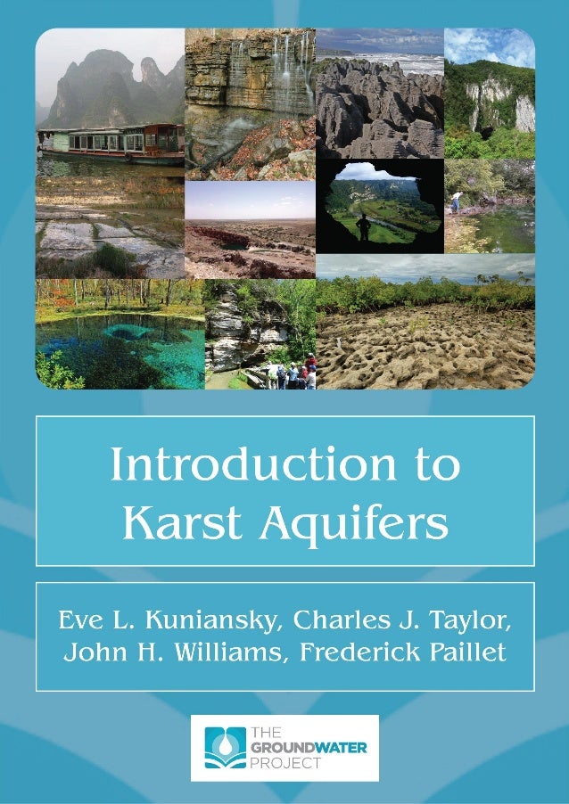
- 5. Introduction to Karst Aquifers Eve L. Kuniansky, Charles J. Taylor, John H. Williams, and Frederick Paillet iv The GROUNDWATER PROJECT ©The Authors Free download from gw-project.org Anyone may use and share gw-project.org links. Direct distribution of the book is strictly prohibited. Cover images Cover Images: Images of karst features around the globe as follows: Top row, left to right: Example of forest karst towers from Li River, China near Guilin (Eve Kuniansky, November, 2006), Waterslide Cave, Stephens Gap Callahan Cave Preserve, Southeastern Cave Conservancy, Jackson County, Alabama, Mississippian Age Pennington Formation (Alan Cressler, November 22, 2014), Putai Blowholes and Pancake Rocks, stylobedding, Dolomite Point, Paparoa National Park, Buller District, West Coast, New Zealand (Alan Cressler, January 3, 2013), Deer Cave, West Entrance Area, Gunung Mulu National Park, Borneo, Sarawak, Malaysia (Alan Cressler, November 25, 2009). Middle row, left to right: Conduits formed along fractures and bedding planes in the middle portion of the Glen Rose Limestone as seen along the channel of Canyon Gorge, Texas- (Bob Morris, U.S. Geological Survey, May 18, 2017), Sinkhole lakes near Carlsbad, New Mexico (Eve Kuniansky, U.S. Geological Survey 2014), Upper Cueva Ventana, Ventana Entrance, Municipio de Arecibo, Puerto Rico, overlooking the Rio Grande de Arecibo valley (Alan Cressler, January 8, 2005), unnamed West Virginia spring (Eve Kuniansky, U.S. Geological Survey, August 22, 2002). Bottom row, left to right: Blue Hole Spring vent, Ichetucknee Springs State Park, Suwannee County, Florida (Alan Cressler, November 21, 2011), Spring that flows out of base of cliff and forms a creek that flows into the Buffalo River, Arkansas (Patrick Tucci, retired U.S. Geological Survey, April 28, 2011), Ocala Limestone, Eocene Age, Ozello Archipelago, Gulf of Mexico, Citrus County, Florida (Alan Cressler, March 17, 2016). All photographs used with permission. U.S. Geological Survey photographs taken while on duty are in the public domain. All photographs by Alan Cressler used with permission and under copyright by Alan Cressler.
- 6. Introduction to Karst Aquifers Eve L. Kuniansky, Charles J. Taylor, John H. Williams, and Frederick Paillet v The GROUNDWATER PROJECT ©The Authors Free download from gw-project.org Anyone may use and share gw-project.org links. Direct distribution of the book is strictly prohibited. Table of Contents THE GROUNDWATER PROJECT FOREWORD ...............................................................................................IX FOREWORD ................................................................................................................................................X PREFACE ....................................................................................................................................................XI ACKNOWLEDGMENTS...............................................................................................................................XII 1 INTRODUCTION ..................................................................................................................................1 2 KARST CONDUIT FLOW DEVELOPS BY GEOCHEMICAL AND FLOW PROCESSES....................................5 2.1 FORMATION OF KARSTIC CONDUIT FLOW SYSTEMS......................................................................................6 2.2 DEEP CHEMICALLY AGGRESSIVE WATER FORMS INTERCONNECTED CONDUITS ..................................................7 2.3 WATER TABLE DECLINE AND FLUCTUATION FORMS INTERCONNECTED CONDUITS..............................................8 2.4 SUMMARY OF FORMATION OF CONDUIT FLOW.........................................................................................10 3 HYDROGEOLOGIC CHARACTERISTICS OF KARST AQUIFERS...............................................................11 3.1 KARST DRAINAGE SYSTEM.....................................................................................................................11 3.2 KARST OCCURRENCE WHERE SOLUBLE AND LESS SOLUBLE UNITS OCCUR TOGETHER ........................................18 3.3 MULTIPLE POROSITY AND PERMEABILITY STRUCTURE.................................................................................20 3.4 VARIANCE IN SURFACE-WATER AND SPRING DISCHARGE IN KARST AQUIFERS .................................................28 3.5 CONDUIT DRAINAGE PATTERNS .............................................................................................................34 3.6 SUBSURFACE PIRACY AND KARST DRAINAGE BASINS ..................................................................................39 3.7 VULNERABILITY OF KARST AQUIFERS TO CONTAMINATION...........................................................................44 3.8 KARST AQUIFER FLOW CHARACTERISTICS COMPARED WITH AQUIFERS COMPOSED OF OTHER ROCK TYPES...........49 4 FLUID MECHANICS CONSIDERATIONS FOR KARST AQUIFERS............................................................52 4.1 LIMITATIONS OF DARCY’S LAW FOR APPLICATION TO KARST AQUIFERS ..........................................................52 4.2 REYNOLDS NUMBER AS AN INDICATOR OF FLOW REGIME............................................................................55 4.3 INVESTIGATION OF ONSET OF TURBULENT FLOW IN ROCK SAMPLES..............................................................58 4.4 FLUID MECHANICS OF PIPES AND OPEN CHANNELS....................................................................................59 5 METHODS OF KARST CHARACTERIZATION........................................................................................63 5.1 HYDROGEOLOGIC MAPPING..................................................................................................................66 Enhancing Mapping with Subsurface Data.............................................................................................68 Enhancing Mapping with Geophysical Data ...........................................................................................70 Surface Geophysics Useful to Karst Aquifer Characterization.................................................................71 5.2 BOREHOLE TESTING.............................................................................................................................74 Borehole Geophysical Tools Commonly Applied to Any Aquifer Type.....................................................75 Borehole Geophysical Tools Particularly Useful for Characterizing Karst Aquifers .................................78 5.3 WATER TRACING TESTS........................................................................................................................82 5.4 AQUIFER TESTS...................................................................................................................................88 5.5 USE OF WATER CHEMISTRY DATA ..........................................................................................................94 Basic Water Quality Data........................................................................................................................95 Use of End Member Mixing to Estimate Groundwater Contribution to Surface Water..........................98 Use of Natural Stable Isotopes..............................................................................................................101 Water Quality Issues for Water Supply.................................................................................................102 6 MATHEMATICAL MODEL APPLICATIONS IN KARST .........................................................................103 6.1 FITTING MODELS ..............................................................................................................................107 Example Application of Complex Fitting Model Using Stable Isotopes.................................................109 6.2 LUMPED PARAMETER MODELS ............................................................................................................112 Example Application of a Lumped Parameter Model ...........................................................................112 6.3 DISTRIBUTED PARAMETER MODELS ......................................................................................................114
- 7. Introduction to Karst Aquifers Eve L. Kuniansky, Charles J. Taylor, John H. Williams, and Frederick Paillet vi The GROUNDWATER PROJECT ©The Authors Free download from gw-project.org Anyone may use and share gw-project.org links. Direct distribution of the book is strictly prohibited. Single-Continuum Porous-Equivalent Models.......................................................................................118 Dual-Continuum Porous-Equivalent Models .........................................................................................121 Hybrid Models.......................................................................................................................................121 Discrete Single and Multiple Fracture or Conduit Network Models......................................................124 Example Comparisons of Single-Continuum and Hybrid Models ..........................................................125 7 SUMMARY......................................................................................................................................137 8 WHAT IS ON THE HORIZON FOR KARST AQUIFER KNOWLEDGE? ....................................................139 9 EXERCISES.......................................................................................................................................141 EXERCISE 1 ...................................................................................................................................................141 EXERCISE 2 ...................................................................................................................................................141 EXERCISE 3 ...................................................................................................................................................142 EXERCISE 4 ...................................................................................................................................................142 EXERCISE 5 ...................................................................................................................................................143 EXERCISE 6 ...................................................................................................................................................144 EXERCISE 7 ...................................................................................................................................................145 EXERCISE 8 ...................................................................................................................................................145 EXERCISE 9 ...................................................................................................................................................146 Part 1.....................................................................................................................................................146 Part 2.....................................................................................................................................................146 EXERCISE 10 .................................................................................................................................................147 Part 1.....................................................................................................................................................147 Part 2.....................................................................................................................................................147 EXERCISE 11 .................................................................................................................................................148 EXERCISE 12 .................................................................................................................................................149 EXERCISE 13 .................................................................................................................................................149 EXERCISE 14 .................................................................................................................................................150 EXERCISE 15 .................................................................................................................................................151 EXERCISE 16 .................................................................................................................................................151 EXERCISE 17 .................................................................................................................................................152 EXERCISE 18 .................................................................................................................................................152 EXERCISE 19 .................................................................................................................................................152 EXERCISE 20 .................................................................................................................................................153 EXERCISE 21 .................................................................................................................................................153 EXERCISE 22 .................................................................................................................................................153 10 REFERENCES ...................................................................................................................................154 11 BOXES.............................................................................................................................................185 BOX 1 STAGES FROM FRACTURE FLOW TO CONDUIT FLOW ....................................................................................185 Stage 1 ..................................................................................................................................................185 Stage 2 ..................................................................................................................................................185 Stage 3 ..................................................................................................................................................186 Stage 4 ..................................................................................................................................................186 Stage 5 ..................................................................................................................................................187 Stage 6 ..................................................................................................................................................187 12 ABBREVIATED GLOSSARY OF KARST AND GROUNDWATER TERMINOLOGY....................................189 Allogenic Recharge................................................................................................................................189 Autogenic Recharge..............................................................................................................................189 Capillary Fringe .....................................................................................................................................189
- 8. Introduction to Karst Aquifers Eve L. Kuniansky, Charles J. Taylor, John H. Williams, and Frederick Paillet vii The GROUNDWATER PROJECT ©The Authors Free download from gw-project.org Anyone may use and share gw-project.org links. Direct distribution of the book is strictly prohibited. Carbonates............................................................................................................................................190 CO2 Partial Pressure ..............................................................................................................................190 Diagenetic Processes.............................................................................................................................191 Dissolved Solids (or TDS—Total Dissolved Solids) .................................................................................191 Eogenetic Karst Aquifer.........................................................................................................................191 Epigene Karst Aquifer............................................................................................................................191 Epikarst .................................................................................................................................................191 Estavelle................................................................................................................................................191 Evaporites .............................................................................................................................................192 Geomorphic Period ...............................................................................................................................192 Hydraulic Conductivity ..........................................................................................................................192 Hypogene Karst Aquifer ........................................................................................................................192 Hyporheic Zone .....................................................................................................................................192 Hysteresis..............................................................................................................................................193 Karst Window........................................................................................................................................195 Mesogenetic Karst Aquifer....................................................................................................................195 Newtonian Fluid....................................................................................................................................195 Non-Point Source ..................................................................................................................................195 Phreatic Zone (Zone of Saturation or Saturated Zone) .........................................................................195 Point Source ..........................................................................................................................................195 Post-Depositional Structural Deformation............................................................................................196 Sinkhole.................................................................................................................................................196 Swallet (Throat or Swallow Hole)..........................................................................................................196 Stream Discharge Hydrograph..............................................................................................................196 Telogenetic Karst Aquifers ....................................................................................................................197 Thermodynamically Saturated..............................................................................................................197 Thermodynamically Undersaturated ....................................................................................................197 Vadose Zone..........................................................................................................................................197 Water Salinity .......................................................................................................................................197 13 EXERCISE SOLUTIONS .....................................................................................................................199 EXERCISE 1 SOLUTION.....................................................................................................................................199 EXERCISE 2 SOLUTION.....................................................................................................................................199 EXERCISE 3 SOLUTION.....................................................................................................................................200 EXERCISE 4 SOLUTION.....................................................................................................................................201 EXERCISE 5 SOLUTION.....................................................................................................................................201 EXERCISE 6 SOLUTION.....................................................................................................................................202 EXERCISE 7 SOLUTION.....................................................................................................................................202 EXERCISE 8 SOLUTION.....................................................................................................................................202 EXERCISE 9 SOLUTION.....................................................................................................................................203 Part 1.....................................................................................................................................................203 Part 2.....................................................................................................................................................203 EXERCISE 10 SOLUTION...................................................................................................................................205 Part 1.....................................................................................................................................................205 Part 2.....................................................................................................................................................205 EXERCISE 11 SOLUTION...................................................................................................................................207 EXERCISE 12 SOLUTION...................................................................................................................................207 EXERCISE 13 SOLUTION...................................................................................................................................208 EXERCISE 14 SOLUTION...................................................................................................................................208
- 9. Introduction to Karst Aquifers Eve L. Kuniansky, Charles J. Taylor, John H. Williams, and Frederick Paillet viii The GROUNDWATER PROJECT ©The Authors Free download from gw-project.org Anyone may use and share gw-project.org links. Direct distribution of the book is strictly prohibited. EXERCISE 15 SOLUTION...................................................................................................................................209 EXERCISE 16 SOLUTION...................................................................................................................................209 EXERCISE 17 SOLUTION...................................................................................................................................210 EXERCISE 18 SOLUTION...................................................................................................................................210 EXERCISE 19 SOLUTION...................................................................................................................................210 EXERCISE 20 SOLUTION...................................................................................................................................211 EXERCISE 21 SOLUTION...................................................................................................................................211 EXERCISE 22 SOLUTION...................................................................................................................................211 14 NOTATION......................................................................................................................................212 15 ABOUT THE AUTHORS ....................................................................................................................213 MODIFICATIONS TO ORIGINAL RELEASE .................................................................................................... A
- 10. Introduction to Karst Aquifers Eve L. Kuniansky, Charles J. Taylor, John H. Williams, and Frederick Paillet ix The GROUNDWATER PROJECT ©The Authors Free download from gw-project.org Anyone may use and share gw-project.org links. Direct distribution of the book is strictly prohibited. The Groundwater Project Foreword The Year 2022 marks as an important year for groundwater because the United Nations Water Members and Partners chosen the theme of this year’s March 22 World Water Day to be: “Groundwater: making the invisible visible”. The goal of the Groundwater Project (GW-Project) is in sync with this theme. The GW-Project, a registered charity in Canada, is committed to contributing to advancement in education and brings a unique approach to the creation and dissemination of knowledge for understanding and problem solving. The GW-Project operates the website https://gw-project.org/ as a global platform for the democratization of groundwater knowledge, founded on the principle that: “Knowledge should be free and the best knowledge should be free knowledge.” Anonymous The mission of the GW-Project is promoting groundwater learning. This is accomplished by providing accessible, engaging, high-quality, educational materials, free- of-charge online in many languages, to all who want to learn about groundwater. In short, providing essential knowledge tools for developing groundwater sustainably for humanity and ecosystems. This is a new type of global educational endeavor in that it is based on volunteerism of professionals from different disciplines and includes academics, consultants and retirees. The GW-Project involves many hundreds of volunteers associated with more than 200 hundred organizations from over 27 countries and six continents, with growing participation. The GW-Project is an on-going endeavor and will continue with hundreds of books being published online over the coming years, first in English and then in other languages, for downloading wherever the Internet is available. An important tenet of the GW-Project books is a strong emphasis on visualization via clear illustrations that stimulate spatial and critical thinking to facilitate absorption of information. The GW-Project publications also include supporting materials such as videos, lectures, laboratory demonstrations, and learning tools in addition to providing, or linking to, public domain software for various groundwater applications supporting the educational process. The GW-Project is a living entity, so subsequent editions of the books will be published from time to time. Users are invited to propose revisions. We thank you for being part of the GW-Project Community. We hope to hear from you about your experience with using the books and related material. We welcome ideas and volunteers! The GW-Project Steering Committee January 2022
- 11. Introduction to Karst Aquifers Eve L. Kuniansky, Charles J. Taylor, John H. Williams, and Frederick Paillet x The GROUNDWATER PROJECT ©The Authors Free download from gw-project.org Anyone may use and share gw-project.org links. Direct distribution of the book is strictly prohibited. Foreword Karst is of great importance to humanity and ecological systems because karst terrain makes up about 10 percent of the Earth’s surface, provides fresh drinking water to an estimated 10 percent of the world’s population and by some estimates supplies up to 25 percent of groundwater withdrawn for agricultural and industrial water use. Karst occurs in more than 100 countries, hence there is an immense scientific literature in many languages about karst. Many karst books are planned for publication by the Groundwater Project to cover many aspects of karst. This book: Introduction to Karst Aquifers in the topic domain: Introduction to Physical and Chemical processes is the first of the karst books. Previous books published by the GW-Project and most of those yet to be published are about groundwater flow represented by Darcy’s law with flow concepts founded on porous media flow theory and hydraulic conductivity of granular or fractured media. In contrast, flow in karst is often non-Darcian. Karst systems have focused outlets, mostly at springs, and the hydraulic conductivity is dominated by solution channels and cavities. Understanding karst systems is a multidisciplinary endeavor aimed at unlocking the mysteries of this most majestic part of the Earth’s subsurface to underpin water use and management. This introductory book provides a brief discussion of: karst-aquifer features; genesis of karst; water flow in karst and pertinent fluid mechanics; many types of investigative methods for characterizing and understanding karst; and mathematical modeling applied to karst. This lays the foundation for other karst books being written by the GW-Project and is aimed at introducing readers to groundwater flow in karst with recognition of key differences from other types of aquifer systems. The authors of this book are senior researchers of Geological Surveys. In combination, they have broad experience in applying diverse methods to understanding a variety of karst systems. In her 35-year career at the United States Geological Survey (USGS) where she attained the level of Regional Groundwater Specialist, Eve Kuniansky provided technical assistance to groundwater projects throughout the southeastern USA, Puerto Rico, the Virgin Islands, and in China, Israel, Cyprus, Ethiopia, Kenya, and South Africa through the USGS International Water Resources Branch, and led the USGS Karst Interest Group. Chuck Taylor heads the Water Resources Section of the Kentucky Geological Survey (KGS) where his primary research is in karst hydrogeology and aquifer characterization. John Williams has advised many government agencies in multiple nations (including the United States, Canada, United Arab Emirates, and Iraq) on issues related to contaminated fractured-bedrock aquifers. Fred Paillet was Chief of the USGS Borehole Geophysics Research Project for many years and has held visiting appointments at universities throughout the world, improving characterization of karst aquifers through advanced analysis of geophysical well logs that are key to determining flow in karst. John Cherry, The Groundwater Project Leader Guelph, Ontario, Canada, January 2022
- 12. Introduction to Karst Aquifers Eve L. Kuniansky, Charles J. Taylor, John H. Williams, and Frederick Paillet xi The GROUNDWATER PROJECT ©The Authors Free download from gw-project.org Anyone may use and share gw-project.org links. Direct distribution of the book is strictly prohibited. Preface Introduction to Karst Aquifers is designed for upper-level undergraduate science and engineering students (that is, students in geology, earth science, hydrology, hydrogeology, water resources management, or civil and environmental engineering), but will be of interest to all readers with some science and math background who want to know more about karst. The topic of karst is extremely broad. However, the focus of this book is narrow, addressing groundwater flow in karst aquifers. An aquifer is a geologic formation, a group of formations, or a part of a formation that contains enough saturated permeable material to yield significant quantities of useable water to wells and springs. Thus, the focus of a karst aquifer book is on water supply in formations composed of rocks that can dissolve (aquifers composed predominantly of carbonate and evaporite rocks). The study of carbonate and evaporite sedimentary rocks is a complex field in geology involving physical, chemical, and biological processes along with an understanding of sedimentation in fluvial and marine environments. Thus, the study of karst aquifers is interdisciplinary because investigating them involves geologic mapping, geophysics, geochemistry, fluid mechanics, geomorphology, hydrology, numerical modeling, and microbiology. Most hydrogeologists develop their skills related to karst aquifers on the job or through study for an advanced degree and continue learning throughout their careers. The purpose of this introductory book is to expose readers to the complexity of flow in karst aquifers and the many methods from various disciplines that have been applied to study and characterize karst aquifers for water supply. Sections 1 through 3 present the important topics pertaining to groundwater flow in karst aquifers in a general way. The rest of the book provides details about the methods of characterization mentioned in the first section. Section 6 describes mathematical models to provide a general understanding of the types of models applied in Karst settings. The extensive Section 10, References, provides hyperlinks to the original articles, when possible, for interested readers who have access to them. Additionally, an abbreviated glossary of terms is provided after the references section. Most terms in the glossary are often defined within the text at their first introduction with italicized text. However, a few terms, such as hysteresis or stream hydrograph, are too complex to adequately describe within the text so the definition is included in the abbreviated glossary. For readers interested in pursuing a career specializing in karst hydrogeology, we recommend becoming proficient in basic mathematics (algebra, geometry, calculus, differential equations and statistics with probability); inorganic chemistry; physics at a level requiring knowledge of calculus; and computer programming. Programming skills are important because many commercial packages for simulating groundwater flow in karst often lack some functionality such that customization is required. Also, programming knowledge helps one understand how data are manipulated by software which is vital to using the software wisely.
- 13. Introduction to Karst Aquifers Eve L. Kuniansky, Charles J. Taylor, John H. Williams, and Frederick Paillet xii The GROUNDWATER PROJECT ©The Authors Free download from gw-project.org Anyone may use and share gw-project.org links. Direct distribution of the book is strictly prohibited. Acknowledgments We deeply appreciate the thorough and useful reviews of and contributions to this book by the following individuals: ❖ Dr. Eileen Poeter, Professor Emeritus, Colorado School of Mines, United States; ❖ Dr. Ineke M. Kalwij, President, Principal Hydrogeologist, Kalwij Water Dynamics Inc.; ❖ Earl Greene, Director, Water Resources Research Act Program, USGS, United States; ❖ David Nelms, Retired Groundwater Specialist, USGS, United States; ❖ Dr. Thomas D. Byl, Hydrologist USGS and Assistant Professor, Tennessee State University, United States; ❖ Dr. Warren Wood, Emeritus, Groundwater Hydrologist, USGS, United States; ❖ Dr. John Cherry, Adjunct Professor, University of Guelph; Professor Emeritus, University of Waterloo, Canada; ❖ Dr. Patryk Quinn, Research Scientist, Engineering Department, University of Guelph, Canada; ❖ Dr. Jack Sharp, Professor Emeritus, Department of Geological Sciences, University of Texas at Austin, United States; ❖ Everton de Oliveira, President of Hidroplan, Brazil, Director-President of the Instituto Água Sustentável (Sustainable Water Institute), Brazil; and, ❖ Dr. Hugh Whiteley, Adjunct Professor, Engineering, University of Guelph, Canada. We are grateful for Amanda Sills and the Formatting Team of the Groundwater Project for their oversight and copyediting of this book. We thank Eileen Poeter (Colorado School of Mines, Golden, Colorado, USA) for reviewing, editing, and producing this book.
- 14. Introduction to Karst Aquifers Eve L. Kuniansky, Charles J. Taylor, John H. Williams, and Frederick Paillet 1 The GROUNDWATER PROJECT ©The Authors Free download from gw-project.org Anyone may use and share gw-project.org links. Direct distribution of the book is strictly prohibited. 1 Introduction The term “karst” is often interchangeably used in areas underlain by soluble bedrocks (carbonates and evaporites) to describe: • a landscape, known as karst terrain, characterized by distinctive surface features such as sinkholes, caves, sinking streams, and springs, whose formation is attributable in part to the process of chemical dissolution, with examples shown in Figure 1; • a hydrogeologic setting, called a karst terrane, in which the surface and subsurface hydrology is largely influenced by the presence of underlying karstified bedrocks and karst aquifers; and, • a groundwater flow system, known as a karst aquifer, in which water storage and movement occurs mainly through subsurface openings created or modified by dissolution, including unique voids known as “solution conduits”. Figure 1 - Karst terrain varies depending on the physiographic and geohydrologic setting as can be seen in both the cover collage and these photos. The photographic images on the cover of this book and this figure present only a few of the many appearances of karst terrain. a) Tufa rimmed lakes at Plitvice Lakes World Heritage karst, Croatia1 . b) Aqua culture village in drowned karst in the South China Sea, Vietnam2 . c) Satellite view of Wakulla Springs, Florida, USA3 . d) Outcrop of the middle portion of the Glen Rose limestone in Canyon Gorge, Texas, USA4 . e) Alapaha River, river sink, Jennings Bluff-Avoca Tracts, Suwannee River Water Management District Lands, Hamilton County, Florida, USA5 . 1 Photo by Kuniansky, 2008a. 2 Photo by Kuniansky, 2012. 3 Public domain image clipped from Google maps (Kuniansky, 2020). 4 photo by Morris, 2017. 5 Photo by Allan Cressler taken November 25, 2010, used with permission.
- 15. Introduction to Karst Aquifers Eve L. Kuniansky, Charles J. Taylor, John H. Williams, and Frederick Paillet 2 The GROUNDWATER PROJECT ©The Authors Free download from gw-project.org Anyone may use and share gw-project.org links. Direct distribution of the book is strictly prohibited. The term karst comes from the Slovenian word “Kras” because the Slovenian Kras region has characteristic karst rocks. This region is in southwestern Slovenia and extends across the border into northeastern Italy. Karst occurs throughout the globe (Figure 2) in a variety of physiographic areas: on islands and in coastal regions, in prominent mountain ranges and massifs, and throughout interior continental regions. In many, perhaps most locations, karst’s presence is easily recognizable by the occurrence of caves, sinkholes, disappearing or losing streams, and the distinctive grooved, scalloped, and fluted erosional features that develop on exposed soluble bedrock surfaces that are called karren. In other locations however, the surficial expression of karst is subtle and less easily recognized. Figure 2 - Outcrop of carbonate and evaporite rocks forming karst terrains and aquifers around the world indicates the unconfined parts of karst aquifers not the total extent as many of these formations dip underground with confined extents often greater than unconfined extents (created from the World Karst Aquifer Map spatial data set Chen and others (2017) on the Mollweide map projection WGS-84 Datum and Spheroid). Many geological, topographical, climatological, and hydrological factors influence the formation and physical manifestations of karst; not all karst develops in the same way, or exhibits the same types of surface and subsurface features. However, where karst occurs, its development and physical manifestation is influenced by a combination of groundwater flow and the hydrogeological characteristics and geochemical evolution of the soluble rocks. In areas underlain by limestone rocks, for example, the formation and characteristics of karst are influenced by the original depositional environment, lithologic and stratigraphic variability, diagenetic processes, post-depositional structural deformation, geomorphological evolution of the landscape, as well as variability and changes in precipitation and geochemical weathering processes over both short and long geological time scales. The focus of this book is on karst aquifers. Karst aquifers serve as vital water resources for a large population, providing fresh drinking water to an estimated 10 percent
- 16. Introduction to Karst Aquifers Eve L. Kuniansky, Charles J. Taylor, John H. Williams, and Frederick Paillet 3 The GROUNDWATER PROJECT ©The Authors Free download from gw-project.org Anyone may use and share gw-project.org links. Direct distribution of the book is strictly prohibited. of the world’s population (Stevanović, 2018) and accounts for up to 25 percent of all groundwater withdrawals (Ford and Williams, 2007). Thus, karst aquifers are important components of local and regional hydrologic and hydrogeologic systems. In karst areas, groundwater and surface water are highly interconnected, with karst aquifers and springs serving as headwaters and major tributaries to surface streams and rivers. Karst aquifers help to sustain important biological and bio-geochemical systems in, for example, the hyporheic zone of surface steams and in subterranean aquatic ecosystems, including habitats for threatened and endangered cave species. In recent years, concerns about effects of global climate change have increased and carbon cycling in karst areas and aquifers has become a topic of greater scientific interest. Hydrogeochemical processes associated with karst areas involve reactions that both generate and sequester carbon and the effects of karstification in areas underlain by carbonates may be one of the larger variables that remain relatively unaccounted for in global carbon budgets and climate-change models (Fong et al., 2013; Cao et al., 2012, 2018). Flow in karst aquifers is unique (Worthington et al., 2017). Aquifers are comprised of either granular material in which water moves through small pores, and/or fractured material where water moves through cracks and interconnected fractures. Some aquifers have both pores and fractures. Pores and fractures occur in karst aquifers, but in some karst aquifers so much rock has dissolved that the openings form large and interconnected conduits. In these cases, water moves not only through cracks and pores, but also through conduits of large aperture (greater than 0.1 m) or submerged caverns where subsurface flow is similar to flow in open channels and pipes. In some places, subsurface conduits occur in insoluble rocks such as lava tubes that form in volcanic rocks when molten lava solidifies and is called pseudokarst. Where conduits are interconnected, locations of water inflow and outflow are more localized than in granular and fractured aquifers, and flow moves more rapidly. At times the flow is turbulent. In contrast to porous media flow and small fracture flow, conduit flow can have very high velocities and provide rapid transit of water from its entry into the subsurface to its discharge location. In some locales, conduits may exist, but their entry and/or exit points may be clogged such that the rate of groundwater movement is similar to aquifers composed of granular rocks, such as sandstone or alluvium. The potential for conduit flow in karst aquifers leads investigators to supplement standard aquifer investigation methods with mapping of surficial karst features, dye tracing, and more elaborate monitoring of the volume of groundwater discharge and water chemistry at springs. The complexities presented by karst aquifers are among the most fascinating and challenging in hydrogeologic sciences. For example, karst aquifers present extreme forms of heterogeneity, including multi-scale porosity and permeability structures and groundwater flow dominated by networks of solutional openings that are fed by a combination of surface runoff and water leaking from the rock matrix. Groundwater flow
- 17. Introduction to Karst Aquifers Eve L. Kuniansky, Charles J. Taylor, John H. Williams, and Frederick Paillet 4 The GROUNDWATER PROJECT ©The Authors Free download from gw-project.org Anyone may use and share gw-project.org links. Direct distribution of the book is strictly prohibited. in karst conduits can occur under high velocities (greater than 10 to 100 meters per day [m/d]) under both laminar and turbulent conditions. Hydrologic, hydraulic, and geochemical (for example, water-quality) characteristics in karst aquifers are typically among the most spatially and temporally variable in hydrogeology. These and other notable hydrogeologic complexities contribute to a widespread perception that groundwater resources provided by karst aquifers are difficult to develop, sustain, and protect. The likelihood of this perception being true increases where karst data collection and interpretation, as well as understanding of karst hydrogeology concepts, are insufficient to enable effective characterization of the aquifer and resource-management decisions. This book reviews and highlights important basic hydrogeological characteristics of karst aquifers and summarizes investigative methods useful in their study and characterization. One key aspect to the investigation of karst aquifers is the realization that traditional methods of groundwater investigation developed and used successfully to characterize granular and many fractured-rock aquifers are often less successful, or must be modified and interpreted differently, when applied to karst. For example, mapping of water levels—a fundamental practice used to determine groundwater flow directions and rates in most aquifers—is often problematic in karst for reasons that will be discussed later. In addition, the hydrogeological complexities presented by karst generally require a multidisciplinary investigative approach that incorporates the use of several highly-specialized techniques such as water-tracing tests, spring-discharge monitoring, and various borehole and surface geophysical methods that often are not taught in traditional groundwater course curricula. Many of these techniques are the subject of additional books planned for the Groundwater Project. The vast range of specialized topics related to karst are beyond the scope of this introductory book. After reading this introductory book, readers may want to consult other publications that provide overviews of karst hydrogeological concepts and investigative techniques, such as Goldscheider and Drew (2007), Taylor and Greene (2008), and Taylor and Doctor (2017). Textbooks authored by White (2019, 2016, 1993, 1999, 1988), Ford and Williams (2007), Milanovic (1988) are highly recommended resources for anyone interested in areas related to karst hydrogeology and water resources. Readers who are not familiar with groundwater flow are encouraged to read other introductory books of the Groundwater Project including the overview book “Groundwater in Our Water Cycle” and the basics presented in “Hydrogeologic Properties of Earth Materials and Principles of Groundwater Flow”.
- 18. Introduction to Karst Aquifers Eve L. Kuniansky, Charles J. Taylor, John H. Williams, and Frederick Paillet 5 The GROUNDWATER PROJECT ©The Authors Free download from gw-project.org Anyone may use and share gw-project.org links. Direct distribution of the book is strictly prohibited. 2 Karst Conduit Flow Develops by Geochemical and Flow Processes Karst is formed in soluble rocks especially limestone and to a lesser extent in dolomite but can develop in gypsum or salt. Karst is the most dramatic evidence of the ability of groundwater to alter the form of the earth's surface and subsurface as illustrated on the cover of this book and in Figure 1. More than one episode of karst development can occur as geological conditions change, which adds complexity to the karst system. Formation of substantial-sized openings in rocks requires chemical dissolution operating over geologic time scales. For example, Mammoth cave in the state of Kentucky in the USA includes multiple bedrock formations and several levels of conduits that extend over an estimated 200 km2 (Figure 3). It is believed that groundwater began interacting with the uppermost cave-forming limestone formation—about 10 million years ago and that the upper levels of the cave system were fully formed by 3.2 million years ago, based on radiometric dating of quartz pebbles (Quinlin and Ewers, 1989; USGS website, 2021). Mammoth cave is the longest known cave system in the world with mapped passages extending more than 600 km. Personnel of Mammoth Cave National Park estimate there may be as much as 1000 km of unmapped caves (Toomey et al., 2017). Figure 3 - Systems of cave networks that constitute karst terrane can be extensive and can require decades of mapping as evidenced from this map of the known passages in the Mammoth Cave system and the adjacent caves from those known in 1908 and those explored as of 2016. Modified from Toomey and others (2017). Karst openings result from the combination of water flow and mineral dissolution that removes rock mass to create and/or enlarge openings. However, much of the beauty observed in karst results from the creation of mineral mass by chemical precipitation that forms striking cave structures (Figure 4). Most karst aquifers are formed as a consequence of the infiltration of precipitation, subsurface diversion of stormwater runoff and surface stream flow, and the subsequent movement of groundwater. These are epigene karst
- 19. Introduction to Karst Aquifers Eve L. Kuniansky, Charles J. Taylor, John H. Williams, and Frederick Paillet 6 The GROUNDWATER PROJECT ©The Authors Free download from gw-project.org Anyone may use and share gw-project.org links. Direct distribution of the book is strictly prohibited. aquifers and are active components of the meteoric water system and the critical zone, and are the topic of this book. The critical zone is Earth's permeable near-surface boundary layer where rock, soil, water, air, and living organisms interact. Another type of karst, hypogene karst, develops by deep-sourced corrosive waters or gases upwelling through fault zones and fractures and/or following the geologic dip of permeable and soluble bedrock strata. Hypogene karst is generally located in, or near, regions of tectonic, volcanic, or high-temperature geothermal activity past or present, such as Carlsbad Caverns, New Mexico, USA. Depending on the depth and hydrogeological isolation, geological strata altered by hypogene karst may or may not interact with shallow meteoric waters to store and transmit fresh groundwater. Thus, they may or may not be identified as aquifers, and may or may not play a role in the occurrence of near-surface karst geomorphic features. Figure 4 - Underground cave photograph showing common structures formed by precipitation of minerals from groundwater (Dave Bunnell, 2006. “Photo by Dave Bunnell showing the most common speleothems” by Dave Bunnell is licensed under CC BY-SA 2.5). 2.1 Formation of Karstic Conduit Flow Systems The formation of karst begins with flow in a network of connected fractures, such as open joints or along bedding plane openings (fractures) originating from rock stresses during crustal movements (for example, as shown in the middle-left photo on the cover of Glen Rose Limestone as seen along the channel of Canyon Gorge, Texas and notice fracture joints with vegetation). There are interconnected fractures with groundwater flow in other
- 20. Introduction to Karst Aquifers Eve L. Kuniansky, Charles J. Taylor, John H. Williams, and Frederick Paillet 7 The GROUNDWATER PROJECT ©The Authors Free download from gw-project.org Anyone may use and share gw-project.org links. Direct distribution of the book is strictly prohibited. types of rock such as granite, but karst does not form because granite and most other igneous rock formations do not contain minerals soluble enough for substantial dissolution. After some time, the enlarged fractures in soluble rocks become connected to form solution channels and caves, which then provide the main paths for groundwater flow. Before any solution enlargement has occurred in a fractured limestone, fresh groundwater originating from rainfall infiltrates through surficial soils then flows through a network of fractures, joints and bedding planes, as is the case in all fractured sedimentary rock. In order to dissolve rock, the water must be chemically aggressive, that is, thermodynamically undersaturated with respect to the mineral calcite (CaCO3). Carbon dioxide (CO2) is continually produced in the vadose zone from microbial decay of organic matter and from respiration of plant roots. That CO2 combines with water to form carbonic acid (H2CO3) which dissolves calcite. This process is well established in soil science. Given the presence of chemically aggressive water, karst development proceeds by hydrogeochemical processes that involve complex interactions through time and space. Comprehensive discussions of the processes of fracture enlargement and cave genesis are provided by Holland and others (1964), Howard (1964a, 1964b), Thraikill (1968), Ford and Cullingford (1976), and Palmer (1999). Long periods of time are required for solution channels to form a conduit flow system because, although recharge water is chemically aggressive, it quickly dissolves calcite and loses its chemical aggressivity, unless conditions change such that the water becomes undersaturated with respect to calcite. There are two ways that conditions may change: 1) chemically aggressive water may form at depth, or 2) the water table may decline allowing unsaturated zone processes to be active deeper in the system. 2.2 Deep Chemically Aggressive Water Forms Interconnected Conduits Occurrence of water undersaturated in calcite at large depth and distance into the subsurface system requires the presence of carbon dioxide gas which can develop when groundwater transports organic carbon into the system that is then oxidized to form carbon dioxide gas. Both aqueous and gaseous carbon dioxide (CO2) play a role in development of karst because CO2 produces carbonic acid that results in dissolution of calcite. The six mechanisms for instigation of calcite dissolution are: 1. variation in groundwater temperature because calcite solubility decreases with rising temperatures unlike most rock forming minerals; 2. production of sulfuric acid along groundwater flow paths, as suggested by Moore and Nicholas (1964) during which oxidation of small amounts of sulfide minerals, especially pyrite, results in sulfuric acid (H2SO4);
- 21. Introduction to Karst Aquifers Eve L. Kuniansky, Charles J. Taylor, John H. Williams, and Frederick Paillet 8 The GROUNDWATER PROJECT ©The Authors Free download from gw-project.org Anyone may use and share gw-project.org links. Direct distribution of the book is strictly prohibited. 3. floods in surface streams or rapid snowmelt causing exceptionally large rapid recharge of undersaturated water; 4. mixing of dissimilar waters at fracture/joint intersections, because when waters of different chemistry (each saturated in calcite but with different CO2 partial pressure or temperatures) mix, the mixed water can be slightly undersaturated in calcite (Wigley and Plummer, 1976; Thraikill, 1968); 5. in-situ formation of CO2 deep in the vadose zone by particulate and dissolved organic transport (Wood and Petraits, 1984); Wood, 1985); and, 6. degassing of groundwater that is thermodynamically saturated with calcite as it reaches caves (Cao et al., 2021) resulting in precipitation of calcium carbonate and formation of stalactites and stalagmites. Another less common source of CO2 or SO4 at depth occurs near magmatic areas or oil fields and can create chemically aggressive water. Once chemically aggressive water is present at depth, karst openings are enlarged by dissolution of rock surrounding permeable openings which then become more permeable, thus higher flow volumes and velocity bring more aggressive water in contact with the soluble rocks and the karstification process proceeds. 2.3 Water Table Decline and Fluctuation Forms Interconnected Conduits When the water table drops during short-term drought or longer-term minor changes in climate, the vadose-zone karstification processes function at greater depth and when the water table rises, groundwater flows in solution openings formed under the earlier saturated and unsaturated conditions. Additionally, as the water table rises and falls seasonally, this results in more mixing of water. Figure 5 illustrates the stages of karst aquifer evolution from a fractured flow system to a conduit flow system as a result of water table decline and rise. In the first stage (Figure 5a) the limestone has normal small fractures before chemical weathering, followed by a second stage in which chemically aggressive water dissolves calcite along the fracture walls. In this second stage (Figure 5b), some fractures have been enlarged but are insufficient to form a network of enhanced hydraulic conductivity and therefore the rock does not yet have conduit flow. In the third stage (Figure 5c), further dissolution has connected the enlarged fractures so that conduit flow begins. In the fourth stage (Figure 5d) enlargement and interconnection has increased the hydraulic conductivity of the interconnected paths so much that flow can be driven by a lower gradient, thus the water table declines and vadose-zone karstification processes occurs at deeper levels. This lowering of the water table may be increased if it is accompanied by down cutting of streams in the area. In the fifth stage (Figure 5e) a wetter period occurs, raising the water table and resulting in active conduit flow through what was the deep part of the vadose zone when the water table was lower.
- 22. Introduction to Karst Aquifers Eve L. Kuniansky, Charles J. Taylor, John H. Williams, and Frederick Paillet 9 The GROUNDWATER PROJECT ©The Authors Free download from gw-project.org Anyone may use and share gw-project.org links. Direct distribution of the book is strictly prohibited. Figure 5 – Illustrations (a-f) show the evolution of a karst hydrologic system over geologic time in six stages from a barren limestone landscape (no soil) with a fracture network with groundwater flow in connected fractures connecting to a nearby hillslope and ending with a fully developed karst hydrologic system that drains the local precipitation through the bottom to discharge at faraway places not within the topographic watershed: a) Stage 1: Barren limestone with small fractures that contribute a small flow from the spring to the stream; b) Stage 2: Soil develops causing generation of CO2 and organic matter that generates more CO2, both creating larger fractures and dissolution channels; c) Stage 3: Connected dissolution channels form to cause lowering of the water table and spring flow from conduits formed along fractures increases, soil development continues; d) Stage 4: Channel network deepens in the vadose zone as CO2 and organic matter are driven downward maintaining chemically aggressive water at deeper levels, and the stream is fed by karst drainage; e) Stage 5: Channel network deepens below the stream bottom so that the stream feeds karst system; and, f) Stage 6: Channel network drops below the local flow system with karst flow draining to a distant exit. The enlargement of karst channels is driven by chemically aggressive subsurface water with its aggressivity continually renewed by production and dispersion of CO2 in the subsurface through the synergistic combination of hydrologic flow, downward erosion along surface stream channels, and hydrogeochemical processes. If limestone extends far and deep, then given sufficient geologic time, the karst system will extend far and deep. Modified from Wood and Cherry (2021).
- 23. Introduction to Karst Aquifers Eve L. Kuniansky, Charles J. Taylor, John H. Williams, and Frederick Paillet 10 The GROUNDWATER PROJECT ©The Authors Free download from gw-project.org Anyone may use and share gw-project.org links. Direct distribution of the book is strictly prohibited. The sixth stage (Figure 5f) is a mature karst with no overland flow, the water table below the image area, unknown distant discharge areas and dry caves. These stages can occur within a single geomorphic period. If crustal uplift or a major climate change occurs, then a different era of karstification can begin as is typical in the evolution of most karst systems. More detailed descriptions of the stages of karst aquifer evolution from a fractured flow system to a conduit flow system are provided in Box 1 along with a repeat of Figure 5 for the readers convenience. Underlying horizontal beds of mudstones, sandstones, dolostones, or any rock that are both less soluble than limestone and less transmissive of water will restrict the downward movement of water resulting in conduits forming in the limestone directly above and along the dip of the less soluble formation. If the water encounters vertical fractures through these less soluble rocks and is still undersaturated with calcite, another deeper more soluble limestone layer will begin to dissolve. This occurs in both the unsaturated zone and saturated zone as changes in the rock facies focus water movement through the more permeable rock. These units of karst aquifers are called preferential flow units or zones (Williams and Kuniansky, 2016; Cunningham et al., 2006; Rose, 1972). If present, these facies changes result in a complex three-dimensional karst network as compared to a system with no facies changes, as in the stages of karst development shown in Figure 5. Inland areas, such as in southwest China along the Li River (as shown in cover collage), dissolution of limestone often occurs over time at the level of the alluvial valley. In the karst areas of southwest China, Laos, and Vietnam, inland caves are common at the level of the current rivers and along alluvial plains and sunken valleys between karst towers (haystacks) or mountain ridges. Often these caverns have rivers running through them under the large haystacks or mountains. Foot trails follow and boats move between the villages in these sunken alluvial valleys (Khang, 1985). Additionally, there are many dry caverns far above the current river valleys. Worthington (2005) discusses how base level lowering results in the upper dry caves and the dissolution processes creating conduits and cave formation. 2.4 Summary of Formation of Conduit Flow In summary, the evolution of karst development is a function of the availability of chemically aggressive water over time. The availability of chemically aggressive water depends on the volume of recharge water and CO2, as well as varying water table elevation, dissolved and particulate organic content, sulfide mineral content, temperature, and mixing of different waters at depth. Once chemically aggressive water is present at depth, karst openings are enlarged by dissolution of rock surrounding permeable openings which then become more permeable, thus higher flow volume and velocity bring more aggressive water in contact with the soluble rocks and the karstification process proceeds. This is a
- 24. Introduction to Karst Aquifers Eve L. Kuniansky, Charles J. Taylor, John H. Williams, and Frederick Paillet 11 The GROUNDWATER PROJECT ©The Authors Free download from gw-project.org Anyone may use and share gw-project.org links. Direct distribution of the book is strictly prohibited. simplified discussion as the formation and depositional environment of carbonates is complex and results in extreme variability in the resulting rock formations. Post- depositional structural changes may also affect how and where fractures occur that allow aggressive water to begin to move through the rocks. The changing geologic structure and climate over the millennia are collaborators in the creation of the dissolution features. Coastal karst aquifers form by complex processes involving mechanical weathering, and biological and geochemical processes creating dissolution and formation of sea caves. While seawater is generally saturated with calcite, dissolution occurs under a variety of conditions, and not all the conditions understood (Taborsi and Kazmer, 2013). The extremely complex processes involved in speleogenesis and karst geomorphology occur over geologic time scales, and are not the focus of this book. Exercise 1 invites the reader to consider the composition of carbonate and evaporite rocks. 3 Hydrogeologic Characteristics of Karst Aquifers In general terms, a karst aquifer can be identified as an aquifer in which permeability, flow, recharge, and storage characteristics have been created or modified as a result of dissolution by naturally occurring acidic fluids, such as rainwater that combined with carbon dioxide to form a weak carbonic acid. To many, the term “karst aquifer” is virtually synonymous with limestone aquifer due to the latter’s susceptibility to dissolution and widespread geographical occurrence, but other carbonate rocks such as dolostone, chalk, marble, and soluble non-carbonates (evaporites) such as gypsum and anhydrite, are also subject to varying degrees of karstification and may exhibit hydrogeological characteristics typical of karst aquifers. 3.1 Karst Drainage System Karst aquifers are one major component of a complex natural drainage system composed of many surface and subsurface hydrologic components (Figure 6) Early on, groundwater professionals recognized that the prevalence and hydrologic significance of recharge from surface runoff draining rapidly into a karst aquifer from point sources (for example, open sinkholes and sinking/disappearing streams) required conceptualizing the aquifer in a non-traditional way. That is, not focusing exclusively on the saturated zone, but also considering the role of the unsaturated zone and its interrelationship with the saturated zone. This led to conceptualizing groundwater flow in the context of the karst drainage system as a whole. Figure 6 illustrates the hydrological zones of a typical karst aquifer, and the major recharge, storage, and flow components within the zones. All of the features contribute to the water budget of a karst aquifer, some being more significant seasonally and/or during and after storm events.
- 25. Introduction to Karst Aquifers Eve L. Kuniansky, Charles J. Taylor, John H. Williams, and Frederick Paillet 12 The GROUNDWATER PROJECT ©The Authors Free download from gw-project.org Anyone may use and share gw-project.org links. Direct distribution of the book is strictly prohibited. Figure 6 - a) Karst drainage system showing relationship between the karst aquifer (blue-shaded area) and the many different surface and subsurface hydrologic components of recharge, storage, and flow. The dark green box indicates the soil/epikarst area and the dark red box the main karst aquifer subsystems (Modified from Hartmann et. al. 2014). b) Cross-sectional diagram showing distribution of unsaturated (vadose) and saturated (phreatic) zone components. The interface between the two zones is defined by the position (or elevation) of the water table which may rise or fall significantly depending on flow conditions and influx of storm recharge. It is also dependent on the presence of overflow springs and relative vertical distance between overflow and underflow springs. Black dashed line and triangle indicate base-level water table elevation, blue dashed line and triangle indicate raised water table elevation under high- or flood-flow conditions. Vertical scale exaggerated. Modified from Trcek (2007). Flow paths and water fluxes in karst drainage systems are complex, being controlled by the distribution and interconnection of zones of higher and lower permeability and higher and lower flow velocities; driven by relative differences in
- 26. Introduction to Karst Aquifers Eve L. Kuniansky, Charles J. Taylor, John H. Williams, and Frederick Paillet 13 The GROUNDWATER PROJECT ©The Authors Free download from gw-project.org Anyone may use and share gw-project.org links. Direct distribution of the book is strictly prohibited. hydraulic heads and corresponding hydraulic gradients within and among these zones. In both the unsaturated and saturated zones, flow components exist that may be broadly characterized as “diffuse”. In diffuse flow zones, permeability is widely distributed throughout the rock matrix, micro-to-small-aperture fractures and pores, as well as small conduits and solutional openings, in which laminar, low-velocity flow occurs. In contrast, flow zones described as “conduit” include large solutional voids, pipe-like or channel-like solutional openings, and solution-widened fractures in which the volumetric flow rate is larger than in other types of aquifers. Both laminar and turbulent flow regimes, occur in conduits. In many karst aquifers, conduits are large horizontal dissolution features along bedding planes in soluble formations. These can be less than a meter to multiple meters thick and generally occur where a more soluble formation overlies a less soluble formation. Flow paths and fluxes vary greatly across spatial and temporal scales, changing seasonally as well as during and after storms. Therefore, it is often necessary to sample and characterize karst aquifer hydrology under designated low-flow, average-flow, and high-flow conditions. In the saturated zone, water levels (potentiometric heads) measured in wells in highly-developed karst aquifers may exhibit significant spatial and temporal differences depending on the spatial variability of permeability zones, antecedent and existing flow conditions (low flow, base flow, or high flow), as well as the timing and variability in recharge that occurs during individual storms. During seasonal increases in recharge, or after intense and/or prolonged storms, water levels may rise in the aquifer and flow paths may be temporarily re-activated in higher-elevation fractures and conduits that are in the unsaturated zone during low-to-base flow conditions. This mechanism is one cause of the oft-noted phenomenon of changes in groundwater flow directions and shifts in the position and configuration of groundwater divides during higher-flow conditions. Worthington (1991) proposed the term “overflow” routes for storm re-activated flow paths and “overflow springs” to identify the discharge from intermittent spring outlets re-activated during high-flow conditions. Conversely the term “underflow springs” identifies the perennial spring outlets that discharge the base flow of the karst drainage system (Figure 7). Other spring classification systems exist and are frequently used, such as the Meinzer classification (Meinzer, 1927) which is based on discharge and descriptive physical characterizations (for example, artesian versus gravity flow). Other classifications rely on geomorphologic or hydrogeologic descriptors, such as, thermal, bedding plane (or contact), geyser, vent, artesian and seepage, perched and seepage, seep, cave or tubular, offshore, onshore, karst, resurgence (river rise), estavelle (transitions between resurgence (or exsurgence) to a sink depending on ambient hydrologic conditions), instream, headwater, and so on (Copeland, 2003, Mathey, 1989). For karst springs, the advantage of the characterizing springs as underflow or overflow outlets is that it describes each spring’s hydrologic function for groundwater discharge and helps one develop a better conceptual model of the structure and functioning of the entire karst drainage system and its conduit flow.
- 27. Introduction to Karst Aquifers Eve L. Kuniansky, Charles J. Taylor, John H. Williams, and Frederick Paillet 14 The GROUNDWATER PROJECT ©The Authors Free download from gw-project.org Anyone may use and share gw-project.org links. Direct distribution of the book is strictly prohibited. Figure 7 - Photos showing discharge from overflow and underflow springs in a shallow karst aquifer (limestone) after a storm event: a), multiple small overflow springs discharging from outlets located at slightly higher elevations than the larger, underflow spring in the center of the photo; and b) view from downstream showing additional overflow spring outlets discharging from limestone bedrock in the wall of the ravine. Field photographs provided by Taylor (2021a). The elevation of underflow springs has much control on the elevation of the water table at the outflow boundary of the karst aquifer, whereas the matrix hydraulic conductivity and the hydraulic capacity of conduits determines the slope of the water table and its fluctuation under varying hydrologic conditions (Ford and Williams, 2007). Underflow springs typically occur at a local or regional groundwater discharge boundary, in the vicinity of the lowest hydraulic heads in the aquifer, which is usually close to the elevation of a nearby base-level stream (White, 1988). Convergent tributary flow through the conduit network to a trunk conduit that discharges through a single large underflow spring is common (White, 1999), but many karst aquifers discharge via a conduit network with multiple underflow spring outlets. Unsaturated zone hydrology is of critical importance to the investigation and characterization of most karst aquifers. As with other kinds of unconfined aquifers, karst aquifers are recharged by diffuse infiltration of precipitation. However, unique to karst is concentrated recharge of surface runoff through sinkholes and joints derived from surface streams that are diverted underground (as shown in Figure 1c where water flows from the Alapaha River into a river sink at Jennings Bluff-Avoca Tracts, Suwannee River Water Management District Lands, Hamilton County, Florida, USA). These are commonly called disappearing, sinking, or losing stream channels. Sinkholes (also known as dolines) exhibit a variety of shapes and sizes, but are simply closed surface depressions that collect and drain surface runoff into underlying fractures and conduits. Sinkholes may be part of the unsaturated zone, or, where they intersect the water table, part of the saturated zone. In terms of the surface hydrology, sinkholes may appear to function as isolated or disconnected surface catchments or basins (“zero” order basins). However, it is important to recognize that the runoff collected and drained by a sinkhole is flowing somewhere via
- 28. Introduction to Karst Aquifers Eve L. Kuniansky, Charles J. Taylor, John H. Williams, and Frederick Paillet 15 The GROUNDWATER PROJECT ©The Authors Free download from gw-project.org Anyone may use and share gw-project.org links. Direct distribution of the book is strictly prohibited. underground conduits, either within the basin defined by surface topography or to another topographic basin, spring or stream. When a sink (a losing stream reach or a sinkhole) moves water from one topographically defined basin to another, this is called stream piracy. It is erroneous to consider sinkholes as “non-contributing” drainage areas (Taylor and Doctor, 2017) because during and after storms, sinkholes that are normally dry can act as rapid natural drains that divert surface runoff to underground conduits. It is this type of concentrated recharge that renders karst aquifers more vulnerable to non-point-source pollutants, and other contaminants that spill or leak into the environment. Rates of drainage from sinkholes vary greatly depending on whether the depressions have open “throats” called swallets. The hydraulic capacity of swallets increases with size of the opening and decreases if filled with overlying soil or sediment. In some karst aquifers the rate of sinkhole drainage is impacted by the elevation of the water table or water that is backed-up in karst conduits. Additionally, some sinkholes or openings to the underground network (karst window) reverse the direction of flow depending on the rise or fall of the groundwater table and are called estavelles or a sinkhole flood. Exercise 2 explains the types of sinkholes and invites the reader to consider how they influence recharge and flow. Infiltration or recharge to karst aquifers is sometimes identified by the terms autogenic and allogenic. Autogenic recharge originates from infiltration of precipitation that falls on the area directly underlain by the karst aquifer, or from underground diversion of surface runoff that accumulated within the geographic boundaries of the area underlain only by the karstified bedrock (Figure 8). Allogenic recharge is contributed by surface runoff carried into the karst aquifer by sinking or disappearing streams, but which originates through precipitation falling on areas underlain by non-karstic bedrocks. Allogenic recharge contributions and the catchment areas they derive from must be included in the water budget for karst aquifers even though they are geographically and geologically outside the physical boundaries of the karst system. Mixing of allogenic waters with autogenic waters, and the timing and proportions of those recharge fluxes, often profoundly alters karst water chemistry. This hydrochemical signature can provide a useful set of parameters that serve as natural tracers for investigation of the internal conduit structure and hydraulic functions of karst aquifers. Section 5.3 “Water Tracing Tests” presents an example of using natural hydrochemical properties with end member mixing models to understand the groundwater contribution to surface-water streamflow.
- 29. Introduction to Karst Aquifers Eve L. Kuniansky, Charles J. Taylor, John H. Williams, and Frederick Paillet 16 The GROUNDWATER PROJECT ©The Authors Free download from gw-project.org Anyone may use and share gw-project.org links. Direct distribution of the book is strictly prohibited. Figure 8 - Geological block diagram illustrating the difference between allogenic and autogenic recharge to epikarst and conduits. Modified from Goldscheider and Drew (2007). Another unique source of recharge, storage, and flow in the unsaturated zone of the karst drainage system is the epikarst (Mangin, 1975; Per Klimchouk, 2015). Epikarst is the uppermost weathered zone of carbonate rocks that possesses substantially enhanced porosity and permeability relative to the deeper parts of the rock mass. Epikarst stores and intermittently distributes infiltrated recharge water to the underlying karst aquifer’s unsaturated zone. Epikarst is an important storage zone that functions as a perched leaky aquifer. Some studies suggest that water storage in the epikarst can be more significant than storage in the saturated zone of the karst aquifer. The enhanced shallow porosity and permeability facilitates considerable lateral flow within epikarst, and, depending on its thickness, decreasing permeability with depth causes flow to converge towards solutional-enhanced, deeply penetrating, vertical fractures, conduits, and sinkhole drains (Figure 9). Recharge percolation from the epikarst to the deeper unsaturated zone occurs as diffuse seepage.
- 30. Introduction to Karst Aquifers Eve L. Kuniansky, Charles J. Taylor, John H. Williams, and Frederick Paillet 17 The GROUNDWATER PROJECT ©The Authors Free download from gw-project.org Anyone may use and share gw-project.org links. Direct distribution of the book is strictly prohibited. Figure 9 - Illustrations of the epikarst zone and its hydrologic function: a) Cross section showing recharge, storage, and flow characteristics within the epikarst zone (Modified from Doerfliger et. al., 1999). b) Geologic block diagram showing relationship between diffuse recharge from epikarst and concentrated recharge from sinkholes and sinking stream drainage and the underlying conduit network. The epikarst or unsaturated zone can have some perched water tables on top of less permeable sediments, such as a mudstone layer or chert layer within the epikarst-usually composed of highly weathered sediment or loess or sometimes the remaining clay and sand minerals post dissolution of all of the limestone (sometimes called residuum). Water flows through the unsaturated zone via: (1) diffuse flow through soil or unconsolidated surface materials, (2) concentrated flow through solution-enlarged sinkhole drains, (3) diffuse percolation through vertical fractures, and (4) diffuse percolation through permeable rock matrix. Subterranean conduits shown as solid black are filled with ground water. Vertical scale exaggerated. Modified by Gunn (1986), from as it appears in Taylor and Greene (2008).
- 31. Introduction to Karst Aquifers Eve L. Kuniansky, Charles J. Taylor, John H. Williams, and Frederick Paillet 18 The GROUNDWATER PROJECT ©The Authors Free download from gw-project.org Anyone may use and share gw-project.org links. Direct distribution of the book is strictly prohibited. 3.2 Karst Occurrence where Soluble and Less Soluble Units Occur Together Carbonate and evaporite rocks are sedimentary rocks that accumulate from shallow tidal flats to deep-water basins in coastal or marine environments. Because carbonates are a product of precipitation of limestone or biological activity rather than being a sediment that is transported from elsewhere, some carbonates can form far from a coastline such as a reef or atoll. Carbonates can form by calcite precipitation from inland waters into rocks called tufa. Often in coastal environments near large rivers where large quantities of sand and gravel are available, karst aquifer systems form within layered sequences of sandstones, mudstones, shales, and carbonates. Many major karst aquifer systems are composed of carbonate and sandstone or are adjacent to other aquifers composed of unconsolidated sediments. Where carbonate and sandstones are interbedded, the carbonate rocks generally yield more water than the sandstones. If sandstones, shales, or less soluble and less permeable rock overlie the carbonates, they can form caprocks that protect the limestone beneath from dissolution and serve as an area of slow, diffuse recharge. The Mammoth Cave system is within a Mississippian age carbonate and sandstone aquifer. The sandstone caprock overlies the cavern system within the Mammoth Cave Plateau, which overlooks the dissolved limestone plain called the Pennyroyal Plain (Figure 10).
- 32. Introduction to Karst Aquifers Eve L. Kuniansky, Charles J. Taylor, John H. Williams, and Frederick Paillet 19 The GROUNDWATER PROJECT ©The Authors Free download from gw-project.org Anyone may use and share gw-project.org links. Direct distribution of the book is strictly prohibited. Figure 10 - a) Karst aquifers commonly occur between strata of other types of sedimentary rocks such as sandstone and shale as shown in this cross-section from the Mammoth Cave Kentucky region. Large volumes of water move rapidly from sinkholes and swallow holes through a well-developed network of solution cavities in the St. Louis and Ste. Genevieve Limestones to discharge at springs or to the Green River. The openings were formed by dissolution of the limestones as water moved along bedding planes and fractures. The sandstone that remained intact protected the upper formations forming the Mammoth Cave Plateau. The Chattanooga Shale forms a confining unit below the Warsaw Limestone and Fort Payne Formation (Miller, 1999). b) East looking view of the Pennyroyal Plain from overlook on Mammoth Cave Plateau at Mammoth Cave National Park with Rick Toomey discussing hydrogeology of the area. Photograph by Kuniansky (2008b). In some parts of the world sediments of gravel, sand, silt, and clay have been deposited on top of older karstified limestones and fill in the conduits. This occurs frequently in the confined parts of the Floridan aquifer system in peninsular Florida where in some cases the sediment plugs up all the older solution features and lakes form (Figure 11a), or the process is ongoing with sediments gradually filling in the solution features. In both cases, recharge occurs slowly as in a traditional porous media aquifer
- 33. Introduction to Karst Aquifers Eve L. Kuniansky, Charles J. Taylor, John H. Williams, and Frederick Paillet 20 The GROUNDWATER PROJECT ©The Authors Free download from gw-project.org Anyone may use and share gw-project.org links. Direct distribution of the book is strictly prohibited. (Figure 11b and c). The dangerous, rapid form of sinkhole collapse makes the news when there is a sudden cover-collapse sinkhole where the sediment falls into a large underground cavern within a period of hours or over several days (Figure 11d). In Canada and northern areas of the central United States, glaciers deposited sediment over many areas of limestones. When both the inlets and outlets of the conduits are clogged with sediment, the flow system reverts to behaving like a fractured-rock or granular flow system because there is no longer rapid inflow to and outflow from interconnected conduits. Sinkhole lakes in Canada and the northern United States are similar to the circular sinkhole lakes of Florida, but were filled in by glacial unconsolidated sediments rather than alluvial and coastal unconsolidated sediments. Figure 11 - In some areas, historically exposed karst terrain has been covered with unconsolidated sediments that fill in the dissolution features: a) sediment infilling over a completely clogged sinkhole; b) sediment slowly settling into solution openings forming a gradual depression in land surface and plugging the karst, but not enough to create a lake; c) a dry depression where sediments have completely plugged the solution openings at an elevation where rainwater moves slowly into the subsurface; and d) a sudden cover-collapse sinkhole. All of these are typical types of sediment filled sinkholes in Florida. In Canada and the northern parts of the USA, unconsolidated sediments from glacial deposits overlie many older limestone systems and similar circular lake features occur. Modified from Rupert and Spencer (2004). 3.3 Multiple Porosity and Permeability Structure Heterogeneities within an aquifer affect the timing, velocity, direction, and amount of groundwater transmitted through an aquifer. Therefore, one of the most important concepts in karst hydrogeology is the recognition of the spectrum of heterogeneity created by the existence of multiple, or more precisely triple, porosity and permeability components and their influence on the hydraulics and hydrologic behavior of the aquifer. The porosity and permeability structure of a karst aquifer include 1) matrix (intergranular), 2) fracture, and 3) solutional (conduit) components. For some karst aquifers, solutional components include macro-porosity features from biologic activity at the time of formation. This triple porosity structure is sometimes described as “nested hydraulic discontinuities”, with each component contributing its own range of hydraulic conductivities, groundwater flow velocities, storage, and residence times to a portion of the aquifer. This nested
- 34. Introduction to Karst Aquifers Eve L. Kuniansky, Charles J. Taylor, John H. Williams, and Frederick Paillet 21 The GROUNDWATER PROJECT ©The Authors Free download from gw-project.org Anyone may use and share gw-project.org links. Direct distribution of the book is strictly prohibited. structure is, in large part, the source of the “scaling effect” observed in hydraulic conductivity measurements (Halihan et al., 1999; 2000). The scaling effect is that different magnitudes of hydraulic conductivity are obtained when different volumes of the aquifer are sampled. Smaller samples of the aquifer generally include only matrix material. These samples have lower magnitude and a wider range of hydraulic conductivity values than larger samples that include fractures and conduits. The larger samples tend to have higher magnitude and a narrower range of hydraulic conductivity values (Figure 12). Figure 12 - a) Graph showing typical range in hydraulic conductivities measured in matrix, fracture, or conduit porosity components in various karst aquifers; and b) photographs depicting typical karst matrix, fracture and conduit permeability components to illustrate scale effect created by these “nested” hydraulic discontinuities. Photographs by Taylor (2021b). Exercise 3 invites the reader to look up the definition of porosity, permeability, and hydraulic conductivity and describe how hydraulic conductivity is related to permeability and porosity. The occurrence of turbulent flow is one of the identifying characteristics of a karst aquifer. The Reynolds number is used to indicate whether flow is laminar, turbulent or in the transition zone between the two regimes. Critical Reynolds numbers for turbulence can occur within fractures or conduit openings on the scale of millimeters given the normal range of flow velocities common in karstic bedrocks (White, 1988). Sections of 4.1 and 4.2 of this book describe the Reynolds number and how this applies to karst aquifers. Conduit permeability contributes to the highest equivalent hydraulic conductivities, fastest flow velocities, and shortest residence times, but conduits typically occupy a relatively small volume of the karst aquifer and contribute relatively little to the
- 35. Introduction to Karst Aquifers Eve L. Kuniansky, Charles J. Taylor, John H. Williams, and Frederick Paillet 22 The GROUNDWATER PROJECT ©The Authors Free download from gw-project.org Anyone may use and share gw-project.org links. Direct distribution of the book is strictly prohibited. storage of groundwater (Worthington et al., 2000). Section 4 of this book discusses fluid mechanics providing a foundation for better understanding of the hydraulics of large flow features in karst. Fractures might occupy a greater aquifer volume than conduits, but their contribution to aquifer hydraulic properties depends on their apertures, frequency, distribution, and especially their interconnection with each other, with sources of recharge, and with water stored in the matrix. Fractures that are not well interconnected hydraulically may store and yield groundwater to nearby conduits, but are not influential in transmission of groundwater throughout the aquifer. Poorly interconnected fractures may function as either low velocity or hydraulic “dead” zones with long groundwater residence times. While intergranular matrix porosity and permeability constitutes the largest volumetric proportion of water in the aquifer, their hydraulic influence on aquifer properties is variable. Carbonate rocks undergo changes in porosity over time and under different conditions. Choquette and Pray (1970) subdivided temporal porosity changes of karst into three stages: • eogenetic changes occurring at deposition and early exposure to the surface; • mesogenetic changes that occur during deep burial; and, • telogenetic changes occurring after the rock has been re-exposed and eroded. Most karst aquifers occur near the land surface because near-surface processes create karst. Thus, typically karst aquifers are subdivided into eogenetic (generally composed of younger near surface carbonates) and telogenetic karst aquifers (generally composed of uplifted older carbonate rocks). Figure 13 diagrams eogenetic, telogenetic, and mesogenetic time-porosity zones.
- 36. Introduction to Karst Aquifers Eve L. Kuniansky, Charles J. Taylor, John H. Williams, and Frederick Paillet 23 The GROUNDWATER PROJECT ©The Authors Free download from gw-project.org Anyone may use and share gw-project.org links. Direct distribution of the book is strictly prohibited. Figure 13 - Time-porosity terms and zones of creation and modification of porosity in sedimentary carbonates. a) Interrelation of major time-porosity terms. Primary porosity either originates at time of deposition (depositional porosity) or was present in particles before their final deposition (predepositional porosity). Secondary or postdepositional porosity originates after final deposition and is subdivided into eogenetic, mesogenetic, or telogenetic porosity depending on stage or burial zone in which it develops as shown in (b). The bar at the base of (a) depicts our concept of "typical" relative durations of stages. b) Schematic representation of major surface and burial zones in which porosity is created or modified. Two major surface realms are those of net deposition and net erosion. Upper cross section and enlarged diagrams A, B, and C depict three major postdepositional zones. The eogenetic zone extends from surface of newly deposited carbonate to depths where processes genetically related to surface become ineffective. The telogenetic zone extends from erosion surface to depths at which major surface-related erosional processes become ineffective. Below a subaerial erosion surface, the practical lower limit of telogenesis is at or near water table. The mesogenetic zone lies below major influences of processes operating at surface. The three terms also apply to time, processes, or features developed in respective zones. From Choquette and Pray (1970). From field data collected over decades, karst hydrologists have begun to distinguish significant differences in the hydraulic characteristics of eogenetic and telogenetic karst aquifers because matrix porosity and permeability is reduced in the latter relative to the former due to increased diagenetic alteration usually associated with increased age and depth of burial (Florea and Vacher, 2006). For example, in the United States, the
- 37. Introduction to Karst Aquifers Eve L. Kuniansky, Charles J. Taylor, John H. Williams, and Frederick Paillet 24 The GROUNDWATER PROJECT ©The Authors Free download from gw-project.org Anyone may use and share gw-project.org links. Direct distribution of the book is strictly prohibited. geologically younger and less diagenetically altered Floridan aquifer in the coastal southeastern states of Florida and Georgia, and the Edwards Aquifer in Texas, exhibit greater overall matrix porosity and permeability compared to the older Paleozoic Mississippian karst aquifers in the mid-continental states of Kentucky and Tennessee. The range of matrix hydraulic conductivities, spanning several orders of magnitude, as shown in Figure 12, reflects the differences in hydraulic conductivity between eogenetic and teleogenetic karst. The Tampa, Florida, and some of the Edwards Aquifer, Texas samples represent eogenetic karst while the Mammoth Cave, Kentucky and Smithville, Ontario, Canada samples represent telogenetic karst. In contrast, the range of hydraulic conductivity values depicted for fractures is greater than for conduits, but conduits have a far greater hydraulic conductivity overall than matrix or fracture porosity. Vacher and Mylorie, 2002, developed a schematic diagram indicating the evolution of porosity and equivalent pore diameter for eogenetic to telogenetic karst; as porosity and pore diameters increase, hydraulic conductivity increases (Figure 14). Figure 14 - Schematic diagram showing the evolution of porosity and pore diameter with progression from eogenetic to telogenetic karst. As karst is buried, both porosity and pore size decrease. After uplift, fracturing and exposure to geochemically aggressive water, dissolution may create caverns within the telogenetic karst, increasing hydraulic conductivity, K. Modified from Vacher and Mylroie (2002). In practical terms, eogenetic karst aquifers are generally capable of supporting larger and more reliable withdrawals of groundwater than telogenetic karst aquifers because of their greater accessible storage and interaction between matrix and conduits (Florea and Vacher, 2006). In contrast, the low matrix permeability of most telogenetic karst aquifers render the largest volume of the aquifer body essentially impermeable, with little to no groundwater held in storage in the matrix, and little to no hydraulic interaction between the matrix and fractures and conduits.