SlideShare a Scribd company logo
1 of 34
Download to read offline
Daufuskie Island Historic Resources Survey:
Current Conditions and Recommendations for the Future of
Historic Resources on Daufuskie Island, South Carolina
A report prepared for the Palmetto Trust for Historic Preservation
Survey Team: Brian Dolphin, Lauren Mojkowski, Meg Southern
October 2013 - February 2014
Daufuskie Island Historic Resources Survey
1
TABLE OF CONTENTS
LIST OF TABLES AND FIGURES…………………………………………………………….…...2
ACKNOWLEDGEMENTS………………………………………………………………….…....3
EXECUTIVE SUMMARY…………………………………………………………………………4
SECTION 1: SURVEY DESIGN………………………………………………………………….5
1.1 Project objectives………………………………………………………………5
1.2 Prior surveys…………………………………………………………………....6
1.3 Survey methodology…………………………………………………………...6
1.3.1 Survey navigation……………………………………………………...6
1.3.2 Explanation of terms…………………………………………………...7
1.3.3 Methodology…………………………………………………………..7
SECTION 2: SURVEY DATA…………………………………………………………………....9
2.1 Organization of survey data…………………………………………………..9
2.2 Presentation of survey data…………………………………………………....9
2.2.1 Totals: Key Contributing and Contributing Features…………….……...9
2.2.1a Key Contributing features……………………………………...9
2.2.1b Contributing features…………………………………………..9
2.2.2 Features improved since 1982……………………………………….10
2.2.2a Key Contributing features……………………………………10
2.2.2b Contributing features…………………………………………10
2.2.3 Features maintained since 1982……………………………………...11
2.2.3a Key Contributing features……………………………………11
2.2.3b Contributing features…………………………………………12
2.2.3 Features neglected since 1982………………………………………12
2.2.4 Features reconstructed features since 1982………………………….13
2.2.4a Key Contributing features…………………………………….13
2.2.4b Contributing features…………………………………………14
2.3 Evaluation of survey data……………………………………………………14
2.3.1 Data gaps and limitations……………………………………………14
2.3.2 Avenues for future research…………………………………………..14
SECTION 3: RECOMMENDATIONS…………………………………………………………...15
3.1 Recommendations: Eight to Advocate………………………………………...15
SECTION 4: APPENDICES…………………………………………………………………….16
Appendix A Maps of survey area…………………………………………………16
A.1 Map of historic site concentration…………………………………….16
Appendix B Spreadsheets…………………………………………………………17
B.1 Key Contributing Features…………………………………………....17
B.2 Contributing Features………………………………………...………18
B.3 Wooded Tracts………………………………………………………20
Appendix C Inventory Forms………………………………………………………24
C.1 Hudson House………………………………………………………...24
C.2 Kearse House………………………………………………………...25
C.3 Robinson House………………………………………………………26
Daufuskie Island Historic Resources Survey
2
C.4 Simmons House………………………………………………………27
C.5 Bright House…………………………………………………………28
C.6 Grant House…………………………………………………………29
C.7 Williams House………………………………………………………30
C.8 Bryan House………………………………………………………….31
Appendix D Contents of appended disc…………………………………………..32
Appendix E Additional sources of information……………………………………32
LIST OF TABLES AND FIGURES
Figures
Figure 1: Discussing objectives and methodology……………………………………...5
Figure 2: Survey photographs in progress……………………………………………..8
Figure 3: Mount Cameral Baptist Church……………………………………………..11
Figure 4: Mary Dunn Cemetery………………………………………………………11
Figure 5: Hudson House………………………………………………………………12
Figure 6: One Room School House…………………………………………………....13
Tables
Table 1: Number of Contributing features surveyed in 1982 and 2013…………….10
Table 2: Contributing features maintained since 1982………………………………12
Table 3: Neglected Contributing features……………………………………………13
Table 4: Eight to Advocate…………………………………………………………...15
Daufuskie Island Historic Resources Survey
3
ACKNOWLEDGEMENTS
This survey would not have been possible without the hospitality and help of numerous
individuals. First and foremost, Mike Bedenbaugh of the Palmetto Trust for Historic
Preservation provided the impetus, encouragement, and logistical support underpinning the
survey from its earliest stages. He also provided survey data from the 2006 Savannah
College of Art and Design inventory. Brad Sauls at the South Carolina State Historic
Preservation Office (hereafter SHPO) made copies of the all-important 1982 National
Register nomination and its attendant maps available to the survey team. He and other
members of the SHPO staff guided survey methodology and execution through digital
publication of the SHPO survey manual. This project was completed in Dr. Robert Weyeneth’s
Charleston Field School course in Fall 2013.
Nancy Ludtke of the Daufuskie Island Historical Foundation (hereafter DIHF) arranged
transportation to and from and across the island, facilitated by the employees of the Haig
Point Club both in Hilton Head and on Daufuskie Island. Her colleague Jo Hill patiently fielded
questions about the island’s history. Paul Vogel, also of the DIHF, made the island’s nascent but
growing archives available to us, and facilitated a meeting with Daufuskie residents that
produced a very useful map of the island’s widely recognized historic resources. Pat Beischler
served as the survey team’s major on-island contact, providing storage space for vehicles,
transportation to the ferry dock at Haig Point, and access to the Daufuskie Island Community
Farm. Robin Townshend graciously provided lodging at both her rental condominium property
at Melrose Plantation and in her own home on Carvin Road, as well as the use of her golf
carts. John Hill and Edgar arranged unusual and vital ferry transport for the second phase of
survey.
Many other residents of Daufuskie welcomed the survey team and made their island home a
hospitable place to conduct research. Many warm thanks to all listed above and to the many
more who were involved in making the survey possible.
Daufuskie Island Historic Resources Survey
4
EXECUTIVE SUMMARY
The Daufuskie Island Historic Resources Survey compiled an inventory of Daufuskie Island’s
extant historic resources listed in the 1982 National Register nomination prepared by
Rebecca Starr.1 Survey was limited to the bounds of the Daufuskie Island historic district, as
defined in the 1982 National Register nomination, and was conducted over a period of two
weekends: October 18 – 20, and November 8 – 10, 2013. A total of nearly 200 properties
were surveyed, with data collected on the existing condition and threat level to residential
structures listed as Key Contributing or Contributing in the 1982 National Register nomination.
Data contained in the following report is intended to guide the Palmetto Trust for Historic
Preservation in its Daufuskie Endangered Place Program. Additional copies of the report are
on file with the South Carolina State Historic Preservation Office and the Daufuskie Island
Historical Foundation.
Surveyors included Brian Dolphin, Lauren Mojkowski, and Meg Southern, all graduate students
in the Public History Program at the University of South Carolina. Brian Dolphin coordinated
logistics for site visits to Daufuskie, conducted survey work in October, authored the evaluation
of survey data section of this report, and compiled a list of residential structures designated
Eight to Advocate. Lauren Mojkowski created the team’s site survey forms, overlayed
photographs from the 1982 and 2013 surveys, and served as lead editor for the final survey
report. Together with Meg Southern, Lauren collected 1982 survey data at the South Carolina
SHPO and created spreadsheets for survey use on the island and completed survey forms for
residential structures. Meg Southern coordinated use of professional-grade camera;
conducted survey work in October; authored the acknowledgements, executive summary,
project objectives, survey methodology, and compiled a list of additional sources for this
report. All members of the survey team alternated duties driving golf carts, recording
observations of features in spreadsheets, and taking photographs during the November phase
of survey.
1Starr, Rebecca. “National Register of Historic Places Inventory - Nomination Form: Daufuskie Historic
District.” Edited by National Park Service, United States Department of the Interior: South Carolina State HIstoric
Preservation Office, 1981.
Daufuskie Island Historic Resources Survey
5
SECTION 1: PROJECT DESIGN
1.1 Project objectives
Objectives of the survey were determined in collaboration with the Palmetto Trust for Historic
Preservation’s Executive Director Mike Bedenbaugh. Primary objectives included:
• To take inventory of the Key Contributing and Contributing properties listed in the
1982 National Register nomination for the Daufuskie historic district;
• To make observations on the current conditions of early twentieth-century domestic
structures; and
• To recommend several of these structures for future preservation in the Palmetto Trust’s
Daufuskie Endangered Places Program (hereafter DEPP).
Secondary objectives included:
• To garner local support for the DEPP; and
• To record the extent of development of wooded lots included in the 1982 survey.
Figure 1: Palmetto Trust Executive Director Mike Bedenbaugh and surveyor Meg Southern
discuss project objectives and methodology.
Daufuskie Island Historic Resources Survey
6
1.2 Prior surveys
This survey draws on earlier preservation reports on the Island’s historic resources. These
reports and their contents include:
• Rebecca Starr’s 1982 National Register nomination: provided the seminal list of
properties, boundaries of the historic district, and references to additional scholarship.2
• The “Beaufort County Historic Sites Survey” completed by Brockington Associates, Inc.,
Brooker Architectural Design Consultants, Historic Beaufort Foundation, and
Preservation Consultants, Inc. in 1998: provided additional details in architectural
history and conditions of then-extant resources.3
• Survey conducted by students at the Savannah College of Art and Design in 2006:
provided the most current street addresses and corresponding property number in the
1982 National Register nomination.4
While these earlier surveys determined properties’ historical significance and contribution to
the historic district, noted significant architectural details and the condition of extant structures,
none were entirely sufficient to The Palmetto Trust’s needs. A more current survey was
necessary to determine which of the properties listed as contributing to the historic district on
the National Register were still extant and which were viable candidates for the Palmetto
Trust’s DEPP. Passage of time required an updated inventory of the island’s existing historic
resources.
1.3 Survey Methodology
1.3.1 Survey navigation
Survey was conducted on foot and via golf cart on Daufuskie’s dirt roads, following Rebecca
Starr’s 1982 map of features included in the National Register nomination of the Daufuskie
Island historic district. This district covers the entirety of the island. Daufuskie Island is
approximately one mile southwest of Hilton Head Island, South Carolina. The Calibogue
Sound forms Daufuksie’s northeast boundary, the Cooper and New Rivers its west boundary,
2 Ibid.
3 This survey and the detailed survey forms it produced are available via Beaufort County’s Planning
Department website.
4
The Savannah College of Art and Design survey was made available by Mike Bedenbaugh of the Palmetto
Trust.
Daufuskie Island Historic Resources Survey
7
the mouth of the Savannah River its south, and the Atlantic Ocean its southeast boundary. The
vast majority of this area was surveyed, including areas of the now private Haig Point and
Melrose Plantation developments (see Map A.1 in Appendix A).5
To determine each property’s location, the 1982 nomination map was cross-referenced with a
more recent roadmap produced by the Daufuskie Island Historical Foundation. Surveyors
drove golf carts to each feature and took observations from public roadways. Survey was
conducted on foot in places where visibility was limited from the roadway. Private property
laws and homeowner privacy were respected in all cases. Occasionally properties were
indiscernible, due either to inaccessibility from the public roadway or because of vegetation,
and were noted in the appended spreadsheets as “Unable to locate” or “Cannot access” (see
Appendix B). Many of those properties no longer contain extant historic structures.
1.3.2 Explanation of terms
In order to maintain consistency with the National Register of Historic Places, this survey
employs the terminology of the 1982 nomination that designated Daufuskie Island an historic
district. Definitions are as follows:
• Contributing feature: any building, structure, object, or site within the boundaries of the
District which reflects the significance of the District as a whole, either because of
historic associations, historic architectural qualities, or archaeological features.
• Key Contributing feature: any Contributing feature of exceptional significance to the
nominated District.6
The survey team inventoried Key Contributing features in the first phase of the survey
(October 18 – 20, 2013) and Contributing features in the second phase of the survey
(November 8 – 10, 2013).
5
Starr, 1982.
6 Though it does not commonly appear in National Register records, Starr uses this term in the 1982 nomination.
Daufuskie Island Historic Resources Survey
8
1.3.3 Methodology
In an effort to reveal significant changes over the twenty one years elapsed, the survey team
employed three documentation strategies:
1. Photograph all Key Contributing and Contributing properties from the same vantage
point as in the 1982 survey. These comparative photographs are stored on the CD-
ROM attached to this report;
2. Observations were made about each of these properties’ conditions and significant
recent changes. These are recorded in the tables in Appendix B;
3. Record significant architectural features and current conditions of early twentieth-
century residences listed as Key Contributing or Contributing in the 1982 National
Register nomination in survey forms created by the 2013 survey team. Architectural
elements were determined to be of import because they were included in the 1982
nomination and Beaufort County’s more recent “Daufuskie Code.”7
7
Starr, 1982; Beaufort County, Daufuskie Island Code.
Figure 2: Survey team member Lauren Mojkowski uses a tablet to compare photographs from
the 1982 survey with extant structures.
Daufuskie Island Historic Resources Survey
9
SECTION 2: SURVEY DATA
2.1 Organization of survey data
For consistency and ease of reference between reports, this survey employs the feature
numbers and names assigned to properties in the 1982 National Register nomination. Features
are analyzed in order of importance, Key Contributing followed by Contributing.8
2.2 Presentation of survey data
2.2.1 Totals: Key Contributing and Contributing Features
2.2.1a Key Contributing features
All eighteen (18) Key Contributing features included in the 1982 National Register nomination
were surveyed in this inventory. They include the following architectural forms:
• Six (6) residences, two (2) of which are lighthouses;
• Four (4) schools;
• Two (2) churches;
• Two (2) cemeteries;
• One (1) meeting hall;
• One (1) road;
• One (1) collection of ruins; and
• One (1) site.
2.2.1b Contributing features
Fifty-one (51) of the historic district’s built features were designated Contributing features in
the 1982 National Register nomination. Thirty-one (31) of those features were evaluated for
this report, sixty percent (60%) of the total number of features evaluated. Table 1 provides a
full breakdown and comparison of Contributing properties surveyed in 1982 and 2013
respectively.
8 Note bene: this numbering system (in the 1982 and 2013 surveys) differs from that employed in the 2006
SCAD survey.
Daufuskie Island Historic Resources Survey
10
Table 1: Number of Contributing features surveyed in 1982 and 2013.
Feature type Listed in 1982 Surveyed in 2013
Homes 43 26
Cemeteries 4 2
Wick Houses 2 2
Storage Houses 1 1
Ice Houses 1 1
Total 51 31
2.2.2 Features improved since 1982
2.2.2a Key Contributing features
Five (5) Key Contributing features have been improved since 1982:
1. Haig Point Lighthouse (#1): restored and converted into a rental unit associated with
the Haig Point Development;
2. Mount Cameral Baptist Church (#52) (see Figure 3) and
3. Jamie Hamilton School (#53): both rehabilitated and now jointly serving as an Island
museum, interpretative center and library administered by the Daufuskie Island
Historical Foundation (DIHF);
4. Daufuskie School (#109) has been rehabilitated to serve as the Island Archives
administered by DIHF;
5. Roller House (#128): restored.
2.2.2b Contributing features
Five (5) Contributing features have been improved since 1982:
1. Smith House (#79): roof rebuilt;
2. Grant House (#104): restored;
3. Graves House (#108): received an addition
4. Bates House (#258): restored;
5. Bryan House (#301): has been restored and converted to joint business-residence.
Now houses Daufuskie Island decorative goods manufacturer the “Iron Fish.” The
homeowners live in and operate an art gallery out of the house.
Daufuskie Island Historic Resources Survey
11
2.2.3 Key and Contributing features maintained since 1982
2.2.3a Key Contributing features
Eight (8) Key Contributing features have been maintained and largely exhibit the same
character they did at the time of the 1982 survey:
1. First Union Baptist Church (#89);
2. Mary Field School (#91);
3. Mary Field Cemetery (#129) (see Figure 4);
4. Mary Dunn Cemetery (#293);
5. Martin House (#302);
6. North-South Road (#371);
7. Bloody Point (#372); and
8. Tabby Ruins (#373).
Development at Bloody Point beginning in the early to mid-2000s has not significantly altered
its historical features. The Tabby Ruins have seen decline in integrity but a large portion are
dutifully maintained by Haig Point and a small outlier example maintained DIHF.
Figure 3: Mount Cameral Baptist Church 1982 (left) and 2013 (right). It now serves as the
Daufuskie Island Historic Foundation's museum.
Figure 4: Mary Dunn Cemetery in 1982 (left) and 2013 (right).
Daufuskie Island Historic Resources Survey
12
2.2.3b Contributing features
Twelve (12) Contributing features have been maintained since 1982. Table 2 provides a list
of these largely unaltered properties.
Table 2: Contributing features maintained since 1982.
2.2.3 Features neglected since 1982
2.2.3a Key Contributing features
One (1) Key Contributing feature has fallen into disrepair since 1982:
1. Hudson House (#85) has been abandoned. Most of its building material is extant –
because it sits at a significant setback from the modern street, building materials have
largely remained in situ (see Figure 5).
Figure 5: Hudson House (#85), in 1982 (left) and 2013 (right). Extensive vegetative growth
obscures photographs taken from the same angle.
National Register feature number Feature Name
2 Haig Point Wick House
39 Cooper River Cemetery
94 Jenkins House
125 Grant House
126 Steven House
131 Grant House
252 Bloody Point Wick House (Silver Dew Winery)
253 Bloody Point Storage Building
259 Bloody Pointe Cemetery
286 Simmons House
287 Hamilton House
291 Blake House
Daufuskie Island Historic Resources Survey
13
2.2.3b Contributing features
Seven (7) Contributing features have fallen into disrepair since 1982. Table 3 provides a list
of these neglected features.
Table 3: Neglected Contributing features.
National Register feature number Feature name
6 Kearse House
92 Robinson House
95 Simmons House
99 Bright House
111 Grant House
112 Williams House
114 Bryan House
2.2.4 Features Reconstructed Since 1982
2.2.4a Key Contributing features
One (1) Key Contributing feature has been reconstructed since the 1982 survey. After falling
in disrepair, One Room School House (#90) was reconstructed in 2007 (see Figure 3). Thus, it
can no longer qualify as a Key Contributing feature of the Daufuskie until 2057, according to
the stipulations of the National Register of Historic Places.
Figure 6: One Room School House (#90), in 1982 (left) and 2013 (right). The structure was
reconstructed in 2007.
Daufuskie Island Historic Resources Survey
14
2.2.4b Contributing features
One (1) Contributing feature has been reconstructed since the 1982 survey. Parker House
(#257) was reconstructed in October 2013, during the time of this survey.
2.3 Evaluation of survey data
2.3.1 Data gaps and limitations
Though this survey aimed to be a comprehensive inventory of all properties listed in the 1982
National Register nomination, it was often limited by discrepancies between maps of the
historic district and an inability to access certain areas of the island. As a result, data remains
to be collected on twenty (20) Contributing features. For a complete list of these structures,
see Spreadsheets B.1 and B.2 in Appendix B.
The same limitations precluded complete inventory of the wooded lots listed as Contributing
features in the 1982 survey. See Spreadsheet B.3 in Appendix B for the feature numbers of
wooded lots that were inaccessible to the 2013 survey team.
2.3.2 Avenues for future research
Considerable development has occurred on Daufuskie Island since the 1982 survey. This
survey observed that wooded tracts have been developed to a greater extent in the southern
portion of the island. While the 2013 survey documented some areas of development, others
remain to be examined.
Future surveys should focus on the extent of development on wooded lots. Computer-
generated maps depicting as-of-yet undeveloped wooded lots and those developed since the
1982 survey would be useful to the Palmetto Trust, the South Carolina SHPO, and the
Beaufort County Planning Department. Satellite mapping techniques would be additionally
useful. Future reports should include a section describing which current wooded lots could act
as development buffer zones for the historic district.
Using this report as a reference, a computer-generated map should also be produced
depicting Key Contributing and Contributing features. Data points from the 1982 survey
should also be collected via satellite for comparative purposes. A copy of this map should be
added to this report as an addendum.
Daufuskie Island Historic Resources Survey
15
SECTION 3: RECOMMENDATIONS
3.1 Recommendations: Eight to Advocate
After surveying Daufuskie Island, the survey team identified one (1) Key Contributing property
and seven (7) Contributing properties that have been abandoned. These have deteriorated
significantly since the 1982 survey. While the Palmetto Trust should further examine these
properties to determine their structural integrity and stability, these structures are excellent
candidates for rehabilitation through the Daufuskie Endangered Places Program (DEPP). The
Palmetto Trust should focus its most immediate attention on the eight (8) structures listed in
Table 4 below.
Table 4: Eight to Advocate. Eight properties for the Palmetto Trust's Daufuskie Endangered
Places Program.
National
Register
number
Feature
name Current contact Contact address
85
Hudson
House
SMALLS ABRAHAM HRS OF
% DOROTHY S
109 Goethe Rd, Bluffton, SC
29910
92
Robinson
House
ROBINSON LOUVENIA
BENTLEY ROBINSON J
2210 E GABLE ST,
SAVANNAH GA 31404
95
Simmons
House SIMMONS JAKE LILLIE
GENERAL DELIVERY, DAUF
ISLAND
99 Bright House HUDSON JAMES CURTIS Sr
1222 SHERMAN AVE,
SAVANNAH, GA 31405
101
Hubbard
House
ESTUS RICHARD A INGRAM
LINDA ETAL
156 RENDANT AVE,
SAVANNAH, GA 31419
111 Grant House KEYSERLING THEODORE H
PO BOX 528, BEAUFORT,
SC 29901
112
Williams
House
WILLIAMS GEORGE HRS OF
% PHOEBE SA
1108 E 39TH ST,
SAVANNAH, GA 31404
114 Bryan House
DRENNAN JAMES H SYLVIA
CORLEY JTROS
1403 PINE STREET, WEST
COLUMBIA, 29172
Daufuskie Island Historic Resources Survey
16
SECTION 4: APPENDICES
Appendix A: Maps of Survey Area
A.1 Map of historic site concentration, with inset showing Frances Jones House.
Provided by Dan and Jean Newton.
Daufuskie Island Historic Resources Survey
17
Appendix B: Spreadsheets
B.1 Key Contributing Features
National
Register
feature
number Feature name Status Threat level
1 Haig Point Lighthouse Rehabilitated Not threatened
52 Mt. Cameral Baptist
Church
Rehabilitated Not threatened
53 Janie Hamilton School Rehabilitated Not threatened
85 Hudson House Neglected Threatened
89 First Union Baptist Church Unaltered Not threatened
90 One Room School House Reconstructed Not threatened
91 Mary Field School Unaltered Not threatened
109 Daufuskie School Rehabilitated Not threatened
112A Single pen Demolished Threatened
124 Oyster Society Hall Rehabilitated Not threatened
128 Roller House Reconstructed Not threatened
129 Mary Field Cemetery Unaltered Not threatened
254 Bloody Point Lighthouse Rehabilitated Not threatened
293 Mary Dunn Cemetery Unaltered Not threatened
302 Martin House Unaltered Not threatened
371 North-South Road Unaltered Not threatened
372 Bloody Point Development Not threatened
373 Tabby Ruins Unaltered Not threatened
Daufuskie Island Historic Resources Survey
18
B.2 Contributing Features
National
Register
feature
number Feature name Status Threat level
2 Haig's Pointe Wick House Unaltered Not threatened
4 Simmons House Could not locate
6 Kearse House Abandoned
Threatened:
demolition by
neglect
39 Cooper River Cemetery Unaltered Not threatened
51 Lawrence House Could not locate
54 Holmes House Could not locate
55 Holmes House Could not locate
79 Smith House Roof replaced Not threatened
80 Washington House Could not locate
81 Webb Cemetery Could not locate
83 Green House Demolished
87 Mickel House Could not locate
92 Robinson House Abandoned
Threatened:
demolition by
neglect
93 Robinson House Could not locate
94 Jenkins House Unaltered
95 Simmons House
Abandoned - chimney
missing
Threatened:
demolition by
neglect
96 Hinson White House Addition at rear
98 Grant House Could not locate
99 Bright House Abandoned
deThreatenedemoliti
on by neglect
101 Hubbard House
Dilapidated - small
portion standing
Threatened:
demolition by
neglect
102 Grant House Demolished
Threatened: only
roof remains
103 Mobley House Could not locate
104 Grant House Restored Not threatened
106 Graham Ice House Could not locate
107 Graham House Could not locate
108 Graves House Addition on side Threatened
110 Graves House Could not locate
111 Grant House Abandoned
Threatened:
demolition by
neglect
112 Williams House Abandoned - chimney Threatened:demolitio
Daufuskie Island Historic Resources Survey
19
missing n by neglect
113 Burn House Could not locate
114 Bryan House Abandoned
Threatened:
demolition by
neglect
120 Yarbrough House Renovated
No longer eligible
for National Register
122 Yarbrough House Renovated
No longer eligible
for National Register
123 Yarbrough House Could not locate
125 Grant House Unaltered
126 Stevens House Unaltered
131 Grant House Unaltered
132 Brown House Could not locate
252
Bloody Pointe Wick
House (Silver Dew
Winery) Unaltered Not threatened
253
Bloody Pointe Storage
Building Unaltered Not threatened
257 Parker House Reconstructed Not threatened
258 Bates House Restored Not threatened
259 Bloody Pointe Cemetery Unaltered
286 Simmons House Unaltered
Threatened:
demolition by
neglect
287 Hamilton House Unaltered
288 Wiley House
Could not see from
street
291 Blake House Unaltered
292 Blake House Could not locate
301 Bryan House Restored Not threatened
303 Porter House Could not locate
311 Fripp Cemetery Could not locate
Daufuskie Island Historic Resources Survey
20
B.3 Wooded Tracts
National Register
feature number Status Notes
8 Developed Haig Point development
9 Undeveloped Old Haig Point Road
10 Undeveloped Old Haig Point Road
11 Undeveloped Old Haig Point Road
12 Undeveloped Old Haig Point Road
13 Undeveloped Old Haig Point Road
14 Indeterminate Could not locate
15 Indeterminate Could not locate
16 Indeterminate Could not locate
17 Indeterminate Could not locate
18 Indeterminate Could not locate
19 Indeterminate Could not locate
20 Indeterminate Could not locate
21 Indeterminate Could not locate
22 Undeveloped Old Haig Point Road
23 Undeveloped Old Haig Point Road
24 Developed New construction
25 Undeveloped
N side of road: camper; pathway
cleared
26 Undeveloped
27 Undeveloped For sale
28 Undeveloped To be developed - "The Marshes"
29 Indeterminate Could not locate
30 Indeterminate Could not locate
31 Indeterminate Could not locate
32 Indeterminate Could not locate
33 Indeterminate Could not locate
34 Indeterminate Could not locate
35 Indeterminate Could not locate
36 Indeterminate Could not locate
37 Developed Campers and small structures
38A Undeveloped
40 Indeterminate Could not locate
41 Indeterminate Could not locate
42 Indeterminate Could not locate
43 Indeterminate Could not locate
44 Indeterminate Could not locate
45 Indeterminate Could not locate
46 Indeterminate Could not locate
47 Indeterminate Could not locate
48 Indeterminate Could not locate
Daufuskie Island Historic Resources Survey
21
49 Indeterminate Could not locate
50 Developed Melrose Boat Landing
52A Indeterminate Could not locate
54A Indeterminate Cannot access
56 Indeterminate Cannot access
57 Indeterminate Cannot access
58 Indeterminate Cannot access
59 Indeterminate Cannot access
60 Indeterminate Cannot access
61 Indeterminate Cannot access
62 Indeterminate Cannot access
63 Indeterminate Cannot access
64 Indeterminate Cannot access
65 Indeterminate Cannot access
66 Indeterminate Cannot access
67 Indeterminate Cannot access
68 Indeterminate Cannot access
69 Indeterminate Cannot access
70 Indeterminate Cannot access
71 Indeterminate Cannot access
72 Indeterminate Cannot access
73 Indeterminate Cannot access
74 Indeterminate Cannot access
75 Indeterminate Cannot access
76 Indeterminate Cannot access
77 Indeterminate Cannot access
78 Indeterminate Cannot access
86 Developed Lot appears to have been subdivided
88 Indeterminate School Road - refer to county maps
99A Undeveloped
100 Developed Haig Point Road
101A Undeveloped
105 Indeterminate Cannot access
130 Indeterminate Could not locate
131A Developed
134 Indeterminate Cannot access
135 Indeterminate Cannot access
136 Indeterminate Cannot access
137 Indeterminate Cannot access
138 Indeterminate Cannot access
139 Indeterminate Cannot access
140 Indeterminate Cannot access
Daufuskie Island Historic Resources Survey
22
141 Indeterminate Cannot access
142 Indeterminate Cannot access
143 Undeveloped
144 Undeveloped
145 Undeveloped
146 Undeveloped
147 Indeterminate Cannot access
148 Undeveloped
149 Undeveloped
150 Undeveloped
151 Undeveloped School Road
255A Indeterminate Could not locate
256A Indeterminate Could not locate
290 Developed
Martinangele Road; small shed present;
potentially subdivided
314 Developed Prospect Boulevard
315 Developed Martinangele Road
316 Developed
Prospect Boulevard; mobile home
community
317 Undeveloped Benjie's Point Road
318 Undeveloped Benjie's Point Road
319 Undeveloped Benjie's Point Road
320 Indeterminate Could not locate
321 Indeterminate Could not locate
322 Indeterminate Could not locate
323 Indeterminate Could not locate
324 Indeterminate Could not locate
325 Indeterminate Could not locate
326 Developed Prospect Boulevard
327 Indeterminate Benjie's Point Road; cannot access
328 Developed Cannot access
329 Undeveloped Mary Dunn Cemetery Road
330 Developed Prospect Boulevard; light industrial shed
331 Undeveloped Mary Dunn Cemetery Road
332 Undeveloped
333 Developed Prospect Boulevard
334 Developed Prospect Court
335 Developed Prospect Boulevard
336 Developed Prospect Hill Court
337 Developed
338 Indeterminate Could not locate
339 Indeterminate Could not locate
340 Indeterminate Could not locate
Daufuskie Island Historic Resources Survey
23
341 Indeterminate Could not locate
342 Indeterminate Could not locate
343 Indeterminate Could not locate
344 Indeterminate Could not locate
345 Indeterminate Could not locate
346 Indeterminate Could not locate
347 Indeterminate Could not locate
348 Indeterminate Could not locate
349 Indeterminate Could not locate
350 Indeterminate Could not locate
351 Indeterminate Could not locate
352 Indeterminate Could not locate
353 Indeterminate Could not locate
354 Indeterminate Could not locate
355 Indeterminate Could not locate
356 Indeterminate Could not locate
357 Indeterminate Could not locate
358 Indeterminate Could not locate
359 Indeterminate Could not locate
360 Indeterminate Could not locate
361 Indeterminate Could not locate
362 Indeterminate Could not locate
363 Indeterminate Could not locate
364 Indeterminate Could not locate
365 Indeterminate Could not locate
366 Developed Prospect Road
367 Developed Prospect Boulevard
368 Developed Prospect Boulevard
369 Developed Prospect Boulevard
370 Developed Multiple structures present
375 Undeveloped
Daufuskie Island Historic Resources Survey
24
Appendix C: Inventory Forms
C.1 Hudson House
Daufuskie Island Survey Project 2013
Building/Site Inventory Form
Photo Number: National Register Site Number: 85
Historic Name: Hudson House Beaufort County Property ID Number: R800 024 000 0082 0000
Common Name: Hudson House
Address/Location: 8 Church Road
Date: c. 1910
Ownership (circle): Private City County State Federal Unknown
Category (circle): Building Site Structure Object
Historic Uses: Singe dwelling Current Uses: Vacant
National Register Status: Key contributing – Daufuskie Island Historic District (1982)
Style: Vernacular cottage Plan: Double pile, dogtrot
Core Shape: Rectangular Stories: 1.5 Construction: Frame
Roof Shape: Gable roof Roof Material: Standing seam
Chimney Type: External Chimney Material: Brick
Exterior Walls, material: Weatherboard
Windows: 8+ Window Type: Sash Pane: 3 over 3
Doors: 2 Foundation: Wooden piers
Porch: Front porch over two bays, hip roof
Outbuildings: Two sheds
Surroundings: Thick woods Acreage: 6.00
Alterations to property/Notes:
Several small, once detached buildings successively moved and attached to main building; shed on second
addition. Very poor condition: porch roof ready to collapse, rear additions much deteriorated where still standing.
Wooden piers appear to be tree trunks.
Daufuskie Island Historic Resources Survey
25
C.2 Kearse House
Daufuskie Island Survey Project 2013
Building/Site Inventory Form
Photo Number: National Register Site Number: 6
Historic Name: Kearse House Beaufort County Property ID Number: R800 022 000 009A 0000
Common Name: Kearse House
Address/Location: 281 Old Haig Point Road
Date: c. 1925
Ownership (circle): Private City County State Federal Unknown
Category (circle): Building Site Structure Object
Historic Uses: Single dwelling Current Uses: Vacant
National Register Status: Key contributing – Daufuskie Island Historic District (1982)
Style: Vernacular cottage Plan: Double pen, double pile
Core Shape: Rectangular Stories: 1 Construction: Frame
Roof Shape: Hip Roof Material: Standing seam metal
Chimney Type: N/A Chimney Material: N/A
Exterior Walls, material: Weatherboard
Windows: Indet. Window Type: Indet. Pane: Indet.
Doors: 1+ Foundation: Brick piers
Porch: Shed, covers façade
Outbuildings: Shed, privy
Surroundings: Thick woods Acreage: 9.88
Alterations to property/Notes:
Stands at significant setback from Old Haig Point Road. Condition very poor: shed porch highly deteriorated,
many windows missing, roof in need of repair and stabilization. Thick woods on three sides makes observation of
elevations difficult.
Daufuskie Island Historic Resources Survey
26
C.3 Robinson House
Daufuskie Island Survey Project 2013
Building/Site Inventory Form
Photo Number: National Register Site Number: 92
Historic Name: Robinson House Beaufort County Property ID Number: R800 024 000 075A 0000
Common Name: Robinson House
Address/Location: 126 Bryan Road
Date: c. 1915
Ownership (circle): Private City County State Federal Unknown
Category (circle): Building Site Structure Object
Historic Uses: Single dwelling Current Uses: Vacant
National Register Status: Contributing – Daufuskie Island Historic District (1982)
Style: Vernacular cottage Plan: Georgian
Core Shape: Rectangular Stories: 1.5 Construction: Frame
Roof Shape: Gable Roof Material: Standing seam
Chimney Type: External Chimney Material: Brick
Exterior Walls, material: Weatherboard
Windows: 6+ Window Type: Sash Pane: 6 over 6
Doors: 1+ Foundation: Concrete block piers
Porch: Wraparound shed porch
Outbuildings: Three frame sheds, one metal shed
Surroundings: Woods Acreage: 2.00
Alterations to property/Notes:
Daufuskie Island Historic Resources Survey
27
C.4 Simmons House
Daufuskie Island Survey Project 2013
Building/Site Inventory Form
Photo Number: National Register Site Number: 95
Historic Name: Simmons House Beaufort County Property ID Number: R800 024 000 0083 0000
Common Name: Simmons House
Address/Location: Lillie’s Lane/24 Church Road
Date: c. 1899
Ownership (circle): Private City County State Federal Unknown
Category (circle): Building Site Structure Object
Historic Uses: Single dwelling Current Uses: Vacant
National Register Status: Contributing – Daufuskie Island Historic District (1982)
Style: Vernacular cottage Plan: Double pen, double pile
Core Shape: Rectangular Stories: 1 Construction: Frame
Roof Shape: Gable and hip Roof Material: Standing seam metal
Chimney Type: Exterior (deteriorated) Chimney Material: Brick
Exterior Walls, material: Weatherboard
Windows: 6+ Window Type: Sash Pane: 6 over 6
Doors: 2+ Foundation: Brick piers
Porch: None
Outbuildings: Two sheds, chicken house, privy
Surroundings: Woods Acreage: 4.00
Alterations to property/Notes:
Exterior brick chimney on N elevation now in ruin near same. Ghost of standing chimney remains visible on
weatherboard of that elevation. Otherwise, Simmons House is largely unchanged from its appearance at the time of
the 1982 National Register nomination.
Daufuskie Island Historic Resources Survey
28
C.5 Bright House
Daufuskie Island Survey Project 2013
Building/Site Inventory Form
Photo Number: National Register Site Number: 99
Historic Name: Bright House Beaufort County Property ID Number: R800 024 000 0067 0000
Common Name: Bright House
Address/Location: 186 Haig Point Road
Date: 1935
Ownership (circle): Private City County State Federal Unknown
Category (circle): Building Site Structure Object
Historic Uses: Single Dwelling Current Uses: Other-Vacant
National Register Status: Contributing- Daufuskie Island Historic District (1982)
Style: Vernacular Cottage Plan: Double Pen
Core Shape: Rectangular Stories: 1 Construction: Frame
Roof Shape: Side Gable Roof Material: Standing seam metal
Chimney Type: None Chimney Material: N/A
Exterior Walls, material: weatherboard
Windows: Indeterminate Window Type: Pane:
Doors: At least one Foundation: Concrete Piers
Porch: No Porch
Outbuildings: None visible
Surroundings: Cleared Land Acreage: 9.61
Alterations to property/Notes: Could not determine some elements because of private property status. Unknown
if there are doors in back of building. Also, exterior shutters closed, so could not evaluate windows.
Daufuskie Island Historic Resources Survey
29
C.6 Grant House
Daufuskie Island Survey Project 2013
Building/Site Inventory Form
Photo Number: National Register Site Number: 111
Historic Name: Grant House Beaufort County Property ID Number: Unavailable
Common Name: Grant House
Address/Location: 110 Bryan Road
Date: c. 1920
Ownership (circle): Private City County State Federal Unknown
Category (circle): Building Site Structure Object
Historic Uses: Single Dwelling Current Uses: Other-Vacant
National Register Status: Contributing- Daufuskie Island Historic District (1982)
Style: Vernacular Cottage Plan: Georgian Plan, Single Pile
Core Shape: Rectangular Stories: 1 Construction: Frame
Roof Shape: Hip Roof Material: Standing seam metal
Chimney Type: Internal Chimney Material: Brick
Exterior Walls, material: weatherboard
Windows: Indeterminate- At least 4 Window Type: Sash Pane: 2 over 2
Doors: Two Foundation: Brick Piers
Porch: Enclosed full porch
Outbuildings: None
Surroundings: Cleared Land Acreage: Unavailable
Alterations to property/Notes: Building in poor condition, glass panes missing from most windows. No assessor
documentation available for this property in Beaufort County real property search.
Daufuskie Island Historic Resources Survey
30
C.7 Williams House
Daufuskie Island Survey Project 2013
Building/Site Inventory Form
Photo Number: National Register Site Number: 112
Historic Name: Williams House Beaufort County Property ID Number: R800 024 000 071A 0000
Common Name: Williams House
Address/Location: 117 Bryan Road
Date: c. 1910
Ownership (circle): Private City County State Federal Unknown
Category (circle): Building Site Structure Object
Historic Uses: Single Dwelling Current Uses: Other-Vacant
National Register Status: Contributing- Daufuskie Island Historic District (1982)
Style: Vernacular Cottage Plan: Georgian Plan, Double Pile
Core Shape: Rectangular Stories: 1 Construction: Frame
Roof Shape: Hip Roof Material: Standing seam metal
Chimney Type: External Chimney Material: Brick
Exterior Walls, material: weatherboard
Windows: Indeterminate- At least 4 Window Type: Sash Pane: 2 over 2
Doors: Two Foundation: Brick Piers
Porch: Wrap porch
Outbuildings: None
Surroundings: Wooded Acreage: .88
Alterations to property/Notes: Could not access all sections of building because of vegetation- could not determine
exact number of windows
Daufuskie Island Historic Resources Survey
31
C.8 Bryan House
Daufuskie Island Survey Project 2013
Building/Site Inventory Form
Photo Number: National Register Site Number: 111
Historic Name: Bryan House Beaufort County Property ID Number: R800 024 000 0070 0000
Common Name: Bryan House
Address/Location: 82 Bryan Road
Date: c. 1920
Ownership (circle): Private City County State Federal Unknown
Category (circle): Building Site Structure Object
Historic Uses: Single Dwelling Current Uses: Other-Vacant
National Register Status: Contributing- Daufuskie Island Historic District (1982)
Style: Vernacular Cottage Plan: Georgian Plan, Double Pile
Core Shape: Rectangular Stories: 1 Construction: Frame
Roof Shape: Side Gable Roof Material: Standing seam metal
Chimney Type: None Chimney Material: N/A
Exterior Walls, material: weatherboard
Windows: Indeterminate- At least 6 Window Type: Pane:
Doors: Two Foundation: Brick Piers
Porch: Wrap Porch
Outbuildings: None
Surroundings: Cleared Land Acreage: 4.0
Alterations to property/Notes: Exterior shutters over windows- type and pane information unavailable.
Daufuskie Island Historic Resources Survey
32
Appendix D: Contents of Appended Disc
The CD-ROM appended to this report contains the following items:
1. Digital versions of the spreadsheets and inventory forms in Appendices B and C;
2. A digital version of this report;
3. Digital versions of 1982 and 2013 survey photographs of all properties inventoried,
organized by site and referencing 1982 National Register site numbers; and
4. Digital version of the original 1982 Daufuskie Island National Register nomination
form, courtesy of South Carolina State Historic Preservation Office.
Appendix E: Additional Sources of Information
Online
Beaufort County South Carolina. “The Daufuskie Island Code.”
http://www.bcgov.net/departments/Planning-and-Development/planning/Daufuskie-Island-
Code.php
Beaufort County South Carolina. “Above Ground Survey, documenting historic resources 50
years or older.” 1998.
http://www.bcgov.net/history/county=history/AboveGroundSurvey/index.php?city=Daufuski
e+Island&name=&Submit=Submit
Palmetto Trust for Historic Preservation
Craig, Lynn. 2007. “Framework for a Master Plan.” Savannah, Ga.: Savannah College of Art
and Design.
South Caroliniana Library, University of South Carolina Columbia
Barnard, George N., F.A. Nowell, John P. Soule, and J.N. Wilson. 1865. [Charleston and
Daufuskie Island, SC: views].
South Carolina. 1966. “Daufuskie Island report.” [Columbia, SC]: South Carolina Office of
Economic Opportunity.
Starr, Rebecca K. 1981. “Daufuskie Island, South Carolina cultural resources survey, 1981.”
South Carolina: South Carolina Coastal Council.
Daufuskie Island Historic Resources Survey
33
Starr, Rebecca K. 1984. “A place called Daufuskie: island bridge to Georgia, 1520 – 1830.”
Thesis (MA) – University of South Carolina, 1984.
Trinkley, Michael, and Colin Brooker. 1989. Archaeological investigations at Haig Point, Webb,
and Oak Ridge, Daufuskie Island, Beaufort County, South Carolina. Columbia, SC: Chicora
Foundation.
Waters-Son. 1863. [Map of South Carolina coastal area from Daufuskie Island to Savannah,
Ga.]. S.I.: s.n.
Thomas Cooper Library, University of South Carolina Columbia
Burn, Billie. 1991. An island named Daufuskie. Spartanburg, SC: Published in association with
Billie Burn Books by the Reprint Co.
Montoussamy-Ashe, Jeanne. 2009. Daufuskie Island: photographs. Columbia, SC: University of
South Carolina Press.
Tyler, Sarah Mae. 2003. “Maintaining the Gullah history, heritage and culture: is ecotourism a
viable solution?” Thesis (MS) – University of Georgia, 2003.
United States. 2012. Gullah Geechee cultural heritage corridor management plan. Denver, Co:
U.S. Dept. of the Interior, National Park Service. http://purl.fdlp.gov/GPO/gpo27726.
Vlach, John Michael. The Afro-American Tradition in Decorative Arts. Cleveland, Ohio:
Cleveland Museum of Art, 1978.
Other sources
Beaufort, SC. Beaufort County Clerk of Court. Deed books 12, 13, 24, and 41.
Beaufort, SC. Beaufort County Department of Education. School Census, 1921.
“Gullah Dialect Preserved on Daufuskie.” Atlanta Journal and Constitution, 30 June 1968.
Holmgren, Virginia C. Hilton Head: A Sea Island Chronicle. Hilton Head Island, SC: Hilton Head
Publishing Company, 1959.

More Related Content

Similar to Daufuskie Island Historic Resources Survey

“You Just Can’t Live Without It”
“You Just Can’t  Live Without It”“You Just Can’t  Live Without It”
“You Just Can’t Live Without It”Carmen Ferreiro
 
STXRecFish_Report_FINAL_1_15_2016 tagged corrected
STXRecFish_Report_FINAL_1_15_2016 tagged correctedSTXRecFish_Report_FINAL_1_15_2016 tagged corrected
STXRecFish_Report_FINAL_1_15_2016 tagged correctedMatthew Gorstein
 
FSU Report on Feb. 10, 2021 SGI Community Workshops
FSU Report on Feb. 10, 2021 SGI Community WorkshopsFSU Report on Feb. 10, 2021 SGI Community Workshops
FSU Report on Feb. 10, 2021 SGI Community WorkshopsGail M. Riegelmayer
 
Project Archaeology Investigating a Light Station
Project Archaeology Investigating a Light StationProject Archaeology Investigating a Light Station
Project Archaeology Investigating a Light StationSarah Bennett, M.A., RPA
 
USGS Report on Naturally Occurring Methane in NY Water Wells - NOT Caused by ...
USGS Report on Naturally Occurring Methane in NY Water Wells - NOT Caused by ...USGS Report on Naturally Occurring Methane in NY Water Wells - NOT Caused by ...
USGS Report on Naturally Occurring Methane in NY Water Wells - NOT Caused by ...Marcellus Drilling News
 
Highbank’s Swamp Point North Aggregate Project NoW Application
Highbank’s Swamp Point North Aggregate Project NoW ApplicationHighbank’s Swamp Point North Aggregate Project NoW Application
Highbank’s Swamp Point North Aggregate Project NoW ApplicationFollow me on Twitter @Stockshaman
 
NDGeospatialSummit2019 - Fishing for History: Use of Recreational Sonar to Cr...
NDGeospatialSummit2019 - Fishing for History: Use of Recreational Sonar to Cr...NDGeospatialSummit2019 - Fishing for History: Use of Recreational Sonar to Cr...
NDGeospatialSummit2019 - Fishing for History: Use of Recreational Sonar to Cr...North Dakota GIS Hub
 
DMR resume 2016
DMR resume 2016DMR resume 2016
DMR resume 2016Doug Reif
 
Recap on slapton fieldtrip coasts 2014 ap
Recap on slapton fieldtrip   coasts 2014 apRecap on slapton fieldtrip   coasts 2014 ap
Recap on slapton fieldtrip coasts 2014 apandypinks
 
Wisconsin’s Great Lakes AOC meeting Nov 3-4 2011 in Green Bay
Wisconsin’s Great Lakes AOC meeting Nov 3-4 2011 in Green BayWisconsin’s Great Lakes AOC meeting Nov 3-4 2011 in Green Bay
Wisconsin’s Great Lakes AOC meeting Nov 3-4 2011 in Green Bayroppedahl
 
DRI General Overview - What We Do
DRI General Overview  - What We DoDRI General Overview  - What We Do
DRI General Overview - What We DoDRIscience
 
CLP RFQ Draft ESE 401 Draft
CLP RFQ Draft ESE 401 DraftCLP RFQ Draft ESE 401 Draft
CLP RFQ Draft ESE 401 DraftJustin Vitkus
 
Josh MacFadyen, PhD, research profile
Josh MacFadyen, PhD, research profileJosh MacFadyen, PhD, research profile
Josh MacFadyen, PhD, research profileJosh MacFadyen
 
Hamilton Wetland Restoration Portfolio
Hamilton Wetland Restoration PortfolioHamilton Wetland Restoration Portfolio
Hamilton Wetland Restoration PortfolioAlexa Shapiro
 
C7.03: Second International Indian Ocean Expedition (IIOE-2) - emerging scien...
C7.03: Second International Indian Ocean Expedition (IIOE-2) - emerging scien...C7.03: Second International Indian Ocean Expedition (IIOE-2) - emerging scien...
C7.03: Second International Indian Ocean Expedition (IIOE-2) - emerging scien...Blue Planet Symposium
 

Similar to Daufuskie Island Historic Resources Survey (20)

“You Just Can’t Live Without It”
“You Just Can’t  Live Without It”“You Just Can’t  Live Without It”
“You Just Can’t Live Without It”
 
STXRecFish_Report_FINAL_1_15_2016 tagged corrected
STXRecFish_Report_FINAL_1_15_2016 tagged correctedSTXRecFish_Report_FINAL_1_15_2016 tagged corrected
STXRecFish_Report_FINAL_1_15_2016 tagged corrected
 
FSU Report on Feb. 10, 2021 SGI Community Workshops
FSU Report on Feb. 10, 2021 SGI Community WorkshopsFSU Report on Feb. 10, 2021 SGI Community Workshops
FSU Report on Feb. 10, 2021 SGI Community Workshops
 
Project Archaeology Investigating a Light Station
Project Archaeology Investigating a Light StationProject Archaeology Investigating a Light Station
Project Archaeology Investigating a Light Station
 
USGS Report on Naturally Occurring Methane in NY Water Wells - NOT Caused by ...
USGS Report on Naturally Occurring Methane in NY Water Wells - NOT Caused by ...USGS Report on Naturally Occurring Methane in NY Water Wells - NOT Caused by ...
USGS Report on Naturally Occurring Methane in NY Water Wells - NOT Caused by ...
 
Highbank’s Swamp Point North Aggregate Project NoW Application
Highbank’s Swamp Point North Aggregate Project NoW ApplicationHighbank’s Swamp Point North Aggregate Project NoW Application
Highbank’s Swamp Point North Aggregate Project NoW Application
 
NDGeospatialSummit2019 - Fishing for History: Use of Recreational Sonar to Cr...
NDGeospatialSummit2019 - Fishing for History: Use of Recreational Sonar to Cr...NDGeospatialSummit2019 - Fishing for History: Use of Recreational Sonar to Cr...
NDGeospatialSummit2019 - Fishing for History: Use of Recreational Sonar to Cr...
 
DMR resume 2016
DMR resume 2016DMR resume 2016
DMR resume 2016
 
Recap on slapton fieldtrip coasts 2014 ap
Recap on slapton fieldtrip   coasts 2014 apRecap on slapton fieldtrip   coasts 2014 ap
Recap on slapton fieldtrip coasts 2014 ap
 
Wisconsin’s Great Lakes AOC meeting Nov 3-4 2011 in Green Bay
Wisconsin’s Great Lakes AOC meeting Nov 3-4 2011 in Green BayWisconsin’s Great Lakes AOC meeting Nov 3-4 2011 in Green Bay
Wisconsin’s Great Lakes AOC meeting Nov 3-4 2011 in Green Bay
 
DRI General Overview - What We Do
DRI General Overview  - What We DoDRI General Overview  - What We Do
DRI General Overview - What We Do
 
CLP RFQ Draft ESE 401 Draft
CLP RFQ Draft ESE 401 DraftCLP RFQ Draft ESE 401 Draft
CLP RFQ Draft ESE 401 Draft
 
C1325 508
C1325 508C1325 508
C1325 508
 
Josh MacFadyen, PhD, research profile
Josh MacFadyen, PhD, research profileJosh MacFadyen, PhD, research profile
Josh MacFadyen, PhD, research profile
 
Level 3 geography exam help
Level 3 geography exam helpLevel 3 geography exam help
Level 3 geography exam help
 
Level 3 geography exam 2011
Level 3 geography exam 2011Level 3 geography exam 2011
Level 3 geography exam 2011
 
Hamilton Wetland Restoration Portfolio
Hamilton Wetland Restoration PortfolioHamilton Wetland Restoration Portfolio
Hamilton Wetland Restoration Portfolio
 
C7.03: Second International Indian Ocean Expedition (IIOE-2) - emerging scien...
C7.03: Second International Indian Ocean Expedition (IIOE-2) - emerging scien...C7.03: Second International Indian Ocean Expedition (IIOE-2) - emerging scien...
C7.03: Second International Indian Ocean Expedition (IIOE-2) - emerging scien...
 
coldwater_spring
coldwater_springcoldwater_spring
coldwater_spring
 
Portfolio EP5-Zukerberg
Portfolio EP5-ZukerbergPortfolio EP5-Zukerberg
Portfolio EP5-Zukerberg
 

Daufuskie Island Historic Resources Survey

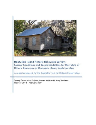
  • 1. Daufuskie Island Historic Resources Survey: Current Conditions and Recommendations for the Future of Historic Resources on Daufuskie Island, South Carolina A report prepared for the Palmetto Trust for Historic Preservation Survey Team: Brian Dolphin, Lauren Mojkowski, Meg Southern October 2013 - February 2014
  • 2. Daufuskie Island Historic Resources Survey 1 TABLE OF CONTENTS LIST OF TABLES AND FIGURES…………………………………………………………….…...2 ACKNOWLEDGEMENTS………………………………………………………………….…....3 EXECUTIVE SUMMARY…………………………………………………………………………4 SECTION 1: SURVEY DESIGN………………………………………………………………….5 1.1 Project objectives………………………………………………………………5 1.2 Prior surveys…………………………………………………………………....6 1.3 Survey methodology…………………………………………………………...6 1.3.1 Survey navigation……………………………………………………...6 1.3.2 Explanation of terms…………………………………………………...7 1.3.3 Methodology…………………………………………………………..7 SECTION 2: SURVEY DATA…………………………………………………………………....9 2.1 Organization of survey data…………………………………………………..9 2.2 Presentation of survey data…………………………………………………....9 2.2.1 Totals: Key Contributing and Contributing Features…………….……...9 2.2.1a Key Contributing features……………………………………...9 2.2.1b Contributing features…………………………………………..9 2.2.2 Features improved since 1982……………………………………….10 2.2.2a Key Contributing features……………………………………10 2.2.2b Contributing features…………………………………………10 2.2.3 Features maintained since 1982……………………………………...11 2.2.3a Key Contributing features……………………………………11 2.2.3b Contributing features…………………………………………12 2.2.3 Features neglected since 1982………………………………………12 2.2.4 Features reconstructed features since 1982………………………….13 2.2.4a Key Contributing features…………………………………….13 2.2.4b Contributing features…………………………………………14 2.3 Evaluation of survey data……………………………………………………14 2.3.1 Data gaps and limitations……………………………………………14 2.3.2 Avenues for future research…………………………………………..14 SECTION 3: RECOMMENDATIONS…………………………………………………………...15 3.1 Recommendations: Eight to Advocate………………………………………...15 SECTION 4: APPENDICES…………………………………………………………………….16 Appendix A Maps of survey area…………………………………………………16 A.1 Map of historic site concentration…………………………………….16 Appendix B Spreadsheets…………………………………………………………17 B.1 Key Contributing Features…………………………………………....17 B.2 Contributing Features………………………………………...………18 B.3 Wooded Tracts………………………………………………………20 Appendix C Inventory Forms………………………………………………………24 C.1 Hudson House………………………………………………………...24 C.2 Kearse House………………………………………………………...25 C.3 Robinson House………………………………………………………26
  • 3. Daufuskie Island Historic Resources Survey 2 C.4 Simmons House………………………………………………………27 C.5 Bright House…………………………………………………………28 C.6 Grant House…………………………………………………………29 C.7 Williams House………………………………………………………30 C.8 Bryan House………………………………………………………….31 Appendix D Contents of appended disc…………………………………………..32 Appendix E Additional sources of information……………………………………32 LIST OF TABLES AND FIGURES Figures Figure 1: Discussing objectives and methodology……………………………………...5 Figure 2: Survey photographs in progress……………………………………………..8 Figure 3: Mount Cameral Baptist Church……………………………………………..11 Figure 4: Mary Dunn Cemetery………………………………………………………11 Figure 5: Hudson House………………………………………………………………12 Figure 6: One Room School House…………………………………………………....13 Tables Table 1: Number of Contributing features surveyed in 1982 and 2013…………….10 Table 2: Contributing features maintained since 1982………………………………12 Table 3: Neglected Contributing features……………………………………………13 Table 4: Eight to Advocate…………………………………………………………...15
  • 4. Daufuskie Island Historic Resources Survey 3 ACKNOWLEDGEMENTS This survey would not have been possible without the hospitality and help of numerous individuals. First and foremost, Mike Bedenbaugh of the Palmetto Trust for Historic Preservation provided the impetus, encouragement, and logistical support underpinning the survey from its earliest stages. He also provided survey data from the 2006 Savannah College of Art and Design inventory. Brad Sauls at the South Carolina State Historic Preservation Office (hereafter SHPO) made copies of the all-important 1982 National Register nomination and its attendant maps available to the survey team. He and other members of the SHPO staff guided survey methodology and execution through digital publication of the SHPO survey manual. This project was completed in Dr. Robert Weyeneth’s Charleston Field School course in Fall 2013. Nancy Ludtke of the Daufuskie Island Historical Foundation (hereafter DIHF) arranged transportation to and from and across the island, facilitated by the employees of the Haig Point Club both in Hilton Head and on Daufuskie Island. Her colleague Jo Hill patiently fielded questions about the island’s history. Paul Vogel, also of the DIHF, made the island’s nascent but growing archives available to us, and facilitated a meeting with Daufuskie residents that produced a very useful map of the island’s widely recognized historic resources. Pat Beischler served as the survey team’s major on-island contact, providing storage space for vehicles, transportation to the ferry dock at Haig Point, and access to the Daufuskie Island Community Farm. Robin Townshend graciously provided lodging at both her rental condominium property at Melrose Plantation and in her own home on Carvin Road, as well as the use of her golf carts. John Hill and Edgar arranged unusual and vital ferry transport for the second phase of survey. Many other residents of Daufuskie welcomed the survey team and made their island home a hospitable place to conduct research. Many warm thanks to all listed above and to the many more who were involved in making the survey possible.
  • 5. Daufuskie Island Historic Resources Survey 4 EXECUTIVE SUMMARY The Daufuskie Island Historic Resources Survey compiled an inventory of Daufuskie Island’s extant historic resources listed in the 1982 National Register nomination prepared by Rebecca Starr.1 Survey was limited to the bounds of the Daufuskie Island historic district, as defined in the 1982 National Register nomination, and was conducted over a period of two weekends: October 18 – 20, and November 8 – 10, 2013. A total of nearly 200 properties were surveyed, with data collected on the existing condition and threat level to residential structures listed as Key Contributing or Contributing in the 1982 National Register nomination. Data contained in the following report is intended to guide the Palmetto Trust for Historic Preservation in its Daufuskie Endangered Place Program. Additional copies of the report are on file with the South Carolina State Historic Preservation Office and the Daufuskie Island Historical Foundation. Surveyors included Brian Dolphin, Lauren Mojkowski, and Meg Southern, all graduate students in the Public History Program at the University of South Carolina. Brian Dolphin coordinated logistics for site visits to Daufuskie, conducted survey work in October, authored the evaluation of survey data section of this report, and compiled a list of residential structures designated Eight to Advocate. Lauren Mojkowski created the team’s site survey forms, overlayed photographs from the 1982 and 2013 surveys, and served as lead editor for the final survey report. Together with Meg Southern, Lauren collected 1982 survey data at the South Carolina SHPO and created spreadsheets for survey use on the island and completed survey forms for residential structures. Meg Southern coordinated use of professional-grade camera; conducted survey work in October; authored the acknowledgements, executive summary, project objectives, survey methodology, and compiled a list of additional sources for this report. All members of the survey team alternated duties driving golf carts, recording observations of features in spreadsheets, and taking photographs during the November phase of survey. 1Starr, Rebecca. “National Register of Historic Places Inventory - Nomination Form: Daufuskie Historic District.” Edited by National Park Service, United States Department of the Interior: South Carolina State HIstoric Preservation Office, 1981.
  • 6. Daufuskie Island Historic Resources Survey 5 SECTION 1: PROJECT DESIGN 1.1 Project objectives Objectives of the survey were determined in collaboration with the Palmetto Trust for Historic Preservation’s Executive Director Mike Bedenbaugh. Primary objectives included: • To take inventory of the Key Contributing and Contributing properties listed in the 1982 National Register nomination for the Daufuskie historic district; • To make observations on the current conditions of early twentieth-century domestic structures; and • To recommend several of these structures for future preservation in the Palmetto Trust’s Daufuskie Endangered Places Program (hereafter DEPP). Secondary objectives included: • To garner local support for the DEPP; and • To record the extent of development of wooded lots included in the 1982 survey. Figure 1: Palmetto Trust Executive Director Mike Bedenbaugh and surveyor Meg Southern discuss project objectives and methodology.
  • 7. Daufuskie Island Historic Resources Survey 6 1.2 Prior surveys This survey draws on earlier preservation reports on the Island’s historic resources. These reports and their contents include: • Rebecca Starr’s 1982 National Register nomination: provided the seminal list of properties, boundaries of the historic district, and references to additional scholarship.2 • The “Beaufort County Historic Sites Survey” completed by Brockington Associates, Inc., Brooker Architectural Design Consultants, Historic Beaufort Foundation, and Preservation Consultants, Inc. in 1998: provided additional details in architectural history and conditions of then-extant resources.3 • Survey conducted by students at the Savannah College of Art and Design in 2006: provided the most current street addresses and corresponding property number in the 1982 National Register nomination.4 While these earlier surveys determined properties’ historical significance and contribution to the historic district, noted significant architectural details and the condition of extant structures, none were entirely sufficient to The Palmetto Trust’s needs. A more current survey was necessary to determine which of the properties listed as contributing to the historic district on the National Register were still extant and which were viable candidates for the Palmetto Trust’s DEPP. Passage of time required an updated inventory of the island’s existing historic resources. 1.3 Survey Methodology 1.3.1 Survey navigation Survey was conducted on foot and via golf cart on Daufuskie’s dirt roads, following Rebecca Starr’s 1982 map of features included in the National Register nomination of the Daufuskie Island historic district. This district covers the entirety of the island. Daufuskie Island is approximately one mile southwest of Hilton Head Island, South Carolina. The Calibogue Sound forms Daufuksie’s northeast boundary, the Cooper and New Rivers its west boundary, 2 Ibid. 3 This survey and the detailed survey forms it produced are available via Beaufort County’s Planning Department website. 4 The Savannah College of Art and Design survey was made available by Mike Bedenbaugh of the Palmetto Trust.
  • 8. Daufuskie Island Historic Resources Survey 7 the mouth of the Savannah River its south, and the Atlantic Ocean its southeast boundary. The vast majority of this area was surveyed, including areas of the now private Haig Point and Melrose Plantation developments (see Map A.1 in Appendix A).5 To determine each property’s location, the 1982 nomination map was cross-referenced with a more recent roadmap produced by the Daufuskie Island Historical Foundation. Surveyors drove golf carts to each feature and took observations from public roadways. Survey was conducted on foot in places where visibility was limited from the roadway. Private property laws and homeowner privacy were respected in all cases. Occasionally properties were indiscernible, due either to inaccessibility from the public roadway or because of vegetation, and were noted in the appended spreadsheets as “Unable to locate” or “Cannot access” (see Appendix B). Many of those properties no longer contain extant historic structures. 1.3.2 Explanation of terms In order to maintain consistency with the National Register of Historic Places, this survey employs the terminology of the 1982 nomination that designated Daufuskie Island an historic district. Definitions are as follows: • Contributing feature: any building, structure, object, or site within the boundaries of the District which reflects the significance of the District as a whole, either because of historic associations, historic architectural qualities, or archaeological features. • Key Contributing feature: any Contributing feature of exceptional significance to the nominated District.6 The survey team inventoried Key Contributing features in the first phase of the survey (October 18 – 20, 2013) and Contributing features in the second phase of the survey (November 8 – 10, 2013). 5 Starr, 1982. 6 Though it does not commonly appear in National Register records, Starr uses this term in the 1982 nomination.
  • 9. Daufuskie Island Historic Resources Survey 8 1.3.3 Methodology In an effort to reveal significant changes over the twenty one years elapsed, the survey team employed three documentation strategies: 1. Photograph all Key Contributing and Contributing properties from the same vantage point as in the 1982 survey. These comparative photographs are stored on the CD- ROM attached to this report; 2. Observations were made about each of these properties’ conditions and significant recent changes. These are recorded in the tables in Appendix B; 3. Record significant architectural features and current conditions of early twentieth- century residences listed as Key Contributing or Contributing in the 1982 National Register nomination in survey forms created by the 2013 survey team. Architectural elements were determined to be of import because they were included in the 1982 nomination and Beaufort County’s more recent “Daufuskie Code.”7 7 Starr, 1982; Beaufort County, Daufuskie Island Code. Figure 2: Survey team member Lauren Mojkowski uses a tablet to compare photographs from the 1982 survey with extant structures.
  • 10. Daufuskie Island Historic Resources Survey 9 SECTION 2: SURVEY DATA 2.1 Organization of survey data For consistency and ease of reference between reports, this survey employs the feature numbers and names assigned to properties in the 1982 National Register nomination. Features are analyzed in order of importance, Key Contributing followed by Contributing.8 2.2 Presentation of survey data 2.2.1 Totals: Key Contributing and Contributing Features 2.2.1a Key Contributing features All eighteen (18) Key Contributing features included in the 1982 National Register nomination were surveyed in this inventory. They include the following architectural forms: • Six (6) residences, two (2) of which are lighthouses; • Four (4) schools; • Two (2) churches; • Two (2) cemeteries; • One (1) meeting hall; • One (1) road; • One (1) collection of ruins; and • One (1) site. 2.2.1b Contributing features Fifty-one (51) of the historic district’s built features were designated Contributing features in the 1982 National Register nomination. Thirty-one (31) of those features were evaluated for this report, sixty percent (60%) of the total number of features evaluated. Table 1 provides a full breakdown and comparison of Contributing properties surveyed in 1982 and 2013 respectively. 8 Note bene: this numbering system (in the 1982 and 2013 surveys) differs from that employed in the 2006 SCAD survey.
  • 11. Daufuskie Island Historic Resources Survey 10 Table 1: Number of Contributing features surveyed in 1982 and 2013. Feature type Listed in 1982 Surveyed in 2013 Homes 43 26 Cemeteries 4 2 Wick Houses 2 2 Storage Houses 1 1 Ice Houses 1 1 Total 51 31 2.2.2 Features improved since 1982 2.2.2a Key Contributing features Five (5) Key Contributing features have been improved since 1982: 1. Haig Point Lighthouse (#1): restored and converted into a rental unit associated with the Haig Point Development; 2. Mount Cameral Baptist Church (#52) (see Figure 3) and 3. Jamie Hamilton School (#53): both rehabilitated and now jointly serving as an Island museum, interpretative center and library administered by the Daufuskie Island Historical Foundation (DIHF); 4. Daufuskie School (#109) has been rehabilitated to serve as the Island Archives administered by DIHF; 5. Roller House (#128): restored. 2.2.2b Contributing features Five (5) Contributing features have been improved since 1982: 1. Smith House (#79): roof rebuilt; 2. Grant House (#104): restored; 3. Graves House (#108): received an addition 4. Bates House (#258): restored; 5. Bryan House (#301): has been restored and converted to joint business-residence. Now houses Daufuskie Island decorative goods manufacturer the “Iron Fish.” The homeowners live in and operate an art gallery out of the house.
  • 12. Daufuskie Island Historic Resources Survey 11 2.2.3 Key and Contributing features maintained since 1982 2.2.3a Key Contributing features Eight (8) Key Contributing features have been maintained and largely exhibit the same character they did at the time of the 1982 survey: 1. First Union Baptist Church (#89); 2. Mary Field School (#91); 3. Mary Field Cemetery (#129) (see Figure 4); 4. Mary Dunn Cemetery (#293); 5. Martin House (#302); 6. North-South Road (#371); 7. Bloody Point (#372); and 8. Tabby Ruins (#373). Development at Bloody Point beginning in the early to mid-2000s has not significantly altered its historical features. The Tabby Ruins have seen decline in integrity but a large portion are dutifully maintained by Haig Point and a small outlier example maintained DIHF. Figure 3: Mount Cameral Baptist Church 1982 (left) and 2013 (right). It now serves as the Daufuskie Island Historic Foundation's museum. Figure 4: Mary Dunn Cemetery in 1982 (left) and 2013 (right).
  • 13. Daufuskie Island Historic Resources Survey 12 2.2.3b Contributing features Twelve (12) Contributing features have been maintained since 1982. Table 2 provides a list of these largely unaltered properties. Table 2: Contributing features maintained since 1982. 2.2.3 Features neglected since 1982 2.2.3a Key Contributing features One (1) Key Contributing feature has fallen into disrepair since 1982: 1. Hudson House (#85) has been abandoned. Most of its building material is extant – because it sits at a significant setback from the modern street, building materials have largely remained in situ (see Figure 5). Figure 5: Hudson House (#85), in 1982 (left) and 2013 (right). Extensive vegetative growth obscures photographs taken from the same angle. National Register feature number Feature Name 2 Haig Point Wick House 39 Cooper River Cemetery 94 Jenkins House 125 Grant House 126 Steven House 131 Grant House 252 Bloody Point Wick House (Silver Dew Winery) 253 Bloody Point Storage Building 259 Bloody Pointe Cemetery 286 Simmons House 287 Hamilton House 291 Blake House
  • 14. Daufuskie Island Historic Resources Survey 13 2.2.3b Contributing features Seven (7) Contributing features have fallen into disrepair since 1982. Table 3 provides a list of these neglected features. Table 3: Neglected Contributing features. National Register feature number Feature name 6 Kearse House 92 Robinson House 95 Simmons House 99 Bright House 111 Grant House 112 Williams House 114 Bryan House 2.2.4 Features Reconstructed Since 1982 2.2.4a Key Contributing features One (1) Key Contributing feature has been reconstructed since the 1982 survey. After falling in disrepair, One Room School House (#90) was reconstructed in 2007 (see Figure 3). Thus, it can no longer qualify as a Key Contributing feature of the Daufuskie until 2057, according to the stipulations of the National Register of Historic Places. Figure 6: One Room School House (#90), in 1982 (left) and 2013 (right). The structure was reconstructed in 2007.
  • 15. Daufuskie Island Historic Resources Survey 14 2.2.4b Contributing features One (1) Contributing feature has been reconstructed since the 1982 survey. Parker House (#257) was reconstructed in October 2013, during the time of this survey. 2.3 Evaluation of survey data 2.3.1 Data gaps and limitations Though this survey aimed to be a comprehensive inventory of all properties listed in the 1982 National Register nomination, it was often limited by discrepancies between maps of the historic district and an inability to access certain areas of the island. As a result, data remains to be collected on twenty (20) Contributing features. For a complete list of these structures, see Spreadsheets B.1 and B.2 in Appendix B. The same limitations precluded complete inventory of the wooded lots listed as Contributing features in the 1982 survey. See Spreadsheet B.3 in Appendix B for the feature numbers of wooded lots that were inaccessible to the 2013 survey team. 2.3.2 Avenues for future research Considerable development has occurred on Daufuskie Island since the 1982 survey. This survey observed that wooded tracts have been developed to a greater extent in the southern portion of the island. While the 2013 survey documented some areas of development, others remain to be examined. Future surveys should focus on the extent of development on wooded lots. Computer- generated maps depicting as-of-yet undeveloped wooded lots and those developed since the 1982 survey would be useful to the Palmetto Trust, the South Carolina SHPO, and the Beaufort County Planning Department. Satellite mapping techniques would be additionally useful. Future reports should include a section describing which current wooded lots could act as development buffer zones for the historic district. Using this report as a reference, a computer-generated map should also be produced depicting Key Contributing and Contributing features. Data points from the 1982 survey should also be collected via satellite for comparative purposes. A copy of this map should be added to this report as an addendum.
  • 16. Daufuskie Island Historic Resources Survey 15 SECTION 3: RECOMMENDATIONS 3.1 Recommendations: Eight to Advocate After surveying Daufuskie Island, the survey team identified one (1) Key Contributing property and seven (7) Contributing properties that have been abandoned. These have deteriorated significantly since the 1982 survey. While the Palmetto Trust should further examine these properties to determine their structural integrity and stability, these structures are excellent candidates for rehabilitation through the Daufuskie Endangered Places Program (DEPP). The Palmetto Trust should focus its most immediate attention on the eight (8) structures listed in Table 4 below. Table 4: Eight to Advocate. Eight properties for the Palmetto Trust's Daufuskie Endangered Places Program. National Register number Feature name Current contact Contact address 85 Hudson House SMALLS ABRAHAM HRS OF % DOROTHY S 109 Goethe Rd, Bluffton, SC 29910 92 Robinson House ROBINSON LOUVENIA BENTLEY ROBINSON J 2210 E GABLE ST, SAVANNAH GA 31404 95 Simmons House SIMMONS JAKE LILLIE GENERAL DELIVERY, DAUF ISLAND 99 Bright House HUDSON JAMES CURTIS Sr 1222 SHERMAN AVE, SAVANNAH, GA 31405 101 Hubbard House ESTUS RICHARD A INGRAM LINDA ETAL 156 RENDANT AVE, SAVANNAH, GA 31419 111 Grant House KEYSERLING THEODORE H PO BOX 528, BEAUFORT, SC 29901 112 Williams House WILLIAMS GEORGE HRS OF % PHOEBE SA 1108 E 39TH ST, SAVANNAH, GA 31404 114 Bryan House DRENNAN JAMES H SYLVIA CORLEY JTROS 1403 PINE STREET, WEST COLUMBIA, 29172
  • 17. Daufuskie Island Historic Resources Survey 16 SECTION 4: APPENDICES Appendix A: Maps of Survey Area A.1 Map of historic site concentration, with inset showing Frances Jones House. Provided by Dan and Jean Newton.
  • 18. Daufuskie Island Historic Resources Survey 17 Appendix B: Spreadsheets B.1 Key Contributing Features National Register feature number Feature name Status Threat level 1 Haig Point Lighthouse Rehabilitated Not threatened 52 Mt. Cameral Baptist Church Rehabilitated Not threatened 53 Janie Hamilton School Rehabilitated Not threatened 85 Hudson House Neglected Threatened 89 First Union Baptist Church Unaltered Not threatened 90 One Room School House Reconstructed Not threatened 91 Mary Field School Unaltered Not threatened 109 Daufuskie School Rehabilitated Not threatened 112A Single pen Demolished Threatened 124 Oyster Society Hall Rehabilitated Not threatened 128 Roller House Reconstructed Not threatened 129 Mary Field Cemetery Unaltered Not threatened 254 Bloody Point Lighthouse Rehabilitated Not threatened 293 Mary Dunn Cemetery Unaltered Not threatened 302 Martin House Unaltered Not threatened 371 North-South Road Unaltered Not threatened 372 Bloody Point Development Not threatened 373 Tabby Ruins Unaltered Not threatened
  • 19. Daufuskie Island Historic Resources Survey 18 B.2 Contributing Features National Register feature number Feature name Status Threat level 2 Haig's Pointe Wick House Unaltered Not threatened 4 Simmons House Could not locate 6 Kearse House Abandoned Threatened: demolition by neglect 39 Cooper River Cemetery Unaltered Not threatened 51 Lawrence House Could not locate 54 Holmes House Could not locate 55 Holmes House Could not locate 79 Smith House Roof replaced Not threatened 80 Washington House Could not locate 81 Webb Cemetery Could not locate 83 Green House Demolished 87 Mickel House Could not locate 92 Robinson House Abandoned Threatened: demolition by neglect 93 Robinson House Could not locate 94 Jenkins House Unaltered 95 Simmons House Abandoned - chimney missing Threatened: demolition by neglect 96 Hinson White House Addition at rear 98 Grant House Could not locate 99 Bright House Abandoned deThreatenedemoliti on by neglect 101 Hubbard House Dilapidated - small portion standing Threatened: demolition by neglect 102 Grant House Demolished Threatened: only roof remains 103 Mobley House Could not locate 104 Grant House Restored Not threatened 106 Graham Ice House Could not locate 107 Graham House Could not locate 108 Graves House Addition on side Threatened 110 Graves House Could not locate 111 Grant House Abandoned Threatened: demolition by neglect 112 Williams House Abandoned - chimney Threatened:demolitio
  • 20. Daufuskie Island Historic Resources Survey 19 missing n by neglect 113 Burn House Could not locate 114 Bryan House Abandoned Threatened: demolition by neglect 120 Yarbrough House Renovated No longer eligible for National Register 122 Yarbrough House Renovated No longer eligible for National Register 123 Yarbrough House Could not locate 125 Grant House Unaltered 126 Stevens House Unaltered 131 Grant House Unaltered 132 Brown House Could not locate 252 Bloody Pointe Wick House (Silver Dew Winery) Unaltered Not threatened 253 Bloody Pointe Storage Building Unaltered Not threatened 257 Parker House Reconstructed Not threatened 258 Bates House Restored Not threatened 259 Bloody Pointe Cemetery Unaltered 286 Simmons House Unaltered Threatened: demolition by neglect 287 Hamilton House Unaltered 288 Wiley House Could not see from street 291 Blake House Unaltered 292 Blake House Could not locate 301 Bryan House Restored Not threatened 303 Porter House Could not locate 311 Fripp Cemetery Could not locate
  • 21. Daufuskie Island Historic Resources Survey 20 B.3 Wooded Tracts National Register feature number Status Notes 8 Developed Haig Point development 9 Undeveloped Old Haig Point Road 10 Undeveloped Old Haig Point Road 11 Undeveloped Old Haig Point Road 12 Undeveloped Old Haig Point Road 13 Undeveloped Old Haig Point Road 14 Indeterminate Could not locate 15 Indeterminate Could not locate 16 Indeterminate Could not locate 17 Indeterminate Could not locate 18 Indeterminate Could not locate 19 Indeterminate Could not locate 20 Indeterminate Could not locate 21 Indeterminate Could not locate 22 Undeveloped Old Haig Point Road 23 Undeveloped Old Haig Point Road 24 Developed New construction 25 Undeveloped N side of road: camper; pathway cleared 26 Undeveloped 27 Undeveloped For sale 28 Undeveloped To be developed - "The Marshes" 29 Indeterminate Could not locate 30 Indeterminate Could not locate 31 Indeterminate Could not locate 32 Indeterminate Could not locate 33 Indeterminate Could not locate 34 Indeterminate Could not locate 35 Indeterminate Could not locate 36 Indeterminate Could not locate 37 Developed Campers and small structures 38A Undeveloped 40 Indeterminate Could not locate 41 Indeterminate Could not locate 42 Indeterminate Could not locate 43 Indeterminate Could not locate 44 Indeterminate Could not locate 45 Indeterminate Could not locate 46 Indeterminate Could not locate 47 Indeterminate Could not locate 48 Indeterminate Could not locate
  • 22. Daufuskie Island Historic Resources Survey 21 49 Indeterminate Could not locate 50 Developed Melrose Boat Landing 52A Indeterminate Could not locate 54A Indeterminate Cannot access 56 Indeterminate Cannot access 57 Indeterminate Cannot access 58 Indeterminate Cannot access 59 Indeterminate Cannot access 60 Indeterminate Cannot access 61 Indeterminate Cannot access 62 Indeterminate Cannot access 63 Indeterminate Cannot access 64 Indeterminate Cannot access 65 Indeterminate Cannot access 66 Indeterminate Cannot access 67 Indeterminate Cannot access 68 Indeterminate Cannot access 69 Indeterminate Cannot access 70 Indeterminate Cannot access 71 Indeterminate Cannot access 72 Indeterminate Cannot access 73 Indeterminate Cannot access 74 Indeterminate Cannot access 75 Indeterminate Cannot access 76 Indeterminate Cannot access 77 Indeterminate Cannot access 78 Indeterminate Cannot access 86 Developed Lot appears to have been subdivided 88 Indeterminate School Road - refer to county maps 99A Undeveloped 100 Developed Haig Point Road 101A Undeveloped 105 Indeterminate Cannot access 130 Indeterminate Could not locate 131A Developed 134 Indeterminate Cannot access 135 Indeterminate Cannot access 136 Indeterminate Cannot access 137 Indeterminate Cannot access 138 Indeterminate Cannot access 139 Indeterminate Cannot access 140 Indeterminate Cannot access
  • 23. Daufuskie Island Historic Resources Survey 22 141 Indeterminate Cannot access 142 Indeterminate Cannot access 143 Undeveloped 144 Undeveloped 145 Undeveloped 146 Undeveloped 147 Indeterminate Cannot access 148 Undeveloped 149 Undeveloped 150 Undeveloped 151 Undeveloped School Road 255A Indeterminate Could not locate 256A Indeterminate Could not locate 290 Developed Martinangele Road; small shed present; potentially subdivided 314 Developed Prospect Boulevard 315 Developed Martinangele Road 316 Developed Prospect Boulevard; mobile home community 317 Undeveloped Benjie's Point Road 318 Undeveloped Benjie's Point Road 319 Undeveloped Benjie's Point Road 320 Indeterminate Could not locate 321 Indeterminate Could not locate 322 Indeterminate Could not locate 323 Indeterminate Could not locate 324 Indeterminate Could not locate 325 Indeterminate Could not locate 326 Developed Prospect Boulevard 327 Indeterminate Benjie's Point Road; cannot access 328 Developed Cannot access 329 Undeveloped Mary Dunn Cemetery Road 330 Developed Prospect Boulevard; light industrial shed 331 Undeveloped Mary Dunn Cemetery Road 332 Undeveloped 333 Developed Prospect Boulevard 334 Developed Prospect Court 335 Developed Prospect Boulevard 336 Developed Prospect Hill Court 337 Developed 338 Indeterminate Could not locate 339 Indeterminate Could not locate 340 Indeterminate Could not locate
  • 24. Daufuskie Island Historic Resources Survey 23 341 Indeterminate Could not locate 342 Indeterminate Could not locate 343 Indeterminate Could not locate 344 Indeterminate Could not locate 345 Indeterminate Could not locate 346 Indeterminate Could not locate 347 Indeterminate Could not locate 348 Indeterminate Could not locate 349 Indeterminate Could not locate 350 Indeterminate Could not locate 351 Indeterminate Could not locate 352 Indeterminate Could not locate 353 Indeterminate Could not locate 354 Indeterminate Could not locate 355 Indeterminate Could not locate 356 Indeterminate Could not locate 357 Indeterminate Could not locate 358 Indeterminate Could not locate 359 Indeterminate Could not locate 360 Indeterminate Could not locate 361 Indeterminate Could not locate 362 Indeterminate Could not locate 363 Indeterminate Could not locate 364 Indeterminate Could not locate 365 Indeterminate Could not locate 366 Developed Prospect Road 367 Developed Prospect Boulevard 368 Developed Prospect Boulevard 369 Developed Prospect Boulevard 370 Developed Multiple structures present 375 Undeveloped
  • 25. Daufuskie Island Historic Resources Survey 24 Appendix C: Inventory Forms C.1 Hudson House Daufuskie Island Survey Project 2013 Building/Site Inventory Form Photo Number: National Register Site Number: 85 Historic Name: Hudson House Beaufort County Property ID Number: R800 024 000 0082 0000 Common Name: Hudson House Address/Location: 8 Church Road Date: c. 1910 Ownership (circle): Private City County State Federal Unknown Category (circle): Building Site Structure Object Historic Uses: Singe dwelling Current Uses: Vacant National Register Status: Key contributing – Daufuskie Island Historic District (1982) Style: Vernacular cottage Plan: Double pile, dogtrot Core Shape: Rectangular Stories: 1.5 Construction: Frame Roof Shape: Gable roof Roof Material: Standing seam Chimney Type: External Chimney Material: Brick Exterior Walls, material: Weatherboard Windows: 8+ Window Type: Sash Pane: 3 over 3 Doors: 2 Foundation: Wooden piers Porch: Front porch over two bays, hip roof Outbuildings: Two sheds Surroundings: Thick woods Acreage: 6.00 Alterations to property/Notes: Several small, once detached buildings successively moved and attached to main building; shed on second addition. Very poor condition: porch roof ready to collapse, rear additions much deteriorated where still standing. Wooden piers appear to be tree trunks.
  • 26. Daufuskie Island Historic Resources Survey 25 C.2 Kearse House Daufuskie Island Survey Project 2013 Building/Site Inventory Form Photo Number: National Register Site Number: 6 Historic Name: Kearse House Beaufort County Property ID Number: R800 022 000 009A 0000 Common Name: Kearse House Address/Location: 281 Old Haig Point Road Date: c. 1925 Ownership (circle): Private City County State Federal Unknown Category (circle): Building Site Structure Object Historic Uses: Single dwelling Current Uses: Vacant National Register Status: Key contributing – Daufuskie Island Historic District (1982) Style: Vernacular cottage Plan: Double pen, double pile Core Shape: Rectangular Stories: 1 Construction: Frame Roof Shape: Hip Roof Material: Standing seam metal Chimney Type: N/A Chimney Material: N/A Exterior Walls, material: Weatherboard Windows: Indet. Window Type: Indet. Pane: Indet. Doors: 1+ Foundation: Brick piers Porch: Shed, covers façade Outbuildings: Shed, privy Surroundings: Thick woods Acreage: 9.88 Alterations to property/Notes: Stands at significant setback from Old Haig Point Road. Condition very poor: shed porch highly deteriorated, many windows missing, roof in need of repair and stabilization. Thick woods on three sides makes observation of elevations difficult.
  • 27. Daufuskie Island Historic Resources Survey 26 C.3 Robinson House Daufuskie Island Survey Project 2013 Building/Site Inventory Form Photo Number: National Register Site Number: 92 Historic Name: Robinson House Beaufort County Property ID Number: R800 024 000 075A 0000 Common Name: Robinson House Address/Location: 126 Bryan Road Date: c. 1915 Ownership (circle): Private City County State Federal Unknown Category (circle): Building Site Structure Object Historic Uses: Single dwelling Current Uses: Vacant National Register Status: Contributing – Daufuskie Island Historic District (1982) Style: Vernacular cottage Plan: Georgian Core Shape: Rectangular Stories: 1.5 Construction: Frame Roof Shape: Gable Roof Material: Standing seam Chimney Type: External Chimney Material: Brick Exterior Walls, material: Weatherboard Windows: 6+ Window Type: Sash Pane: 6 over 6 Doors: 1+ Foundation: Concrete block piers Porch: Wraparound shed porch Outbuildings: Three frame sheds, one metal shed Surroundings: Woods Acreage: 2.00 Alterations to property/Notes:
  • 28. Daufuskie Island Historic Resources Survey 27 C.4 Simmons House Daufuskie Island Survey Project 2013 Building/Site Inventory Form Photo Number: National Register Site Number: 95 Historic Name: Simmons House Beaufort County Property ID Number: R800 024 000 0083 0000 Common Name: Simmons House Address/Location: Lillie’s Lane/24 Church Road Date: c. 1899 Ownership (circle): Private City County State Federal Unknown Category (circle): Building Site Structure Object Historic Uses: Single dwelling Current Uses: Vacant National Register Status: Contributing – Daufuskie Island Historic District (1982) Style: Vernacular cottage Plan: Double pen, double pile Core Shape: Rectangular Stories: 1 Construction: Frame Roof Shape: Gable and hip Roof Material: Standing seam metal Chimney Type: Exterior (deteriorated) Chimney Material: Brick Exterior Walls, material: Weatherboard Windows: 6+ Window Type: Sash Pane: 6 over 6 Doors: 2+ Foundation: Brick piers Porch: None Outbuildings: Two sheds, chicken house, privy Surroundings: Woods Acreage: 4.00 Alterations to property/Notes: Exterior brick chimney on N elevation now in ruin near same. Ghost of standing chimney remains visible on weatherboard of that elevation. Otherwise, Simmons House is largely unchanged from its appearance at the time of the 1982 National Register nomination.
  • 29. Daufuskie Island Historic Resources Survey 28 C.5 Bright House Daufuskie Island Survey Project 2013 Building/Site Inventory Form Photo Number: National Register Site Number: 99 Historic Name: Bright House Beaufort County Property ID Number: R800 024 000 0067 0000 Common Name: Bright House Address/Location: 186 Haig Point Road Date: 1935 Ownership (circle): Private City County State Federal Unknown Category (circle): Building Site Structure Object Historic Uses: Single Dwelling Current Uses: Other-Vacant National Register Status: Contributing- Daufuskie Island Historic District (1982) Style: Vernacular Cottage Plan: Double Pen Core Shape: Rectangular Stories: 1 Construction: Frame Roof Shape: Side Gable Roof Material: Standing seam metal Chimney Type: None Chimney Material: N/A Exterior Walls, material: weatherboard Windows: Indeterminate Window Type: Pane: Doors: At least one Foundation: Concrete Piers Porch: No Porch Outbuildings: None visible Surroundings: Cleared Land Acreage: 9.61 Alterations to property/Notes: Could not determine some elements because of private property status. Unknown if there are doors in back of building. Also, exterior shutters closed, so could not evaluate windows.
  • 30. Daufuskie Island Historic Resources Survey 29 C.6 Grant House Daufuskie Island Survey Project 2013 Building/Site Inventory Form Photo Number: National Register Site Number: 111 Historic Name: Grant House Beaufort County Property ID Number: Unavailable Common Name: Grant House Address/Location: 110 Bryan Road Date: c. 1920 Ownership (circle): Private City County State Federal Unknown Category (circle): Building Site Structure Object Historic Uses: Single Dwelling Current Uses: Other-Vacant National Register Status: Contributing- Daufuskie Island Historic District (1982) Style: Vernacular Cottage Plan: Georgian Plan, Single Pile Core Shape: Rectangular Stories: 1 Construction: Frame Roof Shape: Hip Roof Material: Standing seam metal Chimney Type: Internal Chimney Material: Brick Exterior Walls, material: weatherboard Windows: Indeterminate- At least 4 Window Type: Sash Pane: 2 over 2 Doors: Two Foundation: Brick Piers Porch: Enclosed full porch Outbuildings: None Surroundings: Cleared Land Acreage: Unavailable Alterations to property/Notes: Building in poor condition, glass panes missing from most windows. No assessor documentation available for this property in Beaufort County real property search.
  • 31. Daufuskie Island Historic Resources Survey 30 C.7 Williams House Daufuskie Island Survey Project 2013 Building/Site Inventory Form Photo Number: National Register Site Number: 112 Historic Name: Williams House Beaufort County Property ID Number: R800 024 000 071A 0000 Common Name: Williams House Address/Location: 117 Bryan Road Date: c. 1910 Ownership (circle): Private City County State Federal Unknown Category (circle): Building Site Structure Object Historic Uses: Single Dwelling Current Uses: Other-Vacant National Register Status: Contributing- Daufuskie Island Historic District (1982) Style: Vernacular Cottage Plan: Georgian Plan, Double Pile Core Shape: Rectangular Stories: 1 Construction: Frame Roof Shape: Hip Roof Material: Standing seam metal Chimney Type: External Chimney Material: Brick Exterior Walls, material: weatherboard Windows: Indeterminate- At least 4 Window Type: Sash Pane: 2 over 2 Doors: Two Foundation: Brick Piers Porch: Wrap porch Outbuildings: None Surroundings: Wooded Acreage: .88 Alterations to property/Notes: Could not access all sections of building because of vegetation- could not determine exact number of windows
  • 32. Daufuskie Island Historic Resources Survey 31 C.8 Bryan House Daufuskie Island Survey Project 2013 Building/Site Inventory Form Photo Number: National Register Site Number: 111 Historic Name: Bryan House Beaufort County Property ID Number: R800 024 000 0070 0000 Common Name: Bryan House Address/Location: 82 Bryan Road Date: c. 1920 Ownership (circle): Private City County State Federal Unknown Category (circle): Building Site Structure Object Historic Uses: Single Dwelling Current Uses: Other-Vacant National Register Status: Contributing- Daufuskie Island Historic District (1982) Style: Vernacular Cottage Plan: Georgian Plan, Double Pile Core Shape: Rectangular Stories: 1 Construction: Frame Roof Shape: Side Gable Roof Material: Standing seam metal Chimney Type: None Chimney Material: N/A Exterior Walls, material: weatherboard Windows: Indeterminate- At least 6 Window Type: Pane: Doors: Two Foundation: Brick Piers Porch: Wrap Porch Outbuildings: None Surroundings: Cleared Land Acreage: 4.0 Alterations to property/Notes: Exterior shutters over windows- type and pane information unavailable.
  • 33. Daufuskie Island Historic Resources Survey 32 Appendix D: Contents of Appended Disc The CD-ROM appended to this report contains the following items: 1. Digital versions of the spreadsheets and inventory forms in Appendices B and C; 2. A digital version of this report; 3. Digital versions of 1982 and 2013 survey photographs of all properties inventoried, organized by site and referencing 1982 National Register site numbers; and 4. Digital version of the original 1982 Daufuskie Island National Register nomination form, courtesy of South Carolina State Historic Preservation Office. Appendix E: Additional Sources of Information Online Beaufort County South Carolina. “The Daufuskie Island Code.” http://www.bcgov.net/departments/Planning-and-Development/planning/Daufuskie-Island- Code.php Beaufort County South Carolina. “Above Ground Survey, documenting historic resources 50 years or older.” 1998. http://www.bcgov.net/history/county=history/AboveGroundSurvey/index.php?city=Daufuski e+Island&name=&Submit=Submit Palmetto Trust for Historic Preservation Craig, Lynn. 2007. “Framework for a Master Plan.” Savannah, Ga.: Savannah College of Art and Design. South Caroliniana Library, University of South Carolina Columbia Barnard, George N., F.A. Nowell, John P. Soule, and J.N. Wilson. 1865. [Charleston and Daufuskie Island, SC: views]. South Carolina. 1966. “Daufuskie Island report.” [Columbia, SC]: South Carolina Office of Economic Opportunity. Starr, Rebecca K. 1981. “Daufuskie Island, South Carolina cultural resources survey, 1981.” South Carolina: South Carolina Coastal Council.
  • 34. Daufuskie Island Historic Resources Survey 33 Starr, Rebecca K. 1984. “A place called Daufuskie: island bridge to Georgia, 1520 – 1830.” Thesis (MA) – University of South Carolina, 1984. Trinkley, Michael, and Colin Brooker. 1989. Archaeological investigations at Haig Point, Webb, and Oak Ridge, Daufuskie Island, Beaufort County, South Carolina. Columbia, SC: Chicora Foundation. Waters-Son. 1863. [Map of South Carolina coastal area from Daufuskie Island to Savannah, Ga.]. S.I.: s.n. Thomas Cooper Library, University of South Carolina Columbia Burn, Billie. 1991. An island named Daufuskie. Spartanburg, SC: Published in association with Billie Burn Books by the Reprint Co. Montoussamy-Ashe, Jeanne. 2009. Daufuskie Island: photographs. Columbia, SC: University of South Carolina Press. Tyler, Sarah Mae. 2003. “Maintaining the Gullah history, heritage and culture: is ecotourism a viable solution?” Thesis (MS) – University of Georgia, 2003. United States. 2012. Gullah Geechee cultural heritage corridor management plan. Denver, Co: U.S. Dept. of the Interior, National Park Service. http://purl.fdlp.gov/GPO/gpo27726. Vlach, John Michael. The Afro-American Tradition in Decorative Arts. Cleveland, Ohio: Cleveland Museum of Art, 1978. Other sources Beaufort, SC. Beaufort County Clerk of Court. Deed books 12, 13, 24, and 41. Beaufort, SC. Beaufort County Department of Education. School Census, 1921. “Gullah Dialect Preserved on Daufuskie.” Atlanta Journal and Constitution, 30 June 1968. Holmgren, Virginia C. Hilton Head: A Sea Island Chronicle. Hilton Head Island, SC: Hilton Head Publishing Company, 1959.