2012 fire season wrap up & 2013 outlook - Clark Fork Basin
•Download as PPTX, PDF•
1 like•356 views

Alyssa Stewart, Montana Department of Natural Resources and Conservation Summarizes the 2012 Northern Rockies Geographical Area fire season and provides an outlook for 2013. Presentation provide at the Clark Fork River Basin Water Summary 2012 & Water Outlook 2013 held October 23, 2012.

Recommended
More Related Content
What's hot
What's hot (20)
Viewers also liked
Viewers also liked (18)
More from Clark Fork Task Force
More from Clark Fork Task Force (12)
Recently uploaded
Recently uploaded (20)
2012 fire season wrap up & 2013 outlook - Clark Fork Basin
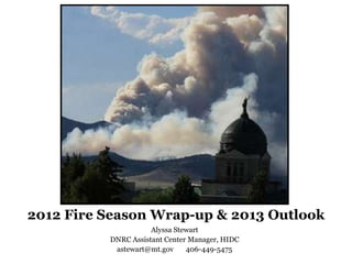
- 1. 2012 Fire Season Wrap-up & 2013 Outlook Alyssa Stewart DNRC Assistant Center Manager, HIDC astewart@mt.gov 406-449-5475
- 2. The Northern Rockies Geographic Area Northern Idaho, Montana, Yellowstone National Park, North Dakota and a small portion of South Dakota.
- 4. 2012 Fire Cause: 60% human, 40% lightning, on par with 10-yr average, 58% human, 42% lightning So far in 2012 there have been 3,272 fires for 1,407,026 acres, including 159 large fires in the NRGA – at least one every month except February.
- 7. Clark Fork River Basin An estimated 527 fires for 148,154 acres burned in the Clark Fork River Basin. This is 16% of the fires and 11% of the total acres burned in the NRGA.
- 8. Why was 2012 a record year in the NRGA? Very dry & hot June, September driest in MT history. Very convective Spring was summer. dry! 2011-2012 snowpack normal to a little less 100-hr and 1000-hr fuel moistures largely 2011 Fall a little dry below normal and but not too bad. set new minimums
- 9. Energy Release Component & 1000-hr Fuel Graphs by Predictive Service Area Energy Release Component (ERC): Composite value that relates fuel moisture to potential heat release per unit of flaming area, predictor of fire intensity – how hot a fire could burn. Based on worst case scenario. All graphs for Fuel Model G, dense conifer – includes 1000 hour fuels that are less susceptible to daily weather changes like a flashy fuel – national standard.
- 10. Northern Panhandle Idaho/ Northwest Montana
- 11. Southern Panhandle Idaho/ Western Montana
- 12. North Central Idaho/ Southwest Montana
- 14. Big Hole Montana
- 15. Fire danger takes current and previous weather, fuel type, and live and dead fuel moisture into account.
- 18. 2013 Outlook?