Urban land use and urban land value
•
0 likes•1,485 views

Land use is a series of operations on land, carried out by humans, with the intention to obtain products and/or benefits through using land resources.

Recommended
More Related Content
What's hot
What's hot (20)
Similar to Urban land use and urban land value
Similar to Urban land use and urban land value (20)
Recently uploaded
Recently uploaded (20)
Urban land use and urban land value
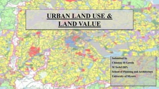
- 1. URBAN LAND USE & LAND VALUE Submitted by Chinmay H Gowda M Tech(URP) School of Planning and Architecture University of Mysore
- 2. What is Urban Land Use? Mysore city proposed landuse map for 2031 Land use is a series of operations on land, carried out by humans, with the intention to obtain products and/or benefits through using land resources. Land use involves the management and modification of natural environment or wilderness into built environment such as settlements and semi-natural habitats such as fields,Pastures and managed woods.
- 3. Classification of land use (Level -1) Sl.no Category Alpha code 1 Residential R 2 Commercial C 3 Industry I 4 Public and semi public PS 5 Mixed use M 6 Recreational P 7 Transportation and communication T 8 Primary activity A 9 Protective area E 10 Special area S
- 4. Classification of land use (Level -2) Sl.no Alpha code Use zone 1 R-1 Primary residential zone R-2 Unplanned residential zone 2 C-1 Retail shopping zone C-2 Commercial district centres C-3 Wholesale,Godowns and regulated markets C-4 Service sector C-5 Weekly markets 3 I-1 Service and light industry I-2 Extensive and heavy industry I-3 Special industrial zone 4 PS-1 Government and public offices PS-2 Government land PS-3 Police station PS-4 Education and research PS-5 Medical and health PS-6 Socio cultural and religious 5 M-1 Mixed industrial zone M-2 Mixed residential zone M-3 Mixed commercial zone 6 P-1 Playgrounds,stadiums P-2 Parks and gardens P-3 Multi open space 7 T-1 Roads T-2 Railways T-3 Airports T-4 Seaports and dockyards T-5 Bus depots T-6 Transmission and communication 8 PA-1 Agriculture PA-2 Forest and horticulture PA-3 Poultry and dairy farming PA-4 Rural settlements PA-5 Brick kiln PA-6 Fishing,pottery 9 E-1 Water bodies E-2 Special recreational zones E-3 Undevelopable use zone 10 S-1 Old built up area S-2 Heritage area
- 5. Steps involved in formulation of a Land use plan • Establish goals and terms of reference 1 • Organize the work 2 • Analyse the problem 3 • Identify oppurtunities for change 4 • Evaluate land suitability 5 • Appraise the alternatives:Environmental,economic,social analysis 6 • Choose the best option 7 • Prepare the land use plan 8 • Implement the plan 9 • Monitor and revise the plan 10
- 6. Allocation of Land use Land-use allocation is a process of allocating different activities or uses to specific units of area within a geospatial context, to maximize a spectrum of social, economic and ecological benefits
- 7. Urban Land use models
- 8. Concentric zone model Concentric zone model was developed by Ernst W Burgess in 1929 to explain how the settlements in the city will grow. 1. The Central Business District - the center of the city 2. Transition zone - A zone of mixed use with both commercial buildings and residential ones. 3. Low-class residential homes - these were later called inner suburbs - housing is cheap, standard of living is low. 4. Middle-class residential zone; A buffer zone between high and low class residential area. 5. Higher-class residential zone - later called outer suburbs. Better quality of life, more expensive to live there.
- 9. 1) Model is simple and comprehensive 2) Significant land use and their relationships are pinpointed in a generalized form. 3) Since it is an inductive model taking examples from American cities ,it interpreted the process of city growth. 1) When the city grows there is no room for the low income zone to expand. 2) Burgess assumed that the city would grow evenly in all directions. 3) He emphasized more on residential patterns and did not concentrate on other land uses. Merits Demerits Advantages and Criticisms
- 10. Sector model / Hoyt’s model Sector model is a model of urban land use proposed in 1939 by land economist Homer Hoyt. 1. It states that the city develops in sectors and not rings. 2. Certain areas of a city are more attractive for different activities because of an environmental factor. 3. Homer Hoyt modified the concentric zone model to account for major transportation routes. 4. According to him the city develops around the nexus of major transportation facilities such as railways,highways,seaports and trolley lines. 5. He theorized that cities would grow in wedge shape spatterns.
- 11. 1) Low cost housing near industrial zone cuts down transportation cost and time. 2) Providing railroute in the industrial zone makes the transportation of heavy goods easy. 1) The theory lacks the idea based on land topography. 2) The theory is based on 20th century rail transport and does not make allowances for private cars transportation. 3) The theory is outdated,many retail buildings have moved to suburbs rather than staying in CBD. Merits Demerits Advantages and Criticisms
- 12. Case study : Chicago Chicago is the 3rd most populous city in the united states, It’s metropolitan area called as Chicagoland is influenced by the Homer hoyt’s sector model.
- 13. Multiple Nuclei model The multiple nuclei model is an economical model created by Chauncy Harris and Edward Ullman in the 1945 article "The Nature of Cities" 1) The model describes the layout of a city. 2) It says that even though a city may have began with a central business district, other smaller CBD’s develop on the outskirts of the city near the more valuable housing areas to allow shorter commutes from the outskirts of the city. 3) This creates nodes or nuclei in other parts of the city besides the CBD.
- 14. 1) Low cost housing near industrial zone cuts down transportation cost and time. 2) Even distribution of resources and people in residential areas. 3) The model is suitable for large expanding cities. 1)There is no proper division between the zones. 2) No consideration of influence of physical relief . 3) Each zone displays a significant degree of internal heterogeneity and not homogenity. Merits Demerits Advantages and Criticisms
- 15. Concepts of Land use Reversible uses When the inherent features and characteristics of the land have not been considerably altered or modified such that the soil horizon,landform and structure remain intact so that the land can be reverted to its former use or original condition. Irreversible uses When land is subjected to applications which brought about changes,alteration or modifications so much so that it prevents the original use or it is physically impossible to restore the land so its previous state or condition.
- 16. Best use of the land The use of land which generates the maximum profit without negative consequences especially on the environment. Land should be used in such a manner consistent with its natural qualities to maximize its productivity and also adhere to the principles of sustainable development. Utilizing land in a manner that is beneficial to both man and environment. Compatible and Incompatible Land uses Some land uses are innately incompatible while others are completely compatible. Compatible uses can coexist harmoniously and effectively in an orderly management.
- 17. Comprehensive land use planning A document embodying specific proposals for guiding,regulating growth and development of a city or municipality Multiple Land uses Combining different land uses,whether reversible or irreversible in an orderly and desirable pattern because: Land is finite and supply is finite Demand is ever increasing Competition is there Land may have more than one use and uses can be combined in different ways.
- 18. Land capability classes LAND CAPABILITY CLASSIFICATION Evaluation of land for land use planning is a consequent step following the soil survey and mapping process. In the recent years, it has been popularized in almost every land development programme. The system of land capability classification requires that every acre of land be used in accordance with its capability and limitations. The land capability classification is a broad grouping of soils bases on their limitations and also serves as a guide to assess suitability of the land for cultivation, grazing and forest plantation.
- 19. Land use suitability Suitable for cultivation Class 1 Very good land Class 2 Good land Class 3 Moderately good land Class 4 Fairly good land Not suitable for cultivation Class 8 Suitable for wildlife Class 5 No limitation Class 6 Minor limitation Class 7 Major limitation Land capability classification system
- 20. Land Capability Groupings The grouping of soils into capability classes and sub-classes is done on the basis of their, capability to produce crops and pasture plants without deterioration over a long period of time. Land suitability class. It is a broad grouping of lands and it can be grouped into (a) land suitable for cultivation and (b) land not suitable for cultivation because of various constraints like excessive wetness or dryness, extreme variation in slopes etc. Class –I Very good land Land suitable for cultivation Class –II Good land Class –III Moderately good land Class –IV Fairly good land Class-V, VI and VII Land suitable for pastures and grazing Land not suitable for cultivation Class – V111 Land suitable for wild life and watershed Land capability classes. It consists of eight classes viz. Class I to Class VIII. Classes I through IV can be used for cultivation and Classes V through VIII cannot be cultivated in their present state under normal management
- 22. LAND VALUE: “The price, of a particular site of land in a city (urban area) is what a fair exchange brings in terms of money during an agreed trade or transaction between two parties, one of whom is the land owner is called land value” The ingredients that constitute land value are utility, scarcity and desirability What is urban land value ? The advantage of having a good connection in the high accessible area will lead to increased land value . Commercial properties or commercial buildings have the most expensive land value, followed by single-family residences, multi-family housing, and condominiums. For commercial purposes, properties close to the station reap the high premium and positive land value. This is consistent with the economic theory that commercial property generally raises demand due to accessibility benefits and its proximity to major transportation facility. Introduction :
- 23. Example for change in land value : This is supported by an example of Bocarejo which shows that the introduction of the BRT (Transmilenio) transport system in Bogota, Colombia that has had positive influence to the value of commercial properties. The farther the commercial area with Transmilenio corridor or BRT system station, the lower the land value in the commercial area Cervero added that there was no evidence that rail investment caused land value change, But hedonic price results show a strong relationship between proximity to the transit system and land value. The strong relationships found due to reflection from substantial differences in land use, modes and corridor, revealed that government policies and decisions have an important role in creating land use and land value.
- 24. Bid Rent Theory : The bid rent theory is a geographical economic theory that refers to how the price and demand for real estate change as the distance from the central business district (CBD) increases. It states that different land users will compete with one another for land close to the city centre.
- 25. Retail establishments wish to maximize their profitability, so they are much more willing to pay more for land close to the CBD and less for land further away from this area. This theory is based upon the reasoning that the more accessible an area (i.e., the greater the concentration of customers), the more profitable. Land users all compete for the most accessible land within the CBD. The amount they are willing to pay is called "bid rent". The result is a pattern of concentric rings of land use, creating the concentric zone model. According to this theory, the poorest houses and buildings would be on the very outskirts of the city, as this is the only location that they can afford to occupy. As many people prefer to trade off the accessibility of being close to the CBD and move to the edges of a settlement, where it is possible to buy more land for the same amount of money. Lower-income housing trades off greater living space for increased accessibility to employment.
- 26. Bid Rent Theory in Central Business District : Commerce is willing to pay the greatest rent in order to be located in the inner core. The inner core is very valuable for these users because it is traditionally the most accessible location for a large population. This large population is essential for department stores, which require a considerable turnover. As a result, they are willing and able to pay a very high land rent value. They maximize the potential of their site by building manystories. As one travels farther from the inner core, the amount thatcommerce is willing to pay declines rapidly. Industry, however, is willing to pay to be in the outer core. There is more land available for factories, but it still has many of the benefits of the inner core, such as a marketplace and good transportation linkages.
- 27. As one goes farther out, the land becomes less attractive to industry because of the reducing transportation linkages and a decreasing marketplace. Because householders do not rely heavily on these factors and can afford the reduced costs ,they can purchase land here. The farther from the inner core, the cheaper the land. This is why inner-city areas are very densely populated while suburbs and rural areas are more sparsely populated.
- 29. Factors Affecting Land Value : The physical attributes of land quality of location, fertility and climate; convenience to shopping, schools and parks; availability of water, sewers, utilities and public transportation absence of bad smells, smoke and noise The legal or governmental forces the type and amount of taxation, zoning and building laws, planning and restrictions
- 30. The social factors population growth or decline changes in family sizes, attitudes toward law and order, prestige and education levels The economic forces value and income levels, growth and new construction, vacancy and availability of land.
- 31. Mysore City Land Use Comprasion : Category Area in hectares % Area 2001 Residential 2,849.91 39.9 Commercial 215.95 3.02 Industrial 962.61 13.48 Park and open spaces 981.7 13.74 Public semi public 639.69 8.96 Transportation 1,150.27 16.1 Public utility 36.48 0.51 Water sheet 143.99 2.02 Agricultural 162.33 2.27 7,142.93 100 Nehru Loka 2,078.14 Total 9,221.07
- 32. Category Area in hectares % Area 2011 Residential 6,097.87 43.45 Commercial 344.07 2.45 Industrial 1855.05 13.22 Park and open spaces 1055.05 7.52 Public semi public 1180.78 8.41 Traffic and Transportation 2,380.56 16.96 Public utility 43.35 0.31 Water sheet 178.95 1.27 Agricultural 898.99 6.41 Nehru Loka 1,634.82 Total 15669.49 Mysore City Land Use Comprasion :
- 33. References https://smallbusiness.chron.com/calculate-land-value-tax-purposes-10165.html https://journals.plos.org/plosone/article?id=10.1371/journal.pone.0157728#:~:text=Land%2Duse%2 0allocation%20is%20a,and%20ecological%20benefits%20%5B1%5D.&text=However%2C%20these%2 0simulation%20models%20are,optimize%20land%20use%20spatial%20configuration. https://planningtank.com/real-estate/factors-affecting-land-value GUIDE TO PRELIMINARYPLANNING SURVEYSOF URBAN AREAS INCLUDING LAND USE CLASSIFICATION BYTOWN AND COUNTRY PLANNING ORGANISATION Ministry of Urban Development &Poverty Alleviation Government of India Arthur B.Gallion, Simon Eisner; Part IV , Elements ofLand Use; The Urban Pattern, Fifth Edition, Mysore C.D.P http://en.wikipedia.org/wiki/Land_use
- 34. THANK YOU