SlideShare a Scribd company logo
1 of 116
Download to read offline
8/10/2019 The Completion of New Yangon City Master Planning | RE Talk Asia
https://www.retalkasia.com/news/2019/08/07/completion-new-yangon-city-master-planning%C2%A0/1565105704 1/4
   
RETALK
ASIA
S erge Pub recently reported that the master planning for New Yangon City was
recently completed by AECOM, which identified the most efficient land use
planning and built environment. This included infrastructure, economic
development, environmental planning, transportation planning, social and cultural
planning. AECOM was able to conduct a thorough analysis and created a
sustainable new city by integrating all elements of the build environment. 
The role of the master planner for New Yangon City is to create a safe, smart, and
livable city for up to 1.2 million habitants, as well as achieve a land-use mix that
MARKETS
WED, AUGUST 07
The Completion of
New Yangon City
Master Planning 
"The role of the master planner for New Yangon City is
to create a safe, smart, and livable city for up to 1.2
million habitants."
8/10/2019 The Completion of New Yangon City Master Planning | RE Talk Asia
https://www.retalkasia.com/news/2019/08/07/completion-new-yangon-city-master-planning%C2%A0/1565105704 2/4
would lead to the creation of 900,000 jobs by 2050 as per New Yangon City’s Socio-
Economic Study, conducted by McKinsey.  
AECOM’s The Four Pillars vision of "Resilient City", "Intelligent City", "Green
City", and "People’s City" was developed into the "Big 8 Moves" - Nature, Culture,
Great Places, Smart City, Industrial Ecosystem, Connected Public Realm, New
Development Model, and Catalyst of Growth - as the foundations of the New
Yangon City’s master plan design.
AECOM’s scientific approach of Sustainable Systems Integration Model ( SSIMTM)
has helped the NYDC to make a selection out of the three proposed alternate plans.
The SSIMTM Approach measures the KPIs in four major categories: Connected
Neighborhood, Workforce Environment, Sustainable Urban Structure, and Green
Infrastructure. 
"The proposed transactional zone between the existing villages and the new city
development will provide a livable city and satisfy the sustainable development
goals. AECOM’s vision of evolving the current villages into specific culture areas in
the future adds a unique element to the city. The proposed social infrastructure and
the creation of a cultural corridor aims to create the city’s identity and evoke a
strong sense of belonging," says Pun.
A Collaborative Effort 
The master planning efforts were conducted in collaboration with other disciplines,
especially with the traffic and transport planners (Oriental Consultants
consortium) and the strategic flood risk assessment consultant (Royal
HaskoningDHV Myanmar).  
8/10/2019 The Completion of New Yangon City Master Planning | RE Talk Asia
https://www.retalkasia.com/news/2019/08/07/completion-new-yangon-city-master-planning%C2%A0/1565105704 3/4
TAGS: 
For traffic and transport, New Yangon City’s master plan examines the transport
network within the city, and also takes into consideration the connectivity with the
surrounding areas. AECOM incorporated the flood risk consultant’s flood-resilient
design in the master plan by using existing creeks as flood mitigation, proposing a
network of dykes, and by providing a detention and retention area which can be
used as public uses, contributing to the city’s social and environmental
infrastructure. 
AECOM’s smart city framework is based on how the city’s urban and social
infrastructure can benefit from technology. This technical-based eco-system will
satisfy the New Yangon City’s sustainable development goals, and will focus on
transport, healthcare, economy, security, education, utilities and environment. 
The endless efforts between AECOM, multiple consultants and NYDC’s Planning &
Development team recently saw New Yangon City Master Plan shortlisted for the
Best Planning Project under the Hong Kong Institute of Urban Design Awards. 
Click here to view the NYDC Master Plan Summary
Click here to view the NYDC Master Plan Infographics
Source: NYDC
IMPORTANT INFORMATION: 
Disclaimer
Terms and Conditions
Privacy Policy
New Yangon City Master Plan1
Final Master Plan Report
24 May 2019
New Yangon City Master Plan 2
Disclaimer
This document was prepared solely for the benefit of New Yangon Development Company Ltd (NYDC). The Consultant nor its parent corporation, or its affiliates, (a) makes any warranty, expressed or implied, with
respect to the use of any information or methods disclosed in this document or (b) assumes any liability with respect to the use of any information or methods disclosed in this document. Any recipient of this
document, by their acceptance or use of this document, releases the Consultant, its parent corporation, and its and their affiliates from any liability for direct, indirect, consequential or special loss or damage whether
arising in contract, warranty, express or implied, tort or otherwise, and irrespective of fault, negligence and strict liability. Given the short time frame of the study and the reliance on public data or that provided by the
Client, a comprehensive risk assessment and detailed forecasting could not be carried out and the projections contained in this document are therefore only indicative. The recommendations made by the Consultant
in this report are based on conclusions drawn from information collated from the Client, through secondary research, and discussions with relevant stakeholders. The Consultant has taken due care to validate the
authenticity and validity of this information from various sources. However, no representation or warranty, express or implied, is given by the Consultant or any of its respective principals, officers, employees, or
agents as to the accuracy or completeness of the information, data or opinions provided to the Consultant by third parties, or collated from various secondary sources and believed to be both authentic and reliable.
Nothing has come to our attention to cause us to believe that the facts and the data collected are not true or correct. No responsibility is assumed for the authenticity of the information furnished by others, which is
believed to be reliable; the Consultant has not independently verified the same.
Neither the Consultant, nor its principals or employees, accept any liability for any direct, consequential or perceived loss arising from the use of this document or its contents. In no event shall the Consultant be
liable for any direct, incidental, and/or consequential damages incurred by any user of the report. In no event shall the Consultant be liable for any loss of profit or revenues. The Consultant undertakes no duty to,
nor accepts any responsibility to, any other party who may rely upon such information unless otherwise agreed or consented to by in writing (including, without limitation, in the form of a reliance letter) herein or in a
separate document. Any party who is entitled to rely on this document may do so only on the document in its entirety and not on any excerpt or summary. Entitlement to rely upon this document is conditional upon
the entitled party accepting full responsibility and not holding the Consultant liable in any way for any impacts on the project or the earnings from the project arising from changes in “external” factors such as
changes in government policy, in the pricing of fuels, road pricing generally, alternate modes of transport, or construction of other means of transport, the behavior of competitors or changes in the owner’s policy
affecting the operation of the project. Further, if this report shall be made available or disclosed to any third party, it should include this statement of limiting conditions. The fact that the Consultant assumes no
liability whatsoever, if for any reason any party suffers any loss for acting upon this document, must also be brought to the notice of the concerned party.
The Consultant devoted professional efforts compatible with the time and budget available in the process. The Consultant’s findings represent its reasonable judgments within the time and budget context of its
commission and utilizing the information available to it at the time. The Consultant has also not considered the investment objectives, financial situation and particular needs of any party who reads or uses this
document. The Consultant encourages all prospective investors to conduct their own investigations and analysis and check the accuracy, reliability and completeness of the information in this report and obtain
independent advice from appropriate sources.
This document may include “forward-looking statements”. These statements relate to the Consultant’s expectations, beliefs, intentions or strategies regarding the future. These statements may be identified by the
use of words like “anticipate,” “believe,” “estimate,” “expect,” “intend,” “may”, “plan”, “project,” “will,” “should,” “seek,” and similar expressions. The forward-looking statements reflect the Consultant’s views and
assumptions with respect to future events as of the date of this report and are subject to future economic conditions, and other risks and uncertainties. Actual and future results and trends could differ materially from
those set forth in such statements due to various factors, including, without limitation, those discussed in this report. These factors are beyond the Consultant’s ability to control or predict.
The Consultant makes no representation or assurance that the proposed new developments will be able to successfully implement the recommended program, or that demand for the recommended uses will be as
projected, as the assumptions upon which the demand projections are based are inherently subject to uncertainty and variation, depending upon evolving events and also the effectiveness of the execution and
implementation of the project. However, the projections have been conscientiously prepared, based on our discussions and industry expertise and the information collated and analyzed by us. They should be
reviewed by the Client. No section or element of this document produced by the Consultant may be removed from this document, reproduced, electronically stored or transmitted in any form by parties other than
those for whom the document has been prepared without the written permission of the Consultant.
New Yangon City Master Plan3
Table of Contents
Regional Context2.1
Site Context2.2
Environmental Conditions2.3
Development Suitability Analysis2.4
Benchmark Summary2.5
Project Background1.1
Consultant Team1.2
Project Scope1.3
Report Structure1.4
3.1 Summary
Four Pillars of NYC4.1
Master Plan Alternatives4.2
Master Plan4.3
Future Development4.4
Green-Blue Network4.5
Great Places4.6
Industrial Ecosystem4.7
Planned Units4.8
Chapter 1 Introduction
Chapter 2 Existing Conditions
Chapter 3 Population, Employment & Land Development
Chapter 4 The Master Plan
Site Analysis2.6
New Yangon City Master Plan4
New Yangon City Master Plan 5
1Introduction
Project Background1.1
Consultant Team1.2
Project Scope1.3
6 New Yangon City Master Plan
1.1 Project Background
Yangon (formerly known as Rangoon), the largest city in Myanmar is often recognized as the
commercial center, ever since the capital moved to Naypyidaw in 2005. With a population of over
7.0million (Census 2014), Greater Yangon is several times larger than the next biggest city in
Myanmar, Mandalay. It is anticipated that the city will continue to be the gateway of Myanmar in the
foreseeable future. The country has seen an upsurge in tourism in the past two decades and needs to
develop various sectors of the economy. Yangon will play a major role in this growth to attract
companies and talent to its shores.
Yangon will compete with other Southeast Asian cities in the region who have had a head-start in
development. However, New Yangon has the advantage of starting with a cleaner slate and harness
knowledge from lessons in the past decades. Keeping the country and city’s needs in the forefront, the
planning for New Yangon City shall be based on a contemporary paradigm, adaptable & future-
proofed, attractive to invest and serve as a catalyst for transformation in the region.
The expansion of Yangon City across the river is a strategic initiative to introduce new development
land for growth. Much of the recent expansions have been towards the north closer to the airport and in
the northwest. This project would be a major push towards expanding in the west in phase 1 and
thereafter in the south in phase 2. A comparison of areas and population of the other cities in the region
illustrates that Yangon, with the addition of New Yangon, will be similar in area. The attractiveness of
Yangon in the next few decades is expected to see the population grow to similar levels as cities
shown here. It is imperative that the master plan of New Yangon is able to accommodate such a
capacity without compromising on sustainability and livability of the built environment.
The most critical aspect of the master plan for New Yangon is expected to be the implementation
framework that allows extensive participation of the private sector in developing various facilities,
amenities and public infrastructure (apart from industrial, housing and commercial areas). While some
of gaps are expected to be filled by the public sector, it is imperative that the master plan framework,
while allowing private enclaves, maintains a seamless public realm for physical and social connectivity
in the New Yangon City.
Future projects in Yangon, such as the Hantharwaddy Airport (Bago City) and proposed multi-purpose
sea port in Kawhmu township, can be considered, which will influence the regional transportation
network and connectivity. The additional port at Twantay Creek will have critical synergies with the
existing and new industrial areas, impacting the need for logistics and transportation. New Yangon City
will open new horizons for the Yangon and the country by unlocking its development potential and
creating a unique position in the region and the world.
We understand New Yangon City will have to fulfill the following key objectives:
• Position Yangon as the ‘gateway’ of Myanmar establishing a unique identity for the city in the region
and the world
• Act as a catalyst for growth and transformation of Yangon into a City of the Future
• Cater to the growing needs of industry, housing, and commercial space contributing to the growing
economy of Myanmar
• Integrate with and become a showcase for Myanmar’s rich cultural diversity and heritage
New Yangon City is a major step towards the expansion of Yangon, which, while alleviating some
pressure of the existing city, may create new development issues. At the onset, the issues surrounding
urbanization and growth of cities will have to be addressed throughout the process of this project and
further evolution of the master plan in later stages of the city.
The master plan presents a pragmatic roadmap for initiating development of Phase I of New Yangon
City. It lays down a framework of the city complete with public transportation and infrastructure. There
is a significant amount of flexibility built into the plan to consider alternate alignments for internal roads,
public transit, and land use, but within parameters of the plan that need to respect adjacencies, future
traffic conditions, and carrying capacity of infrastructure.
Future expansion of the city west of the outer ring road and south of Twantay Canal has been
considered and incorporated into the fabric as well as connectivity requirements. It is acknowledged
that projects and proposals in those area have not been firmed up, hence it is difficult to pin point exact
requirements, however, future expansion in those areas will need to be aware of this master plan and
its proposals, and integrate with the framework to develop a truly cohesive urban environment.
7New Yangon City Master Plan
The area designated for this project is approximately 88.30sqkm (21819.41 acres) of land on the west
bank of Yangon River, across from the existing Yangon city.
AECOM Singapore Pte Ltd was appointed by the New Yangon Development Company Limited
(NYDC) to prepare the Master Plan and Strategic Plan for the New Yangon City (NYC) in September
2018. AECOM worked closely with NYDC and relevant stakeholders for the duration of the project to
deliver a comprehensive and strategic master plan. Concurrently, NYDC appointed consultants to
advise on overall flood risk assessment and for transportation planning. Other consultants were
appointed for environmental and social assessments.
Prior to appointing AECOM, a socio-economic study was conducted for NYDC for advice on the target
economic/ industrial sectors. The study advised on key considerations and strategies for the new city,
and identified four key industrial sectors for early stages of the city – Garments, Furniture, Electronics,
and Logistics. Most importantly, the study provided a roadmap for development of the master plan
coining a tagline for the city – ‘Productive City, Liveable City’. The master plan, while adopting the
principles, develops a spatial framework of development allowing for those goals, objectives, and
industry sectors to thrive and prosper in NYC.
The mission is to:
‘Establish New Yangon as a hub of growth and innovation at
par with other cities in Southeast Asia by harnessing local
potential based on international best practices.’
Some of the key goals of NYC include:
• Create a future ready industrial ecosystem that allows for incremental growth towards higher-order
sectors
• The city should be home to over 900,000 jobs in fully built state which include primary, secondary,
and tertiary sector jobs
• The implementation framework should allow participation of private sector
Myanmar
Greater Yangon
New Yangon
City
Area: 88 sqkm
Location of Yangon City in Myanmar
1.1 Project Background
8 New Yangon City Master Plan
1.2 Consultant Team
Master Planner
(AECOM)
Traffic & Transportation
(Oriental Consultants)
Various Environmental &
Social Impact Assessments
(ERM Myanmar)
Socio-Economic Study
(McKinsey)
Infrastructure Design
(Private Investor)
Costing & QS
(Rider Levett Bucknall)
• The master planner was
responsible for preparing
the physical plans.
• The planner coordinated
inputs from various
consultants to assess
impact on the concept
plans.
• Feedback to other teams to
assess and modify
proposals/
recommendations
• The traffic and
transportation consultant
conducted the following:
connectivity analysis,
transport modelling and
framework setting; and
Traffic Impact Assessment
• Strategic Environmental
Assessment (Phase 1)
and Environmental
Impact Assessments for
Priority Infrastructure
Projects (Stage 1 Phase
1)
• Environmental & Social
Management Framework
to be produced for SEA
and E&S Management
Plans for EIAs.
• Coordination for phasing
and implementation
framework with the
planning team
• Design packaging and
other broader details to be
as per final plan approved
by NYDC
• Planning team provided
feedback for overall
coordination of design for
the city
• Scope of work focuses on
Stage 1 Phase 1
• To closely coordinate with
the planning team for cost
implications of proposals
Flood Risk Assessment
(Royal Haskoning DHV)
• Population and
employment requirements
• Assumptions for various
parameters to be reviewed
and assessed with the
planner
• Flood-risk assessment
and measures to be
incorporated in the plan
Indicative flowchart of various disciplines/ teams engaged in New Yangon City (updated as of February 2019)
New Yangon Development
Company (NYDC)
9New Yangon City Master Plan
1.3 Project Scope
The overall scope of work for the assignment had been sub-divided into four stages of work. The first stage aimed towards developing a comprehensive understanding of the project and key risks associated with the
development. Based on this, in the second stage, three options were developed and presented to the Client and relevant stakeholders during a Visioning Workshop. The team used a proprietary SSIM© lite tool to assess
the options based on selected Key Performance Indicators (KPI) that benchmarked spatial adjacencies and connectivity. The Client and stakeholders provided feedback on the options and selected a set of attributes for
further refinement and development of the master plan in the third stage. The last stage brought together various inputs from all disciplines into the final master plan report.
• Secondary data collection and review of
existing reports
• Site-visit and kick-off meeting (Meeting 01)
• Preliminary pre-consultation workshop
(Workshop 01)
• Population and development assessments
• Preparation of base map
• Preparation of Inception Report
INQUIRE
Project kick-off & Baseline
Reviews
IDEATE
Visioning & Alternatives
ITERATE
Refinement & Draft Master
Plan
INFORM
Documentation
• Existing conditions analysis
• Coordination with Client's consultants
• SSIM© Lite analysis for three options
• Demonstration of planning principles for one
resettlement area
• Three (03) high level master plan options
• Visioning Workshop (Workshop 02)
• Selection of preferred alternative or attributes
• Refinement of preferred alternative
• Coordination with Client's consultants
• Preparation of Draft Master Plan
• Draft Master Plan Workshop (Workshop 03)
• Refinement of draft Master Plan
• Commissioning of renderings
• Preparation of Final Master Plan Report
• Final presentation (Meeting 03)
• Submission of documents and drawings
• Project closure
STAGE I STAGE II STAGE III STAGE IV
10New Yangon City Master PlanNew Yangon City Master Plan10
11New Yangon City Master Plan
2Existing Conditions
This chapter studies and reviews the existing site conditions drawing critical
lessons from various factors that influence the master plan. Connectivity at the
regional level is critical for stitching the site to the rest of Yangon since the new
city is surrounded by rivers/ canals on three sides. To the north is Pan Hlaing river
that brings water from the hinterland. Yangon River in the east divides the site
from existing Yangon city and currently, there are no bridges connecting to the
existing city. To the south is Twantay Canal built during British rule in 1883
shortening the distance between Irrawaddy River and Yangon city. The site is
connected to the existing city via the bridge over Hlaing River Road which
connects to the existing highway/ future Outer Ring Road, that also delineates the
western boundary of the site. At present, there is no rail based mass transit in
Yangon, however, plans prepared by Japan International Cooperation Agency
(JICA) in 2018 identify a number of alignments. The site can potentially be
connected to those proposed alignments in future. Flooding is the primary hazard
for any urban development within the site as most of the site is quite low lying. A
number of existing village settlements within the site and along the periphery of
Yangon River need to be integrated with future urban development, without
disturbing the existing settlements. There is also a need for identifying
‘resettlement land’ against existing land holdings that will be a form of
compensation to land owners. A comprehensive site analysis in this chapter
captures key challenges and opportunities for spatial planning and for the overall
master plan.
This will be delivered through:
Regional Context2.1
Site Context2.2
Environmental Conditions2.3
Development Suitability Analysis2.4
Benchmark Summary2.5
Site Analysis2.6
12 New Yangon City Master Plan
Global Connectivity
Centrality & Connectivity
Due to its strategic location on the northern coast
of the Andaman Sea zone, Myanmar benefits
from a competitive advantage in the view of its
geographical location for regional connections.
Yangon and New Yangon as economic vibrant
hearts will capture the commercial potential from
shipping, logistics as well as services sectors
buffering China and European market zone.
Air Traffic
Myanmar air connectivity allows the country to
capture more than 4bn people and access major
metropolis in South East Asia and South Asia
within a four hour flight zone, through the
Yangon International Airport, creating notable
opportunities for businesses and tourism
development to grow in New Yangon City.
Maritime Connectivity
Both Maritime and hinterland water resources
position Yangon as a future important node to
act as a shipping and commercial interface as
well as a future tourism destination. Indeed, the
activation of the ambitious Special Economic
Zones Plan (ADB) and other active development
funds creates opportunities for the Myanmar sea
interface to initiate large coastal infrastructure
development. Yangon and Kyauk Phyu ports act
as major anchors on the Myanmar seaside
already entertain trading relationship with
neighbours such as Kolkata and Singapore.
2.1 Regional Context
Major international
harbour
Yangon
Myanmar
International maritime
route
Major Cities
Flight Time
13New Yangon City Master Plan
Myanmar Context
One-belt One-road Initiative
Located along the One Belt One Road Initiative
corridor, Myanmar has a strong waterfront
development potential, and more by connecting
its sea ports to its hinterland through the water
canal system.
Rapid Population Growth
The results of the 2014 Myanmar Census show
that the total population is over 50 million. The
rapid demographic growth between 1950 and
2000 calls for urban infrastructure upgrade to
Yangon and its immediate regional surroundings.
Other major cities in Myanmar
There are only three other major cities in
Myanmar with Yangon being the largest. Yangon
has the largest contribution to Myanmar’s GDP
and attracts large populations from the rest of
Myanmar. Consequently, urbanization of Yangon
is expected to be more rapid than other cities in
the region putting tremendous pressure on the
existing infrastructure.
Industrialization as an engine of development
Myanmar has made long strides in developing
higher order industrial estates to create jobs for
its rapid growing population and economy.
Myanmar’s economy grew* at 6.8% in 2017/18
driven by strong performance in domestic trade
and telecommunications. However, the GDP* is
expected to grow at a rate of 6.6% in 2019 and
6.8% in 2020.
Myanmar boundary
One Belt One Road
Andaman Sea
Indian Ocean
Kolkata
Chittagong
Kyauk Phyu
YANGON
Naypyidaw
Bangkok
Hanoi
To Singapore
NEW
YANGON
CITY
Vientiane
Thilawa
Port
2,170km
of shoreline in Myanmar
Myanmar Shoreline
Mandalay
*GDP projections based on ADB’s Economic
report of Myanmar
14 New Yangon City Master Plan
Southern-Yangon Region Connectivity
Air & Sea Connectivity
In addition to the existing international airport in
Yangon, a new airport is planned near Bago
northeast of existing Yangon city. In future, an
airport and deep seaport is proposed in the south
as part of New Yangon Phase II development.
The Southern Yangon Region benefits from
prime connectivity and access to the Andaman
sea peninsula area. From Thilawa port to the
central Yangon shipping terminal, NYC can
connect to the wider maritime routes. However,
during initial stages of development, Yangon
Port would provide a more economical route for
movement of goods.
Land Connectivity
The existing highway that delineates the western
boundary of Phase I provides the only means of
land based connectivity to surrounding land. In
future, the highway is proposed to become part
of a larger Outer Ring Road network connecting
the rest of Yangon.
2.1 Regional Context
NEW
YANGON
CITY
built-up area
port
existing airport
water
NYC
future new
township
ring road
future airport
road network
railway
15New Yangon City Master Plan
New Yangon City Phase I will form part of a
larger corridor-based development plan taking
roots along side the proposed Outer Ring Road.
NYC will act as the start-up phase of the long
term expansion of Yangon urban.
With a set of new townships in Yangon, the
Phase 2 of NYC aims to develop major nodes
such as a future airport, a special economic
zone, and a new deep sea port.
The main aim of New Yangon Phase I and II
plans is to create a robust urbanization
framework that allows creation of approximately
2.0 million jobs. These will be in addition to jobs
created in other proposed townships in Yangon.
The plans accommodate flexibility to absorb
changes to market conditions such that higher
order industries and service sector opportunities
can be developed within NYC and surrounding
new areas.
NEW
YANGON
CITY_
PHASE 1
PHASE 2
90%Thilawa deep-sea port
shipping activities
catchment in Myanmar
THILAWA
Greater Yangon
Port
Existing Airport
Water Body
New Yangon City
future new
township
ring road
Future Airport
HLAWGA
EAST
DAGON NEW
TOWN
DAGON
MYOTHIT
THILAWA
DALA NEW
TOWNSHIP
Southern-Yangon Region Economic Development
16 New Yangon City Master Plan
Greater Yangon
The Greater Yangon Area comprises of Yangon
City and six surrounding townships. The six
identified townships have a direct dependence
on Yangon City for jobs and livelihood, but are
sparsely populated. The study conducted by
Japan International Cooperation Agency (A
Strategic Urban Development Plan of Greater
Yangon, 2013) identifies many of the eastern
and western areas including Hlaing Tharya as
‘new suburbs’ with potential for infill.
The JICA (2018) plan identifies future expansion
areas for the city including East Dagon to the
north-east, Dagon Seikkan to the east, Dala to
the south, Thilawa Port and SEZ to the south-
east and Kyee Myin Daing to the west. The Kyee
Myin Daing township falls within the proposed
New Yangon City development site.
A Comprehensive Urban Transport plan of
Greater Yangon (YUTRA) was conducted by
JICA (2015) which identified a number of MRT
alignments. This master plan takes those plans
into consideration to propose extension or
connection to the network.
Greater Yangon area economic growth is mainly
driven by industrial activities (existing and
planned industrial zones): shipping, logistics,
manufacturing, etc. To favour the development
of theses activities, industrial corridor’s growth
will boost the NYC development by attracting
businesses, and new populations in situ.
With a population of over 7.0million (2014) in
Greater Yangon Region, Yangon City is home to
approximately 5.0 million inhabitants. The overall
population of Yangon Region is expected to
grow to over 10.0 million by 2040 (based on goal
outlined on 2013 Urban Development
Conference in Yangon City). It is anticipated that
most of that growth will be concentrated within
Greater Yangon Area.
2.1 Regional Context
Type of Development
Airport
Water Body
Greater Yangon
Periphery Area
New Yangon City
Industrial Zones
Special Economic Zones
Outer Ring Road
Port
Proposed UMRT
Major Roads
New Yangon City Master Plan 17
Yangon City viewed from the site (October 2018)
18 New Yangon City Master Plan
Surrounding Context
Hlaing Tharyar
One of the largest and most
populated townships in
Myanmar, Hlaing Tharyar is
home to the country’s elite
families and biggest Industrial
Zone.
NEW
YANGON
CITY
2.2 Site Context
New Yangon City Master Plan 19
Dala New Town
Located across the existing
CBD, Dala is primarily rural
settled by low income
communities. The only
transport connection to Yangon
City is through ferry.
Downtown Yangon
Planned on a grid system
during the British rule,
downtown functions as the
backbone of Yangon’s
economic activities.
Shwedagon Pagoda
Shwedagon is the utmost
sacred pagoda in Myanmar.
The 360 ft gilded pagoda
serves as a renowned identity
marker of Yangon City.
Thanlyin
As a major port city of
Myanmar, it also the
location of the country’s
largest port, Thilawa.
Yangon Port
It is the oldest port of
Myanmar handling 90%
of country’s exports and
imports throughput
20 New Yangon City Master Plan
Existing Settlements & Infrastructure
A number of existing settlements in the form of
villages are spread across the site. The
population is primarily dependent on agriculture
with an increasing trend towards seeking
employment in main Yangon city. The population
of Kyee Myin Daing township along the periphery
of Yangon River appears to be primarily
dependent on Yangon City and the river for their
livelihood.
The existing settlements/ villages will be
integrated within the new urban fabric of the city.
The master plan proposes strategies for physical
integration to foster economic and social
integration.
Most of the existing settlements do not have
access to municipal services such as power,
water supply, and sewage disposal. The site has
a few power line alignments that supply
electricity to Yangon city across the river. The
site also has gas pipelines passing north-south
along the highway and east-west through the
southern portion of the site. The gas and power
alignments are to be retained in the master plan.
2.2 Site Context
Dala
Hlaing Tharyar
Danyinzeik
Existing Villages/Townships
Pagoda
Road
Existing Police Station in Kyee Myin Daing township Existing fabric of settlements
Power Lines
Gas Pipelines
0 500 1000 2000m
N
Existing CBD
21New Yangon City Master Plan
Surrounding Land Use
While the site for New Yangon City is separated
from the existing city by rivers and canals, it is
important to review adjacencies and synergies
that can potentially be incompatible or could be
harnessed.
Across Pan Hlaing River in the north, the
Hlaingtharya area is primarily industrial with the
exception of Pun Hlaing Golf Estate at the fork
with Yangon River. Activities immediately
adjacent would be subject to unfavourable views
and perhaps pollution. A number of informal
settlements have been identified in the industrial
area in Hlaingtharya.
The area across Twantay Canal in the south is
primarily agricultural, however, is expected to
urbanize as Phase 2 of NYC kicks in. Strategies
for controlling urbanization in this area, as well
as west of the highway (also agricultural) need to
be considered.
The Yangon River in the east has an
approximate width of 500m and presents
panoramic views of the city skyline. Although the
edge of the river along the existing city is
primarily industrial or ports, the distance from
NYC and presence of existing Kyee Myin Daing
on the east bank which is to be retained, will
have a buffering effect. The skyline of Yangon
City is expected to further develop in the next
few decades. This edge of the site also offers
views to the Shwedagon Pagoda.
Residential
Industrial
Business Area
Open Space
Education & Culture Facilities
Commercial Area
Agriculture Land
0 500 1000 2000m
N
Dala
Hlaing Tharyar
Danyinzeik
Existing CBD
22 New Yangon City Master Plan
Initial Brief
Prior to commissioning this assignment, the
Yangon Regional Government conducted
studies to ascertain initial requirements for kick-
starting development of the city. One of the
prime considerations amongst those was to
compensate existing land owners with serviced
land parcels in proportion to their original
holdings. The second prime consideration was
location of initial industrial area and utilities.
The policy currently adopted by the government
mandates returning 20% of original land holding
as net serviced and developable land. Location
of clusters of such land had been broadly
identified subject to changes based on the
master plan. The total area of such resettlement
land to be identified is approximately 20 sqkm.
An initial development area was also identified
based on feedback from various stakeholders
and private sector. This 13sqkm area would
have to be an industrial estate complete with
required facilities and amenities. Recognizing the
challenges of attracting industries and
businesses, location of utility plants were also
identified early-on such that supply and
distribution plans can be aligned in time for the
kick-off phase of the new city.
The initial development area is proposed to be
connected with the existing city through Bridge 1
over Yangon River. The existing bridge over Pan
Hlaing River (Bridge 2) is proposed to be
upgraded with additional capacity.
Last but not least, the location of a Pagoda has
been identified that will be central to the new city
as focus of religious and cultural activities.
2.2 Site Context
Resettlement
Area 01
Resettlement
Area 02
Resettlement
Area 03
Resettlement
Area 05+06
Resettlement
Area 04
Water
Treatment
Plant
Power
Plant
Waste Water
Treatment Plant
Resettlement Area
Industrial Area
Utility Site
Proposed Main Pagoda
0 500 1000 2000m
N
Dala
Hlaing Tharyar
Danyinzeik
Existing CBD
23New Yangon City Master Plan
Climatic Influence
Yangon has a tropical monsoon Climate with
four distinguishable hydrological seasons:
monsoon (Mid-May to Mid-October), post-
monsoon (Mid-October to Mid-November), cold
weather winter (Mid-November to February) and
pre-monsoon (March to Mid-May). However,
being close to the tropics, humidity in Yangon
relatively high all throughout the year. The
average daily temperature is around 27 degC
with the highs of 37 degC between March to
June and lows of 17 degC in December.
Prevailing wind direction is South-Southwest with
speeds of around 10 km/h. The city experiences
more than 20 days of rain per month from June
to September.
Such climatic conditions require responses that
have long been adopted in the architecture of the
houses in the region. Shade is of primary
importance as protection from the rain and as
means of creating comfortable living
temperature. Along with shade, sustained wind
flow is equally important to create thermal
comfort.
The master plan adopts specific strategies in
response to these climatic conditions. Primary
amongst those are:
• A north-south/ east-west orientation of roads
to allow angular capture of prevailing winds
• Location of industrial uses in relation to
prevailing wind conditions
• The north-south/ east-west orientation allows
creation of structure with minimum surface
areas on the east and west reducing solar
insolation
• Recommending creation of shaded walkways
or colonnades along streets integrated with
buildings especially in public areas
SUNRISE
SUNSET
NOON
0 500 1000 2000m
N
Dala
Hlaing Tharyar
Danyinzeik
Existing CBD
24 New Yangon City Master Plan
2.3 Environmental Conditions
Climatic Conditions
Yangon experiences a tropical monsoon climate four
distinguishable hydrological seasons: monsoon (Mid-
May to Mid-October), post-monsoon (Mid-October to
Mid-November), cold weather winter (Mid-November
to February) and pre-monsoon (March to Mid-May).
The average annual rainfall is 2,681mm, of which
96.4% fall during the wet season and the remaining
3.6% fall during the dry season.
There are a total of 129.3 rain days throughout the
year, with only 7.4 of rain days during the dry season
and 121.9 days during the wet season.
Season* Seasonal Wind **
From May to October (Wet season), wind speed
is mainly higher than 10 km/h with an average of
11.0 km/h from the SSW direction. From
November to April (dry season), the wind speed
is mainly lower than 10km/h with an average of
10.3 km/h from the South direction.
Wind Direction **
The predominant wind throughout the year is
SSW. The prevailing wind is from the North-
West (NW), North and North-East (NE) from
November to January, and the South and South-
West direction from February to October.
Number of rain days at Yangon
Rainfall data at Yangon
Wind Speed data at Yangon
Wind Direction throughout the year (In %)
Source: AECOM
Wind Direction throughout the year
Source: AECOM
Precipitation
Rainfall Days
Wind Speed- Year 2017
Wind Direction
* weather-atlas.com (source used by this website is from the Department of Meteorology and Hydrology in Myanmar)
** NASA’s MERRA-2 Modern Era Retrospective Analysis
25New Yangon City Master Plan
Temperature
The average daily temperature in Yangon is
27.3°C. In the warmer months from March to
May, the mean maximum temperature is around
37.0°C whereas in the cooler months from
November to January, the minimum
temperatures is around 17.0°C. The average
temperate ranges from 24.8°C to 30.3°C
throughout the year.
Temperature data at Yangon
Source: AECOM Analysis
Evaporation *
Due to low humidity and low cloud cover,
evaporation is relatively higher from November
to May. The average high evaporation (179 mm)
occurs in April.
Humidity
Humidity is high in Yangon, ranging from 62 –
87%. The annual average humidity is around
74.4%.
Relative Humidity data at Yangon
Source: AECOM Analysis
Monthly Mean Temperature (C) Average Monthly Evaporation
(Kabaaye Meteorological Station, 1980-2016) Average Monthly Humidity
Average Evaporation (Monthly)
Source: AECOM Analysis
* Strategic Flood Risk Assessment New Yangon City (Royal Haskoning DHV, 2019)
26 New Yangon City Master Plan
2.3 Environmental Conditions
Hazard
Cyclone & Storm Surges Earthquakes
Yangon is exposed to cyclones and storm surges from the Bay of Bengal. Cyclone activities peak
before and after the monsoon (May – October) from April - May and Oct – November. They are
accompanied by heavy rain and strong winds, resulting in increased water level within the system and
severe coastal flooding. In early May 2008, Cyclone Nargis created a landfall in Myanmar. The storm
surge reached a height of 1.5 – 2 metres. It was recorded as the worst natural disaster in Myanmar’s
history. An estimate of 140,000 people were killed and 800,000 were displaced. Yangon was one of the
many cities affected by Cyclone Nargis.
Yangon is located near the Sagaing Fault which is due for a major earthquake (>7.0 magnitude) in 10 –
30 year. A strong earthquake of 6.0 magnitude struck on the 12th of January 2018, preceding one of 4.2
magnitude later in the year on the 18th of April.
40 Storms within 400 km search radius at 16.77 degree, 96.2 degree
(Lat/Lon). Source: Joint Typhoon Warning Center, taken from RHDV
Report 2018
Taik Kyi (60km from Project Site). Mar
2017. Source: https://www.voanews.com
Bagan (500km from Project Site). Aug 2016
Tectonic Map of Myanmar
27New Yangon City Master Plan
Topography
Elevation Slope
More than 99% of the project area
(12,447 ha) is below 5 m from
MSL. Hence, proper flood control
is required for future development.
The land at the project site is highly
suitable for development as 80% of the
land has a slope of 10% rise of less.
The average slope is 4% and the
maximum is 27.6%.
Elevation (MSL) Area (ha) Area (%)
< 1 m 762 6.1%
1 - 3 m 10,226 81.8%
3 - 5 m 1,459 11.7%
> 5 m 55 0.4%
12,502 100%
Percent rise Percentage
0 – 10% 79.4%
10 – 15% 17.1%
15 – 25% 3.40%
25 – 45% 0.05%
> 45% 0%
LEGEND
< 1 m
1-3 m
3-5 m
>5 m
Water Body
Elevation (MSL)
LEGEND
10-15%
15-25%
25-45%
> 45%
Study Area
Slope
0-10%
New Yangon Elevation analysis New Yangon Slope analysis
Source: Topography data were formulated using GIS, using DEM obtained from
Strategic Flood Risk Assessment New Yangon City (Royal Haskoning DHV, 2019)
28 New Yangon City Master Plan
2.3 Environmental Conditions
Flooding & Drainage
Currently, there are several flood outlets and sluice gates functioning to drain stormwater from the site
to the bordering main rivers/canals and to control the water level in the drainage network within the site.
Outlet 1 (Tamata Kaw C Canal) and 2 (Unnamed small creek) drains irrigation water from the
agricultural land to the Pan Hlaing River in the North. Outlet 3 (Kon Ywa C, connected to Kon Ywa
sluice gate) and 4 (Gyaung Waing Creek) discharge water from both irrigation and human settlements
into the Hlaing River. Similarly, outlet 5 (Near Ka La Dan Village , approximately 6.1 miles from Twante
Canal) and 6 (Near Bridge connected to Thon Ein sluice gate approximately 7.1 miles from Twante
Canal) drains into the Twante Canal
There are two operating sluice gates, 1 (Thon Ein) and 2 (Kon Ywa), that control water discharge in the
canal system.
The master plan needs to take these structures and their importance into account as changes in land
use will affect their efficacy to regulate water levels should any flooding occur.
Overview of natural and manmade canals in the project area
1
2
3
4
5
6
1
2
LEGEND
Flood Outlet
Sluice Gates
Source: Strategic Flood Risk Assessment New Yangon City (Royal Haskoning DHV, 2019)
29New Yangon City Master Plan
Ecological Conditions
The site is situated at the lower part of Ayeyarwady river basin where the ecosystem is dominated by
Myanmar coast mangroves, Irrawaddy freshwater swamp forests, and Myanmar coastal rain forests.
The lower Ayeyarwady has seen a general decline in biodiversity with much of the area converted to
agriculture. Deforestation presents a major ongoing problem throughout the region. The coast
mangroves ecoregion, for example, is endangered as a result of agricultural and aquaculture
encroachment, urban expansion, and timber harvesting for fuelwood. The Irrawaddy freshwater swamp
forests are listed as endangered and the Myanmar coastal rainforests are vulnerable.
Within the site, most of the site area has been converted to agricultural lands before 1980s which
mainly is for rice cultivation. However, mangroves have been observed along natural streams
especially at their outlets. Mangrove area have been also observed at the northern edge of the site
along Pan Hlaing River. According to IFC (2018), the river system at lower Ayeyarwady basin is
classified as high eco-sensitive area. IFC also classified the rarity of river reaches in Ayeyarwady basin
in terms of their Bio-physical location - elevation , the steepness of the slope of the river reach, and the
original ecological zone (coniferous, moist deciduous forest, dry deciduous forest, mangrove forest)
and reaches flowing through karst limestone. The rarity of the river reach is used to present the
ecological sensitivity to identify where the rare river reach types are distributed. Rare river reaches may
be important because they could contain unique habitats that support endemic aquatic species. It can
be seen that most of river reaches at lower Ayeyarwady basin is classified as rare, which may provide
important ecological functions or hold specialized biodiversity.
Therefore, the master plan needs to take into account the ecological conditions of existing natural
streams within the site and surrounding the site to propose appropriate ecological conservation and
enhancement strategies for the habitat of the area. NYDC’s Environmental Consultant will assess
biodiversity (flora & fauna) impact as part of Strategic Environmental Assessment for Phase 1.
Mangroves observed at outlet of natural stream within the site River reach rarity assessment for Myanmar rivers
Source: Strategic Environmental Assessment of the Hydropower Sector in Myanmar (IFC, 2018)
Site Location
Country/Boundary
State/ region boundary
Very Common
Common
Rare
Very Rare
Rarity Analysis
Major city/ State capital
30 New Yangon City Master Plan
2.4 Development Suitability Analysis
Land Suitability Analysis
The following detail environmental analyses
were conducted for the land suitability study
of the New Yangon City development. The
objective of the land suitability analysis is to
develop a comprehensive approach to large
scale planning, to determine the optimum site
location for activities and to minimize negative
impacts on the environment. The result from
this analysis will provide useful information to
identify unsuitable locations of proposed
development in the site.
Land suitability analysis using Geographic
Information System (GIS) was conducted to
avoid siting the development on inappropriate
locations and to make use of opportunities of
existing land use of the site. To conduct land
suitability analysis for the site, some key
factors such as elevation, land use, hydrology
and ecology overlaid to analyze the overall
environmental sensitivity of the Project Area,
each weighted differently depending on its
significance on the sensitivity of the
environment and of the proposed site
development.
Site climate and hydrology conditions, such
as seasonal variation of rainfall, humidity, and
sun exposure are important environmental
factors for the design. In addition, existing
land use, ecology, topography and hydrology
can lead to areas with less development
suitability. Therefore, it is important to
understand the environmental baseline of the
existing conditions in order to maximize the
design while being sensitive to the natural
conditions.
As the site is quite flat with majority of the site
area has slope less than 10%, therefore only
elevation will be use as a factor representing
for the site topographic in the suitability
analysis.
2.4 Development Suitability Analysis
Land Suitability Analysis
Distance
from the
river
Suitability Description
< 25m Low
River and ecological buffer zone along river –
frequently inundated
25 – 50m Mid Low
Transition zone between the riparian and
inland area – might be inundated during high
tide
50-100m Mid High
Inland area with lower riparian ecological value
– lesser impacted by riparian flood
> 100m High Inland area – lesser impacted by riparian flood
Land Use Type Suitability
Existing villages, existing pagodas Low
Agriculture lands, existing roads etc. High
Elevation (MSL) Suitability Description
< 1 Low
Above mean sea level but below mean
high tidal level
1 - 2 Mid Low
Above mean sea level but below mean
high tidal level
2 - 3 Mid High Above mean high tidal level
> 3 High
Above the 100-year Pluvial flood level
and High Tidal level
The site elevation is also relevant to flooding
risk of the site in which low lying area will be
more prone to flood. In this study, we will
classify the suitability of site elevation based
on the flooding risk that could happen on site.
Royal Haskoning undertook detailed Strategic
Flood Risk Assessment for Phase 1. This
identified that high water levels in the
surrounding system are caused by strong tide
and storm surges as well as sea level rise.
The pluvial system also provides large
amounts of rainfall with high intensities during
the monsoon periods. Flood mitigation
measures are required to manage these
hazards and risks.
In the ecological baseline analysis, the
existing main natural stream within the site
and their outlets contain high biodiversity
value. Hydrological network is also important
for it flood conveying purpose. Therefore, the
hydrology factor which consists main streams
within the site should be considered in the
Suitability Analysis to reflect area with higher
biodiversity and hydrological value.
Beside the elevation and hydrological factors,
existing land use is also a main factor to be
used in the suitability analysis even though
most of the site is agricultural land but
existing villages as well as existing pagodas
should be considered as sensitive receptors
in the analysis.
In total, three factors of Elevation (combined
with flooding risk), Hydrology (combined with
Biodiversity) and Land Use are overlaid to
analyze the overall environmental sensitivity
of the Project Area, each weighted differently
depending on its significance on the
sensitivity of the development to the area.
The map areas were reclassified according to
the three factors (i.e. elevation, hydrology
land use) in the following sections.
Hydrological Suitability Legend
High
Mid High
Mid Low
Low
Elevation Suitability Legend
High
Low
Land use Suitability Legend
High
Mid High
Mid Low
Low
31New Yangon City Master Plan
The composite sensitivity analysis of existing
environment shows the areas with different
degrees of development suitability. High
sensitivity area with low and mid-low
development suitability are located along the
main natural streams and existing villages which
account for around 11.2% of the site area . The
suitable areas with 8,006 ha (88.9%) for
development are more in existing agricultural
areas, existing roads and area with higher
elevation. Based upon the environmental
analysis, we have formulated environmental
strategies to guide the development in a
technically feasible and environmentally
sustainable manner. The success of the city
development is dependent on the continued
health of the surrounding environment and
ecosystems. It is therefore important to consider
the development’s impact on the environment
and incorporate measures that will mitigate these
impacts for a sustainable development.
For areas with relatively higher suitability, it is
more suitable for high-density development
activities, such as township, industrial area, etc.
However, as it is also located within the plain
area and downstream of rivers, flood mitigation
measures and storm management systems
should be put in place. Due to heavy rainfall and
typhoons resulting flooding risks to the low-lying
may occur in the wet season, it is recommended
to integrate flood mitigation strategies into the
site development, such as constructing flood
retention ponds or wetlands to reduce the peak
flow. The flood retention system could also be
integrated to the water storage systems to supply
domestic water demand for the development. In
addition, environmental and ecological designs
should be applied to minimize negative
environmental impacts.
Development Suitability Legend
High
Mid-High
Mid-Low
Suitability
Area Percentage
(%)
Area (ha)
Low 0.5 43.4
Mid Low 10.4 959.9
Mid High 84.2 7590
High 4.6 417.1
0 500 1000 2000m
N
Suitability Analysis for the NYC
Low
32 New Yangon City Master Plan
Examples of city scale development in Asia are
numerous, but few have been successful in the
past decades. In order to identify the key
success factors, the AECOM team identified the
best practices in terms of city positioning,
products typology, land development
governance, economic model and design
highlights. Rather than being exhaustive in the
greenfield development sector, curated case
studies have helped to define preliminary “Smart
governance” parameters to harness the future
New Yangon City endeavours in the making of a
liveable and sustainable city.
Case studies come from both in China and
Vietnam where large scale projects have been
planned and consistently implemented based on
integrated governance system. Phasing, and
development control are key components of the
new town success tied up with shareholders
inclusion at the different stages of the process.
Urban land development history in South East
Asia, in the recent period, has demonstrated key
points that are highlighted in the case studies
analysis, on the right side.
The key takeaways, here aside, have been
summarized and consistently integrated in the
following recommendations to be found and
detailed in the Spatial Plan chapter (chapter 4).
The key takeaways focus on key strategic
actions to be taken and followed up by NYDC up
front the implementation stage, and during the
implementation phase itself.
2.5 Benchmark Summary
Sino-Singapore Suzhou Industrial Park
Suzhou, CN
700,000
80sq km (projected)
Suzhou-Singapore Township Development (SSTD)
“Develop into an innovation eco-township of
internationalized, modernized, information-
based happy district of Suzhou.”
SEZ, primary investors host and identified
through one-stop business process
SSTD
Residential recreational open space
public amenities commercial
educational (vocational international
schools) industrial parks
• Phase 1: 10 sq. km: hi-tech ready-built estate
• Phase 2: 10 sq. km. focus on logistics
1.25bnUS$ investment debt for infrastructures
• Government-to-Government
• Joint Venture between SSTD and SUDC
(China owned)
• One body two wings structure that defines
the phasing main direction
• Self sufficient planned units according to
Singapore estate planning experience
• Catalyst projects (Park, CBD, Convention
Center, University.
Bold design and
district making
statement to
enhance legibility
for investors
One-stop business
process through a
dedicated
management body
Private sectors
involvement in
development
governance
Public – private
collaboration as
most prominent
development
strategy
Incentives +
preferential grants
towards preferential
industrial sectors
KEY TAKEAWAYS
project name
location
population
land area
land owners
master developers
positioning
primary use +
amenities
KEY FIGURES & POSTIONING
phasing strategy
implementation tools
broad cost
partnership / JV
Planning strategy
IMPLEMENTATION STRATEGY
New Yangon City Master Plan 33
LAND USE
Phu My Hung South-SaigonTianfu New Science City Pudong New Area District
Sino-Singapore
Suzhou Industrial Park
Tianfu New
Science City
Phu My Hung
South-Saigon
Pudong New
Area District
20%
10%
38%
13%
4%
15%
industrial
residential /
mixed use
open space
civic / amenities
utilities
road reserve
20%
11%
17%
13%
2%
16%
21%
commercial
25%
25%
7%
5%
15%
3%
20%
Chengdu, CN
300,000 (working population)
73sq km
“To become a national center city
concentrating on pro-innovation factors
by 2020, and have international
influence in the field of innovation.”
Special Economic Zones (SEZ)
Beijing Vantone Citylogic Invest. Corp.
Residential, lifestyle facilities, medical care,
education, sports and culture: accessible by
expressway, subway and tramway.
Sub-division 8 zones: innovation incubators,
information security, big-data internet, industrial
R&D, design, emerging finance, science and
technology R&D, and school innovation.
169bn RMB investment debt for public
infrastructures
– one belt two wings + six specialization areas
– organization around the Xinglong lake
• China Railway Engineering Corp’s railway
R&D center,
• Sichuan-France ecology technology Center,
• Nokia’s global R&D,
• Chinese Academy of Sciences
– Corridor oriented development
– Grid system as urban structure
– From 17 to 48m ROW to enable urbanity
– Radial development (garden city
principle) principle:
– Central green cores and corridor
(Century Avenue)
– Traditional chessboard design
1996 - 2006: Nguyen Van Linh development
from the District 7
2014: Completion of the Phu My Hung New
City Center
Chengdu Municipal Government
Shanghai, CN
1.8M
500sq km
PNDA Management Office (PNDA)
PNDA
CT&D; PMHDC; TTC; HIPC
Phu My Hung Development Corporation
31sq km
1M
Ho Chi Minh City, VN
“Re-establish HCMC position in the global
economy while creating a modern well-planned
city that can become the most desirable
international business location in SEA.”
Mixed use residential, civic institutions and
public facilities, commercial, open space,
industrial: process export industrial functions.
Management Authority for Southern Area
Development: “one-stop application procedure"
3.3bn US$ investment debt for infrastructures
and 25bn RMB for public investment
• Partnerships between private capitals
(landowners)
25%
15%
13%5%
17%
1%
24%
“Home to the Shanghai free trade zone and a
host of world-class business parks, Pudong has
the most supportive business environment in
China.”
Commercial uses (landmarks trophy skyscrapers),
residential, public facilities, international schools,
and institutions.
1990-1995 : infrastructure and utilities development
on Hangpu River + hospitals and educational and
entertainment facilities
1995-2000: international airport, deep sea water
harbour
• Land developers incorporated into JV to
develop expropriated land;
• Creation od SLDC as a public company,
privately owned by shareholders: PPP model
SEZ, grants and allowances for foreign investments
(1990's: regulation framework reform)
n/a
34 New Yangon City Master Plan
2.6 Site Analysis
Challenges & Opportunities
Wind Flow and Sun Path Land Availability Flood Analysis
With a tropical monsoon climate, New Yangon
City will experience heavy rains, high
temperature, and high humidity. Thermal
comfort needs to be achieved through shading
and by capturing prevailing winds. Passive and
active cooling techniques can be employed for
individual structures that can reduce solar
insolation and allow natural ventilation.
Existing settlements and provision of
resettlement land reduce the amount of
developable land available for the city to
monetize. With approximately 7.0 sqkm of land
under existing settlements and around 19.0
sqkm of land for resettlements, the city will have
limited land availability after provision of green
areas, roads, and public amenities. The
programming of available land needs to
carefully programmed to safeguard future
development of the city.
The site has significant flood risks that require a
robust flood management strategy. Creation of ring
dykes and other means need to be employed. The
existing drainage network needs to be leveraged and
augmented for draining the site in usual as well as
special conditions.
MORNINGNIGHT
NOON
DEVELOPABLE LAND
EXISTING VILLAGE
VILLAGE BUFFER
RESETTLEMENT AREA
Over flow and local run-off
Risk of High Flow Discharge
Risk of High Tide and Storm Surge
35New Yangon City Master Plan
Requirement of Connectivity
Being surrounded by water on three sides, and
with the aim of creating jobs for the entire city,
there is a significant effort required to stitch New
Yangon City with the existing fabric. Future
proposals for mass transit also need to be
extended to NYC for promoting use of public
transportation and reducing the burden on
roads.
Adjacent Land use View Corridor
Adjacent land uses and anticipated growth
patterns will influence the plan for NYC. With
growing needs of the economy and the existing
city, NYC will experience pressures of
urbanization once it is directly connected with
the existing city. It is important to zone uses in
the new city in light of adjacent land uses for
compatibility and enhanced livability.
Shwedagon Pagoda is one of the most sacred
Buddhist pagoda in Myanmar. The proposed
pagoda within the central area of project site
provides an opportunity to create a view corridor
with the existing Shewadagon pagoda.
Additional controls within NYC can be adopted
to suggest importance of these areas within the
socio-cultural fabric of the site.
EXISTING
CITY
NEW YANGON PROPOSED
PAGODA
SHWEDAGON
PAGODA
Residential
Industrial
Logistics
Commercial
Business Area
Recreational Space
Green Open Space
Agricultural Land
CIVIC / CULTURAL
INDUSTRIAL
HUB
INDUSTRIAL
HUB
GROWTH
GROWTH
New Yangon City Master Plan36
New Yangon City Master Plan 37
3Population, Employment &
Land Development
The main focus of any city planning exercise is people. Harnessing the human
agency is key for making cities successful, whether it is in terms of making the city
liveable for the residents or in terms of creating jobs and fostering innovation. City
planning also needs to incorporate flexibility to ensure that people are able to
reimagine and reshape their surroundings to suit changing needs. This chapter
focuses on population, employment, and demand for land in New Yangon, such
that the plan can respond to future dynamics. The analysis builds on the work and
recommendations of the Socio-Economic Master Plan prepared for NYDC earlier,
and analyses the population and employment dynamics over time, thereby
anticipating demand for land. The projections and estimates have assisted in
spatial distribution of various uses across NYC synergizing creating of jobs and
infrastructure over the period of development. It is recommended that surveys be
carried out periodically to ascertain most current development within the city that
should feed into revision of planning for NYC in the future. Demand for land in
New Yangon will arise from various factors, primary amongst those is need for
new residential and commercial infrastructure. The other main factor is the aim of
the city to create 600,000 jobs by 2025 and 900,000 jobs by 2050. This will
require concerted efforts by all stakeholders to attract businesses and create
supporting infrastructure at a rapid pace including housing within NYC as well as
in surrounding areas. At the same time, the city will compete with other upcoming
developments within Greater Yangon area. Such demand will put pressure on
infrastructure and the city needs to be prepared to respond. One of the critical
findings of the analysis indicates that the number of jobs in NYC will lead to high
travel demand from the hinterland. Hence there is a special emphasis on public
transportation from the hinterland. NYC aims to grow and develop at a pace that
has never been seen elsewhere in the world. The city and the private sector will
need to mobilize all resources at hand to help achieve these goals.
New Yangon City Master Plan38
39New Yangon City Master Plan
3.1 Population, Employment and Land Development
Summary
Population Employment Land Development
About 1.2 million people will
live in New Yangon City by
2050
Gradual increase with about
180,000 residents by 2025
and 290,000 by 2030
Aspirational target of 750,000
people by 2025 will require large
construction and planning efforts,
including the construction of about
163,000 homes
NYC will accommodate about
900,000 jobs by 2050,
depending on the scenario
There will be a gap between the
resident workforce and number of
jobs, reaching a peak of more than
400,000 around 2032
This will result in a large number
of commuters, requiring
significant investments in
transport infrastructure
The economic model projects a
gradual increase in land use
from about 24 km2 in 2025 to
44 km2 in 2030 and 90 km2
in 2050
In 2050 about 25% of the area
is for industrial land use, 9%
for services, 31% for
housing and the remainder for
other uses
40New Yangon City Master PlanNew Yangon City Master Plan40
41New Yangon City Master Plan
4The Master Plan
The spatial planning for NYC builds on analysis and proposals for connecting the
city with the existing fabric. Population and employment targets for New Yangon
indicate the need for connectivity with the rest of Greater Yangon. With the main
aim of creating jobs, New Yangon is targeted to have a large industrial area that
also caters to smooth flow of logistics. Existing natural ecosystem allows creation of
an open space network that integrates the natural flow of water in the site. The
master plan aims to create a vibrant public realm that can foster a unique culture
within the city. The site is susceptible to flooding especially during cyclones and
other storm events. This requires special measures to be adopted in the plan for
flood mitigation. A number of character districts have been identified in the city that
have a unique identity through clustering of allied activities, and together will
contribute to the overall image of the city. The city structure also takes into account
future growth towards the west and south by recognizing growth corridors stretching
out along transportation corridors. The city is proposed to have a strong relationship
between land use and transportation especially through the use of Transit Oriented
Development (TOD) concept. Such TOD nodes can also become focal points for
creating a ‘smart’ city, integrating technology with transit and public functions. The
master plan aims to create a framework for sustainable communities that can
ensure distribution of facilities and amenities as the city grows. This ‘Planned Unit
Development’ framework is proposed to be adopted for planning of resettlement
areas, other residential areas, as well as the entire city. While retaining all existing
villages, the plan proposes to provide a buffer that can be used for mitigating level
differences between new and existing, and for providing required amenities. The
master plan was developed after studying many options and employing a
Sustainable Systems Integration Model (SSIMTM) that allowed testing each option
against sustainability performance indicators. The adopted plan was iterated to
optimize performance against such indicators that include connectivity, access to
green spaces, and jobs to housing balance.
This will be delivered through:
Four Pillars of NYC4.1
Master Plan Alternatives4.2
Master Plan4.3
Future Development4.4
Green-Blue Network4.5
Great Places4.6
Industrial Ecosystem4.7
Planned Units4.8
42 New Yangon City Master Plan
4.1 The Vision
The Four Pillars of NYC
Based on extensive background research, data analysis, and multiple stakeholder engagements,
four main pillars for the New Yangon City have been selected and emphasized as principal
enablers for New Yangon City to be able to become a desired living community and a business
destination where industries and services can provide jobs while promoting a sustainable
development.
1. Social, Economic, and Environmental resilience is key for New Yangon City due to various
challenges including flooding, infrastructure provision, job creation, and sustained skill
development;
2. The vision for New Yangon City is to be an ‘Intelligent City’ at the cutting edge of the urban and
industrial innovation while providing sustainable tools for people to enjoy services accessibility
and increase their living quality;
3. Integration of nature in the New Yangon City is at the heart of the future lifestyle proposed by
the Master Plan proposal. Enhancement of the existing ecology system is key to nest
communities into the site’s original ecosystem.
4. The most fundamental pillar shaping New Yangon City are people. NYC is envisioned to
celebrate its people by engaging them in vibrant urban precincts and cultural amenities
embodying the Myanmar culture and Myanmar’s endeavour for vibrant city development.
The vision is further developed into key principles that are translated into big physical moves
allowing formulation of the spatial plan. Embodying the philosophy of the pillars, the big moves
provide a backbone for spatial and physical distribution of land use and activities.
1. RESILIENT CITY
2. INTELLIGENT CITY
3. GREEN CITY
4. PEOPLE’S CITY
“A city of robust eco-system that
creates a vibrant and sustainable
development.”`
“To ensure the future growth and
sustainability of population by
introducing smart elements”
“To create lifestyle, business,
community and industry nested in
Nature”
“An inviting city that celebrates its
rich contents and depth that bring
citizen pride.”
New Yangon City Master Plan 43
Celebrate and enhance the culture of Myanmar and Yangon
through linking the old with new
Design unique places that define the identity of New Yangon City
and give an address for the future investors and communities
Enable a tech-friendly environment to optimize businesses’
performances and to maximize people’s opportunities and
access to services
Enable a future-ready ecosystem of industries, processing and
logistics activities to grow and diversify
Connect employment Centers to homes within a transit oriented
development framework for people to live, learn, work and play.
Foster citizen participation and private sector involvement into
decision-making of the growing New Yangon City
Attract a diversity of businesses in a flexible environment
absorbing potential changes
NATURE
CULTURE
Make New Yangon City the future eco-friendly lifestyle destination
nestled into a natural and sustainable environment
KEY PRINCIPLES BIG MOVES
GREAT PLACES
SMART CITY
CATALYST OF GROWTH
INDUSTRIAL ECOSYSTEM
CONNECTED PUBLIC REALM
NEW DEVELOPMENT MODEL
New Yangon City Master Plan44
RESILIENT CITY
INTELLIGENT CITY
GREEN CITY
PEOPLE’S
CITY
“A city of robust eco-system that
creates a vibrant and sustainable
development.”
“To ensure the future growth and
sustainability of population by
introducing smart elements”
“To create lifestyle, business,
community and industry nested in
Nature”
“An inviting city that celebrates its
rich contents and depth that bring
citizen pride.”
NATURE CULTURE GREAT PLACES
Enhance flood protection
and disaster management
Provide ample and
accessible green
spaces for residents
Tech based management of
resources to enhance
sustainability
Enhance liveability with
active green spaces
Allow flexibility in spaces
for multiple expressions
and interpretations
Create an identity
for districts without
compromising on
flexibility
Integrate culture with the
public realm and daily
activities
Foster expressions of
local culture in space and
architecture
Program spaces to
showcase cultural
vibrancy
The relationships between the four pillars of NYC and physical moves have multiple dimensions.
Some of those have been explored here to be translated into spatial expressions at the master plan
level, while others will need to be explored further in development of the plan. The guiding
principles expressed here are encapsulated in the plan through a set of physical spaces and
relationships that are found to be of fundamental importance for translating the vision of NYC into
reality.
Practice land-
banking for
unlocking future
value
Enhance quality of
spaces with an
active public realm
Promote diversity
and inclusion in
design of public
spaces
New Yangon City Master Plan 45
SMART CITY
INDUSTRIAL
ECOSYSTEM
CONNECTED
PUBLIC REALM
NEW
DEVELOPMENT
MODEL
CATALYST OF
GROWTH
Enable timely
responses through
data collection and
monitoring
Enhance attractiveness
through private sector
participation
Safeguard future expansion
potential to absorb changes
Create backbone
infrastructure for
command, control,
and monitoring
Engage urban tech to
increase efficiency and
attract businesses
Aim for user
convenience through
multiple options
Foster a culture of
feedback loops to build
confidence in systems
Foster citizen
participation and good
governance
Allow decision-making through
participation for greater
ownership and pride in the city
Promote public transit,
discourage private
modes through usage
fees
Allow for strong links
between land use and
transportation with Transit
Oriented Developments
Allow integration of
smart enablers with
the public realm for
maximum outreach
Focus on continued
skill development
Enable diversity and
incremental growth
towards higher-
order industries
Enforce protection of
environment at all
costs
Cluster around and
densify transit corridors
to increase usage
Foster complementary
relationships between
different sectors of
economy
Incentivise development
of public infrastructure
and sustainability
measures
Promote synergetic and
planned growth of the city
through analysis and
monitoring
Nurture and protect the natural
environment for future
generations
New Yangon City Master Plan46
Create nodes and
districts catering to
different key activities
of the city lending an
identity to each
Leveraging existing
green networks,
enhance liveability and
resilience by creating
hierarchies and new
connections
Create a cultural spine
as a means of
expression as well as a
connection between
various programs within
the main public realm of
the city
Enable integration of
urban tech in the
public realm,
transportation, and
infrastructure for
maximum outreach
and social benefit
nature culture great places
1 2 3 4
BIG MOVES
NATURE CULTURE GREAT PLACES SMART CITY
New Yangon City Master Plan 47
Allow for ‘estate’ based
planned development with
norms and standards for a
sustainable and cohesive
city complete with required
facilities and amenities
Identify an industrial zone
leveraging on existing and
future connectivity to create
an ecosystem allowing
clustering as well as
incremental growth
Create a multi-layered public
transit system with Transit
Oriented Development that
connects internally, as well
as with the region’s network
Identify initial catalysts that
lend an identity while
creating phases of
development and land
banking to absorb changes
and capture future value
5 6 7 8
INDUSTRIAL
ECOSYSTEM
CONNECTED
PUBLIC REALM
NEW
DEVELOPMENT
MODEL
CATALYST OF
GROWTH
48 New Yangon City Master Plan
4.2 Master Plan Alternatives
Key Considerations
The overall vision and physical framework of big moves can be put together in multiple ways with other
practical considerations. Three options were developed to study and analyse such combinations. The
main considerations for the alternatives included:
• Relationship with the existing city: Phase I of NYC will have a close relationship with the existing city
allowing activities to spill over the river. Almost a natural expansion, NYC needs to respond to this
relationship intuitively.
• Future Direction of development: New Yangon City will be part of a larger agglomeration within
Greater Yangon, with potential expansion towards the west and south. The new city will need to be
positioned to respond to such future stimuli.
• Location of city center/ major commercial node: Commercial activities usually cluster together that
also provides a unique identity to a district guiding provision of transportation and other
infrastructure. Location of such a node is crucial for developing future relationship with surrounding
areas.
• Location of industrial area: The industrial area will be main employment center, requiring logistics
and connectivity for movement of daily people and goods, and most importantly, will need to have an
early start-up stage with seamless connection with future stages of NYC. The most suitable location
is therefore adjacent to the adjacent highway which is proposed to be upgraded into an Outer Ring
Road.
• ‘Heart’ of the city: A city may have one or many vibrant districts or precincts depending on the size
and population. The ‘heart’ can be defined as one of the most easily recognizable areas that
primarily has commercial and public functions, and which is frequented by most of the residents.
Locating a ‘heart’ is important for enhancing livability and increasing legibility in a city.
The three alternatives have a specific response to each consideration. Along with these considerations,
a set of Key Performance Indicators were developed to test the alternatives against globally adopted
benchmarks.
ASPECT ALTERNATIVE 1 ALTERNATIVE 2 ALTERNATIVE 3
Relationship with existing
city
Strong relationship with
existing city with
commercial node a short
ride from proposed bridge
to pull businesses and
provide an alternative and
absorb overflow of uses
Relationship is primarily in
the form of extended
residential fabric which will
be visible from existing city
Fabric planned as an
organic extension of the
existing city with mixed
use commercial and mixed
use residential parcels
along major roads;
extension of CBD planned
in south-eastern portion of
site visible from existing
CBD across the river
Future direction of
development
Weaker relationship with
future developments in the
west and south, envisaged
to be primarily responding
to transit corridors
Positioned to act as a
catalyst for development
towards the west and
connect with future growth
in the south through the
commercial node and a
commercial corridor
Organic connections
planned towards future
growth in west and south
Location of commercial
node
Strategically located close
to proposed Bridge in
phase I from existing city
to immediately start
absorbing activities and
overflow
Located adjacent to
highway and between the
industrial areas to provide
support to those uses and
possibly for future growth
in the west
Smaller commercial node
as an extension of existing
CBD with smaller
dispersed nodes along
major corridors
Location of industrial area
In the west adjacent to
highway
In the west adjacent to
highway
In the west adjacent to
highway
‘Heart’ of the city
Strong relationship
between civic area around
the proposed Pagoda and
commercial node
A city of two ‘hearts’, the
civic area around the
Pagoda and the
commercial node adjacent
to the highway
While extension of existing
CBD acts as a node,
primary ‘heart’ planned
around the proposed
Pagoda with civic and
flexible commercial uses
49New Yangon City Master Plan
OPTION 1: East CBD OPTION 3: Central Commercial AxisOPTION 2: West CBD
50 New Yangon City Master Plan
4.2 Master Plan Alternatives
SSIMTM Approach
The framework for analysis of the three alternatives was based on the Sustainable Systems Integration
Model (SSIM) prepared by AECOM. The primary objective of SSIM was to measure and optimize
planning outcomes by measuring the efficiency and effectiveness of the spatial arrangement of uses
and densities in a plan. In essence, this processes helped answers questions such as:
▪ Which Plan is a ‘better’ plan that satisfies major goals of the City?
▪ Which plan option is inherently more sustainable?
▪ Which Plan will likely create a better living and working environment for residents and
workers?
▪ Where are the planning gaps and how/ where do we improve the plan?
▪ How do we measure & quantify performance and sustainability?
In the case of Yangon, a range of planning and urban design strategies were tested through the SSIM
model to assess for a variety of metrics.
KPI Framework for New Yangon City
Using the SSIM framework, the Master Plan options were assessed under four categories:
• Connected Neighbourhoods
• Workforce Environment
• Sustainable Urban Infrastructure
• Green Infrastructure
The final score card represents three levels of information about the master plan performance and is
represented by a performance disc or a circle. At individual indicator level (L1,L2, L3, etc.) each
indicator has a score between 0-100 and is represented by a coloured wedge with the length
representing the score. The gap in each wedge represents the potential for improvement in
performance for that particular indicator.
INDICATORS SCORING CRITERION BENCHMARK
CONNECTED NEIGHBORHOODS
Creating a New Yangon that enhances human and environmental health by connecting people with nature,
neighbourhoods, thriving business hubs and people.
GREEN INFRASTRUCTURE
A green infrastructure approach involves maximisation of physical and functional connectivity while optimising the
ecological landscape to create a sustainable community.
WORKFORCE ENVIRONMENT
Providing economic opportunities that are accessible to the residents creates neighbourhoods that are inherently more
sustainable.
SUSTAINABLE URBAN STRUCTURE
Defined streets and blocks, which are fundamental elements of an urban form, can define density, connectivity, and
liveability of neighbourhoods in a comprehensive manner.
G1
Ecosystem
Connectivity
Scores 100 if ecosystem connectivity
index reaches 100%
Have a fully connected ecosystem for
NYC (Aspirational)
G2 Park Space Per Capita
Scores 100 if park space per thousand
population reaches 1.0 hectare
Provide sufficient park space for
residents (Aspirational)
G3 Natural Drainage
Scores 100 if natural drainage of canal
system reaches 25 miles
Have at least 75% of existing canal
system of NYC area (Aspirational)
L1 Access to Transit
Scores 100 if at least 50% residents live
within 800m from a MRT or BRT station
Have at least 50% within 800m (LEED
ND)
L2
Access to Bicycle
Network
Scores 100 if ALL residents live within
250m from a bicycle network
Have ALL residents live close to a
bicycle network (Aspirational)
L3
Access to Parks &
Open Space
Scores 100 if at least 90% residents live
within 800m from a city park
Have at least 90% within 400m (LEED
ND)
L4 Access to Waterfront
Scores 100 if at least half of residents
live within 800m from an accessible
waterfront
Have half people live close to an
accessible waterfront (Aspirational)
E1 Jobs Near Transit
Scores 100 if at least 50% employees
work within 800m from a MRT or BRT
station
Have at least 50% within 800m (LEED
ND)
E2 Jobs Closeness
Scores 100 if average job closeness is
as low as 5.0 km
Have average commute distance less
than 5.0km (Aspirational)
E3 Job Housing Balance
Scores 100 if job-housing ratio is
between 1.3 to 1.7
1.3 – 1.7 (APA)
U1
Roadway Capacity
Per Capita
Scores 100 if major roadway capacity per
population reaches 15.0
Have adequate roadway capacity for
NYC (Aspirational)
U2
TOD Land Use
Diversity
Scores 100 if average land use diversity
index reaches 0.90 in TODs
Promote mixed use development
around TODs (Aspirational)
New Yangon City Master Plan 51
Alternatives
Alternative 1 Alternative 2 Alternative 3
Low Dense Residential
High Dense Residential
Mixed Use Residential
Transport & Logistics
Office Commercial
Retail Commercial
Mixed Use Commercial
Utilities
Light Industrial
Heavy Industrial
Logistics Industrial
River Buffer
Administrative Use
Cultural & Public Facilities
School
Vocational training
Open Space
Existing Settlements
Village Buffer
Legend
52 New Yangon City Master Plan
4.2 Master Plan Alternatives
Evaluation & Analysis
The SSIM analysis of the master plan alternatives demonstrates that Option 2 scores higher on a range
of metrics leading to a higher overall score.
Alternative 1 Overview: The geographic clustering of land uses, lower proportion of mixed use areas
and a higher proximity to job hubs, along with persevering fewer existing natural drainage, led to a
comparative poor performance of the plan.
Alternative 2 Overview: While the plan scores high on a range of metrics, certain KPIs such as E2 and
E3 provide a window of opportunity for future planning efforts within the greater Yangon region. For
example, the jobs provided within the study area can be made more accessible to the existing
population to the east of the river that would lead to a better plan performance.
Alternative 3 Overview: The plan fairs well on a variety of metrics, however owing to comparative poor
performance on park space provision, Option 3 has lower score when compared to Option 2.
It should be noted that, with the exception of a few indicators, a majority of the KPI values in all the
three plans do not met their specific goals. The primary objective of SSIM analysis, therefore, is to
understand the trade offs between the master plans. While Alternative 2 and Alternative 3 are both
arguably better performing plans, the spatial allocation of density and uses of Alternative 2 resonates
more closely with the core growth objective for New Yangon, viz. jobs richness, mixed use
neighborhoods, preservation of existing natural drainage.
WORKFORCE ENVIRONMENT
E1 Jobs Near Transit
E2 Jobs Closeness
E3 Job Housing Balance
G1 Ecosystem Connectivity
G2 Park Space / Capita
G3 Natural Drainage
GREEN INFRASTRCUTURE
U1 Road Capacity / Capita
U2 TOD Land Use Diversity
SUSTAINABLE URBAN
STRUCTURE
L1 Access to Transit
L2 Access to Bicycle Network
L3 Access to Parks & Open Space
L4 Access to Waterfront
CONNECTED NEIGHBORHOOD
L1
L2
L3
L4
E1
E2
E3
U1
U2
G1
G2
G3
80
Alternative 1
✓ Location of phase I areas closest to as envisaged
✓ Provides a twin-node leveraging Bridge 2 and
location of Pagoda creating a vibrant heart
✓ Clear delineation of ‘planned units’ for sustainable
growth
 Static structure with weaker relationship with future
growth in west and south
 Potentially higher dependence on road-side drainage
vs natural drainage
Total Population 1,218,000
Total Employment 784,000
Residential Land Area (km2) 33.12
Commercial Land Area (km2) 2.65
Industrial Land Area (km2) 20.14
Open Space Land Area (km2) 11.17
Score: 100
Performance: 68%
Score: 91
Performance: 91%
Score: 100
Performance: 90%
Score: 86
Performance: 43%
Score: 100
Performance: 51%
Score: 68
Performance: 6.6
Score: 84
Performance: 2.57
Score: 99
Performance: 13.3
Score: 84
Performance: 0.84
Score: 53
Performance: 99%
Score: 78
Performance: 0.70
Score: 47
Performance: 7.1
New Yangon City Master Plan 53
L1
L2
L3
L4
E1
E2
E3
U1
U2
G1
G2
G3
91
Alternative 2 Alternative 3
✓Provides for a future growth node leveraging
the (future) ring road
✓Distinct relationship with future expansion
through growth corridors
✓Clear delineation of ‘planned units’ for
sustainable growth
 Risk of dependence on future growth and
expansion
 Separate commercial node and civic areas
creating two separate hearts of the city
 Weaker relationship of residential areas in
industrial hubs with rest of the city
✓Organic structure promoting retention of all
natural drainage reducing dependence/ cost of
road-side drainage
✓Caters of visual and physical relationship with
existing CBD
✓Combined civic and low-intensity commercial
‘heart’
✓Less defined ‘planned units’ and organic fabric
will be difficult to phase
✓Improvement works for existing drainage
channels required, may balance out savings on
deeper road-side drains
Total Population 1,212,122
Total Employment 901,791
Residential Land Area (km2) 30.93
Commercial Land Area (km2) 6.41
Industrial Land Area (km2) 22.37
Open Space Land Area (km2) 9.14
L1
L2
L3
L4
E1
E2
E3
U1
U2
G1
G2
G3
90
Total Population 1,269,000
Total Employment 812,000
Residential Land Area (km2) 32.84
Commercial Land Area (km2) 4.47
Industrial Land Area (km2) 17.69
Open Space Land Area (km2) 12.73
Score: 100
Performance: 57%
Score: 97
Performance: 97%
Score: 100
Performance: 95%
Score: 90
Performance: 45%
Score: 100
Performance: 60%
Score: 74
Performance: 6.3
Score: 78
Performance: 2.96
Score: 97
Performance: 22.8
Score: 92
Performance: 0.92
Score: 91
Performance: 97%
Score: 91
Performance: 0.82
Score: 91
Performance: 13.7
Score: 100
Performance: 53%
Score: 96
Performance: 96%
Score: 100
Performance: 95%
Score: 100
Performance: 82%
Score: 100
Performance: 63%
Score: 80
Performance: 6.0
Score: 84
Performance: 2.56
Score: 97
Performance: 22.4
Score: 81
Performance: 0.81
Score: 89
Performance: 97%
Score: 86
Performance: 0.70
Score: 78
Performance: 12.9
54 New Yangon City Master Plan
4.2 Master Plan Alternatives
Preferred Option
Performance Overview
Based on the performance analysis and amongst the set of 3 Master Plan options proposed by the
AECOM team, the option 2 is the best performing among the alternatives that were developed for the
study area. In addition to providing enhanced economic opportunities for its residents, the plan also
promoted healthy living and provided a more sustainable living environment. In the long term, the urban
form of Option 2 is most well suited to achieve the objectives set out for the New Yangon.
L1. Access to
Transit
L2. Access
to Bicycle
Network
L3. Access to
Parks &
Open Space
L4. Access to
Waterfront
E1. Jobs
Near Transit
E2. Jobs
Closeness
E3. Job
Housing
Balance
U1. Roadway
Capacity
Per Capita
U2. TOD
Land Use
Diversity
G1. Ecosystem
Connectivity
G2. Park Space
Per Capita
G3. Natural
Drainage
Key Performance Indicators (KPIs)
New Yangon City Master Plan 55
45%
OF RESIDENTS LIVE
WITHIN A 10 MIN. WALK TO
A WATERFRONT
95%OF RESIDENTS LIVE
WITHIN A
10 MIN. WALK TO A
PARK
PARKS
1.38
PARK OPTION
INDEX
(GOAL = ONE)
0.92HECTARES OF
PARKS PER
1000 RESIDENTS
60%
OF JOBS ARE
WITHIN A 10 MIN.
WALK TO A TRANSIT
JOBS
6.3km
JOBS CLOSENESS
INDEX
2.96
JOB HOUSING
BALANCE
1.76
TRANSIT OPTION
INDEX
(GOAL = ONE)
WATER
97%
OF RESIDENTS LIVE WITHIN
250 M OF A BICYCLE
NETWORK
BICYCLE
627km
TOTAL LENGTH OF BICYCLE
NETWORK;
525KM DEDICATED PATH +
102KM TRAIL
57%
OF RESIDENTS LIVE
WITHIN A 10 MIN. WALK
TO A TRANSIT
13.7
Road Capacity Per
Capita
(GOAL = 15)
TRANSIT
91
L1
L2
L3
L4
E1
E2
E3
U1
U2
G1
G2
G3
91
Key Performance Indicator Wheel
56 New Yangon City Master Plan
4.3 Master Plan
Land use Plan
The main goal of New Yangon is to generate jobs in the Greater Yangon area through selected
industrial sectors (in early stages) that leverage on existing skills and available resources. Therefore
around 25% of the site is dedicated to industrial uses. The industrial area is proposed to have a mix of
heavy, light, and logistics related uses.
The city center is planned to be strategically located in the west of the city to become a catalyst for the
future and serve the industrial areas. Around 35% of the site is planned to have residential uses with
varying proportions of density and mix of uses. This residential area will also cater to the resettlement
land requirement. Around 14% of area has been allocated for the green-blue network catering to flood
resilience and drainage requirements of the city. Further allocations for green area at the local level will
need to be made upon detailed planning for each zone/ area.
Civic uses at the city level have been identified, and those at the local level are envisaged to be
allocated from within major land use zones.
Existing villages and village buffer occupies almost 14% of land. The village buffer has been identified
to act as a mitigation zone between existing and new development. A proportion of the village buffer
can be used to provide facilities and amenities for the community.
The land use areas include all roads, net available area will need to be calculated through detailed
planning of individual zones. Due to rounding, the numbers presented may not add up precisely to the
totals indicated.
LAND USE
LAND AREA
(in sq km)
%
Residential GFA 30.93 35%
Residential I (Low Density) 12.75 14.4%
Residential II (High Density) 12.56 14.2%
Residential III (Mixed Use) 5.63 6.4%
Commercial GFA 6.41 7.3%
Commercial I 1.91 2.2%
Commercial II 2.25 2.5%
Commercial III (Mixed Use) 2.25 2.5%
Industrial 22.37 25.3%
Industrial I (Light Industry) 12.82 14.5%
Industrial II ( Heavy Industry) 7.96 9%
Industrial III (Logistics) 1.59 1.8%
Transport & Logistics 1.51 1.7%
Green Spaces 12.01 13.6%
Open Space 9.14 10.35%
River Buffer 0.64 0.7%
Water Bodies 2.24 2.54%
Villages 11.97 13.6%
Existing Villages 5.68 6.4%
Village Buffer 6.29 7.1%
Civic Amenities 2.33 2.6%
Utilities (Physical Infrastructure) 0.77 0.9%
TOTAL 88.30 100.00%
New Yangon City Master Plan 57
Land use Master Plan Illustrative Plan
New Yangon City Master Plan58
New Yangon City
Productive City, Liveable City
New Yangon City Master Plan 59
60 New Yangon City Master Plan
4.4 Future Development
FAR & Density Distribution
The Floor Area Distribution (FAR) within the site has been mandated to strengthen the relationship
between land use and transportation. Higher densities have been allocated near transit stations of both
the MRT and Secondary Transit networks. Land use typologies have been synchronized to allow for
appropriate density to take shape and draw maximum advantages from being allocated close to a
station.
The Land use and FAR distribution also takes into account allocation of density for jobs and housing
throughout the city. While maintaining primacy of a use, higher density allows for creation of mixed use
districts that will help in reducing the need for long trips. Mixed uses will also help in distribution of
amenities throughout the city and close to where they are required.
Together with minimum setbacks, maximum plot coverage or ground coverage, and other controls, the
FAR controls are expected to allow for diversity and individual expression in urban design and
architecture. This master plan does not mandate height restrictions except those near the central
Pagoda. It is expected that FAR controls and cost efficiency constraints will have an overarching
impact on heights of buildings, and allow for a vibrant skyline in New Yangon.
A high FAR has been allowed in the commercial node or city center such that it can have a pronounced
presence in the skyline of New Yangon and even be visible from the existing city. This will help to
create a landmark district in the city and assist in wayfinding.
The FAR map is expected to be a key development control enforced by the relevant authority along
with rest of the development controls. Based on inputs received from developers and the market, FAR
can be revised for various land uses and density can be reallocated across the city in future revisions
of the master plan or from time-to-time
The BCR & FAR provided in the planning guidelines are maximums, to be used for development
control purposes. The assumptions in the master plan for population, employment & infrastructure
provision have been made based on reduced BCR/FAR averages, presented in the Appendix 11.3.
Category of Land Use Zones Max: Floor Area Ratios (FAR)
Max: Building Coverage
Ratios (BCR) (%)
Low Density Residential Area 1.5 60
Medium-High Rise Residential Area 3.0 (Inside TOD), 2.5 (Outside TOD) 50
Mixed Use Area (Residential) 5.0 (Inside TOD), 3.0 (Outside TOD) 80
Commercial Zone (Office & Retail) 8.0 80
Mixed Use Area (Commercial) 8.0 80
Light Industrial Zone 2.5 60
Heavy & Logistics Industrial Zone 2.0 60
Transport & Logistics 2.0 -
Civic Amenities 2.5 50
Utilities (Physical Infrastructure) 1.0 60
Special Zones: All land use zones
within Main Commercial Node Buffer
10 80
FAR Distribution Table*
*Any proposed variations to the maximum BCR & FAR permitted should be submitted to NYDC for approval
61New Yangon City Master Plan
FAR Distribution Density Distribution Heat Map
0
1
1.5
2
2.5
Legend
3
5
8
10
Legend
High (10.0)
Low (0)
0 500 1000 2000m
N0 500 1000 2000m
N
Special Zone Special Zone
62 New Yangon City Master Plan
The Green-Blue Vision
Designing in harmony - a truly holistic approach
to sustainable design recognizes the impacts of
every design choice on natural and cultural
resources. The most precious asset of any place
is its local distinctiveness. This valuable quality is
the main attraction for visitors who are looking for
a rich and authentic experience.
Aside from being attractive and enjoyable for
people, sustainable projects promote biological
diversity, contribute to the quality of the air and
water, and reduce the impacts of construction.
The results of our holistic approach to design
and planning are livable, enduring places that
are compatible with and considerate of natural
ecosystems. We draw on the strengths of both
the natural and the built environment, and create
guidelines to ensure that the attributes that
attracted people to a location in the first place
will still be there years later. Creating a
landscape fabric that becomes a backbone for
New Yangon City.
The aim is to highlight the ecological richness,
using green fabric and water as a main element
to enhance the environmental benefits of the
area, and to expand the public nature of the
green spaces with the concept of “having a home
in a park”.
4.5 Green-Blue: Open Space Network
• Rich bio-diversity
• Connected to wider green
network
• Capitalizing on natural assets
DISCOVER
EXPLORE AND
CONNECT
• Easy to navigate network
of open spaces
• Active and vibrant
• Community integration
REJUVENATING
AND
INVIGORATING
• Fresh environment
• Places for body, mind and spirit
• Healthier community
HARMONY
WITH
NATURE
New Yangon City Master Plan 63
Green Spine
District Park
Neighbourhood Park
Pocket Park
Green Connector
Water Bodies
River Buffer
WetlandPark
Corridor
15ha
1200m
2ha
600m
GreenCorridor
0.2ha
300m
a
1 District
= 4 Neighborhood
= 16 Pockets
Park
P
The proposed open space network in New Yangon
closely follows the blue ecosystem. These Green-
Blue spines are proposed to leveraged for the public
realm as well as for city wide pedestrian and
bicycling networks. A hierarchy of city level to local
green areas is proposed that can together provide
around 12-14 sqm of green area per resident. While
the master plan level green area provides around 10
sqm of green space per person, local green spaces
are proposed to add additional 2-4 sqm per person
through detailed zonal plans or detail area planning
based on the norms outlined in the master plan.
The main aim of the Green-Blue strategy is to create
usable and active spaces that serve a purpose and
are closely linked to day-to-day lives of the residents.
0 500 1000 2000m
NOpen Space Hierarchy
64 New Yangon City Master Plan
The Green-Blue Vision
4.5 Green-Blue: Open Space Network
Central Green Spine
Characteristics:
• City Gathering Space
• Event Spaces
• Thematic Open Spaces
R = 10 km 8 sqm
7
3
52
9
8
6
4
1
1
2
3
4
5
6
7
8
9
Walking/Jogging Path
Green Lawn
Wetland Boardwalk
Flower Garden
Pavilion
Natural Edge
Waterfront Amphitheatre
Viewing Tower
Pier
New Yangon City Master Plan Completed

More Related Content

What's hot

Smart city opportunities in the Helsinki region
Smart city opportunities in the Helsinki regionSmart city opportunities in the Helsinki region
Smart city opportunities in the Helsinki regionHelsinki Business Hub
 
Smart city: Case Study Seoul, North Korea
Smart city: Case Study Seoul, North KoreaSmart city: Case Study Seoul, North Korea
Smart city: Case Study Seoul, North KoreaSandeEp VeRma
 
Review of the city of Vienna, AUSTRIA
Review of the city of Vienna, AUSTRIA Review of the city of Vienna, AUSTRIA
Review of the city of Vienna, AUSTRIA Manaye Teshome
 
CHIN WOO STADIUM
CHIN WOO STADIUMCHIN WOO STADIUM
CHIN WOO STADIUMWESLEY WONG
 
Adaptive Landscape - MSc thesis
Adaptive Landscape - MSc thesisAdaptive Landscape - MSc thesis
Adaptive Landscape - MSc thesisJentse Hoekstra
 
Safe City Concept and Crime Prevention Through Environmental Design (CPTED) f...
Safe City Concept and Crime Prevention Through Environmental Design (CPTED) f...Safe City Concept and Crime Prevention Through Environmental Design (CPTED) f...
Safe City Concept and Crime Prevention Through Environmental Design (CPTED) f...drboon
 
Singapore model of Affordable Housing
Singapore model   of Affordable HousingSingapore model   of Affordable Housing
Singapore model of Affordable HousingJIT KUMAR GUPTA
 
ARC 331_13 Morphological Dimension of Urban Design.pdf
ARC 331_13 Morphological Dimension of Urban Design.pdfARC 331_13 Morphological Dimension of Urban Design.pdf
ARC 331_13 Morphological Dimension of Urban Design.pdfAbdullahAlMamunPrant
 
FOSS4G 2016 Tokyo Qgis初級編テキスト
FOSS4G 2016 Tokyo Qgis初級編テキストFOSS4G 2016 Tokyo Qgis初級編テキスト
FOSS4G 2016 Tokyo Qgis初級編テキストshingo-ootomo
 
The Future of Security in Space - A Thirty-Year US Strategy
The Future of Security in Space - A Thirty-Year US StrategyThe Future of Security in Space - A Thirty-Year US Strategy
The Future of Security in Space - A Thirty-Year US StrategyShareDocView.com
 
あなたのお勧めマップ作ってみよう! OpenStreetMap活用編 uMap
あなたのお勧めマップ作ってみよう! OpenStreetMap活用編 uMapあなたのお勧めマップ作ってみよう! OpenStreetMap活用編 uMap
あなたのお勧めマップ作ってみよう! OpenStreetMap活用編 uMapNoriko Takiguchi
 
Transit Street Design Guide - National Association of City Transportation Off...
Transit Street Design Guide - National Association of City Transportation Off...Transit Street Design Guide - National Association of City Transportation Off...
Transit Street Design Guide - National Association of City Transportation Off...cysytuhi4101
 
Urban Planning Portfolio
Urban Planning PortfolioUrban Planning Portfolio
Urban Planning PortfolioRobert Platt
 
AA presentation
AA presentationAA presentation
AA presentationOneYuhhuey
 
資本主義とお金の未来
資本主義とお金の未来資本主義とお金の未来
資本主義とお金の未来Yosuke YASUDA
 

What's hot (20)

Why Thailand & Opportunities for Advanced Materials and Polymers
Why Thailand & Opportunities for Advanced Materials and PolymersWhy Thailand & Opportunities for Advanced Materials and Polymers
Why Thailand & Opportunities for Advanced Materials and Polymers
 
Smart city opportunities in the Helsinki region
Smart city opportunities in the Helsinki regionSmart city opportunities in the Helsinki region
Smart city opportunities in the Helsinki region
 
Smart city: Case Study Seoul, North Korea
Smart city: Case Study Seoul, North KoreaSmart city: Case Study Seoul, North Korea
Smart city: Case Study Seoul, North Korea
 
Culture FInal
Culture FInalCulture FInal
Culture FInal
 
ANATOMY OF A TRANSACTION
ANATOMY OF A TRANSACTIONANATOMY OF A TRANSACTION
ANATOMY OF A TRANSACTION
 
Review of the city of Vienna, AUSTRIA
Review of the city of Vienna, AUSTRIA Review of the city of Vienna, AUSTRIA
Review of the city of Vienna, AUSTRIA
 
CHIN WOO STADIUM
CHIN WOO STADIUMCHIN WOO STADIUM
CHIN WOO STADIUM
 
Adaptive Landscape - MSc thesis
Adaptive Landscape - MSc thesisAdaptive Landscape - MSc thesis
Adaptive Landscape - MSc thesis
 
Safe City Concept and Crime Prevention Through Environmental Design (CPTED) f...
Safe City Concept and Crime Prevention Through Environmental Design (CPTED) f...Safe City Concept and Crime Prevention Through Environmental Design (CPTED) f...
Safe City Concept and Crime Prevention Through Environmental Design (CPTED) f...
 
Singapore model of Affordable Housing
Singapore model   of Affordable HousingSingapore model   of Affordable Housing
Singapore model of Affordable Housing
 
ARC 331_13 Morphological Dimension of Urban Design.pdf
ARC 331_13 Morphological Dimension of Urban Design.pdfARC 331_13 Morphological Dimension of Urban Design.pdf
ARC 331_13 Morphological Dimension of Urban Design.pdf
 
FOSS4G 2016 Tokyo Qgis初級編テキスト
FOSS4G 2016 Tokyo Qgis初級編テキストFOSS4G 2016 Tokyo Qgis初級編テキスト
FOSS4G 2016 Tokyo Qgis初級編テキスト
 
The Future of Security in Space - A Thirty-Year US Strategy
The Future of Security in Space - A Thirty-Year US StrategyThe Future of Security in Space - A Thirty-Year US Strategy
The Future of Security in Space - A Thirty-Year US Strategy
 
あなたのお勧めマップ作ってみよう! OpenStreetMap活用編 uMap
あなたのお勧めマップ作ってみよう! OpenStreetMap活用編 uMapあなたのお勧めマップ作ってみよう! OpenStreetMap活用編 uMap
あなたのお勧めマップ作ってみよう! OpenStreetMap活用編 uMap
 
Thailand's Smart Electronics
Thailand's Smart ElectronicsThailand's Smart Electronics
Thailand's Smart Electronics
 
Transit Street Design Guide - National Association of City Transportation Off...
Transit Street Design Guide - National Association of City Transportation Off...Transit Street Design Guide - National Association of City Transportation Off...
Transit Street Design Guide - National Association of City Transportation Off...
 
Urban Planning Portfolio
Urban Planning PortfolioUrban Planning Portfolio
Urban Planning Portfolio
 
AA presentation
AA presentationAA presentation
AA presentation
 
資本主義とお金の未来
資本主義とお金の未来資本主義とお金の未来
資本主義とお金の未来
 
Smart City Strategy
Smart City StrategySmart City Strategy
Smart City Strategy
 

Similar to New Yangon City Master Plan Completed

Urban Rejuvenation: Transition to a Smart and Sustainable Future
Urban Rejuvenation: Transition to a Smart and Sustainable FutureUrban Rejuvenation: Transition to a Smart and Sustainable Future
Urban Rejuvenation: Transition to a Smart and Sustainable FutureAmcham India
 
Item 5b Cooperation proposals in the field of financing green energy
Item 5b Cooperation proposals in the field of financing green energyItem 5b Cooperation proposals in the field of financing green energy
Item 5b Cooperation proposals in the field of financing green energyOECD Environment
 
TERI and Yes Bank Survey of the Green Real Estate Sector 2014
TERI and Yes Bank Survey of the Green Real Estate Sector 2014TERI and Yes Bank Survey of the Green Real Estate Sector 2014
TERI and Yes Bank Survey of the Green Real Estate Sector 2014Radhika Kapoor Lalit
 
Rethinking Transportation 2017
Rethinking Transportation 2017Rethinking Transportation 2017
Rethinking Transportation 2017Victor Gridnev
 
TaaS : Transport as a Service, la prochaine disruption majeure
TaaS : Transport as a Service, la prochaine disruption majeureTaaS : Transport as a Service, la prochaine disruption majeure
TaaS : Transport as a Service, la prochaine disruption majeureAnne-Gaelle CHASLES
 
Monitoring evaluation-and-reporting-1299571066-phpapp02 (1)
Monitoring evaluation-and-reporting-1299571066-phpapp02 (1)Monitoring evaluation-and-reporting-1299571066-phpapp02 (1)
Monitoring evaluation-and-reporting-1299571066-phpapp02 (1)V-cool Ndayak
 
Financing energy transition in developing economies: A commercial bank perspe...
Financing energy transition in developing economies: A commercial bank perspe...Financing energy transition in developing economies: A commercial bank perspe...
Financing energy transition in developing economies: A commercial bank perspe...OECD Environment
 
Monitoring Evaluation And Reporting
Monitoring  Evaluation And  ReportingMonitoring  Evaluation And  Reporting
Monitoring Evaluation And Reportingirwansyah.yahya
 
Effective Financing Strategies, HSBC 2011
Effective Financing Strategies, HSBC 2011Effective Financing Strategies, HSBC 2011
Effective Financing Strategies, HSBC 2011nooone
 
SPLC 2018 Summit: Using Data and Spend Analysis to Build a Strategic Sustaina...
SPLC 2018 Summit: Using Data and Spend Analysis to Build a Strategic Sustaina...SPLC 2018 Summit: Using Data and Spend Analysis to Build a Strategic Sustaina...
SPLC 2018 Summit: Using Data and Spend Analysis to Build a Strategic Sustaina...SPLCouncil
 
China into Africa
China into AfricaChina into Africa
China into AfricaAdvisian
 
SOCIAL IMPACT ASSESSMENT: DURING THE CONSTRUCTION OF ROAD WIDNING
SOCIAL IMPACT ASSESSMENT: DURING THE CONSTRUCTION OF ROAD WIDNINGSOCIAL IMPACT ASSESSMENT: DURING THE CONSTRUCTION OF ROAD WIDNING
SOCIAL IMPACT ASSESSMENT: DURING THE CONSTRUCTION OF ROAD WIDNINGIRJET Journal
 
impact assesment .pptx
impact assesment .pptximpact assesment .pptx
impact assesment .pptxSaikumar281375
 
union-bank-corporate-presentation-02032021 (1).pdf
union-bank-corporate-presentation-02032021 (1).pdfunion-bank-corporate-presentation-02032021 (1).pdf
union-bank-corporate-presentation-02032021 (1).pdfBhavyaDesai26
 
Realising Social Value within Facilities Management
Realising Social Value within Facilities ManagementRealising Social Value within Facilities Management
Realising Social Value within Facilities ManagementSunil Shah
 
Westfield Stirling Regional Shopping Centre Expansion
Westfield Stirling Regional Shopping Centre ExpansionWestfield Stirling Regional Shopping Centre Expansion
Westfield Stirling Regional Shopping Centre ExpansionJumpingJaq
 
Colaboration Eco-system MNC Bank.pptx
Colaboration Eco-system MNC Bank.pptxColaboration Eco-system MNC Bank.pptx
Colaboration Eco-system MNC Bank.pptxrezairsyadul
 

Similar to New Yangon City Master Plan Completed (20)

Urban Rejuvenation: Transition to a Smart and Sustainable Future
Urban Rejuvenation: Transition to a Smart and Sustainable FutureUrban Rejuvenation: Transition to a Smart and Sustainable Future
Urban Rejuvenation: Transition to a Smart and Sustainable Future
 
Item 5b Cooperation proposals in the field of financing green energy
Item 5b Cooperation proposals in the field of financing green energyItem 5b Cooperation proposals in the field of financing green energy
Item 5b Cooperation proposals in the field of financing green energy
 
TERI and Yes Bank Survey of the Green Real Estate Sector 2014
TERI and Yes Bank Survey of the Green Real Estate Sector 2014TERI and Yes Bank Survey of the Green Real Estate Sector 2014
TERI and Yes Bank Survey of the Green Real Estate Sector 2014
 
Rethink x+report 051517
Rethink x+report 051517Rethink x+report 051517
Rethink x+report 051517
 
Rethinking Transportation 2017
Rethinking Transportation 2017Rethinking Transportation 2017
Rethinking Transportation 2017
 
TaaS : Transport as a Service, la prochaine disruption majeure
TaaS : Transport as a Service, la prochaine disruption majeureTaaS : Transport as a Service, la prochaine disruption majeure
TaaS : Transport as a Service, la prochaine disruption majeure
 
Monitoring evaluation-and-reporting-1299571066-phpapp02 (1)
Monitoring evaluation-and-reporting-1299571066-phpapp02 (1)Monitoring evaluation-and-reporting-1299571066-phpapp02 (1)
Monitoring evaluation-and-reporting-1299571066-phpapp02 (1)
 
Financing energy transition in developing economies: A commercial bank perspe...
Financing energy transition in developing economies: A commercial bank perspe...Financing energy transition in developing economies: A commercial bank perspe...
Financing energy transition in developing economies: A commercial bank perspe...
 
Monitoring Evaluation And Reporting
Monitoring  Evaluation And  ReportingMonitoring  Evaluation And  Reporting
Monitoring Evaluation And Reporting
 
Effective Financing Strategies, HSBC 2011
Effective Financing Strategies, HSBC 2011Effective Financing Strategies, HSBC 2011
Effective Financing Strategies, HSBC 2011
 
SPLC 2018 Summit: Using Data and Spend Analysis to Build a Strategic Sustaina...
SPLC 2018 Summit: Using Data and Spend Analysis to Build a Strategic Sustaina...SPLC 2018 Summit: Using Data and Spend Analysis to Build a Strategic Sustaina...
SPLC 2018 Summit: Using Data and Spend Analysis to Build a Strategic Sustaina...
 
China into Africa
China into AfricaChina into Africa
China into Africa
 
SOCIAL IMPACT ASSESSMENT: DURING THE CONSTRUCTION OF ROAD WIDNING
SOCIAL IMPACT ASSESSMENT: DURING THE CONSTRUCTION OF ROAD WIDNINGSOCIAL IMPACT ASSESSMENT: DURING THE CONSTRUCTION OF ROAD WIDNING
SOCIAL IMPACT ASSESSMENT: DURING THE CONSTRUCTION OF ROAD WIDNING
 
SDS Impact Report: Haven for Hope
SDS Impact Report: Haven for HopeSDS Impact Report: Haven for Hope
SDS Impact Report: Haven for Hope
 
Tendernotice_1.pdf
Tendernotice_1.pdfTendernotice_1.pdf
Tendernotice_1.pdf
 
impact assesment .pptx
impact assesment .pptximpact assesment .pptx
impact assesment .pptx
 
union-bank-corporate-presentation-02032021 (1).pdf
union-bank-corporate-presentation-02032021 (1).pdfunion-bank-corporate-presentation-02032021 (1).pdf
union-bank-corporate-presentation-02032021 (1).pdf
 
Realising Social Value within Facilities Management
Realising Social Value within Facilities ManagementRealising Social Value within Facilities Management
Realising Social Value within Facilities Management
 
Westfield Stirling Regional Shopping Centre Expansion
Westfield Stirling Regional Shopping Centre ExpansionWestfield Stirling Regional Shopping Centre Expansion
Westfield Stirling Regional Shopping Centre Expansion
 
Colaboration Eco-system MNC Bank.pptx
Colaboration Eco-system MNC Bank.pptxColaboration Eco-system MNC Bank.pptx
Colaboration Eco-system MNC Bank.pptx
 

More from MYO AUNG Myanmar

MAP OF DISTRESS MYANMAR (Burmese version)
MAP OF DISTRESS MYANMAR (Burmese version)MAP OF DISTRESS MYANMAR (Burmese version)
MAP OF DISTRESS MYANMAR (Burmese version)MYO AUNG Myanmar
 
Identity crisis ethnicity and conflict in myanmar crisis group
Identity crisis  ethnicity and conflict in myanmar crisis groupIdentity crisis  ethnicity and conflict in myanmar crisis group
Identity crisis ethnicity and conflict in myanmar crisis groupMYO AUNG Myanmar
 
CHINA IS PLAYING MYANMAR GROUND THE KYAUKPHYU SPECIAL ECONOMIC ZONE AND CHIN...
 CHINA IS PLAYING MYANMAR GROUND THE KYAUKPHYU SPECIAL ECONOMIC ZONE AND CHIN... CHINA IS PLAYING MYANMAR GROUND THE KYAUKPHYU SPECIAL ECONOMIC ZONE AND CHIN...
CHINA IS PLAYING MYANMAR GROUND THE KYAUKPHYU SPECIAL ECONOMIC ZONE AND CHIN...MYO AUNG Myanmar
 
The climate crisis and threats against land and environmental defenders
The climate crisis and threats against land and environmental defendersThe climate crisis and threats against land and environmental defenders
The climate crisis and threats against land and environmental defendersMYO AUNG Myanmar
 
User Privacy or Cyber Sovereignty Freedom House Special Report 2020
User Privacy or Cyber Sovereignty Freedom House Special Report 2020User Privacy or Cyber Sovereignty Freedom House Special Report 2020
User Privacy or Cyber Sovereignty Freedom House Special Report 2020MYO AUNG Myanmar
 
Freedom of Expression Active and Seeking Justice from Myanmar
Freedom of Expression Active and Seeking Justice from MyanmarFreedom of Expression Active and Seeking Justice from Myanmar
Freedom of Expression Active and Seeking Justice from MyanmarMYO AUNG Myanmar
 
NATIONAL LEAGUE FOR DEMOCRACY MYANMAR 2020 SEPTEMBER ELECTION GEAR UP
NATIONAL LEAGUE FOR DEMOCRACY MYANMAR 2020 SEPTEMBER ELECTION GEAR UPNATIONAL LEAGUE FOR DEMOCRACY MYANMAR 2020 SEPTEMBER ELECTION GEAR UP
NATIONAL LEAGUE FOR DEMOCRACY MYANMAR 2020 SEPTEMBER ELECTION GEAR UPMYO AUNG Myanmar
 
SHWE KOKKO BORDER KAYIN STATE PROJECT COLLECTION
SHWE KOKKO BORDER KAYIN STATE PROJECT COLLECTIONSHWE KOKKO BORDER KAYIN STATE PROJECT COLLECTION
SHWE KOKKO BORDER KAYIN STATE PROJECT COLLECTIONMYO AUNG Myanmar
 
Myanmar language version of the UN Charter.Yangon charter myanmar
Myanmar language version of the UN Charter.Yangon charter myanmarMyanmar language version of the UN Charter.Yangon charter myanmar
Myanmar language version of the UN Charter.Yangon charter myanmarMYO AUNG Myanmar
 
WORLD INVESTMENT REPORT 2020 BY UNITED NATIONS CONFERENCE ON TRADE AND DEVELO...
WORLD INVESTMENT REPORT 2020 BY UNITED NATIONS CONFERENCE ON TRADE AND DEVELO...WORLD INVESTMENT REPORT 2020 BY UNITED NATIONS CONFERENCE ON TRADE AND DEVELO...
WORLD INVESTMENT REPORT 2020 BY UNITED NATIONS CONFERENCE ON TRADE AND DEVELO...MYO AUNG Myanmar
 
Myanmar Amber traps scientists in ethical dilemma over funding war
Myanmar Amber traps scientists in ethical dilemma over funding warMyanmar Amber traps scientists in ethical dilemma over funding war
Myanmar Amber traps scientists in ethical dilemma over funding warMYO AUNG Myanmar
 
SITUATIONAL HUMAN RIGHTS OVERVIEW IN BURMA (JANUARY – APRIL 2020)
SITUATIONAL HUMAN RIGHTS OVERVIEW IN BURMA (JANUARY – APRIL 2020)SITUATIONAL HUMAN RIGHTS OVERVIEW IN BURMA (JANUARY – APRIL 2020)
SITUATIONAL HUMAN RIGHTS OVERVIEW IN BURMA (JANUARY – APRIL 2020)MYO AUNG Myanmar
 
2019 country reports on human rights practices burma united state of america ...
2019 country reports on human rights practices burma united state of america ...2019 country reports on human rights practices burma united state of america ...
2019 country reports on human rights practices burma united state of america ...MYO AUNG Myanmar
 
Executive Summary of Independent Commission of Enquiry "ICOE" Final Report En...
Executive Summary of Independent Commission of Enquiry "ICOE" Final Report En...Executive Summary of Independent Commission of Enquiry "ICOE" Final Report En...
Executive Summary of Independent Commission of Enquiry "ICOE" Final Report En...MYO AUNG Myanmar
 
2019 ANNI Report on the Performance and Establishment of National Human Right...
2019 ANNI Report on the Performance and Establishment of National Human Right...2019 ANNI Report on the Performance and Establishment of National Human Right...
2019 ANNI Report on the Performance and Establishment of National Human Right...MYO AUNG Myanmar
 
ALL ABOUT INTERNATIONAL COURT OF JUSTICE (ICJ) AND MYANMAR
ALL ABOUT  INTERNATIONAL COURT OF JUSTICE (ICJ) AND MYANMARALL ABOUT  INTERNATIONAL COURT OF JUSTICE (ICJ) AND MYANMAR
ALL ABOUT INTERNATIONAL COURT OF JUSTICE (ICJ) AND MYANMARMYO AUNG Myanmar
 
STIMSON INNOVATIVE IDEAS CHANGING THE WORLD AND CHINA-MEKONG RIVER AND MYANMAR
STIMSON INNOVATIVE IDEAS CHANGING THE WORLD AND CHINA-MEKONG RIVER AND MYANMARSTIMSON INNOVATIVE IDEAS CHANGING THE WORLD AND CHINA-MEKONG RIVER AND MYANMAR
STIMSON INNOVATIVE IDEAS CHANGING THE WORLD AND CHINA-MEKONG RIVER AND MYANMARMYO AUNG Myanmar
 
THE ASSIATANCE ASSOCIATION FOR POLITICAL PRISONERS (BURMA)
THE ASSIATANCE ASSOCIATION FOR POLITICAL PRISONERS (BURMA)THE ASSIATANCE ASSOCIATION FOR POLITICAL PRISONERS (BURMA)
THE ASSIATANCE ASSOCIATION FOR POLITICAL PRISONERS (BURMA)MYO AUNG Myanmar
 
THE HUMAN RIGHT TO WATER A GUIDE FOR FIRST NATIONS COMUNITIES AND ADVOCATES
THE HUMAN RIGHT TO WATER A GUIDE FOR FIRST NATIONS COMUNITIES AND ADVOCATES THE HUMAN RIGHT TO WATER A GUIDE FOR FIRST NATIONS COMUNITIES AND ADVOCATES
THE HUMAN RIGHT TO WATER A GUIDE FOR FIRST NATIONS COMUNITIES AND ADVOCATES MYO AUNG Myanmar
 
Natural Resource Governance Reform and the Peace Process in Myanmar
Natural Resource Governance Reform and the Peace Process in MyanmarNatural Resource Governance Reform and the Peace Process in Myanmar
Natural Resource Governance Reform and the Peace Process in MyanmarMYO AUNG Myanmar
 

More from MYO AUNG Myanmar (20)

MAP OF DISTRESS MYANMAR (Burmese version)
MAP OF DISTRESS MYANMAR (Burmese version)MAP OF DISTRESS MYANMAR (Burmese version)
MAP OF DISTRESS MYANMAR (Burmese version)
 
Identity crisis ethnicity and conflict in myanmar crisis group
Identity crisis  ethnicity and conflict in myanmar crisis groupIdentity crisis  ethnicity and conflict in myanmar crisis group
Identity crisis ethnicity and conflict in myanmar crisis group
 
CHINA IS PLAYING MYANMAR GROUND THE KYAUKPHYU SPECIAL ECONOMIC ZONE AND CHIN...
 CHINA IS PLAYING MYANMAR GROUND THE KYAUKPHYU SPECIAL ECONOMIC ZONE AND CHIN... CHINA IS PLAYING MYANMAR GROUND THE KYAUKPHYU SPECIAL ECONOMIC ZONE AND CHIN...
CHINA IS PLAYING MYANMAR GROUND THE KYAUKPHYU SPECIAL ECONOMIC ZONE AND CHIN...
 
The climate crisis and threats against land and environmental defenders
The climate crisis and threats against land and environmental defendersThe climate crisis and threats against land and environmental defenders
The climate crisis and threats against land and environmental defenders
 
User Privacy or Cyber Sovereignty Freedom House Special Report 2020
User Privacy or Cyber Sovereignty Freedom House Special Report 2020User Privacy or Cyber Sovereignty Freedom House Special Report 2020
User Privacy or Cyber Sovereignty Freedom House Special Report 2020
 
Freedom of Expression Active and Seeking Justice from Myanmar
Freedom of Expression Active and Seeking Justice from MyanmarFreedom of Expression Active and Seeking Justice from Myanmar
Freedom of Expression Active and Seeking Justice from Myanmar
 
NATIONAL LEAGUE FOR DEMOCRACY MYANMAR 2020 SEPTEMBER ELECTION GEAR UP
NATIONAL LEAGUE FOR DEMOCRACY MYANMAR 2020 SEPTEMBER ELECTION GEAR UPNATIONAL LEAGUE FOR DEMOCRACY MYANMAR 2020 SEPTEMBER ELECTION GEAR UP
NATIONAL LEAGUE FOR DEMOCRACY MYANMAR 2020 SEPTEMBER ELECTION GEAR UP
 
SHWE KOKKO BORDER KAYIN STATE PROJECT COLLECTION
SHWE KOKKO BORDER KAYIN STATE PROJECT COLLECTIONSHWE KOKKO BORDER KAYIN STATE PROJECT COLLECTION
SHWE KOKKO BORDER KAYIN STATE PROJECT COLLECTION
 
Myanmar language version of the UN Charter.Yangon charter myanmar
Myanmar language version of the UN Charter.Yangon charter myanmarMyanmar language version of the UN Charter.Yangon charter myanmar
Myanmar language version of the UN Charter.Yangon charter myanmar
 
WORLD INVESTMENT REPORT 2020 BY UNITED NATIONS CONFERENCE ON TRADE AND DEVELO...
WORLD INVESTMENT REPORT 2020 BY UNITED NATIONS CONFERENCE ON TRADE AND DEVELO...WORLD INVESTMENT REPORT 2020 BY UNITED NATIONS CONFERENCE ON TRADE AND DEVELO...
WORLD INVESTMENT REPORT 2020 BY UNITED NATIONS CONFERENCE ON TRADE AND DEVELO...
 
Myanmar Amber traps scientists in ethical dilemma over funding war
Myanmar Amber traps scientists in ethical dilemma over funding warMyanmar Amber traps scientists in ethical dilemma over funding war
Myanmar Amber traps scientists in ethical dilemma over funding war
 
SITUATIONAL HUMAN RIGHTS OVERVIEW IN BURMA (JANUARY – APRIL 2020)
SITUATIONAL HUMAN RIGHTS OVERVIEW IN BURMA (JANUARY – APRIL 2020)SITUATIONAL HUMAN RIGHTS OVERVIEW IN BURMA (JANUARY – APRIL 2020)
SITUATIONAL HUMAN RIGHTS OVERVIEW IN BURMA (JANUARY – APRIL 2020)
 
2019 country reports on human rights practices burma united state of america ...
2019 country reports on human rights practices burma united state of america ...2019 country reports on human rights practices burma united state of america ...
2019 country reports on human rights practices burma united state of america ...
 
Executive Summary of Independent Commission of Enquiry "ICOE" Final Report En...
Executive Summary of Independent Commission of Enquiry "ICOE" Final Report En...Executive Summary of Independent Commission of Enquiry "ICOE" Final Report En...
Executive Summary of Independent Commission of Enquiry "ICOE" Final Report En...
 
2019 ANNI Report on the Performance and Establishment of National Human Right...
2019 ANNI Report on the Performance and Establishment of National Human Right...2019 ANNI Report on the Performance and Establishment of National Human Right...
2019 ANNI Report on the Performance and Establishment of National Human Right...
 
ALL ABOUT INTERNATIONAL COURT OF JUSTICE (ICJ) AND MYANMAR
ALL ABOUT  INTERNATIONAL COURT OF JUSTICE (ICJ) AND MYANMARALL ABOUT  INTERNATIONAL COURT OF JUSTICE (ICJ) AND MYANMAR
ALL ABOUT INTERNATIONAL COURT OF JUSTICE (ICJ) AND MYANMAR
 
STIMSON INNOVATIVE IDEAS CHANGING THE WORLD AND CHINA-MEKONG RIVER AND MYANMAR
STIMSON INNOVATIVE IDEAS CHANGING THE WORLD AND CHINA-MEKONG RIVER AND MYANMARSTIMSON INNOVATIVE IDEAS CHANGING THE WORLD AND CHINA-MEKONG RIVER AND MYANMAR
STIMSON INNOVATIVE IDEAS CHANGING THE WORLD AND CHINA-MEKONG RIVER AND MYANMAR
 
THE ASSIATANCE ASSOCIATION FOR POLITICAL PRISONERS (BURMA)
THE ASSIATANCE ASSOCIATION FOR POLITICAL PRISONERS (BURMA)THE ASSIATANCE ASSOCIATION FOR POLITICAL PRISONERS (BURMA)
THE ASSIATANCE ASSOCIATION FOR POLITICAL PRISONERS (BURMA)
 
THE HUMAN RIGHT TO WATER A GUIDE FOR FIRST NATIONS COMUNITIES AND ADVOCATES
THE HUMAN RIGHT TO WATER A GUIDE FOR FIRST NATIONS COMUNITIES AND ADVOCATES THE HUMAN RIGHT TO WATER A GUIDE FOR FIRST NATIONS COMUNITIES AND ADVOCATES
THE HUMAN RIGHT TO WATER A GUIDE FOR FIRST NATIONS COMUNITIES AND ADVOCATES
 
Natural Resource Governance Reform and the Peace Process in Myanmar
Natural Resource Governance Reform and the Peace Process in MyanmarNatural Resource Governance Reform and the Peace Process in Myanmar
Natural Resource Governance Reform and the Peace Process in Myanmar
 

Recently uploaded

Navi Mumbai Call Girls Service Pooja 9892124323 Real Russian Girls Looking Mo...
Navi Mumbai Call Girls Service Pooja 9892124323 Real Russian Girls Looking Mo...Navi Mumbai Call Girls Service Pooja 9892124323 Real Russian Girls Looking Mo...
Navi Mumbai Call Girls Service Pooja 9892124323 Real Russian Girls Looking Mo...Pooja Nehwal
 
Open Source Camp Kubernetes 2024 | Running WebAssembly on Kubernetes by Alex ...
Open Source Camp Kubernetes 2024 | Running WebAssembly on Kubernetes by Alex ...Open Source Camp Kubernetes 2024 | Running WebAssembly on Kubernetes by Alex ...
Open Source Camp Kubernetes 2024 | Running WebAssembly on Kubernetes by Alex ...NETWAYS
 
Genesis part 2 Isaiah Scudder 04-24-2024.pptx
Genesis part 2 Isaiah Scudder 04-24-2024.pptxGenesis part 2 Isaiah Scudder 04-24-2024.pptx
Genesis part 2 Isaiah Scudder 04-24-2024.pptxFamilyWorshipCenterD
 
Microsoft Copilot AI for Everyone - created by AI
Microsoft Copilot AI for Everyone - created by AIMicrosoft Copilot AI for Everyone - created by AI
Microsoft Copilot AI for Everyone - created by AITatiana Gurgel
 
Presentation for the Strategic Dialogue on the Future of Agriculture, Brussel...
Presentation for the Strategic Dialogue on the Future of Agriculture, Brussel...Presentation for the Strategic Dialogue on the Future of Agriculture, Brussel...
Presentation for the Strategic Dialogue on the Future of Agriculture, Brussel...Krijn Poppe
 
Call Girls in Sarojini Nagar Market Delhi 💯 Call Us 🔝8264348440🔝
Call Girls in Sarojini Nagar Market Delhi 💯 Call Us 🔝8264348440🔝Call Girls in Sarojini Nagar Market Delhi 💯 Call Us 🔝8264348440🔝
Call Girls in Sarojini Nagar Market Delhi 💯 Call Us 🔝8264348440🔝soniya singh
 
NATIONAL ANTHEMS OF AFRICA (National Anthems of Africa)
NATIONAL ANTHEMS OF AFRICA (National Anthems of Africa)NATIONAL ANTHEMS OF AFRICA (National Anthems of Africa)
NATIONAL ANTHEMS OF AFRICA (National Anthems of Africa)Basil Achie
 
OSCamp Kubernetes 2024 | Zero-Touch OS-Infrastruktur für Container und Kubern...
OSCamp Kubernetes 2024 | Zero-Touch OS-Infrastruktur für Container und Kubern...OSCamp Kubernetes 2024 | Zero-Touch OS-Infrastruktur für Container und Kubern...
OSCamp Kubernetes 2024 | Zero-Touch OS-Infrastruktur für Container und Kubern...NETWAYS
 
Exploring protein-protein interactions by Weak Affinity Chromatography (WAC) ...
Exploring protein-protein interactions by Weak Affinity Chromatography (WAC) ...Exploring protein-protein interactions by Weak Affinity Chromatography (WAC) ...
Exploring protein-protein interactions by Weak Affinity Chromatography (WAC) ...Salam Al-Karadaghi
 
SBFT Tool Competition 2024 -- Python Test Case Generation Track
SBFT Tool Competition 2024 -- Python Test Case Generation TrackSBFT Tool Competition 2024 -- Python Test Case Generation Track
SBFT Tool Competition 2024 -- Python Test Case Generation TrackSebastiano Panichella
 
LANDMARKS AND MONUMENTS IN NIGERIA.pptx
LANDMARKS  AND MONUMENTS IN NIGERIA.pptxLANDMARKS  AND MONUMENTS IN NIGERIA.pptx
LANDMARKS AND MONUMENTS IN NIGERIA.pptxBasil Achie
 
Work Remotely with Confluence ACE 2.pptx
Work Remotely with Confluence ACE 2.pptxWork Remotely with Confluence ACE 2.pptx
Work Remotely with Confluence ACE 2.pptxmavinoikein
 
Open Source Strategy in Logistics 2015_Henrik Hankedvz-d-nl-log-conference.pdf
Open Source Strategy in Logistics 2015_Henrik Hankedvz-d-nl-log-conference.pdfOpen Source Strategy in Logistics 2015_Henrik Hankedvz-d-nl-log-conference.pdf
Open Source Strategy in Logistics 2015_Henrik Hankedvz-d-nl-log-conference.pdfhenrik385807
 
OSCamp Kubernetes 2024 | A Tester's Guide to CI_CD as an Automated Quality Co...
OSCamp Kubernetes 2024 | A Tester's Guide to CI_CD as an Automated Quality Co...OSCamp Kubernetes 2024 | A Tester's Guide to CI_CD as an Automated Quality Co...
OSCamp Kubernetes 2024 | A Tester's Guide to CI_CD as an Automated Quality Co...NETWAYS
 
CTAC 2024 Valencia - Sven Zoelle - Most Crucial Invest to Digitalisation_slid...
CTAC 2024 Valencia - Sven Zoelle - Most Crucial Invest to Digitalisation_slid...CTAC 2024 Valencia - Sven Zoelle - Most Crucial Invest to Digitalisation_slid...
CTAC 2024 Valencia - Sven Zoelle - Most Crucial Invest to Digitalisation_slid...henrik385807
 
WhatsApp 📞 9892124323 ✅Call Girls In Juhu ( Mumbai )
WhatsApp 📞 9892124323 ✅Call Girls In Juhu ( Mumbai )WhatsApp 📞 9892124323 ✅Call Girls In Juhu ( Mumbai )
WhatsApp 📞 9892124323 ✅Call Girls In Juhu ( Mumbai )Pooja Nehwal
 
The 3rd Intl. Workshop on NL-based Software Engineering
The 3rd Intl. Workshop on NL-based Software EngineeringThe 3rd Intl. Workshop on NL-based Software Engineering
The 3rd Intl. Workshop on NL-based Software EngineeringSebastiano Panichella
 
OSCamp Kubernetes 2024 | SRE Challenges in Monolith to Microservices Shift at...
OSCamp Kubernetes 2024 | SRE Challenges in Monolith to Microservices Shift at...OSCamp Kubernetes 2024 | SRE Challenges in Monolith to Microservices Shift at...
OSCamp Kubernetes 2024 | SRE Challenges in Monolith to Microservices Shift at...NETWAYS
 
CTAC 2024 Valencia - Henrik Hanke - Reduce to the max - slideshare.pdf
CTAC 2024 Valencia - Henrik Hanke - Reduce to the max - slideshare.pdfCTAC 2024 Valencia - Henrik Hanke - Reduce to the max - slideshare.pdf
CTAC 2024 Valencia - Henrik Hanke - Reduce to the max - slideshare.pdfhenrik385807
 
Philippine History cavite Mutiny Report.ppt
Philippine History cavite Mutiny Report.pptPhilippine History cavite Mutiny Report.ppt
Philippine History cavite Mutiny Report.pptssuser319dad
 

Recently uploaded (20)

Navi Mumbai Call Girls Service Pooja 9892124323 Real Russian Girls Looking Mo...
Navi Mumbai Call Girls Service Pooja 9892124323 Real Russian Girls Looking Mo...Navi Mumbai Call Girls Service Pooja 9892124323 Real Russian Girls Looking Mo...
Navi Mumbai Call Girls Service Pooja 9892124323 Real Russian Girls Looking Mo...
 
Open Source Camp Kubernetes 2024 | Running WebAssembly on Kubernetes by Alex ...
Open Source Camp Kubernetes 2024 | Running WebAssembly on Kubernetes by Alex ...Open Source Camp Kubernetes 2024 | Running WebAssembly on Kubernetes by Alex ...
Open Source Camp Kubernetes 2024 | Running WebAssembly on Kubernetes by Alex ...
 
Genesis part 2 Isaiah Scudder 04-24-2024.pptx
Genesis part 2 Isaiah Scudder 04-24-2024.pptxGenesis part 2 Isaiah Scudder 04-24-2024.pptx
Genesis part 2 Isaiah Scudder 04-24-2024.pptx
 
Microsoft Copilot AI for Everyone - created by AI
Microsoft Copilot AI for Everyone - created by AIMicrosoft Copilot AI for Everyone - created by AI
Microsoft Copilot AI for Everyone - created by AI
 
Presentation for the Strategic Dialogue on the Future of Agriculture, Brussel...
Presentation for the Strategic Dialogue on the Future of Agriculture, Brussel...Presentation for the Strategic Dialogue on the Future of Agriculture, Brussel...
Presentation for the Strategic Dialogue on the Future of Agriculture, Brussel...
 
Call Girls in Sarojini Nagar Market Delhi 💯 Call Us 🔝8264348440🔝
Call Girls in Sarojini Nagar Market Delhi 💯 Call Us 🔝8264348440🔝Call Girls in Sarojini Nagar Market Delhi 💯 Call Us 🔝8264348440🔝
Call Girls in Sarojini Nagar Market Delhi 💯 Call Us 🔝8264348440🔝
 
NATIONAL ANTHEMS OF AFRICA (National Anthems of Africa)
NATIONAL ANTHEMS OF AFRICA (National Anthems of Africa)NATIONAL ANTHEMS OF AFRICA (National Anthems of Africa)
NATIONAL ANTHEMS OF AFRICA (National Anthems of Africa)
 
OSCamp Kubernetes 2024 | Zero-Touch OS-Infrastruktur für Container und Kubern...
OSCamp Kubernetes 2024 | Zero-Touch OS-Infrastruktur für Container und Kubern...OSCamp Kubernetes 2024 | Zero-Touch OS-Infrastruktur für Container und Kubern...
OSCamp Kubernetes 2024 | Zero-Touch OS-Infrastruktur für Container und Kubern...
 
Exploring protein-protein interactions by Weak Affinity Chromatography (WAC) ...
Exploring protein-protein interactions by Weak Affinity Chromatography (WAC) ...Exploring protein-protein interactions by Weak Affinity Chromatography (WAC) ...
Exploring protein-protein interactions by Weak Affinity Chromatography (WAC) ...
 
SBFT Tool Competition 2024 -- Python Test Case Generation Track
SBFT Tool Competition 2024 -- Python Test Case Generation TrackSBFT Tool Competition 2024 -- Python Test Case Generation Track
SBFT Tool Competition 2024 -- Python Test Case Generation Track
 
LANDMARKS AND MONUMENTS IN NIGERIA.pptx
LANDMARKS  AND MONUMENTS IN NIGERIA.pptxLANDMARKS  AND MONUMENTS IN NIGERIA.pptx
LANDMARKS AND MONUMENTS IN NIGERIA.pptx
 
Work Remotely with Confluence ACE 2.pptx
Work Remotely with Confluence ACE 2.pptxWork Remotely with Confluence ACE 2.pptx
Work Remotely with Confluence ACE 2.pptx
 
Open Source Strategy in Logistics 2015_Henrik Hankedvz-d-nl-log-conference.pdf
Open Source Strategy in Logistics 2015_Henrik Hankedvz-d-nl-log-conference.pdfOpen Source Strategy in Logistics 2015_Henrik Hankedvz-d-nl-log-conference.pdf
Open Source Strategy in Logistics 2015_Henrik Hankedvz-d-nl-log-conference.pdf
 
OSCamp Kubernetes 2024 | A Tester's Guide to CI_CD as an Automated Quality Co...
OSCamp Kubernetes 2024 | A Tester's Guide to CI_CD as an Automated Quality Co...OSCamp Kubernetes 2024 | A Tester's Guide to CI_CD as an Automated Quality Co...
OSCamp Kubernetes 2024 | A Tester's Guide to CI_CD as an Automated Quality Co...
 
CTAC 2024 Valencia - Sven Zoelle - Most Crucial Invest to Digitalisation_slid...
CTAC 2024 Valencia - Sven Zoelle - Most Crucial Invest to Digitalisation_slid...CTAC 2024 Valencia - Sven Zoelle - Most Crucial Invest to Digitalisation_slid...
CTAC 2024 Valencia - Sven Zoelle - Most Crucial Invest to Digitalisation_slid...
 
WhatsApp 📞 9892124323 ✅Call Girls In Juhu ( Mumbai )
WhatsApp 📞 9892124323 ✅Call Girls In Juhu ( Mumbai )WhatsApp 📞 9892124323 ✅Call Girls In Juhu ( Mumbai )
WhatsApp 📞 9892124323 ✅Call Girls In Juhu ( Mumbai )
 
The 3rd Intl. Workshop on NL-based Software Engineering
The 3rd Intl. Workshop on NL-based Software EngineeringThe 3rd Intl. Workshop on NL-based Software Engineering
The 3rd Intl. Workshop on NL-based Software Engineering
 
OSCamp Kubernetes 2024 | SRE Challenges in Monolith to Microservices Shift at...
OSCamp Kubernetes 2024 | SRE Challenges in Monolith to Microservices Shift at...OSCamp Kubernetes 2024 | SRE Challenges in Monolith to Microservices Shift at...
OSCamp Kubernetes 2024 | SRE Challenges in Monolith to Microservices Shift at...
 
CTAC 2024 Valencia - Henrik Hanke - Reduce to the max - slideshare.pdf
CTAC 2024 Valencia - Henrik Hanke - Reduce to the max - slideshare.pdfCTAC 2024 Valencia - Henrik Hanke - Reduce to the max - slideshare.pdf
CTAC 2024 Valencia - Henrik Hanke - Reduce to the max - slideshare.pdf
 
Philippine History cavite Mutiny Report.ppt
Philippine History cavite Mutiny Report.pptPhilippine History cavite Mutiny Report.ppt
Philippine History cavite Mutiny Report.ppt
 

New Yangon City Master Plan Completed

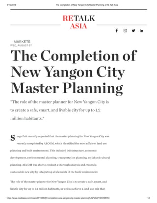
  • 1. 8/10/2019 The Completion of New Yangon City Master Planning | RE Talk Asia https://www.retalkasia.com/news/2019/08/07/completion-new-yangon-city-master-planning%C2%A0/1565105704 1/4     RETALK ASIA S erge Pub recently reported that the master planning for New Yangon City was recently completed by AECOM, which identified the most efficient land use planning and built environment. This included infrastructure, economic development, environmental planning, transportation planning, social and cultural planning. AECOM was able to conduct a thorough analysis and created a sustainable new city by integrating all elements of the build environment.  The role of the master planner for New Yangon City is to create a safe, smart, and livable city for up to 1.2 million habitants, as well as achieve a land-use mix that MARKETS WED, AUGUST 07 The Completion of New Yangon City Master Planning  "The role of the master planner for New Yangon City is to create a safe, smart, and livable city for up to 1.2 million habitants."
  • 2. 8/10/2019 The Completion of New Yangon City Master Planning | RE Talk Asia https://www.retalkasia.com/news/2019/08/07/completion-new-yangon-city-master-planning%C2%A0/1565105704 2/4 would lead to the creation of 900,000 jobs by 2050 as per New Yangon City’s Socio- Economic Study, conducted by McKinsey.   AECOM’s The Four Pillars vision of "Resilient City", "Intelligent City", "Green City", and "People’s City" was developed into the "Big 8 Moves" - Nature, Culture, Great Places, Smart City, Industrial Ecosystem, Connected Public Realm, New Development Model, and Catalyst of Growth - as the foundations of the New Yangon City’s master plan design. AECOM’s scientific approach of Sustainable Systems Integration Model ( SSIMTM) has helped the NYDC to make a selection out of the three proposed alternate plans. The SSIMTM Approach measures the KPIs in four major categories: Connected Neighborhood, Workforce Environment, Sustainable Urban Structure, and Green Infrastructure.  "The proposed transactional zone between the existing villages and the new city development will provide a livable city and satisfy the sustainable development goals. AECOM’s vision of evolving the current villages into specific culture areas in the future adds a unique element to the city. The proposed social infrastructure and the creation of a cultural corridor aims to create the city’s identity and evoke a strong sense of belonging," says Pun. A Collaborative Effort  The master planning efforts were conducted in collaboration with other disciplines, especially with the traffic and transport planners (Oriental Consultants consortium) and the strategic flood risk assessment consultant (Royal HaskoningDHV Myanmar).  
  • 3. 8/10/2019 The Completion of New Yangon City Master Planning | RE Talk Asia https://www.retalkasia.com/news/2019/08/07/completion-new-yangon-city-master-planning%C2%A0/1565105704 3/4 TAGS:  For traffic and transport, New Yangon City’s master plan examines the transport network within the city, and also takes into consideration the connectivity with the surrounding areas. AECOM incorporated the flood risk consultant’s flood-resilient design in the master plan by using existing creeks as flood mitigation, proposing a network of dykes, and by providing a detention and retention area which can be used as public uses, contributing to the city’s social and environmental infrastructure.  AECOM’s smart city framework is based on how the city’s urban and social infrastructure can benefit from technology. This technical-based eco-system will satisfy the New Yangon City’s sustainable development goals, and will focus on transport, healthcare, economy, security, education, utilities and environment.  The endless efforts between AECOM, multiple consultants and NYDC’s Planning & Development team recently saw New Yangon City Master Plan shortlisted for the Best Planning Project under the Hong Kong Institute of Urban Design Awards.  Click here to view the NYDC Master Plan Summary Click here to view the NYDC Master Plan Infographics Source: NYDC IMPORTANT INFORMATION:  Disclaimer Terms and Conditions Privacy Policy
  • 4. New Yangon City Master Plan1 Final Master Plan Report 24 May 2019
  • 5. New Yangon City Master Plan 2 Disclaimer This document was prepared solely for the benefit of New Yangon Development Company Ltd (NYDC). The Consultant nor its parent corporation, or its affiliates, (a) makes any warranty, expressed or implied, with respect to the use of any information or methods disclosed in this document or (b) assumes any liability with respect to the use of any information or methods disclosed in this document. Any recipient of this document, by their acceptance or use of this document, releases the Consultant, its parent corporation, and its and their affiliates from any liability for direct, indirect, consequential or special loss or damage whether arising in contract, warranty, express or implied, tort or otherwise, and irrespective of fault, negligence and strict liability. Given the short time frame of the study and the reliance on public data or that provided by the Client, a comprehensive risk assessment and detailed forecasting could not be carried out and the projections contained in this document are therefore only indicative. The recommendations made by the Consultant in this report are based on conclusions drawn from information collated from the Client, through secondary research, and discussions with relevant stakeholders. The Consultant has taken due care to validate the authenticity and validity of this information from various sources. However, no representation or warranty, express or implied, is given by the Consultant or any of its respective principals, officers, employees, or agents as to the accuracy or completeness of the information, data or opinions provided to the Consultant by third parties, or collated from various secondary sources and believed to be both authentic and reliable. Nothing has come to our attention to cause us to believe that the facts and the data collected are not true or correct. No responsibility is assumed for the authenticity of the information furnished by others, which is believed to be reliable; the Consultant has not independently verified the same. Neither the Consultant, nor its principals or employees, accept any liability for any direct, consequential or perceived loss arising from the use of this document or its contents. In no event shall the Consultant be liable for any direct, incidental, and/or consequential damages incurred by any user of the report. In no event shall the Consultant be liable for any loss of profit or revenues. The Consultant undertakes no duty to, nor accepts any responsibility to, any other party who may rely upon such information unless otherwise agreed or consented to by in writing (including, without limitation, in the form of a reliance letter) herein or in a separate document. Any party who is entitled to rely on this document may do so only on the document in its entirety and not on any excerpt or summary. Entitlement to rely upon this document is conditional upon the entitled party accepting full responsibility and not holding the Consultant liable in any way for any impacts on the project or the earnings from the project arising from changes in “external” factors such as changes in government policy, in the pricing of fuels, road pricing generally, alternate modes of transport, or construction of other means of transport, the behavior of competitors or changes in the owner’s policy affecting the operation of the project. Further, if this report shall be made available or disclosed to any third party, it should include this statement of limiting conditions. The fact that the Consultant assumes no liability whatsoever, if for any reason any party suffers any loss for acting upon this document, must also be brought to the notice of the concerned party. The Consultant devoted professional efforts compatible with the time and budget available in the process. The Consultant’s findings represent its reasonable judgments within the time and budget context of its commission and utilizing the information available to it at the time. The Consultant has also not considered the investment objectives, financial situation and particular needs of any party who reads or uses this document. The Consultant encourages all prospective investors to conduct their own investigations and analysis and check the accuracy, reliability and completeness of the information in this report and obtain independent advice from appropriate sources. This document may include “forward-looking statements”. These statements relate to the Consultant’s expectations, beliefs, intentions or strategies regarding the future. These statements may be identified by the use of words like “anticipate,” “believe,” “estimate,” “expect,” “intend,” “may”, “plan”, “project,” “will,” “should,” “seek,” and similar expressions. The forward-looking statements reflect the Consultant’s views and assumptions with respect to future events as of the date of this report and are subject to future economic conditions, and other risks and uncertainties. Actual and future results and trends could differ materially from those set forth in such statements due to various factors, including, without limitation, those discussed in this report. These factors are beyond the Consultant’s ability to control or predict. The Consultant makes no representation or assurance that the proposed new developments will be able to successfully implement the recommended program, or that demand for the recommended uses will be as projected, as the assumptions upon which the demand projections are based are inherently subject to uncertainty and variation, depending upon evolving events and also the effectiveness of the execution and implementation of the project. However, the projections have been conscientiously prepared, based on our discussions and industry expertise and the information collated and analyzed by us. They should be reviewed by the Client. No section or element of this document produced by the Consultant may be removed from this document, reproduced, electronically stored or transmitted in any form by parties other than those for whom the document has been prepared without the written permission of the Consultant.
  • 6. New Yangon City Master Plan3 Table of Contents Regional Context2.1 Site Context2.2 Environmental Conditions2.3 Development Suitability Analysis2.4 Benchmark Summary2.5 Project Background1.1 Consultant Team1.2 Project Scope1.3 Report Structure1.4 3.1 Summary Four Pillars of NYC4.1 Master Plan Alternatives4.2 Master Plan4.3 Future Development4.4 Green-Blue Network4.5 Great Places4.6 Industrial Ecosystem4.7 Planned Units4.8 Chapter 1 Introduction Chapter 2 Existing Conditions Chapter 3 Population, Employment & Land Development Chapter 4 The Master Plan Site Analysis2.6
  • 7. New Yangon City Master Plan4
  • 8. New Yangon City Master Plan 5 1Introduction Project Background1.1 Consultant Team1.2 Project Scope1.3
  • 9. 6 New Yangon City Master Plan 1.1 Project Background Yangon (formerly known as Rangoon), the largest city in Myanmar is often recognized as the commercial center, ever since the capital moved to Naypyidaw in 2005. With a population of over 7.0million (Census 2014), Greater Yangon is several times larger than the next biggest city in Myanmar, Mandalay. It is anticipated that the city will continue to be the gateway of Myanmar in the foreseeable future. The country has seen an upsurge in tourism in the past two decades and needs to develop various sectors of the economy. Yangon will play a major role in this growth to attract companies and talent to its shores. Yangon will compete with other Southeast Asian cities in the region who have had a head-start in development. However, New Yangon has the advantage of starting with a cleaner slate and harness knowledge from lessons in the past decades. Keeping the country and city’s needs in the forefront, the planning for New Yangon City shall be based on a contemporary paradigm, adaptable & future- proofed, attractive to invest and serve as a catalyst for transformation in the region. The expansion of Yangon City across the river is a strategic initiative to introduce new development land for growth. Much of the recent expansions have been towards the north closer to the airport and in the northwest. This project would be a major push towards expanding in the west in phase 1 and thereafter in the south in phase 2. A comparison of areas and population of the other cities in the region illustrates that Yangon, with the addition of New Yangon, will be similar in area. The attractiveness of Yangon in the next few decades is expected to see the population grow to similar levels as cities shown here. It is imperative that the master plan of New Yangon is able to accommodate such a capacity without compromising on sustainability and livability of the built environment. The most critical aspect of the master plan for New Yangon is expected to be the implementation framework that allows extensive participation of the private sector in developing various facilities, amenities and public infrastructure (apart from industrial, housing and commercial areas). While some of gaps are expected to be filled by the public sector, it is imperative that the master plan framework, while allowing private enclaves, maintains a seamless public realm for physical and social connectivity in the New Yangon City. Future projects in Yangon, such as the Hantharwaddy Airport (Bago City) and proposed multi-purpose sea port in Kawhmu township, can be considered, which will influence the regional transportation network and connectivity. The additional port at Twantay Creek will have critical synergies with the existing and new industrial areas, impacting the need for logistics and transportation. New Yangon City will open new horizons for the Yangon and the country by unlocking its development potential and creating a unique position in the region and the world. We understand New Yangon City will have to fulfill the following key objectives: • Position Yangon as the ‘gateway’ of Myanmar establishing a unique identity for the city in the region and the world • Act as a catalyst for growth and transformation of Yangon into a City of the Future • Cater to the growing needs of industry, housing, and commercial space contributing to the growing economy of Myanmar • Integrate with and become a showcase for Myanmar’s rich cultural diversity and heritage New Yangon City is a major step towards the expansion of Yangon, which, while alleviating some pressure of the existing city, may create new development issues. At the onset, the issues surrounding urbanization and growth of cities will have to be addressed throughout the process of this project and further evolution of the master plan in later stages of the city. The master plan presents a pragmatic roadmap for initiating development of Phase I of New Yangon City. It lays down a framework of the city complete with public transportation and infrastructure. There is a significant amount of flexibility built into the plan to consider alternate alignments for internal roads, public transit, and land use, but within parameters of the plan that need to respect adjacencies, future traffic conditions, and carrying capacity of infrastructure. Future expansion of the city west of the outer ring road and south of Twantay Canal has been considered and incorporated into the fabric as well as connectivity requirements. It is acknowledged that projects and proposals in those area have not been firmed up, hence it is difficult to pin point exact requirements, however, future expansion in those areas will need to be aware of this master plan and its proposals, and integrate with the framework to develop a truly cohesive urban environment.
  • 10. 7New Yangon City Master Plan The area designated for this project is approximately 88.30sqkm (21819.41 acres) of land on the west bank of Yangon River, across from the existing Yangon city. AECOM Singapore Pte Ltd was appointed by the New Yangon Development Company Limited (NYDC) to prepare the Master Plan and Strategic Plan for the New Yangon City (NYC) in September 2018. AECOM worked closely with NYDC and relevant stakeholders for the duration of the project to deliver a comprehensive and strategic master plan. Concurrently, NYDC appointed consultants to advise on overall flood risk assessment and for transportation planning. Other consultants were appointed for environmental and social assessments. Prior to appointing AECOM, a socio-economic study was conducted for NYDC for advice on the target economic/ industrial sectors. The study advised on key considerations and strategies for the new city, and identified four key industrial sectors for early stages of the city – Garments, Furniture, Electronics, and Logistics. Most importantly, the study provided a roadmap for development of the master plan coining a tagline for the city – ‘Productive City, Liveable City’. The master plan, while adopting the principles, develops a spatial framework of development allowing for those goals, objectives, and industry sectors to thrive and prosper in NYC. The mission is to: ‘Establish New Yangon as a hub of growth and innovation at par with other cities in Southeast Asia by harnessing local potential based on international best practices.’ Some of the key goals of NYC include: • Create a future ready industrial ecosystem that allows for incremental growth towards higher-order sectors • The city should be home to over 900,000 jobs in fully built state which include primary, secondary, and tertiary sector jobs • The implementation framework should allow participation of private sector Myanmar Greater Yangon New Yangon City Area: 88 sqkm Location of Yangon City in Myanmar 1.1 Project Background
  • 11. 8 New Yangon City Master Plan 1.2 Consultant Team Master Planner (AECOM) Traffic & Transportation (Oriental Consultants) Various Environmental & Social Impact Assessments (ERM Myanmar) Socio-Economic Study (McKinsey) Infrastructure Design (Private Investor) Costing & QS (Rider Levett Bucknall) • The master planner was responsible for preparing the physical plans. • The planner coordinated inputs from various consultants to assess impact on the concept plans. • Feedback to other teams to assess and modify proposals/ recommendations • The traffic and transportation consultant conducted the following: connectivity analysis, transport modelling and framework setting; and Traffic Impact Assessment • Strategic Environmental Assessment (Phase 1) and Environmental Impact Assessments for Priority Infrastructure Projects (Stage 1 Phase 1) • Environmental & Social Management Framework to be produced for SEA and E&S Management Plans for EIAs. • Coordination for phasing and implementation framework with the planning team • Design packaging and other broader details to be as per final plan approved by NYDC • Planning team provided feedback for overall coordination of design for the city • Scope of work focuses on Stage 1 Phase 1 • To closely coordinate with the planning team for cost implications of proposals Flood Risk Assessment (Royal Haskoning DHV) • Population and employment requirements • Assumptions for various parameters to be reviewed and assessed with the planner • Flood-risk assessment and measures to be incorporated in the plan Indicative flowchart of various disciplines/ teams engaged in New Yangon City (updated as of February 2019) New Yangon Development Company (NYDC)
  • 12. 9New Yangon City Master Plan 1.3 Project Scope The overall scope of work for the assignment had been sub-divided into four stages of work. The first stage aimed towards developing a comprehensive understanding of the project and key risks associated with the development. Based on this, in the second stage, three options were developed and presented to the Client and relevant stakeholders during a Visioning Workshop. The team used a proprietary SSIM© lite tool to assess the options based on selected Key Performance Indicators (KPI) that benchmarked spatial adjacencies and connectivity. The Client and stakeholders provided feedback on the options and selected a set of attributes for further refinement and development of the master plan in the third stage. The last stage brought together various inputs from all disciplines into the final master plan report. • Secondary data collection and review of existing reports • Site-visit and kick-off meeting (Meeting 01) • Preliminary pre-consultation workshop (Workshop 01) • Population and development assessments • Preparation of base map • Preparation of Inception Report INQUIRE Project kick-off & Baseline Reviews IDEATE Visioning & Alternatives ITERATE Refinement & Draft Master Plan INFORM Documentation • Existing conditions analysis • Coordination with Client's consultants • SSIM© Lite analysis for three options • Demonstration of planning principles for one resettlement area • Three (03) high level master plan options • Visioning Workshop (Workshop 02) • Selection of preferred alternative or attributes • Refinement of preferred alternative • Coordination with Client's consultants • Preparation of Draft Master Plan • Draft Master Plan Workshop (Workshop 03) • Refinement of draft Master Plan • Commissioning of renderings • Preparation of Final Master Plan Report • Final presentation (Meeting 03) • Submission of documents and drawings • Project closure STAGE I STAGE II STAGE III STAGE IV
  • 13. 10New Yangon City Master PlanNew Yangon City Master Plan10
  • 14. 11New Yangon City Master Plan 2Existing Conditions This chapter studies and reviews the existing site conditions drawing critical lessons from various factors that influence the master plan. Connectivity at the regional level is critical for stitching the site to the rest of Yangon since the new city is surrounded by rivers/ canals on three sides. To the north is Pan Hlaing river that brings water from the hinterland. Yangon River in the east divides the site from existing Yangon city and currently, there are no bridges connecting to the existing city. To the south is Twantay Canal built during British rule in 1883 shortening the distance between Irrawaddy River and Yangon city. The site is connected to the existing city via the bridge over Hlaing River Road which connects to the existing highway/ future Outer Ring Road, that also delineates the western boundary of the site. At present, there is no rail based mass transit in Yangon, however, plans prepared by Japan International Cooperation Agency (JICA) in 2018 identify a number of alignments. The site can potentially be connected to those proposed alignments in future. Flooding is the primary hazard for any urban development within the site as most of the site is quite low lying. A number of existing village settlements within the site and along the periphery of Yangon River need to be integrated with future urban development, without disturbing the existing settlements. There is also a need for identifying ‘resettlement land’ against existing land holdings that will be a form of compensation to land owners. A comprehensive site analysis in this chapter captures key challenges and opportunities for spatial planning and for the overall master plan. This will be delivered through: Regional Context2.1 Site Context2.2 Environmental Conditions2.3 Development Suitability Analysis2.4 Benchmark Summary2.5 Site Analysis2.6
  • 15. 12 New Yangon City Master Plan Global Connectivity Centrality & Connectivity Due to its strategic location on the northern coast of the Andaman Sea zone, Myanmar benefits from a competitive advantage in the view of its geographical location for regional connections. Yangon and New Yangon as economic vibrant hearts will capture the commercial potential from shipping, logistics as well as services sectors buffering China and European market zone. Air Traffic Myanmar air connectivity allows the country to capture more than 4bn people and access major metropolis in South East Asia and South Asia within a four hour flight zone, through the Yangon International Airport, creating notable opportunities for businesses and tourism development to grow in New Yangon City. Maritime Connectivity Both Maritime and hinterland water resources position Yangon as a future important node to act as a shipping and commercial interface as well as a future tourism destination. Indeed, the activation of the ambitious Special Economic Zones Plan (ADB) and other active development funds creates opportunities for the Myanmar sea interface to initiate large coastal infrastructure development. Yangon and Kyauk Phyu ports act as major anchors on the Myanmar seaside already entertain trading relationship with neighbours such as Kolkata and Singapore. 2.1 Regional Context Major international harbour Yangon Myanmar International maritime route Major Cities Flight Time
  • 16. 13New Yangon City Master Plan Myanmar Context One-belt One-road Initiative Located along the One Belt One Road Initiative corridor, Myanmar has a strong waterfront development potential, and more by connecting its sea ports to its hinterland through the water canal system. Rapid Population Growth The results of the 2014 Myanmar Census show that the total population is over 50 million. The rapid demographic growth between 1950 and 2000 calls for urban infrastructure upgrade to Yangon and its immediate regional surroundings. Other major cities in Myanmar There are only three other major cities in Myanmar with Yangon being the largest. Yangon has the largest contribution to Myanmar’s GDP and attracts large populations from the rest of Myanmar. Consequently, urbanization of Yangon is expected to be more rapid than other cities in the region putting tremendous pressure on the existing infrastructure. Industrialization as an engine of development Myanmar has made long strides in developing higher order industrial estates to create jobs for its rapid growing population and economy. Myanmar’s economy grew* at 6.8% in 2017/18 driven by strong performance in domestic trade and telecommunications. However, the GDP* is expected to grow at a rate of 6.6% in 2019 and 6.8% in 2020. Myanmar boundary One Belt One Road Andaman Sea Indian Ocean Kolkata Chittagong Kyauk Phyu YANGON Naypyidaw Bangkok Hanoi To Singapore NEW YANGON CITY Vientiane Thilawa Port 2,170km of shoreline in Myanmar Myanmar Shoreline Mandalay *GDP projections based on ADB’s Economic report of Myanmar
  • 17. 14 New Yangon City Master Plan Southern-Yangon Region Connectivity Air & Sea Connectivity In addition to the existing international airport in Yangon, a new airport is planned near Bago northeast of existing Yangon city. In future, an airport and deep seaport is proposed in the south as part of New Yangon Phase II development. The Southern Yangon Region benefits from prime connectivity and access to the Andaman sea peninsula area. From Thilawa port to the central Yangon shipping terminal, NYC can connect to the wider maritime routes. However, during initial stages of development, Yangon Port would provide a more economical route for movement of goods. Land Connectivity The existing highway that delineates the western boundary of Phase I provides the only means of land based connectivity to surrounding land. In future, the highway is proposed to become part of a larger Outer Ring Road network connecting the rest of Yangon. 2.1 Regional Context NEW YANGON CITY built-up area port existing airport water NYC future new township ring road future airport road network railway
  • 18. 15New Yangon City Master Plan New Yangon City Phase I will form part of a larger corridor-based development plan taking roots along side the proposed Outer Ring Road. NYC will act as the start-up phase of the long term expansion of Yangon urban. With a set of new townships in Yangon, the Phase 2 of NYC aims to develop major nodes such as a future airport, a special economic zone, and a new deep sea port. The main aim of New Yangon Phase I and II plans is to create a robust urbanization framework that allows creation of approximately 2.0 million jobs. These will be in addition to jobs created in other proposed townships in Yangon. The plans accommodate flexibility to absorb changes to market conditions such that higher order industries and service sector opportunities can be developed within NYC and surrounding new areas. NEW YANGON CITY_ PHASE 1 PHASE 2 90%Thilawa deep-sea port shipping activities catchment in Myanmar THILAWA Greater Yangon Port Existing Airport Water Body New Yangon City future new township ring road Future Airport HLAWGA EAST DAGON NEW TOWN DAGON MYOTHIT THILAWA DALA NEW TOWNSHIP Southern-Yangon Region Economic Development
  • 19. 16 New Yangon City Master Plan Greater Yangon The Greater Yangon Area comprises of Yangon City and six surrounding townships. The six identified townships have a direct dependence on Yangon City for jobs and livelihood, but are sparsely populated. The study conducted by Japan International Cooperation Agency (A Strategic Urban Development Plan of Greater Yangon, 2013) identifies many of the eastern and western areas including Hlaing Tharya as ‘new suburbs’ with potential for infill. The JICA (2018) plan identifies future expansion areas for the city including East Dagon to the north-east, Dagon Seikkan to the east, Dala to the south, Thilawa Port and SEZ to the south- east and Kyee Myin Daing to the west. The Kyee Myin Daing township falls within the proposed New Yangon City development site. A Comprehensive Urban Transport plan of Greater Yangon (YUTRA) was conducted by JICA (2015) which identified a number of MRT alignments. This master plan takes those plans into consideration to propose extension or connection to the network. Greater Yangon area economic growth is mainly driven by industrial activities (existing and planned industrial zones): shipping, logistics, manufacturing, etc. To favour the development of theses activities, industrial corridor’s growth will boost the NYC development by attracting businesses, and new populations in situ. With a population of over 7.0million (2014) in Greater Yangon Region, Yangon City is home to approximately 5.0 million inhabitants. The overall population of Yangon Region is expected to grow to over 10.0 million by 2040 (based on goal outlined on 2013 Urban Development Conference in Yangon City). It is anticipated that most of that growth will be concentrated within Greater Yangon Area. 2.1 Regional Context Type of Development Airport Water Body Greater Yangon Periphery Area New Yangon City Industrial Zones Special Economic Zones Outer Ring Road Port Proposed UMRT Major Roads
  • 20. New Yangon City Master Plan 17 Yangon City viewed from the site (October 2018)
  • 21. 18 New Yangon City Master Plan Surrounding Context Hlaing Tharyar One of the largest and most populated townships in Myanmar, Hlaing Tharyar is home to the country’s elite families and biggest Industrial Zone. NEW YANGON CITY 2.2 Site Context
  • 22. New Yangon City Master Plan 19 Dala New Town Located across the existing CBD, Dala is primarily rural settled by low income communities. The only transport connection to Yangon City is through ferry. Downtown Yangon Planned on a grid system during the British rule, downtown functions as the backbone of Yangon’s economic activities. Shwedagon Pagoda Shwedagon is the utmost sacred pagoda in Myanmar. The 360 ft gilded pagoda serves as a renowned identity marker of Yangon City. Thanlyin As a major port city of Myanmar, it also the location of the country’s largest port, Thilawa. Yangon Port It is the oldest port of Myanmar handling 90% of country’s exports and imports throughput
  • 23. 20 New Yangon City Master Plan Existing Settlements & Infrastructure A number of existing settlements in the form of villages are spread across the site. The population is primarily dependent on agriculture with an increasing trend towards seeking employment in main Yangon city. The population of Kyee Myin Daing township along the periphery of Yangon River appears to be primarily dependent on Yangon City and the river for their livelihood. The existing settlements/ villages will be integrated within the new urban fabric of the city. The master plan proposes strategies for physical integration to foster economic and social integration. Most of the existing settlements do not have access to municipal services such as power, water supply, and sewage disposal. The site has a few power line alignments that supply electricity to Yangon city across the river. The site also has gas pipelines passing north-south along the highway and east-west through the southern portion of the site. The gas and power alignments are to be retained in the master plan. 2.2 Site Context Dala Hlaing Tharyar Danyinzeik Existing Villages/Townships Pagoda Road Existing Police Station in Kyee Myin Daing township Existing fabric of settlements Power Lines Gas Pipelines 0 500 1000 2000m N Existing CBD
  • 24. 21New Yangon City Master Plan Surrounding Land Use While the site for New Yangon City is separated from the existing city by rivers and canals, it is important to review adjacencies and synergies that can potentially be incompatible or could be harnessed. Across Pan Hlaing River in the north, the Hlaingtharya area is primarily industrial with the exception of Pun Hlaing Golf Estate at the fork with Yangon River. Activities immediately adjacent would be subject to unfavourable views and perhaps pollution. A number of informal settlements have been identified in the industrial area in Hlaingtharya. The area across Twantay Canal in the south is primarily agricultural, however, is expected to urbanize as Phase 2 of NYC kicks in. Strategies for controlling urbanization in this area, as well as west of the highway (also agricultural) need to be considered. The Yangon River in the east has an approximate width of 500m and presents panoramic views of the city skyline. Although the edge of the river along the existing city is primarily industrial or ports, the distance from NYC and presence of existing Kyee Myin Daing on the east bank which is to be retained, will have a buffering effect. The skyline of Yangon City is expected to further develop in the next few decades. This edge of the site also offers views to the Shwedagon Pagoda. Residential Industrial Business Area Open Space Education & Culture Facilities Commercial Area Agriculture Land 0 500 1000 2000m N Dala Hlaing Tharyar Danyinzeik Existing CBD
  • 25. 22 New Yangon City Master Plan Initial Brief Prior to commissioning this assignment, the Yangon Regional Government conducted studies to ascertain initial requirements for kick- starting development of the city. One of the prime considerations amongst those was to compensate existing land owners with serviced land parcels in proportion to their original holdings. The second prime consideration was location of initial industrial area and utilities. The policy currently adopted by the government mandates returning 20% of original land holding as net serviced and developable land. Location of clusters of such land had been broadly identified subject to changes based on the master plan. The total area of such resettlement land to be identified is approximately 20 sqkm. An initial development area was also identified based on feedback from various stakeholders and private sector. This 13sqkm area would have to be an industrial estate complete with required facilities and amenities. Recognizing the challenges of attracting industries and businesses, location of utility plants were also identified early-on such that supply and distribution plans can be aligned in time for the kick-off phase of the new city. The initial development area is proposed to be connected with the existing city through Bridge 1 over Yangon River. The existing bridge over Pan Hlaing River (Bridge 2) is proposed to be upgraded with additional capacity. Last but not least, the location of a Pagoda has been identified that will be central to the new city as focus of religious and cultural activities. 2.2 Site Context Resettlement Area 01 Resettlement Area 02 Resettlement Area 03 Resettlement Area 05+06 Resettlement Area 04 Water Treatment Plant Power Plant Waste Water Treatment Plant Resettlement Area Industrial Area Utility Site Proposed Main Pagoda 0 500 1000 2000m N Dala Hlaing Tharyar Danyinzeik Existing CBD
  • 26. 23New Yangon City Master Plan Climatic Influence Yangon has a tropical monsoon Climate with four distinguishable hydrological seasons: monsoon (Mid-May to Mid-October), post- monsoon (Mid-October to Mid-November), cold weather winter (Mid-November to February) and pre-monsoon (March to Mid-May). However, being close to the tropics, humidity in Yangon relatively high all throughout the year. The average daily temperature is around 27 degC with the highs of 37 degC between March to June and lows of 17 degC in December. Prevailing wind direction is South-Southwest with speeds of around 10 km/h. The city experiences more than 20 days of rain per month from June to September. Such climatic conditions require responses that have long been adopted in the architecture of the houses in the region. Shade is of primary importance as protection from the rain and as means of creating comfortable living temperature. Along with shade, sustained wind flow is equally important to create thermal comfort. The master plan adopts specific strategies in response to these climatic conditions. Primary amongst those are: • A north-south/ east-west orientation of roads to allow angular capture of prevailing winds • Location of industrial uses in relation to prevailing wind conditions • The north-south/ east-west orientation allows creation of structure with minimum surface areas on the east and west reducing solar insolation • Recommending creation of shaded walkways or colonnades along streets integrated with buildings especially in public areas SUNRISE SUNSET NOON 0 500 1000 2000m N Dala Hlaing Tharyar Danyinzeik Existing CBD
  • 27. 24 New Yangon City Master Plan 2.3 Environmental Conditions Climatic Conditions Yangon experiences a tropical monsoon climate four distinguishable hydrological seasons: monsoon (Mid- May to Mid-October), post-monsoon (Mid-October to Mid-November), cold weather winter (Mid-November to February) and pre-monsoon (March to Mid-May). The average annual rainfall is 2,681mm, of which 96.4% fall during the wet season and the remaining 3.6% fall during the dry season. There are a total of 129.3 rain days throughout the year, with only 7.4 of rain days during the dry season and 121.9 days during the wet season. Season* Seasonal Wind ** From May to October (Wet season), wind speed is mainly higher than 10 km/h with an average of 11.0 km/h from the SSW direction. From November to April (dry season), the wind speed is mainly lower than 10km/h with an average of 10.3 km/h from the South direction. Wind Direction ** The predominant wind throughout the year is SSW. The prevailing wind is from the North- West (NW), North and North-East (NE) from November to January, and the South and South- West direction from February to October. Number of rain days at Yangon Rainfall data at Yangon Wind Speed data at Yangon Wind Direction throughout the year (In %) Source: AECOM Wind Direction throughout the year Source: AECOM Precipitation Rainfall Days Wind Speed- Year 2017 Wind Direction * weather-atlas.com (source used by this website is from the Department of Meteorology and Hydrology in Myanmar) ** NASA’s MERRA-2 Modern Era Retrospective Analysis
  • 28. 25New Yangon City Master Plan Temperature The average daily temperature in Yangon is 27.3°C. In the warmer months from March to May, the mean maximum temperature is around 37.0°C whereas in the cooler months from November to January, the minimum temperatures is around 17.0°C. The average temperate ranges from 24.8°C to 30.3°C throughout the year. Temperature data at Yangon Source: AECOM Analysis Evaporation * Due to low humidity and low cloud cover, evaporation is relatively higher from November to May. The average high evaporation (179 mm) occurs in April. Humidity Humidity is high in Yangon, ranging from 62 – 87%. The annual average humidity is around 74.4%. Relative Humidity data at Yangon Source: AECOM Analysis Monthly Mean Temperature (C) Average Monthly Evaporation (Kabaaye Meteorological Station, 1980-2016) Average Monthly Humidity Average Evaporation (Monthly) Source: AECOM Analysis * Strategic Flood Risk Assessment New Yangon City (Royal Haskoning DHV, 2019)
  • 29. 26 New Yangon City Master Plan 2.3 Environmental Conditions Hazard Cyclone & Storm Surges Earthquakes Yangon is exposed to cyclones and storm surges from the Bay of Bengal. Cyclone activities peak before and after the monsoon (May – October) from April - May and Oct – November. They are accompanied by heavy rain and strong winds, resulting in increased water level within the system and severe coastal flooding. In early May 2008, Cyclone Nargis created a landfall in Myanmar. The storm surge reached a height of 1.5 – 2 metres. It was recorded as the worst natural disaster in Myanmar’s history. An estimate of 140,000 people were killed and 800,000 were displaced. Yangon was one of the many cities affected by Cyclone Nargis. Yangon is located near the Sagaing Fault which is due for a major earthquake (>7.0 magnitude) in 10 – 30 year. A strong earthquake of 6.0 magnitude struck on the 12th of January 2018, preceding one of 4.2 magnitude later in the year on the 18th of April. 40 Storms within 400 km search radius at 16.77 degree, 96.2 degree (Lat/Lon). Source: Joint Typhoon Warning Center, taken from RHDV Report 2018 Taik Kyi (60km from Project Site). Mar 2017. Source: https://www.voanews.com Bagan (500km from Project Site). Aug 2016 Tectonic Map of Myanmar
  • 30. 27New Yangon City Master Plan Topography Elevation Slope More than 99% of the project area (12,447 ha) is below 5 m from MSL. Hence, proper flood control is required for future development. The land at the project site is highly suitable for development as 80% of the land has a slope of 10% rise of less. The average slope is 4% and the maximum is 27.6%. Elevation (MSL) Area (ha) Area (%) < 1 m 762 6.1% 1 - 3 m 10,226 81.8% 3 - 5 m 1,459 11.7% > 5 m 55 0.4% 12,502 100% Percent rise Percentage 0 – 10% 79.4% 10 – 15% 17.1% 15 – 25% 3.40% 25 – 45% 0.05% > 45% 0% LEGEND < 1 m 1-3 m 3-5 m >5 m Water Body Elevation (MSL) LEGEND 10-15% 15-25% 25-45% > 45% Study Area Slope 0-10% New Yangon Elevation analysis New Yangon Slope analysis Source: Topography data were formulated using GIS, using DEM obtained from Strategic Flood Risk Assessment New Yangon City (Royal Haskoning DHV, 2019)
  • 31. 28 New Yangon City Master Plan 2.3 Environmental Conditions Flooding & Drainage Currently, there are several flood outlets and sluice gates functioning to drain stormwater from the site to the bordering main rivers/canals and to control the water level in the drainage network within the site. Outlet 1 (Tamata Kaw C Canal) and 2 (Unnamed small creek) drains irrigation water from the agricultural land to the Pan Hlaing River in the North. Outlet 3 (Kon Ywa C, connected to Kon Ywa sluice gate) and 4 (Gyaung Waing Creek) discharge water from both irrigation and human settlements into the Hlaing River. Similarly, outlet 5 (Near Ka La Dan Village , approximately 6.1 miles from Twante Canal) and 6 (Near Bridge connected to Thon Ein sluice gate approximately 7.1 miles from Twante Canal) drains into the Twante Canal There are two operating sluice gates, 1 (Thon Ein) and 2 (Kon Ywa), that control water discharge in the canal system. The master plan needs to take these structures and their importance into account as changes in land use will affect their efficacy to regulate water levels should any flooding occur. Overview of natural and manmade canals in the project area 1 2 3 4 5 6 1 2 LEGEND Flood Outlet Sluice Gates Source: Strategic Flood Risk Assessment New Yangon City (Royal Haskoning DHV, 2019)
  • 32. 29New Yangon City Master Plan Ecological Conditions The site is situated at the lower part of Ayeyarwady river basin where the ecosystem is dominated by Myanmar coast mangroves, Irrawaddy freshwater swamp forests, and Myanmar coastal rain forests. The lower Ayeyarwady has seen a general decline in biodiversity with much of the area converted to agriculture. Deforestation presents a major ongoing problem throughout the region. The coast mangroves ecoregion, for example, is endangered as a result of agricultural and aquaculture encroachment, urban expansion, and timber harvesting for fuelwood. The Irrawaddy freshwater swamp forests are listed as endangered and the Myanmar coastal rainforests are vulnerable. Within the site, most of the site area has been converted to agricultural lands before 1980s which mainly is for rice cultivation. However, mangroves have been observed along natural streams especially at their outlets. Mangrove area have been also observed at the northern edge of the site along Pan Hlaing River. According to IFC (2018), the river system at lower Ayeyarwady basin is classified as high eco-sensitive area. IFC also classified the rarity of river reaches in Ayeyarwady basin in terms of their Bio-physical location - elevation , the steepness of the slope of the river reach, and the original ecological zone (coniferous, moist deciduous forest, dry deciduous forest, mangrove forest) and reaches flowing through karst limestone. The rarity of the river reach is used to present the ecological sensitivity to identify where the rare river reach types are distributed. Rare river reaches may be important because they could contain unique habitats that support endemic aquatic species. It can be seen that most of river reaches at lower Ayeyarwady basin is classified as rare, which may provide important ecological functions or hold specialized biodiversity. Therefore, the master plan needs to take into account the ecological conditions of existing natural streams within the site and surrounding the site to propose appropriate ecological conservation and enhancement strategies for the habitat of the area. NYDC’s Environmental Consultant will assess biodiversity (flora & fauna) impact as part of Strategic Environmental Assessment for Phase 1. Mangroves observed at outlet of natural stream within the site River reach rarity assessment for Myanmar rivers Source: Strategic Environmental Assessment of the Hydropower Sector in Myanmar (IFC, 2018) Site Location Country/Boundary State/ region boundary Very Common Common Rare Very Rare Rarity Analysis Major city/ State capital
  • 33. 30 New Yangon City Master Plan 2.4 Development Suitability Analysis Land Suitability Analysis The following detail environmental analyses were conducted for the land suitability study of the New Yangon City development. The objective of the land suitability analysis is to develop a comprehensive approach to large scale planning, to determine the optimum site location for activities and to minimize negative impacts on the environment. The result from this analysis will provide useful information to identify unsuitable locations of proposed development in the site. Land suitability analysis using Geographic Information System (GIS) was conducted to avoid siting the development on inappropriate locations and to make use of opportunities of existing land use of the site. To conduct land suitability analysis for the site, some key factors such as elevation, land use, hydrology and ecology overlaid to analyze the overall environmental sensitivity of the Project Area, each weighted differently depending on its significance on the sensitivity of the environment and of the proposed site development. Site climate and hydrology conditions, such as seasonal variation of rainfall, humidity, and sun exposure are important environmental factors for the design. In addition, existing land use, ecology, topography and hydrology can lead to areas with less development suitability. Therefore, it is important to understand the environmental baseline of the existing conditions in order to maximize the design while being sensitive to the natural conditions. As the site is quite flat with majority of the site area has slope less than 10%, therefore only elevation will be use as a factor representing for the site topographic in the suitability analysis. 2.4 Development Suitability Analysis Land Suitability Analysis Distance from the river Suitability Description < 25m Low River and ecological buffer zone along river – frequently inundated 25 – 50m Mid Low Transition zone between the riparian and inland area – might be inundated during high tide 50-100m Mid High Inland area with lower riparian ecological value – lesser impacted by riparian flood > 100m High Inland area – lesser impacted by riparian flood Land Use Type Suitability Existing villages, existing pagodas Low Agriculture lands, existing roads etc. High Elevation (MSL) Suitability Description < 1 Low Above mean sea level but below mean high tidal level 1 - 2 Mid Low Above mean sea level but below mean high tidal level 2 - 3 Mid High Above mean high tidal level > 3 High Above the 100-year Pluvial flood level and High Tidal level The site elevation is also relevant to flooding risk of the site in which low lying area will be more prone to flood. In this study, we will classify the suitability of site elevation based on the flooding risk that could happen on site. Royal Haskoning undertook detailed Strategic Flood Risk Assessment for Phase 1. This identified that high water levels in the surrounding system are caused by strong tide and storm surges as well as sea level rise. The pluvial system also provides large amounts of rainfall with high intensities during the monsoon periods. Flood mitigation measures are required to manage these hazards and risks. In the ecological baseline analysis, the existing main natural stream within the site and their outlets contain high biodiversity value. Hydrological network is also important for it flood conveying purpose. Therefore, the hydrology factor which consists main streams within the site should be considered in the Suitability Analysis to reflect area with higher biodiversity and hydrological value. Beside the elevation and hydrological factors, existing land use is also a main factor to be used in the suitability analysis even though most of the site is agricultural land but existing villages as well as existing pagodas should be considered as sensitive receptors in the analysis. In total, three factors of Elevation (combined with flooding risk), Hydrology (combined with Biodiversity) and Land Use are overlaid to analyze the overall environmental sensitivity of the Project Area, each weighted differently depending on its significance on the sensitivity of the development to the area. The map areas were reclassified according to the three factors (i.e. elevation, hydrology land use) in the following sections. Hydrological Suitability Legend High Mid High Mid Low Low Elevation Suitability Legend High Low Land use Suitability Legend High Mid High Mid Low Low
  • 34. 31New Yangon City Master Plan The composite sensitivity analysis of existing environment shows the areas with different degrees of development suitability. High sensitivity area with low and mid-low development suitability are located along the main natural streams and existing villages which account for around 11.2% of the site area . The suitable areas with 8,006 ha (88.9%) for development are more in existing agricultural areas, existing roads and area with higher elevation. Based upon the environmental analysis, we have formulated environmental strategies to guide the development in a technically feasible and environmentally sustainable manner. The success of the city development is dependent on the continued health of the surrounding environment and ecosystems. It is therefore important to consider the development’s impact on the environment and incorporate measures that will mitigate these impacts for a sustainable development. For areas with relatively higher suitability, it is more suitable for high-density development activities, such as township, industrial area, etc. However, as it is also located within the plain area and downstream of rivers, flood mitigation measures and storm management systems should be put in place. Due to heavy rainfall and typhoons resulting flooding risks to the low-lying may occur in the wet season, it is recommended to integrate flood mitigation strategies into the site development, such as constructing flood retention ponds or wetlands to reduce the peak flow. The flood retention system could also be integrated to the water storage systems to supply domestic water demand for the development. In addition, environmental and ecological designs should be applied to minimize negative environmental impacts. Development Suitability Legend High Mid-High Mid-Low Suitability Area Percentage (%) Area (ha) Low 0.5 43.4 Mid Low 10.4 959.9 Mid High 84.2 7590 High 4.6 417.1 0 500 1000 2000m N Suitability Analysis for the NYC Low
  • 35. 32 New Yangon City Master Plan Examples of city scale development in Asia are numerous, but few have been successful in the past decades. In order to identify the key success factors, the AECOM team identified the best practices in terms of city positioning, products typology, land development governance, economic model and design highlights. Rather than being exhaustive in the greenfield development sector, curated case studies have helped to define preliminary “Smart governance” parameters to harness the future New Yangon City endeavours in the making of a liveable and sustainable city. Case studies come from both in China and Vietnam where large scale projects have been planned and consistently implemented based on integrated governance system. Phasing, and development control are key components of the new town success tied up with shareholders inclusion at the different stages of the process. Urban land development history in South East Asia, in the recent period, has demonstrated key points that are highlighted in the case studies analysis, on the right side. The key takeaways, here aside, have been summarized and consistently integrated in the following recommendations to be found and detailed in the Spatial Plan chapter (chapter 4). The key takeaways focus on key strategic actions to be taken and followed up by NYDC up front the implementation stage, and during the implementation phase itself. 2.5 Benchmark Summary Sino-Singapore Suzhou Industrial Park Suzhou, CN 700,000 80sq km (projected) Suzhou-Singapore Township Development (SSTD) “Develop into an innovation eco-township of internationalized, modernized, information- based happy district of Suzhou.” SEZ, primary investors host and identified through one-stop business process SSTD Residential recreational open space public amenities commercial educational (vocational international schools) industrial parks • Phase 1: 10 sq. km: hi-tech ready-built estate • Phase 2: 10 sq. km. focus on logistics 1.25bnUS$ investment debt for infrastructures • Government-to-Government • Joint Venture between SSTD and SUDC (China owned) • One body two wings structure that defines the phasing main direction • Self sufficient planned units according to Singapore estate planning experience • Catalyst projects (Park, CBD, Convention Center, University. Bold design and district making statement to enhance legibility for investors One-stop business process through a dedicated management body Private sectors involvement in development governance Public – private collaboration as most prominent development strategy Incentives + preferential grants towards preferential industrial sectors KEY TAKEAWAYS project name location population land area land owners master developers positioning primary use + amenities KEY FIGURES & POSTIONING phasing strategy implementation tools broad cost partnership / JV Planning strategy IMPLEMENTATION STRATEGY
  • 36. New Yangon City Master Plan 33 LAND USE Phu My Hung South-SaigonTianfu New Science City Pudong New Area District Sino-Singapore Suzhou Industrial Park Tianfu New Science City Phu My Hung South-Saigon Pudong New Area District 20% 10% 38% 13% 4% 15% industrial residential / mixed use open space civic / amenities utilities road reserve 20% 11% 17% 13% 2% 16% 21% commercial 25% 25% 7% 5% 15% 3% 20% Chengdu, CN 300,000 (working population) 73sq km “To become a national center city concentrating on pro-innovation factors by 2020, and have international influence in the field of innovation.” Special Economic Zones (SEZ) Beijing Vantone Citylogic Invest. Corp. Residential, lifestyle facilities, medical care, education, sports and culture: accessible by expressway, subway and tramway. Sub-division 8 zones: innovation incubators, information security, big-data internet, industrial R&D, design, emerging finance, science and technology R&D, and school innovation. 169bn RMB investment debt for public infrastructures – one belt two wings + six specialization areas – organization around the Xinglong lake • China Railway Engineering Corp’s railway R&D center, • Sichuan-France ecology technology Center, • Nokia’s global R&D, • Chinese Academy of Sciences – Corridor oriented development – Grid system as urban structure – From 17 to 48m ROW to enable urbanity – Radial development (garden city principle) principle: – Central green cores and corridor (Century Avenue) – Traditional chessboard design 1996 - 2006: Nguyen Van Linh development from the District 7 2014: Completion of the Phu My Hung New City Center Chengdu Municipal Government Shanghai, CN 1.8M 500sq km PNDA Management Office (PNDA) PNDA CT&D; PMHDC; TTC; HIPC Phu My Hung Development Corporation 31sq km 1M Ho Chi Minh City, VN “Re-establish HCMC position in the global economy while creating a modern well-planned city that can become the most desirable international business location in SEA.” Mixed use residential, civic institutions and public facilities, commercial, open space, industrial: process export industrial functions. Management Authority for Southern Area Development: “one-stop application procedure" 3.3bn US$ investment debt for infrastructures and 25bn RMB for public investment • Partnerships between private capitals (landowners) 25% 15% 13%5% 17% 1% 24% “Home to the Shanghai free trade zone and a host of world-class business parks, Pudong has the most supportive business environment in China.” Commercial uses (landmarks trophy skyscrapers), residential, public facilities, international schools, and institutions. 1990-1995 : infrastructure and utilities development on Hangpu River + hospitals and educational and entertainment facilities 1995-2000: international airport, deep sea water harbour • Land developers incorporated into JV to develop expropriated land; • Creation od SLDC as a public company, privately owned by shareholders: PPP model SEZ, grants and allowances for foreign investments (1990's: regulation framework reform) n/a
  • 37. 34 New Yangon City Master Plan 2.6 Site Analysis Challenges & Opportunities Wind Flow and Sun Path Land Availability Flood Analysis With a tropical monsoon climate, New Yangon City will experience heavy rains, high temperature, and high humidity. Thermal comfort needs to be achieved through shading and by capturing prevailing winds. Passive and active cooling techniques can be employed for individual structures that can reduce solar insolation and allow natural ventilation. Existing settlements and provision of resettlement land reduce the amount of developable land available for the city to monetize. With approximately 7.0 sqkm of land under existing settlements and around 19.0 sqkm of land for resettlements, the city will have limited land availability after provision of green areas, roads, and public amenities. The programming of available land needs to carefully programmed to safeguard future development of the city. The site has significant flood risks that require a robust flood management strategy. Creation of ring dykes and other means need to be employed. The existing drainage network needs to be leveraged and augmented for draining the site in usual as well as special conditions. MORNINGNIGHT NOON DEVELOPABLE LAND EXISTING VILLAGE VILLAGE BUFFER RESETTLEMENT AREA Over flow and local run-off Risk of High Flow Discharge Risk of High Tide and Storm Surge
  • 38. 35New Yangon City Master Plan Requirement of Connectivity Being surrounded by water on three sides, and with the aim of creating jobs for the entire city, there is a significant effort required to stitch New Yangon City with the existing fabric. Future proposals for mass transit also need to be extended to NYC for promoting use of public transportation and reducing the burden on roads. Adjacent Land use View Corridor Adjacent land uses and anticipated growth patterns will influence the plan for NYC. With growing needs of the economy and the existing city, NYC will experience pressures of urbanization once it is directly connected with the existing city. It is important to zone uses in the new city in light of adjacent land uses for compatibility and enhanced livability. Shwedagon Pagoda is one of the most sacred Buddhist pagoda in Myanmar. The proposed pagoda within the central area of project site provides an opportunity to create a view corridor with the existing Shewadagon pagoda. Additional controls within NYC can be adopted to suggest importance of these areas within the socio-cultural fabric of the site. EXISTING CITY NEW YANGON PROPOSED PAGODA SHWEDAGON PAGODA Residential Industrial Logistics Commercial Business Area Recreational Space Green Open Space Agricultural Land CIVIC / CULTURAL INDUSTRIAL HUB INDUSTRIAL HUB GROWTH GROWTH
  • 39. New Yangon City Master Plan36
  • 40. New Yangon City Master Plan 37 3Population, Employment & Land Development The main focus of any city planning exercise is people. Harnessing the human agency is key for making cities successful, whether it is in terms of making the city liveable for the residents or in terms of creating jobs and fostering innovation. City planning also needs to incorporate flexibility to ensure that people are able to reimagine and reshape their surroundings to suit changing needs. This chapter focuses on population, employment, and demand for land in New Yangon, such that the plan can respond to future dynamics. The analysis builds on the work and recommendations of the Socio-Economic Master Plan prepared for NYDC earlier, and analyses the population and employment dynamics over time, thereby anticipating demand for land. The projections and estimates have assisted in spatial distribution of various uses across NYC synergizing creating of jobs and infrastructure over the period of development. It is recommended that surveys be carried out periodically to ascertain most current development within the city that should feed into revision of planning for NYC in the future. Demand for land in New Yangon will arise from various factors, primary amongst those is need for new residential and commercial infrastructure. The other main factor is the aim of the city to create 600,000 jobs by 2025 and 900,000 jobs by 2050. This will require concerted efforts by all stakeholders to attract businesses and create supporting infrastructure at a rapid pace including housing within NYC as well as in surrounding areas. At the same time, the city will compete with other upcoming developments within Greater Yangon area. Such demand will put pressure on infrastructure and the city needs to be prepared to respond. One of the critical findings of the analysis indicates that the number of jobs in NYC will lead to high travel demand from the hinterland. Hence there is a special emphasis on public transportation from the hinterland. NYC aims to grow and develop at a pace that has never been seen elsewhere in the world. The city and the private sector will need to mobilize all resources at hand to help achieve these goals.
  • 41. New Yangon City Master Plan38
  • 42. 39New Yangon City Master Plan 3.1 Population, Employment and Land Development Summary Population Employment Land Development About 1.2 million people will live in New Yangon City by 2050 Gradual increase with about 180,000 residents by 2025 and 290,000 by 2030 Aspirational target of 750,000 people by 2025 will require large construction and planning efforts, including the construction of about 163,000 homes NYC will accommodate about 900,000 jobs by 2050, depending on the scenario There will be a gap between the resident workforce and number of jobs, reaching a peak of more than 400,000 around 2032 This will result in a large number of commuters, requiring significant investments in transport infrastructure The economic model projects a gradual increase in land use from about 24 km2 in 2025 to 44 km2 in 2030 and 90 km2 in 2050 In 2050 about 25% of the area is for industrial land use, 9% for services, 31% for housing and the remainder for other uses
  • 43. 40New Yangon City Master PlanNew Yangon City Master Plan40
  • 44. 41New Yangon City Master Plan 4The Master Plan The spatial planning for NYC builds on analysis and proposals for connecting the city with the existing fabric. Population and employment targets for New Yangon indicate the need for connectivity with the rest of Greater Yangon. With the main aim of creating jobs, New Yangon is targeted to have a large industrial area that also caters to smooth flow of logistics. Existing natural ecosystem allows creation of an open space network that integrates the natural flow of water in the site. The master plan aims to create a vibrant public realm that can foster a unique culture within the city. The site is susceptible to flooding especially during cyclones and other storm events. This requires special measures to be adopted in the plan for flood mitigation. A number of character districts have been identified in the city that have a unique identity through clustering of allied activities, and together will contribute to the overall image of the city. The city structure also takes into account future growth towards the west and south by recognizing growth corridors stretching out along transportation corridors. The city is proposed to have a strong relationship between land use and transportation especially through the use of Transit Oriented Development (TOD) concept. Such TOD nodes can also become focal points for creating a ‘smart’ city, integrating technology with transit and public functions. The master plan aims to create a framework for sustainable communities that can ensure distribution of facilities and amenities as the city grows. This ‘Planned Unit Development’ framework is proposed to be adopted for planning of resettlement areas, other residential areas, as well as the entire city. While retaining all existing villages, the plan proposes to provide a buffer that can be used for mitigating level differences between new and existing, and for providing required amenities. The master plan was developed after studying many options and employing a Sustainable Systems Integration Model (SSIMTM) that allowed testing each option against sustainability performance indicators. The adopted plan was iterated to optimize performance against such indicators that include connectivity, access to green spaces, and jobs to housing balance. This will be delivered through: Four Pillars of NYC4.1 Master Plan Alternatives4.2 Master Plan4.3 Future Development4.4 Green-Blue Network4.5 Great Places4.6 Industrial Ecosystem4.7 Planned Units4.8
  • 45. 42 New Yangon City Master Plan 4.1 The Vision The Four Pillars of NYC Based on extensive background research, data analysis, and multiple stakeholder engagements, four main pillars for the New Yangon City have been selected and emphasized as principal enablers for New Yangon City to be able to become a desired living community and a business destination where industries and services can provide jobs while promoting a sustainable development. 1. Social, Economic, and Environmental resilience is key for New Yangon City due to various challenges including flooding, infrastructure provision, job creation, and sustained skill development; 2. The vision for New Yangon City is to be an ‘Intelligent City’ at the cutting edge of the urban and industrial innovation while providing sustainable tools for people to enjoy services accessibility and increase their living quality; 3. Integration of nature in the New Yangon City is at the heart of the future lifestyle proposed by the Master Plan proposal. Enhancement of the existing ecology system is key to nest communities into the site’s original ecosystem. 4. The most fundamental pillar shaping New Yangon City are people. NYC is envisioned to celebrate its people by engaging them in vibrant urban precincts and cultural amenities embodying the Myanmar culture and Myanmar’s endeavour for vibrant city development. The vision is further developed into key principles that are translated into big physical moves allowing formulation of the spatial plan. Embodying the philosophy of the pillars, the big moves provide a backbone for spatial and physical distribution of land use and activities. 1. RESILIENT CITY 2. INTELLIGENT CITY 3. GREEN CITY 4. PEOPLE’S CITY “A city of robust eco-system that creates a vibrant and sustainable development.”` “To ensure the future growth and sustainability of population by introducing smart elements” “To create lifestyle, business, community and industry nested in Nature” “An inviting city that celebrates its rich contents and depth that bring citizen pride.”
  • 46. New Yangon City Master Plan 43 Celebrate and enhance the culture of Myanmar and Yangon through linking the old with new Design unique places that define the identity of New Yangon City and give an address for the future investors and communities Enable a tech-friendly environment to optimize businesses’ performances and to maximize people’s opportunities and access to services Enable a future-ready ecosystem of industries, processing and logistics activities to grow and diversify Connect employment Centers to homes within a transit oriented development framework for people to live, learn, work and play. Foster citizen participation and private sector involvement into decision-making of the growing New Yangon City Attract a diversity of businesses in a flexible environment absorbing potential changes NATURE CULTURE Make New Yangon City the future eco-friendly lifestyle destination nestled into a natural and sustainable environment KEY PRINCIPLES BIG MOVES GREAT PLACES SMART CITY CATALYST OF GROWTH INDUSTRIAL ECOSYSTEM CONNECTED PUBLIC REALM NEW DEVELOPMENT MODEL
  • 47. New Yangon City Master Plan44 RESILIENT CITY INTELLIGENT CITY GREEN CITY PEOPLE’S CITY “A city of robust eco-system that creates a vibrant and sustainable development.” “To ensure the future growth and sustainability of population by introducing smart elements” “To create lifestyle, business, community and industry nested in Nature” “An inviting city that celebrates its rich contents and depth that bring citizen pride.” NATURE CULTURE GREAT PLACES Enhance flood protection and disaster management Provide ample and accessible green spaces for residents Tech based management of resources to enhance sustainability Enhance liveability with active green spaces Allow flexibility in spaces for multiple expressions and interpretations Create an identity for districts without compromising on flexibility Integrate culture with the public realm and daily activities Foster expressions of local culture in space and architecture Program spaces to showcase cultural vibrancy The relationships between the four pillars of NYC and physical moves have multiple dimensions. Some of those have been explored here to be translated into spatial expressions at the master plan level, while others will need to be explored further in development of the plan. The guiding principles expressed here are encapsulated in the plan through a set of physical spaces and relationships that are found to be of fundamental importance for translating the vision of NYC into reality. Practice land- banking for unlocking future value Enhance quality of spaces with an active public realm Promote diversity and inclusion in design of public spaces
  • 48. New Yangon City Master Plan 45 SMART CITY INDUSTRIAL ECOSYSTEM CONNECTED PUBLIC REALM NEW DEVELOPMENT MODEL CATALYST OF GROWTH Enable timely responses through data collection and monitoring Enhance attractiveness through private sector participation Safeguard future expansion potential to absorb changes Create backbone infrastructure for command, control, and monitoring Engage urban tech to increase efficiency and attract businesses Aim for user convenience through multiple options Foster a culture of feedback loops to build confidence in systems Foster citizen participation and good governance Allow decision-making through participation for greater ownership and pride in the city Promote public transit, discourage private modes through usage fees Allow for strong links between land use and transportation with Transit Oriented Developments Allow integration of smart enablers with the public realm for maximum outreach Focus on continued skill development Enable diversity and incremental growth towards higher- order industries Enforce protection of environment at all costs Cluster around and densify transit corridors to increase usage Foster complementary relationships between different sectors of economy Incentivise development of public infrastructure and sustainability measures Promote synergetic and planned growth of the city through analysis and monitoring Nurture and protect the natural environment for future generations
  • 49. New Yangon City Master Plan46 Create nodes and districts catering to different key activities of the city lending an identity to each Leveraging existing green networks, enhance liveability and resilience by creating hierarchies and new connections Create a cultural spine as a means of expression as well as a connection between various programs within the main public realm of the city Enable integration of urban tech in the public realm, transportation, and infrastructure for maximum outreach and social benefit nature culture great places 1 2 3 4 BIG MOVES NATURE CULTURE GREAT PLACES SMART CITY
  • 50. New Yangon City Master Plan 47 Allow for ‘estate’ based planned development with norms and standards for a sustainable and cohesive city complete with required facilities and amenities Identify an industrial zone leveraging on existing and future connectivity to create an ecosystem allowing clustering as well as incremental growth Create a multi-layered public transit system with Transit Oriented Development that connects internally, as well as with the region’s network Identify initial catalysts that lend an identity while creating phases of development and land banking to absorb changes and capture future value 5 6 7 8 INDUSTRIAL ECOSYSTEM CONNECTED PUBLIC REALM NEW DEVELOPMENT MODEL CATALYST OF GROWTH
  • 51. 48 New Yangon City Master Plan 4.2 Master Plan Alternatives Key Considerations The overall vision and physical framework of big moves can be put together in multiple ways with other practical considerations. Three options were developed to study and analyse such combinations. The main considerations for the alternatives included: • Relationship with the existing city: Phase I of NYC will have a close relationship with the existing city allowing activities to spill over the river. Almost a natural expansion, NYC needs to respond to this relationship intuitively. • Future Direction of development: New Yangon City will be part of a larger agglomeration within Greater Yangon, with potential expansion towards the west and south. The new city will need to be positioned to respond to such future stimuli. • Location of city center/ major commercial node: Commercial activities usually cluster together that also provides a unique identity to a district guiding provision of transportation and other infrastructure. Location of such a node is crucial for developing future relationship with surrounding areas. • Location of industrial area: The industrial area will be main employment center, requiring logistics and connectivity for movement of daily people and goods, and most importantly, will need to have an early start-up stage with seamless connection with future stages of NYC. The most suitable location is therefore adjacent to the adjacent highway which is proposed to be upgraded into an Outer Ring Road. • ‘Heart’ of the city: A city may have one or many vibrant districts or precincts depending on the size and population. The ‘heart’ can be defined as one of the most easily recognizable areas that primarily has commercial and public functions, and which is frequented by most of the residents. Locating a ‘heart’ is important for enhancing livability and increasing legibility in a city. The three alternatives have a specific response to each consideration. Along with these considerations, a set of Key Performance Indicators were developed to test the alternatives against globally adopted benchmarks. ASPECT ALTERNATIVE 1 ALTERNATIVE 2 ALTERNATIVE 3 Relationship with existing city Strong relationship with existing city with commercial node a short ride from proposed bridge to pull businesses and provide an alternative and absorb overflow of uses Relationship is primarily in the form of extended residential fabric which will be visible from existing city Fabric planned as an organic extension of the existing city with mixed use commercial and mixed use residential parcels along major roads; extension of CBD planned in south-eastern portion of site visible from existing CBD across the river Future direction of development Weaker relationship with future developments in the west and south, envisaged to be primarily responding to transit corridors Positioned to act as a catalyst for development towards the west and connect with future growth in the south through the commercial node and a commercial corridor Organic connections planned towards future growth in west and south Location of commercial node Strategically located close to proposed Bridge in phase I from existing city to immediately start absorbing activities and overflow Located adjacent to highway and between the industrial areas to provide support to those uses and possibly for future growth in the west Smaller commercial node as an extension of existing CBD with smaller dispersed nodes along major corridors Location of industrial area In the west adjacent to highway In the west adjacent to highway In the west adjacent to highway ‘Heart’ of the city Strong relationship between civic area around the proposed Pagoda and commercial node A city of two ‘hearts’, the civic area around the Pagoda and the commercial node adjacent to the highway While extension of existing CBD acts as a node, primary ‘heart’ planned around the proposed Pagoda with civic and flexible commercial uses
  • 52. 49New Yangon City Master Plan OPTION 1: East CBD OPTION 3: Central Commercial AxisOPTION 2: West CBD
  • 53. 50 New Yangon City Master Plan 4.2 Master Plan Alternatives SSIMTM Approach The framework for analysis of the three alternatives was based on the Sustainable Systems Integration Model (SSIM) prepared by AECOM. The primary objective of SSIM was to measure and optimize planning outcomes by measuring the efficiency and effectiveness of the spatial arrangement of uses and densities in a plan. In essence, this processes helped answers questions such as: ▪ Which Plan is a ‘better’ plan that satisfies major goals of the City? ▪ Which plan option is inherently more sustainable? ▪ Which Plan will likely create a better living and working environment for residents and workers? ▪ Where are the planning gaps and how/ where do we improve the plan? ▪ How do we measure & quantify performance and sustainability? In the case of Yangon, a range of planning and urban design strategies were tested through the SSIM model to assess for a variety of metrics. KPI Framework for New Yangon City Using the SSIM framework, the Master Plan options were assessed under four categories: • Connected Neighbourhoods • Workforce Environment • Sustainable Urban Infrastructure • Green Infrastructure The final score card represents three levels of information about the master plan performance and is represented by a performance disc or a circle. At individual indicator level (L1,L2, L3, etc.) each indicator has a score between 0-100 and is represented by a coloured wedge with the length representing the score. The gap in each wedge represents the potential for improvement in performance for that particular indicator. INDICATORS SCORING CRITERION BENCHMARK CONNECTED NEIGHBORHOODS Creating a New Yangon that enhances human and environmental health by connecting people with nature, neighbourhoods, thriving business hubs and people. GREEN INFRASTRUCTURE A green infrastructure approach involves maximisation of physical and functional connectivity while optimising the ecological landscape to create a sustainable community. WORKFORCE ENVIRONMENT Providing economic opportunities that are accessible to the residents creates neighbourhoods that are inherently more sustainable. SUSTAINABLE URBAN STRUCTURE Defined streets and blocks, which are fundamental elements of an urban form, can define density, connectivity, and liveability of neighbourhoods in a comprehensive manner. G1 Ecosystem Connectivity Scores 100 if ecosystem connectivity index reaches 100% Have a fully connected ecosystem for NYC (Aspirational) G2 Park Space Per Capita Scores 100 if park space per thousand population reaches 1.0 hectare Provide sufficient park space for residents (Aspirational) G3 Natural Drainage Scores 100 if natural drainage of canal system reaches 25 miles Have at least 75% of existing canal system of NYC area (Aspirational) L1 Access to Transit Scores 100 if at least 50% residents live within 800m from a MRT or BRT station Have at least 50% within 800m (LEED ND) L2 Access to Bicycle Network Scores 100 if ALL residents live within 250m from a bicycle network Have ALL residents live close to a bicycle network (Aspirational) L3 Access to Parks & Open Space Scores 100 if at least 90% residents live within 800m from a city park Have at least 90% within 400m (LEED ND) L4 Access to Waterfront Scores 100 if at least half of residents live within 800m from an accessible waterfront Have half people live close to an accessible waterfront (Aspirational) E1 Jobs Near Transit Scores 100 if at least 50% employees work within 800m from a MRT or BRT station Have at least 50% within 800m (LEED ND) E2 Jobs Closeness Scores 100 if average job closeness is as low as 5.0 km Have average commute distance less than 5.0km (Aspirational) E3 Job Housing Balance Scores 100 if job-housing ratio is between 1.3 to 1.7 1.3 – 1.7 (APA) U1 Roadway Capacity Per Capita Scores 100 if major roadway capacity per population reaches 15.0 Have adequate roadway capacity for NYC (Aspirational) U2 TOD Land Use Diversity Scores 100 if average land use diversity index reaches 0.90 in TODs Promote mixed use development around TODs (Aspirational)
  • 54. New Yangon City Master Plan 51 Alternatives Alternative 1 Alternative 2 Alternative 3 Low Dense Residential High Dense Residential Mixed Use Residential Transport & Logistics Office Commercial Retail Commercial Mixed Use Commercial Utilities Light Industrial Heavy Industrial Logistics Industrial River Buffer Administrative Use Cultural & Public Facilities School Vocational training Open Space Existing Settlements Village Buffer Legend
  • 55. 52 New Yangon City Master Plan 4.2 Master Plan Alternatives Evaluation & Analysis The SSIM analysis of the master plan alternatives demonstrates that Option 2 scores higher on a range of metrics leading to a higher overall score. Alternative 1 Overview: The geographic clustering of land uses, lower proportion of mixed use areas and a higher proximity to job hubs, along with persevering fewer existing natural drainage, led to a comparative poor performance of the plan. Alternative 2 Overview: While the plan scores high on a range of metrics, certain KPIs such as E2 and E3 provide a window of opportunity for future planning efforts within the greater Yangon region. For example, the jobs provided within the study area can be made more accessible to the existing population to the east of the river that would lead to a better plan performance. Alternative 3 Overview: The plan fairs well on a variety of metrics, however owing to comparative poor performance on park space provision, Option 3 has lower score when compared to Option 2. It should be noted that, with the exception of a few indicators, a majority of the KPI values in all the three plans do not met their specific goals. The primary objective of SSIM analysis, therefore, is to understand the trade offs between the master plans. While Alternative 2 and Alternative 3 are both arguably better performing plans, the spatial allocation of density and uses of Alternative 2 resonates more closely with the core growth objective for New Yangon, viz. jobs richness, mixed use neighborhoods, preservation of existing natural drainage. WORKFORCE ENVIRONMENT E1 Jobs Near Transit E2 Jobs Closeness E3 Job Housing Balance G1 Ecosystem Connectivity G2 Park Space / Capita G3 Natural Drainage GREEN INFRASTRCUTURE U1 Road Capacity / Capita U2 TOD Land Use Diversity SUSTAINABLE URBAN STRUCTURE L1 Access to Transit L2 Access to Bicycle Network L3 Access to Parks & Open Space L4 Access to Waterfront CONNECTED NEIGHBORHOOD L1 L2 L3 L4 E1 E2 E3 U1 U2 G1 G2 G3 80 Alternative 1 ✓ Location of phase I areas closest to as envisaged ✓ Provides a twin-node leveraging Bridge 2 and location of Pagoda creating a vibrant heart ✓ Clear delineation of ‘planned units’ for sustainable growth  Static structure with weaker relationship with future growth in west and south  Potentially higher dependence on road-side drainage vs natural drainage Total Population 1,218,000 Total Employment 784,000 Residential Land Area (km2) 33.12 Commercial Land Area (km2) 2.65 Industrial Land Area (km2) 20.14 Open Space Land Area (km2) 11.17 Score: 100 Performance: 68% Score: 91 Performance: 91% Score: 100 Performance: 90% Score: 86 Performance: 43% Score: 100 Performance: 51% Score: 68 Performance: 6.6 Score: 84 Performance: 2.57 Score: 99 Performance: 13.3 Score: 84 Performance: 0.84 Score: 53 Performance: 99% Score: 78 Performance: 0.70 Score: 47 Performance: 7.1
  • 56. New Yangon City Master Plan 53 L1 L2 L3 L4 E1 E2 E3 U1 U2 G1 G2 G3 91 Alternative 2 Alternative 3 ✓Provides for a future growth node leveraging the (future) ring road ✓Distinct relationship with future expansion through growth corridors ✓Clear delineation of ‘planned units’ for sustainable growth  Risk of dependence on future growth and expansion  Separate commercial node and civic areas creating two separate hearts of the city  Weaker relationship of residential areas in industrial hubs with rest of the city ✓Organic structure promoting retention of all natural drainage reducing dependence/ cost of road-side drainage ✓Caters of visual and physical relationship with existing CBD ✓Combined civic and low-intensity commercial ‘heart’ ✓Less defined ‘planned units’ and organic fabric will be difficult to phase ✓Improvement works for existing drainage channels required, may balance out savings on deeper road-side drains Total Population 1,212,122 Total Employment 901,791 Residential Land Area (km2) 30.93 Commercial Land Area (km2) 6.41 Industrial Land Area (km2) 22.37 Open Space Land Area (km2) 9.14 L1 L2 L3 L4 E1 E2 E3 U1 U2 G1 G2 G3 90 Total Population 1,269,000 Total Employment 812,000 Residential Land Area (km2) 32.84 Commercial Land Area (km2) 4.47 Industrial Land Area (km2) 17.69 Open Space Land Area (km2) 12.73 Score: 100 Performance: 57% Score: 97 Performance: 97% Score: 100 Performance: 95% Score: 90 Performance: 45% Score: 100 Performance: 60% Score: 74 Performance: 6.3 Score: 78 Performance: 2.96 Score: 97 Performance: 22.8 Score: 92 Performance: 0.92 Score: 91 Performance: 97% Score: 91 Performance: 0.82 Score: 91 Performance: 13.7 Score: 100 Performance: 53% Score: 96 Performance: 96% Score: 100 Performance: 95% Score: 100 Performance: 82% Score: 100 Performance: 63% Score: 80 Performance: 6.0 Score: 84 Performance: 2.56 Score: 97 Performance: 22.4 Score: 81 Performance: 0.81 Score: 89 Performance: 97% Score: 86 Performance: 0.70 Score: 78 Performance: 12.9
  • 57. 54 New Yangon City Master Plan 4.2 Master Plan Alternatives Preferred Option Performance Overview Based on the performance analysis and amongst the set of 3 Master Plan options proposed by the AECOM team, the option 2 is the best performing among the alternatives that were developed for the study area. In addition to providing enhanced economic opportunities for its residents, the plan also promoted healthy living and provided a more sustainable living environment. In the long term, the urban form of Option 2 is most well suited to achieve the objectives set out for the New Yangon. L1. Access to Transit L2. Access to Bicycle Network L3. Access to Parks & Open Space L4. Access to Waterfront E1. Jobs Near Transit E2. Jobs Closeness E3. Job Housing Balance U1. Roadway Capacity Per Capita U2. TOD Land Use Diversity G1. Ecosystem Connectivity G2. Park Space Per Capita G3. Natural Drainage Key Performance Indicators (KPIs)
  • 58. New Yangon City Master Plan 55 45% OF RESIDENTS LIVE WITHIN A 10 MIN. WALK TO A WATERFRONT 95%OF RESIDENTS LIVE WITHIN A 10 MIN. WALK TO A PARK PARKS 1.38 PARK OPTION INDEX (GOAL = ONE) 0.92HECTARES OF PARKS PER 1000 RESIDENTS 60% OF JOBS ARE WITHIN A 10 MIN. WALK TO A TRANSIT JOBS 6.3km JOBS CLOSENESS INDEX 2.96 JOB HOUSING BALANCE 1.76 TRANSIT OPTION INDEX (GOAL = ONE) WATER 97% OF RESIDENTS LIVE WITHIN 250 M OF A BICYCLE NETWORK BICYCLE 627km TOTAL LENGTH OF BICYCLE NETWORK; 525KM DEDICATED PATH + 102KM TRAIL 57% OF RESIDENTS LIVE WITHIN A 10 MIN. WALK TO A TRANSIT 13.7 Road Capacity Per Capita (GOAL = 15) TRANSIT 91 L1 L2 L3 L4 E1 E2 E3 U1 U2 G1 G2 G3 91 Key Performance Indicator Wheel
  • 59. 56 New Yangon City Master Plan 4.3 Master Plan Land use Plan The main goal of New Yangon is to generate jobs in the Greater Yangon area through selected industrial sectors (in early stages) that leverage on existing skills and available resources. Therefore around 25% of the site is dedicated to industrial uses. The industrial area is proposed to have a mix of heavy, light, and logistics related uses. The city center is planned to be strategically located in the west of the city to become a catalyst for the future and serve the industrial areas. Around 35% of the site is planned to have residential uses with varying proportions of density and mix of uses. This residential area will also cater to the resettlement land requirement. Around 14% of area has been allocated for the green-blue network catering to flood resilience and drainage requirements of the city. Further allocations for green area at the local level will need to be made upon detailed planning for each zone/ area. Civic uses at the city level have been identified, and those at the local level are envisaged to be allocated from within major land use zones. Existing villages and village buffer occupies almost 14% of land. The village buffer has been identified to act as a mitigation zone between existing and new development. A proportion of the village buffer can be used to provide facilities and amenities for the community. The land use areas include all roads, net available area will need to be calculated through detailed planning of individual zones. Due to rounding, the numbers presented may not add up precisely to the totals indicated. LAND USE LAND AREA (in sq km) % Residential GFA 30.93 35% Residential I (Low Density) 12.75 14.4% Residential II (High Density) 12.56 14.2% Residential III (Mixed Use) 5.63 6.4% Commercial GFA 6.41 7.3% Commercial I 1.91 2.2% Commercial II 2.25 2.5% Commercial III (Mixed Use) 2.25 2.5% Industrial 22.37 25.3% Industrial I (Light Industry) 12.82 14.5% Industrial II ( Heavy Industry) 7.96 9% Industrial III (Logistics) 1.59 1.8% Transport & Logistics 1.51 1.7% Green Spaces 12.01 13.6% Open Space 9.14 10.35% River Buffer 0.64 0.7% Water Bodies 2.24 2.54% Villages 11.97 13.6% Existing Villages 5.68 6.4% Village Buffer 6.29 7.1% Civic Amenities 2.33 2.6% Utilities (Physical Infrastructure) 0.77 0.9% TOTAL 88.30 100.00%
  • 60. New Yangon City Master Plan 57 Land use Master Plan Illustrative Plan
  • 61. New Yangon City Master Plan58 New Yangon City Productive City, Liveable City
  • 62. New Yangon City Master Plan 59
  • 63. 60 New Yangon City Master Plan 4.4 Future Development FAR & Density Distribution The Floor Area Distribution (FAR) within the site has been mandated to strengthen the relationship between land use and transportation. Higher densities have been allocated near transit stations of both the MRT and Secondary Transit networks. Land use typologies have been synchronized to allow for appropriate density to take shape and draw maximum advantages from being allocated close to a station. The Land use and FAR distribution also takes into account allocation of density for jobs and housing throughout the city. While maintaining primacy of a use, higher density allows for creation of mixed use districts that will help in reducing the need for long trips. Mixed uses will also help in distribution of amenities throughout the city and close to where they are required. Together with minimum setbacks, maximum plot coverage or ground coverage, and other controls, the FAR controls are expected to allow for diversity and individual expression in urban design and architecture. This master plan does not mandate height restrictions except those near the central Pagoda. It is expected that FAR controls and cost efficiency constraints will have an overarching impact on heights of buildings, and allow for a vibrant skyline in New Yangon. A high FAR has been allowed in the commercial node or city center such that it can have a pronounced presence in the skyline of New Yangon and even be visible from the existing city. This will help to create a landmark district in the city and assist in wayfinding. The FAR map is expected to be a key development control enforced by the relevant authority along with rest of the development controls. Based on inputs received from developers and the market, FAR can be revised for various land uses and density can be reallocated across the city in future revisions of the master plan or from time-to-time The BCR & FAR provided in the planning guidelines are maximums, to be used for development control purposes. The assumptions in the master plan for population, employment & infrastructure provision have been made based on reduced BCR/FAR averages, presented in the Appendix 11.3. Category of Land Use Zones Max: Floor Area Ratios (FAR) Max: Building Coverage Ratios (BCR) (%) Low Density Residential Area 1.5 60 Medium-High Rise Residential Area 3.0 (Inside TOD), 2.5 (Outside TOD) 50 Mixed Use Area (Residential) 5.0 (Inside TOD), 3.0 (Outside TOD) 80 Commercial Zone (Office & Retail) 8.0 80 Mixed Use Area (Commercial) 8.0 80 Light Industrial Zone 2.5 60 Heavy & Logistics Industrial Zone 2.0 60 Transport & Logistics 2.0 - Civic Amenities 2.5 50 Utilities (Physical Infrastructure) 1.0 60 Special Zones: All land use zones within Main Commercial Node Buffer 10 80 FAR Distribution Table* *Any proposed variations to the maximum BCR & FAR permitted should be submitted to NYDC for approval
  • 64. 61New Yangon City Master Plan FAR Distribution Density Distribution Heat Map 0 1 1.5 2 2.5 Legend 3 5 8 10 Legend High (10.0) Low (0) 0 500 1000 2000m N0 500 1000 2000m N Special Zone Special Zone
  • 65. 62 New Yangon City Master Plan The Green-Blue Vision Designing in harmony - a truly holistic approach to sustainable design recognizes the impacts of every design choice on natural and cultural resources. The most precious asset of any place is its local distinctiveness. This valuable quality is the main attraction for visitors who are looking for a rich and authentic experience. Aside from being attractive and enjoyable for people, sustainable projects promote biological diversity, contribute to the quality of the air and water, and reduce the impacts of construction. The results of our holistic approach to design and planning are livable, enduring places that are compatible with and considerate of natural ecosystems. We draw on the strengths of both the natural and the built environment, and create guidelines to ensure that the attributes that attracted people to a location in the first place will still be there years later. Creating a landscape fabric that becomes a backbone for New Yangon City. The aim is to highlight the ecological richness, using green fabric and water as a main element to enhance the environmental benefits of the area, and to expand the public nature of the green spaces with the concept of “having a home in a park”. 4.5 Green-Blue: Open Space Network • Rich bio-diversity • Connected to wider green network • Capitalizing on natural assets DISCOVER EXPLORE AND CONNECT • Easy to navigate network of open spaces • Active and vibrant • Community integration REJUVENATING AND INVIGORATING • Fresh environment • Places for body, mind and spirit • Healthier community HARMONY WITH NATURE
  • 66. New Yangon City Master Plan 63 Green Spine District Park Neighbourhood Park Pocket Park Green Connector Water Bodies River Buffer WetlandPark Corridor 15ha 1200m 2ha 600m GreenCorridor 0.2ha 300m a 1 District = 4 Neighborhood = 16 Pockets Park P The proposed open space network in New Yangon closely follows the blue ecosystem. These Green- Blue spines are proposed to leveraged for the public realm as well as for city wide pedestrian and bicycling networks. A hierarchy of city level to local green areas is proposed that can together provide around 12-14 sqm of green area per resident. While the master plan level green area provides around 10 sqm of green space per person, local green spaces are proposed to add additional 2-4 sqm per person through detailed zonal plans or detail area planning based on the norms outlined in the master plan. The main aim of the Green-Blue strategy is to create usable and active spaces that serve a purpose and are closely linked to day-to-day lives of the residents. 0 500 1000 2000m NOpen Space Hierarchy
  • 67. 64 New Yangon City Master Plan The Green-Blue Vision 4.5 Green-Blue: Open Space Network Central Green Spine Characteristics: • City Gathering Space • Event Spaces • Thematic Open Spaces R = 10 km 8 sqm 7 3 52 9 8 6 4 1 1 2 3 4 5 6 7 8 9 Walking/Jogging Path Green Lawn Wetland Boardwalk Flower Garden Pavilion Natural Edge Waterfront Amphitheatre Viewing Tower Pier