
Recommended
More Related Content
What's hot
What's hot (20)
Viewers also liked
Viewers also liked (10)
Similar to Q1 2017 WIRA NOAA Update
Similar to Q1 2017 WIRA NOAA Update (20)
More from WallopsIslandRegionalAlliance
More from WallopsIslandRegionalAlliance (18)
Recently uploaded
Recently uploaded (20)
Q1 2017 WIRA NOAA Update
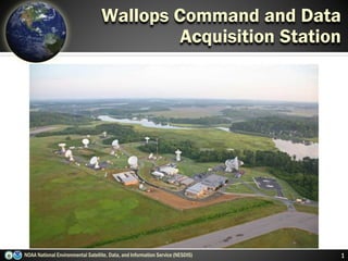
- 1. NOAA National Environmental Satellite, Data, and Information Service (NESDIS) 1 Wallops Command and Data Acquisition Station
- 2. Three Observation Points NOAA National Environmental Satellite, Data, and Information Service (NESDIS) 2 N S Polar-orbiting Operational Environmental Satellites Geostationary Operational Environmental Satellites N S Each satellite covers the Earth twice per day Pole-to-pole orbit is 102 minutes and views each location at the same time of day Global coverage every 12 hours with one satellite EUMETSAT in the mid-morning orbit; NOAA in the early afternoon orbit Continuous monitoring of the Americas Same geographic image over time Full image every 30 minutes and Northern Hemisphere images every 15 minutes Usable images between 60oN and 60oS Deep Space at Lagrange 1 Point Continuous monitors the surface of the Sun Uninterrupted view of the sun Located ~1 million miles from Earth, at the Lagrange Point 1 position of the Sun-Earth system ~1 million Miles
- 3. 2011 Irene Forecast Irene “2001” Forecast 3 Building on 10+ years of Forecast Improvement NOAA National Environmental Satellite, Data, and Information Service (NESDIS)
- 4. 4NOAA National Environmental Satellite, Data, and Information Service (NESDIS) Deepwater Horizon Montage of 2010 Hurricane Season Satellite-tagged Dolphin DART Tsunami Buoy Coral Reef Watch El Nino signature Abby Sunderland Harmful Algal Bloom Ozone Hole Supporting NOAA’s Mission Snow & Ice Chart AVHRR Composite Stream gage GOES SXI image
- 5. NOAA National Environmental Satellite, Data, and Information Service (NESDIS) 5 Wallops Command and Data Acquisition Station Station Facts Facility dedicated on: June 22, 1966 Number of Buildings and Square Footage: 7 Buildings with 48,662 sq. ft. Number of Antennas: 16 Workforce: 67 Civil Servant FTE Annual Funding (NOAA Appropriations): $9.67M
- 6. NOAA National Environmental Satellite, Data, and Information Service (NESDIS) 6 Wallops Command and Data Acquisition Station Missions Supported Geostationary Satellites (GOES) Polar-Orbiting Satellites (POES; Suomi NPP) Deep Space Climate Observatory (DSCOVR) Advanced Composition Explorer (ACE) Jason–2 & 3 Altimetry Satellite COSMIC-2 Radio Occultation Meteosat Second Generations (MSG) Metop Data Collection System (DCS)
- 7. GOES-R Launch Commitment Date* 1Q FY 2017 Program Architecture 4 Satellites (GOES-R, S, T & U) 10 year operational design life for each spacecraft Program Operational Life FY 2017 – FY 2036 Program Life-cycle $10.829 billion GOES-R Series Overview 7NOAA National Environmental Satellite, Data, and Information Service (NESDIS) *Launch Commitment Date based on FY 2017 President’s Budget Request * Benefits Maintains continuity of weather observations and critical environmental data from geostationary orbit Provides faster scanning of entire hemisphere while simultaneously observing individual storms, improving hurricane tracking, aviation flight route planning, air quality warnings and fire detection Provides a new lightning mapping capability for improved warning lead time for severe storms and tornadoes, allowing time to protect lives and property Provides improved warning of solar events to minimize impact to communications, navigation systems, power grids and satellites in orbit
- 8. Visual & IR Imagery Lightning Mapping Space Weather Monitoring Solar Imaging Advanced Baseline Imager (ABI) Geostationary Lightning Mapper (GLM) Magnetometer Extreme UV/X-Ray Irradiance Sensors (EXIS) Terrestrial Weather Solar Weather Space Environment In-Situ Suite (SEISS) Solar Ultra-Violet Imager (SUVI) 8 Key for “nowcasting” out to 3 days Improves hurricane track & intensity forecasts Increases thunderstorm & tornado warning lead time Improves aviation flight route planning Data for long-term climate variability studies Improves solar flare warnings for communications and navigation disruptions More accurate monitoring of energetic particles responsible for radiation hazards to humans and spacecraft Better monitoring of Coronal Mass Ejections to improve geomagnetic storm forecasting GOES-R Instruments NOAA National Environmental Satellite, Data, and Information Service (NESDIS)
Editor's Notes
- Q Did Vermont take you by surprise completely? And I didn’t hear any warnings about Vermont. ADMINISTRATOR FUGATE: No, we knew they were in the area of heavy rainfall. And this is one thing that Director Bill Reed was trying to get people not to focus just on the center of circulation or on the coast. The heavy rainfall -- particularly this storm had a lot of rain ahead of it as it was moving ashore -- the concern was where we could expect rainfall. In fact, if you went back to the Hydromet Prediction Center, they were putting out forecasts of these types of measures that we could see as far as rainfall, so it was something we were expecting. But the reality is with flash flooding, much of this occurred very quickly. In fact, in many of these rivers in Vermont, they’ve already gone back down. It was just a very quick response rate from the rain, the flooding, and now we’re looking at the damages. You remember seeing the satellite how big that storm was and how close it was to the state of Florida? We would not have been able to not evacuate. But the science is that good on track. But where we know where we still have a lot of work to do is intensity forecasts -- what goes up and goes down. Remember Hurricane Charlie in Florida? It went from a category one in Cuba, crossing over, became a category four in less than 24 hours. We’ve seen a lot of these storms that the smaller storms, rapid anticipation. We also see storms that weaken. And that is an area that -- that skill we still need to work on. But based on the forecast, that's what we prepare for. http://m.whitehouse.gov/the-press-office/2011/08/29/press-briefing-press-secretary-jay-carney-and-fema-administrator-craig-f
- GOES-R is the Weather Sentinel Use for Hurricane, Severe Storms, Flash Floods Hemispheric views familiar with TV weathercasts Feeds weather models Fire/smoke products- air quality monitoring Sea Surface Temperature monitoring – fishing/climate Winds for aviation Solar X-ray imager – solar tracking for communications satellites, utility, CIP Search and Rescue Data Collection Systems (DCP) – using GOES E/W Distribute via DOMSAT and NWSTG from Wallops Island