SlideShare a Scribd company logo
1 of 15
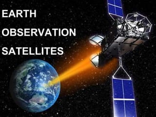
EARTH
OBSERVATION
SATELLITES
Earth observation
satellites are satellites
specifically designed to
observe Earth from
orbit.
Earth-observation satellites
help us monitor and protect
our environment, manage our
resources
Uses:
1. Environmental monitoring
2. Meteorology
3. Mapping of terrain
ASTER
•Advanced Spaceborne Thermal Emission And Reflection Radiometer
•Government of Japan and NASA
•One of the 5 payloads on the Terra Satellite
Terra (EOS AM-1)
ASTER
Uses:
Cloud cover
Glaciers
Land
Temperature
Sea ice
Snow cover
Launch Date:
18 ,
December
1999
705
km
98.8
min
16 days VNIR
(visible
Near
Infrared)
SWIR
(short
wave
Infrared)
TIR
(Thermal
Infrared)
3
6
5
15x15m
30x30m
90x90m
8 bit
8 bit
12 bit
60km
60km
60km
±
8.55°
±
8.55°
± 24°
Name Altitude Orbital Temporal Sensor # of Spatial Quant- Swath off
period Res. Bands Res. Titization nadir
Visible and Near infrared Short wave infrared
Thermal infrared
ASTER IMAGES
False color image of a volcanic
eruption and the direction of flow of
ash
Landsat-8
•NASA and USGS
•The most recent satellite added to the landsat program
Name Altitude Orbital Temporal Sensor # of Spatial Quant- Swath off
period Res. Bands Res. Titization nadir
Landsat-8
Uses:
Oceano-
graph
Aerosols
Vegetation
Types
Thermal
Mapping
Biomass
Content
Cloud Cover
Launch date:
Feb 11,2013
705
km
99
min
16 days OLI
(Operati-
onal
Land
Imager)
Push
broom
TIR
(Thermal
Infrared)
Push
broom
9
2
30x30m
M.S
15x15m
pan
90x90m
TI
12 bit
12 bit
185
km
185
km
± 15°
± 15°
Shrinkage of the Araj Sea from 1977-2010 due to diversion of water for agricultural use.
SPOT-5
•Satellite Pour L’observation de la terre
•CNES
National Center for Space studies,French Space Agency
Name Altitude Orbital Temporal Sensor # of Spatial Quant- Swath off
period Res. Bands Res. Titization nadir
SPOT-5
Uses:
Environment-
al
Assessment
Agriculture
Marine
Studies
Launch date:
May 3,
2002
822
km
101.4
min
26 days HGR
(High
Resolution
Geometric
Instrument)
4 10x10m
M.S
20x20
MIR
5x5m
pan
8 bit 60
km
± 27°
Landsat-7
• NASA and USGS
•Seventh satellite of the Landsat program
Name Altitude Orbital Temporal Sensor # of Spatial Quant- Swath off
period Res. Bands Res. Titization nadir
Landsat-7
Uses:
Oceano-
graph
Vegetation
Types
Mineral
Deposit
Identification
Launch date:
April 15,1999
705
km
99
min
16 days ETM+
(Enhanch
-ed
Thematic
Mapper)
Whisk
broom
8 30x30m
M.S
60x60m
thermal
15x15m
pan
8 bit 183
km
No
off
nadir
View-
ing
Earth Observation Satellites

More Related Content

What's hot

Global Positioning System
Global Positioning System Global Positioning System
Global Positioning System Varun B P
 
A Brief Introduction to Remote Sensing Satellites
A Brief Introduction to Remote Sensing Satellites A Brief Introduction to Remote Sensing Satellites
A Brief Introduction to Remote Sensing Satellites Alireza Rahimzadeganasl
 
Fundamentals of Remote Sensing
Fundamentals of Remote SensingFundamentals of Remote Sensing
Fundamentals of Remote SensingShah Naseer
 
Indian remote sensing satellites
Indian remote sensing satellitesIndian remote sensing satellites
Indian remote sensing satellitesHiba Shahid
 
Introduction to Synthetic Aperture Radar (SAR)
Introduction to Synthetic Aperture Radar (SAR)Introduction to Synthetic Aperture Radar (SAR)
Introduction to Synthetic Aperture Radar (SAR)NopphawanTamkuan
 
Microwave remote sensing
Microwave remote sensingMicrowave remote sensing
Microwave remote sensingMohsin Siddique
 
Thermal remote sensing
Thermal remote sensing   Thermal remote sensing
Thermal remote sensing Rahat Malik
 
Remote Sensing PPT
Remote Sensing PPTRemote Sensing PPT
Remote Sensing PPTAmal Murali
 
mateorological and ocean monitoring satellite (2).pptx
mateorological and ocean monitoring satellite (2).pptxmateorological and ocean monitoring satellite (2).pptx
mateorological and ocean monitoring satellite (2).pptxsapna kinattinkara
 
Remote sensing concept, history and principles
Remote sensing  concept, history and principlesRemote sensing  concept, history and principles
Remote sensing concept, history and principlesAjay Singh Lodhi
 
Remote sensing satellites with sensors
Remote sensing satellites with sensorsRemote sensing satellites with sensors
Remote sensing satellites with sensorsAnchit Garg
 
Introduction to Landsat
Introduction to LandsatIntroduction to Landsat
Introduction to LandsatNizam GIS
 
Introduction of gps global navigation satellite systems
Introduction of gps   global navigation satellite systems Introduction of gps   global navigation satellite systems
Introduction of gps global navigation satellite systems DocumentStory
 
Thermal Remote Sensing
Thermal Remote SensingThermal Remote Sensing
Thermal Remote SensingRohit Kumar
 
Synthetic aperture radar
Synthetic aperture radarSynthetic aperture radar
Synthetic aperture radarMahesh pawar
 
Global positioning system (gps)
Global positioning system (gps)Global positioning system (gps)
Global positioning system (gps)Gokul Saud
 

What's hot (20)

Global Positioning System
Global Positioning System Global Positioning System
Global Positioning System
 
A Brief Introduction to Remote Sensing Satellites
A Brief Introduction to Remote Sensing Satellites A Brief Introduction to Remote Sensing Satellites
A Brief Introduction to Remote Sensing Satellites
 
Fundamentals of Remote Sensing
Fundamentals of Remote SensingFundamentals of Remote Sensing
Fundamentals of Remote Sensing
 
Indian remote sensing satellites
Indian remote sensing satellitesIndian remote sensing satellites
Indian remote sensing satellites
 
GNSS
GNSSGNSS
GNSS
 
Ocean- sat for Oceanography
Ocean- sat for Oceanography Ocean- sat for Oceanography
Ocean- sat for Oceanography
 
Introduction to Synthetic Aperture Radar (SAR)
Introduction to Synthetic Aperture Radar (SAR)Introduction to Synthetic Aperture Radar (SAR)
Introduction to Synthetic Aperture Radar (SAR)
 
SPOT
SPOTSPOT
SPOT
 
Microwave remote sensing
Microwave remote sensingMicrowave remote sensing
Microwave remote sensing
 
Irnss ppt.
Irnss ppt.Irnss ppt.
Irnss ppt.
 
Thermal remote sensing
Thermal remote sensing   Thermal remote sensing
Thermal remote sensing
 
Remote Sensing PPT
Remote Sensing PPTRemote Sensing PPT
Remote Sensing PPT
 
mateorological and ocean monitoring satellite (2).pptx
mateorological and ocean monitoring satellite (2).pptxmateorological and ocean monitoring satellite (2).pptx
mateorological and ocean monitoring satellite (2).pptx
 
Remote sensing concept, history and principles
Remote sensing  concept, history and principlesRemote sensing  concept, history and principles
Remote sensing concept, history and principles
 
Remote sensing satellites with sensors
Remote sensing satellites with sensorsRemote sensing satellites with sensors
Remote sensing satellites with sensors
 
Introduction to Landsat
Introduction to LandsatIntroduction to Landsat
Introduction to Landsat
 
Introduction of gps global navigation satellite systems
Introduction of gps   global navigation satellite systems Introduction of gps   global navigation satellite systems
Introduction of gps global navigation satellite systems
 
Thermal Remote Sensing
Thermal Remote SensingThermal Remote Sensing
Thermal Remote Sensing
 
Synthetic aperture radar
Synthetic aperture radarSynthetic aperture radar
Synthetic aperture radar
 
Global positioning system (gps)
Global positioning system (gps)Global positioning system (gps)
Global positioning system (gps)
 

Similar to Earth Observation Satellites

Presentation on the background theory of InSAR
Presentation on the background theory of InSARPresentation on the background theory of InSAR
Presentation on the background theory of InSARSERC at Carleton College
 
Types of satellite metrological & resource satellites
Types of satellite metrological & resource satellitesTypes of satellite metrological & resource satellites
Types of satellite metrological & resource satellitesManish Kothe
 
Terra presentation
Terra presentationTerra presentation
Terra presentationNimra Butt
 
Remote Sensing fundamentals
Remote Sensing fundamentalsRemote Sensing fundamentals
Remote Sensing fundamentalsMohammed_82
 
Remote sensing with all fundamentals
Remote sensing with all  fundamentalsRemote sensing with all  fundamentals
Remote sensing with all fundamentalsMohammed_82
 
REMOTE SENSING PLATFORMS.ppt
REMOTE SENSING PLATFORMS.pptREMOTE SENSING PLATFORMS.ppt
REMOTE SENSING PLATFORMS.pptDivyaPriya700213
 
4_REMOTE SENSING PLATFORMS.ppt
4_REMOTE SENSING PLATFORMS.ppt4_REMOTE SENSING PLATFORMS.ppt
4_REMOTE SENSING PLATFORMS.pptDivyaPriya700213
 
remote sensing platforms materials for student
remote sensing platforms materials for studentremote sensing platforms materials for student
remote sensing platforms materials for studentWidyastutiSAA
 
Lrm 111 intro remote sensing lesson iv
Lrm 111 intro remote sensing lesson ivLrm 111 intro remote sensing lesson iv
Lrm 111 intro remote sensing lesson ivmusadoto
 
Spaceborne Imagery For Environmental & Disaster Monitoring
Spaceborne Imagery For Environmental & Disaster MonitoringSpaceborne Imagery For Environmental & Disaster Monitoring
Spaceborne Imagery For Environmental & Disaster Monitoringgpetrie
 
Meteorologcal application of satellites
Meteorologcal application of satellitesMeteorologcal application of satellites
Meteorologcal application of satellitesSARANYA VS
 
Envi sat satellite
Envi sat satelliteEnvi sat satellite
Envi sat satelliteEhsanYousaf1
 

Similar to Earth Observation Satellites (20)

Presentation on the background theory of InSAR
Presentation on the background theory of InSARPresentation on the background theory of InSAR
Presentation on the background theory of InSAR
 
Landsat.pptx
Landsat.pptxLandsat.pptx
Landsat.pptx
 
Egm 2008
Egm 2008Egm 2008
Egm 2008
 
Types of satellite metrological & resource satellites
Types of satellite metrological & resource satellitesTypes of satellite metrological & resource satellites
Types of satellite metrological & resource satellites
 
Envisat
EnvisatEnvisat
Envisat
 
Terra presentation
Terra presentationTerra presentation
Terra presentation
 
Remote Sensing fundamentals
Remote Sensing fundamentalsRemote Sensing fundamentals
Remote Sensing fundamentals
 
Rs fundamentals
Rs fundamentalsRs fundamentals
Rs fundamentals
 
Remote sensing with all fundamentals
Remote sensing with all  fundamentalsRemote sensing with all  fundamentals
Remote sensing with all fundamentals
 
AAS National Conference 2008: Graham Gibbs
AAS National Conference 2008: Graham GibbsAAS National Conference 2008: Graham Gibbs
AAS National Conference 2008: Graham Gibbs
 
REMOTE SENSING PLATFORMS.ppt
REMOTE SENSING PLATFORMS.pptREMOTE SENSING PLATFORMS.ppt
REMOTE SENSING PLATFORMS.ppt
 
4_REMOTE SENSING PLATFORMS.ppt
4_REMOTE SENSING PLATFORMS.ppt4_REMOTE SENSING PLATFORMS.ppt
4_REMOTE SENSING PLATFORMS.ppt
 
remote sensing platforms materials for student
remote sensing platforms materials for studentremote sensing platforms materials for student
remote sensing platforms materials for student
 
Lrm 111 intro remote sensing lesson iv
Lrm 111 intro remote sensing lesson ivLrm 111 intro remote sensing lesson iv
Lrm 111 intro remote sensing lesson iv
 
Spaceborne Imagery For Environmental & Disaster Monitoring
Spaceborne Imagery For Environmental & Disaster MonitoringSpaceborne Imagery For Environmental & Disaster Monitoring
Spaceborne Imagery For Environmental & Disaster Monitoring
 
Meteorologcal application of satellites
Meteorologcal application of satellitesMeteorologcal application of satellites
Meteorologcal application of satellites
 
Remote sensing systems
Remote sensing systemsRemote sensing systems
Remote sensing systems
 
Envi sat satellite
Envi sat satelliteEnvi sat satellite
Envi sat satellite
 
space technology
space technologyspace technology
space technology
 
Landsat seminar
Landsat seminarLandsat seminar
Landsat seminar
 

Recently uploaded

Install Stable Diffusion in windows machine
Install Stable Diffusion in windows machineInstall Stable Diffusion in windows machine
Install Stable Diffusion in windows machinePadma Pradeep
 
SQL Database Design For Developers at php[tek] 2024
SQL Database Design For Developers at php[tek] 2024SQL Database Design For Developers at php[tek] 2024
SQL Database Design For Developers at php[tek] 2024Scott Keck-Warren
 
Transcript: New from BookNet Canada for 2024: BNC BiblioShare - Tech Forum 2024
Transcript: New from BookNet Canada for 2024: BNC BiblioShare - Tech Forum 2024Transcript: New from BookNet Canada for 2024: BNC BiblioShare - Tech Forum 2024
Transcript: New from BookNet Canada for 2024: BNC BiblioShare - Tech Forum 2024BookNet Canada
 
My Hashitalk Indonesia April 2024 Presentation
My Hashitalk Indonesia April 2024 PresentationMy Hashitalk Indonesia April 2024 Presentation
My Hashitalk Indonesia April 2024 PresentationRidwan Fadjar
 
Bun (KitWorks Team Study 노별마루 발표 2024.4.22)
Bun (KitWorks Team Study 노별마루 발표 2024.4.22)Bun (KitWorks Team Study 노별마루 발표 2024.4.22)
Bun (KitWorks Team Study 노별마루 발표 2024.4.22)Wonjun Hwang
 
Bluetooth Controlled Car with Arduino.pdf
Bluetooth Controlled Car with Arduino.pdfBluetooth Controlled Car with Arduino.pdf
Bluetooth Controlled Car with Arduino.pdfngoud9212
 
New from BookNet Canada for 2024: BNC BiblioShare - Tech Forum 2024
New from BookNet Canada for 2024: BNC BiblioShare - Tech Forum 2024New from BookNet Canada for 2024: BNC BiblioShare - Tech Forum 2024
New from BookNet Canada for 2024: BNC BiblioShare - Tech Forum 2024BookNet Canada
 
Are Multi-Cloud and Serverless Good or Bad?
Are Multi-Cloud and Serverless Good or Bad?Are Multi-Cloud and Serverless Good or Bad?
Are Multi-Cloud and Serverless Good or Bad?Mattias Andersson
 
Connect Wave/ connectwave Pitch Deck Presentation
Connect Wave/ connectwave Pitch Deck PresentationConnect Wave/ connectwave Pitch Deck Presentation
Connect Wave/ connectwave Pitch Deck PresentationSlibray Presentation
 
SIP trunking in Janus @ Kamailio World 2024
SIP trunking in Janus @ Kamailio World 2024SIP trunking in Janus @ Kamailio World 2024
SIP trunking in Janus @ Kamailio World 2024Lorenzo Miniero
 
APIForce Zurich 5 April Automation LPDG
APIForce Zurich 5 April  Automation LPDGAPIForce Zurich 5 April  Automation LPDG
APIForce Zurich 5 April Automation LPDGMarianaLemus7
 
Dev Dives: Streamline document processing with UiPath Studio Web
Dev Dives: Streamline document processing with UiPath Studio WebDev Dives: Streamline document processing with UiPath Studio Web
Dev Dives: Streamline document processing with UiPath Studio WebUiPathCommunity
 
WordPress Websites for Engineers: Elevate Your Brand
WordPress Websites for Engineers: Elevate Your BrandWordPress Websites for Engineers: Elevate Your Brand
WordPress Websites for Engineers: Elevate Your Brandgvaughan
 
"Debugging python applications inside k8s environment", Andrii Soldatenko
"Debugging python applications inside k8s environment", Andrii Soldatenko"Debugging python applications inside k8s environment", Andrii Soldatenko
"Debugging python applications inside k8s environment", Andrii SoldatenkoFwdays
 
Build your next Gen AI Breakthrough - April 2024
Build your next Gen AI Breakthrough - April 2024Build your next Gen AI Breakthrough - April 2024
Build your next Gen AI Breakthrough - April 2024Neo4j
 
Understanding the Laravel MVC Architecture
Understanding the Laravel MVC ArchitectureUnderstanding the Laravel MVC Architecture
Understanding the Laravel MVC ArchitecturePixlogix Infotech
 
Advanced Test Driven-Development @ php[tek] 2024
Advanced Test Driven-Development @ php[tek] 2024Advanced Test Driven-Development @ php[tek] 2024
Advanced Test Driven-Development @ php[tek] 2024Scott Keck-Warren
 
"ML in Production",Oleksandr Bagan
"ML in Production",Oleksandr Bagan"ML in Production",Oleksandr Bagan
"ML in Production",Oleksandr BaganFwdays
 
Vertex AI Gemini Prompt Engineering Tips
Vertex AI Gemini Prompt Engineering TipsVertex AI Gemini Prompt Engineering Tips
Vertex AI Gemini Prompt Engineering TipsMiki Katsuragi
 

Recently uploaded (20)

Install Stable Diffusion in windows machine
Install Stable Diffusion in windows machineInstall Stable Diffusion in windows machine
Install Stable Diffusion in windows machine
 
SQL Database Design For Developers at php[tek] 2024
SQL Database Design For Developers at php[tek] 2024SQL Database Design For Developers at php[tek] 2024
SQL Database Design For Developers at php[tek] 2024
 
Transcript: New from BookNet Canada for 2024: BNC BiblioShare - Tech Forum 2024
Transcript: New from BookNet Canada for 2024: BNC BiblioShare - Tech Forum 2024Transcript: New from BookNet Canada for 2024: BNC BiblioShare - Tech Forum 2024
Transcript: New from BookNet Canada for 2024: BNC BiblioShare - Tech Forum 2024
 
My Hashitalk Indonesia April 2024 Presentation
My Hashitalk Indonesia April 2024 PresentationMy Hashitalk Indonesia April 2024 Presentation
My Hashitalk Indonesia April 2024 Presentation
 
Bun (KitWorks Team Study 노별마루 발표 2024.4.22)
Bun (KitWorks Team Study 노별마루 발표 2024.4.22)Bun (KitWorks Team Study 노별마루 발표 2024.4.22)
Bun (KitWorks Team Study 노별마루 발표 2024.4.22)
 
Bluetooth Controlled Car with Arduino.pdf
Bluetooth Controlled Car with Arduino.pdfBluetooth Controlled Car with Arduino.pdf
Bluetooth Controlled Car with Arduino.pdf
 
New from BookNet Canada for 2024: BNC BiblioShare - Tech Forum 2024
New from BookNet Canada for 2024: BNC BiblioShare - Tech Forum 2024New from BookNet Canada for 2024: BNC BiblioShare - Tech Forum 2024
New from BookNet Canada for 2024: BNC BiblioShare - Tech Forum 2024
 
Are Multi-Cloud and Serverless Good or Bad?
Are Multi-Cloud and Serverless Good or Bad?Are Multi-Cloud and Serverless Good or Bad?
Are Multi-Cloud and Serverless Good or Bad?
 
Connect Wave/ connectwave Pitch Deck Presentation
Connect Wave/ connectwave Pitch Deck PresentationConnect Wave/ connectwave Pitch Deck Presentation
Connect Wave/ connectwave Pitch Deck Presentation
 
SIP trunking in Janus @ Kamailio World 2024
SIP trunking in Janus @ Kamailio World 2024SIP trunking in Janus @ Kamailio World 2024
SIP trunking in Janus @ Kamailio World 2024
 
APIForce Zurich 5 April Automation LPDG
APIForce Zurich 5 April  Automation LPDGAPIForce Zurich 5 April  Automation LPDG
APIForce Zurich 5 April Automation LPDG
 
Dev Dives: Streamline document processing with UiPath Studio Web
Dev Dives: Streamline document processing with UiPath Studio WebDev Dives: Streamline document processing with UiPath Studio Web
Dev Dives: Streamline document processing with UiPath Studio Web
 
WordPress Websites for Engineers: Elevate Your Brand
WordPress Websites for Engineers: Elevate Your BrandWordPress Websites for Engineers: Elevate Your Brand
WordPress Websites for Engineers: Elevate Your Brand
 
"Debugging python applications inside k8s environment", Andrii Soldatenko
"Debugging python applications inside k8s environment", Andrii Soldatenko"Debugging python applications inside k8s environment", Andrii Soldatenko
"Debugging python applications inside k8s environment", Andrii Soldatenko
 
Build your next Gen AI Breakthrough - April 2024
Build your next Gen AI Breakthrough - April 2024Build your next Gen AI Breakthrough - April 2024
Build your next Gen AI Breakthrough - April 2024
 
Understanding the Laravel MVC Architecture
Understanding the Laravel MVC ArchitectureUnderstanding the Laravel MVC Architecture
Understanding the Laravel MVC Architecture
 
Advanced Test Driven-Development @ php[tek] 2024
Advanced Test Driven-Development @ php[tek] 2024Advanced Test Driven-Development @ php[tek] 2024
Advanced Test Driven-Development @ php[tek] 2024
 
"ML in Production",Oleksandr Bagan
"ML in Production",Oleksandr Bagan"ML in Production",Oleksandr Bagan
"ML in Production",Oleksandr Bagan
 
E-Vehicle_Hacking_by_Parul Sharma_null_owasp.pptx
E-Vehicle_Hacking_by_Parul Sharma_null_owasp.pptxE-Vehicle_Hacking_by_Parul Sharma_null_owasp.pptx
E-Vehicle_Hacking_by_Parul Sharma_null_owasp.pptx
 
Vertex AI Gemini Prompt Engineering Tips
Vertex AI Gemini Prompt Engineering TipsVertex AI Gemini Prompt Engineering Tips
Vertex AI Gemini Prompt Engineering Tips
 

Earth Observation Satellites

  • 2. Earth observation satellites are satellites specifically designed to observe Earth from orbit. Earth-observation satellites help us monitor and protect our environment, manage our resources
  • 3. Uses: 1. Environmental monitoring 2. Meteorology 3. Mapping of terrain
  • 4. ASTER •Advanced Spaceborne Thermal Emission And Reflection Radiometer •Government of Japan and NASA •One of the 5 payloads on the Terra Satellite Terra (EOS AM-1)
  • 5. ASTER Uses: Cloud cover Glaciers Land Temperature Sea ice Snow cover Launch Date: 18 , December 1999 705 km 98.8 min 16 days VNIR (visible Near Infrared) SWIR (short wave Infrared) TIR (Thermal Infrared) 3 6 5 15x15m 30x30m 90x90m 8 bit 8 bit 12 bit 60km 60km 60km ± 8.55° ± 8.55° ± 24° Name Altitude Orbital Temporal Sensor # of Spatial Quant- Swath off period Res. Bands Res. Titization nadir
  • 6. Visible and Near infrared Short wave infrared Thermal infrared ASTER IMAGES
  • 7. False color image of a volcanic eruption and the direction of flow of ash
  • 8. Landsat-8 •NASA and USGS •The most recent satellite added to the landsat program
  • 9. Name Altitude Orbital Temporal Sensor # of Spatial Quant- Swath off period Res. Bands Res. Titization nadir Landsat-8 Uses: Oceano- graph Aerosols Vegetation Types Thermal Mapping Biomass Content Cloud Cover Launch date: Feb 11,2013 705 km 99 min 16 days OLI (Operati- onal Land Imager) Push broom TIR (Thermal Infrared) Push broom 9 2 30x30m M.S 15x15m pan 90x90m TI 12 bit 12 bit 185 km 185 km ± 15° ± 15°
  • 10. Shrinkage of the Araj Sea from 1977-2010 due to diversion of water for agricultural use.
  • 11. SPOT-5 •Satellite Pour L’observation de la terre •CNES National Center for Space studies,French Space Agency
  • 12. Name Altitude Orbital Temporal Sensor # of Spatial Quant- Swath off period Res. Bands Res. Titization nadir SPOT-5 Uses: Environment- al Assessment Agriculture Marine Studies Launch date: May 3, 2002 822 km 101.4 min 26 days HGR (High Resolution Geometric Instrument) 4 10x10m M.S 20x20 MIR 5x5m pan 8 bit 60 km ± 27°
  • 13. Landsat-7 • NASA and USGS •Seventh satellite of the Landsat program
  • 14. Name Altitude Orbital Temporal Sensor # of Spatial Quant- Swath off period Res. Bands Res. Titization nadir Landsat-7 Uses: Oceano- graph Vegetation Types Mineral Deposit Identification Launch date: April 15,1999 705 km 99 min 16 days ETM+ (Enhanch -ed Thematic Mapper) Whisk broom 8 30x30m M.S 60x60m thermal 15x15m pan 8 bit 183 km No off nadir View- ing