
Recommended
Recommended
More Related Content
What's hot
What's hot (18)
Similar to Main points of The Grand Canyon Monument to an Ancient Earth
Similar to Main points of The Grand Canyon Monument to an Ancient Earth (20)
Recently uploaded
Recently uploaded (20)
Main points of The Grand Canyon Monument to an Ancient Earth
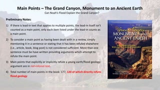
- 1. Preliminary Notes: 1) If there is lead-in text that applies to multiple points, the lead-in itself isn’t counted as a main point, only each item listed under the lead-in counts as a main point. 2) To consider a main point as having been dealt with in a review, simply mentioning it in a sentence or stating that it has been refuted elsewhere (i.e., article, book, blog post) is not considered sufficient. More than one sentence must be have written providing arguments which attempt to refute the main point. 3) Main points that explicitly or implicitly refute a young earth/flood geology argument are in red colored text. 4) Total number of main points in the book: 177, 120 of which directly refute flood geology Main Points – The Grand Canyon, Monument to an Ancient Earth Can Noah’s Flood Explain the Grand Canyon?
- 2. 1. There are two views for the origin of the Grand Canyon, modern (or conventional) and the young earth view (p. 15). 2. For any view of the history of the Grand Canyon to be considered plausible, it must be able to provide consistent explanations for the origin of not just isolated layers or features, but for how the entire sequence of layers fit together to form a larger story (p. 16). Introduction 2 main points
- 3. There were two schools of thought when geology became a true scientific discipline near the beginning of the 19th century: 1. The catastrophists – who didn't necessarily believe that the Earth was young, but the believed that the planet's history was shaped by one or more violent episodes, and 2. The uniformitarians, who believed that present natural processes and environments could be used to explain Earth's history (p. 22). 3. The 1961 book The Genesis Flood: The Biblical Record and Its Scientific Implications established flood geology and the modern Young Earth Creationism movement as a major cultural and political force (p. 23). The basic principles of flood geology are: 4. The earth was created in six 24-hour days about 6,000 years ago (p. 24). 5. Noah's flood occurred about 4,500 years ago (p. 24). What is Flood Geology? 15 main points (7 directly refute flood geology)
- 4. Basic principles of flood geology (continued): 6. Noah's flood was global in extent and caused by a combination of 40 days of heavy rainfall and the bursting open of the fountains of the great deep. The fountains of the great deep are understood to be superheated seawater jetting skyward along large fractures in the Earth’s crust or water under the Earth’s crust being expelled along faults and from volcanoes (p. 24). 7. Noah's flood left an immense record that is preserved in the rocks, fossils, and landforms of planet Earth. The massive tectonic forces at play during and shortly after the flood caused the uplifting of entire mountain ranges that exist today (p. 24-25). 8. Before Adam and Eve sinned, there was no death and a peaceful coexistence of immortal creatures prevailed on the Earth. Therefore, almost all fossil-bearing sedimentary rock must date to sometime after “the fall” (p. 25). There are several biblical problems with the young earth/flood geology view, including: 9. Flood geologists add to scripture by assuming that their "literal" interpretation of the scriptures is the only correct one (p. 26). 10. Flood geologists understand the Hebrew word for land, eretz, to mean the entire planet Earth. But, the ancient Hebrews knew nothing about planet Earth – the land around them was all they knew (p. 26). Chapter 2 (continued)
- 5. Biblical problems with young earth/flood geology (continued): 11. Flood geologists assume the word "all" in modern Bible translations refers to everything or everyone on the planet earth (p. 26). 12. The account of Noah in Genesis refers to bitumen (Genesis 6:14), a tarry substance found at oil seeps, which was used to waterproof the ark. Oil comes from the remains of microscopic organisms, but how did so many organisms live, die, get deeply buried, turn into bitumen, and seep to the surface in the few thousand years between the fall of Adam and Eve and the flood (p. 26)? 13. Flood geologists use Genesis 7:20 (that floodwater “covered the mountains to a depth of more than twenty feet”) to argue that the flood must have been global. However, the passage could as well be understood to mean that the mountains were “drenched” and that water rose to a depth of twenty feet against the mountains (p. 27). 14. Flood geologists argue that all the "millions and millions of dead things" buried in the Earth’s strata could only have perished after the fall of Adam and Eve. But nowhere does Scripture say that animal death resulted from man’s sin (p. 27). 15. The Bible does not claim that a "pre-flood" Garden of Eden was located anywhere else but the modern Mesopotamian region where the Euphrates, Tigris, and two other rivers merge near the Persian Gulf (p. 27-28). Chapter 2 (continued)
- 6. 1. Leading flood geologists divide all history into five periods: early creation week, pre-flood (day 3 of creation until beginning of the flood), early flood (first 150 days), late flood (day 151 to end of the flood), and post-flood (p. 31-32). 2. According to flood geology, the vast majority of all the Earth’s sedimentary deposits – including those now comprising high mountains and those found tens of thousands of feet below the surface – would have been deposited, sorted, shifted, folded, tilted, and hardened into rock during or shortly after the flood (p. 32). 3. The flood geology view of the origin of rocks in northern Arizona – southern Utah region has to account not just for the Grand Canyon layers being deposited by Noah's flood, but also the Grand Staircase layers (p. 33). 4. Flood geologists don’t all agree on which layers should be assigned to each part of the flood as described in Genesis chapters 7 and 8 (p. 33). 5. Flood geologists now recognize that erosion at the start of the flood wouldn’t be able to supply enough sediment to form all the sedimentary rock deposited by the flood, and have suggested that significant accumulations ("stockpiles") of various types of loose sediment already existed in various areas of the pre-flood Earth (p. 36). Timeline of Flood Geology 12 main points (1 directly refutes flood geology)
- 7. According to the most influential flood geologists, the sequence of rock exposed in the Grand Canyon and Grand Staircase were formed as follows: 6. The metamorphic basement rock was formed when Earth's crust shifted during the creation week when land was being formed. Some say it formed during Noah’s flood when the Earth’s crust was violently set into motion (p. 35). 7. The over 12,000 foot thick Grand Canyon Supergroup was deposited and hardened into rock during the pre-flood period, sometime between the Day 3 of creation and Noah’s flood (p. 35). 8. The 4,000 feet-thick accumulation of roughly horizontal Grand Canyon layers, from the Tapeats Sandstone up to the Kaibab Formation, were early flood deposits (p. 36). 9. The over 5,000 foot thick sequence of rocks of the Grand Staircase above the Kaibab Formation were deposited during the late flood period (p. 37). 10. The sedimentary rocks exposed in Bryce Canyon, as well as higher layers, were deposited in the post-flood period (p. 38). Chapter 3 (continued)
- 8. 11. If a global flood was required to deposit the layers of the Grand Canyon and Grand Staircase, how were thousands of feet of Supergroup layers deposited without a flood (p. 34)? 12. Flood geologists say dinosaurs swam or clung to floating debris during the first five+ months of the flood and then exited the flood waters when shifting currents allowed freshly deposited sediments to be exposed to the air, thus explaining the hundreds of Grand Staircase strata with dinosaur footprints, nests, and fossils (p. 38). Chapter 3 (continued)
- 9. 1. Modern geologists and astronomers place the overall age of the Earth at about 4.5 billion years (p. 41). 2. No place on Earth has a continuous, uninterrupted record of rocks from the beginning to the present (p. 44). According to conventional geology, the rock sequence exposed in the Grand Canyon and Grand Staircase formed as follows: 3. The crystalline basement rock was formed when thick deposits of sand, mud, and lava that formed on the flanks of volcanic islands collided with the continental edge of early North America. These deposits were then buried miles deep under mountains, forming metamorphic rock (p. 42, 44-45). 4. The metamorphic rock was later intruded by lava about 1.7 billion years ago, then forced up, and overlying material was eroded away (p. 42-43, 45-46). 5. The alternating layers of sedimentary rock in the Grand Canyon Supergroup were deposited from about 1.25 billion to 740 million years ago in a way that is consistent with periods of rising and falling sea level (or more precisely, subsidence and uplift of the land as well as rising and falling sea levels) (p. 43, 47). Time Frame of Modern Geology 10 main points
- 10. Conventional geology explanation for rock sequence: 6. The Grand Canyon Supergroup hardened into rock, uplifted and tilted into large blocks, and then eroded over a period of 200 million years. By about 525 million years ago, erosion had left a low lying surface close to sea level with some ridges of resistant rock. This now buried surface forms what is known as the Great Unconformity (p. 42, 48). 7. Over the next 255 million years, the sea alternately advanced and receded across the region as the crust subsided and was uplifted, leading to the accumulation of thousands of feet of sedimentary rock now seen in the walls of the Grand Canyon (p. 42, 48-49). 8. The Grand Staircase layers once covered the Grand Canyon area and were deposited from about 252 to 65 million years ago (Mesozoic Era) as seas alternately advanced and receded across the region (p. 43, 49-50). 9. The lake limestone layers in Bryce Canyon and higher locations were deposited near the start of the Cenozoic Era (65 to 0 million years ago) (p. 43, 50). 10. The Grand Canyon and Grand Staircase were carved later during the Cenozoic Era (p. 42, 50). Chapter 4 (continued)
- 11. 1. A good place to observe the process of compaction and cementation of sediments into rock is the Gulf of Mexico, where oil drilling penetrates increasingly harder sediment, until it finally reaches fully hardened rock thousands of feet below the surface (p. 57). 2. Multiple layers in the Grand Canyon contain conglomerates with rounded cobbles, indicating they were carried by rivers from long-vanished, distant mountains (p. 57). There are two ways sand can be transported and deposited to eventually form sandstone: 3. Water deposition is the most common – e.g., the Tapeats Sandstone (p. 58). 4. Wind deposition often occurs – e.g., the Coconino Sandstone (p. 58). 5. Many Grand Canyon formations that are typically referred to as sandstone (e.g., Tapeats Sandstone) or shale (e.g., Bright Angle Shale) actually contain many interbedded siltstone layers (p. 58). 6. Shale is composed of very-fine-grained clay or mud, often with silt, and crumbles fairly easily – therefore, it erodes more readily and forms the flattish benches seen in the Grand Canyon (p. 58). Chapter 5: Sedimentary Rock Types and How They Form 19 main points: 19 (11 directly refute flood geology)
- 12. 7. If you shake a container with mixed sediments in water, the coarse grains will settle to the bottom and the finest grains will end up on top (graded bedding) (p. 58-59). 8. Limestone is rock formed from accumulations of calcium-carbonate shell fragments and/or limey mud (p. 59). 9. No limestone has ever been documented to form from floodwater (p. 61). 10. Evaporite rock forms when mineral salts precipitate out of concentrated fluids (p. 61). 11. Over time, the sea advancing over the land (transgression) and later retreating (regression) forms a sequence of limestone, shale, and sandstone layers (p. 61-62). 12. Rivers today drop immense volumes of sediment into the world’s oceans, producing thick sequences of sand, silt, and clay – this, coupled with sea level changes over millions of years, can easily account for sedimentary layers such as those observed in the Grand Canyon (p. 62). 13. Migrating underwater sand dunes can’t explain the deposition of cross bedded sandstones in a matter of days because the water currents involved wouldn’t be able to transport near enough sand in such a short time span (p. 65). Chapter 5 (continued)
- 13. There are several problems with the flood geology explanation for limestone, including: 14. Calcite is one of the few minerals that are more soluble in cold water than in hot water, meaning cooling would work against limestone formation (p. 63). 15. In a violent global flood, lots of clay and quartz should be mixed together with lime material, but clay and quartz are almost entirely absent from limestones such as the Redwall Limestone (p. 63). 16. Limestone deposits are clearly accumulations of calcium carbonate shell debris deposited close to where the shells formed, not carried from distant, enormous pre-flood accumulations (p. 63). 17. The idea of rapid growth of coral-reef-type, post-flood limestones is based on extrapolation of the growth rates of the fastest growing corals and not entire reef surfaces (p. 63-64). Hyper-concentrated gravity currents cannot be used to explain rapid deposition of sediment for two major reasons: 18. Source problem – hundreds to thousands of stockpiles of sediment and fossils would have to be pre-positioned all over the world at elevations higher than their destinations, awaiting transport at various times during the flood (p. 64). 19. Lower concentrated turbidity currents are the most common type of gravity current, and they produce graded bedding, which is not common in the Grand Canyon (p. 64-65). Chapter 5 (continued)
- 14. The following sedimentary structures found in the Grand Canyon illustrate the environments and conditions of their deposition – none of them need to be explained by a global flood: 1. The presence of mud cracks implies baking under the sun. They were preserved when sediment of a different texture or color got washed into the cracks. In some cases syneresis cracks can resemble polygonal mud cracks, but more often they are spindle-shaped or sinuous and do not resemble those in the Grand Canyon (p. 68). 2. Raindrop prints can only be made when mud, silt, or sand is exposed to the air (p. 69). 3. Regularly spaced ripple marks are typically generated by currents moving in one direction or by the to and fro motion of waves in shallow water – not the high velocity, bottom churning currents envisioned by flood geologists (p. 69-70). 4. Cross beds in the Coconino Sandstone indicate a desert dune environment rather than an underwater environment because saturated sand in underwater dunes cannot maintain slopes as steep as those in dry sand, and the maximum cross bed angles in the Coconino are more like those in desert dunes (p. 70). 5. Preserved trace fossils of reptile- and scorpion-like creatures in exposed surfaces of cross beds are difficult to reconcile with repeated global tsunamis and giant underwater landslides called for by flood geology (p. 71). Chapter 6: Sedimentary Structures, Clues from the Scene of the Crime 6 main points (6 directly refute flood geology)
- 15. 6. To account for the Grand Canyon’s sedimentary structures in the flood model, either large regions of the planet had to repeatedly flood and dry out in the midst of a year-long flood, or some yet-to-be-identified process must have allowed them to form repeatedly in deep water (p. 71). Chapter 6 (continued)
- 16. 1. After 200 years of geologic study, it is clear that the basic geologic processes creating rocks today – both slow and fast – and the same physical and chemical laws, have been active over much of earth history (p. 73). 2. Flood geologists commonly misrepresent uniformitarianism as being synonymous with materialism or evolutionism, but when they seek to find scientific evidence in support of a young Earth, they actually apply uniformitarian principles (p. 73). 3. Flood geologists assume that natural laws describing physical and chemical processes must have been different during the creation week, before the fall in the Garden of Eden, or at various points during Noah’s flood (p.74). 4. A modern analog to the Grand Canyon’s crystalline basement rock is found in Canada north of the Great Lakes. If the ocean were to advance over this crystalline rock and begin to deposit sediment, the result would be comparable to the Unkar Group in the Grand Canyon (p. 74-75). 5. A modern analog to the depositional environment for the Bright Angel Shale is the muddy sea floor beyond the mouth of the Rio de la Plata in Argentina (p. 75). Chapter 7: Using the Present to Understand the Past 8 main points (8 directly refute flood geology)
- 17. 6. A modern analog to the depositional environment for the Muav Limestone is the southern coast of the Arabian Gulf (p. 76). 7. A modern analog to the karst processes responsible for the caves and sinkholes in the Redwall Limestone is the Yucatan Peninsula of Mexico (p. 77-78). 8. A modern analog to the depositional environment for the Coconino Sandstone is the Namib Desert in West Africa (p. 78-79). Chapter 7 (continued)
- 18. Several relative dating principles can be used to put a series of geologic events into their proper sequence, including: 1. Principle of superposition - younger sedimentary layers are placed on top of older layers (p. 82-83). 2. Principle of lateral continuity - when sedimentary layers can be traced from one side of a canyon to the other, it can be concluded that the layers were originally continuous before they were separated (p. 83-84). 3. Principle of faunal succession - if we find a particular group of identical fossils in two distinct (separate) rock outcrops, it is likely that those organisms (and the strata comprising the outcrops) were deposited in the same time frame (p. 84). 4. Principle of original horizontality - steeply tilted layers were not deposited in that position, but were tilted sometime after the sediments had been hardened into rock (p. 84). 5. Principle of cross-cutting relationships - faults or dikes must always be younger than the layers or features they cross (p. 84-85). Chapter 8: Solving Puzzles, Relative Dating and the Geologic Column 8 main points (2 directly refute flood geology)
- 19. 6. Radiometric dating made it possible to assign ages to the geologic strata which previously could only be assigned to eons, eras, periods, epochs or ages according to relative criteria such as types of fossils contained in the strata (p. 86-87). 7. After decades of investigation, a particular assemblage of fossil worms, sponges, crinoids, echinoids, bryozoans, brachiopods, pelecypods, scaphopods, gastropods, cephalopods, crustaceans, and fish has been found in the Kaibab Formation. Because strata at other locations around the world with the same fossil assemblage contained material (e.g., volcanic ash) that could be radiometrically dated, an age for the Kaibab Formation could be assigned (p. 87). 8. Young earth/Flood geology proponents accept the basic construction of the geologic column, but compress the order of events forming that column into a one-year flood (p. 87). Chapter 8 (continued)
- 20. 1. Radiometric dating works on the principle that the loss of parent isotopes and the gain of daughter isotopes indicate the age of the object (p. 90). 2. Young earth advocates claim that radiometric dating doesn’t work because there are usually some daughter atoms already present at the time the magma crystalizes, but scientists have discovered accurate ways to determine how many of the daughter atoms existed when the “clock” was started (p. 90). 3. Metamorphic rocks are generally not useful for radiometric dating, unless what you are interested in is the timing of metamorphic resetting (p. 92). 4. Some young earth advocates try to use radiocarbon to date old rocks, coal, or diamonds, with meaningless results (p. 93). 5. There is agreement between the dates recorded for ancient historical events and the radiometric ages measured for rocks or other articles from those events – e.g., Mt. Vesuvius (p. 93). 6. If we divide the distance between Africa and North America (3,480 miles) by the maximum age of the Atlantic Ocean crust obtained through radiometric dating (180 million years), we get an average continental spreading rate that is very close to that obtained from precise satellite measurements (~ 1 inch per year) (p. 94). Chapter 9: So Just How Old is That Rock? 11 main points (9 directly refute flood geology)
- 21. A flood geologist’s attempt to discredit radiometric dating using a sample from Mt. St. Helens is flawed because: 7. Fragments of old rock from the subsurface can become entrained in upwelling lava, so a sample taken at the surface could be a mixture of new and old rock (p. 95). 8. Geologists have long recognized that potassium-argon (K-Ar) dating yields inaccurate results for recent lava flows – newer methods such as Argon-Argon take the processes into account which cause the K-Ar method to produce erroneous results (p. 95). A flood geologist’s attempt to discredit radiometric dating by using four different radiometric dating methods (K-Ar, Rb- Sr, Sm-Nd, and U-Pb) on an igneous intrusion to the Hakatai Shale is flawed because: 9. Geologists have known for a long time that argon (Ar) leaks from reheated rocks much more readily than strontium (Sr), lead (Pb), or neodymium (Nd) (p. 96). 10. After taking the uncertainties of the U-Pb, Sm-Nd, and Rb-Sr methods into account, the results from those three methods weren’t as wildly divergent as claimed (p. 96-97). 11. A flood geologist’s attempt to discredit radiometric dating by applying the isochron method to recent lava flows pouring over the edge of the western Grand Canyon is flawed because samples were collected from four different flows, guaranteeing meaningless “ages” (p. 97). Chapter 9 (continued)
- 22. 1. Nineteen major unconformities have been identified in the Grand Canyon (p. 99). 2. Flood geologists deny that any unconformities exist in the Grand Canyon above the Great Unconformity because they would mean there were repeated and extended periods of exposure and erosion in the middle of a year-long flood (p. 101). We find five characteristic examples of Grand Canyon unconformities indicating that the thick sequence of sedimentary rock couldn’t have been deposited in a single year-long flood: 3. To make the unconformity above the Grand Canyon Supergroup, over 12,000 feet of Supergroup rocks were (1) deposited, (2) buried, (3) hardened, (4) faulted and tilted, (5) uplifted and subjected to erosion, and finally (6) covered by the Cambrian-age strata. According to flood geology, all this happened in the first 1,650 years of Earth history (p. 101-102). 4. Several formations contain rock fragments that were “ripped up” from the underlying layer (e.g., Tapeats Sandstone, Surprise Canyon Formation) (p. 102). Chapter 10: Missing Time, Gaps in the Rock Record 8 main points (8 directly refute flood geology)
- 23. Five characteristic examples of Grand Canyon unconformities (continued): 5. Suites of fossils in the canyon’s geologic column exist in the expected order, but with one or more entire fossil groups missing, indicating a period when either there was no deposition or material was eroded away (p. 103). 6. Channels were carved into a lower stratigraphic unit that are filled either with material from an upper unit or with unique deposits. (e.g., Redwall Ls. channels filled in with Surprise Canyon Fm.) (p. 103). 7. There are filled-in caves and sinkholes, some having walls plastered with fragments of rock from the surrounding formation (Redwall Ls.) (p. 105). 8. Fossils of Lepidodendron trees and other plant material in the bottom layers of the Surprise Canyon Formation indicate a land environment, not a marine environment (p. 103, 105). Chapter 10 (continued)
- 24. 1. If the movement caused by large earthquakes all around the globe had been sustained for days or months, as called for by catastrophic plate tectonics, the frictional heat would have boiled of most, if not all, of the Earth’s oceans (p. 112). 2. Rapid flexing of huge volumes of rock, as would occur with the rapid uplift of mountains, would cause everything to crush and melt (p. 114). 3. At least four tectonic episodes that would have impacted the Grand Canyon region have been identified, two affecting rocks below the Great Unconformity and two occurring after all the horizontal Paleozoic layers had been deposited and hardened (p. 115). Chapter 11: Plate Tectonics, Our Restless Earth 3 main points (3 directly refute flood geology)
- 25. 1. When we look at the Grand Canyon, its layers are riddled with fractures that continue through multiple formations – the Palisades in eastern Grand Canyon being a dramatic example (p. 118-119). 2. If flood geology model were true, we should expect to see just one type of faulting, but in the Grand Canyon, we see reverse and normal faulting (p. 120). 3. Flood geologists argue that the deformation of rock layers along the Butte Fault shows that the folding occurred while the sediments were still soft, but a close examination of the folding shows both flexural slip and abundant fractures, indicating the layers were solid (p. 125-126). 4. When folding occurs in freshly deposited sediments, the layers quickly lose their consistency and flow into a jumbled mess (p. 127). Chapter 12: Broken and Bent Rock, Fractures, Faults, and Folds 4 main points (4 directly refute flood geology)
- 26. 1. The fact that some types of fossils are never found together is our first clue, on a global scale, that fossils do not represent animals that were buried in Noah’s flood (p. 131). 2. Anyone can observe the fossil sequence in the Grand Canyon-Grand Staircase. Both flood geologists and modern geologists must explain this sequence in order for their claims to be considered valid (p. 134). 3. The increase in complexity and diversity from the lowest (oldest) to highest (youngest) rocks is readily apparent in both the Grand Canyon and what is observed globally (p. 134). 4. After each major extinction, fossils from major taxonomic groups appear or disappear in the Grand Canyon-Grand Staircase sequence with the same order and timing as observed globally (p. 134). 5. No fossils of creatures in the modern-day Gulf of California are found in the Grand Canyon rock sequence (p. 135). 6. Corals, brachiopods, and snails are found in both modern seas and the Grand Canyon layers, but they are so distinct that biologists place them in different orders (p. 135). 7. Before occurrence of the flood, the Bible mentions seed-bearing plants, trees that bear fruit with seed in it, birds, livestock, and wild animals, but none of these creatures are present in the layers of the Grand Canyon (p. 136). Chapter 13: Fossils of the Grand Canyon and Grand Staircase 17 main points (16 directly refute flood geology)
- 27. 8. According to flood geology, all major categories of organisms living today were present prior to the flood, but only structures produced by colonial algae exist in the Grand Canyon Supergroup – rock which most flood geologists classify as pre-flood (p. 137). 9. Progressing upward through the Paleozoic Grand Canyon strata, we see faunal replacement of large taxonomic groups within the sponges, brachiopods, echinoderms, mollusks, and other creatures (p. 139). Progressing upward through the Mesozoic strata of the Grand Staircase, we make several observations that are at odds with the flood geology explanation: 10. Many layers – e.g., Chinle Formation – contain only land and fresh water fossils and none of these are known in the lower Grand Canyon rocks (p. 140). 11. Other layers – e.g., Kaiparowits Formation and Navajo Sandstone – contain dinosaur footprints, eggshell fragments, and bones, but none of these are found in the Grand Canyon rocks (p. 140-141). 12. Other layers – e.g., Carmel Formation – do contain marine faunas (p. 141). 13. Another layer which is above the Grand Canyon layers but not in the Grand Staircase layers – the Mancos Shale – contains fossils of plesiosaurs, but no fossils of whales, dolphins, or sea lions (p. 141). Chapter 13 (continued)
- 28. 14. Young earth advocates only tell half the story when they point out that complex organisms like trilobites occur in the lowest Grand Canyon strata and simpler organisms like sponges occur in higher strata (p. 141). 15. Flood geologists argue that fossils provide evidence of catastrophic transport and sorting, but sometimes fossils indicating some kind of transport are found in association with the remains of delicate organisms such as ferns (p. 142). 16. Many fossils are disarticulated parts of organisms, but they are not worn down or widely scattered from one another, and they are often found in recognizable associations with other organisms typical of a particular environment (p. 142). 17. Some flood geologists say earthquakes caused the sorting of fossils by size or density, but in the fossil record there is no such ordering (p. 142-143). Chapter 13 (continued)
- 29. 1. We find that the complexity or diversity of plant fossils generally increases in progressively younger layers in both the Grand Canyon and what is observed globally (p. 148). 2. No rocks of Precambrian age, in the Grand Canyon or anywhere in the world, have any type of plant fossils in them – just different kinds of algae (p. 148). 3. Pollen and spores demonstrate the same principle of floral succession in the Grand Canyon and Grand Staircase that macrofossils (of plants) do (p. 150). 4. Grand Canyon rock layers show a complete absence of fossil flowering plant pollen (p. 150). Chapter 14: Tiny Plants – Big Impact, Pollen, Spores, and Plant Fossils 4 main points (4 directly refute flood geology)
- 30. 1. Trace fossils in the Coconino Sandstone range from the tracks of small to large vertebrates to tracks and burrows very similar to those left by spiders, scorpions, millipedes, and other arthropods (p. 154). 2. In some of the largest sets of vertebrate tracks, a sinuous groove between the rows of prints indicates where the animal’s tail dragged (p. 155, 157). 3. The footprint area and depth of the tracks are proportional to the weight of the animal; tracks of the largest animals indicate they weighted between 20 and 30 pounds (p. 157). 4. The tracks of spiders, scorpions, isopods, and millipedes are preserved in the Coconino Sandstone (p. 156-157). 5. Mists associated with marine air moving over sand dunes have been proposed as a mechanism for preserving the tracks of vertebrates and arthropods in the Coconino until they were covered over by blowing sand (p. 158). 6. Prints made in wet sand are completely obliterated by even a gentle wave of water washing over them (p. 158). 7. The current velocity in water tank experiments often cited as evidence that vertebrates could leave tracks underwater was only about 0.2 mph, much slower than the raging torrents required by the flood geology model (p. 159). Chapter 15: Trace Fossils, Footprints and Imprints of Past Life 7 main points (7 directly refute flood geology)
- 31. 1. Flood geologists say the Grand Canyon was carved when large post-flood lakes totaling 3,000 cubic miles in volume breached, sending their water rushing through the Kaibab Arch in a matter of days (p. 164). 2. Regarding the large lakes proposed by flood geologists, there is no evidence Canyonlands Lake ever existed, the connection between Uinta Lake and Canyonlands Lake is even more hypothetical, and Hopi (Bidahochi) Lake was a series of small lakes or playas (p. 165). 3. The existence of steep cliffs like that of the Redwall Limestone is evidence that they were already hard rock when carved (p. 165 -167). 4. 3,000 cubic miles of water would not have been sufficient to carve the 1,000 cubic mile Grand Canyon (p. 167). 5. Scientists know where the sediment eroded from the Grand Canyon is located – the Bouse and Imperial Formations found below the canyon (p. 168). Chapter 16 – Carving of the Grand Canyon, A Lot of Time and a Little Water, A Lot of Water and a Little Time (or Something Else?) 11 main points (10 directly refute flood geology)
- 32. 6. Well rounded river gravels in the Bouse and Imperial Formations fit well with a long history of Colorado River flow (p. 168). 7. Rather than supporting the rapid carving idea, the Channeled Scablands provide an exquisite field site for seeing what is left behind by a megaflood – and that site looks nothing like the Grand Canyon (p. 169). 8. The small, U-shaped canyons and gullies cutting into the loose material below Mount St. Helens do not look anything like the single, massive, V-shaped Grand Canyon (p. 170). 9. Canyon Lake Gorge argues against the rapid carving of Grand Canyon because the volume of water was 1,500 times more than the volume of rock and sediment that was eroded (p. 171). 10. Providence Canyon argues against the rapid carving of Grand Canyon because its pinnacles and narrow walls can disappear overnight in heavy Georgia rainstorms while the buttes and spires of the Grand Canyon have stood the test of time (p. 171). 11. When young earth advocates ask if the Grand Canyon was carved in a lot of time by a little water, or by a lot of water in a little time, this is a misleading question. Carving of the Grand Canyon required a lot of water and a lot of time (p. 171). Chapter 16 (continued)
- 33. 1. How long ago was the Grand Canyon carved is a more difficult to answer than how old the rock layers are, because you are trying to date a hole in the rock (p. 173). 2. Geologists studying the Grand Staircase layers and the evidence of regional uplift generally agree that the maximum possible age of the Grand Canyon is about 80 million years (p. 173-174). 3. A majority of geologists hold to the view that most Grand Canyon incision occurred over the last 6 million years, while a smaller group argues that incision of an earlier paleo canyon began long before that (p. 174). 4. Some geologists maintain that incision of the Kaibab uplift occurred through the process of headward erosion and stream capture (p. 174-175). 5. Some geologists maintain that incision of the Kaibab uplift occurred through the process of karst piracy (p. 175-176). Chapter 17: How Old is the Grand Canyon? 8 main points (3 directly refute flood geology)
- 34. Young earth advocates cite disagreement among scientists over how and when the Grand Canyon was carved as weakness in the conventional old-earth model, but they don’t recognize that such assertions: 6. Imply that agreement is a sign of strength – i.e., they would have to concede that the Grand Canyon’s layers are millions of years old, because virtually all scientists agree on this (p. 176) 7. Undermine their own arguments – i.e., they disagree on when the Grand Canyon was carved and which layers should be considered flood deposits and which should be considered post-flood deposits (p. 176-177). 8. Represent a fundamental lack of understanding of how science works (p. 177). Chapter 17 (continued)
- 35. 1. A number of packrat middens in Grand Canyon caves have been carbon-14 dated to be about 20,000 to 10,000 years old (p. 180). 2. The record of past plant communities as contained in pollen found in packrat middens and dung reveals a history of changing climate in the Grand Canyon – e.g. juniper and ash forests existed in lower reaches of the canyon for a long period in the past (p. 180). 3. Carbon 14 dating of dung on the floor of Rampart cave suggests that it has not been inhabited by sloths for more than 11,000 years (p. 182). 4. Carbon 14 dating of the deepest dung deposits in Rampart cave suggests that sloths occupied the cave for almost 25,000 years starting more than 35,000 years ago (p. 182). 5. There is no evidence that humans ever overlapped with sloths in Rampart Cave – the oldest human artifacts in Grand Canyon caves have been radiocarbon dated to about 6,000 years ago (p. 182). Chapter 18 – Life in the Canyon, Packrats, Pollen, and Giant Sloths 5 main points (5 directly refute flood geology)
- 36. Note: Chapter 19 is a summary chapter – points made there which were already made in previous chapters are not repeated again here. 1. The Vishnu Schist contains altered minerals that form under high temperatures and pressures typically found only at depths 10+ miles below the surface (p. 188). 2. Granite crisscrossing through the Vishnu Schist contains large crystals, indicating a slow rate of cooling (p. 188). 3. Why is a global catastrophe needed to explain the erosional surface at the top of the Grand Canyon Supergroup but not the equally extensive erosional surface between the Vishnu Schist and the base of the Grand Canyon Supergroup (p. 192)? 4. The Bass Formation at the bottom of the Grand Canyon Supergroup should contain a representative sampling of life forms described in Genesis Ch. 1, or at least, fossils of shelled organisms, fish, coral, lobsters and an occasional marine reptile or mammal (p. 192-193). Chapter 19: River to Rim, Putting all the Pieces Together 16 main points (16 directly refute flood geology)
- 37. 5. The blocks of Shinumo Quartzite lodged in the Tapeats Sandstone could be argued to fit within the global flood model, but only if viewed in isolation from all the underlying and overlying layers (p. 193). 6. The size and density of lime and clay particles overlaps substantially, so according to the flood model, clay and lime particles should be highly mixed in Tonto Group layers (p. 195). 7. The flood explanation for formation of limestone and salt deposits requires release of separate pockets of calcite-rich and salt-rich fluids by the fountains of the great deep which somehow avoided mixing with each other (p. 196). 8. How did the 47 species of trilobites avoid being mixed with any jawed fish in the Tonto Group layers (p. 196)? 9. If the channels in the Muav Limestone filled with the Temple Butte Formation were carved out by submarine currents during the flood, how would a unique set of organism fossils be found exclusively in these channels and nowhere else (p. 197)? 10. To get 500 foot thick deposits of crinoid-rich Redwall Limestone over its present area now covered by multiple western states, crinoid communities would have had to initially cover a vastly larger area and be ripped up and stacked within the smaller present area – all in clear, un-muddied water (p. 199). Chapter 19 (continued)
- 38. 11. For the Supai Group and Hermit Formation, the fact that terrestrial and marine fossils are not found intermingled within the same layers is clear evidence of distinct intervals of time when the region was sometimes above sea level and other times below it (p. 200-201). 12. The abrupt transition in color and composition between the Coconino Sandstone and the underlying Hermit Formation, together with sand-filled fissures within the Hermit, suggest a period of erosion down into the Hermit, with weathered cracks later filling in with sand (p. 202). 13. Given the proximity of the Coconino dunes to an ancient sea, it would not be surprising for some of the dune sands near the coastline to be cemented with dolomite (p. 203). 14. Alternating layers of limestone, shale, sandstone, and evaporites of the Toroweap and Kaibab Formations reflect the return of cyclic sea level advance and retreat (p. 202-203). 15. Evaporites in the Toroweap and Kaibab Formations provide strong testimony to periods of exposure during which intensive evaporation and drying occurred (p. 203). 16. Flood geology arguments often have a ring of plausibility to them when they are applied to one layer or one feature in isolation, but there is no way to piece together all the individual explanations into a coherent whole (p. 204). Chapter 19 (continued)
- 39. 1. Flood geology adherents often claim that we are all looking at the same data but that our different worldviews cause us to interpret the data differently. However, the previous chapters illustrate something quite different (p. 207). 2. Science goes where the data leads, flood geology does not (p. 207). 3. Does it matter? It certainly does! Truth always matters (p. 209). Total number of main points in the book: 177, 120 of which directly refute flood geology Chapter 20: Science Vs. Flood Geology, Not Just A Difference in Worldview 3 main points (2 directly refute flood geology)