SlideShare a Scribd company logo
1 of 77
Download to read offline
View of the planet Earth from the Apollo spacecraft. The Red Sea, which separates Saudi

Arabia

from the continent of Africa, is clearly visible at the top. (Photograph courtesy of NASA.)

Contents
Preface Historical perspective Developing the theory Understanding plate motions
"Hotspots": Mantle Some unanswered questions Plate tectonics and people Endnotes
thermal plumes
1 of 77 2002-01-01 11:52
This pdf-version was edited by Peter Lindeberg in December 2001. Any deviation from the

original text is non-intentional.

This book was originally published in paper form in February 1996 (design and coordination by

Martha Kiger; illustrations and production by Jane Russell). It is for sale for $7 from:

U.S. Government Printing Office

Superintendent of Documents, Mail Stop SSOP

Washington, DC 20402-9328

or it can be ordered directly from the U.S. Geological Survey:

Call toll-free 1-888-ASK-USGS

Or write to

USGS Information Services

Box 25286, Building 810

Denver Federal Center

Denver, CO 80225

303-202-4700; Fax 303-202-4693

ISBN 0-16-048220-8

Version 1.08

The online edition contains all text from the original book in its entirety.

Some figures have been modified to enhance legibility at screen resolutions.

Many of the images in this book are available in high resolution from the USGS Media for
Science page.
USGS Home Page
URL: http://pubs.usgs.gov/publications/text/dynamic.html

Last updated: 01.29.01

Contact: jmwatson@usgs.gov

2 of 77 2002-01-01 11:52
In the early 1960s, the emergence of the theory of plate tectonics started a revolution in the
earth sciences. Since then, scientists have verified and refined this theory, and now have a
much better understanding of how our planet has been shaped by plate-tectonic processes.
We now know that, directly or indirectly, plate tectonics influences nearly all geologic
processes, past and present. Indeed, the notion that the entire Earth's surface is continually
shifting has profoundly changed the way we view our world.
People benefit from, and are at the mercy of, the forces and consequences of plate tectonics.
With little or no warning, an earthquake or volcanic eruption can unleash bursts of energy far
more powerful than anything we can generate. While we have no control over plate-tectonic
processes, we now have the knowledge to learn from them. The more we know about plate
tectonics, the better we can appreciate the grandeur and beauty of the land upon which we
live, as well as the occasional violent displays of the Earth's awesome power.
This booklet gives a brief introduction to the concept of plate tectonics and complements the
visual and written information in This Dynamic Planet (see Further reading), a map published
in 1994 by the U.S. Geological Survey (USGS) and the Smithsonian Institution. The booklet
highlights some of the people and discoveries that advanced the development of the theory
and traces its progress since its proposal. Although the general idea of plate tectonics is now
widely accepted, many aspects still continue to confound and challenge scientists. The
earth-science revolution launched by the theory of plate tectonics is not finished.
Oldoinyo Lengai, an active volcano in the East African Rift Zone, where Africa is being pulled
apart by plate-tectonic processes. (Photograph by Jorg Keller, Albert-Ludwigs-Universität
Freiburg, Germany.)
In geologic terms, a plate is a large, rigid slab of solid rock. The word tectonics comes from
3 of 77 2002-01-01 11:52
the Greek root "to build." Putting these two words together, we get the term plate tectonics,

which refers to how the Earth's surface is built of plates. The theory of plate tectonics states

that the Earth's outermost layer is fragmented into a dozen or more large and small plates

that are moving relative to one another as they ride atop hotter, more mobile material.

Before the advent of plate tectonics, however, some people already believed that the

present-day continents were the fragmented pieces of preexisting larger landmasses

("supercontinents"). The diagrams below show the break-up of the supercontinent Pangaea

(meaning "all lands" in Greek), which figured prominently in the theory of continental drift --

the forerunner to the theory of plate

tectonics.

According to the continental drift theory, the supercontinent Pangaea began to break up
about 225-200 million years ago, eventually fragmenting into the continents as we know
them today.
4 of 77 2002-01-01 11:52
Plate tectonics is a relatively new scientific concept, introduced some 30 years ago, but it has
revolutionized our understanding of the dynamic planet upon which we live. The theory has
unified the study of the Earth by drawing together many branches of the earth sciences, from
paleontology (the study of fossils) to seismology (the study of earthquakes). It has provided
explanations to questions that scientists had speculated upon for centuries -- such as why
earthquakes and volcanic eruptions occur in very specific areas around the world, and how
and why great mountain ranges like the Alps and Himalayas formed.
Why is the Earth so restless? What causes the ground to shake violently, volcanoes to erupt
with explosive force, and great mountain ranges to rise to incredible heights? Scientists,
philosophers, and theologians have wrestled with questions such as these for centuries. Until
the 1700s, most Europeans thought that a Biblical Flood played a major role in shaping the
Earth's surface. This way of thinking was known as "catastrophism," and geology (the study of
the Earth) was based on the belief that all earthly changes were sudden and caused by a
series of catastrophes. However, by the mid-19th century, catastrophism gave way to
"uniformitarianism," a new way of thinking centered around the "Uniformitarian Principle"
proposed in 1785 by James Hutton, a Scottish geologist. This principle is commonly stated as
follows: The present is the key to the past. Those holding this viewpoint assume that the
geologic forces and processes -- gradual as well as catastrophic -- acting on the Earth today
are the same as those that have acted in the geologic past.
The layer of the the Earth we live on is broken into a dozen or so rigid slabs (called tectonic

plates by geologists) that

are moving relative to one another.

The belief that continents have not always been fixed in their present positions was suspected
5 of 77 2002-01-01 11:52
long before the 20th century; this notion was first suggested as early as 1596 by the Dutch
map maker Abraham Ortelius in his work Thesaurus Geographicus. Ortelius suggested that the
Americas were "torn away from Europe and Africa . . . by earthquakes and floods" and went
on to say: "The vestiges of the rupture reveal themselves, if someone brings forward a map of
the world and considers carefully the coasts of the three [continents]." Ortelius' idea surfaced
again in the 19th century. However, it was not until 1912 that the idea of moving continents
was seriously considered as a full-blown scientific theory -- called Continental Drift --
introduced in two articles published by a 32-year-old German meteorologist named Alfred
Lothar Wegener. He contended that, around 200 million years ago, the supercontinent
Pangaea began to split apart. Alexander Du Toit, Professor of Geology at Johannesburg
University and one of Wegener's staunchest supporters, proposed that Pangaea first broke into
two large continental landmasses, Laurasia in the northern hemisphere and Gondwanaland in
the southern hemisphere. Laurasia and Gondwanaland then continued to break apart into the
various smaller continents that exist today.
In 1858, geographer Antonio Snider-Pellegrini made these two maps showing his version of
how the American and African continents may once have fit together, then later separated.
Left: The formerly joined continents before (avant) their separation. Right: The continents
after (aprés) the separation. (Reproductions of the original maps courtesy of University of
California, Berkeley.)
Wegener's theory was based in part on what appeared to him to be the remarkable fit of the
South American and African continents, first noted by Abraham Ortelius three centuries
earlier. Wegener was also intrigued by the occurrences of unusual geologic structures and of
plant and animal fossils found on the matching coastlines of South America and Africa, which
are now widely separated by the Atlantic Ocean. He reasoned that it was physically
impossible for most of these organisms to have swum or have been transported across the vast
oceans. To him, the presence of identical fossil species along the coastal parts of Africa and
South America was the most compelling evidence that the two continents were once joined.
In Wegener's mind, the drifting of continents after the break-up of Pangaea explained not
only the matching fossil occurrences but also the evidence of dramatic climate changes on
some continents. For example, the discovery of fossils of tropical plants (in the form of coal
deposits) in Antarctica led to the conclusion that this frozen land previously must have been
situated closer to the equator, in a more temperate climate where lush, swampy vegetation
could grow. Other mismatches of geology and climate included distinctive fossil ferns
6 of 77 2002-01-01 11:52
(Glossopteris) discovered in now-polar regions, and the occurrence of glacial deposits in
present-day arid Africa, such as the Vaal River valley of South Africa.
The theory of continental drift would become the spark that ignited a new way of viewing
the Earth. But at the time Wegener introduced his theory, the scientific community firmly
believed the continents and oceans to be permanent features on the Earth's surface. Not
surprisingly, his proposal was not well received, even though it seemed to agree with the
scientific information available at the time. A fatal weakness in Wegener's theory was that it
could not satisfactorily answer the most fundamental question raised by his critics: What kind
of forces could be strong enough to move such large masses of solid rock over such great
distances? Wegener suggested that the continents simply plowed through the ocean floor, but
Harold Jeffreys, a noted English geophysicist, argued correctly that it was physically
impossible for a large mass of solid rock to plow through the ocean floor without breaking up.
As noted by Snider-Pellegrini and Wegener, the locations of certain fossil plants and animals

on present-day, widely

separated continents would form definite patterns (shown by the bands of colors), if the

continents are rejoined.

Undaunted by rejection, Wegener devoted the rest of his life to doggedly pursuing additional
evidence to defend his theory. He froze to death in 1930 during an expedition crossing the
Greenland ice cap, but the controversy he spawned raged on. However, after his death, new
evidence from ocean floor exploration and other studies rekindled interest in Wegener's
theory, ultimately leading to the development of the theory of plate tectonics.
Plate tectonics has proven to be as important to the earth sciences as the discovery of the
7 of 77 2002-01-01 11:52
structure of the atom was to physics and chemistry and the theory of evolution was to the life
sciences. Even though the theory of plate tectonics is now widely accepted by the scientific
community, aspects of the theory are still being debated today. Ironically, one of the chief
outstanding questions is the one Wegener failed to resolve: What is the nature of the forces
propelling the plates? Scientists also debate how plate tectonics may have operated (if at all)
earlier in the Earth's history and whether similar processes operate, or have ever operated, on
other planets in our solar system.
| Inside the Earth | What is a tectonic plate? | Alfred Lothar Wegener | Polar dinosaurs in
Australia? |
Inside the Earth
The size of the Earth -- about 12,750 kilometers (km) in diameter-was known by the ancient
Greeks, but it was not until the turn of the 20th century that scientists determined that our
planet is made up of three main layers: crust, mantle, and core. This layered structure can be
compared to that of a boiled egg. The crust, the outermost layer, is rigid and very thin
compared with the other two. Beneath the oceans, the crust varies little in thickness,
generally extending only to about 5 km. The thickness of the crust beneath continents is much
more variable but averages about 30 km; under large mountain ranges, such as the Alps or the
Sierra Nevada, however, the base of the crust can be as deep as 100 km. Like the shell of an
egg, the Earth's crust is brittle and can break.
Cutaway views showing the internal structure of the Earth. Below: This view drawn to scale
demonstrates that the Earth's crust literally is only skin deep. Below right: A view not drawn
to scale to show the Earth's three main layers (crust, mantle, and core) in more detail (see
text).
8 of 77 2002-01-01 11:52
Below the crust is the mantle, a dense, hot layer of semi-solid rock approximately 2,900 km
thick. The mantle, which contains more iron, magnesium, and calcium than the crust, is
hotter and denser because temperature and pressure inside the Earth increase with depth. As
a comparison, the mantle might be thought of as the white of a boiled egg. At the center of
the Earth lies the core, which is nearly twice as dense as the mantle because its composition
is metallic (iron-nickel alloy) rather than stony. Unlike the yolk of an egg, however, the
Earth's core is actually made up of two distinct parts: a 2,200 km-thick liquid outer core and a
1,250 km-thick solid inner core. As the Earth rotates, the liquid outer core spins, creating the
Earth's magnetic field.
Not surprisingly, the Earth's internal structure influences plate tectonics. The upper part of
the mantle is cooler and more rigid than the deep mantle; in many ways, it behaves like the
overlying crust. Together they form a rigid layer of rock called the lithosphere (from lithos,
Greek for stone). The lithosphere tends to be thinnest under the oceans and in volcanically
active continental areas, such as the Western United States. Averaging at least 80 km in
thickness over much of the Earth, the lithosphere has been broken up into the moving plates
that contain the world's continents and oceans. Scientists believe that below the lithosphere
is a relatively narrow, mobile zone in the mantle called the asthenosphere (from asthenes,
Greek for weak). This zone is composed of hot, semi-solid material, which can soften and
flow after being subjected to high temperature and pressure over geologic time. The rigid
lithosphere is thought to "float" or move about on the slowly flowing asthenosphere.
What is a tectonic plate?
A tectonic plate (also called lithospheric plate) is a massive, irregularly shaped slab of solid
rock, generally composed of both continental and oceanic lithosphere. Plate size can vary
greatly, from a few hundred to thousands of kilometers across; the Pacific and Antarctic
Plates are among the largest. Plate thickness also varies greatly, ranging from less than 15 km
for young oceanic lithosphere to about 200 km or more for ancient continental lithosphere
(for example, the interior parts of North and South America).
How do these massive slabs of solid rock float despite their tremendous weight? The answer
lies in the composition of the rocks. Continental crust is composed of granitic rocks which are
made up of relatively lightweight minerals such as quartz and feldspar. By contrast, oceanic
crust is composed of basaltic rocks, which are much denser and heavier. The variations in
plate thickness are nature's way of partly compensating for the imbalance in the weight and
density of the two types of crust. Because continental rocks are much lighter, the crust under
the continents is much thicker (as much as 100 km) whereas the crust under the oceans is
generally only about 5 km thick. Like icebergs, only the tips of which are visible above water,
continents have deep "roots" to support their elevations.
9 of 77 2002-01-01 11:52
Most of the boundaries between individual plates cannot be seen, because they are hidden
beneath the oceans. Yet oceanic plate boundaries can be mapped accurately from outer
space by measurements from GEOSAT satellites. Earthquake and volcanic activity is
concentrated near these boundaries. Tectonic plates probably developed very early in the
Earth's 4.6-billion-year history, and they have been drifting about on the surface ever
since-like slow-moving bumper cars repeatedly clustering together and then separating.
Like many features on the Earth's surface, plates change over time. Those composed partly or
entirely of oceanic lithosphere can sink under another plate, usually a lighter, mostly
continental plate, and eventually disappear completely. This process is happening now off the
coast of Oregon and Washington. The small Juan de Fuca Plate, a remnant of the formerly
much larger oceanic Farallon Plate, will someday be entirely consumed as it continues to sink
beneath the North American Plate.
10 of 77 2002-01-01 11:52
These four diagrams illustrate the shrinking of the formerly very large Farallon Plate, as it
was progressively consumed beneath the North American and Caribbean Plates, leaving only
the present-day Juan de Fuca, Rivera, and Cocos Plates as small remnants (see text). Large
solid arrows show the present-day sense of relative movement between the Pacific and North
American Plates. (Modified from USGS Professional Paper 1515).
Alfred Lothar Wegener: Moving continents
Perhaps Alfred Wegener's greatest contribution to the scientific world was his ability to weave
seemingly dissimilar, unrelated facts into a theory, which was remarkably visionary for the
time. Wegener was one of the first to realize that an understanding of how the Earth works
required input and knowledge from all the earth sciences.
Wegener's scientific vision sharpened in 1914 as he was recuperating in a military hospital
from an injury suffered as a German soldier during World War I. While bed-ridden, he had
ample time to develop an idea that had intrigued him for years. Like others before him,
Wegener had been struck by the remarkable fit of the coastlines of South America and Africa.
But, unlike the others, to support his theory Wegener sought out many other lines of geologic
and paleontologic evidence that these two continents were once joined. During his long
convalescence, Wegener was able to fully develop his ideas into the Theory of Continental
Drift, detailed in a book titled Die Entstehung der Kontinente und Ozeane (in German, The
Origin of Continents and Oceans) published in 1915.
Alfred Lothar Wegener (1880-1930), the originator of the theory of continental drift.
(Photograph courtesy of the Alfred Wegener Institute for Polar and Marine Research,
Bremerhaven, Germany.)
Wegener obtained his doctorate in planetary astronomy in 1905 but soon became interested in
11 of 77 2002-01-01 11:52
meteorology; during his lifetime, he participated in several meteorologic expeditions to
Greenland. Tenacious by nature, Wegener spent much of his adult life vigorously defending
his theory of continental drift, which was severely attacked from the start and never gained
acceptance in his lifetime. Despite overwhelming criticism from most leading geologists, who
regarded him as a mere meteorologist and outsider meddling in their field, Wegener did not
back down but worked even harder to strengthen his theory.
A couple of years before his death, Wegener finally achieved one of his lifetime goals: an
academic position. After a long but unsuccessful search for a university position in his native
Germany, he accepted a professorship at the University of Graz in Austria. Wegener's
frustration and long delay in gaining a university post perhaps stemmed from his broad
scientific interests. As noted by Johannes Georgi, Wegener's longtime friend and colleague,
"One heard time and again that he had been turned down for a certain chair because he was
interested also, and perhaps to a greater degree, in matters that lay outside its terms of
reference -- as if such a man would not have been worthy of any chair in the wide realm of
world science."
Ironically, shortly after achieving his academic goal, Wegener died on a meteorologic
expedition to Greenland. Georgi had asked Wegener to coordinate an expedition to establish
a winter weather station to study the jet stream (storm track) in the upper atmosphere.
Wegener reluctantly agreed. After many delays due to severe weather, Wegener and 14
others set out for the winter station in September of 1930 with 15 sledges and 4,000 pounds
of supplies. The extreme cold turned back all but one of the 13 Greenlanders, but Wegener
was determined to push on to the station, where he knew the supplies were desperately
needed by Georgi and the other researchers. Travelling under frigid conditions, with
temperatures as low as minus 54 °C, Wegener reached the station five weeks later. Wanting
to return home as soon as possible, he insisted upon starting back to the base camp the very
next morning. But he never made it; his body was found the next summer.
Alfred Wegener (left) and an Innuit guide on 1 November 1930 during his final meteorological
expedition in Greenland. This is one of the last photographs of Wegener, who died later
during the expedition (see text). (Photograph courtesy of the Alfred Wegener Institute for
Polar and Marine Research, Bremerhaven, Germany.)
Wegener was still an energetic, brilliant researcher when he died at the age of 50. A year
12 of 77 2002-01-01 11:52
before his untimely death, the fourth revised edition (1929) of his classic book was published;
in this edition, he had already made the significant observation that shallower oceans were
geologically younger. Had he not died in 1930, Wegener doubtless would have pounced upon
the new Atlantic bathymetric data just acquired by the German research vessel Meteor in the
late 1920s. These data showed the existence of a central valley along much of the crest of
the Mid-Atlantic Ridge. Given his fertile mind, Wegener just possibly might have recognized
the shallow Mid-Atlantic Ridge as a geologically young feature resulting from thermal
expansion, and the central valley as a rift valley resulting from stretching of the oceanic
crust. From stretched, young crust in the middle of the ocean to seafloor spreading and plate
tectonics would have been short mental leaps for a big thinker like Wegener. This conjectural
scenario by Dr. Peter R. Vogt (U.S. Naval Research Laboratory, Washington, D.C.), an
acknowledged expert on plate tectonics, implies that "Wegener probably would have been
part of the plate-tectonics revolution, if not the actual instigator, had he lived longer." In any
case, many of Wegener's ideas clearly served as the catalyst and framework for the
development of the theory of plate tectonics three decades later.
Polar dinosaurs in Australia?
As a meteorologist, Alfred Wegener was fascinated by questions such as: Why do coal
deposits, a relic of lush ancient forests, occur in the icy barrenness of Antarctica? And why
are glacial deposits found in now sweltering tropical Africa? Wegener reasoned that such
anomalies could be explained if these two present-day continents -- together with South
America, India, and Australia -- originally were part of a supercontinent that extended from
the equator to the South Pole and encompassed a wide range of climatic and geologic
environments. The break-up of Pangaea and subsequent movement of the individual
continents to their present positions formed the basis for Wegener's continental drift theory.
Recently, paleontologists (specialists in studies of fossils) have carefully studied some
well-preserved dinosaur remains unearthed at Dinosaur Cove, at the southeastern tip of
mainland Australia. Dinosaurs found in most other parts of the world are believed to have
lived in temperate or tropical regions, but these Australian species, popularly called "polar"
dinosaurs, seemed well adapted to cooler temperature conditions. They apparently had keen
night vision and were warm-blooded, enabling them to forage for food during long winter
nights, at freezing or sub-freezing temperatures.
13 of 77 2002-01-01 11:52
This scene -- from a mini-sheet of postage stamps featuring Australian dinosaurs-- shows
some of the warm-blooded dinosaurs that thrived in the Dinosaur Cove area under the polar
weather conditions that prevailed during the Early Cretaceous (100 - 125 million years ago).
(Original artwork by Peter Trusler; reproduced with permission of the Australia Post.)
The last of the dinosaurs became extinct during a period of sharp global cooling toward the
end of the Cretaceous period (about 65 million years ago). One current theory contends that
the impact of one or more large comets or asteroids was responsible for the cooling trend
("impact winter") that killed off the dinosaurs; another theory attributes the sudden cooling to
global climate change brought on by a series of huge volcanic eruptions over a short period of
time ("volcanic winter"). The discovery of the polar dinosaurs clearly suggests that they
survived the volcanic winter that apparently killed other dinosaur species. This then raises an
intriguing question: Why did they become extinct if they were well adapted to a cold climate?
Paleontologists do not have the answers. Regardless, this recently acquired paleontologic
evidence convincingly demonstrates that Australia has drifted north toward the equator
during the past 100 million years. At the time when the Australian polar dinosaurs thrived,
their habitat was much farther south, well within the Antarctic Circle.
In 1991, paleontologists discovered the Cryolophosaurus ellioti, a previously unknown
dinosaur species and the only one found on the continent of Antarctica. Cryolophosaurus
fossils were found at Mount Kirkpatrick, located only 600 km from the present-day South Pole.
This newly discovered carnivorous dinosaur probably was similar in appearance to the
Allosaurus (see artwork above), except for a distinctive bony crest on its head, another
meat-eating species found at Dinosaur Cove, Australia. Studies show that the Cryolophosaurus
lived about 200 millions years ago, when Antarctica was still part of Gondwana and had a
climate similar to that of Pacific Northwest--mild enough to support large plant-eating animal
life, upon which the Cryolophosaurus preyed. With the break-up of Gondwana, Allosaurus and
Cryolophosaurus parted company, as Australia drifted northward toward the equator and
Antarctica drifted southward to the South Pole.
Had the Australian polar dinosaurs and the Cryolophosaurus been discovered while he was
alive, the embattled Alfred Wegener would have been delighted!
14 of 77 2002-01-01 11:52
Approximately 100 million years ago, the Dinosaur Cove area (small red outlined boxes) at
the southern end of Australia was well within the Antarctic Circle, more than 40 degrees
closer to the South Pole than it is today.
Continental drift was hotly debated off and on for decades following Wegener's death before
it was largely dismissed as being eccentric, preposterous, and improbable. However,
beginning in the 1950s, a wealth of new evidence emerged to revive the debate about
Wegener's provocative ideas and their implications. In particular, four major scientific
developments spurred the formulation of the plate-tectonics theory: (1) demonstration of the
ruggedness and youth of the ocean floor; (2) confirmation of repeated reversals of the Earth
magnetic field in the geologic past; (3) emergence of the seafloor-spreading hypothesis and
associated recycling of oceanic crust; and (4) precise documentation that the world's
earthquake and volcanic activity is concentrated along oceanic trenches and submarine
mountain ranges.
Ocean floor mapping
About two thirds of the Earth's surface lies beneath the oceans. Before the 19th century, the
depths of the open ocean were largely a matter of speculation, and most people thought that
the ocean floor was relatively flat and featureless. However, as early as the 16th century, a
few intrepid navigators, by taking soundings with hand lines, found that the open ocean can
differ considerably in depth, showing that the ocean floor was not as flat as generally
believed. Oceanic exploration during the next centuries dramatically improved our knowledge
of the ocean floor. We now know that most of the geologic processes occurring on land are
linked, directly or indirectly, to the dynamics of the ocean floor.
15 of 77 2002-01-01 11:52
"Modern" measurements of ocean depths greatly increased in the 19th century, when
deep-sea line soundings (bathymetric surveys) were routinely made in the Atlantic and
Caribbean. In 1855, a bathymetric chart published by U.S. Navy Lieutenant Matthew Maury
revealed the first evidence of underwater mountains in the central Atlantic (which he called
"Middle Ground"). This was later confirmed by survey ships laying the trans-Atlantic telegraph
cable. Our picture of the ocean floor greatly sharpened after World War I (1914-18), when
echo-sounding devices -- primitive sonar systems -- began to measure ocean depth by
recording the time it took for a sound signal (commonly an electrically generated "ping") from
the ship to bounce off the ocean floor and return. Time graphs of the returned signals
revealed that the ocean floor was much more rugged than previously thought. Such
echo-sounding measurements clearly demonstrated the continuity and roughness of the
submarine mountain chain in the central Atlantic (later called the Mid-Atlantic Ridge)
suggested by the earlier bathymetric measurements.
The mid-ocean ridge (shown in red) winds its way between the continents much like the seam
on a baseball.
In 1947, seismologists on the U.S. research ship Atlantis found that the sediment layer on the
floor of the Atlantic was much thinner than originally thought. Scientists had previously
believed that the oceans have existed for at least 4 billion years, so therefore the sediment
layer should have been very thick. Why then was there so little accumulation of sedimentary
rock and debris on the ocean floor? The answer to this question, which came after further
exploration, would prove to be vital to advancing the concept of plate tectonics.
16 of 77 2002-01-01 11:52
Computer-generated detailed topographic map of a segment of the Mid-Oceanic Ridge.
"Warm" colors (yellow to red) indicate the ridge rising above the seafloor, and the "cool"
colors (green to blue) represent lower elevations. This image (at latitude 9° north) is of a
small part of the East Pacific Rise. (Imagery courtesy of Stacey Tighe, University of Rhode
Island.)
In the 1950s, oceanic exploration greatly expanded. Data gathered by oceanographic surveys
conducted by many nations led to the discovery that a great mountain range on the ocean
floor virtually encircled the Earth. Called the global mid-ocean ridge, this immense submarine
mountain chain -- more than 50,000 kilometers (km) long and, in places, more than 800 km
across -- zig-zags between the continents, winding its way around the globe like the seam on
a baseball. Rising an average of about 4,500 meters(m) above the sea floor, the mid-ocean
ridge overshadows all the mountains in the United States except for Mount McKinley (Denali)
in Alaska (6,194 m). Though hidden beneath the ocean surface, the global mid-ocean ridge
system is the most prominent topographic feature on the surface of our planet.
Magnetic striping and polar reversals
Beginning in the 1950s, scientists, using magnetic instruments (magnetometers) adapted from
airborne devices developed during World War II to detect submarines, began recognizing odd
magnetic variations across the ocean floor. This finding, though unexpected, was not entirely
surprising because it was known that basalt -- the iron-rich, volcanic rock making up the
ocean floor-- contains a strongly magnetic mineral (magnetite) and can locally distort
compass readings. This distortion was recognized by Icelandic mariners as early as the late
18th century. More important, because the presence of magnetite gives the basalt
measurable magnetic properties, these newly discovered magnetic variations provided
another means to study the deep ocean floor.
17 of 77 2002-01-01 11:52
A theoretical model of the formation of magnetic striping. New oceanic crust forming
continuously at the crest of the mid-ocean ridge cools and becomes increasingly older as it
moves away from the ridge crest with seafloor spreading (see text): a. the spreading ridge
about 5 million years ago; b. about 2 to 3 million years ago; and c. present-day.
Early in the 20th century, paleomagnetists (those who study the Earth's ancient magnetic
field) -- such as Bernard Brunhes in France (in 1906) and Motonari Matuyama in Japan (in the
1920s) -- recognized that rocks generally belong to two groups according to their magnetic
properties. One group has so-called normal polarity, characterized by the magnetic minerals
in the rock having the same polarity as that of the Earth's present magnetic field. This would
result in the north end of the rock's "compass needle" pointing toward magnetic north. The
other group, however, has reversed polarity, indicated by a polarity alignment opposite to
that of the Earth's present magnetic field. In this case, the north end of the rock's compass
needle would point south. How could this be? This answer lies in the magnetite in volcanic
rock. Grains of magnetite -- behaving like little magnets -- can align themselves with the
orientation of the Earth's magnetic field. When magma (molten rock containing minerals and
gases) cools to form solid volcanic rock, the alignment of the magnetite grains is "locked in,"
recording the Earth's magnetic orientation or polarity (normal or reversed) at the time of
cooling.
18 of 77 2002-01-01 11:52
The center part of the figure -- representing the deep ocean floor with the sea magically
removed -- shows the magnetic striping (see text) mapped by oceanographic surveys offshore
of the Pacific Northwest. Thin black lines show transform faults (discussed later) that offset
the striping.
As more and more of the seafloor was mapped during the 1950s, the magnetic variations
turned out not to be random or isolated occurrences, but instead revealed recognizable
patterns. When these magnetic patterns were mapped over a wide region, the ocean floor
showed a zebra-like pattern. Alternating stripes of magnetically different rock were laid out
in rows on either side of the mid-ocean ridge: one stripe with normal polarity and the
adjoining stripe with reversed polarity. The overall pattern, defined by these alternating
bands of normally and reversely polarized rock, became known as magnetic striping.
Seafloor spreading and recycling of oceanic crust
The discovery of magnetic striping naturally prompted more questions: How does the
19 of 77 2002-01-01 11:52
magnetic striping pattern form? And why are the stripes symmetrical around the crests of the
mid-ocean ridges? These questions could not be answered without also knowing the
significance of these ridges. In 1961, scientists began to theorize that mid-ocean ridges mark
structurally weak zones where the ocean floor was being ripped in two lengthwise along the
ridge crest. New magma from deep within the Earth rises easily through these weak zones and
eventually erupts along the crest of the ridges to create new oceanic crust. This process,
later called seafloor spreading, operating over many millions of years has built the 50,000
km-long system of mid-ocean ridges. This hypothesis was supported by several lines of
evidence: (1) at or near the crest of the ridge, the rocks are very young, and they become
progressively older away from the ridge crest; (2) the youngest rocks at the ridge crest always
have present-day (normal) polarity; and (3) stripes of rock parallel to the ridge crest
alternated in magnetic polarity (normal-reversed-normal, etc.), suggesting that the Earth's
magnetic field has flip-flopped many times. By explaining both the zebralike magnetic striping
and the construction of the mid-ocean ridge system, the seafloor spreading hypothesis quickly
gained converts and represented another major advance in the development of the
plate-tectonics theory. Furthermore, the oceanic crust now came to be appreciated as a
natural "tape recording" of the history of the reversals in the Earth's magnetic field.
Additional evidence of seafloor spreading came from an unexpected source: petroleum
exploration. In the years following World War II, continental oil reserves were being depleted
rapidly and the search for offshore oil was on. To conduct offshore exploration, oil companies
built ships equipped with a special drilling rig and the capacity to carry many kilometers of
drill pipe. This basic idea later was adapted in constructing a research vessel, named the
Glomar Challenger, designed specifically for marine geology studies, including the collection
of drill-core samples from the deep ocean floor. In 1968, the vessel embarked on a year-long
scientific expedition, criss-crossing the Mid-Atlantic Ridge between South America and Africa
and drilling core samples at specific locations. When the ages of the samples were
determined by paleontologic and isotopic dating studies, they provided the clinching evidence
that proved the seafloor spreading hypothesis.
Above: The Glomar Challenger was the first research vessel specifically designed in the late
20 of 77 2002-01-01 11:52
1960s for the purpose of drilling into and taking core samples from the deep ocean floor.
Below: The JOIDES Resolution is the deep-sea drilling ship of the 1990s (JOIDES= Joint
Oceanographic Institutions for Deep Earth Sampling). This ship, which carries more than
9,000 m of drill pipe, is capable of more precise positioning and deeper drilling than the
Glomar Challenger. (Photographs courtesy of Ocean Drilling Program, Texas A & M
University.)
A profound consequence of seafloor spreading is that new crust was, and is now, being
continually created along the oceanic ridges. This idea found great favor with some scientists
who claimed that the shifting of the continents can be simply explained by a large increase in
size of the Earth since its formation. However, this so-called "expanding Earth" hypothesis was
unsatisfactory because its supporters could offer no convincing geologic mechanism to
produce such a huge, sudden expansion. Most geologists believe that the Earth has changed
little, if at all, in size since its formation 4.6 billion years ago, raising a key question: how can
new crust be continuously added along the oceanic ridges without increasing the size of the
Earth?
This question particularly intrigued Harry H. Hess, a Princeton University geologist and a
Naval Reserve Rear Admiral, and Robert S. Dietz, a scientist with the U.S. Coast and Geodetic
Survey who first coined the term seafloor spreading. Dietz and Hess were among the small
handful who really understood the broad implications of sea floor spreading. If the Earth's
crust was expanding along the oceanic ridges, Hess reasoned, it must be shrinking elsewhere.
He suggested that new oceanic crust continuously spread away from the ridges in a conveyor
belt-like motion. Many millions of years later, the oceanic crust eventually descends into the
oceanic trenches -- very deep, narrow canyons along the rim of the Pacific Ocean basin.
According to Hess, the Atlantic Ocean was expanding while the Pacific Ocean was shrinking.
As old oceanic crust was consumed in the trenches, new magma rose and erupted along the
spreading ridges to form new crust. In effect, the ocean basins were perpetually being
"recycled," with the creation of new crust and the destruction of old oceanic lithosphere
occurring simultaneously. Thus, Hess' ideas neatly explained why the Earth does not get
bigger with sea floor spreading, why there is so little sediment accumulation on the ocean
21 of 77 2002-01-01 11:52
floor, and why oceanic rocks are much younger than continental rocks.
Concentration of earthquakes
During the 20th century, improvements in seismic instrumentation and greater use of
earthquake-recording instruments (seismographs) worldwide enabled scientists to learn that
earthquakes tend to be concentrated in certain areas, most notably along the oceanic
trenches and spreading ridges. By the late 1920s, seismologists were beginning to identify
several prominent earthquake zones parallel to the trenches that typically were inclined
40-60° from the horizontal and extended several hundred kilometers into the Earth. These
zones later became known as Wadati-Benioff zones, or simply Benioff zones, in honor of the
seismologists who first recognized them, Kiyoo Wadati of Japan and Hugo Benioff of the
United States. The study of global seismicity greatly advanced in the 1960s with the
establishment of the Worldwide Standardized Seismograph Network (WWSSN) to monitor the
compliance of the 1963 treaty banning above-ground testing of nuclear weapons. The
much-improved data from the WWSSN instruments allowed seismologists to map precisely the
zones of earthquake concentration worldwide.
As early as the 1920s, scientists noted that earthquakes are concentrated in very specific
narrow zones (see text). In 1954, French seismologist J.P. Rothé published this map showing
the concentration of earthquakes along the zones indicated by dots and cross-hatched areas.
(Original illustration reproduced with permission of the Royal Society of London.)
22 of 77 2002-01-01 11:52
But what was the significance of the connection between earthquakes and oceanic trenches
and ridges? The recognition of such a connection helped confirm the seafloor-spreading
hypothesis by pin-pointing the zones where Hess had predicted oceanic crust is being
generated (along the ridges) and the zones where oceanic lithosphere sinks back into the
mantle (beneath the trenches).
| Magnetic Stripes and Isotopic Clocks | Harry Hammond Hess | Exploring the Deep Ocean
Floor |
Magnetic stripes and isotopic clocks
Oceanographic exploration in the 1950s led to a much better understanding of the ocean
floor. Among the new findings was the discovery of zebra stripe-like magnetic patterns for the
rocks of the ocean floor. These patterns were unlike any seen for continental rocks.
Obviously, the ocean floor had a story to tell, but what?
In 1962, scientists of the U.S. Naval Oceanographic Office prepared a report summarizing
available information on the magnetic stripes mapped for the volcanic rocks making up the
ocean floor. After digesting the data in this report, along with other information, two young
British geologists, Frederick Vine and Drummond Matthews, and also Lawrence Morley of the
Canadian Geological Survey, suspected that the magnetic pattern was no accident. In 1963,
they hypothesized that the magnetic striping was produced by repeated reversals of the
Earth's magnetic field, not as earlier thought, by changes in intensity of the magnetic field or
by other causes. Field reversals had already been demonstrated for magnetic rocks on the
continents, and a logical next step was to see if these continental magnetic reversals might
be correlated in geologic time with the oceanic magnetic striping. About the same time as
these exciting discoveries were being made on the ocean floor, new techniques for
determining the geologic ages of rocks ("dating") were also developing rapidly.
23 of 77 2002-01-01 11:52
An observed magnetic profile (blue) for the ocean floor across the East Pacific Rise is
matched quite well by a calculated profile (red) based on the Earth's magnetic reversals for
the past 4 million years and an assumed constant rate of movement of ocean floor away from
a hypothetical spreading center (bottom). The remarkable similarity of these two profiles
provided one of the clinching arguments in support of the seafloor spreading hypothesis.
A team of U.S. Geological Survey scientists -- geophysicists Allan Cox and Richard Doell, and
isotope geochemist Brent Dalrymple -- reconstructed the history of magnetic reversals for the
past 4 million years using a dating technique based on the isotopes of the chemical elements
potassium and argon. The potassium-argon technique -- like other "isotopic clocks" -- works
because certain elements, such as potassium, contain unstable, parent radioactive isotopes
that decay at a steady rate over geologic time to produce daughter isotopes. The rate of
decay is expressed in terms of an element's "half-life," the time it takes for half of the
radioactive isotope of the element to decay. The decay of the radioactive potassium isotope
(potassium-40) yields a stable daughter isotope (argon-40), which does not decay further. The
age of a rock can be determined ("dated") by measuring the total amount of potassium in the
rock, the amount of the remaining radioactive potassium-40 that has not decayed, and the
amount of argon-40. Potassium is found in common rock-forming minerals, and because the
potassium-40 isotope has a half-life of 1,310 million years, it can be used in dating rocks
millions of years old.
Other commonly used isotopic clocks are based on radioactive decay of certain isotopes of the
elements uranium, thorium, strontium, and rubidium. However, it was the potassium-argon
dating method that unlocked the riddle of the magnetic striping on the ocean floor and
provided convincing evidence for the seafloor spreading hypothesis. Cox and his colleagues
used this method to date continental volcanic rocks from around the world. They also
measured the magnetic orientation of these same rocks, allowing them to assign ages to the
Earth's recent magnetic reversals. In 1966, Vine and Matthews -- and also Morley working
independently -- compared these known ages of magnetic reversals with the magnetic striping
pattern found on the ocean floor. Assuming that the ocean floor moved away from the
spreading center at a rate of several centimeters per year, they found there was a
remarkable correlation between the ages of the Earth's magnetic reversals and the striping
pattern. Following their break-through discovery, similar studies were repeated for other
spreading centers. Eventually, scientists were able to date and correlate the magnetic
24 of 77 2002-01-01 11:52
striping patterns for nearly all of the ocean floor, parts of which are as old as 180 million
years.
Harry Hammond Hess: Spreading the seafloor
Harry Hess (1906-1969) in his Navy uniform as Captain of the assault transport Cape Johnson
during World War II. After the war, he remained active in the Naval Reserve, reaching the
rank of Rear Admiral. (Photograph courtesy of Department of Geological and Geophysical
Sciences, Princeton University.)
Harry Hammond Hess, a professor of geology at Princeton University, was very influential in
setting the stage for the emerging plate-tectonics theory in the early 1960s. He believed in
many of the observations Wegener used in defending his theory of continental drift, but he
had very different views about large-scale movements of the Earth.
Even while serving in the U.S. Navy during World War II, Hess was keenly interested in the
geology of the ocean basins. In between taking part in the fighting in the Marianas, Leyte,
Linguayan, and Iwo Jima, Hess -- with the cooperation of his crew -- was able to conduct
echo-sounding surveys in the Pacific while cruising from one battle to the next. Building on
the work of English geologist Arthur Holmes in the 1930s, Hess' research ultimately resulted in
a ground-breaking hypothesis that later would be called seafloor spreading. In 1959, he
informally presented this hypothesis in a manuscript that was widely circulated. Hess, like
Wegener, ran into resistance because little ocean-floor data existed for testing his ideas. In
1962, these ideas were published in a paper titled "History of Ocean Basins," which was one of
the most important contributions in the development of plate tectonics. In this classic paper,
Hess outlined the basics of how seafloor spreading works: molten rock (magma) oozes up from
the Earth's interior along the mid-oceanic ridges, creating new seafloor that spreads away
from the active ridge crest and, eventually, sinks into the deep oceanic trenches.
Hess' concept of a mobile seafloor explained several very puzzling geologic questions. If the
oceans have existed for at least 4 billion years, as most geologists believed, why is there so
little sediment deposited on the ocean floor? Hess reasoned that the sediment has been
accumulating for about 300 million years at most. This interval is approximately the time
needed for the ocean floor to move from the ridge crest to the trenches, where oceanic crust
descends into the trench and is destroyed. Meanwhile, magma is continually rising along the
mid-oceanic ridges, where the "recycling" process is completed by the creation of new
oceanic crust. This recycling of the seafloor also explained why the oldest fossils found on the
25 of 77 2002-01-01 11:52
seafloor are no more than about 180 million years old. In contrast, marine fossils in rock
strata on land -- some of which are found high in the Himalayas, over 8,500 m above sea level
-- can be considerably older. Most important, however, Hess' ideas also resolved a question
that plagued Wegener's theory of continental drift: how do the continents move? Wegener had
a vague notion that the continents must simply "plow" through the ocean floor, which his
critics rightly argued was physically impossible. With seafloor spreading, the continents did
not have to push through the ocean floor but were carried along as the ocean floor spread
from the ridges.
In 1962, Hess was well aware that solid evidence was still lacking to test his hypothesis and to
convince a more receptive but still skeptical scientific community. But the Vine-Matthews
explanation of magnetic striping of the seafloor a year later and additional oceanic
exploration during subsequent years ultimately provided the arguments to confirm Hess'
model of seafloor spreading. The theory was strengthened further when dating studies
showed that the seafloor becomes older with distance away from the ridge crests. Finally,
improved seismic data confirmed that oceanic crust was indeed sinking into the trenches,
fully proving Hess' hypothesis, which was based largely on intuitive geologic reasoning. His
basic idea of seafloor spreading along mid-oceanic ridges has well withstood the test of time.
Hess, who served for years as the head of Princeton's Geology Department, died in 1969.
Unlike Wegener, he was able to see his seafloor-spreading hypothesis largely accepted and
confirmed as knowledge of the ocean floor increased dramatically during his lifetime. Like
Wegener, he was keenly interested in other sciences in addition to geology. In recognition of
his enormous stature worldwide, in 1962 Hess -- best known for his geologic research -- was
appointed by President John F. Kennedy to the prestigious position of Chairman of the Space
Science Board of the National Academy of Sciences. Thus, in addition to being a major force
in the development of plate tectonics, Hess also played a prominent role in designing the
nation's space program.
Exploring the deep ocean floor: Hot springs and strange
creatures
The ocean floor is home to many unique communities of plants and animals. Most of these
marine ecosystems are near the water surface, such as the Great Barrier Reef, a
2,000-km-long coral formation off the northeastern coast of Australia. Coral reefs, like nearly
all complex living communities, depend on solar energy for growth (photosynthesis). The sun's
energy, however, penetrates at most only about 300 m below the surface of the water. The
relatively shallow penetration of solar energy and the sinking of cold, subpolar water combine
to make most of the deep ocean floor a frigid environment with few life forms.
In 1977, scientists discovered hot springs at a depth of 2.5 km, on the Galapagos Rift
(spreading ridge) off the coast of Ecuador. This exciting discovery was not really a surprise.
Since the early 1970s, scientists had predicted that hot springs (geothermal vents) should be
found at the active spreading centers along the mid-oceanic ridges, where magma, at
temperatures over 1,000 °C, presumably was being erupted to form new oceanic crust. More
exciting, because it was totally unexpected, was the discovery of abundant and unusual sea
life -- giant tube worms, huge clams, and mussels -- that thrived around the hot springs.
26 of 77 2002-01-01 11:52
View of the first high-temperature vent (380 °C) ever seen by scientists during a dive of the
deep-sea submersible Alvin on the East Pacific Rise (latitude 21° north) in 1979. Such
geothermal vents--called smokers because they resemble chimneys--spew dark, mineral-rich,
fluids heated by contact with the newly formed, still-hot oceanic crust. This photograph
shows a black smoker, but smokers can also be white, grey, or clear depending on the
material being ejected. (Photograph by Dudley Foster from RISE expedition, courtesy of
William R. Normark, USGS.)
Since 1977, other hot springs and associated sea life have been found at a number of sites
along the mid-oceanic ridges, many on the East Pacific Rise. The waters around these
deep-ocean hot springs, which can be as hot as 380 °C, are home to a unique ecosystem.
Detailed studies have shown that hydrogen sulfide-oxidizing bacteria, which live symbiotically
with the larger organisms, form the base of this ecosystem's food chain. The hydrogen sulfide
(H2S--the gas that smells like rotten eggs) needed by these bacteria to live is contained in the
volcanic gases that spew out of the hot springs. Most of the sulfur comes from the Earth's
interior; a small portion (less than 15 percent) is produced by chemical reaction of the sulfate
(SO4) present in the sea water. Thus, the energy source that sustains this deep-ocean
ecosystem is not sunlight but rather the energy from chemical reaction (chemosynthesis).
27 of 77 2002-01-01 11:52
The deep-sea hot-spring environment supports abundant and bizarre sea life, including tube
worms, crabs, giant clams. This hot-spring "neighborhood" is at 13° N along the East Pacific
Rise. (Photograph by Richard A. Lutz, Rutgers University, New Brunswick, New Jersey.)
The manipulator arm of the research submersible Alvin collecting a giant clam from the deep
ocean floor. (Photograph by John M. Edmond, Massachusetts Institute of Technology.)
28 of 77 2002-01-01 11:52
The size of deep-sea giant clams is evident from the hands of a scientist holding them.
(Photograph by William R. Normark, USGS.)
But the story about the source of life-sustaining energy in the deep sea is still unfolding. In
the late 1980s, scientists documented the existence of a dim glow at some of the hot
geothermal vents, which are the targets of current intensive research. The occurrence of
"natural" light on the dark seafloor has great significance, because it implies that
photosynthesis may be possible at deep-sea geothermal vents. Thus, the base of the deep-sea
ecosystem's food chain may comprise both chemosynthetic and, probably in small proportion,
photosynthetic bacteria.
29 of 77 2002-01-01 11:52
USGS scientist Jan Morton entering the submersible Alvin before its launch to begin a
research dive. (Photograph by Randolph A. Koski, USGS.)
The Alvin below water after the launch and en route to the deep seafloor. (Photograph
courtesy of the Woods Hole Oceanographic Institution).
A colony of tube worms, some as long as 1.5 m, clustered around an ocean floor hot spring.
(Photograph by Daniel Fornari, Woods Hole Oceanographic Institution.)
30 of 77 2002-01-01 11:52
Close-up of spider crab that was observed to be eating tube worms. (Photograph by William
R. Normark, USGS.)
Scientists discovered the hot-springs ecosystems with the help of Alvin, the world's first
deep-sea submersible. Constructed in the early 1960s for the U.S. Navy, Alvin is a
three-person, self-propelling capsule-like submarine nearly eight meters long. In 1975,
scientists of Project FAMOUS (French-American Mid-Ocean Undersea Study) used Alvin to dive
on a segment of the Mid-Atlantic Ridge in an attempt to make the first direct observation of
seafloor spreading. No hot springs were observed on this expedition; it was during the next
Alvin expedition, the one in 1977 to the Galapagos Rift, that the hot springs and strange
creatures were discovered. Since the advent of Alvin, other manned submersibles have been
built and used successfully to explore the deep ocean floor. Alvin has an operational
maximum depth of about 4,000 m, more than four times greater than that of the deepest
diving military submarine. Shinkai 6500, a Japanese research submarine built in 1989, can
work at depths down to 6,400 m. The United States and Japan are developing research
submersible systems that will be able to explore the ocean floor's deepest spot: the 10,920-m
Challenger Deep at the southern end of the Marianas Trench off the Mariana Islands.
Sketch of the Shinkai 6500, a Japanese vessel that is currently the world's deepest-diving
manned research submarine. (Courtesy of Japan Marine Science & Technology Center.)
Scientists now have a fairly good understanding of how the plates move and how such
31 of 77 2002-01-01 11:52
movements relate to earthquake activity. Most movement occurs along narrow zones between
plates where the results of plate-tectonic forces are most evident.
There are four types of plate boundaries:
Divergent boundaries -- where new crust is generated as the plates pull away from each

other.

Convergent boundaries -- where crust is destroyed as one plate dives under another.

Transform boundaries -- where crust is neither produced nor destroyed as the plates

slide horizontally past each other.

Plate boundary zones -- broad belts in which boundaries are not well defined and the

effects of plate interaction are unclear.

Artist's cross section illustrating the main types of plate boundaries (see text); East African Rift Zone is a
good example of a continental rift zone. (Cross section by José F. Vigil from This Dynamic Planet -- a
wall map produced jointly by the U.S. Geological Survey, the Smithsonian Institution, and the U.S. Naval
Research Laboratory.)
Divergent boundaries
Divergent boundaries occur along spreading centers where plates are moving apart and new

crust is created by magma pushing up from the mantle. Picture two giant conveyor belts,

facing each other but slowly moving in opposite directions as they transport newly formed

oceanic crust away from the ridge crest.

Perhaps the best known of the divergent boundaries is the Mid-Atlantic Ridge. This submerged

mountain range, which extends from the Arctic Ocean to beyond the southern tip of Africa, is

but one segment of the global mid-ocean ridge system that encircles the Earth. The rate of

spreading along the Mid-Atlantic Ridge averages about 2.5 centimeters per year (cm/yr), or

25 km in a million years. This rate may seem slow by human standards, but because this

32 of 77 2002-01-01 11:52
process has been going on for millions of years, it has resulted in plate movement of
thousands of kilometers. Seafloor spreading over the past 100 to 200 million years has caused
the Atlantic Ocean to grow from a tiny inlet of water between the continents of Europe,
Africa, and the Americas into the vast ocean that exists today.
The Mid-Atlantic Ridge, which splits nearly the entire Atlantic Ocean north to south, is probably the
best-known and most-studied example of a divergent-plate boundary. (Illustration adapted from the map
This Dynamic Planet.)
33 of 77 2002-01-01 11:52
Map showing the Mid-Atlantic Ridge splitting Iceland and separating the North American and Eurasian
Plates. The map also shows Reykjavik, the capital of Iceland, the Thingvellir area, and the locations of
some of Iceland's active volcanoes (red triangles), including Krafla.
The volcanic country of Iceland, which straddles the Mid-Atlantic Ridge, offers scientists a
natural laboratory for studying on land the processes also occurring along the submerged
parts of a spreading ridge. Iceland is splitting along the spreading center between the North
American and Eurasian Plates, as North America moves westward relative to Eurasia.
The consequences of plate movement are easy to see around Krafla Volcano, in the
northeastern part of Iceland. Here, existing ground cracks have widened and new ones appear
every few months. From 1975 to 1984, numerous episodes of rifting (surface cracking) took
place along the Krafla fissure zone. Some of these rifting events were accompanied by
volcanic activity; the ground would gradually rise 1-2 m before abruptly dropping, signalling
an impending eruption. Between 1975 and 1984, the displacements caused by rifting totalled
about 7 m.
Lava fountains (10 m high) spouting from eruptive fissures during the October 1980 eruption of Krafla
Volcano. (Photograph by Gudmundur E. Sigvaldason, Nordic Volcanological Institute, Reykjavik,
Iceland.)
34 of 77 2002-01-01 11:52
Aerial view of the area around Thingvellir, Iceland, showing a fissure zone (in shadow) that is an on-land
exposure of the Mid-Atlantic Ridge. Left of the fissure, the North American Plate is pulling westward away
from the Eurasian Plate (right of fissure). This photograph encompasses the historical tourist area of
Thingvellir, the site of Iceland's first parliament, called the Althing, founded around the year A.D. 930. Large
building (upper center) is a hotel for visitors. (Photograph by Oddur Sigurdsson, NationalEnergyAuthority,Iceland.)
In East Africa, spreading processes have already torn Saudi Arabia away from the rest of the
African continent, forming the Red Sea. The actively splitting African Plate and the Arabian
Plate meet in what geologists call a triple junction, where the Red Sea meets the Gulf of
Aden. A new spreading center may be developing under Africa along the East African Rift
Zone. When the continental crust stretches beyond its limits, tension cracks begin to appear
on the Earth's surface. Magma rises and squeezes through the widening cracks, sometimes to
erupt and form volcanoes. The rising magma, whether or not it erupts, puts more pressure on
the crust to produce additional fractures and, ultimately, the rift zone.
35 of 77 2002-01-01 11:52
Map of East Africa showing some of the historically active volcanoes(red triangles) and the Afar
Triangle (shaded, center) -- a so-called triple junction (or triple point), where three plates are pulling
away from one another: the Arabian Plate, and the two parts of the African Plate (the Nubian and the
Somalian) splitting along the East African Rift Zone.
East Africa may be the site of the Earth's next major ocean. Plate interactions in the region
provide scientists an opportunity to study first hand how the Atlantic may have begun to form
about 200 million years ago. Geologists believe that, if spreading continues, the three plates
that meet at the edge of the present-day African continent will separate completely, allowing
the Indian Ocean to flood the area and making the easternmost corner of Africa (the Horn of
Africa) a large island.
Helicopter view (in February 1994) of the active lava lake within the summit crater of 'Erta 'Ale
(Ethiopia), one of the active volcanoes in the East African Rift Zone. Two helmeted, red-suited
volcanologists -- observing the activity from the crater rim -- provide scale. Red color within the crater
shows where molten lava is breaking through the lava lake's solidified, black crust. (Photograph by
36 of 77 2002-01-01 11:52
Jacques Durieux, Groupe Volcans Actifs.)
Oldoinyo Lengai, another active volcano in the East African Rift Zone, erupts explosively in 1966.
(Photograph by Gordon Davies, courtesy of Celia Nyamweru, St. Lawrence University, Canton, New
York.)
Convergent boundaries
The size of the Earth has not changed significantly during the past 600 million years, and very
likely not since shortly after its formation 4.6 billion years ago. The Earth's unchanging size
implies that the crust must be destroyed at about the same rate as it is being created, as
Harry Hess surmised. Such destruction (recycling) of crust takes place along convergent
boundaries where plates are moving toward each other, and sometimes one plate sinks (is
subducted) under another. The location where sinking of a plate occurs is called a subduction
zone.
The type of convergence -- called by some a very slow "collision" -- that takes place
between plates depends on the kind of lithosphere involved. Convergence can occur between
an oceanic and a largely continental plate, or between two largely oceanic plates, or
between two largely continental plates.
Oceanic-continental convergence
If by magic we could pull a plug and drain the Pacific Ocean, we would see a most amazing
sight -- a number of long narrow, curving trenches thousands of kilometers long and 8 to 10
km deep cutting into the ocean floor. Trenches are the deepest parts of the ocean floor and
are created by subduction.
Off the coast of South America along the Peru-Chile trench, the oceanic Nazca Plate is
pushing into and being subducted under the continental part of the South American Plate. In
turn, the overriding South American Plate is being lifted up, creating the towering Andes
37 of 77 2002-01-01 11:52
mountains, the backbone of the continent. Strong, destructive earthquakes and the rapid
uplift of mountain ranges are common in this region. Even though the Nazca Plate as a whole
is sinking smoothly and continuously into the trench, the deepest part of the subducting plate
breaks into smaller pieces that become locked in place for long periods of time before
suddenly moving to generate large earthquakes. Such earthquakes are often accompanied by
uplift of the land by as much as a few meters.
The convergence of the Nazca and South American Plates has deformed and pushed up limestone strata
to form towering peaks of the Andes, as seen here in the Pachapaqui mining area in Peru. (Photograph
by George Ericksen, USGS.)
On 9 June 1994, a magnitude-8.3 earthquake struck about 320 km northeast of La Paz,
Bolivia, at a depth of 636 km. This earthquake, within the subduction zone between the
Nazca Plate and the South American Plate, was one of deepest and largest subduction
earthquakes recorded in South America. Fortunately, even though this powerful earthquake
was felt as far away as Minnesota and Toronto, Canada, it caused no major damage because
of its great depth.
38 of 77 2002-01-01 11:52
Volcanic arcs and oceanic trenches partly encircling the Pacific Basin form the so-called Ring of Fire, a
zone of frequent earthquakes and volcanic eruptions. The trenches are shown in blue-green. The volcanic
island arcs, although not labelled, are parallel to, and always landward of, the trenches. For example,
the island arc associated with the Aleutian Trench is represented by the long chain of volcanoes that
make up the Aleutian Islands.
Oceanic-continental convergence also sustains many of the Earth's active volcanoes, such as
those in the Andes and the Cascade Range in the Pacific Northwest. The eruptive activity is
clearly associated with subduction, but scientists vigorously debate the possible sources of
magma: Is magma generated by the partial melting of the subducted oceanic slab, or the
overlying continental lithosphere, or both?
Oceanic-oceanic convergence
As with oceanic-continental convergence, when two oceanic plates converge, one is usually
subducted under the other, and in the process a trench is formed. The Marianas Trench
(paralleling the Mariana Islands), for example, marks where the fast-moving Pacific Plate
converges against the slower moving Philippine Plate. The Challenger Deep, at the southern
end of the Marianas Trench, plunges deeper into the Earth's interior (nearly 11,000 m) than
Mount Everest, the world's tallest mountain, rises above sea level (about 8,854 m).
39 of 77 2002-01-01 11:52
Subduction processes in oceanic-oceanic plate convergence also result in the formation of
volcanoes. Over millions of years, the erupted lava and volcanic debris pile up on the ocean
floor until a submarine volcano rises above sea level to form an island volcano. Such
volcanoes are typically strung out in chains called island arcs. As the name implies, volcanic
island arcs, which closely parallel the trenches, are generally curved. The trenches are the
key to understanding how island arcs such as the Marianas and the Aleutian Islands have
formed and why they experience numerous strong earthquakes. Magmas that form island arcs
are produced by the partial melting of the descending plate and/or the overlying oceanic
lithosphere. The descending plate also provides a source of stress as the two plates interact,
leading to frequent moderate to strong earthquakes.
Continental-continental convergence
The Himalayan mountain range dramatically demonstrates one of the most visible and
spectacular consequences of plate tectonics. When two continents meet head-on, neither is
subducted because the continental rocks are relatively light and, like two colliding icebergs,
resist downward motion. Instead, the crust tends to buckle and be pushed upward or
sideways. The collision of India into Asia 50 million years ago caused the Eurasian Plate to
crumple up and override the Indian Plate. After the collision, the slow continuous
convergence of the two plates over millions of years pushed up the Himalayas and the Tibetan
Plateau to their present heights. Most of this growth occurred during the past 10 million
years. The Himalayas, towering as high as 8,854 m above sea level, form the highest
continental mountains in the world. Moreover, the neighboring Tibetan Plateau, at an average
elevation of about 4,600 m, is higher than all the peaks in the Alps except for Mont Blanc and
Monte Rosa, and is well above the summits of most mountains in the United States.
40 of 77 2002-01-01 11:52
Above: The collision between the Indian and Eurasian plates has pushed up the Himalayas and the
Tibetan Plateau. Below: Cartoon cross sections showing the meeting of these two plates before and after
their collision. The reference points (small squares) show the amount of uplift of an imaginary point in
the Earth's crust during this mountain-building process.
The Himalayas: Two continents collide
Among the most dramatic and visible creations of plate-tectonic forces are the lofty
Himalayas, which stretch 2,900 km along the border between India and Tibet. This immense
mountain range began to form between 40 and 50 million years ago, when two large
landmasses, India and Eurasia, driven by plate movement, collided. Because both these
continental landmasses have about the same rock density, one plate could not be subducted
under the other. The pressure of the impinging plates could only be relieved by thrusting
skyward, contorting the collision zone, and forming the jagged Himalayan peaks.
About 225 million years ago, India was a large island still situated off the Australian coast,
and a vast ocean (called Tethys Sea) separated India from the Asian continent. When Pangaea
broke apart about 200 million years ago, India began to forge northward. By studying the
history -- and ultimately the closing-- of the Tethys, scientists have reconstructed India's
northward journey. About 80 million years ago, India was located roughly 6,400 km south of
the Asian continent, moving northward at a rate of about 9 m a century. When India rammed
41 of 77 2002-01-01 11:52
into Asia about 40 to 50 million years ago, its northward advance slowed by about half. The
collision and associated decrease in the rate of plate movement are interpreted to mark the
beginning of the rapid uplift of the Himalayas.
The 6,000-km-plus journey of the India landmass (Indian Plate) before its collision with Asia (Eurasian
Plate) about 40 to 50 million years ago (see text). India was once situated well south of the Equator, near
the continent of Australia.
The Himalayas and the Tibetan Plateau to the north have risen very rapidly. In just 50 million
years, peaks such as Mt. Everest have risen to heights of more than 9 km. The impinging of
the two landmasses has yet to end. The Himalayas continue to rise more than 1 cm a year -- a
growth rate of 10 km in a million years! If that is so, why aren't the Himalayas even higher?
Scientists believe that the Eurasian Plate may now be stretching out rather than thrusting up,
and such stretching would result in some subsidence due to gravity.
42 of 77 2002-01-01 11:52
Sunset view of towering, snow-capped Mt. Everest, from the village of Lobuche (Solu-khumbu), Nepal.
(Photograph by Gimmy Park Li.)
Fifty kilometers north of Lhasa (the capital of Tibet), scientists found layers of pink sandstone
containing grains of magnetic minerals (magnetite) that have recorded the pattern of the
Earth's flip-flopping magnetic field. These sandstones also contain plant and animal fossils
that were deposited when the Tethys Sea periodically flooded the region. The study of these
fossils has revealed not only their geologic age but also the type of environment and climate
in which they formed. For example, such studies indicate that the fossils lived under a
relatively mild, wet environment about 105 million years ago, when Tibet was closer to the
equator. Today, Tibet's climate is much more arid, reflecting the region's uplift and
northward shift of nearly 2,000 km. Fossils found in the sandstone layers offer dramatic
evidence of the climate change in the Tibetan region due to plate movement over the past
100 million years.
At present, the movement of India continues to put enormous pressure on the Asian
continent, and Tibet in turn presses on the landmass to the north that is hemming it in. The
net effect of plate-tectonics forces acting on this geologically complicated region is to
squeeze parts of Asia eastward toward the Pacific Ocean. One serious consequence of these
processes is a deadly "domino" effect: tremendous stresses build up within the Earth's crust,
which are relieved periodically by earthquakes along the numerous faults that scar the
landscape. Some of the world's most destructive earthquakes in history are related to
continuing tectonic processes that began some 50 million years ago when the Indian and
Eurasian continents first met.
Transform boundaries
The zone between two plates sliding horizontally past one another is called a transform-fault
boundary, or simply a transform boundary. The concept of transform faults originated with
Canadian geophysicist J. Tuzo Wilson, who proposed that these large faults or fracture zones
connect two spreading centers (divergent plate boundaries) or, less commonly, trenches
(convergent plate boundaries). Most transform faults are found on the ocean floor. They
commonly offset the active spreading ridges, producing zig-zag plate margins, and are
43 of 77 2002-01-01 11:52
generally defined by shallow earthquakes. However, a few occur on land, for example the San
Andreas fault zone in California. This transform fault connects the East Pacific Rise, a
divergent boundary to the south, with the South Gorda -- Juan de Fuca -- Explorer Ridge,
another divergent boundary to the north.
The Blanco, Mendocino, Murray, and Molokai fracture zones are some of the many fracture zones
(transform faults) that scar the ocean floor and offset ridges (see text). The San Andreas is one of the few
transform faults exposed on land.
The San Andreas fault zone, which is about 1,300 km long and in places tens of kilometers
wide, slices through two thirds of the length of California. Along it, the Pacific Plate has been
grinding horizontally past the North American Plate for 10 million years, at an average rate of
about 5 cm/yr. Land on the west side of the fault zone (on the Pacific Plate) is moving in a
northwesterly direction relative to the land on the east side of the fault zone (on the North
American Plate).
44 of 77 2002-01-01 11:52
Aerial view of the San Andreas fault slicing through the Carrizo Plain in the Temblor Range east of the
city of San Luis Obispo. (Photograph by Robert E. Wallace, USGS.)
Oceanic fracture zones are ocean-floor valleys that horizontally offset spreading ridges; some
of these zones are hundreds to thousands of kilometers long and as much as 8 km deep.
Examples of these large scars include the Clarion, Molokai, and Pioneer fracture zones in the
Northeast Pacific off the coast of California and Mexico. These zones are presently inactive,
but the offsets of the patterns of magnetic striping provide evidence of their previous
transform-fault activity.
Plate-boundary zones
Not all plate boundaries are as simple as the main types discussed above. In some regions, the
boundaries are not well defined because the plate-movement deformation occurring there
extends over a broad belt (called a plate-boundary zone). One of these zones marks the
Mediterranean-Alpine region between the Eurasian and African Plates, within which several
smaller fragments of plates (microplates) have been recognized. Because plate-boundary
zones involve at least two large plates and one or more microplates caught up between them,
they tend to have complicated geological structures and earthquake patterns.
Rates of motion
We can measure how fast tectonic plates are moving today, but how do scientists know what
the rates of plate movement have been over geologic time? The oceans hold one of the key
pieces to the puzzle. Because the ocean-floor magnetic striping records the flip-flops in the
Earth's magnetic field, scientists, knowing the approximate duration of the reversal, can
calculate the average rate of plate movement during a given time span. These average rates
45 of 77 2002-01-01 11:52
of plate separations can range widely. The Arctic Ridge has the slowest rate (less than 2.5
cm/yr), and the East Pacific Rise near Easter Island, in the South Pacific about 3,400 km west
of Chile, has the fastest rate (more than 15 cm/yr).
One of the mysterious, imposing stone monoliths -- some standing 5 m tall and weighing 14 tons -- on
Easter Island (Chile), carved by ancient Polynesians out of volcanic rock. Easter Island, which lies on
the Nazca Plate close to the East Pacific Rise, is moving eastward toward South America by seafloor
spreading at the fastest rate known in the world (see text). (Photograph by Carlos Capurro, U.S.
Embassy, Santiago, Chile.)
Evidence of past rates of plate movement also can be obtained from geologic mapping
studies. If a rock formation of known age -- with distinctive composition, structure, or fossils
-- mapped on one side of a plate boundary can be matched with the same formation on the
other side of the boundary, then measuring the distance that the formation has been offset
can give an estimate of the average rate of plate motion. This simple but effective technique
has been used to determine the rates of plate motion at divergent boundaries, for example
the Mid-Atlantic Ridge, and transform boundaries, such as the San Andreas Fault.
46 of 77 2002-01-01 11:52
Above: Artist's conception of a Global Positioning System (GPS) satellite in orbit. (Illustration courtesy
of NASA.) Below: A GPS ground receiver -- here set up on the flank of Augustine Volcano (Cook Inlet,
Alaska) -- recording the signals sent by four or more of the orbiting GPS satellites. (Photograph by Jerry
Svarc, USGS.)
Current plate movement can be tracked directly by means of ground-based or space-based
geodetic measurements; geodesy is the science of the size and shape of the Earth.
Ground-based measurements are taken with conventional but very precise ground-surveying
techniques, using laser-electronic instruments. However, because plate motions are global in
scale, they are best measured by satellite-based methods. The late 1970s witnessed the rapid
growth of space geodesy, a term applied to space-based techniques for taking precise,
repeated measurements of carefully chosen points on the Earth's surface separated by
hundreds to thousands of kilometers. The three most commonly used space-geodetic
techniques -- very long baseline interferometry (VLBI), satellite laser ranging (SLR), and the
Global Positioning System (GPS) -- are based on technologies developed for military and
aerospace research, notably radio astronomy and satellite tracking.
Among the three techniques, to date the GPS has been the most useful for studying the
Earth's crustal movements. Twenty-one satellites are currently in orbit 20,000 km above the
Earth as part of the NavStar system of the U.S. Department of Defense. These satellites
continuously transmit radio signals back to Earth. To determine its precise position on Earth
(longitude, latitude, elevation), each GPS ground site must simultaneously receive signals
from at least four satellites, recording the exact time and location of each satellite when its
signal was received. By repeatedly measuring distances between specific points, geologists
can determine if there has been active movement along faults or between plates. The
separations between GPS sites are already being measured regularly around the Pacific basin.
By monitoring the interaction between the Pacific Plate and the surrounding, largely
continental plates, scientists hope to learn more about the events building up to earthquakes
and volcanic eruptions in the circum-Pacific Ring of Fire. Space-geodetic data have already
47 of 77 2002-01-01 11:52
confirmed that the rates and direction of plate movement, averaged over several years,
compare well with rates and direction of plate movement averaged over millions of years.
The vast majority of earthquakes and volcanic eruptions occur near plate boundaries, but
there are some exceptions. For example, the Hawaiian Islands, which are entirely of volcanic
origin, have formed in the middle of the Pacific Ocean more than 3,200 km from the nearest
plate boundary. How do the Hawaiian Islands and other volcanoes that form in the interior of
plates fit into the plate-tectonics picture?
Space Shuttle photograph of the Hawaiian Islands, the southernmost part of the long volcanic trail of the
"Hawaiian hotspot" (see text). Kauai is in the lower right corner (edge) and the Big Island of Hawaii in
the upper left corner. Note the curvature of the Earth (top edge). (Photograph courtesy of NASA.)
In 1963, J. Tuzo Wilson, the Canadian geophysicist who discovered transform faults, came up
with an ingenious idea that became known as the "hotspot" theory. Wilson noted that in
certain locations around the world, such as Hawaii, volcanism has been active for very long
periods of time. This could only happen, he reasoned, if relatively small, long-lasting, and
exceptionally hot regions -- called hotspots -- existed below the plates that would provide
localized sources of high heat energy (thermal plumes) to sustain volcanism. Specifically,
Wilson hypothesized that the distinctive linear shape of the Hawaiian Island-Emperor
Seamounts chain resulted from the Pacific Plate moving over a deep, stationary hotspot in the
mantle, located beneath the present-day position of the Island of Hawaii. Heat from this
hotspot produced a persistent source of magma by partly melting the overriding Pacific Plate.
The magma, which is lighter than the surrounding solid rock, then rises through the mantle
and crust to erupt onto the seafloor, forming an active seamount. Over time, countless
eruptions cause the seamount to grow until it finally emerges above sea level to form an
island volcano. Wilson suggested that continuing plate movement eventually carries the island
beyond the hotspot, cutting it off from the magma source, and volcanism ceases. As one
island volcano becomes extinct, another develops over the hotspot, and the cycle is repeated.
This process of volcano growth and death, over many millions of years, has left a long trail of
volcanic islands and seamounts across the Pacific Ocean floor.
According to Wilson's hotspot theory, the volcanoes of the Hawaiian chain should get
48 of 77 2002-01-01 11:52
progressively older and become more eroded the farther they travel beyond the hotspot. The
oldest volcanic rocks on Kauai, the northwesternmost inhabited Hawaiian island, are about
5.5 million years old and are deeply eroded. By comparison, on the "Big Island" of Hawaii -­
southeasternmost in the chain and presumably still positioned over the hotspot -- the oldest
exposed rocks are less than 0.7 million years old and new volcanic rock is continually being
formed.
Above: Artist's conception of the movement of the Pacific Plate over the fixed Hawaiian "Hot Spot,"
illustrating the formation of the Hawaiian Ridge-Emperor Seamount Chain. (Modified from a drawing
provided by Maurice Krafft, Centre de Volcanologie, France). Below: J. Tuzo Wilson's original diagram
(slightly modified), published in 1963, to show his proposed origin of the Hawaiian Islands. (Reproduced
with permission of the Canadian Journal of Physics.)
The possibility that the Hawaiian Islands become younger to the southeast was suspected by
the ancient Hawaiians, long before any scientific studies were done. During their voyages,
sea-faring Hawaiians noticed the differences in erosion, soil formation, and vegetation and
recognized that the islands to the northwest (Niihau and Kauai) were older than those to the
southeast (Maui and Hawaii). This idea was handed down from generation to generation in the
legends of Pele, the fiery Goddess of Volcanoes. Pele originally lived on Kauai. When her
older sister Namakaokahai, the Goddess of the Sea, attacked her, Pele fled to the Island of
Oahu. When she was forced by Namakaokahai to flee again, Pele moved southeast to Maui and
finally to Hawaii, where she now lives in the Halemaumau Crater at the summit of Kilauea
Volcano. The mythical flight of Pele from Kauai to Hawaii, which alludes to the eternal
struggle between the growth of volcanic islands from eruptions and their later erosion by
ocean waves, is consistent with geologic evidence obtained centuries later that clearly shows
the islands becoming younger from northwest to southeast.
49 of 77 2002-01-01 11:52
World map showing the locations of selected prominent hotspots; those labelled are mentioned in the
text. (Modified from the map This Dynamic Planet.)
Although Hawaii is perhaps the best known hotspot, others are thought to exist beneath the
oceans and continents. More than a hundred hotspots beneath the Earth's crust have been
active during the past 10 million years. Most of these are located under plate interiors (for
example, the African Plate), but some occur near diverging plate boundaries. Some are
concentrated near the mid-oceanic ridge system, such as beneath Iceland, the Azores, and
the Galapagos Islands.
A few hotspots are thought to exist below the North American Plate. Perhaps the best known
is the hotspot presumed to exist under the continental crust in the region of Yellowstone
National Park in northwestern Wyoming. Here are several calderas (large craters formed by
the ground collapse accompanying explosive volcanism) that were produced by three gigantic
eruptions during the past two million years, the most recent of which occurred about 600,000
years ago. Ash deposits from these powerful eruptions have been mapped as far away as Iowa,
Missouri, Texas, and even northern Mexico. The thermal energy of the presumed Yellowstone
hotspot fuels more than 10,000 hot pools and springs, geysers (like Old Faithful), and bubbling
mudpots (pools of boiling mud). A large body of magma, capped by a hydrothermal system (a
zone of pressurized steam and hot water), still exists beneath the caldera. Recent surveys
demonstrate that parts of the Yellowstone region rise and fall by as much as 1 cm each year,
indicating the area is still geologically restless. However, these measurable ground
movements, which most likely reflect hydrothermal pressure changes, do not necessarily
signal renewed volcanic activity in the area.
Snow-capped 4,169-m-high Mauna Loa Volcano, Island of Hawaii, seen from the USGS Hawaiian
Volcano Observatory. Built by Hawaiian hotspot volcanism, Mauna Loa -- the largest mountain in the
50 of 77 2002-01-01 11:52
world -- is a classic example of a shield volcano. (Photograph by Robert I. Tilling, USGS.)
J. Tuzo Wilson: Discovering transforms and hotspots
Canadian geophysicist J. Tuzo Wilson was also pivotal in advancing the plate-tectonics theory.
Intrigued by Wegener's notion of a mobile Earth and influenced by Harry Hess' exciting ideas,
Wilson was eager to convert others to the revolution brewing in the earth sciences in the
early 1960s. Wilson had known Hess in the late 1930s, when he was studying for his doctorate
at Princeton University, where Hess was a dynamic young lecturer.
J. Tuzo Wilson (1908-1993) made major contributions to the development of the plate-tectonics theory in
the 1960s and 1970s. He remained a dominant force in the Canadian scientific scene until his death.
(Photograph courtesy of the Ontario Science Centre.)
In 1963, Wilson developed a concept crucial to the plate-tectonics theory. He suggested that
the Hawaiian and other volcanic island chains may have formed due to the movement of a
plate over a stationary "hotspot" in the mantle. This hypothesis eliminated an apparent
contradiction to the plate-tectonics theory -- the occurrence of active volcanoes located
many thousands of kilometers from the nearest plate boundary. Hundreds of subsequent
studies have proven Wilson right. However, in the early 1960s, his idea was considered so
radical that his "hotspot" manuscript was rejected by all the major international scientific
journals. This manuscript ultimately was published in 1963 in a relatively obscure publication,
the Canadian Journal of Physics, and became a milestone in plate tectonics.
Another of Wilson's important contributions to the development of the plate-tectonics theory
was published two years later. He proposed that there must be a third type of plate boundary
to connect the oceanic ridges and trenches, which he noted can end abruptly and "transform"
into major faults that slip horizontally. A well-known example of such a transform-fault
boundary is the San Andreas Fault zone. Unlike ridges and trenches, transform faults offset
the crust horizontally, without creating or destroying crust.
Wilson was a professor of geophysics at the University of Toronto from 1946 until 1974, when
he retired from teaching and became the Director of the Ontario Science Centre. He was a
tireless lecturer and traveller until his death in 1993. Like Hess, Wilson was able to see his
concepts of hotspots and transform faults confirmed, as knowledge of the dynamics and
seismicity of the ocean floor increased dramatically. Wilson and other scientists, including
Robert Dietz, Harry Hess, Drummond Matthews, and Frederick Vine, were the principal
architects in the early development of plate tectonics during the mid-1960s -- a theory that is
as vibrant and exciting today as it was when it first began to evolve less than 30 years ago.
51 of 77 2002-01-01 11:52
Interestingly, Wilson was in his mid-fifties, at the peak of his scientific career, when he made
his insightful contributions to the plate-tectonics theory. If Alfred Wegener had not died at
age 50 in his scientific prime, the plate tectonics revolution may have begun sooner.
The long trail of the Hawaiian hotspot
Over the past 70 million years, the combined processes of magma formation, volcano eruption
and growth, and continued movement of the Pacific Plate over the stationary Hawaiian
"hot-spot" have left a long trail of volcanoes across the Pacific Ocean floor. The Hawaiian
Ridge-Emperor Seamounts chain extends some 6,000 km from the "Big Island" of Hawaii to the
Aleutian Trench off Alaska. The Hawaiian Islands themselves are a very small part of the chain
and are the youngest islands in the immense, mostly submarine mountain chain composed of
more than 80 volcanoes. The length of the Hawaiian Ridge segment alone, from the Big Island
northwest to Midway Island, is about equal to the distance from Washington, D.C. to Denver,
Colorado (2,600 km). The amount of lava erupted to form the Hawaiian-Emperor chain is
calculated to be at least 750,000 cubic kilometers-more than enough to blanket the entire
State of California with a layer of lava roughly 1.5 km thick.
Map of part of the Pacific basin showing the volcanic trail of the Hawaiian hotspot-- 6,000-km-long
Hawaiian Ridge-Emperor Seamounts chain. (Base map reprinted by permission from World Ocean Floor
by Bruce C. Heezen and Marie Tharp, Copyright 1977.)
A sharp bend in the chain indicates that the motion of the Pacific Plate abruptly changed
about 43 million years ago, as it took a more westerly turn from its earlier northerly
direction. Why the Pacific Plate changed direction is not known, but the change may be
related in some way to the collision of India into the Asian continent, which began about the
same time.
As the Pacific Plate continues to move west-northwest, the Island of Hawaii will be carried
beyond the hotspot by plate motion, setting the stage for the formation of a new volcanic
island in its place. In fact, this process may be under way. Loihi Seamount, an active
submarine volcano, is forming about 35 km off the southern coast of Hawaii. Loihi already has
risen about 3 km above the ocean floor to within 1 km of the ocean surface. According to the
hotspot theory, assuming Loihi continues to grow, it will become the next island in the
Hawaiian chain. In the geologic future, Loihi may eventually become fused with the Island of
52 of 77 2002-01-01 11:52
Hawaii, which itself is composed of five volcanoes knitted together-Kohala, Mauna Kea,
Hualalai, Mauna Loa, and Kilauea.
The tectonic plates do not randomly drift or wander about the Earth's surface; they are driven
by definite yet unseen forces. Although scientists can neither precisely describe nor fully
understand the forces, most believe that the relatively shallow forces driving the lithospheric
plates are coupled with forces originating much deeper in the Earth.
What drives the plates?
From seismic and other geophysical evidence and laboratory experiments, scientists generally
agree with Harry Hess' theory that the plate-driving force is the slow movement of hot,
softened mantle that lies below the rigid plates. This idea was first considered in the 1930s by
Arthur Holmes, the English geologist who later influenced Harry Hess' thinking about seafloor
spreading. Holmes speculated that the circular motion of the mantle carried the continents
along in much the same way as a conveyor belt. However, at the time that Wegener proposed
his theory of continental drift, most scientists still believed the Earth was a solid, motionless
body. We now know better. As J. Tuzo Wilson eloquently stated in 1968, "The earth, instead
of appearing as an inert statue, is a living, mobile thing." Both the Earth's surface and its
interior are in motion. Below the lithospheric plates, at some depth the mantle is partially
molten and can flow, albeit slowly, in response to steady forces applied for long periods of
time. Just as a solid metal like steel, when exposed to heat and pressure, can be softened
and take different shapes, so too can solid rock in the mantle when subjected to heat and
pressure in the Earth's interior over millions of years.
Left: Conceptual drawing of assumed convection cells in the mantle (see text). Below a depth of about
700 km, the descending slab begins to soften and flow, losing its form. Below: Sketch showing convection
cells commonly seen in boiling water or soup. This analogy, however, does not take into account the huge
differences in the size and the flow rates of these cells.
53 of 77 2002-01-01 11:52
The mobile rock beneath the rigid plates is believed to be moving in a circular manner
somewhat like a pot of thick soup when heated to boiling. The heated soup rises to the
surface, spreads and begins to cool, and then sinks back to the bottom of the pot where it is
reheated and rises again. This cycle is repeated over and over to generate what scientists call
a convection cell or convective flow. While convective flow can be observed easily in a pot of
boiling soup, the idea of such a process stirring up the Earth's interior is much more difficult
to grasp. While we know that convective motion in the Earth is much, much slower than that
of boiling soup, many unanswered questions remain: How many convection cells exist? Where
and how do they originate? What is their structure?
Convection cannot take place without a source of heat. Heat within the Earth comes from two
main sources: radioactive decay and residual heat. Radioactive decay, a spontaneous process
that is the basis of "isotopic clocks" used to date rocks, involves the loss of particles from the
nucleus of an isotope (the parent) to form an isotope of a new element (the daughter). The
radioactive decay of naturally occurring chemical elements -- most notably uranium, thorium,
and potassium -- releases energy in the form of heat, which slowly migrates toward the
Earth's surface. Residual heat is gravitational energy left over from the formation of the Earth
-- 4.6 billion years ago -- by the "falling together" and compression of cosmic debris. How and
why the escape of interior heat becomes concentrated in certain regions to form convection
cells remains a mystery.
Until the 1990s, prevailing explanations about what drives plate tectonics have emphasized
mantle convection, and most earth scientists believed that seafloor spreading was the
primary mechanism. Cold, denser material convects downward and hotter, lighter material
rises because of gravity; this movement of material is an essential part of convection. In
addition to the convective forces, some geologists argue that the intrusion of magma into the
spreading ridge provides an additional force (called "ridge push") to propel and maintain plate
movement. Thus, subduction processes are considered to be secondary, a logical but largely
passive consequence of seafloor spreading. In recent years however, the tide has turned. Most
scientists now favor the notion that forces associated with subduction are more important
than seafloor spreading. Professor Seiya Uyeda (Tokai University, Japan), a world-renowned
expert in plate tectonics, concluded in his keynote address at a major scientific conference
on subduction processes in June 1994 that "subduction . . . plays a more fundamental role
than seafloor spreading in shaping the earth's surface features" and "running the plate
tectonic machinery." The gravity-controlled sinking of a cold, denser oceanic slab into the
subduction zone (called "slab pull") -- dragging the rest of the plate along with it -- is now
considered to be the driving force of plate tectonics.
We know that forces at work deep within the Earth's interior drive plate motion, but we may
never fully understand the details. At present, none of the proposed mechanisms can explain
all the facets of plate movement; because these forces are buried so deeply, no mechanism
54 of 77 2002-01-01 11:52
40910709 the-story-of-plate-tectonics

More Related Content

What's hot

continental theory and plate tectonic
continental theory and plate tectoniccontinental theory and plate tectonic
continental theory and plate tectonicCharity Hope Ponce
 
Venusian Habitable Climate Scenarios: Modeling Venus Through Time and Applica...
Venusian Habitable Climate Scenarios: Modeling Venus Through Time and Applica...Venusian Habitable Climate Scenarios: Modeling Venus Through Time and Applica...
Venusian Habitable Climate Scenarios: Modeling Venus Through Time and Applica...Sérgio Sacani
 
Are the creation ministries shooting straight with us
Are the creation ministries shooting straight with usAre the creation ministries shooting straight with us
Are the creation ministries shooting straight with usTimothy Helble
 
Ch 22 4 theory of plate tectonics
Ch 22 4 theory of plate tectonicsCh 22 4 theory of plate tectonics
Ch 22 4 theory of plate tectonicsrobtownsend
 
Big Bang And Starlight Travel
Big  Bang And  Starlight  TravelBig  Bang And  Starlight  Travel
Big Bang And Starlight TravelLarry Kisner
 
Time traveling alfred wegener essay
Time traveling alfred wegener essayTime traveling alfred wegener essay
Time traveling alfred wegener essayTanya14
 
Early Astronomers
Early AstronomersEarly Astronomers
Early AstronomersReni Jane
 
Alfred wegener presentation
Alfred wegener presentation Alfred wegener presentation
Alfred wegener presentation tf007236
 
The history of the earth
The history of the earthThe history of the earth
The history of the earthtexasgeoman
 
What we know about space power point by jx51
What we know about space power point by jx51What we know about space power point by jx51
What we know about space power point by jx51Catherine Lambert
 
Unit 2 - the earth's relief
Unit 2 - the earth's reliefUnit 2 - the earth's relief
Unit 2 - the earth's reliefRocío G.
 
History of Astronomy
History of AstronomyHistory of Astronomy
History of AstronomyBob Smullen
 
Astronomy lesson thursday
Astronomy lesson thursdayAstronomy lesson thursday
Astronomy lesson thursdayFelix Bunagan
 

What's hot (19)

continental theory and plate tectonic
continental theory and plate tectoniccontinental theory and plate tectonic
continental theory and plate tectonic
 
Venusian Habitable Climate Scenarios: Modeling Venus Through Time and Applica...
Venusian Habitable Climate Scenarios: Modeling Venus Through Time and Applica...Venusian Habitable Climate Scenarios: Modeling Venus Through Time and Applica...
Venusian Habitable Climate Scenarios: Modeling Venus Through Time and Applica...
 
origin of earth
origin of earthorigin of earth
origin of earth
 
Origin of the Earth
Origin of the EarthOrigin of the Earth
Origin of the Earth
 
Are the creation ministries shooting straight with us
Are the creation ministries shooting straight with usAre the creation ministries shooting straight with us
Are the creation ministries shooting straight with us
 
Ch 22 4 theory of plate tectonics
Ch 22 4 theory of plate tectonicsCh 22 4 theory of plate tectonics
Ch 22 4 theory of plate tectonics
 
Big Bang And Starlight Travel
Big  Bang And  Starlight  TravelBig  Bang And  Starlight  Travel
Big Bang And Starlight Travel
 
Psrd spa
Psrd spaPsrd spa
Psrd spa
 
Time traveling alfred wegener essay
Time traveling alfred wegener essayTime traveling alfred wegener essay
Time traveling alfred wegener essay
 
G10 Earth Science Review
G10 Earth Science Review G10 Earth Science Review
G10 Earth Science Review
 
Early Astronomers
Early AstronomersEarly Astronomers
Early Astronomers
 
Alfred wegener presentation
Alfred wegener presentation Alfred wegener presentation
Alfred wegener presentation
 
The history of the earth
The history of the earthThe history of the earth
The history of the earth
 
What we know about space power point by jx51
What we know about space power point by jx51What we know about space power point by jx51
What we know about space power point by jx51
 
Pangaea
PangaeaPangaea
Pangaea
 
Unit 2 - the earth's relief
Unit 2 - the earth's reliefUnit 2 - the earth's relief
Unit 2 - the earth's relief
 
Moon Gn
Moon GnMoon Gn
Moon Gn
 
History of Astronomy
History of AstronomyHistory of Astronomy
History of Astronomy
 
Astronomy lesson thursday
Astronomy lesson thursdayAstronomy lesson thursday
Astronomy lesson thursday
 

Similar to 40910709 the-story-of-plate-tectonics

geotectonics lec_1
geotectonics lec_1geotectonics lec_1
geotectonics lec_1ssusera8cca9
 
Honors geo. ch3 p.p (pt. 1)
Honors geo. ch3 p.p (pt. 1)Honors geo. ch3 p.p (pt. 1)
Honors geo. ch3 p.p (pt. 1)tobin15
 
Honors geo. ch3 p.p (pt. 1)
Honors geo. ch3 p.p (pt. 1)Honors geo. ch3 p.p (pt. 1)
Honors geo. ch3 p.p (pt. 1)tobin15
 
Tectonics: Plate Tectonic Theory history
Tectonics: Plate Tectonic Theory historyTectonics: Plate Tectonic Theory history
Tectonics: Plate Tectonic Theory historygeomillie
 
Natural Disasters Topic 3 (Plate Tectonics)
Natural Disasters Topic 3 (Plate Tectonics)Natural Disasters Topic 3 (Plate Tectonics)
Natural Disasters Topic 3 (Plate Tectonics)William W. Little
 
Introduction to geodynamics
Introduction to geodynamicsIntroduction to geodynamics
Introduction to geodynamicsPrashant Katti
 
IBM and GE are both in the market for approximately $10 million of.docx
IBM and GE are both in the market for approximately $10 million of.docxIBM and GE are both in the market for approximately $10 million of.docx
IBM and GE are both in the market for approximately $10 million of.docxwilcockiris
 
Plate Tectonics
Plate TectonicsPlate Tectonics
Plate Tectonicsomerpasa
 
Integ Sci 10 Lesson 1 [Autosaved].pptx
Integ Sci 10 Lesson 1 [Autosaved].pptxInteg Sci 10 Lesson 1 [Autosaved].pptx
Integ Sci 10 Lesson 1 [Autosaved].pptxNorbertoBGamayon
 
Continental drift- Yalizet
Continental drift- YalizetContinental drift- Yalizet
Continental drift- Yalizetihsl
 
Geology Complete (Earth Science Topic)
Geology Complete (Earth Science Topic)Geology Complete (Earth Science Topic)
Geology Complete (Earth Science Topic)Avigail Gabaleo Maximo
 
Environmental studies notes for Marine students
Environmental studies notes for Marine studentsEnvironmental studies notes for Marine students
Environmental studies notes for Marine studentsCaptMadanKumar
 

Similar to 40910709 the-story-of-plate-tectonics (20)

geotectonics lec_1
geotectonics lec_1geotectonics lec_1
geotectonics lec_1
 
ContDrift.ppt
ContDrift.pptContDrift.ppt
ContDrift.ppt
 
2. Continental Drift.pptx
2. Continental Drift.pptx2. Continental Drift.pptx
2. Continental Drift.pptx
 
Honors geo. ch3 p.p (pt. 1)
Honors geo. ch3 p.p (pt. 1)Honors geo. ch3 p.p (pt. 1)
Honors geo. ch3 p.p (pt. 1)
 
Honors geo. ch3 p.p (pt. 1)
Honors geo. ch3 p.p (pt. 1)Honors geo. ch3 p.p (pt. 1)
Honors geo. ch3 p.p (pt. 1)
 
Tectonics: Plate Tectonic Theory history
Tectonics: Plate Tectonic Theory historyTectonics: Plate Tectonic Theory history
Tectonics: Plate Tectonic Theory history
 
Plate Tectonics Essay
Plate Tectonics EssayPlate Tectonics Essay
Plate Tectonics Essay
 
Natural Disasters Topic 3 (Plate Tectonics)
Natural Disasters Topic 3 (Plate Tectonics)Natural Disasters Topic 3 (Plate Tectonics)
Natural Disasters Topic 3 (Plate Tectonics)
 
Introduction to geodynamics
Introduction to geodynamicsIntroduction to geodynamics
Introduction to geodynamics
 
IBM and GE are both in the market for approximately $10 million of.docx
IBM and GE are both in the market for approximately $10 million of.docxIBM and GE are both in the market for approximately $10 million of.docx
IBM and GE are both in the market for approximately $10 million of.docx
 
Tectonic Plates
Tectonic PlatesTectonic Plates
Tectonic Plates
 
PLATE-TECTONICS.pptx
PLATE-TECTONICS.pptxPLATE-TECTONICS.pptx
PLATE-TECTONICS.pptx
 
movements in the earth
movements in the earthmovements in the earth
movements in the earth
 
Plate Tectonics
Plate TectonicsPlate Tectonics
Plate Tectonics
 
Plate Tectonic
Plate TectonicPlate Tectonic
Plate Tectonic
 
Integ Sci 10 Lesson 1 [Autosaved].pptx
Integ Sci 10 Lesson 1 [Autosaved].pptxInteg Sci 10 Lesson 1 [Autosaved].pptx
Integ Sci 10 Lesson 1 [Autosaved].pptx
 
Continental drift- Yalizet
Continental drift- YalizetContinental drift- Yalizet
Continental drift- Yalizet
 
Theories of the earth's crustal movement powerpoint
Theories of the earth's crustal movement powerpointTheories of the earth's crustal movement powerpoint
Theories of the earth's crustal movement powerpoint
 
Geology Complete (Earth Science Topic)
Geology Complete (Earth Science Topic)Geology Complete (Earth Science Topic)
Geology Complete (Earth Science Topic)
 
Environmental studies notes for Marine students
Environmental studies notes for Marine studentsEnvironmental studies notes for Marine students
Environmental studies notes for Marine students
 

Recently uploaded

Historical philosophical, theoretical, and legal foundations of special and i...
Historical philosophical, theoretical, and legal foundations of special and i...Historical philosophical, theoretical, and legal foundations of special and i...
Historical philosophical, theoretical, and legal foundations of special and i...jaredbarbolino94
 
How to Make a Pirate ship Primary Education.pptx
How to Make a Pirate ship Primary Education.pptxHow to Make a Pirate ship Primary Education.pptx
How to Make a Pirate ship Primary Education.pptxmanuelaromero2013
 
Gas measurement O2,Co2,& ph) 04/2024.pptx
Gas measurement O2,Co2,& ph) 04/2024.pptxGas measurement O2,Co2,& ph) 04/2024.pptx
Gas measurement O2,Co2,& ph) 04/2024.pptxDr.Ibrahim Hassaan
 
Difference Between Search & Browse Methods in Odoo 17
Difference Between Search & Browse Methods in Odoo 17Difference Between Search & Browse Methods in Odoo 17
Difference Between Search & Browse Methods in Odoo 17Celine George
 
Pharmacognosy Flower 3. Compositae 2023.pdf
Pharmacognosy Flower 3. Compositae 2023.pdfPharmacognosy Flower 3. Compositae 2023.pdf
Pharmacognosy Flower 3. Compositae 2023.pdfMahmoud M. Sallam
 
Like-prefer-love -hate+verb+ing & silent letters & citizenship text.pdf
Like-prefer-love -hate+verb+ing & silent letters & citizenship text.pdfLike-prefer-love -hate+verb+ing & silent letters & citizenship text.pdf
Like-prefer-love -hate+verb+ing & silent letters & citizenship text.pdfMr Bounab Samir
 
DATA STRUCTURE AND ALGORITHM for beginners
DATA STRUCTURE AND ALGORITHM for beginnersDATA STRUCTURE AND ALGORITHM for beginners
DATA STRUCTURE AND ALGORITHM for beginnersSabitha Banu
 
Introduction to AI in Higher Education_draft.pptx
Introduction to AI in Higher Education_draft.pptxIntroduction to AI in Higher Education_draft.pptx
Introduction to AI in Higher Education_draft.pptxpboyjonauth
 
EPANDING THE CONTENT OF AN OUTLINE using notes.pptx
EPANDING THE CONTENT OF AN OUTLINE using notes.pptxEPANDING THE CONTENT OF AN OUTLINE using notes.pptx
EPANDING THE CONTENT OF AN OUTLINE using notes.pptxRaymartEstabillo3
 
Types of Journalistic Writing Grade 8.pptx
Types of Journalistic Writing Grade 8.pptxTypes of Journalistic Writing Grade 8.pptx
Types of Journalistic Writing Grade 8.pptxEyham Joco
 
call girls in Kamla Market (DELHI) 🔝 >༒9953330565🔝 genuine Escort Service 🔝✔️✔️
call girls in Kamla Market (DELHI) 🔝 >༒9953330565🔝 genuine Escort Service 🔝✔️✔️call girls in Kamla Market (DELHI) 🔝 >༒9953330565🔝 genuine Escort Service 🔝✔️✔️
call girls in Kamla Market (DELHI) 🔝 >༒9953330565🔝 genuine Escort Service 🔝✔️✔️9953056974 Low Rate Call Girls In Saket, Delhi NCR
 
POINT- BIOCHEMISTRY SEM 2 ENZYMES UNIT 5.pptx
POINT- BIOCHEMISTRY SEM 2 ENZYMES UNIT 5.pptxPOINT- BIOCHEMISTRY SEM 2 ENZYMES UNIT 5.pptx
POINT- BIOCHEMISTRY SEM 2 ENZYMES UNIT 5.pptxSayali Powar
 
Meghan Sutherland In Media Res Media Component
Meghan Sutherland In Media Res Media ComponentMeghan Sutherland In Media Res Media Component
Meghan Sutherland In Media Res Media ComponentInMediaRes1
 
MARGINALIZATION (Different learners in Marginalized Group
MARGINALIZATION (Different learners in Marginalized GroupMARGINALIZATION (Different learners in Marginalized Group
MARGINALIZATION (Different learners in Marginalized GroupJonathanParaisoCruz
 
Procuring digital preservation CAN be quick and painless with our new dynamic...
Procuring digital preservation CAN be quick and painless with our new dynamic...Procuring digital preservation CAN be quick and painless with our new dynamic...
Procuring digital preservation CAN be quick and painless with our new dynamic...Jisc
 
Final demo Grade 9 for demo Plan dessert.pptx
Final demo Grade 9 for demo Plan dessert.pptxFinal demo Grade 9 for demo Plan dessert.pptx
Final demo Grade 9 for demo Plan dessert.pptxAvyJaneVismanos
 
Introduction to ArtificiaI Intelligence in Higher Education
Introduction to ArtificiaI Intelligence in Higher EducationIntroduction to ArtificiaI Intelligence in Higher Education
Introduction to ArtificiaI Intelligence in Higher Educationpboyjonauth
 
Computed Fields and api Depends in the Odoo 17
Computed Fields and api Depends in the Odoo 17Computed Fields and api Depends in the Odoo 17
Computed Fields and api Depends in the Odoo 17Celine George
 
Crayon Activity Handout For the Crayon A
Crayon Activity Handout For the Crayon ACrayon Activity Handout For the Crayon A
Crayon Activity Handout For the Crayon AUnboundStockton
 

Recently uploaded (20)

Historical philosophical, theoretical, and legal foundations of special and i...
Historical philosophical, theoretical, and legal foundations of special and i...Historical philosophical, theoretical, and legal foundations of special and i...
Historical philosophical, theoretical, and legal foundations of special and i...
 
How to Make a Pirate ship Primary Education.pptx
How to Make a Pirate ship Primary Education.pptxHow to Make a Pirate ship Primary Education.pptx
How to Make a Pirate ship Primary Education.pptx
 
Gas measurement O2,Co2,& ph) 04/2024.pptx
Gas measurement O2,Co2,& ph) 04/2024.pptxGas measurement O2,Co2,& ph) 04/2024.pptx
Gas measurement O2,Co2,& ph) 04/2024.pptx
 
Difference Between Search & Browse Methods in Odoo 17
Difference Between Search & Browse Methods in Odoo 17Difference Between Search & Browse Methods in Odoo 17
Difference Between Search & Browse Methods in Odoo 17
 
Pharmacognosy Flower 3. Compositae 2023.pdf
Pharmacognosy Flower 3. Compositae 2023.pdfPharmacognosy Flower 3. Compositae 2023.pdf
Pharmacognosy Flower 3. Compositae 2023.pdf
 
Like-prefer-love -hate+verb+ing & silent letters & citizenship text.pdf
Like-prefer-love -hate+verb+ing & silent letters & citizenship text.pdfLike-prefer-love -hate+verb+ing & silent letters & citizenship text.pdf
Like-prefer-love -hate+verb+ing & silent letters & citizenship text.pdf
 
DATA STRUCTURE AND ALGORITHM for beginners
DATA STRUCTURE AND ALGORITHM for beginnersDATA STRUCTURE AND ALGORITHM for beginners
DATA STRUCTURE AND ALGORITHM for beginners
 
Introduction to AI in Higher Education_draft.pptx
Introduction to AI in Higher Education_draft.pptxIntroduction to AI in Higher Education_draft.pptx
Introduction to AI in Higher Education_draft.pptx
 
EPANDING THE CONTENT OF AN OUTLINE using notes.pptx
EPANDING THE CONTENT OF AN OUTLINE using notes.pptxEPANDING THE CONTENT OF AN OUTLINE using notes.pptx
EPANDING THE CONTENT OF AN OUTLINE using notes.pptx
 
Types of Journalistic Writing Grade 8.pptx
Types of Journalistic Writing Grade 8.pptxTypes of Journalistic Writing Grade 8.pptx
Types of Journalistic Writing Grade 8.pptx
 
call girls in Kamla Market (DELHI) 🔝 >༒9953330565🔝 genuine Escort Service 🔝✔️✔️
call girls in Kamla Market (DELHI) 🔝 >༒9953330565🔝 genuine Escort Service 🔝✔️✔️call girls in Kamla Market (DELHI) 🔝 >༒9953330565🔝 genuine Escort Service 🔝✔️✔️
call girls in Kamla Market (DELHI) 🔝 >༒9953330565🔝 genuine Escort Service 🔝✔️✔️
 
POINT- BIOCHEMISTRY SEM 2 ENZYMES UNIT 5.pptx
POINT- BIOCHEMISTRY SEM 2 ENZYMES UNIT 5.pptxPOINT- BIOCHEMISTRY SEM 2 ENZYMES UNIT 5.pptx
POINT- BIOCHEMISTRY SEM 2 ENZYMES UNIT 5.pptx
 
Meghan Sutherland In Media Res Media Component
Meghan Sutherland In Media Res Media ComponentMeghan Sutherland In Media Res Media Component
Meghan Sutherland In Media Res Media Component
 
MARGINALIZATION (Different learners in Marginalized Group
MARGINALIZATION (Different learners in Marginalized GroupMARGINALIZATION (Different learners in Marginalized Group
MARGINALIZATION (Different learners in Marginalized Group
 
TataKelola dan KamSiber Kecerdasan Buatan v022.pdf
TataKelola dan KamSiber Kecerdasan Buatan v022.pdfTataKelola dan KamSiber Kecerdasan Buatan v022.pdf
TataKelola dan KamSiber Kecerdasan Buatan v022.pdf
 
Procuring digital preservation CAN be quick and painless with our new dynamic...
Procuring digital preservation CAN be quick and painless with our new dynamic...Procuring digital preservation CAN be quick and painless with our new dynamic...
Procuring digital preservation CAN be quick and painless with our new dynamic...
 
Final demo Grade 9 for demo Plan dessert.pptx
Final demo Grade 9 for demo Plan dessert.pptxFinal demo Grade 9 for demo Plan dessert.pptx
Final demo Grade 9 for demo Plan dessert.pptx
 
Introduction to ArtificiaI Intelligence in Higher Education
Introduction to ArtificiaI Intelligence in Higher EducationIntroduction to ArtificiaI Intelligence in Higher Education
Introduction to ArtificiaI Intelligence in Higher Education
 
Computed Fields and api Depends in the Odoo 17
Computed Fields and api Depends in the Odoo 17Computed Fields and api Depends in the Odoo 17
Computed Fields and api Depends in the Odoo 17
 
Crayon Activity Handout For the Crayon A
Crayon Activity Handout For the Crayon ACrayon Activity Handout For the Crayon A
Crayon Activity Handout For the Crayon A
 

40910709 the-story-of-plate-tectonics

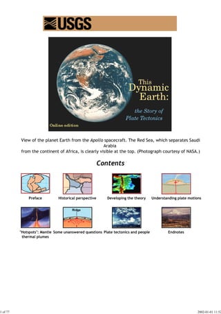
  • 1. View of the planet Earth from the Apollo spacecraft. The Red Sea, which separates Saudi Arabia from the continent of Africa, is clearly visible at the top. (Photograph courtesy of NASA.) Contents Preface Historical perspective Developing the theory Understanding plate motions "Hotspots": Mantle Some unanswered questions Plate tectonics and people Endnotes thermal plumes 1 of 77 2002-01-01 11:52
  • 2. This pdf-version was edited by Peter Lindeberg in December 2001. Any deviation from the original text is non-intentional. This book was originally published in paper form in February 1996 (design and coordination by Martha Kiger; illustrations and production by Jane Russell). It is for sale for $7 from: U.S. Government Printing Office Superintendent of Documents, Mail Stop SSOP Washington, DC 20402-9328 or it can be ordered directly from the U.S. Geological Survey: Call toll-free 1-888-ASK-USGS Or write to USGS Information Services Box 25286, Building 810 Denver Federal Center Denver, CO 80225 303-202-4700; Fax 303-202-4693 ISBN 0-16-048220-8 Version 1.08 The online edition contains all text from the original book in its entirety. Some figures have been modified to enhance legibility at screen resolutions. Many of the images in this book are available in high resolution from the USGS Media for Science page. USGS Home Page URL: http://pubs.usgs.gov/publications/text/dynamic.html Last updated: 01.29.01 Contact: jmwatson@usgs.gov 2 of 77 2002-01-01 11:52
  • 3. In the early 1960s, the emergence of the theory of plate tectonics started a revolution in the earth sciences. Since then, scientists have verified and refined this theory, and now have a much better understanding of how our planet has been shaped by plate-tectonic processes. We now know that, directly or indirectly, plate tectonics influences nearly all geologic processes, past and present. Indeed, the notion that the entire Earth's surface is continually shifting has profoundly changed the way we view our world. People benefit from, and are at the mercy of, the forces and consequences of plate tectonics. With little or no warning, an earthquake or volcanic eruption can unleash bursts of energy far more powerful than anything we can generate. While we have no control over plate-tectonic processes, we now have the knowledge to learn from them. The more we know about plate tectonics, the better we can appreciate the grandeur and beauty of the land upon which we live, as well as the occasional violent displays of the Earth's awesome power. This booklet gives a brief introduction to the concept of plate tectonics and complements the visual and written information in This Dynamic Planet (see Further reading), a map published in 1994 by the U.S. Geological Survey (USGS) and the Smithsonian Institution. The booklet highlights some of the people and discoveries that advanced the development of the theory and traces its progress since its proposal. Although the general idea of plate tectonics is now widely accepted, many aspects still continue to confound and challenge scientists. The earth-science revolution launched by the theory of plate tectonics is not finished. Oldoinyo Lengai, an active volcano in the East African Rift Zone, where Africa is being pulled apart by plate-tectonic processes. (Photograph by Jorg Keller, Albert-Ludwigs-Universität Freiburg, Germany.) In geologic terms, a plate is a large, rigid slab of solid rock. The word tectonics comes from 3 of 77 2002-01-01 11:52
  • 4. the Greek root "to build." Putting these two words together, we get the term plate tectonics, which refers to how the Earth's surface is built of plates. The theory of plate tectonics states that the Earth's outermost layer is fragmented into a dozen or more large and small plates that are moving relative to one another as they ride atop hotter, more mobile material. Before the advent of plate tectonics, however, some people already believed that the present-day continents were the fragmented pieces of preexisting larger landmasses ("supercontinents"). The diagrams below show the break-up of the supercontinent Pangaea (meaning "all lands" in Greek), which figured prominently in the theory of continental drift -- the forerunner to the theory of plate tectonics. According to the continental drift theory, the supercontinent Pangaea began to break up about 225-200 million years ago, eventually fragmenting into the continents as we know them today. 4 of 77 2002-01-01 11:52
  • 5. Plate tectonics is a relatively new scientific concept, introduced some 30 years ago, but it has revolutionized our understanding of the dynamic planet upon which we live. The theory has unified the study of the Earth by drawing together many branches of the earth sciences, from paleontology (the study of fossils) to seismology (the study of earthquakes). It has provided explanations to questions that scientists had speculated upon for centuries -- such as why earthquakes and volcanic eruptions occur in very specific areas around the world, and how and why great mountain ranges like the Alps and Himalayas formed. Why is the Earth so restless? What causes the ground to shake violently, volcanoes to erupt with explosive force, and great mountain ranges to rise to incredible heights? Scientists, philosophers, and theologians have wrestled with questions such as these for centuries. Until the 1700s, most Europeans thought that a Biblical Flood played a major role in shaping the Earth's surface. This way of thinking was known as "catastrophism," and geology (the study of the Earth) was based on the belief that all earthly changes were sudden and caused by a series of catastrophes. However, by the mid-19th century, catastrophism gave way to "uniformitarianism," a new way of thinking centered around the "Uniformitarian Principle" proposed in 1785 by James Hutton, a Scottish geologist. This principle is commonly stated as follows: The present is the key to the past. Those holding this viewpoint assume that the geologic forces and processes -- gradual as well as catastrophic -- acting on the Earth today are the same as those that have acted in the geologic past. The layer of the the Earth we live on is broken into a dozen or so rigid slabs (called tectonic plates by geologists) that are moving relative to one another. The belief that continents have not always been fixed in their present positions was suspected 5 of 77 2002-01-01 11:52
  • 6. long before the 20th century; this notion was first suggested as early as 1596 by the Dutch map maker Abraham Ortelius in his work Thesaurus Geographicus. Ortelius suggested that the Americas were "torn away from Europe and Africa . . . by earthquakes and floods" and went on to say: "The vestiges of the rupture reveal themselves, if someone brings forward a map of the world and considers carefully the coasts of the three [continents]." Ortelius' idea surfaced again in the 19th century. However, it was not until 1912 that the idea of moving continents was seriously considered as a full-blown scientific theory -- called Continental Drift -- introduced in two articles published by a 32-year-old German meteorologist named Alfred Lothar Wegener. He contended that, around 200 million years ago, the supercontinent Pangaea began to split apart. Alexander Du Toit, Professor of Geology at Johannesburg University and one of Wegener's staunchest supporters, proposed that Pangaea first broke into two large continental landmasses, Laurasia in the northern hemisphere and Gondwanaland in the southern hemisphere. Laurasia and Gondwanaland then continued to break apart into the various smaller continents that exist today. In 1858, geographer Antonio Snider-Pellegrini made these two maps showing his version of how the American and African continents may once have fit together, then later separated. Left: The formerly joined continents before (avant) their separation. Right: The continents after (aprés) the separation. (Reproductions of the original maps courtesy of University of California, Berkeley.) Wegener's theory was based in part on what appeared to him to be the remarkable fit of the South American and African continents, first noted by Abraham Ortelius three centuries earlier. Wegener was also intrigued by the occurrences of unusual geologic structures and of plant and animal fossils found on the matching coastlines of South America and Africa, which are now widely separated by the Atlantic Ocean. He reasoned that it was physically impossible for most of these organisms to have swum or have been transported across the vast oceans. To him, the presence of identical fossil species along the coastal parts of Africa and South America was the most compelling evidence that the two continents were once joined. In Wegener's mind, the drifting of continents after the break-up of Pangaea explained not only the matching fossil occurrences but also the evidence of dramatic climate changes on some continents. For example, the discovery of fossils of tropical plants (in the form of coal deposits) in Antarctica led to the conclusion that this frozen land previously must have been situated closer to the equator, in a more temperate climate where lush, swampy vegetation could grow. Other mismatches of geology and climate included distinctive fossil ferns 6 of 77 2002-01-01 11:52
  • 7. (Glossopteris) discovered in now-polar regions, and the occurrence of glacial deposits in present-day arid Africa, such as the Vaal River valley of South Africa. The theory of continental drift would become the spark that ignited a new way of viewing the Earth. But at the time Wegener introduced his theory, the scientific community firmly believed the continents and oceans to be permanent features on the Earth's surface. Not surprisingly, his proposal was not well received, even though it seemed to agree with the scientific information available at the time. A fatal weakness in Wegener's theory was that it could not satisfactorily answer the most fundamental question raised by his critics: What kind of forces could be strong enough to move such large masses of solid rock over such great distances? Wegener suggested that the continents simply plowed through the ocean floor, but Harold Jeffreys, a noted English geophysicist, argued correctly that it was physically impossible for a large mass of solid rock to plow through the ocean floor without breaking up. As noted by Snider-Pellegrini and Wegener, the locations of certain fossil plants and animals on present-day, widely separated continents would form definite patterns (shown by the bands of colors), if the continents are rejoined. Undaunted by rejection, Wegener devoted the rest of his life to doggedly pursuing additional evidence to defend his theory. He froze to death in 1930 during an expedition crossing the Greenland ice cap, but the controversy he spawned raged on. However, after his death, new evidence from ocean floor exploration and other studies rekindled interest in Wegener's theory, ultimately leading to the development of the theory of plate tectonics. Plate tectonics has proven to be as important to the earth sciences as the discovery of the 7 of 77 2002-01-01 11:52
  • 8. structure of the atom was to physics and chemistry and the theory of evolution was to the life sciences. Even though the theory of plate tectonics is now widely accepted by the scientific community, aspects of the theory are still being debated today. Ironically, one of the chief outstanding questions is the one Wegener failed to resolve: What is the nature of the forces propelling the plates? Scientists also debate how plate tectonics may have operated (if at all) earlier in the Earth's history and whether similar processes operate, or have ever operated, on other planets in our solar system. | Inside the Earth | What is a tectonic plate? | Alfred Lothar Wegener | Polar dinosaurs in Australia? | Inside the Earth The size of the Earth -- about 12,750 kilometers (km) in diameter-was known by the ancient Greeks, but it was not until the turn of the 20th century that scientists determined that our planet is made up of three main layers: crust, mantle, and core. This layered structure can be compared to that of a boiled egg. The crust, the outermost layer, is rigid and very thin compared with the other two. Beneath the oceans, the crust varies little in thickness, generally extending only to about 5 km. The thickness of the crust beneath continents is much more variable but averages about 30 km; under large mountain ranges, such as the Alps or the Sierra Nevada, however, the base of the crust can be as deep as 100 km. Like the shell of an egg, the Earth's crust is brittle and can break. Cutaway views showing the internal structure of the Earth. Below: This view drawn to scale demonstrates that the Earth's crust literally is only skin deep. Below right: A view not drawn to scale to show the Earth's three main layers (crust, mantle, and core) in more detail (see text). 8 of 77 2002-01-01 11:52
  • 9. Below the crust is the mantle, a dense, hot layer of semi-solid rock approximately 2,900 km thick. The mantle, which contains more iron, magnesium, and calcium than the crust, is hotter and denser because temperature and pressure inside the Earth increase with depth. As a comparison, the mantle might be thought of as the white of a boiled egg. At the center of the Earth lies the core, which is nearly twice as dense as the mantle because its composition is metallic (iron-nickel alloy) rather than stony. Unlike the yolk of an egg, however, the Earth's core is actually made up of two distinct parts: a 2,200 km-thick liquid outer core and a 1,250 km-thick solid inner core. As the Earth rotates, the liquid outer core spins, creating the Earth's magnetic field. Not surprisingly, the Earth's internal structure influences plate tectonics. The upper part of the mantle is cooler and more rigid than the deep mantle; in many ways, it behaves like the overlying crust. Together they form a rigid layer of rock called the lithosphere (from lithos, Greek for stone). The lithosphere tends to be thinnest under the oceans and in volcanically active continental areas, such as the Western United States. Averaging at least 80 km in thickness over much of the Earth, the lithosphere has been broken up into the moving plates that contain the world's continents and oceans. Scientists believe that below the lithosphere is a relatively narrow, mobile zone in the mantle called the asthenosphere (from asthenes, Greek for weak). This zone is composed of hot, semi-solid material, which can soften and flow after being subjected to high temperature and pressure over geologic time. The rigid lithosphere is thought to "float" or move about on the slowly flowing asthenosphere. What is a tectonic plate? A tectonic plate (also called lithospheric plate) is a massive, irregularly shaped slab of solid rock, generally composed of both continental and oceanic lithosphere. Plate size can vary greatly, from a few hundred to thousands of kilometers across; the Pacific and Antarctic Plates are among the largest. Plate thickness also varies greatly, ranging from less than 15 km for young oceanic lithosphere to about 200 km or more for ancient continental lithosphere (for example, the interior parts of North and South America). How do these massive slabs of solid rock float despite their tremendous weight? The answer lies in the composition of the rocks. Continental crust is composed of granitic rocks which are made up of relatively lightweight minerals such as quartz and feldspar. By contrast, oceanic crust is composed of basaltic rocks, which are much denser and heavier. The variations in plate thickness are nature's way of partly compensating for the imbalance in the weight and density of the two types of crust. Because continental rocks are much lighter, the crust under the continents is much thicker (as much as 100 km) whereas the crust under the oceans is generally only about 5 km thick. Like icebergs, only the tips of which are visible above water, continents have deep "roots" to support their elevations. 9 of 77 2002-01-01 11:52
  • 10. Most of the boundaries between individual plates cannot be seen, because they are hidden beneath the oceans. Yet oceanic plate boundaries can be mapped accurately from outer space by measurements from GEOSAT satellites. Earthquake and volcanic activity is concentrated near these boundaries. Tectonic plates probably developed very early in the Earth's 4.6-billion-year history, and they have been drifting about on the surface ever since-like slow-moving bumper cars repeatedly clustering together and then separating. Like many features on the Earth's surface, plates change over time. Those composed partly or entirely of oceanic lithosphere can sink under another plate, usually a lighter, mostly continental plate, and eventually disappear completely. This process is happening now off the coast of Oregon and Washington. The small Juan de Fuca Plate, a remnant of the formerly much larger oceanic Farallon Plate, will someday be entirely consumed as it continues to sink beneath the North American Plate. 10 of 77 2002-01-01 11:52
  • 11. These four diagrams illustrate the shrinking of the formerly very large Farallon Plate, as it was progressively consumed beneath the North American and Caribbean Plates, leaving only the present-day Juan de Fuca, Rivera, and Cocos Plates as small remnants (see text). Large solid arrows show the present-day sense of relative movement between the Pacific and North American Plates. (Modified from USGS Professional Paper 1515). Alfred Lothar Wegener: Moving continents Perhaps Alfred Wegener's greatest contribution to the scientific world was his ability to weave seemingly dissimilar, unrelated facts into a theory, which was remarkably visionary for the time. Wegener was one of the first to realize that an understanding of how the Earth works required input and knowledge from all the earth sciences. Wegener's scientific vision sharpened in 1914 as he was recuperating in a military hospital from an injury suffered as a German soldier during World War I. While bed-ridden, he had ample time to develop an idea that had intrigued him for years. Like others before him, Wegener had been struck by the remarkable fit of the coastlines of South America and Africa. But, unlike the others, to support his theory Wegener sought out many other lines of geologic and paleontologic evidence that these two continents were once joined. During his long convalescence, Wegener was able to fully develop his ideas into the Theory of Continental Drift, detailed in a book titled Die Entstehung der Kontinente und Ozeane (in German, The Origin of Continents and Oceans) published in 1915. Alfred Lothar Wegener (1880-1930), the originator of the theory of continental drift. (Photograph courtesy of the Alfred Wegener Institute for Polar and Marine Research, Bremerhaven, Germany.) Wegener obtained his doctorate in planetary astronomy in 1905 but soon became interested in 11 of 77 2002-01-01 11:52
  • 12. meteorology; during his lifetime, he participated in several meteorologic expeditions to Greenland. Tenacious by nature, Wegener spent much of his adult life vigorously defending his theory of continental drift, which was severely attacked from the start and never gained acceptance in his lifetime. Despite overwhelming criticism from most leading geologists, who regarded him as a mere meteorologist and outsider meddling in their field, Wegener did not back down but worked even harder to strengthen his theory. A couple of years before his death, Wegener finally achieved one of his lifetime goals: an academic position. After a long but unsuccessful search for a university position in his native Germany, he accepted a professorship at the University of Graz in Austria. Wegener's frustration and long delay in gaining a university post perhaps stemmed from his broad scientific interests. As noted by Johannes Georgi, Wegener's longtime friend and colleague, "One heard time and again that he had been turned down for a certain chair because he was interested also, and perhaps to a greater degree, in matters that lay outside its terms of reference -- as if such a man would not have been worthy of any chair in the wide realm of world science." Ironically, shortly after achieving his academic goal, Wegener died on a meteorologic expedition to Greenland. Georgi had asked Wegener to coordinate an expedition to establish a winter weather station to study the jet stream (storm track) in the upper atmosphere. Wegener reluctantly agreed. After many delays due to severe weather, Wegener and 14 others set out for the winter station in September of 1930 with 15 sledges and 4,000 pounds of supplies. The extreme cold turned back all but one of the 13 Greenlanders, but Wegener was determined to push on to the station, where he knew the supplies were desperately needed by Georgi and the other researchers. Travelling under frigid conditions, with temperatures as low as minus 54 °C, Wegener reached the station five weeks later. Wanting to return home as soon as possible, he insisted upon starting back to the base camp the very next morning. But he never made it; his body was found the next summer. Alfred Wegener (left) and an Innuit guide on 1 November 1930 during his final meteorological expedition in Greenland. This is one of the last photographs of Wegener, who died later during the expedition (see text). (Photograph courtesy of the Alfred Wegener Institute for Polar and Marine Research, Bremerhaven, Germany.) Wegener was still an energetic, brilliant researcher when he died at the age of 50. A year 12 of 77 2002-01-01 11:52
  • 13. before his untimely death, the fourth revised edition (1929) of his classic book was published; in this edition, he had already made the significant observation that shallower oceans were geologically younger. Had he not died in 1930, Wegener doubtless would have pounced upon the new Atlantic bathymetric data just acquired by the German research vessel Meteor in the late 1920s. These data showed the existence of a central valley along much of the crest of the Mid-Atlantic Ridge. Given his fertile mind, Wegener just possibly might have recognized the shallow Mid-Atlantic Ridge as a geologically young feature resulting from thermal expansion, and the central valley as a rift valley resulting from stretching of the oceanic crust. From stretched, young crust in the middle of the ocean to seafloor spreading and plate tectonics would have been short mental leaps for a big thinker like Wegener. This conjectural scenario by Dr. Peter R. Vogt (U.S. Naval Research Laboratory, Washington, D.C.), an acknowledged expert on plate tectonics, implies that "Wegener probably would have been part of the plate-tectonics revolution, if not the actual instigator, had he lived longer." In any case, many of Wegener's ideas clearly served as the catalyst and framework for the development of the theory of plate tectonics three decades later. Polar dinosaurs in Australia? As a meteorologist, Alfred Wegener was fascinated by questions such as: Why do coal deposits, a relic of lush ancient forests, occur in the icy barrenness of Antarctica? And why are glacial deposits found in now sweltering tropical Africa? Wegener reasoned that such anomalies could be explained if these two present-day continents -- together with South America, India, and Australia -- originally were part of a supercontinent that extended from the equator to the South Pole and encompassed a wide range of climatic and geologic environments. The break-up of Pangaea and subsequent movement of the individual continents to their present positions formed the basis for Wegener's continental drift theory. Recently, paleontologists (specialists in studies of fossils) have carefully studied some well-preserved dinosaur remains unearthed at Dinosaur Cove, at the southeastern tip of mainland Australia. Dinosaurs found in most other parts of the world are believed to have lived in temperate or tropical regions, but these Australian species, popularly called "polar" dinosaurs, seemed well adapted to cooler temperature conditions. They apparently had keen night vision and were warm-blooded, enabling them to forage for food during long winter nights, at freezing or sub-freezing temperatures. 13 of 77 2002-01-01 11:52
  • 14. This scene -- from a mini-sheet of postage stamps featuring Australian dinosaurs-- shows some of the warm-blooded dinosaurs that thrived in the Dinosaur Cove area under the polar weather conditions that prevailed during the Early Cretaceous (100 - 125 million years ago). (Original artwork by Peter Trusler; reproduced with permission of the Australia Post.) The last of the dinosaurs became extinct during a period of sharp global cooling toward the end of the Cretaceous period (about 65 million years ago). One current theory contends that the impact of one or more large comets or asteroids was responsible for the cooling trend ("impact winter") that killed off the dinosaurs; another theory attributes the sudden cooling to global climate change brought on by a series of huge volcanic eruptions over a short period of time ("volcanic winter"). The discovery of the polar dinosaurs clearly suggests that they survived the volcanic winter that apparently killed other dinosaur species. This then raises an intriguing question: Why did they become extinct if they were well adapted to a cold climate? Paleontologists do not have the answers. Regardless, this recently acquired paleontologic evidence convincingly demonstrates that Australia has drifted north toward the equator during the past 100 million years. At the time when the Australian polar dinosaurs thrived, their habitat was much farther south, well within the Antarctic Circle. In 1991, paleontologists discovered the Cryolophosaurus ellioti, a previously unknown dinosaur species and the only one found on the continent of Antarctica. Cryolophosaurus fossils were found at Mount Kirkpatrick, located only 600 km from the present-day South Pole. This newly discovered carnivorous dinosaur probably was similar in appearance to the Allosaurus (see artwork above), except for a distinctive bony crest on its head, another meat-eating species found at Dinosaur Cove, Australia. Studies show that the Cryolophosaurus lived about 200 millions years ago, when Antarctica was still part of Gondwana and had a climate similar to that of Pacific Northwest--mild enough to support large plant-eating animal life, upon which the Cryolophosaurus preyed. With the break-up of Gondwana, Allosaurus and Cryolophosaurus parted company, as Australia drifted northward toward the equator and Antarctica drifted southward to the South Pole. Had the Australian polar dinosaurs and the Cryolophosaurus been discovered while he was alive, the embattled Alfred Wegener would have been delighted! 14 of 77 2002-01-01 11:52
  • 15. Approximately 100 million years ago, the Dinosaur Cove area (small red outlined boxes) at the southern end of Australia was well within the Antarctic Circle, more than 40 degrees closer to the South Pole than it is today. Continental drift was hotly debated off and on for decades following Wegener's death before it was largely dismissed as being eccentric, preposterous, and improbable. However, beginning in the 1950s, a wealth of new evidence emerged to revive the debate about Wegener's provocative ideas and their implications. In particular, four major scientific developments spurred the formulation of the plate-tectonics theory: (1) demonstration of the ruggedness and youth of the ocean floor; (2) confirmation of repeated reversals of the Earth magnetic field in the geologic past; (3) emergence of the seafloor-spreading hypothesis and associated recycling of oceanic crust; and (4) precise documentation that the world's earthquake and volcanic activity is concentrated along oceanic trenches and submarine mountain ranges. Ocean floor mapping About two thirds of the Earth's surface lies beneath the oceans. Before the 19th century, the depths of the open ocean were largely a matter of speculation, and most people thought that the ocean floor was relatively flat and featureless. However, as early as the 16th century, a few intrepid navigators, by taking soundings with hand lines, found that the open ocean can differ considerably in depth, showing that the ocean floor was not as flat as generally believed. Oceanic exploration during the next centuries dramatically improved our knowledge of the ocean floor. We now know that most of the geologic processes occurring on land are linked, directly or indirectly, to the dynamics of the ocean floor. 15 of 77 2002-01-01 11:52
  • 16. "Modern" measurements of ocean depths greatly increased in the 19th century, when deep-sea line soundings (bathymetric surveys) were routinely made in the Atlantic and Caribbean. In 1855, a bathymetric chart published by U.S. Navy Lieutenant Matthew Maury revealed the first evidence of underwater mountains in the central Atlantic (which he called "Middle Ground"). This was later confirmed by survey ships laying the trans-Atlantic telegraph cable. Our picture of the ocean floor greatly sharpened after World War I (1914-18), when echo-sounding devices -- primitive sonar systems -- began to measure ocean depth by recording the time it took for a sound signal (commonly an electrically generated "ping") from the ship to bounce off the ocean floor and return. Time graphs of the returned signals revealed that the ocean floor was much more rugged than previously thought. Such echo-sounding measurements clearly demonstrated the continuity and roughness of the submarine mountain chain in the central Atlantic (later called the Mid-Atlantic Ridge) suggested by the earlier bathymetric measurements. The mid-ocean ridge (shown in red) winds its way between the continents much like the seam on a baseball. In 1947, seismologists on the U.S. research ship Atlantis found that the sediment layer on the floor of the Atlantic was much thinner than originally thought. Scientists had previously believed that the oceans have existed for at least 4 billion years, so therefore the sediment layer should have been very thick. Why then was there so little accumulation of sedimentary rock and debris on the ocean floor? The answer to this question, which came after further exploration, would prove to be vital to advancing the concept of plate tectonics. 16 of 77 2002-01-01 11:52
  • 17. Computer-generated detailed topographic map of a segment of the Mid-Oceanic Ridge. "Warm" colors (yellow to red) indicate the ridge rising above the seafloor, and the "cool" colors (green to blue) represent lower elevations. This image (at latitude 9° north) is of a small part of the East Pacific Rise. (Imagery courtesy of Stacey Tighe, University of Rhode Island.) In the 1950s, oceanic exploration greatly expanded. Data gathered by oceanographic surveys conducted by many nations led to the discovery that a great mountain range on the ocean floor virtually encircled the Earth. Called the global mid-ocean ridge, this immense submarine mountain chain -- more than 50,000 kilometers (km) long and, in places, more than 800 km across -- zig-zags between the continents, winding its way around the globe like the seam on a baseball. Rising an average of about 4,500 meters(m) above the sea floor, the mid-ocean ridge overshadows all the mountains in the United States except for Mount McKinley (Denali) in Alaska (6,194 m). Though hidden beneath the ocean surface, the global mid-ocean ridge system is the most prominent topographic feature on the surface of our planet. Magnetic striping and polar reversals Beginning in the 1950s, scientists, using magnetic instruments (magnetometers) adapted from airborne devices developed during World War II to detect submarines, began recognizing odd magnetic variations across the ocean floor. This finding, though unexpected, was not entirely surprising because it was known that basalt -- the iron-rich, volcanic rock making up the ocean floor-- contains a strongly magnetic mineral (magnetite) and can locally distort compass readings. This distortion was recognized by Icelandic mariners as early as the late 18th century. More important, because the presence of magnetite gives the basalt measurable magnetic properties, these newly discovered magnetic variations provided another means to study the deep ocean floor. 17 of 77 2002-01-01 11:52
  • 18. A theoretical model of the formation of magnetic striping. New oceanic crust forming continuously at the crest of the mid-ocean ridge cools and becomes increasingly older as it moves away from the ridge crest with seafloor spreading (see text): a. the spreading ridge about 5 million years ago; b. about 2 to 3 million years ago; and c. present-day. Early in the 20th century, paleomagnetists (those who study the Earth's ancient magnetic field) -- such as Bernard Brunhes in France (in 1906) and Motonari Matuyama in Japan (in the 1920s) -- recognized that rocks generally belong to two groups according to their magnetic properties. One group has so-called normal polarity, characterized by the magnetic minerals in the rock having the same polarity as that of the Earth's present magnetic field. This would result in the north end of the rock's "compass needle" pointing toward magnetic north. The other group, however, has reversed polarity, indicated by a polarity alignment opposite to that of the Earth's present magnetic field. In this case, the north end of the rock's compass needle would point south. How could this be? This answer lies in the magnetite in volcanic rock. Grains of magnetite -- behaving like little magnets -- can align themselves with the orientation of the Earth's magnetic field. When magma (molten rock containing minerals and gases) cools to form solid volcanic rock, the alignment of the magnetite grains is "locked in," recording the Earth's magnetic orientation or polarity (normal or reversed) at the time of cooling. 18 of 77 2002-01-01 11:52
  • 19. The center part of the figure -- representing the deep ocean floor with the sea magically removed -- shows the magnetic striping (see text) mapped by oceanographic surveys offshore of the Pacific Northwest. Thin black lines show transform faults (discussed later) that offset the striping. As more and more of the seafloor was mapped during the 1950s, the magnetic variations turned out not to be random or isolated occurrences, but instead revealed recognizable patterns. When these magnetic patterns were mapped over a wide region, the ocean floor showed a zebra-like pattern. Alternating stripes of magnetically different rock were laid out in rows on either side of the mid-ocean ridge: one stripe with normal polarity and the adjoining stripe with reversed polarity. The overall pattern, defined by these alternating bands of normally and reversely polarized rock, became known as magnetic striping. Seafloor spreading and recycling of oceanic crust The discovery of magnetic striping naturally prompted more questions: How does the 19 of 77 2002-01-01 11:52
  • 20. magnetic striping pattern form? And why are the stripes symmetrical around the crests of the mid-ocean ridges? These questions could not be answered without also knowing the significance of these ridges. In 1961, scientists began to theorize that mid-ocean ridges mark structurally weak zones where the ocean floor was being ripped in two lengthwise along the ridge crest. New magma from deep within the Earth rises easily through these weak zones and eventually erupts along the crest of the ridges to create new oceanic crust. This process, later called seafloor spreading, operating over many millions of years has built the 50,000 km-long system of mid-ocean ridges. This hypothesis was supported by several lines of evidence: (1) at or near the crest of the ridge, the rocks are very young, and they become progressively older away from the ridge crest; (2) the youngest rocks at the ridge crest always have present-day (normal) polarity; and (3) stripes of rock parallel to the ridge crest alternated in magnetic polarity (normal-reversed-normal, etc.), suggesting that the Earth's magnetic field has flip-flopped many times. By explaining both the zebralike magnetic striping and the construction of the mid-ocean ridge system, the seafloor spreading hypothesis quickly gained converts and represented another major advance in the development of the plate-tectonics theory. Furthermore, the oceanic crust now came to be appreciated as a natural "tape recording" of the history of the reversals in the Earth's magnetic field. Additional evidence of seafloor spreading came from an unexpected source: petroleum exploration. In the years following World War II, continental oil reserves were being depleted rapidly and the search for offshore oil was on. To conduct offshore exploration, oil companies built ships equipped with a special drilling rig and the capacity to carry many kilometers of drill pipe. This basic idea later was adapted in constructing a research vessel, named the Glomar Challenger, designed specifically for marine geology studies, including the collection of drill-core samples from the deep ocean floor. In 1968, the vessel embarked on a year-long scientific expedition, criss-crossing the Mid-Atlantic Ridge between South America and Africa and drilling core samples at specific locations. When the ages of the samples were determined by paleontologic and isotopic dating studies, they provided the clinching evidence that proved the seafloor spreading hypothesis. Above: The Glomar Challenger was the first research vessel specifically designed in the late 20 of 77 2002-01-01 11:52
  • 21. 1960s for the purpose of drilling into and taking core samples from the deep ocean floor. Below: The JOIDES Resolution is the deep-sea drilling ship of the 1990s (JOIDES= Joint Oceanographic Institutions for Deep Earth Sampling). This ship, which carries more than 9,000 m of drill pipe, is capable of more precise positioning and deeper drilling than the Glomar Challenger. (Photographs courtesy of Ocean Drilling Program, Texas A & M University.) A profound consequence of seafloor spreading is that new crust was, and is now, being continually created along the oceanic ridges. This idea found great favor with some scientists who claimed that the shifting of the continents can be simply explained by a large increase in size of the Earth since its formation. However, this so-called "expanding Earth" hypothesis was unsatisfactory because its supporters could offer no convincing geologic mechanism to produce such a huge, sudden expansion. Most geologists believe that the Earth has changed little, if at all, in size since its formation 4.6 billion years ago, raising a key question: how can new crust be continuously added along the oceanic ridges without increasing the size of the Earth? This question particularly intrigued Harry H. Hess, a Princeton University geologist and a Naval Reserve Rear Admiral, and Robert S. Dietz, a scientist with the U.S. Coast and Geodetic Survey who first coined the term seafloor spreading. Dietz and Hess were among the small handful who really understood the broad implications of sea floor spreading. If the Earth's crust was expanding along the oceanic ridges, Hess reasoned, it must be shrinking elsewhere. He suggested that new oceanic crust continuously spread away from the ridges in a conveyor belt-like motion. Many millions of years later, the oceanic crust eventually descends into the oceanic trenches -- very deep, narrow canyons along the rim of the Pacific Ocean basin. According to Hess, the Atlantic Ocean was expanding while the Pacific Ocean was shrinking. As old oceanic crust was consumed in the trenches, new magma rose and erupted along the spreading ridges to form new crust. In effect, the ocean basins were perpetually being "recycled," with the creation of new crust and the destruction of old oceanic lithosphere occurring simultaneously. Thus, Hess' ideas neatly explained why the Earth does not get bigger with sea floor spreading, why there is so little sediment accumulation on the ocean 21 of 77 2002-01-01 11:52
  • 22. floor, and why oceanic rocks are much younger than continental rocks. Concentration of earthquakes During the 20th century, improvements in seismic instrumentation and greater use of earthquake-recording instruments (seismographs) worldwide enabled scientists to learn that earthquakes tend to be concentrated in certain areas, most notably along the oceanic trenches and spreading ridges. By the late 1920s, seismologists were beginning to identify several prominent earthquake zones parallel to the trenches that typically were inclined 40-60° from the horizontal and extended several hundred kilometers into the Earth. These zones later became known as Wadati-Benioff zones, or simply Benioff zones, in honor of the seismologists who first recognized them, Kiyoo Wadati of Japan and Hugo Benioff of the United States. The study of global seismicity greatly advanced in the 1960s with the establishment of the Worldwide Standardized Seismograph Network (WWSSN) to monitor the compliance of the 1963 treaty banning above-ground testing of nuclear weapons. The much-improved data from the WWSSN instruments allowed seismologists to map precisely the zones of earthquake concentration worldwide. As early as the 1920s, scientists noted that earthquakes are concentrated in very specific narrow zones (see text). In 1954, French seismologist J.P. Rothé published this map showing the concentration of earthquakes along the zones indicated by dots and cross-hatched areas. (Original illustration reproduced with permission of the Royal Society of London.) 22 of 77 2002-01-01 11:52
  • 23. But what was the significance of the connection between earthquakes and oceanic trenches and ridges? The recognition of such a connection helped confirm the seafloor-spreading hypothesis by pin-pointing the zones where Hess had predicted oceanic crust is being generated (along the ridges) and the zones where oceanic lithosphere sinks back into the mantle (beneath the trenches). | Magnetic Stripes and Isotopic Clocks | Harry Hammond Hess | Exploring the Deep Ocean Floor | Magnetic stripes and isotopic clocks Oceanographic exploration in the 1950s led to a much better understanding of the ocean floor. Among the new findings was the discovery of zebra stripe-like magnetic patterns for the rocks of the ocean floor. These patterns were unlike any seen for continental rocks. Obviously, the ocean floor had a story to tell, but what? In 1962, scientists of the U.S. Naval Oceanographic Office prepared a report summarizing available information on the magnetic stripes mapped for the volcanic rocks making up the ocean floor. After digesting the data in this report, along with other information, two young British geologists, Frederick Vine and Drummond Matthews, and also Lawrence Morley of the Canadian Geological Survey, suspected that the magnetic pattern was no accident. In 1963, they hypothesized that the magnetic striping was produced by repeated reversals of the Earth's magnetic field, not as earlier thought, by changes in intensity of the magnetic field or by other causes. Field reversals had already been demonstrated for magnetic rocks on the continents, and a logical next step was to see if these continental magnetic reversals might be correlated in geologic time with the oceanic magnetic striping. About the same time as these exciting discoveries were being made on the ocean floor, new techniques for determining the geologic ages of rocks ("dating") were also developing rapidly. 23 of 77 2002-01-01 11:52
  • 24. An observed magnetic profile (blue) for the ocean floor across the East Pacific Rise is matched quite well by a calculated profile (red) based on the Earth's magnetic reversals for the past 4 million years and an assumed constant rate of movement of ocean floor away from a hypothetical spreading center (bottom). The remarkable similarity of these two profiles provided one of the clinching arguments in support of the seafloor spreading hypothesis. A team of U.S. Geological Survey scientists -- geophysicists Allan Cox and Richard Doell, and isotope geochemist Brent Dalrymple -- reconstructed the history of magnetic reversals for the past 4 million years using a dating technique based on the isotopes of the chemical elements potassium and argon. The potassium-argon technique -- like other "isotopic clocks" -- works because certain elements, such as potassium, contain unstable, parent radioactive isotopes that decay at a steady rate over geologic time to produce daughter isotopes. The rate of decay is expressed in terms of an element's "half-life," the time it takes for half of the radioactive isotope of the element to decay. The decay of the radioactive potassium isotope (potassium-40) yields a stable daughter isotope (argon-40), which does not decay further. The age of a rock can be determined ("dated") by measuring the total amount of potassium in the rock, the amount of the remaining radioactive potassium-40 that has not decayed, and the amount of argon-40. Potassium is found in common rock-forming minerals, and because the potassium-40 isotope has a half-life of 1,310 million years, it can be used in dating rocks millions of years old. Other commonly used isotopic clocks are based on radioactive decay of certain isotopes of the elements uranium, thorium, strontium, and rubidium. However, it was the potassium-argon dating method that unlocked the riddle of the magnetic striping on the ocean floor and provided convincing evidence for the seafloor spreading hypothesis. Cox and his colleagues used this method to date continental volcanic rocks from around the world. They also measured the magnetic orientation of these same rocks, allowing them to assign ages to the Earth's recent magnetic reversals. In 1966, Vine and Matthews -- and also Morley working independently -- compared these known ages of magnetic reversals with the magnetic striping pattern found on the ocean floor. Assuming that the ocean floor moved away from the spreading center at a rate of several centimeters per year, they found there was a remarkable correlation between the ages of the Earth's magnetic reversals and the striping pattern. Following their break-through discovery, similar studies were repeated for other spreading centers. Eventually, scientists were able to date and correlate the magnetic 24 of 77 2002-01-01 11:52
  • 25. striping patterns for nearly all of the ocean floor, parts of which are as old as 180 million years. Harry Hammond Hess: Spreading the seafloor Harry Hess (1906-1969) in his Navy uniform as Captain of the assault transport Cape Johnson during World War II. After the war, he remained active in the Naval Reserve, reaching the rank of Rear Admiral. (Photograph courtesy of Department of Geological and Geophysical Sciences, Princeton University.) Harry Hammond Hess, a professor of geology at Princeton University, was very influential in setting the stage for the emerging plate-tectonics theory in the early 1960s. He believed in many of the observations Wegener used in defending his theory of continental drift, but he had very different views about large-scale movements of the Earth. Even while serving in the U.S. Navy during World War II, Hess was keenly interested in the geology of the ocean basins. In between taking part in the fighting in the Marianas, Leyte, Linguayan, and Iwo Jima, Hess -- with the cooperation of his crew -- was able to conduct echo-sounding surveys in the Pacific while cruising from one battle to the next. Building on the work of English geologist Arthur Holmes in the 1930s, Hess' research ultimately resulted in a ground-breaking hypothesis that later would be called seafloor spreading. In 1959, he informally presented this hypothesis in a manuscript that was widely circulated. Hess, like Wegener, ran into resistance because little ocean-floor data existed for testing his ideas. In 1962, these ideas were published in a paper titled "History of Ocean Basins," which was one of the most important contributions in the development of plate tectonics. In this classic paper, Hess outlined the basics of how seafloor spreading works: molten rock (magma) oozes up from the Earth's interior along the mid-oceanic ridges, creating new seafloor that spreads away from the active ridge crest and, eventually, sinks into the deep oceanic trenches. Hess' concept of a mobile seafloor explained several very puzzling geologic questions. If the oceans have existed for at least 4 billion years, as most geologists believed, why is there so little sediment deposited on the ocean floor? Hess reasoned that the sediment has been accumulating for about 300 million years at most. This interval is approximately the time needed for the ocean floor to move from the ridge crest to the trenches, where oceanic crust descends into the trench and is destroyed. Meanwhile, magma is continually rising along the mid-oceanic ridges, where the "recycling" process is completed by the creation of new oceanic crust. This recycling of the seafloor also explained why the oldest fossils found on the 25 of 77 2002-01-01 11:52
  • 26. seafloor are no more than about 180 million years old. In contrast, marine fossils in rock strata on land -- some of which are found high in the Himalayas, over 8,500 m above sea level -- can be considerably older. Most important, however, Hess' ideas also resolved a question that plagued Wegener's theory of continental drift: how do the continents move? Wegener had a vague notion that the continents must simply "plow" through the ocean floor, which his critics rightly argued was physically impossible. With seafloor spreading, the continents did not have to push through the ocean floor but were carried along as the ocean floor spread from the ridges. In 1962, Hess was well aware that solid evidence was still lacking to test his hypothesis and to convince a more receptive but still skeptical scientific community. But the Vine-Matthews explanation of magnetic striping of the seafloor a year later and additional oceanic exploration during subsequent years ultimately provided the arguments to confirm Hess' model of seafloor spreading. The theory was strengthened further when dating studies showed that the seafloor becomes older with distance away from the ridge crests. Finally, improved seismic data confirmed that oceanic crust was indeed sinking into the trenches, fully proving Hess' hypothesis, which was based largely on intuitive geologic reasoning. His basic idea of seafloor spreading along mid-oceanic ridges has well withstood the test of time. Hess, who served for years as the head of Princeton's Geology Department, died in 1969. Unlike Wegener, he was able to see his seafloor-spreading hypothesis largely accepted and confirmed as knowledge of the ocean floor increased dramatically during his lifetime. Like Wegener, he was keenly interested in other sciences in addition to geology. In recognition of his enormous stature worldwide, in 1962 Hess -- best known for his geologic research -- was appointed by President John F. Kennedy to the prestigious position of Chairman of the Space Science Board of the National Academy of Sciences. Thus, in addition to being a major force in the development of plate tectonics, Hess also played a prominent role in designing the nation's space program. Exploring the deep ocean floor: Hot springs and strange creatures The ocean floor is home to many unique communities of plants and animals. Most of these marine ecosystems are near the water surface, such as the Great Barrier Reef, a 2,000-km-long coral formation off the northeastern coast of Australia. Coral reefs, like nearly all complex living communities, depend on solar energy for growth (photosynthesis). The sun's energy, however, penetrates at most only about 300 m below the surface of the water. The relatively shallow penetration of solar energy and the sinking of cold, subpolar water combine to make most of the deep ocean floor a frigid environment with few life forms. In 1977, scientists discovered hot springs at a depth of 2.5 km, on the Galapagos Rift (spreading ridge) off the coast of Ecuador. This exciting discovery was not really a surprise. Since the early 1970s, scientists had predicted that hot springs (geothermal vents) should be found at the active spreading centers along the mid-oceanic ridges, where magma, at temperatures over 1,000 °C, presumably was being erupted to form new oceanic crust. More exciting, because it was totally unexpected, was the discovery of abundant and unusual sea life -- giant tube worms, huge clams, and mussels -- that thrived around the hot springs. 26 of 77 2002-01-01 11:52
  • 27. View of the first high-temperature vent (380 °C) ever seen by scientists during a dive of the deep-sea submersible Alvin on the East Pacific Rise (latitude 21° north) in 1979. Such geothermal vents--called smokers because they resemble chimneys--spew dark, mineral-rich, fluids heated by contact with the newly formed, still-hot oceanic crust. This photograph shows a black smoker, but smokers can also be white, grey, or clear depending on the material being ejected. (Photograph by Dudley Foster from RISE expedition, courtesy of William R. Normark, USGS.) Since 1977, other hot springs and associated sea life have been found at a number of sites along the mid-oceanic ridges, many on the East Pacific Rise. The waters around these deep-ocean hot springs, which can be as hot as 380 °C, are home to a unique ecosystem. Detailed studies have shown that hydrogen sulfide-oxidizing bacteria, which live symbiotically with the larger organisms, form the base of this ecosystem's food chain. The hydrogen sulfide (H2S--the gas that smells like rotten eggs) needed by these bacteria to live is contained in the volcanic gases that spew out of the hot springs. Most of the sulfur comes from the Earth's interior; a small portion (less than 15 percent) is produced by chemical reaction of the sulfate (SO4) present in the sea water. Thus, the energy source that sustains this deep-ocean ecosystem is not sunlight but rather the energy from chemical reaction (chemosynthesis). 27 of 77 2002-01-01 11:52
  • 28. The deep-sea hot-spring environment supports abundant and bizarre sea life, including tube worms, crabs, giant clams. This hot-spring "neighborhood" is at 13° N along the East Pacific Rise. (Photograph by Richard A. Lutz, Rutgers University, New Brunswick, New Jersey.) The manipulator arm of the research submersible Alvin collecting a giant clam from the deep ocean floor. (Photograph by John M. Edmond, Massachusetts Institute of Technology.) 28 of 77 2002-01-01 11:52
  • 29. The size of deep-sea giant clams is evident from the hands of a scientist holding them. (Photograph by William R. Normark, USGS.) But the story about the source of life-sustaining energy in the deep sea is still unfolding. In the late 1980s, scientists documented the existence of a dim glow at some of the hot geothermal vents, which are the targets of current intensive research. The occurrence of "natural" light on the dark seafloor has great significance, because it implies that photosynthesis may be possible at deep-sea geothermal vents. Thus, the base of the deep-sea ecosystem's food chain may comprise both chemosynthetic and, probably in small proportion, photosynthetic bacteria. 29 of 77 2002-01-01 11:52
  • 30. USGS scientist Jan Morton entering the submersible Alvin before its launch to begin a research dive. (Photograph by Randolph A. Koski, USGS.) The Alvin below water after the launch and en route to the deep seafloor. (Photograph courtesy of the Woods Hole Oceanographic Institution). A colony of tube worms, some as long as 1.5 m, clustered around an ocean floor hot spring. (Photograph by Daniel Fornari, Woods Hole Oceanographic Institution.) 30 of 77 2002-01-01 11:52
  • 31. Close-up of spider crab that was observed to be eating tube worms. (Photograph by William R. Normark, USGS.) Scientists discovered the hot-springs ecosystems with the help of Alvin, the world's first deep-sea submersible. Constructed in the early 1960s for the U.S. Navy, Alvin is a three-person, self-propelling capsule-like submarine nearly eight meters long. In 1975, scientists of Project FAMOUS (French-American Mid-Ocean Undersea Study) used Alvin to dive on a segment of the Mid-Atlantic Ridge in an attempt to make the first direct observation of seafloor spreading. No hot springs were observed on this expedition; it was during the next Alvin expedition, the one in 1977 to the Galapagos Rift, that the hot springs and strange creatures were discovered. Since the advent of Alvin, other manned submersibles have been built and used successfully to explore the deep ocean floor. Alvin has an operational maximum depth of about 4,000 m, more than four times greater than that of the deepest diving military submarine. Shinkai 6500, a Japanese research submarine built in 1989, can work at depths down to 6,400 m. The United States and Japan are developing research submersible systems that will be able to explore the ocean floor's deepest spot: the 10,920-m Challenger Deep at the southern end of the Marianas Trench off the Mariana Islands. Sketch of the Shinkai 6500, a Japanese vessel that is currently the world's deepest-diving manned research submarine. (Courtesy of Japan Marine Science & Technology Center.) Scientists now have a fairly good understanding of how the plates move and how such 31 of 77 2002-01-01 11:52
  • 32. movements relate to earthquake activity. Most movement occurs along narrow zones between plates where the results of plate-tectonic forces are most evident. There are four types of plate boundaries: Divergent boundaries -- where new crust is generated as the plates pull away from each other. Convergent boundaries -- where crust is destroyed as one plate dives under another. Transform boundaries -- where crust is neither produced nor destroyed as the plates slide horizontally past each other. Plate boundary zones -- broad belts in which boundaries are not well defined and the effects of plate interaction are unclear. Artist's cross section illustrating the main types of plate boundaries (see text); East African Rift Zone is a good example of a continental rift zone. (Cross section by José F. Vigil from This Dynamic Planet -- a wall map produced jointly by the U.S. Geological Survey, the Smithsonian Institution, and the U.S. Naval Research Laboratory.) Divergent boundaries Divergent boundaries occur along spreading centers where plates are moving apart and new crust is created by magma pushing up from the mantle. Picture two giant conveyor belts, facing each other but slowly moving in opposite directions as they transport newly formed oceanic crust away from the ridge crest. Perhaps the best known of the divergent boundaries is the Mid-Atlantic Ridge. This submerged mountain range, which extends from the Arctic Ocean to beyond the southern tip of Africa, is but one segment of the global mid-ocean ridge system that encircles the Earth. The rate of spreading along the Mid-Atlantic Ridge averages about 2.5 centimeters per year (cm/yr), or 25 km in a million years. This rate may seem slow by human standards, but because this 32 of 77 2002-01-01 11:52
  • 33. process has been going on for millions of years, it has resulted in plate movement of thousands of kilometers. Seafloor spreading over the past 100 to 200 million years has caused the Atlantic Ocean to grow from a tiny inlet of water between the continents of Europe, Africa, and the Americas into the vast ocean that exists today. The Mid-Atlantic Ridge, which splits nearly the entire Atlantic Ocean north to south, is probably the best-known and most-studied example of a divergent-plate boundary. (Illustration adapted from the map This Dynamic Planet.) 33 of 77 2002-01-01 11:52
  • 34. Map showing the Mid-Atlantic Ridge splitting Iceland and separating the North American and Eurasian Plates. The map also shows Reykjavik, the capital of Iceland, the Thingvellir area, and the locations of some of Iceland's active volcanoes (red triangles), including Krafla. The volcanic country of Iceland, which straddles the Mid-Atlantic Ridge, offers scientists a natural laboratory for studying on land the processes also occurring along the submerged parts of a spreading ridge. Iceland is splitting along the spreading center between the North American and Eurasian Plates, as North America moves westward relative to Eurasia. The consequences of plate movement are easy to see around Krafla Volcano, in the northeastern part of Iceland. Here, existing ground cracks have widened and new ones appear every few months. From 1975 to 1984, numerous episodes of rifting (surface cracking) took place along the Krafla fissure zone. Some of these rifting events were accompanied by volcanic activity; the ground would gradually rise 1-2 m before abruptly dropping, signalling an impending eruption. Between 1975 and 1984, the displacements caused by rifting totalled about 7 m. Lava fountains (10 m high) spouting from eruptive fissures during the October 1980 eruption of Krafla Volcano. (Photograph by Gudmundur E. Sigvaldason, Nordic Volcanological Institute, Reykjavik, Iceland.) 34 of 77 2002-01-01 11:52
  • 35. Aerial view of the area around Thingvellir, Iceland, showing a fissure zone (in shadow) that is an on-land exposure of the Mid-Atlantic Ridge. Left of the fissure, the North American Plate is pulling westward away from the Eurasian Plate (right of fissure). This photograph encompasses the historical tourist area of Thingvellir, the site of Iceland's first parliament, called the Althing, founded around the year A.D. 930. Large building (upper center) is a hotel for visitors. (Photograph by Oddur Sigurdsson, NationalEnergyAuthority,Iceland.) In East Africa, spreading processes have already torn Saudi Arabia away from the rest of the African continent, forming the Red Sea. The actively splitting African Plate and the Arabian Plate meet in what geologists call a triple junction, where the Red Sea meets the Gulf of Aden. A new spreading center may be developing under Africa along the East African Rift Zone. When the continental crust stretches beyond its limits, tension cracks begin to appear on the Earth's surface. Magma rises and squeezes through the widening cracks, sometimes to erupt and form volcanoes. The rising magma, whether or not it erupts, puts more pressure on the crust to produce additional fractures and, ultimately, the rift zone. 35 of 77 2002-01-01 11:52
  • 36. Map of East Africa showing some of the historically active volcanoes(red triangles) and the Afar Triangle (shaded, center) -- a so-called triple junction (or triple point), where three plates are pulling away from one another: the Arabian Plate, and the two parts of the African Plate (the Nubian and the Somalian) splitting along the East African Rift Zone. East Africa may be the site of the Earth's next major ocean. Plate interactions in the region provide scientists an opportunity to study first hand how the Atlantic may have begun to form about 200 million years ago. Geologists believe that, if spreading continues, the three plates that meet at the edge of the present-day African continent will separate completely, allowing the Indian Ocean to flood the area and making the easternmost corner of Africa (the Horn of Africa) a large island. Helicopter view (in February 1994) of the active lava lake within the summit crater of 'Erta 'Ale (Ethiopia), one of the active volcanoes in the East African Rift Zone. Two helmeted, red-suited volcanologists -- observing the activity from the crater rim -- provide scale. Red color within the crater shows where molten lava is breaking through the lava lake's solidified, black crust. (Photograph by 36 of 77 2002-01-01 11:52
  • 37. Jacques Durieux, Groupe Volcans Actifs.) Oldoinyo Lengai, another active volcano in the East African Rift Zone, erupts explosively in 1966. (Photograph by Gordon Davies, courtesy of Celia Nyamweru, St. Lawrence University, Canton, New York.) Convergent boundaries The size of the Earth has not changed significantly during the past 600 million years, and very likely not since shortly after its formation 4.6 billion years ago. The Earth's unchanging size implies that the crust must be destroyed at about the same rate as it is being created, as Harry Hess surmised. Such destruction (recycling) of crust takes place along convergent boundaries where plates are moving toward each other, and sometimes one plate sinks (is subducted) under another. The location where sinking of a plate occurs is called a subduction zone. The type of convergence -- called by some a very slow "collision" -- that takes place between plates depends on the kind of lithosphere involved. Convergence can occur between an oceanic and a largely continental plate, or between two largely oceanic plates, or between two largely continental plates. Oceanic-continental convergence If by magic we could pull a plug and drain the Pacific Ocean, we would see a most amazing sight -- a number of long narrow, curving trenches thousands of kilometers long and 8 to 10 km deep cutting into the ocean floor. Trenches are the deepest parts of the ocean floor and are created by subduction. Off the coast of South America along the Peru-Chile trench, the oceanic Nazca Plate is pushing into and being subducted under the continental part of the South American Plate. In turn, the overriding South American Plate is being lifted up, creating the towering Andes 37 of 77 2002-01-01 11:52
  • 38. mountains, the backbone of the continent. Strong, destructive earthquakes and the rapid uplift of mountain ranges are common in this region. Even though the Nazca Plate as a whole is sinking smoothly and continuously into the trench, the deepest part of the subducting plate breaks into smaller pieces that become locked in place for long periods of time before suddenly moving to generate large earthquakes. Such earthquakes are often accompanied by uplift of the land by as much as a few meters. The convergence of the Nazca and South American Plates has deformed and pushed up limestone strata to form towering peaks of the Andes, as seen here in the Pachapaqui mining area in Peru. (Photograph by George Ericksen, USGS.) On 9 June 1994, a magnitude-8.3 earthquake struck about 320 km northeast of La Paz, Bolivia, at a depth of 636 km. This earthquake, within the subduction zone between the Nazca Plate and the South American Plate, was one of deepest and largest subduction earthquakes recorded in South America. Fortunately, even though this powerful earthquake was felt as far away as Minnesota and Toronto, Canada, it caused no major damage because of its great depth. 38 of 77 2002-01-01 11:52
  • 39. Volcanic arcs and oceanic trenches partly encircling the Pacific Basin form the so-called Ring of Fire, a zone of frequent earthquakes and volcanic eruptions. The trenches are shown in blue-green. The volcanic island arcs, although not labelled, are parallel to, and always landward of, the trenches. For example, the island arc associated with the Aleutian Trench is represented by the long chain of volcanoes that make up the Aleutian Islands. Oceanic-continental convergence also sustains many of the Earth's active volcanoes, such as those in the Andes and the Cascade Range in the Pacific Northwest. The eruptive activity is clearly associated with subduction, but scientists vigorously debate the possible sources of magma: Is magma generated by the partial melting of the subducted oceanic slab, or the overlying continental lithosphere, or both? Oceanic-oceanic convergence As with oceanic-continental convergence, when two oceanic plates converge, one is usually subducted under the other, and in the process a trench is formed. The Marianas Trench (paralleling the Mariana Islands), for example, marks where the fast-moving Pacific Plate converges against the slower moving Philippine Plate. The Challenger Deep, at the southern end of the Marianas Trench, plunges deeper into the Earth's interior (nearly 11,000 m) than Mount Everest, the world's tallest mountain, rises above sea level (about 8,854 m). 39 of 77 2002-01-01 11:52
  • 40. Subduction processes in oceanic-oceanic plate convergence also result in the formation of volcanoes. Over millions of years, the erupted lava and volcanic debris pile up on the ocean floor until a submarine volcano rises above sea level to form an island volcano. Such volcanoes are typically strung out in chains called island arcs. As the name implies, volcanic island arcs, which closely parallel the trenches, are generally curved. The trenches are the key to understanding how island arcs such as the Marianas and the Aleutian Islands have formed and why they experience numerous strong earthquakes. Magmas that form island arcs are produced by the partial melting of the descending plate and/or the overlying oceanic lithosphere. The descending plate also provides a source of stress as the two plates interact, leading to frequent moderate to strong earthquakes. Continental-continental convergence The Himalayan mountain range dramatically demonstrates one of the most visible and spectacular consequences of plate tectonics. When two continents meet head-on, neither is subducted because the continental rocks are relatively light and, like two colliding icebergs, resist downward motion. Instead, the crust tends to buckle and be pushed upward or sideways. The collision of India into Asia 50 million years ago caused the Eurasian Plate to crumple up and override the Indian Plate. After the collision, the slow continuous convergence of the two plates over millions of years pushed up the Himalayas and the Tibetan Plateau to their present heights. Most of this growth occurred during the past 10 million years. The Himalayas, towering as high as 8,854 m above sea level, form the highest continental mountains in the world. Moreover, the neighboring Tibetan Plateau, at an average elevation of about 4,600 m, is higher than all the peaks in the Alps except for Mont Blanc and Monte Rosa, and is well above the summits of most mountains in the United States. 40 of 77 2002-01-01 11:52
  • 41. Above: The collision between the Indian and Eurasian plates has pushed up the Himalayas and the Tibetan Plateau. Below: Cartoon cross sections showing the meeting of these two plates before and after their collision. The reference points (small squares) show the amount of uplift of an imaginary point in the Earth's crust during this mountain-building process. The Himalayas: Two continents collide Among the most dramatic and visible creations of plate-tectonic forces are the lofty Himalayas, which stretch 2,900 km along the border between India and Tibet. This immense mountain range began to form between 40 and 50 million years ago, when two large landmasses, India and Eurasia, driven by plate movement, collided. Because both these continental landmasses have about the same rock density, one plate could not be subducted under the other. The pressure of the impinging plates could only be relieved by thrusting skyward, contorting the collision zone, and forming the jagged Himalayan peaks. About 225 million years ago, India was a large island still situated off the Australian coast, and a vast ocean (called Tethys Sea) separated India from the Asian continent. When Pangaea broke apart about 200 million years ago, India began to forge northward. By studying the history -- and ultimately the closing-- of the Tethys, scientists have reconstructed India's northward journey. About 80 million years ago, India was located roughly 6,400 km south of the Asian continent, moving northward at a rate of about 9 m a century. When India rammed 41 of 77 2002-01-01 11:52
  • 42. into Asia about 40 to 50 million years ago, its northward advance slowed by about half. The collision and associated decrease in the rate of plate movement are interpreted to mark the beginning of the rapid uplift of the Himalayas. The 6,000-km-plus journey of the India landmass (Indian Plate) before its collision with Asia (Eurasian Plate) about 40 to 50 million years ago (see text). India was once situated well south of the Equator, near the continent of Australia. The Himalayas and the Tibetan Plateau to the north have risen very rapidly. In just 50 million years, peaks such as Mt. Everest have risen to heights of more than 9 km. The impinging of the two landmasses has yet to end. The Himalayas continue to rise more than 1 cm a year -- a growth rate of 10 km in a million years! If that is so, why aren't the Himalayas even higher? Scientists believe that the Eurasian Plate may now be stretching out rather than thrusting up, and such stretching would result in some subsidence due to gravity. 42 of 77 2002-01-01 11:52
  • 43. Sunset view of towering, snow-capped Mt. Everest, from the village of Lobuche (Solu-khumbu), Nepal. (Photograph by Gimmy Park Li.) Fifty kilometers north of Lhasa (the capital of Tibet), scientists found layers of pink sandstone containing grains of magnetic minerals (magnetite) that have recorded the pattern of the Earth's flip-flopping magnetic field. These sandstones also contain plant and animal fossils that were deposited when the Tethys Sea periodically flooded the region. The study of these fossils has revealed not only their geologic age but also the type of environment and climate in which they formed. For example, such studies indicate that the fossils lived under a relatively mild, wet environment about 105 million years ago, when Tibet was closer to the equator. Today, Tibet's climate is much more arid, reflecting the region's uplift and northward shift of nearly 2,000 km. Fossils found in the sandstone layers offer dramatic evidence of the climate change in the Tibetan region due to plate movement over the past 100 million years. At present, the movement of India continues to put enormous pressure on the Asian continent, and Tibet in turn presses on the landmass to the north that is hemming it in. The net effect of plate-tectonics forces acting on this geologically complicated region is to squeeze parts of Asia eastward toward the Pacific Ocean. One serious consequence of these processes is a deadly "domino" effect: tremendous stresses build up within the Earth's crust, which are relieved periodically by earthquakes along the numerous faults that scar the landscape. Some of the world's most destructive earthquakes in history are related to continuing tectonic processes that began some 50 million years ago when the Indian and Eurasian continents first met. Transform boundaries The zone between two plates sliding horizontally past one another is called a transform-fault boundary, or simply a transform boundary. The concept of transform faults originated with Canadian geophysicist J. Tuzo Wilson, who proposed that these large faults or fracture zones connect two spreading centers (divergent plate boundaries) or, less commonly, trenches (convergent plate boundaries). Most transform faults are found on the ocean floor. They commonly offset the active spreading ridges, producing zig-zag plate margins, and are 43 of 77 2002-01-01 11:52
  • 44. generally defined by shallow earthquakes. However, a few occur on land, for example the San Andreas fault zone in California. This transform fault connects the East Pacific Rise, a divergent boundary to the south, with the South Gorda -- Juan de Fuca -- Explorer Ridge, another divergent boundary to the north. The Blanco, Mendocino, Murray, and Molokai fracture zones are some of the many fracture zones (transform faults) that scar the ocean floor and offset ridges (see text). The San Andreas is one of the few transform faults exposed on land. The San Andreas fault zone, which is about 1,300 km long and in places tens of kilometers wide, slices through two thirds of the length of California. Along it, the Pacific Plate has been grinding horizontally past the North American Plate for 10 million years, at an average rate of about 5 cm/yr. Land on the west side of the fault zone (on the Pacific Plate) is moving in a northwesterly direction relative to the land on the east side of the fault zone (on the North American Plate). 44 of 77 2002-01-01 11:52
  • 45. Aerial view of the San Andreas fault slicing through the Carrizo Plain in the Temblor Range east of the city of San Luis Obispo. (Photograph by Robert E. Wallace, USGS.) Oceanic fracture zones are ocean-floor valleys that horizontally offset spreading ridges; some of these zones are hundreds to thousands of kilometers long and as much as 8 km deep. Examples of these large scars include the Clarion, Molokai, and Pioneer fracture zones in the Northeast Pacific off the coast of California and Mexico. These zones are presently inactive, but the offsets of the patterns of magnetic striping provide evidence of their previous transform-fault activity. Plate-boundary zones Not all plate boundaries are as simple as the main types discussed above. In some regions, the boundaries are not well defined because the plate-movement deformation occurring there extends over a broad belt (called a plate-boundary zone). One of these zones marks the Mediterranean-Alpine region between the Eurasian and African Plates, within which several smaller fragments of plates (microplates) have been recognized. Because plate-boundary zones involve at least two large plates and one or more microplates caught up between them, they tend to have complicated geological structures and earthquake patterns. Rates of motion We can measure how fast tectonic plates are moving today, but how do scientists know what the rates of plate movement have been over geologic time? The oceans hold one of the key pieces to the puzzle. Because the ocean-floor magnetic striping records the flip-flops in the Earth's magnetic field, scientists, knowing the approximate duration of the reversal, can calculate the average rate of plate movement during a given time span. These average rates 45 of 77 2002-01-01 11:52
  • 46. of plate separations can range widely. The Arctic Ridge has the slowest rate (less than 2.5 cm/yr), and the East Pacific Rise near Easter Island, in the South Pacific about 3,400 km west of Chile, has the fastest rate (more than 15 cm/yr). One of the mysterious, imposing stone monoliths -- some standing 5 m tall and weighing 14 tons -- on Easter Island (Chile), carved by ancient Polynesians out of volcanic rock. Easter Island, which lies on the Nazca Plate close to the East Pacific Rise, is moving eastward toward South America by seafloor spreading at the fastest rate known in the world (see text). (Photograph by Carlos Capurro, U.S. Embassy, Santiago, Chile.) Evidence of past rates of plate movement also can be obtained from geologic mapping studies. If a rock formation of known age -- with distinctive composition, structure, or fossils -- mapped on one side of a plate boundary can be matched with the same formation on the other side of the boundary, then measuring the distance that the formation has been offset can give an estimate of the average rate of plate motion. This simple but effective technique has been used to determine the rates of plate motion at divergent boundaries, for example the Mid-Atlantic Ridge, and transform boundaries, such as the San Andreas Fault. 46 of 77 2002-01-01 11:52
  • 47. Above: Artist's conception of a Global Positioning System (GPS) satellite in orbit. (Illustration courtesy of NASA.) Below: A GPS ground receiver -- here set up on the flank of Augustine Volcano (Cook Inlet, Alaska) -- recording the signals sent by four or more of the orbiting GPS satellites. (Photograph by Jerry Svarc, USGS.) Current plate movement can be tracked directly by means of ground-based or space-based geodetic measurements; geodesy is the science of the size and shape of the Earth. Ground-based measurements are taken with conventional but very precise ground-surveying techniques, using laser-electronic instruments. However, because plate motions are global in scale, they are best measured by satellite-based methods. The late 1970s witnessed the rapid growth of space geodesy, a term applied to space-based techniques for taking precise, repeated measurements of carefully chosen points on the Earth's surface separated by hundreds to thousands of kilometers. The three most commonly used space-geodetic techniques -- very long baseline interferometry (VLBI), satellite laser ranging (SLR), and the Global Positioning System (GPS) -- are based on technologies developed for military and aerospace research, notably radio astronomy and satellite tracking. Among the three techniques, to date the GPS has been the most useful for studying the Earth's crustal movements. Twenty-one satellites are currently in orbit 20,000 km above the Earth as part of the NavStar system of the U.S. Department of Defense. These satellites continuously transmit radio signals back to Earth. To determine its precise position on Earth (longitude, latitude, elevation), each GPS ground site must simultaneously receive signals from at least four satellites, recording the exact time and location of each satellite when its signal was received. By repeatedly measuring distances between specific points, geologists can determine if there has been active movement along faults or between plates. The separations between GPS sites are already being measured regularly around the Pacific basin. By monitoring the interaction between the Pacific Plate and the surrounding, largely continental plates, scientists hope to learn more about the events building up to earthquakes and volcanic eruptions in the circum-Pacific Ring of Fire. Space-geodetic data have already 47 of 77 2002-01-01 11:52
  • 48. confirmed that the rates and direction of plate movement, averaged over several years, compare well with rates and direction of plate movement averaged over millions of years. The vast majority of earthquakes and volcanic eruptions occur near plate boundaries, but there are some exceptions. For example, the Hawaiian Islands, which are entirely of volcanic origin, have formed in the middle of the Pacific Ocean more than 3,200 km from the nearest plate boundary. How do the Hawaiian Islands and other volcanoes that form in the interior of plates fit into the plate-tectonics picture? Space Shuttle photograph of the Hawaiian Islands, the southernmost part of the long volcanic trail of the "Hawaiian hotspot" (see text). Kauai is in the lower right corner (edge) and the Big Island of Hawaii in the upper left corner. Note the curvature of the Earth (top edge). (Photograph courtesy of NASA.) In 1963, J. Tuzo Wilson, the Canadian geophysicist who discovered transform faults, came up with an ingenious idea that became known as the "hotspot" theory. Wilson noted that in certain locations around the world, such as Hawaii, volcanism has been active for very long periods of time. This could only happen, he reasoned, if relatively small, long-lasting, and exceptionally hot regions -- called hotspots -- existed below the plates that would provide localized sources of high heat energy (thermal plumes) to sustain volcanism. Specifically, Wilson hypothesized that the distinctive linear shape of the Hawaiian Island-Emperor Seamounts chain resulted from the Pacific Plate moving over a deep, stationary hotspot in the mantle, located beneath the present-day position of the Island of Hawaii. Heat from this hotspot produced a persistent source of magma by partly melting the overriding Pacific Plate. The magma, which is lighter than the surrounding solid rock, then rises through the mantle and crust to erupt onto the seafloor, forming an active seamount. Over time, countless eruptions cause the seamount to grow until it finally emerges above sea level to form an island volcano. Wilson suggested that continuing plate movement eventually carries the island beyond the hotspot, cutting it off from the magma source, and volcanism ceases. As one island volcano becomes extinct, another develops over the hotspot, and the cycle is repeated. This process of volcano growth and death, over many millions of years, has left a long trail of volcanic islands and seamounts across the Pacific Ocean floor. According to Wilson's hotspot theory, the volcanoes of the Hawaiian chain should get 48 of 77 2002-01-01 11:52
  • 49. progressively older and become more eroded the farther they travel beyond the hotspot. The oldest volcanic rocks on Kauai, the northwesternmost inhabited Hawaiian island, are about 5.5 million years old and are deeply eroded. By comparison, on the "Big Island" of Hawaii -­ southeasternmost in the chain and presumably still positioned over the hotspot -- the oldest exposed rocks are less than 0.7 million years old and new volcanic rock is continually being formed. Above: Artist's conception of the movement of the Pacific Plate over the fixed Hawaiian "Hot Spot," illustrating the formation of the Hawaiian Ridge-Emperor Seamount Chain. (Modified from a drawing provided by Maurice Krafft, Centre de Volcanologie, France). Below: J. Tuzo Wilson's original diagram (slightly modified), published in 1963, to show his proposed origin of the Hawaiian Islands. (Reproduced with permission of the Canadian Journal of Physics.) The possibility that the Hawaiian Islands become younger to the southeast was suspected by the ancient Hawaiians, long before any scientific studies were done. During their voyages, sea-faring Hawaiians noticed the differences in erosion, soil formation, and vegetation and recognized that the islands to the northwest (Niihau and Kauai) were older than those to the southeast (Maui and Hawaii). This idea was handed down from generation to generation in the legends of Pele, the fiery Goddess of Volcanoes. Pele originally lived on Kauai. When her older sister Namakaokahai, the Goddess of the Sea, attacked her, Pele fled to the Island of Oahu. When she was forced by Namakaokahai to flee again, Pele moved southeast to Maui and finally to Hawaii, where she now lives in the Halemaumau Crater at the summit of Kilauea Volcano. The mythical flight of Pele from Kauai to Hawaii, which alludes to the eternal struggle between the growth of volcanic islands from eruptions and their later erosion by ocean waves, is consistent with geologic evidence obtained centuries later that clearly shows the islands becoming younger from northwest to southeast. 49 of 77 2002-01-01 11:52
  • 50. World map showing the locations of selected prominent hotspots; those labelled are mentioned in the text. (Modified from the map This Dynamic Planet.) Although Hawaii is perhaps the best known hotspot, others are thought to exist beneath the oceans and continents. More than a hundred hotspots beneath the Earth's crust have been active during the past 10 million years. Most of these are located under plate interiors (for example, the African Plate), but some occur near diverging plate boundaries. Some are concentrated near the mid-oceanic ridge system, such as beneath Iceland, the Azores, and the Galapagos Islands. A few hotspots are thought to exist below the North American Plate. Perhaps the best known is the hotspot presumed to exist under the continental crust in the region of Yellowstone National Park in northwestern Wyoming. Here are several calderas (large craters formed by the ground collapse accompanying explosive volcanism) that were produced by three gigantic eruptions during the past two million years, the most recent of which occurred about 600,000 years ago. Ash deposits from these powerful eruptions have been mapped as far away as Iowa, Missouri, Texas, and even northern Mexico. The thermal energy of the presumed Yellowstone hotspot fuels more than 10,000 hot pools and springs, geysers (like Old Faithful), and bubbling mudpots (pools of boiling mud). A large body of magma, capped by a hydrothermal system (a zone of pressurized steam and hot water), still exists beneath the caldera. Recent surveys demonstrate that parts of the Yellowstone region rise and fall by as much as 1 cm each year, indicating the area is still geologically restless. However, these measurable ground movements, which most likely reflect hydrothermal pressure changes, do not necessarily signal renewed volcanic activity in the area. Snow-capped 4,169-m-high Mauna Loa Volcano, Island of Hawaii, seen from the USGS Hawaiian Volcano Observatory. Built by Hawaiian hotspot volcanism, Mauna Loa -- the largest mountain in the 50 of 77 2002-01-01 11:52
  • 51. world -- is a classic example of a shield volcano. (Photograph by Robert I. Tilling, USGS.) J. Tuzo Wilson: Discovering transforms and hotspots Canadian geophysicist J. Tuzo Wilson was also pivotal in advancing the plate-tectonics theory. Intrigued by Wegener's notion of a mobile Earth and influenced by Harry Hess' exciting ideas, Wilson was eager to convert others to the revolution brewing in the earth sciences in the early 1960s. Wilson had known Hess in the late 1930s, when he was studying for his doctorate at Princeton University, where Hess was a dynamic young lecturer. J. Tuzo Wilson (1908-1993) made major contributions to the development of the plate-tectonics theory in the 1960s and 1970s. He remained a dominant force in the Canadian scientific scene until his death. (Photograph courtesy of the Ontario Science Centre.) In 1963, Wilson developed a concept crucial to the plate-tectonics theory. He suggested that the Hawaiian and other volcanic island chains may have formed due to the movement of a plate over a stationary "hotspot" in the mantle. This hypothesis eliminated an apparent contradiction to the plate-tectonics theory -- the occurrence of active volcanoes located many thousands of kilometers from the nearest plate boundary. Hundreds of subsequent studies have proven Wilson right. However, in the early 1960s, his idea was considered so radical that his "hotspot" manuscript was rejected by all the major international scientific journals. This manuscript ultimately was published in 1963 in a relatively obscure publication, the Canadian Journal of Physics, and became a milestone in plate tectonics. Another of Wilson's important contributions to the development of the plate-tectonics theory was published two years later. He proposed that there must be a third type of plate boundary to connect the oceanic ridges and trenches, which he noted can end abruptly and "transform" into major faults that slip horizontally. A well-known example of such a transform-fault boundary is the San Andreas Fault zone. Unlike ridges and trenches, transform faults offset the crust horizontally, without creating or destroying crust. Wilson was a professor of geophysics at the University of Toronto from 1946 until 1974, when he retired from teaching and became the Director of the Ontario Science Centre. He was a tireless lecturer and traveller until his death in 1993. Like Hess, Wilson was able to see his concepts of hotspots and transform faults confirmed, as knowledge of the dynamics and seismicity of the ocean floor increased dramatically. Wilson and other scientists, including Robert Dietz, Harry Hess, Drummond Matthews, and Frederick Vine, were the principal architects in the early development of plate tectonics during the mid-1960s -- a theory that is as vibrant and exciting today as it was when it first began to evolve less than 30 years ago. 51 of 77 2002-01-01 11:52
  • 52. Interestingly, Wilson was in his mid-fifties, at the peak of his scientific career, when he made his insightful contributions to the plate-tectonics theory. If Alfred Wegener had not died at age 50 in his scientific prime, the plate tectonics revolution may have begun sooner. The long trail of the Hawaiian hotspot Over the past 70 million years, the combined processes of magma formation, volcano eruption and growth, and continued movement of the Pacific Plate over the stationary Hawaiian "hot-spot" have left a long trail of volcanoes across the Pacific Ocean floor. The Hawaiian Ridge-Emperor Seamounts chain extends some 6,000 km from the "Big Island" of Hawaii to the Aleutian Trench off Alaska. The Hawaiian Islands themselves are a very small part of the chain and are the youngest islands in the immense, mostly submarine mountain chain composed of more than 80 volcanoes. The length of the Hawaiian Ridge segment alone, from the Big Island northwest to Midway Island, is about equal to the distance from Washington, D.C. to Denver, Colorado (2,600 km). The amount of lava erupted to form the Hawaiian-Emperor chain is calculated to be at least 750,000 cubic kilometers-more than enough to blanket the entire State of California with a layer of lava roughly 1.5 km thick. Map of part of the Pacific basin showing the volcanic trail of the Hawaiian hotspot-- 6,000-km-long Hawaiian Ridge-Emperor Seamounts chain. (Base map reprinted by permission from World Ocean Floor by Bruce C. Heezen and Marie Tharp, Copyright 1977.) A sharp bend in the chain indicates that the motion of the Pacific Plate abruptly changed about 43 million years ago, as it took a more westerly turn from its earlier northerly direction. Why the Pacific Plate changed direction is not known, but the change may be related in some way to the collision of India into the Asian continent, which began about the same time. As the Pacific Plate continues to move west-northwest, the Island of Hawaii will be carried beyond the hotspot by plate motion, setting the stage for the formation of a new volcanic island in its place. In fact, this process may be under way. Loihi Seamount, an active submarine volcano, is forming about 35 km off the southern coast of Hawaii. Loihi already has risen about 3 km above the ocean floor to within 1 km of the ocean surface. According to the hotspot theory, assuming Loihi continues to grow, it will become the next island in the Hawaiian chain. In the geologic future, Loihi may eventually become fused with the Island of 52 of 77 2002-01-01 11:52
  • 53. Hawaii, which itself is composed of five volcanoes knitted together-Kohala, Mauna Kea, Hualalai, Mauna Loa, and Kilauea. The tectonic plates do not randomly drift or wander about the Earth's surface; they are driven by definite yet unseen forces. Although scientists can neither precisely describe nor fully understand the forces, most believe that the relatively shallow forces driving the lithospheric plates are coupled with forces originating much deeper in the Earth. What drives the plates? From seismic and other geophysical evidence and laboratory experiments, scientists generally agree with Harry Hess' theory that the plate-driving force is the slow movement of hot, softened mantle that lies below the rigid plates. This idea was first considered in the 1930s by Arthur Holmes, the English geologist who later influenced Harry Hess' thinking about seafloor spreading. Holmes speculated that the circular motion of the mantle carried the continents along in much the same way as a conveyor belt. However, at the time that Wegener proposed his theory of continental drift, most scientists still believed the Earth was a solid, motionless body. We now know better. As J. Tuzo Wilson eloquently stated in 1968, "The earth, instead of appearing as an inert statue, is a living, mobile thing." Both the Earth's surface and its interior are in motion. Below the lithospheric plates, at some depth the mantle is partially molten and can flow, albeit slowly, in response to steady forces applied for long periods of time. Just as a solid metal like steel, when exposed to heat and pressure, can be softened and take different shapes, so too can solid rock in the mantle when subjected to heat and pressure in the Earth's interior over millions of years. Left: Conceptual drawing of assumed convection cells in the mantle (see text). Below a depth of about 700 km, the descending slab begins to soften and flow, losing its form. Below: Sketch showing convection cells commonly seen in boiling water or soup. This analogy, however, does not take into account the huge differences in the size and the flow rates of these cells. 53 of 77 2002-01-01 11:52
  • 54. The mobile rock beneath the rigid plates is believed to be moving in a circular manner somewhat like a pot of thick soup when heated to boiling. The heated soup rises to the surface, spreads and begins to cool, and then sinks back to the bottom of the pot where it is reheated and rises again. This cycle is repeated over and over to generate what scientists call a convection cell or convective flow. While convective flow can be observed easily in a pot of boiling soup, the idea of such a process stirring up the Earth's interior is much more difficult to grasp. While we know that convective motion in the Earth is much, much slower than that of boiling soup, many unanswered questions remain: How many convection cells exist? Where and how do they originate? What is their structure? Convection cannot take place without a source of heat. Heat within the Earth comes from two main sources: radioactive decay and residual heat. Radioactive decay, a spontaneous process that is the basis of "isotopic clocks" used to date rocks, involves the loss of particles from the nucleus of an isotope (the parent) to form an isotope of a new element (the daughter). The radioactive decay of naturally occurring chemical elements -- most notably uranium, thorium, and potassium -- releases energy in the form of heat, which slowly migrates toward the Earth's surface. Residual heat is gravitational energy left over from the formation of the Earth -- 4.6 billion years ago -- by the "falling together" and compression of cosmic debris. How and why the escape of interior heat becomes concentrated in certain regions to form convection cells remains a mystery. Until the 1990s, prevailing explanations about what drives plate tectonics have emphasized mantle convection, and most earth scientists believed that seafloor spreading was the primary mechanism. Cold, denser material convects downward and hotter, lighter material rises because of gravity; this movement of material is an essential part of convection. In addition to the convective forces, some geologists argue that the intrusion of magma into the spreading ridge provides an additional force (called "ridge push") to propel and maintain plate movement. Thus, subduction processes are considered to be secondary, a logical but largely passive consequence of seafloor spreading. In recent years however, the tide has turned. Most scientists now favor the notion that forces associated with subduction are more important than seafloor spreading. Professor Seiya Uyeda (Tokai University, Japan), a world-renowned expert in plate tectonics, concluded in his keynote address at a major scientific conference on subduction processes in June 1994 that "subduction . . . plays a more fundamental role than seafloor spreading in shaping the earth's surface features" and "running the plate tectonic machinery." The gravity-controlled sinking of a cold, denser oceanic slab into the subduction zone (called "slab pull") -- dragging the rest of the plate along with it -- is now considered to be the driving force of plate tectonics. We know that forces at work deep within the Earth's interior drive plate motion, but we may never fully understand the details. At present, none of the proposed mechanisms can explain all the facets of plate movement; because these forces are buried so deeply, no mechanism 54 of 77 2002-01-01 11:52