
Recommended
Recommended
More Related Content
Recently uploaded
Recently uploaded (20)
Featured
Featured (20)
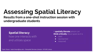
Assessing Spatial Literacy: Results from a one-shot instruction session with undergraduate students
- 1. Assessing Spatial Literacy Spatial literacy: how one interacts with and utilizes space A spatially literate person can think critically about space as it is ● used ● represented ● reasoned Taylor Hixson • taylor.hixson@nyu.edu • Geospatial Services Librarian • NYUAD Library Results from a one-shot instruction session with undergraduate students
- 2. Assessment 1: What is GIS?
- 3. Assessment 2: Clearest and muddiest points Something that I learned today: Something that is still not clear to me:
- 4. Resources Spatial Habits of Mind checklist: goo.gl/8h1tTF “Understanding and nurturing spatial literacy” (open access article): doi.org/10.1016/j.sbspro.2011.07.004 Defining Spatial Literacy: Why Students Need Spatial Thinking Skills: goo.gl/Khn3Bi
Editor's Notes
- Hello, I am the Geospatial Services Librarian at NYUAD. One of the research areas I am most interested in is spatial literacy. Spatial literacy is how we interact with and utilize the space around us--from parallel parking to placing furniture to land use and urban development. To me, a spatially literate person can think critically about space as it is 1) used, 2) represented, and 3) reasoned. I can talk at length about spatial literacy, but today I am focusing on assessing spatial literacy acquisition in a one-shot I did for undergraduate students in a Global Climate Change class. For this one-shot, I was focusing on the representation aspect of spatial literacy. More specifically, how Geographic Information Systems can represent space in environmental science and climate change . This is not my focus, but as a spatially literate person, I should have no problem teaching it ;)
- I opened the class with a poll to learn about their assumed or prior knowledge of Geographic information systems because it is the mechanism we were talking about representing spatial data--however, as you can see in the answers, GIS is also the mechanism for use and reasoning. This provided a baseline for seeing what their spatial literacy may already be--only looking for a vague familiarity with the concept we discussed.
- At the end of the hour session, I asked the students to complete a form to provide one thing they learned today and one thing that was still not clear. Something that I learned today: Data, learned and gis are connected, which is good--but using words like detail, map, stretch, raster, color, view, and multiple forms of the word compare show that they were learning concepts and terms about representation of space. Clearest points text dashboard: https://voyant-tools.org/?corpus=266a9bbce0becf05547c44499ce84704 Some themes that appeared in what they still did not know: Reasoning words likes understanding, interpreting, and analyzing came up in the muddiest points, but obviously, because that was not the focus. I take this as a good sign because it shows interest in increasing spatial literacy Muddiest points text dashboard: https://voyant-tools.org/?corpus=9c73ac2d93c69872cd8432a2bdd99b28