SlideShare a Scribd company logo
1 of 13
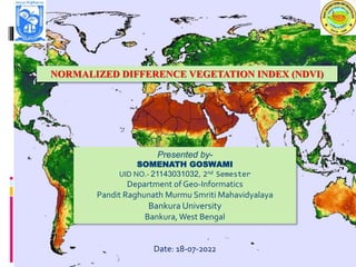
NORMALIZED DIFFERENCE VEGETATION INDEX (NDVI)
Presented by-
SOMENATH GOSWAMI
UID NO.- 21143031032, 2nd Semester
Department of Geo-Informatics
Pandit Raghunath Murmu Smriti Mahavidyalaya
Bankura University
Bankura, West Bengal
Date: 18-07-2022
1
Contents
 Introduction
 Formula of NDVI
 Range of NDVI
 Spectral Reflectance Curve
 Sources of NDVI Data
 How to Create NDVI Map in ArcGIS ?
 Output of NDVI Map
 Advantages & Disadvantages of NDVI
 Applications of NDVI
 Conclusion
2
Introduction
 NDVI is an indicator of vegetation health based on how plants reflect
certain ranges of the electromagnetic spectrum.
 The NDVI is a dimensionless index that describes the difference
between visible and near-infrared reflectance of vegetation cover and
can be used to estimate the density of green on an area of land.
Formula of NDVI
NDVI = (NIR - Red) / (NIR + Red) [According to Rouse et al. 1974]
In Landsat 4-7, NDVI = (Band 4 – Band 3) / (Band 4 + Band 3).
In Landsat 8-9, NDVI = (Band 5 – Band 4) / (Band 5 + Band 4).
3
Range of NDVI
The NDVI value varies from -1 to +1.
Higher the value of NDVI reflects high Near Infrared (NIR), means dense
greenery. Generally, we obtain following result:
1. NDVI = -1 to 0 representWater bodies
2. NDVI = -0.1 to 0.1 represent Barren rocks, sand, or snow
3. NDVI = 0.1 to 0.5 represent Shrubs and grasslands or senescing crops
4. NDVI = 0.5 to 1.0 represent Dense vegetation or tropical rainforest
4
Spectral reflectance curve
Spectral reflectance curve shows the relationship between electromagnetic
spectrum (distribution of the continuum of radiant energies plotted either as a
function of wavelength or of frequency) and the associated percent reflectance for
any given material.
 It is plotted in a chart that represent wavelengths in horizontal axis and percent
reflectance in the vertical axis .This curve will visualize the formula of NDVI
5
Sources of NDVI Data
There are different sources of NDVI data. We can calculate NDVI from Landsat,
Sentinel 2 MSI data and can directly get from the MODIS, NOAA, SPOT satellite
images. For analysis of Normal Difference Vegetation Index (NDVI), Landsat 7 and
Landsat 8 data’s bands, wavelength & their resolution are given below.
6
How to Create NDVI in ArcGIS ?
At first open the ArcMap software → Click on the ADD DATA option → Then go to
the folder where the data desired → Select the Landsat 8 (band 5,4) data → click the
ADD option → Then go to tha Windows Option → Select the band 5,4 →Check the
Background
Click on the Arc Toolbox →Then click Spatial Analyst Tool →Then click Map Agebra
→ Then double click on the Raster Calculator → A new dialog box will be appeared →
Gave the (float(B5-B4)/float(B5+B4))→Gave the output raster name (NDVI_Cal)→
Click OK button
 Click on the ADD DATA option → Then go to the folder where the data desired →
Select the Bankura_Shapefile data → click the ADD option → Click on the Arc
Toolbox →Then click Spatial Analyst Tool →Then click Extraction→ Then double
click on the Extract by Mask→ A new dialog box will be appeared → Gave the
Input (NDVI_Cal)→Gave the output raster name (NDVI_BK_Mask)→ Click OK
button.
Right click NDVI_BK_Mask → Click Properties → Then click the Symbology → lick
the Classified → Change the Colour As NDVI → Apply → Click OK 7
Output of NDVI
8
Advantages & Disadvantages of NDVI
Advantages :
1. Larger Monitoring range , better adaptability of time and space .
2. NDVI is especially useful for continental- to global-scale vegetation monitoring
because it can compensate for changing illumination conditions, surface slope,
and viewing angle.
Disadvantages:
1. Lower sensibility for high vegetation coverage zone , posteriority
2. Any time there's very low vegetation cover (majority of the scene is soil), NDVI
will be sensitive to that soil.This can confound measurements.
9
Applications of NDVI
 Climate change
 Agricultural production
 Desertification
 Fire prediction
 Land cover change
Vegetation health ( e.g. , crops , forest canopy )
10
Conclusion
 NDVI is a useful measure of neighborhood greenness.
 In addition to showing strong correlation with expert ratings, this
measure has practical advantages including availability of data and
ease of application to various boundaries which would aid in
replication and comparability across studies.
11
Normalized Difference Vegetation Index (NDVI)

More Related Content

What's hot

Remote sensing - Scanners
Remote sensing - ScannersRemote sensing - Scanners
Remote sensing - ScannersPramoda Raj
 
hyperspectral remote sensing and its geological applications
hyperspectral remote sensing and its geological applicationshyperspectral remote sensing and its geological applications
hyperspectral remote sensing and its geological applicationsabhijeet_banerjee
 
Introduction to Landsat
Introduction to LandsatIntroduction to Landsat
Introduction to LandsatNizam GIS
 
Microwave remote sensing
Microwave remote sensingMicrowave remote sensing
Microwave remote sensingMohsin Siddique
 
Aerial photography.pptx
Aerial photography.pptxAerial photography.pptx
Aerial photography.pptxPramoda Raj
 
Digital image processing and interpretation
Digital image processing and interpretationDigital image processing and interpretation
Digital image processing and interpretationP.K. Mani
 
VISUAL IMAGE INTERPRETATION.pptx
VISUAL IMAGE INTERPRETATION.pptxVISUAL IMAGE INTERPRETATION.pptx
VISUAL IMAGE INTERPRETATION.pptxSamirsinh Parmar
 
Scanners, image resolution, orbit in remote sensing, pk mani
Scanners, image resolution, orbit in remote sensing, pk maniScanners, image resolution, orbit in remote sensing, pk mani
Scanners, image resolution, orbit in remote sensing, pk maniP.K. Mani
 
Energy interaction with earth surface features
Energy interaction with earth surface featuresEnergy interaction with earth surface features
Energy interaction with earth surface featuressuchismita11
 
Band ratioing presentation
Band ratioing presentationBand ratioing presentation
Band ratioing presentationsk asadul haque
 
Iirs overview -Remote sensing and GIS application in Water Resources Management
Iirs overview -Remote sensing and GIS application in Water Resources ManagementIirs overview -Remote sensing and GIS application in Water Resources Management
Iirs overview -Remote sensing and GIS application in Water Resources ManagementTushar Dholakia
 
Remote sensing and image interpretation
Remote sensing and image interpretationRemote sensing and image interpretation
Remote sensing and image interpretationMd. Nazir Hossain
 
Fundamentals of Remote Sensing
Fundamentals of Remote Sensing Fundamentals of Remote Sensing
Fundamentals of Remote Sensing Pallab Jana
 
drought monitoring and management using remote sensing
drought monitoring and management using remote sensingdrought monitoring and management using remote sensing
drought monitoring and management using remote sensingveerendra manduri
 

What's hot (20)

Digital Elevation Model (DEM)
Digital Elevation Model (DEM)Digital Elevation Model (DEM)
Digital Elevation Model (DEM)
 
Remote sensing & gis
Remote sensing & gisRemote sensing & gis
Remote sensing & gis
 
Remote sensing - Scanners
Remote sensing - ScannersRemote sensing - Scanners
Remote sensing - Scanners
 
Introduction to Remote Sensing
Introduction to Remote SensingIntroduction to Remote Sensing
Introduction to Remote Sensing
 
hyperspectral remote sensing and its geological applications
hyperspectral remote sensing and its geological applicationshyperspectral remote sensing and its geological applications
hyperspectral remote sensing and its geological applications
 
Visual Interpretation
Visual InterpretationVisual Interpretation
Visual Interpretation
 
Functions of GIS
Functions of GISFunctions of GIS
Functions of GIS
 
Introduction to Landsat
Introduction to LandsatIntroduction to Landsat
Introduction to Landsat
 
Microwave remote sensing
Microwave remote sensingMicrowave remote sensing
Microwave remote sensing
 
Aerial photography.pptx
Aerial photography.pptxAerial photography.pptx
Aerial photography.pptx
 
Digital image processing and interpretation
Digital image processing and interpretationDigital image processing and interpretation
Digital image processing and interpretation
 
VISUAL IMAGE INTERPRETATION.pptx
VISUAL IMAGE INTERPRETATION.pptxVISUAL IMAGE INTERPRETATION.pptx
VISUAL IMAGE INTERPRETATION.pptx
 
Scanners, image resolution, orbit in remote sensing, pk mani
Scanners, image resolution, orbit in remote sensing, pk maniScanners, image resolution, orbit in remote sensing, pk mani
Scanners, image resolution, orbit in remote sensing, pk mani
 
Energy interaction with earth surface features
Energy interaction with earth surface featuresEnergy interaction with earth surface features
Energy interaction with earth surface features
 
Band ratioing presentation
Band ratioing presentationBand ratioing presentation
Band ratioing presentation
 
Iirs overview -Remote sensing and GIS application in Water Resources Management
Iirs overview -Remote sensing and GIS application in Water Resources ManagementIirs overview -Remote sensing and GIS application in Water Resources Management
Iirs overview -Remote sensing and GIS application in Water Resources Management
 
Remote sensing and image interpretation
Remote sensing and image interpretationRemote sensing and image interpretation
Remote sensing and image interpretation
 
Fundamentals of Remote Sensing
Fundamentals of Remote Sensing Fundamentals of Remote Sensing
Fundamentals of Remote Sensing
 
drought monitoring and management using remote sensing
drought monitoring and management using remote sensingdrought monitoring and management using remote sensing
drought monitoring and management using remote sensing
 
Spatial data for GIS
Spatial data for GISSpatial data for GIS
Spatial data for GIS
 

Similar to Normalized Difference Vegetation Index (NDVI)

Raster Analysis (Color Composite and Remote Sensing Indices)
Raster Analysis (Color Composite and Remote Sensing Indices)Raster Analysis (Color Composite and Remote Sensing Indices)
Raster Analysis (Color Composite and Remote Sensing Indices)NopphawanTamkuan
 
Data Processing Using IRS Satellite Imagery for Disaster Monitoring (Case Stu...
Data Processing Using IRS Satellite Imagery for Disaster Monitoring (Case Stu...Data Processing Using IRS Satellite Imagery for Disaster Monitoring (Case Stu...
Data Processing Using IRS Satellite Imagery for Disaster Monitoring (Case Stu...NopphawanTamkuan
 
Classification of Multi-date Image using NDVI values
Classification of Multi-date Image using NDVI valuesClassification of Multi-date Image using NDVI values
Classification of Multi-date Image using NDVI valuesijsrd.com
 
Terra-i, An eye on habitat change
Terra-i, An eye on habitat changeTerra-i, An eye on habitat change
Terra-i, An eye on habitat changelreymondin
 
Detection of urban tree canopy from very high resolution imagery using an ob...
Detection of urban tree canopy from very high resolution  imagery using an ob...Detection of urban tree canopy from very high resolution  imagery using an ob...
Detection of urban tree canopy from very high resolution imagery using an ob...IJECEIAES
 
Optical Remote sensing with case studies
Optical Remote sensing with case studiesOptical Remote sensing with case studies
Optical Remote sensing with case studiesSAISIKAN PATRA
 
Separability Analysis of Integrated Spaceborne Radar and Optical Data: Sudan ...
Separability Analysis of Integrated Spaceborne Radar and Optical Data: Sudan ...Separability Analysis of Integrated Spaceborne Radar and Optical Data: Sudan ...
Separability Analysis of Integrated Spaceborne Radar and Optical Data: Sudan ...rsmahabir
 
[DSC Europe 22] Crop type clustering using NDVI - Bright Aboh
[DSC Europe 22] Crop type clustering using NDVI - Bright Aboh[DSC Europe 22] Crop type clustering using NDVI - Bright Aboh
[DSC Europe 22] Crop type clustering using NDVI - Bright AbohDataScienceConferenc1
 
IRJET- Optimum Band Selection in Sentinel-2A Satellite for Crop Classificatio...
IRJET- Optimum Band Selection in Sentinel-2A Satellite for Crop Classificatio...IRJET- Optimum Band Selection in Sentinel-2A Satellite for Crop Classificatio...
IRJET- Optimum Band Selection in Sentinel-2A Satellite for Crop Classificatio...IRJET Journal
 
GLOBAL EVALUATION OF FOUR AVHRR-NDVI DATA-SETS INTERCOMPARISON AND ASSESSMENT...
GLOBAL EVALUATION OF FOUR AVHRR-NDVI DATA-SETS INTERCOMPARISON AND ASSESSMENT...GLOBAL EVALUATION OF FOUR AVHRR-NDVI DATA-SETS INTERCOMPARISON AND ASSESSMENT...
GLOBAL EVALUATION OF FOUR AVHRR-NDVI DATA-SETS INTERCOMPARISON AND ASSESSMENT...grssieee
 
Improvement of Anomaly Detection Algorithms in Hyperspectral Images Using Dis...
Improvement of Anomaly Detection Algorithms in Hyperspectral Images Using Dis...Improvement of Anomaly Detection Algorithms in Hyperspectral Images Using Dis...
Improvement of Anomaly Detection Algorithms in Hyperspectral Images Using Dis...sipij
 
Rahul seminar1 for_slideshare
Rahul seminar1 for_slideshareRahul seminar1 for_slideshare
Rahul seminar1 for_slideshareRahulSingh769902
 
REMOTE SENSING AND GEOGRAPHIC INFORMATION SYSTEMS
REMOTE SENSING AND GEOGRAPHIC INFORMATION SYSTEMS REMOTE SENSING AND GEOGRAPHIC INFORMATION SYSTEMS
REMOTE SENSING AND GEOGRAPHIC INFORMATION SYSTEMS AM Publications
 
Data Processing Using DIWATA-1 Microsatellite Imagery for Disaster Monitoring
Data Processing Using DIWATA-1 Microsatellite Imagery for Disaster MonitoringData Processing Using DIWATA-1 Microsatellite Imagery for Disaster Monitoring
Data Processing Using DIWATA-1 Microsatellite Imagery for Disaster MonitoringNopphawanTamkuan
 

Similar to Normalized Difference Vegetation Index (NDVI) (20)

Raster Analysis (Color Composite and Remote Sensing Indices)
Raster Analysis (Color Composite and Remote Sensing Indices)Raster Analysis (Color Composite and Remote Sensing Indices)
Raster Analysis (Color Composite and Remote Sensing Indices)
 
Data Processing Using IRS Satellite Imagery for Disaster Monitoring (Case Stu...
Data Processing Using IRS Satellite Imagery for Disaster Monitoring (Case Stu...Data Processing Using IRS Satellite Imagery for Disaster Monitoring (Case Stu...
Data Processing Using IRS Satellite Imagery for Disaster Monitoring (Case Stu...
 
Classification of Multi-date Image using NDVI values
Classification of Multi-date Image using NDVI valuesClassification of Multi-date Image using NDVI values
Classification of Multi-date Image using NDVI values
 
Basic remote sensing and gis
Basic remote sensing and gisBasic remote sensing and gis
Basic remote sensing and gis
 
Af33174179
Af33174179Af33174179
Af33174179
 
Af33174179
Af33174179Af33174179
Af33174179
 
NDVI
NDVINDVI
NDVI
 
Terra-i, An eye on habitat change
Terra-i, An eye on habitat changeTerra-i, An eye on habitat change
Terra-i, An eye on habitat change
 
Detection of urban tree canopy from very high resolution imagery using an ob...
Detection of urban tree canopy from very high resolution  imagery using an ob...Detection of urban tree canopy from very high resolution  imagery using an ob...
Detection of urban tree canopy from very high resolution imagery using an ob...
 
Optical Remote sensing with case studies
Optical Remote sensing with case studiesOptical Remote sensing with case studies
Optical Remote sensing with case studies
 
Terra-i, An eye on Habitat Change
Terra-i, An eye on Habitat ChangeTerra-i, An eye on Habitat Change
Terra-i, An eye on Habitat Change
 
Separability Analysis of Integrated Spaceborne Radar and Optical Data: Sudan ...
Separability Analysis of Integrated Spaceborne Radar and Optical Data: Sudan ...Separability Analysis of Integrated Spaceborne Radar and Optical Data: Sudan ...
Separability Analysis of Integrated Spaceborne Radar and Optical Data: Sudan ...
 
[DSC Europe 22] Crop type clustering using NDVI - Bright Aboh
[DSC Europe 22] Crop type clustering using NDVI - Bright Aboh[DSC Europe 22] Crop type clustering using NDVI - Bright Aboh
[DSC Europe 22] Crop type clustering using NDVI - Bright Aboh
 
IRJET- Optimum Band Selection in Sentinel-2A Satellite for Crop Classificatio...
IRJET- Optimum Band Selection in Sentinel-2A Satellite for Crop Classificatio...IRJET- Optimum Band Selection in Sentinel-2A Satellite for Crop Classificatio...
IRJET- Optimum Band Selection in Sentinel-2A Satellite for Crop Classificatio...
 
GLOBAL EVALUATION OF FOUR AVHRR-NDVI DATA-SETS INTERCOMPARISON AND ASSESSMENT...
GLOBAL EVALUATION OF FOUR AVHRR-NDVI DATA-SETS INTERCOMPARISON AND ASSESSMENT...GLOBAL EVALUATION OF FOUR AVHRR-NDVI DATA-SETS INTERCOMPARISON AND ASSESSMENT...
GLOBAL EVALUATION OF FOUR AVHRR-NDVI DATA-SETS INTERCOMPARISON AND ASSESSMENT...
 
Improvement of Anomaly Detection Algorithms in Hyperspectral Images Using Dis...
Improvement of Anomaly Detection Algorithms in Hyperspectral Images Using Dis...Improvement of Anomaly Detection Algorithms in Hyperspectral Images Using Dis...
Improvement of Anomaly Detection Algorithms in Hyperspectral Images Using Dis...
 
Lab 2
Lab 2Lab 2
Lab 2
 
Rahul seminar1 for_slideshare
Rahul seminar1 for_slideshareRahul seminar1 for_slideshare
Rahul seminar1 for_slideshare
 
REMOTE SENSING AND GEOGRAPHIC INFORMATION SYSTEMS
REMOTE SENSING AND GEOGRAPHIC INFORMATION SYSTEMS REMOTE SENSING AND GEOGRAPHIC INFORMATION SYSTEMS
REMOTE SENSING AND GEOGRAPHIC INFORMATION SYSTEMS
 
Data Processing Using DIWATA-1 Microsatellite Imagery for Disaster Monitoring
Data Processing Using DIWATA-1 Microsatellite Imagery for Disaster MonitoringData Processing Using DIWATA-1 Microsatellite Imagery for Disaster Monitoring
Data Processing Using DIWATA-1 Microsatellite Imagery for Disaster Monitoring
 

Recently uploaded

Roles & Responsibilities in Pharmacovigilance
Roles & Responsibilities in PharmacovigilanceRoles & Responsibilities in Pharmacovigilance
Roles & Responsibilities in PharmacovigilanceSamikshaHamane
 
Types of Journalistic Writing Grade 8.pptx
Types of Journalistic Writing Grade 8.pptxTypes of Journalistic Writing Grade 8.pptx
Types of Journalistic Writing Grade 8.pptxEyham Joco
 
Presiding Officer Training module 2024 lok sabha elections
Presiding Officer Training module 2024 lok sabha electionsPresiding Officer Training module 2024 lok sabha elections
Presiding Officer Training module 2024 lok sabha electionsanshu789521
 
Full Stack Web Development Course for Beginners
Full Stack Web Development Course  for BeginnersFull Stack Web Development Course  for Beginners
Full Stack Web Development Course for BeginnersSabitha Banu
 
Incoming and Outgoing Shipments in 1 STEP Using Odoo 17
Incoming and Outgoing Shipments in 1 STEP Using Odoo 17Incoming and Outgoing Shipments in 1 STEP Using Odoo 17
Incoming and Outgoing Shipments in 1 STEP Using Odoo 17Celine George
 
How to Make a Pirate ship Primary Education.pptx
How to Make a Pirate ship Primary Education.pptxHow to Make a Pirate ship Primary Education.pptx
How to Make a Pirate ship Primary Education.pptxmanuelaromero2013
 
18-04-UA_REPORT_MEDIALITERAСY_INDEX-DM_23-1-final-eng.pdf
18-04-UA_REPORT_MEDIALITERAСY_INDEX-DM_23-1-final-eng.pdf18-04-UA_REPORT_MEDIALITERAСY_INDEX-DM_23-1-final-eng.pdf
18-04-UA_REPORT_MEDIALITERAСY_INDEX-DM_23-1-final-eng.pdfssuser54595a
 
Earth Day Presentation wow hello nice great
Earth Day Presentation wow hello nice greatEarth Day Presentation wow hello nice great
Earth Day Presentation wow hello nice greatYousafMalik24
 
DATA STRUCTURE AND ALGORITHM for beginners
DATA STRUCTURE AND ALGORITHM for beginnersDATA STRUCTURE AND ALGORITHM for beginners
DATA STRUCTURE AND ALGORITHM for beginnersSabitha Banu
 
Hierarchy of management that covers different levels of management
Hierarchy of management that covers different levels of managementHierarchy of management that covers different levels of management
Hierarchy of management that covers different levels of managementmkooblal
 
Enzyme, Pharmaceutical Aids, Miscellaneous Last Part of Chapter no 5th.pdf
Enzyme, Pharmaceutical Aids, Miscellaneous Last Part of Chapter no 5th.pdfEnzyme, Pharmaceutical Aids, Miscellaneous Last Part of Chapter no 5th.pdf
Enzyme, Pharmaceutical Aids, Miscellaneous Last Part of Chapter no 5th.pdfSumit Tiwari
 
CELL CYCLE Division Science 8 quarter IV.pptx
CELL CYCLE Division Science 8 quarter IV.pptxCELL CYCLE Division Science 8 quarter IV.pptx
CELL CYCLE Division Science 8 quarter IV.pptxJiesonDelaCerna
 
Software Engineering Methodologies (overview)
Software Engineering Methodologies (overview)Software Engineering Methodologies (overview)
Software Engineering Methodologies (overview)eniolaolutunde
 
KSHARA STURA .pptx---KSHARA KARMA THERAPY (CAUSTIC THERAPY)————IMP.OF KSHARA ...
KSHARA STURA .pptx---KSHARA KARMA THERAPY (CAUSTIC THERAPY)————IMP.OF KSHARA ...KSHARA STURA .pptx---KSHARA KARMA THERAPY (CAUSTIC THERAPY)————IMP.OF KSHARA ...
KSHARA STURA .pptx---KSHARA KARMA THERAPY (CAUSTIC THERAPY)————IMP.OF KSHARA ...M56BOOKSTORE PRODUCT/SERVICE
 
CARE OF CHILD IN INCUBATOR..........pptx
CARE OF CHILD IN INCUBATOR..........pptxCARE OF CHILD IN INCUBATOR..........pptx
CARE OF CHILD IN INCUBATOR..........pptxGaneshChakor2
 
History Class XII Ch. 3 Kinship, Caste and Class (1).pptx
History Class XII Ch. 3 Kinship, Caste and Class (1).pptxHistory Class XII Ch. 3 Kinship, Caste and Class (1).pptx
History Class XII Ch. 3 Kinship, Caste and Class (1).pptxsocialsciencegdgrohi
 
Introduction to ArtificiaI Intelligence in Higher Education
Introduction to ArtificiaI Intelligence in Higher EducationIntroduction to ArtificiaI Intelligence in Higher Education
Introduction to ArtificiaI Intelligence in Higher Educationpboyjonauth
 
EPANDING THE CONTENT OF AN OUTLINE using notes.pptx
EPANDING THE CONTENT OF AN OUTLINE using notes.pptxEPANDING THE CONTENT OF AN OUTLINE using notes.pptx
EPANDING THE CONTENT OF AN OUTLINE using notes.pptxRaymartEstabillo3
 
भारत-रोम व्यापार.pptx, Indo-Roman Trade,
भारत-रोम व्यापार.pptx, Indo-Roman Trade,भारत-रोम व्यापार.pptx, Indo-Roman Trade,
भारत-रोम व्यापार.pptx, Indo-Roman Trade,Virag Sontakke
 

Recently uploaded (20)

Roles & Responsibilities in Pharmacovigilance
Roles & Responsibilities in PharmacovigilanceRoles & Responsibilities in Pharmacovigilance
Roles & Responsibilities in Pharmacovigilance
 
Types of Journalistic Writing Grade 8.pptx
Types of Journalistic Writing Grade 8.pptxTypes of Journalistic Writing Grade 8.pptx
Types of Journalistic Writing Grade 8.pptx
 
Presiding Officer Training module 2024 lok sabha elections
Presiding Officer Training module 2024 lok sabha electionsPresiding Officer Training module 2024 lok sabha elections
Presiding Officer Training module 2024 lok sabha elections
 
Full Stack Web Development Course for Beginners
Full Stack Web Development Course  for BeginnersFull Stack Web Development Course  for Beginners
Full Stack Web Development Course for Beginners
 
Incoming and Outgoing Shipments in 1 STEP Using Odoo 17
Incoming and Outgoing Shipments in 1 STEP Using Odoo 17Incoming and Outgoing Shipments in 1 STEP Using Odoo 17
Incoming and Outgoing Shipments in 1 STEP Using Odoo 17
 
How to Make a Pirate ship Primary Education.pptx
How to Make a Pirate ship Primary Education.pptxHow to Make a Pirate ship Primary Education.pptx
How to Make a Pirate ship Primary Education.pptx
 
18-04-UA_REPORT_MEDIALITERAСY_INDEX-DM_23-1-final-eng.pdf
18-04-UA_REPORT_MEDIALITERAСY_INDEX-DM_23-1-final-eng.pdf18-04-UA_REPORT_MEDIALITERAСY_INDEX-DM_23-1-final-eng.pdf
18-04-UA_REPORT_MEDIALITERAСY_INDEX-DM_23-1-final-eng.pdf
 
9953330565 Low Rate Call Girls In Rohini Delhi NCR
9953330565 Low Rate Call Girls In Rohini  Delhi NCR9953330565 Low Rate Call Girls In Rohini  Delhi NCR
9953330565 Low Rate Call Girls In Rohini Delhi NCR
 
Earth Day Presentation wow hello nice great
Earth Day Presentation wow hello nice greatEarth Day Presentation wow hello nice great
Earth Day Presentation wow hello nice great
 
DATA STRUCTURE AND ALGORITHM for beginners
DATA STRUCTURE AND ALGORITHM for beginnersDATA STRUCTURE AND ALGORITHM for beginners
DATA STRUCTURE AND ALGORITHM for beginners
 
Hierarchy of management that covers different levels of management
Hierarchy of management that covers different levels of managementHierarchy of management that covers different levels of management
Hierarchy of management that covers different levels of management
 
Enzyme, Pharmaceutical Aids, Miscellaneous Last Part of Chapter no 5th.pdf
Enzyme, Pharmaceutical Aids, Miscellaneous Last Part of Chapter no 5th.pdfEnzyme, Pharmaceutical Aids, Miscellaneous Last Part of Chapter no 5th.pdf
Enzyme, Pharmaceutical Aids, Miscellaneous Last Part of Chapter no 5th.pdf
 
CELL CYCLE Division Science 8 quarter IV.pptx
CELL CYCLE Division Science 8 quarter IV.pptxCELL CYCLE Division Science 8 quarter IV.pptx
CELL CYCLE Division Science 8 quarter IV.pptx
 
Software Engineering Methodologies (overview)
Software Engineering Methodologies (overview)Software Engineering Methodologies (overview)
Software Engineering Methodologies (overview)
 
KSHARA STURA .pptx---KSHARA KARMA THERAPY (CAUSTIC THERAPY)————IMP.OF KSHARA ...
KSHARA STURA .pptx---KSHARA KARMA THERAPY (CAUSTIC THERAPY)————IMP.OF KSHARA ...KSHARA STURA .pptx---KSHARA KARMA THERAPY (CAUSTIC THERAPY)————IMP.OF KSHARA ...
KSHARA STURA .pptx---KSHARA KARMA THERAPY (CAUSTIC THERAPY)————IMP.OF KSHARA ...
 
CARE OF CHILD IN INCUBATOR..........pptx
CARE OF CHILD IN INCUBATOR..........pptxCARE OF CHILD IN INCUBATOR..........pptx
CARE OF CHILD IN INCUBATOR..........pptx
 
History Class XII Ch. 3 Kinship, Caste and Class (1).pptx
History Class XII Ch. 3 Kinship, Caste and Class (1).pptxHistory Class XII Ch. 3 Kinship, Caste and Class (1).pptx
History Class XII Ch. 3 Kinship, Caste and Class (1).pptx
 
Introduction to ArtificiaI Intelligence in Higher Education
Introduction to ArtificiaI Intelligence in Higher EducationIntroduction to ArtificiaI Intelligence in Higher Education
Introduction to ArtificiaI Intelligence in Higher Education
 
EPANDING THE CONTENT OF AN OUTLINE using notes.pptx
EPANDING THE CONTENT OF AN OUTLINE using notes.pptxEPANDING THE CONTENT OF AN OUTLINE using notes.pptx
EPANDING THE CONTENT OF AN OUTLINE using notes.pptx
 
भारत-रोम व्यापार.pptx, Indo-Roman Trade,
भारत-रोम व्यापार.pptx, Indo-Roman Trade,भारत-रोम व्यापार.pptx, Indo-Roman Trade,
भारत-रोम व्यापार.pptx, Indo-Roman Trade,
 

Normalized Difference Vegetation Index (NDVI)

  • 1. NORMALIZED DIFFERENCE VEGETATION INDEX (NDVI) Presented by- SOMENATH GOSWAMI UID NO.- 21143031032, 2nd Semester Department of Geo-Informatics Pandit Raghunath Murmu Smriti Mahavidyalaya Bankura University Bankura, West Bengal Date: 18-07-2022
  • 2. 1 Contents  Introduction  Formula of NDVI  Range of NDVI  Spectral Reflectance Curve  Sources of NDVI Data  How to Create NDVI Map in ArcGIS ?  Output of NDVI Map  Advantages & Disadvantages of NDVI  Applications of NDVI  Conclusion
  • 3. 2 Introduction  NDVI is an indicator of vegetation health based on how plants reflect certain ranges of the electromagnetic spectrum.  The NDVI is a dimensionless index that describes the difference between visible and near-infrared reflectance of vegetation cover and can be used to estimate the density of green on an area of land.
  • 4. Formula of NDVI NDVI = (NIR - Red) / (NIR + Red) [According to Rouse et al. 1974] In Landsat 4-7, NDVI = (Band 4 – Band 3) / (Band 4 + Band 3). In Landsat 8-9, NDVI = (Band 5 – Band 4) / (Band 5 + Band 4). 3
  • 5. Range of NDVI The NDVI value varies from -1 to +1. Higher the value of NDVI reflects high Near Infrared (NIR), means dense greenery. Generally, we obtain following result: 1. NDVI = -1 to 0 representWater bodies 2. NDVI = -0.1 to 0.1 represent Barren rocks, sand, or snow 3. NDVI = 0.1 to 0.5 represent Shrubs and grasslands or senescing crops 4. NDVI = 0.5 to 1.0 represent Dense vegetation or tropical rainforest 4
  • 6. Spectral reflectance curve Spectral reflectance curve shows the relationship between electromagnetic spectrum (distribution of the continuum of radiant energies plotted either as a function of wavelength or of frequency) and the associated percent reflectance for any given material.  It is plotted in a chart that represent wavelengths in horizontal axis and percent reflectance in the vertical axis .This curve will visualize the formula of NDVI 5
  • 7. Sources of NDVI Data There are different sources of NDVI data. We can calculate NDVI from Landsat, Sentinel 2 MSI data and can directly get from the MODIS, NOAA, SPOT satellite images. For analysis of Normal Difference Vegetation Index (NDVI), Landsat 7 and Landsat 8 data’s bands, wavelength & their resolution are given below. 6
  • 8. How to Create NDVI in ArcGIS ? At first open the ArcMap software → Click on the ADD DATA option → Then go to the folder where the data desired → Select the Landsat 8 (band 5,4) data → click the ADD option → Then go to tha Windows Option → Select the band 5,4 →Check the Background Click on the Arc Toolbox →Then click Spatial Analyst Tool →Then click Map Agebra → Then double click on the Raster Calculator → A new dialog box will be appeared → Gave the (float(B5-B4)/float(B5+B4))→Gave the output raster name (NDVI_Cal)→ Click OK button  Click on the ADD DATA option → Then go to the folder where the data desired → Select the Bankura_Shapefile data → click the ADD option → Click on the Arc Toolbox →Then click Spatial Analyst Tool →Then click Extraction→ Then double click on the Extract by Mask→ A new dialog box will be appeared → Gave the Input (NDVI_Cal)→Gave the output raster name (NDVI_BK_Mask)→ Click OK button. Right click NDVI_BK_Mask → Click Properties → Then click the Symbology → lick the Classified → Change the Colour As NDVI → Apply → Click OK 7
  • 10. Advantages & Disadvantages of NDVI Advantages : 1. Larger Monitoring range , better adaptability of time and space . 2. NDVI is especially useful for continental- to global-scale vegetation monitoring because it can compensate for changing illumination conditions, surface slope, and viewing angle. Disadvantages: 1. Lower sensibility for high vegetation coverage zone , posteriority 2. Any time there's very low vegetation cover (majority of the scene is soil), NDVI will be sensitive to that soil.This can confound measurements. 9
  • 11. Applications of NDVI  Climate change  Agricultural production  Desertification  Fire prediction  Land cover change Vegetation health ( e.g. , crops , forest canopy ) 10
  • 12. Conclusion  NDVI is a useful measure of neighborhood greenness.  In addition to showing strong correlation with expert ratings, this measure has practical advantages including availability of data and ease of application to various boundaries which would aid in replication and comparability across studies. 11