
Recommended
More Related Content
What's hot
What's hot (20)
Similar to Class 10 RESOURCE & DEVELOPMENT
Similar to Class 10 RESOURCE & DEVELOPMENT (20)
Recently uploaded
Recently uploaded (20)
Class 10 RESOURCE & DEVELOPMENT
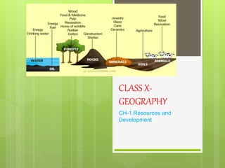
- 2. RESOURCE All materials available in our environment which satisfy our needs ,has utility & usability are called as Resources. It is technologically accessible ,economically feasible & culturally acceptable .
- 3. Interdependent relationship between nature, technology & institution 1) Nature is defined by the rainfall, climate, topographic features of the place and does not depend on man made or developed resources. 2) Technology is developed with the nature and natural resources of the place, technology is developed for man's facilitation. 3) Institutions develop technologies based on resources.
- 6. NATURAL RESOURCE Natural resources are those resources that are drawn from nature and are used without much modification- air, water, soils, minerals are the natural resources. Natural resources are classified into different groups depending upon their level of development and use, origin, renewability and distribution Natural resources also called as ‘gifts of nature’.
- 7. ON THE BASIS OF ORIGIN
- 8. ON THE BASIS OF EXHAUSTABILITY
- 9. ON THE BASIS OF OWNERSHIP INDIVIDUAL RESOURCE Resources which are owned by an individual. E.g. plot, car, house, etc. COMMUNITY RESOURCE Resources which belongs to a community of people. E.g. parks, community halls, picnic spots, etc. NATIONAL RESOURCE Resources which belongs to a nation. These resources are found within the political boundaries and territorial waters (i.e ocean water upto 12 nautical miles (22.2 kms) from the coast of a country. INTERNATIONAL RESOURCE Resources which are found beyond the territorial boundaries of a country. These resources are managed by the international institutes.
- 10. ON THE BASIS 0F STATUS OF DEVELOPMENT
- 12. DEVELOPMENT OF RESOURCES Development of Resources: Resources are the free gifts of nature and are very important for human beings. Some of the problems faced are: • Depletion of resources for satisfying the greed of few individuals. • Accumulation of resources in only few hands leaves others unsatisfied. • Unsystematic use of resources is creating many problems around the world, such as global warming, ecological crisis, disturbance in ozone layer, etc.
- 13. SUSTAINABLE DEVELOPMENT Development which should takes place without damaging the environment and compromising with the needs of the future generations is called sustainable development.
- 14. RIO DE JANEIRO EARTH SUMMIT 1992
- 15. • In June 1992, more than 100 heads of states met in Rio de Janeiro in Brazil, for the first International Earth Summit. • The Summit was organized for addressing urgent problems of environmental protection and socio-economic development. • The assembled leaders signed the Declaration on Global Climatic Change and Biological Diversity. • The Rio Convention endorsed the global Forest Principles and adopted Agenda 21 for achieving Sustainable Development in the 21st century.
- 16. AGENDA 21 • It aims at achieving global sustainable development. • It is an agenda to combat environmental damage, poverty, disease through global co-operation on common interests, mutual needs and shared responsibilities. • One major objective of the Agenda 21 is that every local government should draw its own local Agenda 21.
- 17. RESOURCE PLANNING Resource planning is the judicious use of resources. • In India, resources are unevenly distributed and thus resource planning becomes very essential. • In India, many states are rich in mineral and deficient in other resources, such as Jharkhand is rich in minerals, but there is problem of drinking water and other facilities, Arunachal Pradesh has plenty of water but lack of other development because of lack of resources. • These types of discriminations can be reduced or completely eradicated with proper planning of judicious use of resources.
- 20. CONSERVATION OF RESOURCE Irrational consumption and over-utilization of resources have lead to socio-economic and environmental problems. • Judicious use and conservation of resources is must. Gandhiji told "There is enough for everybody's need and not for any body's greed." He thought that exploitative nature of modern technology is the root cause for depletion at global level. He believed in the production by masses and not in the mass production.
- 22. Land is one of the most important natural resources. • Land supports our life system with the basic necessities of life (i.e. food, cloth and shelter). Thus, proper planning is must for the proper utilization of land as a resource. • Land is not even everywhere, India comprises of many types of land forms (i.e mountains, plateau, plains and islands).
- 24. LAND UTILISATION 1. Forests 2. Land not available for cultivation: (a) Barren and waste land. (b) Lands used for buildings, roads, factories, etc. (i.e. for non-agriculture purpose). 3. Other Uncultivated Land (excluding fallow land): (a) Permanent pastures and grazing land. (b) Land under miscellaneous tree crops groves (not included in net sown area). (c) Cultruable waste land (left uncultivated for more than 5 agricultural years). 4. Fallow Lands: (a) Current fallow-(left without cultivation for one or less than one agricultural year). (b) Other than current fallow-(left uncultivated for the past 1 to 5 agricultural years). 5. Net Sown Area: Area which is sown at least once in a year is called net sown area. 6. Gross Cropped Area: Area sown more than once in an agricultural year plus net sown area is known as gross cropped area.
- 25. LAND USE PATTERN IN INDIA
- 26. • Pattern of use of land depends upon physical and human factors both. • Climate, topography, type of soil, etc. are considered as physical factors. • While population, technology, skill, population density, tradition, capability, etc. are considered as human factors. • India has total 3.28 million square kilometer land used data. But only 93% of land of total geographical area is available. This is because land used data has not been collected for the north eastern states except Assam and the land occupied by Pakistan and China has not been surveyed because of many unavoidable reasons. • The land under permanent pasture is decreasing; this will create the problem for grazing.
- 27. The total net sown area (NSA) is not more than 54% including land other than fallow land. • Land other than fallow land is either of poor quality or too costly to cultivate, these lands are cultivated only once or twice in two or three consecutive years. • The pattern of net sown area varies widely from state to state. Where net sown area is 80% in state like Punjab, it is only 10% in the state of Arunachal Pradesh, Mizoram, Manipur and Andaman and Nicobar Island. Such difference is creating lot of discrimination. • According to National Forest Policy (1952), the forest should be 33% of total geographical area, which is essential to maintain ecological balance. But the forest area in India is far less than desired measures. This is because of illegal deforestation and development which cannot be overlooked, such as construction of roads and building, etc.
- 28. LAND DEGRADATION & CONSERVATION • Land is limited but the demand is increasing everyday. • The change in land use pattern shows the changes in the society. • Land Degradation: It is the decline in the productive capacity of land for some time or permanently. • Most of our basic needs (i.e. food, clothing & shelter) is obtained from land. • But in past few decades the quality of land is degrading fiercely because of human activity. • Presently, about 130 million hectare of land is reported under degraded land in India. • Approximately, 28% of land belongs to forest degraded area. • 56% is water eroded land area. • Rest degraded land is because of over deposition of salinity and alkalinity.
- 29. CAUSES OF LAND DEGARDATION 1. Deforestation 2. Overgrazing 3. Urbanization 4. Industrialization 5. Dumping of Chemical Wastes 6. Excessive use of Fertilizers 7. Bad Farming Techniques
- 30. MEASURES TO CONTROL LAND DEGRADATION. Some of the measures to control land degradation are: 1. Constructing retention walls in the mountain areas to stop landslides. 2. Land Reclamation (i.e. Proper management of waste lands) 3. Regulated use of chemical fertilizers and pesticides 4. Afforestation 5. Check on Overgrazing 6. Control of Mining Activities 7. By proper irrigation. 8. By proper harvesting. 9. Discharge of industrial waste and effluents only after proper treatment. 10. By preventing the deforestation.
- 31. SOIL • The uppermost or topmost layer of the earth's crust is known as soil. It is the loose material consisting of organic and inorganic substances. (Humus is a dark coloured stable form of organic matter that remains after most of plant or animals residues have decomposed). • Most of the food items like wheat, rice, pulses, fruits, vegetables, etc. are obtained from plants that grow on soil. Soil provides food, cloth and shelter, etc.
- 32. Factorsof SoilFormation: 1. Relief: Altitude and slope determines the accumulation of soil. 2. Parent Rock: It determines, colour, texture, chemical properties, mineral contents, etc. 3. Climate: Rainfall and temperature influence rate of humus and weathering. 4. Time: It determines thickness of soil profile. 5. Organisms: Microorganisms & vegetation affect the rate of humus formation. Soil Profile:
- 33. L
- 39. SOILEROSION ANDSOILCONSERVATION The denudation of the soil cover and subsequent washing down is described as soil erosion. Or • Removal of top soil is called soil erosion. • The running water cuts through the clayey soil and makes deep channels known as Gullies. • The land becomes unfit for cultivation and is known as Bad Land.
- 40. DEGRADATION OF SOIL • Soil erosion is the degradation of soil by human activities. • Following are the factors responsible for the soil erosion: - 1. Deforestation 2. Overgrazing 3. Construction 4. Overuse of Chemical Fertilizers 5. Pesticides 6. Natural Calamities (Flood, landslides, etc.)
- 41. CONSERVATION OF SOIL 1. Mulching: Bare ground between plants is covered with a layer of organic matter like straw. It helps to retail soil moisture. 2. Contour Ploughing: Ploughing along contours can decrease the flow of water down the slopes. 3. Terrace Cultivation: Steps can be cut out on the slopes making terraces. 4. Strip Cropping: Strips of grass are grown between the crops. This breaks the force of wind. 5. Shelter Belts: Rows of trees are planted to create shelter. Thus, the speed of wind is reduced. 6. Rock Dam: Rocks are piled to slow the speed of wind. 7. Contour Barriers: Stones, grass, soil are used to make barriers. Trenches are made in front of the barriers to collect water. 8. Afforestation, Crop Rotation, Control over Deforestation and Overgrazing, etc.