
Recommended
Recommended
More Related Content
What's hot
What's hot (14)
Viewers also liked
Similar to 2011 08-03 big-cfbca
Similar to 2011 08-03 big-cfbca (20)
Recently uploaded
Recently uploaded (20)
2011 08-03 big-cfbca
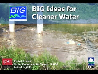
- 1. Rachel Powers Senior Environmental Planner, H-GAC August 3, 2011 BIG Ideas for Cleaner Water
- 14. Stakeholder and Public Involvement
- 16. Considerations
- 29. Public Involvement & Support
- 31. Already Started
- 33. 713-993-4559 [email_address] www.h-gac.com/BIG Photo: Harris County Pct 4 Used with permission BIG Ideas for Cleaner Water
Editor's Notes
- The Houston-Galveston Area Council is a voluntary association of governments in the 13-county region, serving an area of 12,500 square miles and more than 5.7 million people. H-GAC is governed by a 35 member board of directors composed of local elected officials from H-GAC’s member governments. H-GAC is the Governor-appointed regional water quality management planning agency. In the Houston region, as in many parts of Texas and the country, the most widespread water quality problem is bacteria in the waterways. This photo is of people tubing on the West Fork of the San Jacinto River.
- There are over 16,000 miles of streams and shoreline in the 13-county region. It contains the intersection of five ecosystems, making it one of the most biodiverse areas in the country. Many of our waterways are appropriate for recreation, which is what we are here to talk about today.
- I am going to start off by providing a little bit of background information: The Bacteria TMDL projects—defining the problem The Draft Implementation Plan—what we plan to do about the problem Your Input—the plan isn’t final yet, so we want to know what you think This photo is in Buffalo Bayou, which has the longest paddling trail (at about 26 miles) in the state. We have time at the end of the presentation for questions—and you are welcome to ask questions at any time.
- We’ll start off with a description of the problem. A TMDL is short for Total Maximum Daily Load. It is “a calculation of the maximum amount of a pollutant that a water body can receive and still safely meet water quality standards.” The federal Clean Water Act requires that, once a waterbody is identified as being impaired (aka polluted), a TMDK must be developed. The Clean Water Act requires that states establish standards that describe the ways that water bodies are used. The standard associated with the contact recreation use is designed to ensure that water is safe for swimming, waterskiing, wading by children, or other activities that involve direct contact with the water. Most water bodies in Texas and in the Houston-Galveston region must meet the standard for contact recreation. The TCEQ determines whether water quality in a water body designated for contact recreation meets the contact recreation standard by measuring the levels of indicator bacteria—either Escherichia coli (E. coli) or Enterococcus, depending on waterway characteristics. High concentrations of indicator bacteria have been associated with an increased risk of becoming ill from recreational activities. The higher the level of bacteria, the higher the risk of illness. In the Houston-Galveston region, bacteria are the most common pollutant of concern. It is this high level of bacteria impairment that is the focus of this document. Let’s talk about our waterways for a bit.
- This map shows the project area that are addressed by the TMDLs. You can see Galveston Bay at the lower right and Lake Conroe at the upper right. The project area—shown in green--includes parts of 10 counties, part or all of 56 cities, a population of about 4 million people, and an are of about 2,00 square miles, which is just a tiny bit smaller than Delaware (although the BIG has about 4 times as many people as Delaware). This map shows all of the waterways in the region. Most of them are not tested at all.
- This map also shows the BIG project area, although it shows only the waterways that are monitored as part of the statewide monitoring network.
- The yellow spots on the map indicate monitoring locations. Our region is one of the most densely monitored regions in the country, even though it seems as though only a small percentage of streams are monitored in our region.
- Based on results of the monitoring, the waterways shown in red do not meet state standards and are considered impaired. The 62 bacteria-impaired segments covered by the I‑Plan represent 80 percent of assessed streams. Unfortunately, many of the waterways that are not shown in red have not been monitored enough to determine whether they have excess levels of bacteria. The is a good chance that they, too, are impaired.
- Studies have been done that correlate the level of E. coli with highly credible cases of gastrointestinal illness. While the study was not in Houston and did not look at situations, like Houston’s, with extremely high levels of bacteria, it seems reasonable to assume that higher levels of bacteria as correlated with higher risk of illness.
- We mentioned earlier that the higher the bacteria levels, the higher the risk of becoming ill if the water is ingested. This map shows how high the bacteria levels are relative to the state standard. While there are multiple criteria that can be used to determine if a waterway is impaired, the most common criteria is to look at the geometric mean of bacteria levels in samples over time—essentially a fancy average. In freshwater, the standard is 126 colony forming units per/100 ml. The streams with light blue highlights meet the geomean standard, but frequently have high enough bacteria levels to be impaired. The streams with dark blue highlights are over the standard, but less than twice the standard. The streams with yellow highlights are greater than double the standard but less than 10x the standard. The streams with red highlights have more than 10x the standard. When we talk with people in other parts of the country, they think a high level is around 180, rather than 1000.
- Seven years of data are normally required for a stream to be listed as impaired… which means that data collection started more than 20 years ago on this project. Number of streams added: 1996: 8 streams listed 2002: 40 segments 2006: 20 segments More in the future based on current standards Approval of the TMDLs for tributaries of Lake Houston is possible in March 2011
- I’ve given you some idea of the problem—now lets begin to look at the solution. Once a TMDL is completed, an Implementation Plan, or I‑Plan, must be developed. An I‑Plan recommends implementation activities designed to reduce the pollutant of concern and restore the waterway to its designated use. This photo is on Spring Creek.
- At the request of the state, H-GAC formed a 31-member citizen advisory group to direct the development of the I-Plan. The Bacteria Implementation Group, or BIG, includes representatives of city and county governments, resource agencies, business and agriculture interests, conservation and professional organizations, watershed groups, and the public. While the committee has only 31 members, over 1200 people receive e-mails on a regular basis, and dozens of these people have been actively involved in the process. The first BIG meeting was July 8, 2008. The BIG quickly established 14 workgroups to provide recommendations related to sources of the bacteria and to other issues related to the plan. (Between the BIG and the workgroups, we have held over 100 meetings in just over two years.) The workgroups identified over 140 possible activities to include in the plan.
- Large stakeholder driven process to find appropriate solutions to reduce bacteria 31-member committee; 43 alternates 29 BIG meetings (First meeting: July 2008) 77 Workgroup meetings E-mails sent to over 1200 stakeholders about twice each month 13 public comment/involvement meetings hosted by H-GAC 14 news publications Dozens of presentations and articles for other organizations 205 formal comments
- These activities were presented to the BIG. The BIG selected 24 IAs for further development. These activities were expanded and form the basis for the draft plan that we are discussing tonight—and represent just about any source of bacteria you can imagine… and we’ll get to those in just a moment.
- Before we jump into the activities themselves, let’s briefly review the criteria that were considered by the BIG as they identified priorities. Let’s compare two activities, both of which are in the plan, to see who these factors played out: Wastewater treatment facilities vs. the Feral Hog. WWTF has human sources of waste, which are greater concern that non-human sources of waste. WWTF don’t move, have permits, and legally liable for bacteria pollution. For a well-run WWTF, there are few direct expenses associated with the implementation activities—on the order of $5000 each year. We are not recommending multi-million dollar activities right off the bat. Obviously, we want activities that work, rather than those that don’t work. Unfortunately, for most activities, there is little evidence to indicate how well various activities reduce the amount of bacteria entering waterways—and so we choose knowns over unknowns.
- The Red dots are WWTF over 10 MGD. The small green dots are under 0.5 MGD. There are over 600 wastewater treatment facilities in the BIG project area, which range from huge plants for the city of Houston to teensy ‘package plants’ for mobile home parks. This is a large number of plants; a similar area in the Dallas region might have only 60 facilities. While wastewater treatment facilities are not the only target, they are one of the most obvious. Unfortunately, we have very little data to indicate how much bacteria the facilities might be contributing to waterways, because Texas only recently (January 2010) began requiring that facilities test their effluent for bacteria. Some of those facilities are only required to test four times a year and self-report the data. While most facilities are probably very well run the vast majority of the time, some are probably run poorly most of the time. Before we do anything else, the BIG would like to find out what contributions the facilities are making. Thus, the recommendations are to test more frequently (at least monthly) and to set limits for bacteria. These limits will be in place as a result of the TMDL approvals everywhere except for in the Clear Creek Watershed, which was approved first, before the state began to require testing. If facilities are found to be deficient, they will need to be fixed. If the facilities work fine, little will need to be done. Let me emphasize that WWTF are not the only problem—we’ll get to the others soon. NOTE: Why hasn’t Texas required testing for bacteria? Texas has required testing for bacteria residual, which is usually an indication that sewage has been adequately disinfected. For various reasons, such as malfunctioning baffles that decrease detention time, sometimes the sewage is not in contact long enough with the chlorine to be effective.
- Sanitary sewer systems convey our waste from our homes and businesses to wastewater treatment facilities. For the most part, they are underground, and it is hard to tell if they are malfunctioning, leaking, or overflowing. The numbers shown here are considered to be very conservative. Utilities self-report spills, and the resulting fines are an effective disincentive to reporting problems. The BIG is recommending a proactive, common-sense approach to managing and maintaining the sewer systems. Rather than waiting until sewage is spewing into our waterways, inspect them regularly and have a long-term plan for maintenance and repair. While there may be up-front expenses involved, it is possible that money will be saved in the long term. This activity will be included in permits as they are renewed starting in five years, so utilities can prepare for the undertaking. Subscriber systems, or satellite systems, are sewer systems that are owned by an entity different from the entity that holds the permit for the wastewater treatment facility. They are not subject to permit requirements and have minimal oversight. We can’t even tell you where they are. Some of the activities address these systems.
- There are about 90 permits in the region for Municipal Separate Storm Sewer Systems—or MS4 permits. Most of these are MUDs that ‘share’ an sewered area. These permits are largely concerned with non-point source sources of pollution. Most of these permits are only a few years old. The BIG has recommended providing support to these communities by identifying best practices, sharing what works, and providing opportunities to learn collaboratively from each other. Areas outside of permitted areas are encouraged to participate. The MUD financing has to do with development. When new development occurs, certain infrastructure can be financed through MUD bonds. The TCEQ was not considering water quality features to be required infrastructure, and so it was more expensive and difficult to fund such features. A group of BIG members are working with TCEQ to facilitate financing for water quality features.
- In general, the BIG and it’s committees felt that the problem was not a lack of regulations. Rather, the problem is a lack of compliance and enforcement. We’ll be working to support enforcement actions and education pertaining to construction activities. EPA, on the other hand, is in the process of making its regulations more stringent.
- Illicit discharges and dumping are difficult to identify and rules for dealing with illicit discharges and dumping are not uniformly effective throughout the region. The I-Plan will focus on voluntary identification of problems as well as on working to strengthen regulations. Honey trucks are liquid waste haulers that haul waste from septic systems and grease traps. There are widespread concerns that these trucks will dispose of their waste into manholes or directly into waterways.
- The amount of agricultural land is shrinking. There are voluntary programs to develop water quality management plans for individual farms, and we hope to expand those additional, voluntary programs and focus them on bacteria reduction. Even though we have a lot of cattle, there are no permitted CAFOs, or contained animal feeding operations, which have received so much publicity in national news and in other parts of the state. Nobody wants to eliminate wildlife, but feral hogs are a non-native, destructive species. There are many reasons for trying to contain their population, and one of them is bacteria loading into our waterways. On the map, the gray in the middles represents high- and low-density development; most of the remainder is cultivated, forest, grassland, or similar ‘undeveloped’ areas.
- In the 13-county region, the population is supposed to grow by about 3.5 million people—or slightly less than the population of the City of Los Angeles. That means millions of more people not picking up after their dogs or cats, not maintaining their septic system, blowing leaves down the gutter, and otherwise contributing to bacteria loads. The BIG recommends public education as a way to change behavior help people take better care of our waterways. The next two slides show a projection of population growth. You can see that the red areas—with high population density—grow, while green areas—with low population density—shrink.
- The plan also contains provisions for continued monitoring of water quality and implementation of activities, research regarding effective practices, and annual evaluation and revision of the plan. The BIG will continue to be the governing body for the decision-making process. Notably, the draft plan has provisions for including additional watersheds as TMDLs are developed in the area, so the BIG project area will probably grow to include much of the San Jacinto River below Lake Conroe.
- We have talked about: The problem The draft plan Now, we’ll talk briefly about opportunities to provide input.
- There is a clipboard here so you can sign-up to receive e-mails (about 2/month). Please share comments, and please tell friends.
- We have talked about: The problem The draft plan Now, we’ll talk briefly about opportunities to provide input.
- We have talked about: The problem The draft plan Now, we’ll talk briefly about opportunities to provide input.
- We have talked about: The problem The draft plan Now, we’ll talk briefly about opportunities to provide input.
- The end. Photo is on Spring Creek at Jesse Jones Park and Nature Center. By the way, if you have any pictures of kids splashing in the water, please contact Rachel.