TOWN PLANNING PORTFOLIO - Parimi Rama Krishna Sarma.pdf
•
0 likes•735 views

This is the Town Planning Project of my batch . To contact/ whatsApp me : 9182823089

Recommended
More Related Content
What's hot
What's hot (20)
Similar to TOWN PLANNING PORTFOLIO - Parimi Rama Krishna Sarma.pdf
Similar to TOWN PLANNING PORTFOLIO - Parimi Rama Krishna Sarma.pdf (20)
Recently uploaded
Recently uploaded (20)
TOWN PLANNING PORTFOLIO - Parimi Rama Krishna Sarma.pdf
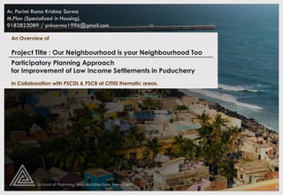
- 1. Participatory Planning Approach for Improvement of Low Income Settlements in Puducherry An Overview of Ar. Parimi Rama Krishna Sarma M.Plan (Specialized in Housing). 9182823089 / prksarma1996@gmail.com In Collaboration with PSCDL & PSCB at CITIIS thematic areas. Project Title : Our Neighbourhood is your Neighbourhood Too
- 2. PARTICIPATORY PLANNING APPROACH FOR IMPROVEMENT OF LOW INCOME SETTLEMENTS IN PUDUCHERRY 1 Aim To enhance the standard of living and housing condition of the low income settlements through participatory planning approach Objective 1. To study and analyze overall Housing scenario in Puducherry City. 2. To comprehensively study and analyze the scenario of slums in Puducherry city. 3. To study the various Policies, Government interventions and other interventions for slum upgradation 4. To study three identified slums, their socio-economic characteristics, the issues and the need pertaining to housing 5. To formulate a suitable planning and design strategy by enabling community participation and sustainable approaches AIM & OBJECTIVE BACKGROUND STUDY Location The Puducherry Union territory has 4 Regions - Situated on the coromandel coast, about 160 kms south of Chennai, lies the Puducherry district. The French ruled this territory for 300 years, and today, it stands as a living monument of the French culture in India. Yanam Puducherry Karaikal Mahe PUDUCHERRY 1. Yanam 2. Puducherry (Capital) 3. Karaikal 4. Mahe
- 3. HISTORY & EVOLUTION PARTICIPATORY PLANNING APPROACH FOR IMPROVEMENT OF LOW INCOME SETTLEMENTS IN PUDUCHERRY 2 • Puducherry is the Tamil interpretation of “new town” and mainly arrived from “Poduke”, the name of the marketplace as the “Port town” for Roman trading, way back in 1st century as mentioned in the ‘The Periplus of the Erythraean Sea’. • Puducherry gained its significance as “The French Riviera of the East” after the advent of the French colonialization in India.
- 4. GROWTH, CORRIDORS, DRIVERS AND DENSIFICATION PARTICIPATORY PLANNING APPROACH FOR IMPROVEMENT OF LOW INCOME SETTLEMENTS IN PUDUCHERRY 3 Oulgarai (NH-203) Aurovilli Year Development 1672 French governor Francis Martin purchased town of Puducherry from Sultan of Bijapur. Eventually brought many more villages under French administration. 1674 Fortified town constructed Year Acquisition Of Villages 1701 Chandernagar (West Bengal) 1708 Ariankuppam, Oulgarai, Murungapakkam, olandai, PakenamPak 1674-1716 Muthialpet, Nellithope and Mudaliarpet developed subsequently. 1725 Mahe 1731 Yanam 1739 Karaikal 1749 Bahour, Vazhudavur Year Development 1763 Development of Boulevard Town 1881 Process of ‘Renonciation’ started 1948 Until, comprised only of rural population 1961 An unprecedented growth of urban population has taken place. • Spatial trend of growth is seen within the Oulgaret Municipal area and Puducherry Municipal area. • Puducherry’s growth pattern is also guided along the major transport corridors, which are east coast road to Chennai, roads towards Tindivanam, Villupuram and Cuddalore. • Over the recent years, development towards East Coast road, Cuddalore Road and Tindivanam Road have gained significance for residential developments.
- 5. PARTICIPATORY PLANNING APPROACH FOR IMPROVEMENT OF LOW INCOME SETTLEMENTS IN PUDUCHERRY 4 POPULATION Name Population Total No. Of Households H.H. Size Municipalities Puducherry Municipality 2,44,377 (10.6%) 60,638 4 Ozhukarai Municipality 3,00,104 (37.8%) 74,133 4 Commune Panchayat Ariyankuppam 72,055 (31.6%) 16,274 4.2 Villianur 1,26,778 (42.7%) 12,438 4.2 Mannadipet 86,500 (40.7%) 17,646 4.1 Bahour 68,757 (26.3%) 19,292 4.5 Nettapakkam 51,718 (38.9%) 30,139 4.2 Puducherry Planning Area 9,50,289 (29.2%) 2,30,560 4.1 Puducherry Region Permanent Semi-permanent Temporary Urban (Puducherry and Ozhukarai Municipality) 1,41,039 87.37% 8,731 5.41% 10,422 6.46 % Rural (Commune Panchayats) 42,108 60.78% 10,522 15.1% 16,431 23.72 % Total 1,83,147 79.39% 19,253 8.35 % 26,853 11.64 % Population Distribution of Households in Urban & Rural : Urban Housing Condition Rural Housing Condition Population Distribution Of Puducherry Planning Area HH by ownership Owned Rented No exclusive room 6,917 (3%) 2,305 (1%) 1 Room 59,945 (26%) 36,889 (16%) 2 Rooms 53,028 (23%) 25,362 (11%) 3 Rooms 25,362 (11%) 9,222 (4%) >3 Rooms 11,528 (5%) 2,305 (1%) Total 1,54,475(67%) 76,085 (33%) Proportion of Households by ownership of Dwellings • It is observed that HH size is less in core city because of the rising trend of nuclear family whereas Household size is more in rural areas. • In rural areas almost 1/4th population lives in Temporary houses. • Ratio of HH residing in owned to rented is 67:33, i.e 33% of Households are living in Rented Houses. Occupation pattern (%) Migration Pattern • As per CDP-2036 the Puducherry Municipality (92%) and Villianur Commune (92.7%) has observed the highest migration due to marriage. • It is observed that the number of in- migrants is gradually increasing from 1981 to 2001 due to more employment opportunities which is 12%. • Around 4% of people migrated in 2011 due to increase in better educational facilities in Puducherry. • The overall work force participation rate in 2001 is 36.13% and 36.63% in 2011. • Increase in working population is observed due to growth of major industries and increase in tourism sector. • Tourism and Industries are the key economic sector of the region.
- 6. Map of Puducherry City profile PARTICIPATORY PLANNING APPROACH FOR IMPROVEMENT OF LOW INCOME SETTLEMENTS IN PUDUCHERRY 5 CITY PROFILE & PHYSIO - GRAPHICS Wind • In Puducherry region, the wind direction is not the same throughout the year. It changes from season to season. Soil Type • the soil is red loamy, red sandy, coastal alluvium .It is projected that soil moisture will increase by 15-20% over southern India during monsoon, but decline throughout the rest of the year which will impact the sediments . Rainfall • Rainfall happens as cyclonic storms mainly during the North-East monsoon which comprises of 50% of the total rainfall. • The low lying coastal areas are prone to floods by tidal waves immediately after most of the storms during north east monsoon. Climate • Located on a flat plain at an average elevation of 15 m from mean sea level (MSL). • The relative humidity is generally high and ranges to maximum of 70% during August to April and minimum of 60% during June and July. • The temperature varies between 27˚C to 37˚C. Puducherry city is non contiguous geographic in nature. Season Wind Direction Winter Season NNE (or) ENE Summer Season SW SW Monsoon W OR SW NE Monsoon N OR NE
- 7. PARTICIPATORY PLANNING APPROACH FOR IMPROVEMENT OF LOW INCOME SETTLEMENTS IN PUDUCHERRY 6 LAND USE • Multi nuclei concept has been adopted for the 2036 Master plan, each growth center and growth points are given land uses such that they can act as self-sustainable centers in terms of economy generations and civic amenities as well. • It is assumed that 40% of the land will be required in growth center, 25% in growth point, 15% in transit nodes • Majority of the commercial development takes place along the transportation corridors • Mixed Residential Zone where both commercial and residential development is allowed with restriction stipulated in the Development Control Regulations. Existing Land Use Map (2015) of Puducherry Planning area Legend : Land Use Landuse 1997 Puducherry Planning Area land use 2015 Puducherry Oulgaret P.P.A. Agriculture 21.85% 10.89 8.27 46.1% Commercial 1.74% 4.34 2.37 1% Water body 7.35% 13.18 2.51 13.45% Industry 5.03% 2.19 3.50 3.67% Mixed 0.91% 2.19 1.24 0.42% Recreation 5.40% 1.78 0.31 0.19% PSP 6.48% 6.38 22.85 5.15% Residential 30.88% 26.36 26.35 10.88% transportation 17.90% 17.32 14.97 7.49% Vacant 22.76% 15.22 17.45 11.40% Total 100 % Total area 4190 Ha 1955Ha 3455Ha 294.23Ha Land Cover Classification Comparison of existing land use
- 8. PARTICIPATORY PLANNING APPROACH FOR IMPROVEMENT OF LOW INCOME SETTLEMENTS IN PUDUCHERRY 7 LAND RATES Land rates of Different localities : • The areas like MG Road area and Anna Nagar have planned development and adequacy of amenities. Hence the land values are highest. • The areas like Thengaithittu have lowest land values as the land is not suitable for construction activities because of water bodies, salinity and low line area.
- 9. PARTICIPATORY PLANNING APPROACH FOR IMPROVEMENT OF LOW INCOME SETTLEMENTS IN PUDUCHERRY 8 ORGANISATION SET UP ROLE ORGANISATIONS 1. Housing Supply PSCB, PHB, Private Developers 2. Basic Service Provisioning PUDA, Smart City Corporation, PWD 3. Housing Finance HUDCO, NABARD 4. Approval & Regulations PPA, TCPD, Local Bodies
- 10. PARTICIPATORY PLANNING APPROACH FOR IMPROVEMENT OF LOW INCOME SETTLEMENTS IN PUDUCHERRY 9 COASTAL REGULATIONS • The Puducherry region has 24 KM coastline. For regulating the development and construction activities, the coastal stretches within 500 meters of high tide line on the landward side are classified into three categories, namely : CRZ-I, CRZ-II, CRZ-III CRZ I A • Areas that are ecologically sensitive such as national parks/marine parks, sanctuaries, reserve forests, wildlife habitats, mangroves, corals/coral reefs, areas close to breeding and spawning grounds of fish and other marine life, areas of outstanding natural beauty/ historically/ heritage areas. CRZ I B • Area between Low Tide Line and the high Tide Line CRZ II : • Areas up to or close to the shoreline, within the existing municipal limits or in other existing legally designated urban areas. • which are substantially built-up with a ratio of built-up plots to that of total plots being more than 50 per cent and have been provided with drainage and approach roads and other infrastructural facilities, such as water supply, sewerage mains, etc. CRZ III A • Where the population density is more than 2161 persons per sq.km as per 2011 census base. • In CRZ-III A, area up to 50 meters from the HTL on the landward side shall be earmarked as the ‘No Development Zone (NDZ)’. CRZ III B • Where the population density is less than 2161 persons per sq.km as per 2011 census base. CRZ-IV • Includes the water area covered between Low Tide Line and 12 nautical miles seaward. Except for fishing and related activities, all actions impugning on the sea and tidal water will be regulated in this zone.
- 11. PARTICIPATORY PLANNING APPROACH FOR IMPROVEMENT OF LOW INCOME SETTLEMENTS IN PUDUCHERRY 10 POLICIES & PROGRAMMES IMPLEMENTED BY GoP FOR SLUM DEVELOPMENT Year Policies Objectives Implementing Agency 1969 Pondicherry Land Acquisition & Development Scheme To make available Housing Plots at Reasonable Price. Lands are acquired and developed into Housing Plots with all infrastructure facilities and sold on “No Loss No Profit” basis to eligible public of various Income Groups. Health Education and Welfare Department UT 1971 The Public Premises (Eviction of Unauthorised Occupants) Act This act is enacted to provide for a speedy machinery for the eviction of unauthorized occupants in public premises Revenue Department & Municipalities Central 1972 Environmental Improvement of Urban Slums / Slum Upgradation Programme This is a CSS aimed at improving the environmental conditions in the existing slums by providing basic infrastructure like roads, water supply, toilets, drainage service, etc. Pondicherry Slum Clearance Board (PSCB) UT 1975 The Pondicherry Land Grant Rules (G.O.M.S.No. 91 dated 4th Aug. 1975) To assign Free House Sites (FHS) to the landless people in Puducherry to enable them to construct house and to improve their Security of Tenure Directorate of Survey and Land Records (DoSLR) UT 1986 The Slum Areas (Improvement and Clearance) Act Act that provides for the improvement and clearance of slum areas in certain territories and for the protection of tenants in such areas from eviction. Pondicherry Slum Clearance Board (PSCB) UT 2003 Puducherry Kamarajar Housing Scheme (PKHS) for Houseless Poor This scheme provides financial assistance to the BPL category families to construct a house on their own plot to achieve the objective of a ‘hut free state’. Pondicherry Slum Clearance Board (PSCB) UT 2005 Jawaharlal Nehru National Urban Renewal Mission (JNNURM) later replaced by Atal Mission for Rejuvenation and Urban Transformation (AMRUT) JNNURM is a CSS aimed at creating better urban services in the cities of India. Pondicherry Slum Clearance Board (PSCB) Central 2012 Rajiv Gandhi Housing Scheme (RGHS) This scheme provides housing subsidy for construction of house for the homeless scheduled caste and economically backward class people in Puducherry. Adi-Dravidar Welfare Department State: Tamil Nadu 2013 Rajiv Awas Yojana (RAY) later replaced by Pradhan Mantri Awas Yojana (PMAY) in 2015 It is a CSS aimed at creation of a ‘slum free India’ by providing access to urban civic amenities, social amenities and decent shelter for the urban poor. Pondicherry Slum Clearance Board (PSCB) Central 2014 Right to Fair Compensation and Transparency in Land Acquisition, Rehabilitation and Settlement Act The act provides the basis for acquisition of land for ‘public purposes’ replacing the old Land Acquisition Act, 1894. Revenue Department Central
- 12. PARTICIPATORY PLANNING APPROACH FOR IMPROVEMENT OF LOW INCOME SETTLEMENTS IN PUDUCHERRY 11 POLICIES & PROGRAMMES IMPLEMENTED BY GoP FOR SLUM DEVELOPMENT Legend :
- 13. PARTICIPATORY PLANNING APPROACH FOR IMPROVEMENT OF LOW INCOME SETTLEMENTS IN PUDUCHERRY 12 SLUM LOCATIONS & TYPOLOGY Existing slum locations in ward map ABD Area • The Untenable slums considered under SFCPoA are of 24 along with 143 tenable slums in 180 total slums , other 13 slums were not considered yet. • The slums in Puducherry are scattered in form of areas. • The Ward No. 8,1024,32 & 38 have high count of slums • The 20 Slums considered are under only ABD Area. • 20 slums (smart city mission), 3 site locations (HFAPoA – SFCPoA) City Population 244377 100% Slum population as per Census - 2011 Slum Population 77328 31.64% Area of Puducherry municipality 19.54 Sq. kms. CDP Report ABD Area Population 114000 100% ABD Area Population ABD Slum Population 15130 13.27% ABD Slum Population ABD Area 5.94 Sq. kms. ABD Area Legend : SITE : LAMBERT SARVANAN NAGAR
- 14. PARTICIPATORY PLANNING APPROACH FOR IMPROVEMENT OF LOW INCOME SETTLEMENTS IN PUDUCHERRY 13 SITE PLAN , CONNECTIVITY & LANDUSE Site Connectivity Land Use • The site is coming under Reddiarpalayam revenue village. • The site area is mostly of residential use and it is the predominant land use in this municipality with a percentage value of 28% • The Public & Semi-Public land use is the second largest occupied area with a percentage value of 14%. Site Plan : LAMBERT SARVANAN NAGAR • The Site Lambert Sarvanan Nagar is selected for smart city mission of Puducherry, under the category of New Housing Build. • The Site lies in Ward Rediarpalayam of Oulgaret Municipality. Existing Site Image Legend :
- 15. PARTICIPATORY PLANNING APPROACH FOR IMPROVEMENT OF LOW INCOME SETTLEMENTS IN PUDUCHERRY 14 SITE PROFILE , CLIMATE & LAND CHARACTERISTICS Project – New Housing Build Site Lambert Sarvanan Nagar Area Total Site Area = 2.97 Ha Proposed Site= 2873 SQM (0.2873 Ha) Municipality Oulgaret Proposed DU 160 Existing Units Total = 896 Dus 56 Blocks Completed = 432 Dus Under construction = 464 DUs Construction 2005-06 Proposed Site Land abutting the site on the North Cost / Housing unit Rs 8 Lakh (out of which 10% borne by Beneficiary as one time consolidated expenditure) Existing Problems Proposed site does not have a sewerage network in place. In addition to septic tanks there are open L shaped drains for sewage flow. Quality of water supplied is poor Land Characteristics Climate & Wind Flow
- 16. PARTICIPATORY PLANNING APPROACH FOR IMPROVEMENT OF LOW INCOME SETTLEMENTS IN PUDUCHERRY 15 STILT & TYPICAL FLOOR PLAN
- 17. PARTICIPATORY PLANNING APPROACH FOR IMPROVEMENT OF LOW INCOME SETTLEMENTS IN PUDUCHERRY 16 FLOOR PLAN & UNIT PLAN
- 18. PARTICIPATORY PLANNING APPROACH FOR IMPROVEMENT OF LOW INCOME SETTLEMENTS IN PUDUCHERRY 17 LANDSCAPE & SEWAGE PLANS Sewage Layout - Landscape Plan & Details
- 19. PARTICIPATORY PLANNING APPROACH FOR IMPROVEMENT OF LOW INCOME SETTLEMENTS IN PUDUCHERRY 18 Site View Site Walkthrough Section (A-A’) Front Elevation – South Side Dwelling Unit Walkthrough ELEVETION , SECTION , SITE VIEW & WALKTHROUGH’s • Building Height – 21.88 Mt. (S+6) • Stilt Height – 2.4 Mt. • Floor to floor Clear Height – 3.048 Mt. • Parapet – 1 Mt. • Mumty – 2.2 Mt.
- 20. THE END Ar. Parimi Rama Krishna Sarma M.Plan (Specialized in Housing). 9182823089 / prksarma1996@gmail.com