High Profile Call Girls Nagpur Meera Call 7001035870 Meet With Nagpur Escorts
Chapter13gullyerosion
1. 13–1
Soil conservation guidelines for Queensland
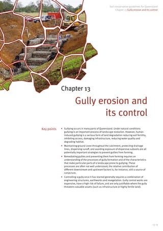
Chapter 13 Gully erosion and its control
Chapter 13
Gully erosion and
its control
• Gullying occurs in many parts of Queensland. Under natural conditions
gullying is an important process of landscape evolution. However, human-
induced gullying is a serious form of land degradation reducing soil fertility,
inhibiting access, damaging infrastructure, reducing water quality and
degrading habitat.
• Maintaining ground cover throughout the catchment, protecting drainage
lines, dispersing runoff, and avoiding exposure of dispersive subsoils are all
potentially important strategies to prevent gullies from forming.
• Remediating gullies and preventing them from forming requires an
understanding of the processes of gully formation and of the characteristics
that make particular parts of a landscape prone to gullying. These
processes are often not well understood; the relative contribution of
different downstream and upstream factors is, for instance, still a source of
conjecture.
• Controlling a gully once it has started generally requires a combination of
engineering structures, earthworks and revegetation. Gully control works are
expensive, have a high risk of failure, and are only justifiable where the gully
threatens valuable assets (such as infrastructure or highly fertile land).
Key points
4. 13–4
Glossary
average recurrence interval (ARI): the average period in
years between the occurrence of an event (usually a storm
or a flood) of specified magnitude and an event of equal
or greater magnitude.
back-push bank: a bank constructed by pushing
soil uphill rather than the conventional method of
constructing from the topside where the spoil-borrow
area becomes the flow channel; preferably used where
excavation of subsoil on the topside channel area may be
vulnerable to erosion such as in dispersive soils.
badlands erosion: a severely eroded gullied landscape
where surface soil has been stripped away; mostly devoid
of vegetation.
basal sapping: an alluvial gully process that occurs where
seepage exits at the base of a scarp within an alluvium,
and which leads to undercutting of the scarp.
bentonite: a clay that has great capacity to absorb water
and swell accordingly; used to seal dams and other
earthen structures
breakaways: a system of advancing gullies on a
floodplain, and which can coalesce to form a continuous
eroding front.
broad-crested weir: a weir for which the face is long
enough to allow parallel flow of water across the weir
such that a nappe does not develop —compare with a
sharp-crested weir.
builders’ plastic: durable poly construction plastic film
used on building sites or general areas where strong cover
or under-lay is required.
bund: an earthen structure used to restrain or divert
runoff flows; used in agriculture to collect surface run-off,
increase water infiltration and prevent soil erosion.
colluvial soil: unconsolidated soil and rock material
moved largely by gravity and deposited on lower slopes,
and/or at the base of a slope.
compost blanket: a 3–5cm thick layer of loose compost
made from biodegradable organic material and applied
directly to the soil surface to reduce runoff, control
erosion, and establish vegetation; seed commonly
included either prior to or during application.
cut-off wall: a watertight barrier for preventing seepage or
movement of water under or past a structure; made as a
masonary structure or a core of impervious material that
will reduce percolation of water.
dispersive soil: a structurally unstable soil with a high
percentage of clay and which readily breaks down into
constituent particles of clay, silt and sand. These soils are
highly erodible and cause turbidity in water—dispersion
occurs when linkages holding the clay platelets are
broken.
drop structure: a vertical structure used to convey runoff
from a higher level to a lower level, and commonly used
for cross-drainage works on roads, and for control of gully
erosion.
energy dissipater: an engineered hydraulic structure
used to absorb the kinetic energy developed in flowing
water; the kinetic energy is developed when flow
velocities are high as over a weir, or flowing down a chute.
erosion control mat: a mat woven from synthetic material
(polypropylene), or natural fibers such as straw, jute, or
coconut; used to increase soil stabilization, effectively
decreasing erosion and allowing vegetation to effectively
take root.
frontage: in the context of rural land: the land abutting a
stream or watercourse, that is, that part of a property that
is riparian to a stream.
gabion: a rectangular wire mesh cage filled with rock,
brick, or similar material, used for construction retaining
wall and anti-erosion structures—see also Reno mattress.
geofabric, geotextiles: permeable fabrics used on
earthen construction projects to reinforce and protect
the soil surface; or to separate different layers of soil;
typically made from polypropylene or polyester in three
basic forms: woven (resembling mail bag sacking), needle
punched (resembling felt), or heat bonded (resembling
ironed felt).
gully: commonly used to describe any drainage line
flowing towards a stream; in a soil conservation context:
a section of a drainage line that is unstable, with evidence
of soil removed by flowing water; highly visible form of
soil erosion, with steep-sided, incised, drainage lines
greater than 30 cm deep—also known as ‘dongas’, ‘
wadis’, or ‘arroyas’.
gypsum: a natural crystalline hydrated form of calcium
sulphate, (CaSO4
2H2
O); used as a soil ameliorant to
improve soil structure; improves water infiltration, seed
germination and root growth.
5. 13–5
Soil conservation guidelines for Queensland
Chapter 13 Gully erosion and its control
hydraulic head: the energy of a unit weight of a liquid,
expressed as the vertical height through which it would
fall to release the contained energy; the sum of three
components: the elevation head, the pressure head and
the velocity head.
hydraulic jump, (or ‘standing wave’): an abrupt rise
occurring in a liquid when a high velocity flow discharges
into a zone of lower velocity; accompanied by violent
turbulence; may be defined in terms of the sudden change
from super-critical flow to sub-critical flow
hydromulching, hydroseeding: a procedure where
a mixture of seed fertiliser and a mulch material is
sprayed as a water slurry onto an exposed soil surface
for revegetation purposes; mulch material can be paper,
wood, sugar cane, flax. With hydromulching, the mulch is
applied at heavier rates to protect the soil surface.
hydrostatic pressure: the pressure exerted on a portion
of a column of water as a result of the weight of the fluid
above it.
infiltration: the downward movement of water into a
soil, governed largely by the structural condition of
the soil, the antecedent moisture content of the soil,
and the nature of the soil surface including presence of
vegetation.
mitre drain, (or spur drain): a drain to conduct runoff from
a road shoulder or table drain to a disposal area away
from the road alignment.
nappe: a sheet (or curtain) of free-falling water flowing
from a structure such as a weir; also used to describe
the path of the falling water—see broad-crested weir or
sharp-crested weir.
notch: an indented section of a runoff control structure
designed to pass a flow over or through the structure at a
predetermined depth.
pervious weir, (or leaky weir): a weir constructed from
a permeable material designed to let the runoff pass
through, but trap sediment to provide a seedbed for
establishing a stabilising cover on a gully floor/bed;
consist of brush, logs, wire netting with straw, or similar
material.
Reno mattress: a thin flexible cage (less than 500 mm
thick), made of woven wire mesh to contain loose rock
or stone, and divided into cells to prevent the rock from
moving under a runoff flow; filled with rock at a project
site to form flexible, permeable, structures to promote
growth of natural vegetation—see also gabion.
riparian frontage land: defined for some landscapes
to be the width of land equivalent to the height of the
streambank, plus five metres.
sharp-crested weir: a weir that the crest is such that water
flowing over the weir falls cleanly away from the wall; a
weir that causes the nappe to spring clear of the crest,
leaving the flow to be free of viscous effects—compare
with a broad-crested weir.
sheep-foot roller: an earth compactor consisting of steel
drums on which projecting lugs are fixed for compacting
fine grained soils such as heavy clays and silty clays;
used for compacting soils in dams, embankments, earth-
fill projects, subgrade layers in pavements.
slaking: the process where soil disintegrates and
crumbles when exposed to moisture; the partial
breakdown of soil aggregates when wet rapidly and due
to the swelling of clay and the expulsion of air from pore
spaces.
spalling: a gully advancement process where runoff water
flowing over the sides of a gully can trickle back against
the gully wall, causing flakes or layers of wetted-up soil to
break off from the drier material underneath.
stilling basin (or stilling pond): a structure located
at the outlet of a pipe, spillway or chute to reduce the
energy (and turbulence) of the outflowing water and
subsequently reducing the flow to non erosive velocities.
stoloniferous plant: a species with a horizontal-growing
stem that runs along the ground surface and takes root at
intervals, examples include couch, kikuyu, sand spinifex;
useful as a protective cover against erosion.
table drain: part of a road formation, being a trapezoidal
or parabolic-shaped drain adjacent to the edge of a road
and designed to carry runoff water away from the road
surface.
verandah chute: technically a drop structure made
from corrugated iron, or similar roofing material, which
is cantilevered over the head of a gully; runof water is
discharged away from the face of the gully head and a
natural stilling basin is formed in the gully bed by the
falling water.
whoa-boy: a low trafficable bank across a road, designed
to intercept runoff flowing down the road; normally an
earth/gravel bank, but may be sealed.
wing bank: a bank located at the head of a structure to
ensure runoff is directed to the structure and not able to
bypass it.
6. 13–6
13.1 Introduction
Gullies are a highly visible form of soil erosion, with steep-sided, incised,
drainage lines greater than 30 cm deep. In lay terms, the word ‘gully’ is often
used to describe any drainage line flowing towards a stream; in soil conservation
it is a section of a drainage line that is unstable, with visible evidence of soil
removal. In some countries, gullies are referred to as dongas, wadis, or arroyas.
Gully erosion is both a natural and a human-induced process. Natural gully
erosion plays a major role in landscape evolution. Gullies, and the streams
that they feed into, help carve out valleys and supply alluvial sediment to fill
floodplains.
Gullies can occur anywhere in a natural drainage line as runoff flows from the
most remote part of a catchment to its outlet. However, a natural drainage line
is not a prerequisite for a gully to occur. Any management practice that leads
to runoff concentration has the potential to cause a gully at any location in the
landscape. This includes cultivation furrows, roads, tracks, stock pads and fence
lines.
Gullying occurs on all soil types but those with dispersive subsoils are most
vulnerable. Around 45% of Queensland has soils with at least some dispersive
properties. In these areas, gullies can sometimes affect most of the landscape,
creating what is referred to as ‘badlands’ erosion. Gully erosion is extensive in
vulnerable landscapes, with approximately 80,000 km of gully network in Great
Barrier Reef catchments (Thorburn and Wilkinson 2013).
Since the phasing out of the soil conservation extension service of government
agencies in the 1990s, there has been very little documentation on the
performance of gully control measures in rural areas. It is important that what
has been learnt from the gully erosion control work is shared. This needs to be
shared with people working on gully control both in Australia and overseas. It is
hoped that this chapter can provide a useful basis for future discussions.
Wherever possible, it is best to prevent gullies starting rather than attempting to
control them once a gully has formed.
Stabilising gullies with built structures can be difficult and costly and they
are prone to failure. They have only ever been used to a minimal extent by
landholders in Queensland. Gully control structures are often built in urban areas
and incorporated into designs to provide road cross-drainage.
While gully control structures may be justified on better quality soils, or where a
road or building is threatened by an advancing gully, the use of such structures
to control numerous gullies over large areas of vulnerable soils is impracticable.
This is especially so in the more remote grazing lands of the state, where graziers
are often struggling economically due to the long distance to markets, the
extreme wet/ dry climate, low soil productivity, land degradation from erosion
and weed invasion and increasing costs of production in relation to the amounts
received from sale of product. The result is little to no extra income or time to
reinvest in long-term property management or soil conservation actions such as
gully erosion control (Shellberg and Brooks 2013).
This chapter considers the impacts of gully erosion, the factors that contribute to
gully development, strategies to prevent gully erosion and options for controlling
it. Specialist advice should be sought before commencing a gully control project.
Keep in mind that opinions on the best plan of attack can vary considerably
depending on the past experiences of the specialist and on the resources
available—including time, materials, expertise and finances. For these reasons,
it is worth seeking several opinions.
Parts of this chapter have incorporated information prepared by Grant
Witheridge in a series of erosion and sediment control fact sheets detailing a
range of works used for gully control (see Catchments and Creeks 2010 a–e).
7. 13–7
Soil conservation guidelines for Queensland
Chapter 13 Gully erosion and its control
13.2 Impacts
Gully erosion is important because it affects soil productivity, restricts land
use, degrades cultural sites and potable water supplies, and can threaten
infrastructure such as roads, fences, access and buildings. As gullies have a
direct connection to streams they have a major impact on water quality. Eroded
soil ends up in waterways, road culverts, dams, reservoirs, creeks, rivers and
marine environments. Depositions in streams can result in a decreased hydraulic
capacity, leading to more frequent overbank flooding.
The dominant sediment supply from many rivers in the Great Barrier Reef
catchment is from a combination of gully and streambank erosion, and subsoil
erosion from hill-slope rilling, rather than broadscale hill-slope sheet erosion
(Kroon et al. 2013). Wilkinson et al. (2015) reported that gully erosion contributes
approximately 40% of all fine sediment to the Great Barrier Reef lagoon. Bartley
et al. (2015) reported that approximately 30–40% of additional catchment
sediment yields are derived from streambank erosion.
Sediment from eroding gullies does not necessarily go straight to creeks and
rivers. Larger soil particles such as sand and silt are readily deposited and move
downstream as a series of pulses during larger floods. However, gully erosion
from soils with a high percentage of clays—dispersive soils—can produce very
small clay particles that remain in suspension and can result in turbid water.
Any nutrients from applied fertilisers and pesticides that are attached to
eroded particles will pollute watercourses and affect aquatic life. Cropping
areas are more likely to deliver fertilisers and pesticides, but their usage is
being better managed now as farmers adopt best management practices and
strive for increased efficiency. However, there is virtually no use of fertilisers
in the extensive grazing lands of Queensland. Pesticide use in these areas is
normally limited to that required for the control of exotic weeds, with little risk of
downstream impacts, unlike those risks from transported sediment.
Gullies associated with drainage lines or tracks can cause a considerable
increase in the time to travel about a property; and are also a significant safety
hazard, especially for smaller vehicles like quad bikes. When a property road
becomes impassable due to gullying, often new access is made on adjacent land.
Unless preventative measures are taken against erosion, the new road will suffer
the same fate as the old road.
8. 13–8
13.3 Gully components
The various components of a gully are illustrated in Figure 13.1. They include
the head, sides and the bed or floor of a gully. As a gully lengthens, it develops
lateral branches. There may be several gully heads advancing up a gully at any
one time in what can be called a ‘steps and stairs’ pattern.
Figure 13.1: The components of a gully
Gully head
Lateral
gully
branch
Secondary
gully head
Gully
floor
Gully
sides
The difference between a creek and a gully
Just as there is no well-defined difference between a river and a creek, there is
no well-defined difference between a creek and a gully. Figure 13.2 shows the
numbering system used for different stream orders. Higher stream orders are
rivers, while the lower stream orders can be gullies that flow into a creek. Some
differences between creeks and gullies include:
• Gullies can retreat to the very top of their catchments.
• Gullies generally have far more capacity than they need to carry the flow they
receive.
• Gullies may be short and isolated on hillslopes.
• Tree roots help to stabilise saturated streambanks, but trees have a limited
role in stabilising gully heads.
• Gullies would not normally be a habitat for fish and any structures built in
them should not need to cater for fish passage.
Figure 13.2: Numbering system of
stream orders
9. 13–9
Soil conservation guidelines for Queensland
Chapter 13 Gully erosion and its control
13.4 Triggers for gully development
Any change in a land use or practice that reduces rainfall infiltration results in
shorter times of concentration of runoff, increased volumes and velocities of
runoff, and therefore higher risks of erosion.
Gullies can be created by local, upstream or downstream influences, and often
there is more than one factor involved. In some circumstances, the local or
downstream influences may be just as important as those upstream.
13.4.1 Local triggers
Local triggers of gully formation usually occur on land that is not within a natural
watercourse, but may divert and/or concentrate overland runoff flows to land
that is vulnerable to erosion. They include:
• roads and tracks
• stock pads
• fences
• firebreaks
• dam by-washes
• furrows in cultivation that can develop into rills that become gullies
• failed contour banks and waterways
• sink-holes on alluvial plains from cracking soil, or old stump holes
• levee banks or diversion banks that direct runoff to an incised stream
• saline areas.
Saline areas have depleted vegetation and become very susceptible to erosion.
On the positive side, the eroding gully may help to provide drainage to the area
that could assist in alleviating the salinity problem by lowering the watertable.
Control options in this situation should aim to stabilise the drain but allow it to
maintain its subsoil drainage function.
Figure 13.3: Gully initiation as a result of concentrated flow down (a) a vehicle access track, and (b) a walking track/stock
pad on a stream bank
(a) (b)
10. 13–10
13.4.2 Upstream triggers
Runoff first commences as overland flow when the rate of rainfall exceeds the
rate of infiltration. This situation may occur as a result of raindrops impacting on
bare soil and reducing its infiltration rate. This occurs more quickly on a bare soil
compared to a covered soil, but can occur when rainfall rate exceeds infiltration
rate, regardless of soil cover conditions.
An effective ground cover allows rain to soak into the soil, until it becomes so
saturated that the rainfall becomes overland runoff. On sloping land, overland
runoff can concentrate after a very short distance, perhaps only a few metres.
Upstream triggers include increased runoff from changed land use such as tree
clearing, overgrazing, cultivation, burning or urban developments. Overgrazing
results in degraded surface vegetation—a reduction in biomass, ground cover
and vegetal basal area—leading to reduced rainfall infiltration, increased runoff
and initiation of the erosion processes (Prosser and Dietrich 1995).
Increased runoff from hillslopes will concentrate in a natural drainage line and
create a risk for gully erosion to occur. A change in the equilibrium of the stream
may occur when a channel needs to modify its shape to allow for an increase in
flood levels. The increase in runoff is said to destabilise the equilibrium of the
drainage line.
The gully erosion process begins when scouring occurs at one location along
an overland flow path (Figure 13.3). This may be due to a combination of factors
including a lack of ground cover, a more erodible soil, and an increase in the
flow velocity caused by the narrowing of the flow path or a sudden change in
land slope. It may also occur after infiltrated runoff through the surface soil is
impeded by impervious subsoil, resulting in the soil quickly becoming saturated.
13.4.3 Downstream triggers
This form of gully initiation is quite common and yet it is rarely mentioned in
most texts.
An example of a downstream influence is when the outlet of a stream is lowered,
resulting in the overall length of its bed becoming steeper. In past geological
eras, an increase in stream gradients may have occurred as result of a fall in
ocean levels or a rise in the catchment landscape. Erosion of the streambed may
steadily advance upwards into the catchment. When the stream bed erodes,
the stream can become more incised. Drainage lines flowing into the stream
then become eroding gullies over-falling into the stream. This sets off a system
of advancing gullies throughout a catchment. Such gullies may eat their way
back to the very top of their catchments even though their contributing areas
can be very small. Where a gully has virtually no catchment, raindrop impact in
the gully itself can become the main source of runoff, soil loss and subsequent
downstream sediment.
There is evidence that gully development in the Fitzroy and Burdekin River
catchment could be associated with downstream triggers. Jones (2006) pointed
out that these two catchments were once small coastal catchments with their
headwaters in the coastal mountain range that is still present today. These
coastal streams were short and steep by comparison with those in the interior,
and also a lot wetter, allowing a more active erosion environment along the
coast. As the coastal streams expanded, the drainage divide moved rapidly
westwards through gaps in the coastal range.
11. 13–11
Soil conservation guidelines for Queensland
Chapter 13 Gully erosion and its control
Stream capture began a phase of regional erosion, where rills and gullies
transported large quantities of sediments to the coast (similar to that shown in
Figure 13.4). Large volumes of sediment were transported beyond the present
coast during periods of low sea level and contributed to a major eastward bulge
on the central Queensland continental shelf. Much of the sediment from the
Burdekin was deposited in what is now the vast agricultural area of the Burdekin
Delta (Jones 2006).
Figure 13.4: Gully forming processes: a) the scarp retreat model; b) an example from a tributary of the Grand Canyon in
the United States. The more active stream on the right is capturing the lower sloping stream network on the left. A similar
process is occurring in the Fitzroy, Burdekin and other coastal catchments in Queensland. (Source: Google Earth)
13.4.4 Some examples of gully development in Queensland
Gully erosion in grazing lands
About 80% of Queensland is available for grazing, from the humid coast to the
arid western rangelands. All of these lands are subject to soil erosion, most
commonly by water but also by wind in more arid areas. Erosion can seriously
affect the productivity of grazing lands. The movement of sediment, nutrients
and organic matter, by wind or by water, also adversely affects water quality in
streams.
The following quote from a study of the Upper Nogoa catchment reported by
Skinner et al. (1972) described the situation where gully heads have retreated to
the top of their catchments.
... most of the sharply defined gully heads have long ago advanced nearly
to the tops of their catchments. The most striking change visible is the
development of networks of rills and scour gullies on bare areas. Many new
scours five chains long or more appeared between 1956 and 1965, and rills
existing in 1956 were noticeably deeper and wider in 1965. So it appears that
gullying is now essentially a sheet erosion/rill erosion process rather than one
of upslope advance of sharply defined heads.
Sheet erosion involves the loss of surface soil over large areas, caused by the
action of water or wind. This form of erosion is not always obvious but it results
in significant loss of productive soil. In some arid areas, all of the topsoil may be
removed, leaving a scalded surface. Where runoff begins to concentrate, both rill
and gully erosion may occur.
(a) (b)
12. 13–12
Gullies in grazing lands may be relatively isolated or they may occur frequently
throughout a landscape, being influenced by any of the three triggers discussed
above.
Soils with dispersible subsoils can develop tunnel erosion. Landscapes with
such soils may develop closely spaced gullies similar to a ‘badlands’ situation.
This occurs in some parts of the Burdekin and Fitzroy catchments as well as in
other zones with extensive areas of dispersive soils.
Gully erosion in cropping lands
Gully erosion is not widespread on Queensland’s cropping lands, which
represent only 2.5% of the total area of the state. However, it is still significant,
particularly where valuable on-farm assets are threatened.
Cultivated soil is vulnerable to gully erosion, especially under bare fallows
or fast-flowing floodwaters. Bare soils readily produce runoff that is soon
concentrated by the furrows in the paddock. Rill erosion occurs and as the
rills deepen they soon become gullies that cannot be cultivated and cropped.
This makes the paddock very difficult to manage, and rates of soil loss will be
very high. By the middle of the last century, soil erosion had become a very
serious problem in Queensland cropping lands, resulting in large areas of land
withdrawn from cropping uses.
Soil conservation measures for cropping lands are now widely accepted by
landholders and include the maintenance of surface cover and the construction
of soil conservation works, like contour banks and grassed waterways. As a
result, gullying is less common than previously, although there is a need for
continued vigilance.
Contour banks direct runoff into grassed waterways. If these are not well
maintained, they are likely to fail, resulting in the development of gullies within
the waterways.
Significant areas of cropping land are still in need of conservation measures to
control erosion and to prevent the development of gullies.
Gullies associated with streams
Many streams have steep banks that have the potential to initiate a serious gully
erosion problem. Under natural conditions, runoff from adjacent land usually
enters a stream via a drainage line that is stable with a relatively low gradient.
However, if the natural flow is diverted by a road, diversion bank, cattle pads
or other feature, then a highly erosive, cascading waterfall can form as runoff
flows over the bank. This will result in a gully that can rapidly progress upslope;
the greater the height of the streambank, the greater the potential for serious
erosion.
Streambed erosion can be caused by a number of human-induced factors and
has been discussed earlier (see Chapter 11 Stream stability). Streambed erosion
is also a natural process that has been caused in the past by changes in climate
which have led to falls in sea levels. A sea-level fall can initiate an increase in the
rate of erosion along the length of the stream. If streambed erosion occurs where
a drainage line enters a stream, the stability at this point will be upset, resulting
in gullying in the associated, adjacent drainage line.
13. 13–13
Soil conservation guidelines for Queensland
Chapter 13 Gully erosion and its control
Alluvial gullies
Alluvial gullies are initiated in river- and creek-banks along river frontage lands.
While gullies are normally associated with a relatively narrow flow path, a
system of advancing gullies on a floodplain—also called ‘breakaways’—can
coalesce to form a continuous eroding front (Shellberg and Brooks 2012). Where
highly erodible soils occur, the wide gully head can retreat rapidly onto river
terraces and elevated floodplains as shown in the cross-sectional view in Figure
13.5a, and in the aerial view in Figure 13.5b. Examples are found in some of the
rivers flowing into the Gulf of Carpentaria.
Figure 13.5: Gullies on a floodplain coalescing to form a continuous front: (a) cross-sectional view; (b) plan view (source:
Shellberg and Brooks 2013)
Alluvial gully erosion can result from both natural and human-induced
processes. River incision over geologic time, dispersive soils, intense high-
rainfall events and flooding are natural factors priming the landscape for gully
erosion. Overgrazing and poorly located stock pads and roads on streambanks
can accelerate the erosion process.
Growth of an alluvial gully system can occur as floods recede and floodwaters on
the floodplain drain into the stream channel. However, raindrop impact on the
gullied area and local runoff can also make significant contributions.
Most alluvial gullies drain directly into nearby rivers that deliver sediment and
nutrients long distances and eventually settle in inland basins, estuaries and
coastal waters. However, some alluvial gullies may drain away from the main
rivers and deposit sediment into local creeks and lagoons.
Gully erosion associated with infrastructure
Runoff concentrated by property infrastructure such as roads, tracks, dam by-
washes, fences and laneways all have the potential to cause gully erosion. Stock
pads leading to poorly located yards and watering points can also develop into
gullies.
This form of erosion may occur anywhere in Queensland but outback areas
can be especially vulnerable. South-west Queensland has an average annual
rainfall of around 125 mm but the road systems in this area are constantly being
damaged by gully erosion. Dispersive subsoils are common and the low rainfall
means that it is very difficult to maintain an effective vegetation cover to protect
the soil surface.
(a) (b)
14. 13–14
Properly installed road structures—such as culverts, inverts or floodways—can
safely convey overland flows and flood flows across the road corridor. These
can act like a drop structure and safely convey runoff from a higher level above a
road to a lower level below the road. The greater the spread of the flow below a
road, the less likely it is that gully erosion will be initiated.
More information on this topic can be found in Chapter 14 Property infrastructure.
Gully erosion associated with mining activities
Seismic exploration activities require extensive road and track construction in a
crisscross pattern. These roads were often constructed with a subsurface profile,
resulting in the exposure of dispersive soils where concentrated runoff has then
led to serious gully erosion.
Mining activities can create steep spoil heaps with exposed dispersive subsoils.
Such sites are also prone to serious gully erosion.
15. 13–15
Soil conservation guidelines for Queensland
Chapter 13 Gully erosion and its control
13.5 Gully development and expansion
Runoff gains energy as it flows over a gully head into a plunge pool, causing
various gully expansion processes to occur. A gully, like a stream out of balance,
attempts to reach a new balance as it goes through processes that may change
its length, depth and width.
Figure 13.6: Runoff in a gully after heavy rainfall
Gully depth is often limited by the depth to the underlying rock, which means
that for many Queensland landscapes, gullies are normally less than 2 m deep.
However, on deep alluvial and colluvial soils, gullies may reach depths of
10–15 m.
A gully floor can be subject to further down-cutting as secondary gullies
advance up the channel in a ‘stepwise’ pattern (Figure 13.6). Gullies generally
create far more capacity than they need to accommodate the runoff they are
likely to carry, so it is rare for a flow to overtop the banks of a gully.
The following are processes that can cause gullies to expand:
• gully head advancement
• development of lateral branches
• slumping initiated from subsurface flows (seepage)
• slumping initiated by erosion of the toe slope
• basal sapping
• spalling
• tunnelling in dispersive soils
• raindrop impact
• slaking
• trickle flows
• cracking.
16. 13–16
13.5.1 Gully head advancement
Splashback at the base of the gully head erodes the subsoil, resulting in the
surface soil falling into the plunge-pool and the gully advancing upslope (Figure
13.7a).
As a gully ‘eats’ its way upslope, the slope in the bed or floor of a gully will be
less than the original land slope. For example, a gully advancing up a 3% land
slope may have a floor with a bed slope of only 1%. This means that the height of
the overfall at the gully head (points A, B and C in Figure 13.7b) and the height of
the gully sides would increase as the gully advances.
Figure 13.7: Gully advances: (a) gully head development; (b) changes in height and bedslope as gully advances upslope
Plunge pool
Stable top soil
Dispersible
sub soil
Surface flow
A B C
Overfall at
the knick point
Gully heads can advance almost to the very top of their catchment (Figure 13.8).
The gully in the inset of Figure 13.8b has developed because it is flowing into a
deep drainage line. Such gullies have very little catchment and often have far
more capacity than is required to accommodate the runoff that might occur even
in an extreme rainfall event. The Grand Canyon in the United States provides an
example of this situation. The canyon is up to 1800 m deep, but the Colorado
River that created the canyon by erosion is generally less than 10 m deep.
Figure 13.8: Examples of gullies that have advanced to the top of their catchment: (a) in plan view; (b) in the field
0 km 1 km 2 km
Development of lateral branches
Runoff may enter a gully from the sides, causing secondary gullies or branches,
resulting in a ‘badlands’ landscape, (Figure 13.8b). The gully floor may be subject
to further down-cutting as secondary gullies advance up the channel. Sediment
deposition below gully heads results in a ‘steps and stairs’ pattern.
(a) (b)
(a) (b)
17. 13–17
Soil conservation guidelines for Queensland
Chapter 13 Gully erosion and its control
Erosion and sedimentation may occur simultaneously in different sections of
a gully. In a sediment laden flow, sediment is deposited when vegetation is
encountered, or when the grade becomes so low that the flow is too slow to carry
the total load. This is most likely to occur in the downstream segments of a gully,
and the deposition then gradually extends upstream.
13.5.2 Slumping initiated from subsurface flows (seepage)
In a prolonged rainfall event, the soil becomes saturated and runoff occurs,
either above the surface (overland flow), or if local conditions allow, below the
surface (subsurface flow).
Subsurface flow—seepage, through-flow or interflow—can cause the saturation
of the walls of a gully, leading to slumping of both gully heads and gully sides.
Figure 13.9a shows how seepage can occur in the A2 horizon of dispersive clay
soils; Figure 13.9b is a field example of this process.
Figure 13.9: Sidewall gully expansion resulting from subsurface flows: (a) diagrammatic representation; (b) field example
Seepage flow through the
bleached A2 horizon
Impermeable,dispersive,
clay B horizon
New South Wales Soil Conservation Service (1992) and Milton (1971) point
out the importance of seepage in gully development in New South Wales and
Victoria, respectively.
The amount of saturation, and the subsequent impact on gully development,
depends on the soil type. For example, some soils have permeable topsoil and
impermeable subsoils. Where bleached topsoils occur on the side of a gully,
water can seep out resulting in a collapse of the gully wall.
‘Basal sapping’ is a term used to describe an alluvial gullying process that
occurs where seepage exits at the base of an eroding scarp within the alluvium
and causing a similar process as shown in Figure 13.9b.
Groundwater flows, or seepage, can contribute to the failure of gully control
structures, especially where flows are saline. These small but continuous
flows can weaken vegetation and threaten the stability of a chute lined with
vegetation. Where soils are dispersive, groundwater flows causing tunnelling can
lead to the failure of structures. Groundwater flows may also cause a build-up in
hydrostatic head behind a concrete structure, leading to uplift of the structure.
Where a gully control structure is being considered, it is essential to monitor
seepage flow at a gully head and side walls, and ensure any structural works will
not be affected by groundwater impacts.
(a) (b)
18. 13–18
13.5.3 Slumping initiated by erosion of the toe slope
Figure 13.10 shows how a gully with dispersive soil can be undermined and
widened by a shallow flow in the gully. Under these circumstances, gullies can
expand with little or no surface flow.
Gully scouring of the toe slope can lead to mass failure of the side of the gully
under gravity. This soil is then washed away by subsequent flows.
Unstructured soils and soils that slake are also vulnerable to sidewall slumping.
Figure 13.10: Gully widening by undercutting and slumping: (a) diagrammatic representation; (b) real-life example
A shallow flow in
the gully causes
undermining of the
dispersible soil
Dispersible
subsoil
The soil above the undermined
area collapses into the gully to be
carried away by the next flow.
13.5.4 Spalling
Water running over the sides of a gully can trickle back against the gully wall,
causing a layer of wetted-up soil to break off from the drier material underneath.
The process is known as ‘spalling’ and may cause gully advancement similar to
that illustrated as a lateral gully branch in Figure 13.1. Collapse of the topsoil will
occur if sufficient undermining occurs.
13.5.5 Tunnelling in dispersive soils
Dispersive soils are prone to tunnel erosion, an insidious process where
subsurface water movement creates tunnels below the ground surface. The
tunnels can remain unnoticed until they collapse to form potholes or sink-
holes that can expand into gullies. Dispersed particles escaping from a tunnel
system will cause turbidity of the runoff in the gully showing a muddy or milky
appearance.
Tunnelling, or piping, can occur in susceptible soils in their natural situation, or
following disturbance. It can occur in paddocks used for grazing or cropping, or
in construction projects such as dams, gully control structures, trenches, roads,
embankments and building sites.
Runoff can enter impermeable and dispersive subsoil via a crack or channel in
the subsoil; post-holes, rotting tree stumps, old root lines or animal burrows
may all provide an entry point. The whole process is speeded up significantly if
water is able to find an exit point such as an adjacent gully. As the saturated clay
acts as a fluid, it will exert hydrostatic pressure, forcing its way to an outlet lower
down the slope or at the side of a gully (Figure 13.11), or at a road cutting—that is,
where an hydraulic gradient exists from the entry point to a potential exit point.
(a) (b)
19. 13–19
Soil conservation guidelines for Queensland
Chapter 13 Gully erosion and its control
Figure 13.11: Gully expansion by tunnel erosion: (a) diagrammatic representation; (b) field example (source: New South
Wales Soil Conservation Service 1991a)
13.5.6 Raindrop impact
Where gullies have very small or no catchments, there will be very little runoff
produced, and raindrop impact can be the main process leading to gully growth.
Raindrops impacting on bare gully floors and sides can be responsible for the
loss of significant quantities of soil. On gully sides with dispersive soils, this can
result in the fluting or carving of subsoils into intricate patterns. In Figure 13.12,
a flat pebble in the floor of a gully has protected a 5 cm high column of soil from
raindrop impact. That pebble would have been removed, however, if a significant
runoff flow had occurred in the gully.
Figure 13.12: Loss of soil from a gully due to raindrop impact
Slaking
Slaking, which can be linked to gully expansion, is the breakdown of soil
aggregates into small sub-aggregates when wet rapidly. Slaking is similar to
dispersion, and refers to the process where the soil disintegrates and crumbles
when exposed to moisture; the smaller soil particles are then more vulnerable to
dispersal.
Some soils are vulnerable to both slaking and dispersion while others slake
but do not disperse. Slaking occurs in a range of soil textures and is linked to
the desirable process of self-mulching that occurs in many cracking clay soils
(vertosols). Self-mulching produces a loose surface layer of granular aggregates.
Non-dispersive clay soils can also lead to tunnel erosion, and this has caused
the failure of some gully control structures constructed in these soils.
(a) From this: (b)
(a) To this:
20. 13–20
13.5.7 Trickle flows
Peak flows from intense rainfall can obviously cause considerable gully erosion;
however, prolonged low flows can also exacerbate the growth of a gully.
Constant trickle flows in a drainage line may occur as the aftermath of a large
rainfall event, or when there is seepage of groundwater into an incised channel.
Saturation of the trickle pathway can make the soil structurally weak and very
susceptible to erosion. The constant wet conditions result in less cohesive
strength of the soil and can weaken the ability of vegetation to resist the erosion
process.
13.5.8 Cracking
In very dry weather, cracks of up to 2 m deep and 100 mm wide can develop in
cracking clay soils, such as those found on the Darling Downs and in the Central
Highlands. Large slabs of soil may fall into the gully, leaving vertical sides. The
cracks are interconnected laterally and when runoff occurs, water penetrates
the cracks and moves downslope through the soil. The soil swells and closes up
eventually, but not quickly enough to prevent large volumes of water from filling
cracks in the subsoil. If a lower outlet exists, the hydraulic head may cause a
subsurface flow and tunnelling will develop.
In soils with dispersive clay subsoils, cracks can occur in the subsoil adjacent to
a gully and will extend upwards to the surface. Runoff will then enter the cracks
and cause rapid expansion of the gully (see Figure 13.13 showing examples from
the Bowen Catchment)
Figure 13.13: Field examples from the Bowen catchment: a cracking vertosol overlying a dispersive sodosol has resulted
in the expansion of the gully (P. Zund personal communication
21. 13–21
Soil conservation guidelines for Queensland
Chapter 13 Gully erosion and its control
13.6 Minimising gully erosion
It is essential that lands susceptible to gullying be monitored regularly to detect
early stages of gully formation.
Economically, it is far better to prevent gullies from occurring than to attempt to
control them once the erosion has started. Once they have started, some control
measures are relatively simple; others are more complex and need care with their
design and construction. Significant expense may be required and attempts to
control gullies can end in failure.
A range of measures to avoid development of gullies is described below.
13.6.1 Grazing land management
Surface cover is the key to mitigating erosion in grazing lands. It prevents
erosion by maintaining the soil in a condition that absorbs rainfall. Any runoff
that does occur may have its kinetic energy dissipated by the cover and is
less likely to concentrate into an erosive force. However, surface cover is
only likely to be effective in reducing gully development where the gullies are
initiated by upstream triggers. Where downstream triggers are influencing gully
development, the gully head may continue to advance upslope into a well-
managed pasture.
Wilkinson et al. (2015) suggest three land-use principles for the adoption of
suitable grazing practices in the Great Barrier Reef catchments to reduce gully
sediment yields:
• Promote revegetation of gully channels to reduce sediment transport capacity
and so trap sediment, by reducing the slope gradient or by increasing
hydraulic roughness.
• Maintain vegetation ground cover on gully features to reduce surface erosion.
This was based on previous studies that showed gully erosion rates were
slower where ground cover was higher; also that incision of new gullies was
also sensitive to vegetation cover.
• Reduce surface runoff into gully systems and so reduce gully sediment yield.
Information on maintaining adequate surface cover in grazing lands [e.g. >70%
at end of dry season; see Wilkinson et al. (2015)] can be obtained from the
publication Managing grazing lands in Queensland (Department of Environment
and Resource Management 2011). This provides information under the following
categories:
• managing total grazing pressure
• using appropriate pasture utilisation rates
• implementing appropriately timed spelling and herd management strategies
• monitoring pasture composition
• strategic use of hay, supplements, fodder trees and shrubs
• managing the tree/grass balance to avoid woodland thickening
• implementing forage budgeting strategies
• using climate and seasonal forecasting resources
• maintaining native grassland free of encroachment from woody vegetation
• using appropriate fire management practices
• fencing according to land types
• managing the distance stock has to travel to water.
22. 13–22
Contour banks are not necessary on well-managed pasture land. Poorly
maintained banks on former cropping land returned to pasture may lead to rilling
and gullying. Banks located on such land may be levelled, or gaps created in
them, to safely disperse overland runoff, particularly where it is not intended that
the land will be returned to cropping uses.
Certain types of regrowth vegetation may be protected under vegetation
management legislation and regulations. More detailed information on the
legislative requirements related to vegetation management may be found at the
Queensland Government website: <qld.gov.au/environment/land/vegetation/
management/>.
13.6.2 Management of riparian lands
Riparian ‘frontage’ lands are defined in some landscapes to be the width of
land equivalent to the height of the streambank, plus five metres. These areas
need careful management as they are often fertile and generally retain high
levels of soil moisture. As pastures in these areas are often ‘sweeter’ they are
preferentially grazed by stock, potentially making the riparian land subject to
severe erosion. Erosion of streambanks and gullies, as well as scalding, may be
evident.
Fencing riparian zones and providing off-stream water points can have a number
of benefits associated with restricting stock access to the area, including:
• preventing the disturbance and bogging of the streambed
• preventing the formation of cattle pads that can cause gullies
• assisting the rehabilitation of gullies
• improving water quality
• reducing the spread of weeds
• making stock mustering easier.
Fencing riparian areas allows grazing pressure to be more closely controlled.
Restricting the grazing of riparian land until early in the dry season can have the
following benefits:
• Grazing is directed onto the green leaf of pasture grasses (reducing the
amount of browsing on trees and shrubs).
• High levels of ground cover are maintained—pastures have had a chance to be
spelled over the wet season.
• Advantage can be taken of the high feed quality compared to surrounding
areas.
Strategies for fencing riparian areas include:
• establishing a frontage paddock by fencing out the upland areas adjacent to
the floodplain
• fencing out high-priority water bodies such as natural springs
• protecting areas that are especially vulnerable to gully and streambank
erosion
• separating out the immediate riparian area.
Fencing is not necessarily intended to completely exclude stock from riparian
areas and should create paddocks large enough to be workable management
units. In most cases, it would be impractical to fence both sides of all riparian
areas in extensive grazing lands.
23. 13–23
Soil conservation guidelines for Queensland
Chapter 13 Gully erosion and its control
Off-stream watering points (or troughs) supplied from permanent natural
waterholes or from bores may be used as an alternative to fencing, as they
reduce the time cattle spend in creeks and waterholes. In many cases, stock
prefer to drink from well-placed troughs, particularly if access to the watercourse
is difficult, water quality is low, or there is danger (e.g. crocodile habitats).
13.6.3 Management of cropping lands
Gully erosion can best be avoided in cropping lands by:
• adopting stubble retention and zero tillage practices
• constructing contour banks and vegetated waterways on sloping land, and
maintaining them to appropriate specifications
• ensuring that contour banks discharge into waterways at stable locations; and
the waterways discharge into naturally stabilised areas
• adopting strip cropping practices on cultivated floodplains to spread flood
flows, and avoiding practices that concentrate flood flows.
Chapters 7–10 and Chapter 12 in these Guidelines contain more detailed
information relative to managing cropping land to mitigate gully erosion.
13.6.4 Roads, tracks, fences and firebreaks
Property infrastructure is a common initiator and driver of gully erosion. The
susceptibility of roads and tracks—and their table drains—to erosion may
depend on soil types, the cross-sectional profiles and their location in the
landscape. Similarly, fences and firebreaks oriented across the land slope
may result in the diversion/concentration of overland runoff leading to the
development of gullies.
Roads, fences and firebreaks should be situated in locations that do not readily
divert overland runoff and concentrate it to areas that lead to gully erosion. The
best place for a road is to follow a ridge line. An examination of satellite imagery
in seriously eroded paddocks in the Burdekin catchment shows that graziers
being aware of this consistently use ridge lines for access. Roads that run directly
up and down the slope will divert or concentrate less runoff than those diagonal
to the slope.
Roads should have a profile that does not concentrate overland runoff. Roads
that are below normal ground level through constant use or inappropriate
maintenance should be re-profiled to a form that does not concentrate overland
runoff; alternatively, they should have drainage works incorporated to ensure
runoff is dispersed onto stable areas. Associated table drains and mitre drains
should have a trapezoidal shape with a flat bottom, and not a triangular shape
that is more conducive to eroding.
Access on vulnerable, steep riparian frontage land can be located so as to
restrict the amount of runoff that can be diverted or concentrated. Whoa-boys
can be located within the access to ensure concentrated runoff is directed to
stable areas. Similarly, fences can be located in riparian areas such that stock
tracks do not develop into gullies through the banks of watercourses.
More information about the effects of property infrastructure on erosion is
provided in Chapter 14 Property infrastructure.
24. 13–24
13.7 Managing gully erosion
13.7.1 Options for the control of gullies
Prior to undertaking any repairs or rejuvenation of gullied areas, it is important to
carry out a full assessment: causes, options and resources available, including a
plan for ongoing monitoring and maintenance.
SEQ catchments (2015a) list the following as a gully erosion planning checklist:
• define the problem
• design a solution
• implement the design
• check effectiveness.
In general, options that should be initially considered include managing the
contributing catchment in a way that increases rainfall infiltration, and reducing
overland runoff. Installing engineering measures can be very expensive, and not
always with a great measure of success.
Management options for controlling gully erosion include a combination of:
• improving the vegetation cover in the contributing catchment by:
—
— reducing grazing pressure at critical periods
—
— maintaining tree cover
—
— revegetating
• fencing off a gully system to encourage revegetation and natural recovery
• filling or reshaping the gully and stabilising the drainage pathway
• stabilising the bed of the gully
• stabilising the head of the gully by:
—
— diversion of runoff
—
— installing a dam
—
— installing a chute or a drop structure
—
— reducing the effects of seepage.
In southern areas of Queensland, where engineering options are to be
undertaken, autumn is a good time for gully reclamation work. There is less
chance of heavy rainfall and high volumes of runoff, yet there is sufficient soil
moisture and warmth to promote the growth of vegetation where required.
In northern areas the best time to carry out construction works is when there is a
low chance of heavy rain occurring soon after any works are completed, yet soil
moisture is adequate to aid germination. This is likely to occur at the end of the
wet season through even to the beginning of the next wet season.
Gully control structures may be designed vegetated waterways, or they may
be made of earth, concrete, rocks, sandbags, masonry, wood or other building
material. Specialised skills are required for their design and construction, and
they may be expensive to implement. These structures have an inherent risk of
failure and may be undermined (or bypassed) by uncontrolled flows, or by flows
that exceed the design runoff event.
25. 13–25
Soil conservation guidelines for Queensland
Chapter 13 Gully erosion and its control
13.7.2 Preliminary assessment
The following factors should be considered before any gully control attempts:
• The cause: As discussed in Section 13.4, gullies may be initiated by local,
upstream or downstream triggers. Local triggers are often more obvious, but
the downstream or upstream triggers may indicate additional options that
should be addressed.
• The effect: Is the gully threatening the productivity of the surrounding land, or
threatening farming operations? What is the value of the potentially affected
land? Is the gully threatening property infrastructure such as a road or dam?
What are the downstream impacts on water quality?
• The catchment and its hydrology: The amount of runoff depends on
catchment area. However, large gullies may develop independently of
catchment area, and may be more influenced by soil type, vegetation and land
slope or landscape position. The occurrence of seepage flows also needs to
be considered and, where present, a check should be made on salinity levels.
• Soil type: Compared to gullies in poor soils that are highly erodible, those
in fertile soils are easier to control with stabilising vegetation. Soils with
dispersive subsoils, particularly, are very prone to gullying and are more
difficult to rehabilitate.
• Gully components: Where is the most actively eroding part of the gully—the
gully head, the gully bed (floor) or the sides? Is the gully branching out? What
is the height of the gully head?
• Sediment movement: If there is considerable sediment moving through a
system, it may be captured to assist in filling a gully or stabilising the floor.
However, sediment loads may be minimal where the upstream catchment is
well managed, or where the gully is very large in relation to its contributing
catchment.
A useful exercise when assessing a gully is to consider how an agency such as
a road authority would control a gully if there was the road structure was being
threatened by an advancing gully head. In many cases, there may be no simple
solution and a project costing many thousands of dollars may be necessary to
protect the road.
13.7.3 The role of vegetation
Engineering structures may be needed to stabilise a gully head or to promote
siltation and vegetative growth in the gully floor. They are, however, subject to
decay and will become less effective over time.
Vegetation is the primary, long-term defence in preventing or reducing gully
erosion; and, in a favourable climate, it can multiply and thrive and improve
over the years. However, gullies are a harsh environment in which to establish
vegetation as they dry out rapidly and often have exposed infertile subsoils.
Establishing suitable vegetation in the dry climatic zones of western Queensland
can be especially challenging.
The chances of gully initiation and expansion can be reduced if there are high
levels of native pasture to minimise the amount of runoff from a catchment. This
reduces the effects of raindrop impact and improves rainfall infiltration.
Native pastures are mostly tussocky species and, in general, are better adapted
to Queensland climatic conditions in the grazing lands compared to many of the
introduced stoloniferous species. The tussock native species generally have
deeper root systems, provide increased roughness—and therefore increased
infiltration—and produce more biomass and shed more litter (Scott Wilkinson,
personal communication).
26. 13–26
On the other hand, in the wet tropics, stoloniferous grasses provide better
surface protection than clumping grasses such as guinea grass (Panicum
maximum). In these high rainfall areas, species such as signal grass (Bracharia
decumbens), creeping signal grass (B. humidicola) and carpet grasses
(Axonopus spp.) can quickly provide cover with no exposed soil (Darryl Evans,
personal communication).
Most grasses with runners and stolons are exotic species. Many of these are well
established in the agricultural cropping lands and have been used successfully
for controlling erosion, particularly in the higher-rainfall areas. A list of possible
species is provided in Appendix 4, although local advice should also be obtained
to see if a proposed plant could be a potential weed.
Grass seed sown directly on gully scarps, sidewalls and excavated subsoils will
usually have poor success with germination. Establishment rates can be greatly
improved by ensuring soil moisture content is adequate, battering sidewalls,
adding organic and chemical soil amendments and excluding grazing stock.
For very small gully heads some success has been obtained by simply planting
a suitable grass above the eroding head of the gully. The grass could be a
stoloniferous species, or maybe one or two rows of a species with an extensive
root system, such as vetiver grass (see Figure 13.14). Once grass is established,
wing banks will be required to direct flow through it. As the gully advances
into the grassed area, some degree of stability may be achieved so long as
undercutting does not occur at the gully head.
Vegetation alone may not be able to fully stabilise an actively eroding gully
head, but the rate of advancement may be reduced by planting erosion-resistant
grass immediately above the head of the gully (Figure 13.14). Vetiver grass, with
a very deep root system, is suitable for this purpose in some coastal areas in
Queensland as well as in higher-rainfall, inland areas.
Figure 13.14: Vetiver grass planted above a gully head to reduce its rate of advancement
Trees are desirable in the areas surrounding gullies but are not likely to be
successful in stabilising an actively eroding gully head. Trees growing in gullies
should not be too dense and should have an open canopy to allow protective
vegetation to grow on the soil surface.
Retaining or re-establishing trees in grazing lands will lessen the risks of gully
heads advancing by regulating soil moisture; and, by reducing rainfall splash,
the risks of sediment transport will be lessened.
Where subsurface flows are contributing to gully erosion, trees and other deep-
rooted vegetation above and beside the gully may assist by helping to lower
the watertable and drying out the soil profile. They may also provide structural
support to subsoils in gully walls prone to slumping.
27. 13–27
Soil conservation guidelines for Queensland
Chapter 13 Gully erosion and its control
As discussed in Chapter 11, tree roots help to stabilise streambanks in a similar
manner to reinforcing rods in concrete. However, most gullies have far more
capacity than they require and over-bank flooding is unlikely to occur. Unlike
streambanks that become saturated and heavy during a flood, the banks of
gullies are generally not prone to slumping.
Shrubs in the gully floor can provide erosion control if they are so closely spaced
that their interlocking branches prevent high-velocity water from coming into
direct contact with the soil. This can occur on the outside banks of channel
bends. Shrubs on and above the bank may increase its strength while shrubs at
the bank base can reduce toe erosion and undercutting.
The branches of low-growing trees and shrubs in the beds of gullies can reduce
flow velocities and their roots may help stabilise the bed. However, if trees
suppress the growth of surface vegetation cover, they can create a higher risk
of erosion. Trees are not likely to be successful in stabilising an actively eroding
gully head.
As soils in gullies are often infertile and/or shallow, the strategic use of fertiliser
can meet the nutritional needs of stabilising plants when there is a depth of
adequate soil and soil moisture. Stock can apply heavy grazing pressure to
fertilised gullies where fresh, green growth occurs, so fertiliser use should
be carried out in fenced-off areas that can control grazing pressure. Hand
application of fertiliser would normally be required as gullies are usually
inaccessible to machinery and, if used, machinery could create an erosion
risk from the resulting wheel tracks. An area to be treated with fertiliser would
usually be small; for example, a gully 1000 m long and 10 m wide will occupy one
hectare.
13.7.4 Fencing off gullies
In many situations, fencing is the most practical option for stabilising a gully.
Grazing animals are attracted to gullies, where there may be shade and shelter
provided by trees and where there may be fresh growth of palatable plants after
rain. Such areas can be subject to heavy grazing, and the development of stock
pads can create further gullying. Stock walking around the head of a gully will
create a pad that can hasten the advance of the gully head.
Fencing off a gully in a triangle with the apex above the gully head can result
in stock pads that divert water away from the head (Scott Wilkinson, personal
communication). This is a suitable option only if the diverted runoff is distributed
over a stable area. It would not be suitable if it is likely to create another gully
head where it enters the gully lower downslope.
When fencing off individual gullies, a buffer zone should be included to cater
for tree growth outside of the gullied area, and also for occasional vehicle
access—the wider the buffer, the better. Where it is likely that the growth of the
gully can be controlled, a minimum width of 20–30 m is recommended. Where
future expansion of the gully is likely, this area needs to be included within the
fenced-out area. For riparian areas, any gullies feeding into the stream should be
included in the fenced-off area.
For gullies occurring throughout a large management unit, it may not be practical
to fence off individual gullies. Such areas need careful management. Rather
than allow stock continuous access, a useful strategy can be to graze these for
a short period only, following the summer growing season. This ensures minimal
creation of stock pads and stimulates future pasture growth.
Contour ripping and seeding may help to rehabilitate degraded areas between
gullies, except where dispersive subsoils may be at risk of tunnelling due to the
subsoil becoming saturated following runoff events.
28. 13–28
Fencing and good pasture management can slow down the rate of advancement
of a gully head, but its growth up the catchment may still continue. Methods of
dealing with gully heads are considered in following sections.
13.7.5 Stabilising gullies in cultivation and farm waterways
Gullies in cropping lands can be filled when constructing contour banks. It is
important that banks have sufficient capacity where they cross old gully lines
as this is where contour banks often fail. Land levelling between contour banks
should be should be carried out to remove, as much as possible, any wash lines
and rills so that runoff along rows does not concentrate towards old gully lines
(Figure 13.15). Where contour banks discharge into eroding waterways, they
can be stabilised by reshaping or filling followed by establishment of suitable
vegetation.
Figure 13.15: Check for low sections in contour banks by looking uphill across the line of banks
Gully filling of an eroded farm waterway has a good chance of success where
there is a good establishment of a stoloniferous plant species adjacent to
the gullied area. Construction work, and establishing the vegetation, is best
done following the wet season, when the risk of heavy rainfall is less and
temperatures are still warm enough for grass to grow. Soil from an adjacent area,
with plant runners, may be used for filling. Depending on the size and shape of
the waterway channel, it may be possible to take soil from waterway banks that
are higher than necessary, and from areas of silt deposition.
13.7.6 Reshaping or filling a gully
This option will rarely be cost-effective in grazing lands, unless the gully is
threatening a valuable asset. In cropping lands filling a gully may be cost-
effective only if the land can be reclaimed for cropping purposes, or for other
more intensive land uses. Similarly, reshaping a gully may only be practical if the
outcome provides other benefits, such as an alternative land use or provision of
a stable drainage structure.
Past practices of dumping car bodies or other similar waste in gullies is not
recommended. Use of such waste materials can exacerbate erosion as the voids
created can encourage tunnel erosion, or lead to subsidence, or can concentrate
flows against unprotected gully banks.
All earthmoving activities should be undertaken with great care, especially
with steep-sided gullies and where undercutting has occurred. The use of
earthmoving equipment should adhere to all workplace safety procedures.
Whether a gully can be shaped or refilled depends on its size and the amount of
fill needed to restore it to a desired shape. Where there is insufficient soil to fill a
gully, the sides can be battered to a more gentle grade of 1:2 or 1:3 (V:H) to allow
for vegetation to be established.
29. 13–29
Soil conservation guidelines for Queensland
Chapter 13 Gully erosion and its control
When filling or reshaping a gully, it is always easier to move soil following
ripping. Bulldozers are the most suitable to fill a gully, but a grader or scraper
may also be used, depending on the distance the material has to be moved
from source to gully. For reshaping a gully, an excavator may be more practical,
depending on the size and depth of the gully.
Further information on this topic can be found in the publication Gully filling and
shaping (New South Wales Soil Conservation Service 1991d).
Filling a gully
The planting of stoloniferous plant species adjacent to and above the gully, the
year before filling and levelling is to be carried out, will reduce costs and ensure
the success of the project. Alternatively, the area may be sown to a cover crop/
grass seed mixture after the gullied areas have been filled.
When filling a gully, each layer of soil progressively pushed in should be well
compacted. Loosely deposited soil will offer little resistance to runoff erosion.
Soils that are either too dry or too wet cannot be effectively compacted and may
require watering (if too dry) before construction works, or alternatively (if too
wet), should be left to dry out to an appropriate moisture content. Sheep-foot
rollers are recommended for compaction of the layers—the tracks on bulldozers
are designed to distribute weight and are not as suitable. Excavators with a
roller/compactor attachment are also suitable.
Gullies that are filled with dispersive subsoils will be susceptible to tunnel
erosion that can easily develop if the soil is left uncompacted. The risk of tunnel
erosion can be reduced by mixing gypsum into dispersive subsoils at a rate
determined by soil analysis. An approximate guide is to apply 2.5–3.5 t/ha to
each 10 cm layer of soil.
Gully filling is not recommended in saline areas. An eroding gully may help to
provide drainage to the area, thereby assisting in alleviating the salinity problem
by lowering the water table. Control options in this situation may be not to fill it
in, but to aim to stabilise the gully as a drain; and/or to address the root cause of
the salinity problem.
A practical method of filling a gully is described in the New South Wales Soil
Conservation Service (1991d) publication. The technique involves the following
steps as illustrated in Figure 13.16:
• Rip and fill the lateral branches first.
• Rip along the sides of the gully; this levels the surface and mixes the topsoil
with any exposed infertile subsoils.
• Stockpile the topsoil.
• Push fill into the gully; progressively, each layer should be well compacted,
preferably with a sheep-foot roller or alternatively with rubber-tyred
machinery.
• Re-spread the topsoil to completely fill the gully.
• Fertilise and seed with appropriate vegetation; if available, an overlay of a hay
mulch is beneficial.
• Fence off the area.
30. 13–30
Figure 13.16: Filling a gully to eliminate erosion: (a) dealing with lateral branches; (b) ripping and stockpiling topsoil; (c)
filling the gully with subsoils; (d) re-spreading topsoil (source: New South Wales Soil Conservation Service, 1991d)
Reshaping a gully
Before beginning to reshape a gully, overland flow should be temporarily
diverted away from the gully until vegetation has become established, but only if
a suitable runoff disposal area exists.
Shaping of the gully walls should be carried out only after the head of a gully has
been stabilised with a structure such as a chute or flume. Preferably, the walls
should be shaped back from the gully floor so as to not restrict water flow in
the gully—that is, fill is not placed into the flow channel, except maybe later, for
topdressing to encourage revegetation.
Figure 13.17 shows the use of an excavator to reshape the sides of a deep
gully with steep sides. The area to be reshaped should be pegged out before
construction. In a 2 m deep gully, for a batter slope of 1:3 (V:H), topsoil would
be removed from a 6 m width on the gully edges. After marking the topsoil line
to give the desired batter length, all the topsoil is removed using a bulldozer,
and stockpiled beyond that line, leaving room for the excavator to operate. On
completion of the shaping, all exposed surfaces are re-covered with topsoil from
the stockpiles.
(a) (b)
(c) (d)
31. 13–31
Soil conservation guidelines for Queensland
Chapter 13 Gully erosion and its control
Figure 13.17: Shaping a gully side using an excavator
Stabilising batters with erosion control mats
Erosion control mats assist with seed germination and provide protection from
raindrop impact erosion. They are not intended for use in high-flow velocity
areas, but can be useful in stabilising batters. Although these products are
commonly used in urban projects, they are economically questionable over large
areas of a rural property.
The mats are made from a range of fibres including man-made materials and
natural fibres such as jute, wool and coconut fibre in various thicknesses; and
as they are usually biodegradable they are used only for temporary protection
against erosion. They provide an ideal environment for seed germination
by retaining moisture and heat in the surface soil; they protect the soil and
encourage plant growth. By the time vegetation is established, the mats will
break down and eventually provide mulch for new vegetation.
Some erosion control blankets have a nylon mesh incorporated into the blanket
to provide strength. The Local Government Association of Queensland (2006)
recommends the mesh side be placed on the ground so that the nylon mesh does
not otherwise trap wildlife such as snakes, lizards and birds.
Some of these products may be sprayed on to the surface of the batter with
hydromulch machinery. Hydroseeding can be applied in conjunction with
biodegradable erosion blankets to improve the establishment of vegetation.
Compost blankets provide excellent protection as well as a very suitable medium
for establishing vegetation (Bhattarai et al. 2011). Hydromulching may also be
useful for stabilising the areas surrounding chutes (Landloch 2002, 2004) (see
also Section 13.11 of this chapter).
Due to the vast range of proprietary products available, independent advice
should be sought on the appropriate blanket for a particular situation.
Manufacturers supply product specifications and installation guidelines, and
design and installation information on the more common types of erosion
blankets is provided in Institution of Engineers, Australia (1996).
13.7.7 Gully floor/bed stabilisation
The floor of a gully—or gully bed—may be well grassed and stable, or may be
bare and eroding. Some gully beds reach stability by eroding down to the rocky
parent material. The soil in a gully bed can be an inhospitable medium for plant
growth. It may be either exposed subsoil material or redeposited sediments that
are often infertile with limited moisture storage capacity.
Weirs, check dams, grade stabilisation or grade-control structures are all bed
stabilisation measures that aim to improve the environment for the growth of
vegetation by trapping coarser sediments and some of the suspended sediment
of minor flows. They may also reduce the rate of sidewall expansion of a gully
by stabilising the toe of the gully sides. However they are not likely to prevent a
gully head from advancing up its catchment; additional measures are required to
control the headward advancement.
32. 13–32
Other gully control measures, such as improved management of the catchment,
and stabilising a gully head, should be considered in conjunction with installing
any bed stabilisation measures. An advancing secondary gully head may
threaten a structure built to control the main gully head, so a gully floor needs to
be stable before a head control structure is built. Failure to do this may result in
the undermining of the head structure.
The long-term success of bed stabilisation work depends on establishing a good
vegetative cover on the gully floor. This prevents further gullying and allows
the floor to gradually silt up, and so reduce the fall over an upstream head.
Stabilising the bed of a gully will promote the colonisation of vegetation and
reduce the risk of further down-cutting and gully development. It may be the best
option for stabilising a gully in situations where control of the head otherwise is
difficult.
In grazing lands, branches of dead shrubs or trees can play a useful role in
stabilising a gully bed by providing hydraulic roughness to slow water flow, trap
sediment and restrict animal access (Figure 13.18). Branches should face towards
the head of the gully to reduce the velocity of the runoff after it flows over the
gully head. The interwoven branches act as semi-permeable barriers to flow,
detaining runoff and resulting in increased soil moisture in the gully floor.
Figure 13.18: Tree branches stabilising a gully bed
The amount of sediment moving down a gully depends on the condition and size
of its catchment as well as the stability of the gully itself. While the upstream
section of a gully may be stable, it is possible there will be insufficient sediment
moving to any structure that may be constructed lower downstream. Failure of
this structure can result in the subsequent removal by erosion of any stored
sediment, unless it has been adequately stabilised by vegetation.
Although it is unlikely that a gully can be completely filled, growth of vegetation
can assist in stabilising the gully floor. Most gullies carve out far more capacity
than they require, even for a major runoff event, and many gullies in upland areas
have advanced almost to the head of their catchment, meaning they will deliver
very little runoff or sediment.
Pervious weirs
Weirs that are constructed from a permeable material—such as brush, logs, wire
netting with straw—are termed ‘pervious weirs’ or ‘leaky weirs’, as they let the
runoff pass through, but trap sediment. A series of small weirs made from wire
netting, logs or concrete, or bundles of small tree branches, can trap sediment
that encourages vegetative growth.
33. 13–33
Soil conservation guidelines for Queensland
Chapter 13 Gully erosion and its control
Stiff grass barriers planted across a gully floor can assist in building up
deposited sediment—vegetation grows through the sediment after it has been
deposited. The success of this measure depends on finding a species that is
suited to the local climate and can grow in the often infertile soils in a gully floor.
Lomandra is a native species that has provided successful stabilisation of bed
and banks in reshaped watercourses in south-eastern Queensland.
The Monto strain of vetiver grass, Vetiveria zizanioides L. (Figure 13.19), has
been one species found to be suitable for a range of soil types in southern
Queensland. It has been used in establishing rows across gully floors, where it
acts as a barrier to flood flows, resulting in sediment being deposited in front of
the rows.
Unlike earth structures that often fail due to cracking or undermining, vetiver
grass weirs do not easily wash away because of the species’ dense, deep root
system. As water flows over and through the grass ‘weirs’, turbulence and
scouring of the bed or bank is minimised. The vetiver rows should extend out
onto the shoulders of the gully to prevent water from cutting around the ends
into the walls of the gully.
Figure 13.19: Vetiver grass used as a bed stabilisation measure
Sediment deposition
Bed stabilisation structures have not been used widely in Queensland. However,
limited experience has shown that they can be successful in trapping sediment
and encouraging plant growth. Care needs to be taken in their construction,
especially where there are dispersive soils.
If sediment is being carried in a gully, a series of small, grade-control structures,
or weirs of around 20–50 cm in height can trap sediment to encourage vegetative
growth along the length of the channel. Such structures aim to reduce the
effective slope in a gully floor by creating a series of ‘stairs’ as shown in Figure
13.20.
Figure 13.20: A series of continuous bed stabilisation structures on a gully floor
34. 13–34
A common method is to construct a series of structures in the bed of a gully
where each structure deposits sediment as far back as the structure above
(Figure 13.20). However, as shown below, this approach is likely to be impractical
in many situations.
Table 13.1 shows that for a 1 km long gully on a 2% slope, there would be a need
for 20 weirs with a height of 1 m, or 80 weirs with a height of 0.25 m; either
option would be a major undertaking involving significant cost.
Table 13.1: Number of weirs needed to stabilise a 1 km gully on a 2% bed slope
Height of weir (m)
Length of deposited
sediment on a 2% slope (m)
Number of structures
required on a 1 km length
of gully
0.25 12.5 80
0.5 25 40
0.75 37.5 27
1 50 20
However, sediment is rarely deposited in a level plane. As with natural levees,
heavy particles will be deposited first into water ponded behind the weir, leading
to a grade in the deposited sediment. Sediment deposition will naturally grade
out to a bed slope up to about 1%; depending on particle size, sand will grade
out to about 0.5%. Therefore, a more practical option is to build a limited number
of weirs at strategic locations, or at wider spacings, as shown in Figure 13.21.
The success of such an option will depend on revegetation occurring in the gaps
between the structures, for example, X to Y.
Figure 13.21: A series of spaced bed stabilisation structures on the gully floor
Care needs to be taken when selecting the location of a weir. It is tempting
to reduce costs by choosing a location where the gully is relatively narrow.
However, it may be much safer to choose a location where the width is greater
and flow velocities will be lower.
35. 13–35
Soil conservation guidelines for Queensland
Chapter 13 Gully erosion and its control
13.8 Weirs for stabilising a gully bed
13.8.1 Types of weirs
The durability of a weir depends on the construction materials used. Weirs can
be made from wire netting, rock, gabions, logs, tyres, concrete, steel sheet piles
or hay bales. Strips of suitable vegetation can also be used to act like a pervious
weir. Where the vegetation has a relatively short life, the intention is that the
weirs will retain some sediment and promote vegetative growth before the weir
decays.
Wire netting weirs
Wire netting weirs, Figures 13.22 and 13.23, should have a maximum height of
30–50 cm; the higher the weir, the greater the risk of failure in a large runoff
event. As the wire netting is likely to rust, these weirs should not be considered
as permanent control measures.
At the weir site, a trench is dug across the gully floor to a depth of 30 cm and
keyed into the sides of the gully for a distance of 0.5 m–1.0 m.
Figure 13.22: Diagrammatic view of a wire netting weir with a rock apron
geofabric
15 cm
topsoil
Steel pickets are hammered into the trench at a distance of 0.5 m to 1.5 metres
apart; the higher weirs, the closer the pegs. Plain wire should be threaded
through the top holes of the pickets and twitched tight. The steel pickets near
the centre can be further hammered in to provide a dish shape for the crest of the
weir.
Wire netting with a maximum mesh diameter of 10 cm can be folded in half over
the crest wire to form a double thickness and is then secured to the pickets.
The wire netting placed in the trench will prevent runoff flowing underneath the
mesh. The trenches should be filled in with layers of soil, each layer being well
compacted.
An alternative to digging a trench for some netting weirs is to have the netting
extended upstream and secured to the ground surface by the use of wire pegs. If
necessary, a second strip of netting can be secured on the upstream side of the
weir so that it overlaps the first strip by 20 cm.
To ensure protection of the side walls, the wire netting should be extended up
the sides for a distance greater than the expected height of flows over the crest.
Angular rock could be placed below the weir to dissipate the energy of runoff
flowing through or over the weir. The rock should be covered tightly with netting
and secured with steel pegs.
36. 13–36
Figure 13.23: Field examples of wire netting weirs: (a) sediment trap used to encourage vegetation in the gully floor;
(b) a variation—sticks and small branches or rocks, wrapped in wire netting, secured to the gully floor with stakes
(Source: Wilkinson et al. 2013)
Hay bale weirs
The use of weirs made of hay bales should be restricted to low-flow, minor gully
situations. They are virtually impervious but some water can flow between the
bales. The intention is that the bales will cause some sediment deposition and
vegetation growth before they decay and fall apart. Where bales are used they
should be checked to ensure undesirable weed seeds are not introduced.
Hay bale weirs are relatively easy to install but they should be staked to the
ground to prevent them from floating away. This can be achieved by hammering
two steel pegs through each bale around 20 cm from the ends. Wire is threaded
through the tops of the pegs, then secured at each end of the weir. The pegs are
then hammered in until the wire presses firmly on top of the bales.
Provided the bales are used only in low-flow situations, there would be a limited
need for energy dissipation measures below the weir. Because of the temporary
nature of hay bales, an elaborate runoff dissipation measure below the weir is
not justified.
Rock and gabion weirs
Rocks can be used to construct weirs, as shown in Figure 13.24—gabions (wire
baskets filled with rocks) can also be used. These are suited to all soil types,
including cracking clays, however, care is required when used on dispersive soils
where it may be necessary to treat the soil with a gypsum amendment.
For a rock or gabion weir, a trench should be dug across the gully floor to a depth
of up to 30 cm and keyed into the gully sides to a distance of 1 m. The trench
should be lined with a suitable geofabric (filter cloth) that is then covered by a
layer of topsoil before rocks are placed to form the weir.
A rock apron is required for energy dissipation, with the downstream end of the
apron level with or below the gully floor so there is no risk of a new gully head
being established. Netting should be laid over the rock and pegged securely on
a 1 m by 0.5 m grid. A stoloniferous grass planted into any sediment deposited
among the rocks provides greater strength to the structure.
Figure 13.24: Rock weir with a notch in the middle to direct flows to the centre of a channel
A notch to help
direct flows to the
middle of the weir
Geofabric
Sidewall
protection
Topsoil
(a) (b)
37. 13–37
Soil conservation guidelines for Queensland
Chapter 13 Gully erosion and its control
Tyre-rock weirs
Recycled tyres filled with rock can be used to construct a weir as, shown in Figure
13.25. However, there may be environmental concerns with use of recycled tyres
in certain locations. Before using this technique a landholder should check with
the local government authority for any relevant environmental regulations
Recycled tyres can be obtained with one sidewall removed. This makes it easier
to fill the tyres with rocks and eliminates the chance for pockets of air to cause
flotation and subsequent damage to the structure. Steel pickets secure the tyres
in place and rust-resistant wire netting is placed over the top of the tyres to
assist in containing the rocks.
Figure 13.25: Weir made of rock-filled old truck tyres (source: Ecoflex)
Concrete and log weirs
Concrete weirs are generally a high-cost option and are not suited to cracking
clay soils. As an alternative, a weir can be constructed using logs that may
provide more flexibility (Figure 13.26).
For their installation, a 15 cm wide trench should be dug to a depth of 45 cm
across the gully floor and 1 m into the sides of the gully wall. This is to ensure
that deep flows do not come into contact with the gully walls. For the concrete
weirs, formwork should be fabricated with a notched shape, similar to that
shown in Figure 13.26 for a log weir.
A dissipater is required to absorb the energy of runoff flowing over the weir. Side
protection should also be provided to accommodate the expected height of flow
plus freeboard. More detail is provided for the design and construction of energy
dissipaters and sidewall protection, in sections 13.11 Chutes and 13.12 Drop
structures.
For concrete weirs, reinforcing mesh should be used in the weir and in the
dissipater, and weep holes through the wall are necessary for drainage to relieve
hydrostatic pressure behind the structure. This can be achieved with short
lengths of pipe installed at 1 m intervals and exiting just above the dissipater.
The inlet ends should be covered with a filter cloth.
38. 13–38
Figure 13.26: Weir constructed from logs
Sandbag weirs
An alternative form of a concrete weir can be made with sandbags filled with a
5:1 sand/cement mix. The bags should be no more than three-quarters full and
should be filled on site, as vibration during transportation will cause sorting of
the particles. The bags are laid lengthwise, on geofabric, overlapping by one-
third. Steel rods driven through the bags anchor them to the gully floor. As with a
concrete weir, drainage weep holes will be necessary.
The bags should be thoroughly wetted to set the concrete. An alternative is to
place prepared wet concrete into the bags. These will be heavier to handle but
can be made to fit more tightly into place than bags with a dry mix. This method
also avoids the risk of the cement and sand mixture not being sufficiently wetted
to set completely.
Rocks covered with netting may be used to form the energy dissipation apron
below the weir.
13.8.2 Design of bed stabilisation structures
The following should be considered when designing bed stabilisation structures:
• soil type
• weir spacing and height
• expected depth of flows in the gully
• weir shape
• risk of undermining by scouring or tunnelling
• a need for sidewall protection to control scouring, soil dispersion, tunnelling
and bypassing of a structure.
• energy dissipation below a weir.
Any control measures in dispersive soils are prone to failure if appropriate
measures are not taken to prevent the works or measures are not bypassed or
undermined by runoff flows in the gully.
When a weir overtops, water falling from the crest can cause undermining of
the structure by creating a downstream ‘plunge pool’—again, the greater the
height of the weir, the greater the potential risk. Some form of energy dissipation
is required to reduce the risk. Water flowing over the crest of a weir can also
erode the sides of the gully and this can be prevented by using wire netting, or a
suitable geofabric for sidewall protection.
39. 13–39
Soil conservation guidelines for Queensland
Chapter 13 Gully erosion and its control
Weir spacing and height
In some situations, a few bed stabilisation structures near the head of a gully
may be all that is necessary. In other situations it may be desirable to stabilise a
kilometre or more of a gully using a series of weirs. In the latter case, the height
to which they will be built should be determined, and an assessment made of the
number of structures required.
Using Figure 13.27 as an example, depending on the bed slope, doubling the
height of a weir from A to B creates a considerable increase in the amount of
sediment that may be captured and stored, assuming that sediment is being
transported within the system.
Figure 13.27: Doubling the height of a weir greatly increases the potential to store sediment
stored sediment
weir vegetation
A
B
Table 13.2 shows how the length of sediment deposited behind a weir varies with
the weir height and the bed slope. For example, on a two percent bed slope, a
0.5 m high structure would be capable of depositing sediment upstream for a
distance of 25 metres, assuming arbitrarily, it will be deposited on a horizontal
plane.
Table 13.2: Length of sediment behind a weir as a function of weir height and bed slope
Weir
height (m)
Length of sediment deposited (m)
Bed slope (percentage)
1 2 3 4 5
0.25 25 13 8 6 5
0.50 50 25 17 13 10
0.75 75 38 25 19 15
1.00 100 50 33 25 20
As shown in Figure 13.27 and Table 13.2, the higher the weir, the more sediment it
will trap and the greater the distance the weirs can be apart.
However, high weirs are more prone to failure because:
• the greater the depth of water behind a weir, the more strength is required of
the weir.
• erosion of the sidewalls, or undermining of the structure by both scouring and
tunnelling, is more likely. Dispersive soils are especially prone to failure by
tunnelling, and the greater the head of water, the greater the risk of tunnelling.
• water flowing over a high structure will release more kinetic energy, requiring
greater attention to dissipation below the structure.
As a consequence, it is recommended that maximum weir heights should be
30–50 cm. Structures can be built to a greater height but more attention to their
engineering design is required.
Flow depth over the weir
The expected height of flow over a weir during a major runoff event should be
estimated to determine the likely risks involved with a structure. This will also
provide design parameters such as the size of rock to use, or the height to which
netting or fabric protection is required on the gully walls.