
Recommended
More Related Content
Similar to A Miners Drift Volume 01 Issue 02 2018-APR-16
Similar to A Miners Drift Volume 01 Issue 02 2018-APR-16 (20)
Recently uploaded
Recently uploaded (20)
A Miners Drift Volume 01 Issue 02 2018-APR-16
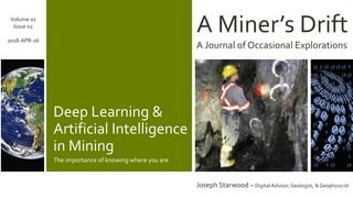
- 1. A Miner’s Drift A Journal of Occasional Explorations Joseph Starwood – Digital Advisor, Geologist, & Geophysicist Volume 01 Issue 02 2018-APR-16 Deep Learning & Artificial Intelligence in Mining The importance of knowing where you are
- 2. Deep Learning & Artificial Intelligence in Mining The importance of knowing where you are Stories of lost mines abound. Each year in the United States, over 8000 people set out to find the legendary Lost Dutchman Gold Mine; most guided by only cryptic maps. And, each year, the mine goes undiscovered. Precise location is critical to exploration and mining. There is no room for error – let alone cryptic. This hold true when applying deep learning and artificial intelligence methods; where we seek subtle signatures in the data.
- 3. 2018-APR-16 A Miner’s Drift Volume 01 Issue 02 Copyright 2018 All rights reserved “There’s gold in them thar hills” __Mulberry Sellers, a character by MarkTwain The problem, as always, is where exactly that gold is located in those hills. Or, for mining in general, where exactly the ore is located. Location is fundamental to mining. It is critical that a miner know where the ore body and its boundaries are located. Miners must also know their own position with respect to the ore body as well as with respect to property boundaries and other important reference points. The same holds true for deep learning and artificial intelligence models. Correct locations for input data points will yield useful results. However, incorrect locations will lead to erroneous results. Determining the correct spatial location of any given data point is not as easy as one might think. Mining is a peculiar business. The various data sets forming the input data for the models may not, and often do not, share the same basis for location. In other words, the location values for one data set may not directly correspond to those in another data set. Geoscientific data, in particular, relies on correctly locating data points in three dimensional space. This poses complex challenges for data scientists. Let’s look at some of the challenges data scientists must overcome if their models are to be correct: INCH BY INCH,YARD BYYARD Measurement of length is one of the most basic ways in which input data sets may differ from one another. The length measurements may utilize the imperial system (i.e.: inch, foot, yard, etc.) or the metric system (i.e.: meter, kilometer, etc.). This happens when one work activity used the imperial system and a another work active used the metric system. This case might arise when a mining company acquires an existing property. The earlier pre-acquisition work relied on one measurement system, and the acquiring mining company uses a different system. Mixing data based on the imperial system with data based on the metric system will yield erroneous results. “1065.5” in feet is not the same as “1065.5” in meters. The imperial measurement location (1365.5, 1241.3, 515.8) is not the same as the metric measurement location (1365.5, 1241.3, 515.8). PAGE 3
- 4. 2018-APR-16 A Miner’s Drift Volume 01 Issue 02 Copyright 2018 All rights reserved When different measurement systems are used across the various input data sets, the data first must be converted to use just one preferred measurement system. TIP: Always verify the measurement system for each input data set before its use in deep learning or artificial intelligence modeling. THE MAP IS NOTTHETERRITORY In mining, geoscientific data may be presented on maps and cross- sections. When presented this way, three dimensional data is reduced to a two dimensional view. Thus, the third dimension is omitted. For example, an exploration map of iron (Fe) may show several data points with their values along with contour lines inferring the boundaries for different iron concentrations. However, the map may well ignore the local topographic relief; the vertical coordinate). The data is presented only in terms of its X andY (North-South and East-West) positions Similarly, a cross-section (a vertical map) highlighting silver (Ag) at the mine may show several data points with their values along with contour lines inferring the boundaries for different silver concentrations A cross-section may or may not be aligned with either the North-South or East-West axes.This means that we may know the vertical measurement (Z-axis), but not the horizontal measurements (X- andY- axes). To complicate things further, the cross-section may have one or more ‘dog-legs’. This means that the cross- section, is composed of two or more contiguous non-coplanar rectangles. When viewed in map perspective, such a cross-section has two or more non-collinear segments. TIP: Remember that maps and cross- sections are two dimensional representations of data; not the data itself. Always locate and use the original data for deep learning or artificial intelligence modeling. PAGE 4
- 5. 2018-APR-16 A Miner’s Drift Volume 01 Issue 02 Copyright 2018 All rights reserved GEOGRAPHICCOORDINATE SYSTEMS A geographic coordinate system is used to specify locations on Earth. These locations are expressed using numbers, letters, and symbols. Each location represents a position in a three dimensional space with two numbers representing the horizontal position and one number the vertical position. Three coordinate systems are used most often in mining: 1) Latitude, Longitude, & Elevation; 2) Universal Transverse Mercator & Elevation; and 3) Mine Grid & Elevation. When different measurement systems are used across the various input data sets, the data first must be converted to use just one preferred coordinate system. LATITUDE & LONGITUDE The Latitude & Longitude system for horizontal position is perhaps the most familiar. Longitude is measured starting from a designated north- south line called the Prime Meridian. Latitude is measured starting from a designated east-west line called the Equator. In both, measurements are expressed as angles using degrees, minutes, and seconds of arc. Vertical position is often measured with respect to mean sea level. UNIVERSAL TRANSVERSE MERCATOR The UniversalTransverse Mercator system is a bit more complicated. It uses a pattern of rectangular regions known as zones. Locations are specified as easting and northing planar coordinate pairs in their zone, and are measured in meters. Again, vertical position is often measured with respect to mean sea level. PAGE 5
- 6. 2018-APR-16 A Miner’s Drift Volume 01 Issue 02 Copyright 2018 All rights reserved MINE GRID The Mine Grid system establishes a Cartesian coordinate system based on a local reference point. The top- bottom axis (grid north-south axis) may or may not be aligned to true North. Locations are measured as east or west and as north and south of the reference point, and are expressed in imperial or metric units. The Mine Grid system is unique in its treatment of vertical position. The designated local reference point serves as the origin for measuring other locations as above or below. However, this origin may be given an arbitrary value other than mean sea level and perhaps other than zero. Mind Grids are often oriented to the strike of the ore body or another dominate geographic feature. They may also be referred to as ‘Local Grids’ or ‘Local Coordinates’. TIP: Always verify the type of coordinate system for each input data set before its use in deep learning or artificial intelligence modeling. TRUE NORTH Across much of the Earth,True North differs from Magnetic North. This arises because the Earth’s magnetic pole is offset from the Earth’s rotational (axial), orTrue North, pole. The difference betweenTrue North and Magnetic North is referred to as the magnetic declination. A given place on Earth, say the exploration site or the mine site, will have a specific magnetic declination. Location measurements must be corrected toTrue North. Ideally, geoscientists, engineers, and others will have applied corrections to the location data. However, this may not always be the case. Some compasses do not allow the user to apply a correction for the magnetic declination. TIP: Always verify the coordinate system used for each input data set before its use in deep learning or artificial intelligence modeling. PAGE 6 True North
- 7. CONCLUSION Deep Learning and artificial intelligence can play a powerful role in exploration and mining. Achieving good results depends upon the completeness and correctness of the input data. For location data, the raw data must first be corrected to ensure that it uses the preferred units of measure and geographic coordinates, and that it is properly corrected to True North. Doing so prepares the input data for deep learning and artificial intelligence methods. Data scientists, geoscientists, and mine engineers must collaborate to correctly transform the data and thus achieve meaningful results.
- 8. During his early career, Joseph worked as an exploration geologist and geophysicist. He focused on gold, silver, copper, and molybdenum deposits in the western United States. His work included Kuroko style gold systems. He also worked in various capacities for coal mining, oil & gas, and heavy construction companies. Joseph has presented at: ▪ InfraGardGreat Lakes Regional Conference – 2014 ▪ Society for Mining, Metallurgy, and Exploration Annual Meeting – 2014 ▪ Great Lakes Software ExcellenceConference (GLSEC) – 2011 & 2013 ▪ Calvin College Colloquium Series – 2010 ▪ Integrate: Uniting theWorld of IT Symposium – 2010 ▪ SEI ArchitectureTechnology User Network (SATURN) – 2009 ▪ Financial Services Solutions Symposium (FSSS) – 2008 & 2009 He also contributed to: • Software Engineering Institute (SEI) – Hard Problems in SOA Workshop – 2008 Contact theAuthor: • LinkedIn: www.linkedin.com/in/josephstarwood • e-Mail: JosephStarwood@JosephStarwood.com Known within Microsoft Corporation as 'The Mining Guy', Joseph Starwood is a Digital Advisor who helps mining companies, equipment suppliers, and service providers extract value from their information technology (IT) and operational technology (OT) investments and assets. He co-authored the Mining Book of Dreams as well as the Microsoft Upstream Reference Architecture for Mining (MURA-Mining). PLEASE NOTE The author is an employee of Microsoft Corporation. The views, thoughts, and opinions expressed in this text belong wholly to the author, and do not necessarily reflect those of anyone else (the author’semployer, or any other group or individual). All product names, logos, and brands are property of their respective owners. All company, product and service names used in this text are for identification purposes only. Use of these names, logos, and brands does not imply endorsement. The information in this text is provided without representations or warranties, express or implied.
- 9. ThankYou!