SlideShare a Scribd company logo
1 of 14
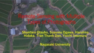
Remote Sensing with Multiple
Types of Photographs
Shuntaro Otsubo, Susumu Ogawa, Haruhiro
Hidaka, Tran Thanh Dan, Yoichi Imamura
Nagasaki University
Introduction
Recently, UAV (Unmanned Aerial
Vehicle) technology are developed
rapidly. UAV may work at lower cost
than satellite or aerial photos. The
expansion of research for UAV is
expected. However, the number of
bands for UAV is less than satellite
images. In this study, UAV, a digital
camera, aerial photos, and satellite
data were used in multiple types.
Phantom 4
Objectives
• To get RGB, near infrared, and short infrared
images with high resolution in multiple types
by UAV and a digital camera.
• To obtain NDVI and NDWI images with UAV
and a digital camera. NDWI is a normalized
difference water index.
• To monitor vegetation covers and to make a
land-use map with UAV and a digital camera.
Photographing methods with UAV
• IR72 filter is a band pass filter more than 720
nm. Near infrared photos are taken with UAV
and a digital camera with an IR 72 filter.
Additionally, IR90 filter is a band pass filter
more than 900 nm. Short infrared photos are
taken with UAV and a digital camera with an
IR 90 filter.
IR72 filter
Methods: Paddy field map
• Band 3 distributions were calculated in the survey
field with PhotoScan. Band 3 distribution made
paddy field maps because vegetation absorbed
Band 3, red.
Study area
Onigi paddy fields
NDVI at Onigi village (July 30 2016)
RGB image with UAV
NIR image with UAV NDVI image in Hasami with UAV
Orthogonal images with UAV (left) and
aerial photos (right) at Onigi village
Resolution: 6 cm
Fine resolution DEM at Onigi
Resolution: ~10 cm
NDWI at Onigi village (July 30 2016)
Rice paddy
fields
Detecting a land use map at
Onigi village
Tea
plantations
Rice paddy
fields
Abandoned
Fields
CONCLUSIONS
• RGB, near infrared, and short infrared images were
obtained by a digital camera with band pass filters,
while RGB and near infrared were inquired by UAV
with 6 cm resolution.
• NDVI images were obtained by a digital camera and
UAV with IR72, while NDWI images were estimated
by a digital camera with IR72 and IR90, which
estimates water contents and permeability in soils.
• Vegetation cover was monitored in any time and also
land use map was obtained with fine-resolution DEM.
Thank you for your attention

More Related Content

What's hot

What's hot (8)

3D remote sensing of mines
3D remote sensing of mines 3D remote sensing of mines
3D remote sensing of mines
 
MEROPY - How does robotics provide solutions to the constraints of field crop...
MEROPY - How does robotics provide solutions to the constraints of field crop...MEROPY - How does robotics provide solutions to the constraints of field crop...
MEROPY - How does robotics provide solutions to the constraints of field crop...
 
Applications of uav and its use cases - Landfill Site Mapping and Glacial Lak...
Applications of uav and its use cases - Landfill Site Mapping and Glacial Lak...Applications of uav and its use cases - Landfill Site Mapping and Glacial Lak...
Applications of uav and its use cases - Landfill Site Mapping and Glacial Lak...
 
Ground Penetrating Radar Survey
Ground Penetrating Radar Survey Ground Penetrating Radar Survey
Ground Penetrating Radar Survey
 
CAMS GA Solar Radiation
CAMS GA Solar RadiationCAMS GA Solar Radiation
CAMS GA Solar Radiation
 
Gpr application
Gpr applicationGpr application
Gpr application
 
Ground Penetrating Radar : Basic and Applications for Civil Engineering
Ground Penetrating Radar : Basic and Applications for Civil EngineeringGround Penetrating Radar : Basic and Applications for Civil Engineering
Ground Penetrating Radar : Basic and Applications for Civil Engineering
 
Fusion of Multi-Frequency in GPR
Fusion of Multi-Frequency in GPRFusion of Multi-Frequency in GPR
Fusion of Multi-Frequency in GPR
 

Viewers also liked

Uav market opportunity
Uav market opportunityUav market opportunity
Uav market opportunity
NiMA Asghari
 
Optical satellite communications
Optical satellite communicationsOptical satellite communications
Optical satellite communications
Islam Kotb Ismail
 

Viewers also liked (9)

Satellite Network communication System Overview
Satellite   Network  communication  System OverviewSatellite   Network  communication  System Overview
Satellite Network communication System Overview
 
Satellite Applications
Satellite ApplicationsSatellite Applications
Satellite Applications
 
Airbus - Topology Optimization Methods for Optimal Aircraft Components
Airbus - Topology Optimization Methods for Optimal Aircraft ComponentsAirbus - Topology Optimization Methods for Optimal Aircraft Components
Airbus - Topology Optimization Methods for Optimal Aircraft Components
 
Uav market opportunity
Uav market opportunityUav market opportunity
Uav market opportunity
 
Optical satellite communications
Optical satellite communicationsOptical satellite communications
Optical satellite communications
 
Drones and their Increasing Number of Applications
Drones and their Increasing Number of ApplicationsDrones and their Increasing Number of Applications
Drones and their Increasing Number of Applications
 
UAV Presentation
UAV PresentationUAV Presentation
UAV Presentation
 
Drones: Present & Future
Drones: Present & FutureDrones: Present & Future
Drones: Present & Future
 
Drone-Unmanned Aerial Vehicle
Drone-Unmanned Aerial VehicleDrone-Unmanned Aerial Vehicle
Drone-Unmanned Aerial Vehicle
 

Similar to Remote sensing with multiple types of photographs

iaetsd Unmanned aerial vehicle in the field of agriculture
iaetsd Unmanned aerial vehicle in the field of agricultureiaetsd Unmanned aerial vehicle in the field of agriculture
iaetsd Unmanned aerial vehicle in the field of agriculture
Iaetsd Iaetsd
 

Similar to Remote sensing with multiple types of photographs (20)

Stumags
StumagsStumags
Stumags
 
Lidar and sensing
Lidar and sensingLidar and sensing
Lidar and sensing
 
Surveying Innovations in Quarrying
Surveying Innovations in QuarryingSurveying Innovations in Quarrying
Surveying Innovations in Quarrying
 
Remote sensing technology and applications
Remote  sensing technology and applicationsRemote  sensing technology and applications
Remote sensing technology and applications
 
Radiometric Calibration of Digital Images
Radiometric Calibration of Digital ImagesRadiometric Calibration of Digital Images
Radiometric Calibration of Digital Images
 
iaetsd Unmanned aerial vehicle in the field of agriculture
iaetsd Unmanned aerial vehicle in the field of agricultureiaetsd Unmanned aerial vehicle in the field of agriculture
iaetsd Unmanned aerial vehicle in the field of agriculture
 
Remote Sensing Data Acquisition,Scanning/Imaging systems
Remote Sensing Data Acquisition,Scanning/Imaging systemsRemote Sensing Data Acquisition,Scanning/Imaging systems
Remote Sensing Data Acquisition,Scanning/Imaging systems
 
Vegetation cover monitoring
Vegetation cover monitoringVegetation cover monitoring
Vegetation cover monitoring
 
LIDAR
LIDARLIDAR
LIDAR
 
Drones in Agriculture | EquiAgra
Drones in Agriculture | EquiAgra Drones in Agriculture | EquiAgra
Drones in Agriculture | EquiAgra
 
GNSS Observation (4)
GNSS Observation (4)GNSS Observation (4)
GNSS Observation (4)
 
Development of machine vision and laser radar based autonomous vehicle guidan...
Development of machine vision and laser radar based autonomous vehicle guidan...Development of machine vision and laser radar based autonomous vehicle guidan...
Development of machine vision and laser radar based autonomous vehicle guidan...
 
UAV-based remote sensing as a monitoring tool for smallholder cropping systems
UAV-based remote sensing as a monitoring tool for smallholder cropping systemsUAV-based remote sensing as a monitoring tool for smallholder cropping systems
UAV-based remote sensing as a monitoring tool for smallholder cropping systems
 
Remote sensing
Remote sensingRemote sensing
Remote sensing
 
Remote Sensing - Operating Satellites
Remote Sensing -  Operating SatellitesRemote Sensing -  Operating Satellites
Remote Sensing - Operating Satellites
 
Image classification and land cover mapping
Image classification and land cover mappingImage classification and land cover mapping
Image classification and land cover mapping
 
Lidar
LidarLidar
Lidar
 
Remote sensing ang GIS
Remote sensing ang GISRemote sensing ang GIS
Remote sensing ang GIS
 
Method for Estimation of Grow Index of Tealeaves Based on Bi-Directional Refl...
Method for Estimation of Grow Index of Tealeaves Based on Bi-Directional Refl...Method for Estimation of Grow Index of Tealeaves Based on Bi-Directional Refl...
Method for Estimation of Grow Index of Tealeaves Based on Bi-Directional Refl...
 
Lidar : light detection and rangeing
Lidar : light detection and rangeingLidar : light detection and rangeing
Lidar : light detection and rangeing
 

Recently uploaded

Verification of thevenin's theorem for BEEE Lab (1).pptx
Verification of thevenin's theorem for BEEE Lab (1).pptxVerification of thevenin's theorem for BEEE Lab (1).pptx
Verification of thevenin's theorem for BEEE Lab (1).pptx
chumtiyababu
 
XXXXXXXXXXXXXXXXXXXXXXXXXXXXXXXXXXXXXXXXXXXXXXXXXXXX
XXXXXXXXXXXXXXXXXXXXXXXXXXXXXXXXXXXXXXXXXXXXXXXXXXXXXXXXXXXXXXXXXXXXXXXXXXXXXXXXXXXXXXXXXXXXXXXXXXXXXXXX
XXXXXXXXXXXXXXXXXXXXXXXXXXXXXXXXXXXXXXXXXXXXXXXXXXXX
ssuser89054b
 
"Lesotho Leaps Forward: A Chronicle of Transformative Developments"
"Lesotho Leaps Forward: A Chronicle of Transformative Developments""Lesotho Leaps Forward: A Chronicle of Transformative Developments"
"Lesotho Leaps Forward: A Chronicle of Transformative Developments"
mphochane1998
 
Kuwait City MTP kit ((+919101817206)) Buy Abortion Pills Kuwait
Kuwait City MTP kit ((+919101817206)) Buy Abortion Pills KuwaitKuwait City MTP kit ((+919101817206)) Buy Abortion Pills Kuwait
Kuwait City MTP kit ((+919101817206)) Buy Abortion Pills Kuwait
jaanualu31
 
Integrated Test Rig For HTFE-25 - Neometrix
Integrated Test Rig For HTFE-25 - NeometrixIntegrated Test Rig For HTFE-25 - Neometrix
Integrated Test Rig For HTFE-25 - Neometrix
Neometrix_Engineering_Pvt_Ltd
 
Cara Menggugurkan Sperma Yang Masuk Rahim Biyar Tidak Hamil
Cara Menggugurkan Sperma Yang Masuk Rahim Biyar Tidak HamilCara Menggugurkan Sperma Yang Masuk Rahim Biyar Tidak Hamil
Cara Menggugurkan Sperma Yang Masuk Rahim Biyar Tidak Hamil
Cara Menggugurkan Kandungan 087776558899
 

Recently uploaded (20)

Verification of thevenin's theorem for BEEE Lab (1).pptx
Verification of thevenin's theorem for BEEE Lab (1).pptxVerification of thevenin's theorem for BEEE Lab (1).pptx
Verification of thevenin's theorem for BEEE Lab (1).pptx
 
Thermal Engineering-R & A / C - unit - V
Thermal Engineering-R & A / C - unit - VThermal Engineering-R & A / C - unit - V
Thermal Engineering-R & A / C - unit - V
 
Design For Accessibility: Getting it right from the start
Design For Accessibility: Getting it right from the startDesign For Accessibility: Getting it right from the start
Design For Accessibility: Getting it right from the start
 
Online food ordering system project report.pdf
Online food ordering system project report.pdfOnline food ordering system project report.pdf
Online food ordering system project report.pdf
 
Computer Networks Basics of Network Devices
Computer Networks  Basics of Network DevicesComputer Networks  Basics of Network Devices
Computer Networks Basics of Network Devices
 
Introduction to Serverless with AWS Lambda
Introduction to Serverless with AWS LambdaIntroduction to Serverless with AWS Lambda
Introduction to Serverless with AWS Lambda
 
FEA Based Level 3 Assessment of Deformed Tanks with Fluid Induced Loads
FEA Based Level 3 Assessment of Deformed Tanks with Fluid Induced LoadsFEA Based Level 3 Assessment of Deformed Tanks with Fluid Induced Loads
FEA Based Level 3 Assessment of Deformed Tanks with Fluid Induced Loads
 
XXXXXXXXXXXXXXXXXXXXXXXXXXXXXXXXXXXXXXXXXXXXXXXXXXXX
XXXXXXXXXXXXXXXXXXXXXXXXXXXXXXXXXXXXXXXXXXXXXXXXXXXXXXXXXXXXXXXXXXXXXXXXXXXXXXXXXXXXXXXXXXXXXXXXXXXXXXXX
XXXXXXXXXXXXXXXXXXXXXXXXXXXXXXXXXXXXXXXXXXXXXXXXXXXX
 
Computer Lecture 01.pptxIntroduction to Computers
Computer Lecture 01.pptxIntroduction to ComputersComputer Lecture 01.pptxIntroduction to Computers
Computer Lecture 01.pptxIntroduction to Computers
 
Thermal Engineering Unit - I & II . ppt
Thermal Engineering  Unit - I & II . pptThermal Engineering  Unit - I & II . ppt
Thermal Engineering Unit - I & II . ppt
 
"Lesotho Leaps Forward: A Chronicle of Transformative Developments"
"Lesotho Leaps Forward: A Chronicle of Transformative Developments""Lesotho Leaps Forward: A Chronicle of Transformative Developments"
"Lesotho Leaps Forward: A Chronicle of Transformative Developments"
 
Kuwait City MTP kit ((+919101817206)) Buy Abortion Pills Kuwait
Kuwait City MTP kit ((+919101817206)) Buy Abortion Pills KuwaitKuwait City MTP kit ((+919101817206)) Buy Abortion Pills Kuwait
Kuwait City MTP kit ((+919101817206)) Buy Abortion Pills Kuwait
 
Integrated Test Rig For HTFE-25 - Neometrix
Integrated Test Rig For HTFE-25 - NeometrixIntegrated Test Rig For HTFE-25 - Neometrix
Integrated Test Rig For HTFE-25 - Neometrix
 
Thermal Engineering -unit - III & IV.ppt
Thermal Engineering -unit - III & IV.pptThermal Engineering -unit - III & IV.ppt
Thermal Engineering -unit - III & IV.ppt
 
Generative AI or GenAI technology based PPT
Generative AI or GenAI technology based PPTGenerative AI or GenAI technology based PPT
Generative AI or GenAI technology based PPT
 
Work-Permit-Receiver-in-Saudi-Aramco.pptx
Work-Permit-Receiver-in-Saudi-Aramco.pptxWork-Permit-Receiver-in-Saudi-Aramco.pptx
Work-Permit-Receiver-in-Saudi-Aramco.pptx
 
HAND TOOLS USED AT ELECTRONICS WORK PRESENTED BY KOUSTAV SARKAR
HAND TOOLS USED AT ELECTRONICS WORK PRESENTED BY KOUSTAV SARKARHAND TOOLS USED AT ELECTRONICS WORK PRESENTED BY KOUSTAV SARKAR
HAND TOOLS USED AT ELECTRONICS WORK PRESENTED BY KOUSTAV SARKAR
 
S1S2 B.Arch MGU - HOA1&2 Module 3 -Temple Architecture of Kerala.pptx
S1S2 B.Arch MGU - HOA1&2 Module 3 -Temple Architecture of Kerala.pptxS1S2 B.Arch MGU - HOA1&2 Module 3 -Temple Architecture of Kerala.pptx
S1S2 B.Arch MGU - HOA1&2 Module 3 -Temple Architecture of Kerala.pptx
 
Cara Menggugurkan Sperma Yang Masuk Rahim Biyar Tidak Hamil
Cara Menggugurkan Sperma Yang Masuk Rahim Biyar Tidak HamilCara Menggugurkan Sperma Yang Masuk Rahim Biyar Tidak Hamil
Cara Menggugurkan Sperma Yang Masuk Rahim Biyar Tidak Hamil
 
COST-EFFETIVE and Energy Efficient BUILDINGS ptx
COST-EFFETIVE  and Energy Efficient BUILDINGS ptxCOST-EFFETIVE  and Energy Efficient BUILDINGS ptx
COST-EFFETIVE and Energy Efficient BUILDINGS ptx
 

Remote sensing with multiple types of photographs

  • 1. Remote Sensing with Multiple Types of Photographs Shuntaro Otsubo, Susumu Ogawa, Haruhiro Hidaka, Tran Thanh Dan, Yoichi Imamura Nagasaki University
  • 2. Introduction Recently, UAV (Unmanned Aerial Vehicle) technology are developed rapidly. UAV may work at lower cost than satellite or aerial photos. The expansion of research for UAV is expected. However, the number of bands for UAV is less than satellite images. In this study, UAV, a digital camera, aerial photos, and satellite data were used in multiple types. Phantom 4
  • 3. Objectives • To get RGB, near infrared, and short infrared images with high resolution in multiple types by UAV and a digital camera. • To obtain NDVI and NDWI images with UAV and a digital camera. NDWI is a normalized difference water index. • To monitor vegetation covers and to make a land-use map with UAV and a digital camera.
  • 4. Photographing methods with UAV • IR72 filter is a band pass filter more than 720 nm. Near infrared photos are taken with UAV and a digital camera with an IR 72 filter. Additionally, IR90 filter is a band pass filter more than 900 nm. Short infrared photos are taken with UAV and a digital camera with an IR 90 filter. IR72 filter
  • 5. Methods: Paddy field map • Band 3 distributions were calculated in the survey field with PhotoScan. Band 3 distribution made paddy field maps because vegetation absorbed Band 3, red.
  • 7. NDVI at Onigi village (July 30 2016)
  • 8. RGB image with UAV NIR image with UAV NDVI image in Hasami with UAV
  • 9. Orthogonal images with UAV (left) and aerial photos (right) at Onigi village Resolution: 6 cm
  • 10. Fine resolution DEM at Onigi Resolution: ~10 cm
  • 11. NDWI at Onigi village (July 30 2016) Rice paddy fields
  • 12. Detecting a land use map at Onigi village Tea plantations Rice paddy fields Abandoned Fields
  • 13. CONCLUSIONS • RGB, near infrared, and short infrared images were obtained by a digital camera with band pass filters, while RGB and near infrared were inquired by UAV with 6 cm resolution. • NDVI images were obtained by a digital camera and UAV with IR72, while NDWI images were estimated by a digital camera with IR72 and IR90, which estimates water contents and permeability in soils. • Vegetation cover was monitored in any time and also land use map was obtained with fine-resolution DEM.
  • 14. Thank you for your attention