Quantification Of Roaming Behaviour Of Free-ranging Domestic Dogs To Inform Zoonosis Transmission Salome DUERR
•
1 like•502 views

Presentation at 3rd GRF One Health Summit 2015 Session Wildlife, Livestock and Pets

Recommended
Recommended
More Related Content
More from Global Risk Forum GRFDavos
More from Global Risk Forum GRFDavos (20)
Recently uploaded
Recently uploaded (20)
Quantification Of Roaming Behaviour Of Free-ranging Domestic Dogs To Inform Zoonosis Transmission Salome DUERR
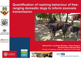
- 1. Quantification of roaming behaviour of free- ranging domestic dogs to inform zoonosis transmission Faculty of Veterinary Science, Veterinary Public Health Salome Dürr, Courtenay Bombara, Jaime Gongora, Navneet Dhand, Michael Ward
- 2. Research questions › How might rabies spread in northern Australia following an incursion? › What impact might a rabies outbreak have? › What is the best control strategy? - Vaccination - dog confinement - population management 2 › Development of a rabies simulation model in domestic dog populations
- 3. Study sites – six remote communities 3 Galiwin’ku (Elcho Island): 350 dogs, 2100 humans 5 communities in the Northern Peninsula Area, Cape York: 450 dogs, 2300 humans Human-dog ratio: 2.7 – 8.8 Dog density: 140-450 dogs/km2
- 4. 4
- 5. 5 › Multi-dog households › Free-roaming; open gates › Live in close relationship to community members › No rabies vaccination
- 6. The GPS unit › CatTraQ™ › customer adapted robust cases › size: 5 x 5 x 2 cm, weight: 56 g › accuracy (static test): median distance from fix point 18 meters › tolerated by the dogs without any distress › time between two records set at 1 minute 6
- 7. GPS collar study 2013 – 2014 › 116 dogs collared within six communities - 7 – 20% of the estimated dog population per community - 3 time points - collar retrieved after 2-14 days - convenience sampling › Data from 105 dogs further analysed - 44 female (59% sterilized) - 61 males (38% castrated) - age 6 months – 12 yrs (median 3 years) 7
- 8. Sample sizes • 54 dogs collared • 48 usable data Sept 2013 • 36 dogs collared • 32 usable data April 2014 • 46 dogs collared • 37 usable data Sept 2014 8 data from 105 dogs - 25 from 3 time points - 26 from 2 time points - 54 from 1 time point • 26 dogs collared • 21 usable data Nov 2013 • 24 dogs collared • 20 usable data April 2014 • 31 dogs collared • 25 usable data Oct 2014 Northern Peninsula Area Galiwin’ku
- 9. Dog treatments, questionnaire, camera, genetics 9
- 10. Two dogs in Seisia and New Mapoon 10 Ninja, male, 4 years Lucky, male, 2 years
- 11. Observation of hunting trips 11 Weapon, male, 1.5 years Suzie, female, 1 year
- 12. Data analysis – home range and utilization distribution › Home range: defined as the area an animal commonly uses for normal activities, such as foraging, hunting and breeding. › Utilization distribution: integrates relative time frequencies with which the various areas are used by an animal within its HR. It therefore provides information on spatial and temporal use of the area. › Comparing three different analysis methods 12
- 13. BRB – Biased Random Bridge › Isopleths representing the probability of finding the dog at any point of time within the area › BRB places kernel functions over each step (“track”) travelled by the animal between two consecutive GPS fixes 13
- 14. Results 14 › HR and UD shapes are generally circular around the dog owner’s house. › Core HRs (50% isopleth) range from 0.2 to 0.4 ha › Extended HRs (95% isopleth) range from 3.4 to 5.3 ha › Some individuals roam much more with a HR size of 40‒104 ha
- 15. Risk factors for roaming 15 Gender effect only trends Season effect significant Age effect significant Non-significant factors: - Genetics of the dogs (dingo relationship) - Use as hunting dogs - Breed - Region and community
- 16. Aim of the field study: contact rates › Depend mainly on the distance between the dogs’ homes › Distance kernel 16
- 17. Thanks to many people and animals involved! 17