2018 GIS in Government: Pits and False Hills and Spikes, Oh My Fixing Blunders in the USGS Seamless 1/3 Arc-second DEM

The U.S. Geological Survey (USGS) National Geospatial Technical Operations Center (NGTOC) maintains the USGS Seamless 1/3 Arc-Second (approximately 10-meter resolution) Digital Elevation Model (DEM). This national dataset provides foundational elevation information for earth science studies and mapping applications over the conterminous United States, Hawaii, Puerto Rico, other territorial islands, and parts of Alaska. Through the 3D Elevation Program, the Seamless DEM is continually updated with new lidar and interferometric synthetic aperture radar (ifSAR) collections (IfSAR in Alaska only). Although eventually all of the 1/3 Arc-Second Seamless DEM will be derived from lidar or ifSAR, currently portions of the dataset, especially in the western United States, are still sourced from legacy data created from digitized 1:24,000 scale topographic map contour lines. This legacy data contains some blunders resulting from errors in data capture, processing, or in the original source map sheet. The purpose of this presentation will be to discuss the types of blunders that are present in a small fraction of our legacy data, how those blunders came to be, and what steps USGS is taking to fix these issues to better support our customers.

Recommended
Recommended
More Related Content
What's hot
What's hot (20)
Similar to 2018 GIS in Government: Pits and False Hills and Spikes, Oh My Fixing Blunders in the USGS Seamless 1/3 Arc-second DEM
Similar to 2018 GIS in Government: Pits and False Hills and Spikes, Oh My Fixing Blunders in the USGS Seamless 1/3 Arc-second DEM (20)
More from GIS in the Rockies
More from GIS in the Rockies (20)
Recently uploaded
Recently uploaded (20)
2018 GIS in Government: Pits and False Hills and Spikes, Oh My Fixing Blunders in the USGS Seamless 1/3 Arc-second DEM
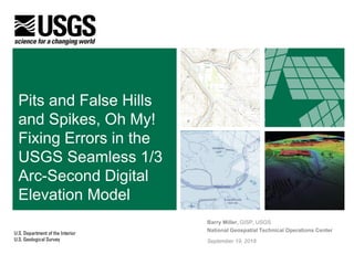
- 1. Pits and False Hills and Spikes, Oh My! Fixing Errors in the USGS Seamless 1/3 Arc-Second Digital Elevation Model Barry Miller, GISP, USGS National Geospatial Technical Operations Center September 19, 2018
- 2. + 2 Overview Project Background Where are the Errors? How Do We Validate Errors? Examples of Errors and Their Impact The Error Fixing Process How Can You Help? Questions?
- 3. + 3 Background The NGTOC maintains the USGS Seamless 1/3 Arc-Second (approximately 10- meter resolution) Digital Elevation Model (DEM) This layer was formerly called the National Elevation Dataset (NED) Through the 3D Elevation Program, the Seamless DEM is continuously updated with high resolution lidar (contiguous United States, Hawaii, and overseas territories) and interferometric synthetic aperture radar (IfSAR) acquisition (over Alaska only) The goal is to acquire the entire contiguous United States in an 8-year period (based on full funding) The lidar data is accurate and a great source for The National Map However, about 50% of our Seamless DEM are still sourced from legacy data interpolated from digitized 1:24,000 scale topographic map contour lines These interpolated raster DEMs can and do have errors in them that may not be overwritten with new lidar derived data for several years
- 4. + 4 Reported Elevation Errors - Since Oct. 2014, the NGTOC has received 282 user-reported elevation errors in the continental U.S. - If points that are now covered by lidar are removed, there are 154 potential errors - Errors primarily occur in P method codes 3 “DLG2DEM” and 5 “LT4X”
- 5. + 5 Error Validation In 2012, the USGS Earth Resources Observation and Science (EROS) Center received a project where Intermap created a difference layer subtracting the USGS 1 Arc-Second bare earth DEM (2010) from a downsampled Intermap NEXTMap IfSAR derived Digital Terrain Model (DTM) The original purpose of this difference layer was to determine elevation changes in order to update topographic maps, but the same layer could also identify potential elevation errors Despite using a proprietary surface feature removal algorithm developed by Intermap, the radar DTM does not penetrate to true ground in heavily vegetated areas and/or high slope regions where radar shadow has a larger impact However, the difference between the two surfaces, especially if they are large, can indicate the presence of an error
- 6. + 6 Error Validation Blue differences show areas where the USGS National Elevation Dataset (NED), the previous name for our current 1/3 arc-second seamless DEM, is HIGHER than the IfSAR DTM This would imply a false hill or a spike Red differences show areas where the USGS NED is LOWER, indicating the presence of a false pit or depression The difference layer can show a false positive, particularly in heavily forested and/or sloped terrain where the IfSAR DTM does not show true ground Current imagery, analysis of historic topographic maps vs. new ones, and visual artifacts in hillshades are also considered when validating reported errors
- 7. + 7 Examples of Errors and Their Impacts The 1/3 Arc-Second Seamless DEM is used as the source for USGS contour lines and hillshades As a result, elevation errors can propagate through many parts of the U.S. National Map Private industry as well as academic researchers also use the 1/3 Arc-Second Seamless DEM which can impact their products or research Imagery orthorectification requires a DEM, and some workflows use the 1/3 Arc- Second Seamless DEM as an input Finally, web map engines such as Google Map/Earth and Esri ArcGIS Earth also use USGS products as an elevation baseline The next several slides will show examples of validated reported errors and some affected derivative products
- 8. + 8 Lincoln County, Nevada Elevation Error - A USGS NAIP image is on the left while the NEXTMap DTM Minus USGS NED is on the right - This false hill error is near a quadrangle boundary 37.630871 N, 114.429582 W Image Date: July 2015 37.630871 N, 114.429582 W Raster Source: NEXTMap DTM Minus USGS NED
- 9. + 9 Lincoln County, Nevada Elevation Error - The previous error created an artificial cliff within the USGS Topo web service - It is also falsely portrays two ravines as two hills 37.630871 N, 114.429582 W Raster Source: USGS US Topo
- 10. + 10 Fresno County, California Elevation Error - This error indicates both a large hole (red) that does not exist in real life in the northern quadrangle and a hill (blue) in the southern quadrangle - These hour glass errors show up in multiple locations 36.125025 N, 120.478775 W Image Date: Jun3 2014 36.125025 N, 120.478775 W Raster Source: NEXTMap DTM Minus USGS NED
- 11. + 11 Fresno County, California Elevation Error - The previous error created a pit within the USGS shaded relief web service 36.125025 N, 120.478775 W Raster Source: USGS US Topo
- 12. + 12 Fresno County, California Elevation Error - In addition to impacting USGS web services, this error also affected the generation of an orthoimage created by DigitalGlobe 36.125025 N, 120.478775 W Image Date: Oct 16 2017 DEM Error in Ortho Image © 2018 DigitalGlobe, Nextview License Applies © 2018 DigitalGlobe, Nextview License Applies 36.125025 N, 120.478775 W Image Date: Jul 09 2017
- 13. + 13 Big Horn County, Wyoming Elevation Error - This shows a series of errors to include false pits, false hills, and hourglass errors - There is a significant amount of “noise” in this difference layer due to the high slope and vegetation 44.918957 N, 107.990475 W Image Date: Sep 2015 44.918957 N, 107.990475 W Raster Source: NEXTMap DTM Minus USGS NED
- 14. + 14 Big Horn County, Wyoming Elevation Error 44.918957 N, 107.990475 W Raster Source: Google Maps 3D View - The error in Wyoming shows up in Google Map’s 3D view as an obvious spike - Google Maps uses many different elevation sources so sometimes we can use it as another validation tool to verify the presence of an error
- 15. + 15 Error Fixing Process A reported error is validated by using a combination of the IfSAR DTM Minus USGS NED difference layer, current satellite imagery, visible anomalies in hillshades, Google Map 3D View, and observed changes in historic and current US topographic map Once validated, we use the Product Tracking System to determine if the error is located in an area where USGS or its 3DEP partners will soon collect lidar data If the area is not slated for collection soon, we will proceed to correct the error in a four part process: 1. Download historic and current US Topographic maps 2. Convert any Geospatial PDFs into GeoTiffs with the correct geographic transformation 3. Digitize new contour lines with the applicable conversion factors 4. Use ArcGIS Topo to Raster to generate a DEM patch The next several slides will walk through an example
- 16. + 16 Yavapai County, Arizona Elevation Error - The false hill is the blue area identified as an error by a user - The large red area is the Agua Fria River north of Phoenix and does not indicate a error, but rather a temporal change where the hydroflattened river has decreased in elevation 33.946142 N, 112.2313822 W Image Date: May 2015 33.946142 N, 112.2313822 W Raster Source: NEXTMap DTM Minus USGS NED
- 17. + 17 Step 1) Download Current + Historical Topo Map 33.946142 N, 112.2313822 W Raster Source: New River, AZ 2014 US Topo 33.946142 N, 112.2313822 W Raster Source: New River, AZ 1964 Historic Topographic Map - The false hill is reflected in the most recent US Topo from 2014 - A 1964 historic US topographic map does not contain this error - We download both map sheets from The National Map and load them into Global Mapper
- 18. + 18 Step 2) Convert Geospatial PDFs to GeoTIFFs - The horizontal and vertical datum are obtained from the historic topographic map metadata - The contour interval is also noted because it will be used in Step 3 - The historic topographic map will be in its the original datum/projection - We use Global Mapper to convert the historic map into a GeoTIFF in NAD83 UTM Zone XX - We also convert the Geospatial PDF for the current US Topo map into a GeoTIFF
- 19. + 19 Step 3) Digitize Contour Lines - We modify The US National Map topographic contour lines to match the historic topographic map (in the current NAD83 UTM Zone XX projection) or digitize the lines from scratch if it is faster - Referencing the contour interval on the historic map, we populate an “Elev_1929” field with the respective heights in feet - We use NOAA’s Online Vertical Datum Transformation tool to determine the NAVD88 height and populate the “ContourEle” field with the new values for any modified contour lines - We convert all the heights of the contour lines that will be used in the elevation correction patch to meters in a new “ElevMeter” field
- 20. + 20 Step 4) Digitize Contour Lines 33.946142 N, 112.2313822 W Raster Source: New River, AZ 2014 US Topo 33.946142 N, 112.2313822 W Raster Source: Custom Raster DEM Export - After exporting the edited contour lines, we generate a raster patch using the ArcGIS Topo to Raster tool - The patch is blended with the rest of the 1/3 arc second tile using a mosaic dataset and exported as a new version of the corrected DEM
- 21. + 21 How Can You Help? Unfortunately, there are many false positives present in the Intermap DTM Minus USGS NED difference layer This prevents an easy automated detection algorithm Manual review is necessary to determine where errors are present and to correct the baseline 1/3 Arc-Second Seamless DEM If you see an elevation error, please report it to USGS via The National Map help desk at tnm_help@usgs.gov
- 22. + 22 Summary Project Background Where are the Errors? How Do We Validate Errors? Examples of Errors and Their Impact The Error Fixing Process How Can You Help? Questions?
- 23. + 23 Questions? Barry Miller – USGS NGTOC Elevation Applied Researcher (bymiller@usgs.gov)
- 24. + 24 Contributors Brendan Berve – USGS NGTOC Cartographic Applied Researcher (bberve@usgs.gov) Kalen Brady – USGS NGTOC Elevation Applied Researcher (ksbrady@usgs.gov) Jenni Clark– USGS NGTOC Elevation Applied Research Student (jclark@contractor.usgs.gov) Phil Rufe – USGS NGTOC Topographic Applied Research Chief (prufe@usgs.gov) Thank You!