2. Course Outcomes
1. Understand the significance of hydrology,
components, precipitation measurement and analysis.
2. Identify the different losses in precipitation and its
analysis.
3. Estimate runoff and develop unit hydrographs.
4. Illustrate the different systems of irrigation and
compute water requirements of crops.
5. Explain reservoirs, canals and design the canal
capacity by Kennedy's and Lacey's method.
3. Module-I
Hydrology: Introduction, Importance of hydrology, Global
and Indian water availability, Practical application of
hydrology, Hydrologic cycle (Horton’s) qualitative and
engineering representation.
Precipitation: Definition, Forms and types of precipitation,
measurement of rain fall using Symon’s and Syphon type
of rain gauges, optimum number of rain gauge stations,
consistency of rainfall data (double mass curve method),
computation of mean rainfall, estimation of missing data,
presentation of precipitation data, moving average curve,
mass curve, rainfall hyetographs.
4. Module-II
Losses: Evaporation: Introduction, Process, factors affecting
evaporation, measurement using IS class-A Pan, estimation
using empirical formulae (Meyer’s and Rohwer’s equations)
Reservoir evaporation and control
Evapo-transpiration: Introduction, Consumptive use, AET,
PET, Factors affecting, Measurement, Estimation by Blaney-
Criddle equation
Infiltration: Introduction, factors affecting infiltration capacity,
measurement by double ring infiltrometer, Horton’s infiltration
equation, infiltration indices.
5. Module-III
Runoff: Definition, concept of
catchment, factors affecting
runoff, rainfall – runoff
relationship using regression
analysis.
Hydrographs: Definition,
components of hydrograph,
base flow separation, unit
hydrograph, assumption,
application and limitations,
derivation from simple storm
hydrographs, S curve and its
computations, Conversion of
UH of different durations
6. Module-IV
Irrigation: Definition.
Benefits and ill effects of
irrigation. System of
irrigation: surface and
ground water, flow
irrigation, lift irrigation,
Bandhara irrigation.
Water Requirements of
Crops: Duty, delta and
base period, relationship
between them, factors
affecting duty of water
crops and crop seasons in
India, irrigation efficiency,
7. Module-V
Canals: Types of canals,
Alignment of canals.
Definition of gross command
area, cultural command
area, intensity of irrigation,
time factor, crop factor,
unlined and lined canals,
standard sections, design of
canals by Lacey's and
Kennedy's method.
Reservoirs: Definition,
investigation for reservoir
site, storage zones,
determination of storage
capacity using mass curves,
economical height of dam.
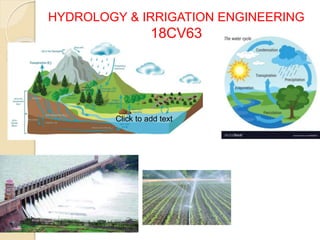
9. HYDROLOGY
Hydrology means the science of
water. It is the science that deals with
the occurrence, circulation and
distribution of water of the earth and
earth's atmosphere.
Definition by Wisler and Brater
The science that deals with processes
governing the depletion and
replenishment of water resources of
the land areas of the earth.
10. Hydrology is a interdisciplinary
science
Hydrology
Physics, Chemistry, Biology, Geology, Fluid Mechanics, Mathematics, Probability,
Statistics
Surface Water Ground Water Water affects plants and
animals
21. Importance of hydrology
Maximum probable flood that may
occur at a given site.
Water yield from the basin.
Groundwater development
Maximum intensity of storm and its
frequency for the design of drainage
system
22. Practical application of
hydrology
Design of hydraulic structures
Municipal and industrial water supply
Irrigation
Hydropower
Flood control
Erosion and sediment control
Navigation
26. Indian water availability
Rain gauge station : 3000 (IMD)
Indian Average rainfall : 120cm
Geographical area of the country : 3.28x10⁶ km2
Total available water : 3916 km3 ≈ 4000 km3
Lost to atmosphere 700km3
Groundwater 2150km3
Surface runoff 1150km3
Total 4000km3
According to irrigation commission of India the total surface water in the
country is about 1800 km3
Depression storage 150km3
Diversion works and
pumping
150km3
Towards sea 1500km3
Total 1800km3
27.
28.
29.
30. Precipitation
All forms of moisture that reaches the
earth surface from the atmosphere.
Usual forms are rainfall, snowfall, hail,
frost, dew
Of all these, only the first two contribute
significant amount of water.
Rainfall being the predominant form
causing stream flow and flood flow
31. Formation of precipitation
Atmosphere must have moisture
There must be sufficient nuclei present to aid condensation
Weather conditions must be good for condensation of water
vapour to takes place
Products of condensation must reach the earth
32.
33. Forms of precipitation
Rain : Size of the drop 0.5 to 6mm
Light rain – 2.5mm/h
Moderate rain – 2.5-7.5mm/h
Heavy rain - >7.5mm/h
Snow : consist of ice crystals, density – 0.06-0.15g/cm3
Drizzle : fine sprinkle of numerous water droplets
Glaze : type of ice coating
Sleet : precipitation of snow and rain simultaneously
Hail : irregular pellets or lumps of size more than 8mm
Dew : it forms directly by condensation on the ground
mainly during night when the surface has been cooled
by the outgoing radiation
44. Cyclonic precipitation
A cyclone is a large low pressure region with circular wind
motion.
It is caused by the lifting of the air mass due to the pressure
difference.
45. Cold front : when cold air mass drives away a hot air mass.
Heavy rainfall
Warm front : if the hot air mass replaces the cold air mass
Distributed rainfall over a large area
Stationary front : Cold and warm air masses drawn
simultaneously to a low pressure area
46. Orographic Precipitation
Air masses which strikes some natural topographic
barriers like mountains and can not move forward and
hence rise up causing condensation and precipitation.
Heavy rainfall in the windward side
47. Convective precipitation
Air which is warmer than the surrounding air due to
localized heating rises because of lesser density.
The warm air continues to rise undergoes cooling
and results in precipitation.
48. Measurement of precipitation
1) Non recording rain gauges ( Symons gauge) : it
records the amount of rainfall only.
2) Recording rain gauges(Automatic rain gauges) : it
records the amount of rainfall and also provide the
information regarding when exactly the rain
commenced, when the rain ended, intensity of
rainfall.
a) Tipping bucket type
b) Weighing bucket type
c) Float type ( Siphons gauge)
55. Adequacy of rain gauge stations :
As per Indian standard recommendation
1. One gauge per 520km2 in plain areas.
2. One gauge per 260 - 390km2 in regions with
an average elevation of 1km above the sea
level.
3. One gauge per 130km2 in predominantly hilly
regions with heavy rainfall.
Optimum number of rain gauge stations
70. consistency of rainfall data (double mass curve method)
It is used to test the consistency of rainfall record
at any raingauge stations.
P’ = (tan’/tan) x P
Where,
P – observed rainfall at
station X in the same year
tan’ – slope of the adjusted
mass curve
tan - slope of the
unadjusted mass curve
P’ – adjusted rainfall of
station X in any year