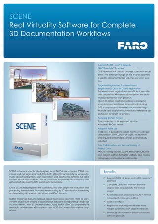
SlideShare a Scribd company logo
1 of 2
Download to read offline
SCENE
Real Virtuality Software for Complete
3D Documentation Workflows
SCENE software is specifically designed for all FARO laser scanners. SCENE pro-
cesses and manages scanned data both efficiently and easily by using auto-
matic object recognition, scan registration and positioning. Offering full-color
images, SCENE also provides tools for automatic targetless scan positioning and
generates high-quality data quickly and accurately.
Once SCENE has prepared the scan data, you can begin the evaluation and
processing immediately. From simple measuring to 3D visualization to meshing
and exporting into various point cloud and CAD formats.
SCENE WebShare Cloud is a cloud-based hosting service from FARO for con-
venient and secure sharing of scan project data and collaborating worldwide
via the internet. With SCENE WebShare Cloud, FARO offers a comprehensive
service to provide users with simple access to 3D documentation anytime, any-
where.
Benefits
Supports FARO’s X Series and FARO Freestyle3D
Scanners
Complete & efficient workflow from the
original data acquisition to the finished
project
Automated scan processing results in mininal
manual post-processing editing
Intuitive interface
Registration features provide even more
reliable automatic scan placement results
Interfaces with numerous industry-standard
software products
Autodesk ReCap Format
Scan projects can be exported into the
Autodesk®
ReCap format.
Supports FARO Focus3D
X Series &
FARO Freestyle3D
Scanners
GPS information is used to arrange scans with each
other. The extended range of the X Series scanners
is used to document larger volumes-per-scan posi-
tion.
Adaptive Point Size
In 3D view, it is possible to adjust the shown point size
of each scan point. Quality of object visualization
and required rendering power can be individually
adjusted.
Targetless Registration: TopView-Based
Registration & Cloud-to-Cloud Registration
TopView-based registration is an efficient, versatile
and unique-to-FARO method that allows the auto-
matic placment of scan projects.
Cloud-to-Cloud registration utilizes overlapping
scan data and additional information including
GPS, compass and altimeter to accurately align
multiple laser scans without the use of reference ob-
jects such as targets or spheres.
Easy Collaboration and Secure Sharing of
Project Data
FARO’s hosting solution, SCENE WebShare Cloud al-
lows project partners for faster workflow due to easy
data sharing and worldwide collaboration.
For more information call 800.736.0234
or visit www.faro.com/software
Specifications
Editing Scan Data
- Automatic search for reference spheres and black and white
reference targets
- Target-less scan placement by TopView-based registration or Cloud-to-
Cloud registration methods. Alternatively, automatic identification of
edges, corner points and fast plane detection
- Improve registration results through intelligent fine registration
- Object markers for the manual identification of spheres, black and white
reference targets, circular reference targets, planes, and slabs
- Online correspondence search for the automatic assignment of reference
points, now even faster through parallelization
- Automatic coloring of scans with high-resolution color photographs using
the FARO color option
- Coloring of scan points with the aid of imported color photos
- Editing of mulitple scans simultaneously in 3D View
- Generation of new scan files from selected areas
- Filters, including “dark points” and “stray points”
Data Management of Extensive Projects
- Project database with multi-user interface and project history
- Hierarchical structure
- Graphical project view to manage all existing scan projects
- Bundling of an unlimited number of scans to one project
Navigation
- Displaying of scan positions for viewpoint selection and changing to other
scans by clicking
- 3D navigation supports 3Dconnexion Space Mouse devices
- Predefined views (front view, side view, top view)
Sharing
- Fully integrates with the SCENE WebShare Cloud service
- Automatically creates overview maps & panoramic scan images
- Enables simple measurements and to add infomation, documents, hyper-
links, categories and tags
- Intuitive web-based adminstration tools to manage projects, users and
sharing of information
Import & Export
- Control points for geo-referencing (.cor, .csv)
- Scan points (FARO Scan, FARO Cloud, ASTM E57, .dxf, VRML, .igs, .txt, .xyz,
.xyb, .pts, .ptx, .ptz, .pod)
- CAD objects (.wrl, .igs and .dxf)
- Import digital photos (.jpg, .png, .bmp, .tif)
- Export panoramic images (.jpg), export orthophotos (.tiff)
- Direct data transfer to: AutoCAD, ReCap, Revit, Microstation, Geomagic,
Polyworks, Rapidform, Pointools, Reconstructor, AVEVA, Intergraph, LFM,
Point-sense, PointCab, Carlson and more than 100 others
Creating Workspaces
- Project Point Cloud for efficient navigation in 3D data
- Object fitting with visual quality indicators for spheres / tubes / planes
(including automatic border detection)
- Create mesh surfaces
- Take measurements
- Intuitive user interface with structure view
- Document objects by adding notes and attaching external documents via
hyperlink technology
- Creation of virtual scans
Analysis
- Distance measurement
- Analysis of evenness
Views
- 3D View, Planar View & Quick View
- Stereoscopic visualization with suitable graphics board and 3D capable 3D
device
- Color scans are shown either in color or black & white
- CAD object display
- Correspondence view to control scan placement on the screen
- Multi-Clipping Boxes to control the visualization in 3D View
- Adaptive point size visualization
System Requirements
- Microsoft Windows 7, 8, 8.1, 64-Bit
- At least 2 GHz (2.5 GHz Multi-Core-x64-processor recommended)
- 16 GB RAM or more
- Mouse with 2 buttons and scroll wheel
- Graphics card with 512MB and OpenGL 2.0 (NVIDIA cards recommended,
Quadro class necessary for stereoscopic visualization)
- Internet connection for licensing SCENE
- Solid State Drive for highest performance recommended
Areas of Application
- Architecture
- Construction
- Engineering
- Facility Management
- Power Plant Design / Virtual Eeality
- Surveying
- Heritage and Archeology
- Factory Planning / Automation Technology
- Forensics and Accident Reconstruction
- Marketing, Advertising and Computer Graphics
© 2015 FARO | FARO and the FARO Logo are registered trademarks of FARO Technologies Inc. SFDC_04MKT_0401.pdf

More Related Content

What's hot

StreetMap Premium for ArcGIS
StreetMap Premium for ArcGISStreetMap Premium for ArcGIS
StreetMap Premium for ArcGISEsri
 
Not Just Dots on a Map: How Geography Influences Real World Decisions Part 2
Not Just Dots on a Map: How Geography Influences Real World Decisions Part 2Not Just Dots on a Map: How Geography Influences Real World Decisions Part 2
Not Just Dots on a Map: How Geography Influences Real World Decisions Part 2American Public Gardens Association
 
IMGS Geospatial User Group 2014: GeoMedia 2014
IMGS Geospatial User Group 2014: GeoMedia 2014IMGS Geospatial User Group 2014: GeoMedia 2014
IMGS Geospatial User Group 2014: GeoMedia 2014IMGS
 
Esriuk_track5_mobile_solutions
Esriuk_track5_mobile_solutionsEsriuk_track5_mobile_solutions
Esriuk_track5_mobile_solutionsEsri UK
 
GIS as a Platform by Sam Viana (Esri Inc)
GIS as a Platform by Sam Viana (Esri Inc)GIS as a Platform by Sam Viana (Esri Inc)
GIS as a Platform by Sam Viana (Esri Inc)Esri South Africa
 
Super map gis 8c
Super map gis 8cSuper map gis 8c
Super map gis 8cDaniel PI
 
Architecting the ArcGIS Platform
Architecting the ArcGIS PlatformArchitecting the ArcGIS Platform
Architecting the ArcGIS PlatformEsri UK
 
Visualize Your Data
Visualize Your DataVisualize Your Data
Visualize Your DataKyung Yoo
 
Getting your Data Out There: An Introduction to Distributed GIS
Getting your Data Out There:An Introduction to Distributed GISGetting your Data Out There:An Introduction to Distributed GIS
Getting your Data Out There: An Introduction to Distributed GISJohn Reiser
 
Building ArcGIS Mobile Solutions in the Cloud
Building ArcGIS Mobile Solutions in the CloudBuilding ArcGIS Mobile Solutions in the Cloud
Building ArcGIS Mobile Solutions in the CloudAllan Laframboise
 
Strategies for Integrating Utility System Operational Data into ArcGIS Server...
Strategies for Integrating Utility System Operational Data into ArcGIS Server...Strategies for Integrating Utility System Operational Data into ArcGIS Server...
Strategies for Integrating Utility System Operational Data into ArcGIS Server...True North Geographic Technologies
 
ArcGIS JavaScript API (build a web layer-based map application with html5 and...
ArcGIS JavaScript API (build a web layer-based map application with html5 and...ArcGIS JavaScript API (build a web layer-based map application with html5 and...
ArcGIS JavaScript API (build a web layer-based map application with html5 and...Stefano Marchisio
 
ArcGIS for Transportation Analytics
ArcGIS for Transportation AnalyticsArcGIS for Transportation Analytics
ArcGIS for Transportation AnalyticsEsri
 
Arc gis desktop_and_geoprocessing
Arc gis desktop_and_geoprocessingArc gis desktop_and_geoprocessing
Arc gis desktop_and_geoprocessingEsri
 
Esri Ireland "ArcGIS - The Platform Story" Roadmap Session - Eamonn Doyle, Es...
Esri Ireland "ArcGIS - The Platform Story" Roadmap Session - Eamonn Doyle, Es...Esri Ireland "ArcGIS - The Platform Story" Roadmap Session - Eamonn Doyle, Es...
Esri Ireland "ArcGIS - The Platform Story" Roadmap Session - Eamonn Doyle, Es...Esri Ireland
 
Esri South Africa ArcGIS 10.2 Rollout
Esri South Africa ArcGIS 10.2 Rollout Esri South Africa ArcGIS 10.2 Rollout
Esri South Africa ArcGIS 10.2 Rollout Esri South Africa
 
Working with ArcGIS Online
Working with ArcGIS OnlineWorking with ArcGIS Online
Working with ArcGIS OnlineEsri
 

What's hot (20)

Collector for ArcGIS
Collector for ArcGISCollector for ArcGIS
Collector for ArcGIS
 
StreetMap Premium for ArcGIS
StreetMap Premium for ArcGISStreetMap Premium for ArcGIS
StreetMap Premium for ArcGIS
 
Not Just Dots on a Map: How Geography Influences Real World Decisions Part 2
Not Just Dots on a Map: How Geography Influences Real World Decisions Part 2Not Just Dots on a Map: How Geography Influences Real World Decisions Part 2
Not Just Dots on a Map: How Geography Influences Real World Decisions Part 2
 
IMGS Geospatial User Group 2014: GeoMedia 2014
IMGS Geospatial User Group 2014: GeoMedia 2014IMGS Geospatial User Group 2014: GeoMedia 2014
IMGS Geospatial User Group 2014: GeoMedia 2014
 
High Accuracy Data Collection with Esri's Collector App
High Accuracy Data Collection with Esri's Collector AppHigh Accuracy Data Collection with Esri's Collector App
High Accuracy Data Collection with Esri's Collector App
 
Esriuk_track5_mobile_solutions
Esriuk_track5_mobile_solutionsEsriuk_track5_mobile_solutions
Esriuk_track5_mobile_solutions
 
GIS as a Platform by Sam Viana (Esri Inc)
GIS as a Platform by Sam Viana (Esri Inc)GIS as a Platform by Sam Viana (Esri Inc)
GIS as a Platform by Sam Viana (Esri Inc)
 
Super map gis 8c
Super map gis 8cSuper map gis 8c
Super map gis 8c
 
Architecting the ArcGIS Platform
Architecting the ArcGIS PlatformArchitecting the ArcGIS Platform
Architecting the ArcGIS Platform
 
Visualize Your Data
Visualize Your DataVisualize Your Data
Visualize Your Data
 
Getting your Data Out There: An Introduction to Distributed GIS
Getting your Data Out There:An Introduction to Distributed GISGetting your Data Out There:An Introduction to Distributed GIS
Getting your Data Out There: An Introduction to Distributed GIS
 
GIS and the Cloud
GIS and the CloudGIS and the Cloud
GIS and the Cloud
 
Building ArcGIS Mobile Solutions in the Cloud
Building ArcGIS Mobile Solutions in the CloudBuilding ArcGIS Mobile Solutions in the Cloud
Building ArcGIS Mobile Solutions in the Cloud
 
Strategies for Integrating Utility System Operational Data into ArcGIS Server...
Strategies for Integrating Utility System Operational Data into ArcGIS Server...Strategies for Integrating Utility System Operational Data into ArcGIS Server...
Strategies for Integrating Utility System Operational Data into ArcGIS Server...
 
ArcGIS JavaScript API (build a web layer-based map application with html5 and...
ArcGIS JavaScript API (build a web layer-based map application with html5 and...ArcGIS JavaScript API (build a web layer-based map application with html5 and...
ArcGIS JavaScript API (build a web layer-based map application with html5 and...
 
ArcGIS for Transportation Analytics
ArcGIS for Transportation AnalyticsArcGIS for Transportation Analytics
ArcGIS for Transportation Analytics
 
Arc gis desktop_and_geoprocessing
Arc gis desktop_and_geoprocessingArc gis desktop_and_geoprocessing
Arc gis desktop_and_geoprocessing
 
Esri Ireland "ArcGIS - The Platform Story" Roadmap Session - Eamonn Doyle, Es...
Esri Ireland "ArcGIS - The Platform Story" Roadmap Session - Eamonn Doyle, Es...Esri Ireland "ArcGIS - The Platform Story" Roadmap Session - Eamonn Doyle, Es...
Esri Ireland "ArcGIS - The Platform Story" Roadmap Session - Eamonn Doyle, Es...
 
Esri South Africa ArcGIS 10.2 Rollout
Esri South Africa ArcGIS 10.2 Rollout Esri South Africa ArcGIS 10.2 Rollout
Esri South Africa ArcGIS 10.2 Rollout
 
Working with ArcGIS Online
Working with ArcGIS OnlineWorking with ArcGIS Online
Working with ArcGIS Online
 

Viewers also liked

3D Documentation in Dangerous and Confined Spaces by Dr. Travis Doering, Ph. D
3D Documentation in Dangerous and Confined Spaces by Dr. Travis Doering, Ph. D3D Documentation in Dangerous and Confined Spaces by Dr. Travis Doering, Ph. D
3D Documentation in Dangerous and Confined Spaces by Dr. Travis Doering, Ph. DMelissa Tiffany
 
Using Scan Data of an Accident Scene and Involved Vehicles to Assist in Compl...
Using Scan Data of an Accident Scene and Involved Vehicles to Assist in Compl...Using Scan Data of an Accident Scene and Involved Vehicles to Assist in Compl...
Using Scan Data of an Accident Scene and Involved Vehicles to Assist in Compl...Melissa Tiffany
 
Targetless Registration: By the numbers by David Dustin
Targetless Registration: By the numbers by David Dustin Targetless Registration: By the numbers by David Dustin
Targetless Registration: By the numbers by David Dustin Melissa Tiffany
 
Using 3D Laser Scanning in Limited or Restricted Access Environments by Bria...
Using 3D Laser Scanning in Limited or Restricted Access Environments  by Bria...Using 3D Laser Scanning in Limited or Restricted Access Environments  by Bria...
Using 3D Laser Scanning in Limited or Restricted Access Environments by Bria...Melissa Tiffany
 
Our FARO Inspired Journey: Past Present and Future by David Dustin
Our FARO Inspired Journey: Past Present and Future by David DustinOur FARO Inspired Journey: Past Present and Future by David Dustin
Our FARO Inspired Journey: Past Present and Future by David DustinMelissa Tiffany
 
3D Scanning for 3D Printing: Making Reality Digital and then Physical Again, ...
3D Scanning for 3D Printing: Making Reality Digital and then Physical Again, ...3D Scanning for 3D Printing: Making Reality Digital and then Physical Again, ...
3D Scanning for 3D Printing: Making Reality Digital and then Physical Again, ...Melissa Tiffany
 
FARO 2013 3D Documentation Conference - Direct Dimensions on 3D Printing
FARO 2013 3D Documentation Conference - Direct Dimensions on 3D PrintingFARO 2013 3D Documentation Conference - Direct Dimensions on 3D Printing
FARO 2013 3D Documentation Conference - Direct Dimensions on 3D PrintingDirect Dimensions, Inc.
 

Viewers also liked (7)

3D Documentation in Dangerous and Confined Spaces by Dr. Travis Doering, Ph. D
3D Documentation in Dangerous and Confined Spaces by Dr. Travis Doering, Ph. D3D Documentation in Dangerous and Confined Spaces by Dr. Travis Doering, Ph. D
3D Documentation in Dangerous and Confined Spaces by Dr. Travis Doering, Ph. D
 
Using Scan Data of an Accident Scene and Involved Vehicles to Assist in Compl...
Using Scan Data of an Accident Scene and Involved Vehicles to Assist in Compl...Using Scan Data of an Accident Scene and Involved Vehicles to Assist in Compl...
Using Scan Data of an Accident Scene and Involved Vehicles to Assist in Compl...
 
Targetless Registration: By the numbers by David Dustin
Targetless Registration: By the numbers by David Dustin Targetless Registration: By the numbers by David Dustin
Targetless Registration: By the numbers by David Dustin
 
Using 3D Laser Scanning in Limited or Restricted Access Environments by Bria...
Using 3D Laser Scanning in Limited or Restricted Access Environments  by Bria...Using 3D Laser Scanning in Limited or Restricted Access Environments  by Bria...
Using 3D Laser Scanning in Limited or Restricted Access Environments by Bria...
 
Our FARO Inspired Journey: Past Present and Future by David Dustin
Our FARO Inspired Journey: Past Present and Future by David DustinOur FARO Inspired Journey: Past Present and Future by David Dustin
Our FARO Inspired Journey: Past Present and Future by David Dustin
 
3D Scanning for 3D Printing: Making Reality Digital and then Physical Again, ...
3D Scanning for 3D Printing: Making Reality Digital and then Physical Again, ...3D Scanning for 3D Printing: Making Reality Digital and then Physical Again, ...
3D Scanning for 3D Printing: Making Reality Digital and then Physical Again, ...
 
FARO 2013 3D Documentation Conference - Direct Dimensions on 3D Printing
FARO 2013 3D Documentation Conference - Direct Dimensions on 3D PrintingFARO 2013 3D Documentation Conference - Direct Dimensions on 3D Printing
FARO 2013 3D Documentation Conference - Direct Dimensions on 3D Printing
 

Similar to Scene 5.4 Tech Sheet

WebShare Cloud Workflow by Matt Byrd
WebShare Cloud Workflow by Matt ByrdWebShare Cloud Workflow by Matt Byrd
WebShare Cloud Workflow by Matt ByrdMelissa Tiffany
 
What is point cloud annotation?
What is point cloud annotation?What is point cloud annotation?
What is point cloud annotation?Annotation Support
 
Autocad civil3d brochure 3d civil
Autocad civil3d brochure 3d civilAutocad civil3d brochure 3d civil
Autocad civil3d brochure 3d civiljcps
 
ArcGIS Extensions
ArcGIS ExtensionsArcGIS Extensions
ArcGIS ExtensionsEsri
 
A sneak peek into the Viasys VDC product roadmaps
A sneak peek into the Viasys VDC product roadmapsA sneak peek into the Viasys VDC product roadmaps
A sneak peek into the Viasys VDC product roadmapsViasys VDC
 
Desktop Softwares for Unmanned Aerial Systems(UAS))
Desktop Softwares for Unmanned Aerial Systems(UAS))Desktop Softwares for Unmanned Aerial Systems(UAS))
Desktop Softwares for Unmanned Aerial Systems(UAS))Kamal Shahi
 
What's New in the ArcGIS Platform - Smart Education - Higher - AC18
What's New in the ArcGIS Platform - Smart Education - Higher - AC18What's New in the ArcGIS Platform - Smart Education - Higher - AC18
What's New in the ArcGIS Platform - Smart Education - Higher - AC18Esri UK
 
3D Laser Scanning – All You Should Know About
3D Laser Scanning – All You Should Know About3D Laser Scanning – All You Should Know About
3D Laser Scanning – All You Should Know AboutKevinSmith511452
 
Azure IoT Platform services - The modern IoT developer toolbox
Azure IoT Platform services - The modern IoT developer toolboxAzure IoT Platform services - The modern IoT developer toolbox
Azure IoT Platform services - The modern IoT developer toolboxMicrosoft Tech Community
 
Sample 3D Projects_ TMA Solutions
Sample 3D Projects_ TMA SolutionsSample 3D Projects_ TMA Solutions
Sample 3D Projects_ TMA SolutionsTMA Solutions
 
3D Visualization in ArcGIS Pro
3D Visualization in ArcGIS Pro3D Visualization in ArcGIS Pro
3D Visualization in ArcGIS Prothangqd
 
Kisters 3DViewStation - CAD viewer for PLM and stand alone
Kisters 3DViewStation - CAD viewer for PLM and stand aloneKisters 3DViewStation - CAD viewer for PLM and stand alone
Kisters 3DViewStation - CAD viewer for PLM and stand aloneGermar Nikol
 
MIDIH Research Studio-AWEAR experiment
MIDIH Research Studio-AWEAR experimentMIDIH Research Studio-AWEAR experiment
MIDIH Research Studio-AWEAR experimentMIDIH_EU
 
Mapgears - Technical product overview
Mapgears - Technical product overviewMapgears - Technical product overview
Mapgears - Technical product overviewAlexandre St-Cyr
 
Remote Sensing Field Camp 2016
Remote Sensing Field Camp 2016 Remote Sensing Field Camp 2016
Remote Sensing Field Camp 2016 COGS Presentations
 
The new WAC eTool embedding One Tool Power for SiteSync Pro
The new WAC eTool embedding One Tool Power for SiteSync ProThe new WAC eTool embedding One Tool Power for SiteSync Pro
The new WAC eTool embedding One Tool Power for SiteSync ProWireless Applications Corp.
 

Similar to Scene 5.4 Tech Sheet (20)

EN_3DLS_Oil_Gas_Offshore
EN_3DLS_Oil_Gas_OffshoreEN_3DLS_Oil_Gas_Offshore
EN_3DLS_Oil_Gas_Offshore
 
WebShare Cloud Workflow by Matt Byrd
WebShare Cloud Workflow by Matt ByrdWebShare Cloud Workflow by Matt Byrd
WebShare Cloud Workflow by Matt Byrd
 
What is point cloud annotation?
What is point cloud annotation?What is point cloud annotation?
What is point cloud annotation?
 
Autocad civil3d brochure 3d civil
Autocad civil3d brochure 3d civilAutocad civil3d brochure 3d civil
Autocad civil3d brochure 3d civil
 
ArcGIS Extensions
ArcGIS ExtensionsArcGIS Extensions
ArcGIS Extensions
 
A sneak peek into the Viasys VDC product roadmaps
A sneak peek into the Viasys VDC product roadmapsA sneak peek into the Viasys VDC product roadmaps
A sneak peek into the Viasys VDC product roadmaps
 
Desktop Softwares for Unmanned Aerial Systems(UAS))
Desktop Softwares for Unmanned Aerial Systems(UAS))Desktop Softwares for Unmanned Aerial Systems(UAS))
Desktop Softwares for Unmanned Aerial Systems(UAS))
 
What's New in the ArcGIS Platform - Smart Education - Higher - AC18
What's New in the ArcGIS Platform - Smart Education - Higher - AC18What's New in the ArcGIS Platform - Smart Education - Higher - AC18
What's New in the ArcGIS Platform - Smart Education - Higher - AC18
 
3D Laser Scanning – All You Should Know About
3D Laser Scanning – All You Should Know About3D Laser Scanning – All You Should Know About
3D Laser Scanning – All You Should Know About
 
Azure IoT Platform services - The modern IoT developer toolbox
Azure IoT Platform services - The modern IoT developer toolboxAzure IoT Platform services - The modern IoT developer toolbox
Azure IoT Platform services - The modern IoT developer toolbox
 
Sample 3D Projects_ TMA Solutions
Sample 3D Projects_ TMA SolutionsSample 3D Projects_ TMA Solutions
Sample 3D Projects_ TMA Solutions
 
3D Visualization in ArcGIS Pro
3D Visualization in ArcGIS Pro3D Visualization in ArcGIS Pro
3D Visualization in ArcGIS Pro
 
What's New Solid Edge ST7
What's New Solid Edge ST7What's New Solid Edge ST7
What's New Solid Edge ST7
 
Kisters 3DViewStation - CAD viewer for PLM and stand alone
Kisters 3DViewStation - CAD viewer for PLM and stand aloneKisters 3DViewStation - CAD viewer for PLM and stand alone
Kisters 3DViewStation - CAD viewer for PLM and stand alone
 
MIDIH Research Studio-AWEAR experiment
MIDIH Research Studio-AWEAR experimentMIDIH Research Studio-AWEAR experiment
MIDIH Research Studio-AWEAR experiment
 
Mapgears - Technical product overview
Mapgears - Technical product overviewMapgears - Technical product overview
Mapgears - Technical product overview
 
Remote Sensing Field Camp 2016
Remote Sensing Field Camp 2016 Remote Sensing Field Camp 2016
Remote Sensing Field Camp 2016
 
The new WAC eTool embedding One Tool Power for SiteSync Pro
The new WAC eTool embedding One Tool Power for SiteSync ProThe new WAC eTool embedding One Tool Power for SiteSync Pro
The new WAC eTool embedding One Tool Power for SiteSync Pro
 
3D Modeling by GIS
3D Modeling by GIS3D Modeling by GIS
3D Modeling by GIS
 
Plant reverse engineering
Plant reverse engineeringPlant reverse engineering
Plant reverse engineering
 

More from Derrick McBreairty

More from Derrick McBreairty (6)

Security Awareness Training 2016
Security Awareness Training 2016Security Awareness Training 2016
Security Awareness Training 2016
 
AL_PCI-Cheatsheet_web
AL_PCI-Cheatsheet_webAL_PCI-Cheatsheet_web
AL_PCI-Cheatsheet_web
 
HIPAA_CheatSheet
HIPAA_CheatSheetHIPAA_CheatSheet
HIPAA_CheatSheet
 
AWS Business Dev Cert
AWS Business Dev CertAWS Business Dev Cert
AWS Business Dev Cert
 
TechSheet_Freestyle
TechSheet_FreestyleTechSheet_Freestyle
TechSheet_Freestyle
 
TechSheet_Focus3D X 330
TechSheet_Focus3D X 330TechSheet_Focus3D X 330
TechSheet_Focus3D X 330
 

Scene 5.4 Tech Sheet

  • 1. SCENE Real Virtuality Software for Complete 3D Documentation Workflows SCENE software is specifically designed for all FARO laser scanners. SCENE pro- cesses and manages scanned data both efficiently and easily by using auto- matic object recognition, scan registration and positioning. Offering full-color images, SCENE also provides tools for automatic targetless scan positioning and generates high-quality data quickly and accurately. Once SCENE has prepared the scan data, you can begin the evaluation and processing immediately. From simple measuring to 3D visualization to meshing and exporting into various point cloud and CAD formats. SCENE WebShare Cloud is a cloud-based hosting service from FARO for con- venient and secure sharing of scan project data and collaborating worldwide via the internet. With SCENE WebShare Cloud, FARO offers a comprehensive service to provide users with simple access to 3D documentation anytime, any- where. Benefits Supports FARO’s X Series and FARO Freestyle3D Scanners Complete & efficient workflow from the original data acquisition to the finished project Automated scan processing results in mininal manual post-processing editing Intuitive interface Registration features provide even more reliable automatic scan placement results Interfaces with numerous industry-standard software products Autodesk ReCap Format Scan projects can be exported into the Autodesk® ReCap format. Supports FARO Focus3D X Series & FARO Freestyle3D Scanners GPS information is used to arrange scans with each other. The extended range of the X Series scanners is used to document larger volumes-per-scan posi- tion. Adaptive Point Size In 3D view, it is possible to adjust the shown point size of each scan point. Quality of object visualization and required rendering power can be individually adjusted. Targetless Registration: TopView-Based Registration & Cloud-to-Cloud Registration TopView-based registration is an efficient, versatile and unique-to-FARO method that allows the auto- matic placment of scan projects. Cloud-to-Cloud registration utilizes overlapping scan data and additional information including GPS, compass and altimeter to accurately align multiple laser scans without the use of reference ob- jects such as targets or spheres. Easy Collaboration and Secure Sharing of Project Data FARO’s hosting solution, SCENE WebShare Cloud al- lows project partners for faster workflow due to easy data sharing and worldwide collaboration.
  • 2. For more information call 800.736.0234 or visit www.faro.com/software Specifications Editing Scan Data - Automatic search for reference spheres and black and white reference targets - Target-less scan placement by TopView-based registration or Cloud-to- Cloud registration methods. Alternatively, automatic identification of edges, corner points and fast plane detection - Improve registration results through intelligent fine registration - Object markers for the manual identification of spheres, black and white reference targets, circular reference targets, planes, and slabs - Online correspondence search for the automatic assignment of reference points, now even faster through parallelization - Automatic coloring of scans with high-resolution color photographs using the FARO color option - Coloring of scan points with the aid of imported color photos - Editing of mulitple scans simultaneously in 3D View - Generation of new scan files from selected areas - Filters, including “dark points” and “stray points” Data Management of Extensive Projects - Project database with multi-user interface and project history - Hierarchical structure - Graphical project view to manage all existing scan projects - Bundling of an unlimited number of scans to one project Navigation - Displaying of scan positions for viewpoint selection and changing to other scans by clicking - 3D navigation supports 3Dconnexion Space Mouse devices - Predefined views (front view, side view, top view) Sharing - Fully integrates with the SCENE WebShare Cloud service - Automatically creates overview maps & panoramic scan images - Enables simple measurements and to add infomation, documents, hyper- links, categories and tags - Intuitive web-based adminstration tools to manage projects, users and sharing of information Import & Export - Control points for geo-referencing (.cor, .csv) - Scan points (FARO Scan, FARO Cloud, ASTM E57, .dxf, VRML, .igs, .txt, .xyz, .xyb, .pts, .ptx, .ptz, .pod) - CAD objects (.wrl, .igs and .dxf) - Import digital photos (.jpg, .png, .bmp, .tif) - Export panoramic images (.jpg), export orthophotos (.tiff) - Direct data transfer to: AutoCAD, ReCap, Revit, Microstation, Geomagic, Polyworks, Rapidform, Pointools, Reconstructor, AVEVA, Intergraph, LFM, Point-sense, PointCab, Carlson and more than 100 others Creating Workspaces - Project Point Cloud for efficient navigation in 3D data - Object fitting with visual quality indicators for spheres / tubes / planes (including automatic border detection) - Create mesh surfaces - Take measurements - Intuitive user interface with structure view - Document objects by adding notes and attaching external documents via hyperlink technology - Creation of virtual scans Analysis - Distance measurement - Analysis of evenness Views - 3D View, Planar View & Quick View - Stereoscopic visualization with suitable graphics board and 3D capable 3D device - Color scans are shown either in color or black & white - CAD object display - Correspondence view to control scan placement on the screen - Multi-Clipping Boxes to control the visualization in 3D View - Adaptive point size visualization System Requirements - Microsoft Windows 7, 8, 8.1, 64-Bit - At least 2 GHz (2.5 GHz Multi-Core-x64-processor recommended) - 16 GB RAM or more - Mouse with 2 buttons and scroll wheel - Graphics card with 512MB and OpenGL 2.0 (NVIDIA cards recommended, Quadro class necessary for stereoscopic visualization) - Internet connection for licensing SCENE - Solid State Drive for highest performance recommended Areas of Application - Architecture - Construction - Engineering - Facility Management - Power Plant Design / Virtual Eeality - Surveying - Heritage and Archeology - Factory Planning / Automation Technology - Forensics and Accident Reconstruction - Marketing, Advertising and Computer Graphics © 2015 FARO | FARO and the FARO Logo are registered trademarks of FARO Technologies Inc. SFDC_04MKT_0401.pdf