Enzyme, Pharmaceutical Aids, Miscellaneous Last Part of Chapter no 5th.pdf
Hydrology
1. Examination of Drainage and Ponding By Lee III
Kylie Bednarick, Ali Bostwick, Alena Senf
Dr. Tom Owino
BE 3220, Biosystems Engineering, Clemson University, Clemson SC, 29632
Introduction
During the Spring season, Clemson, SC is subjected to infrequent, varied
rainfall events. The greenspace between Lee III, the Fluor-Daniel
Engineering Innovation Building, and the road is frequently flooded and
muddy following large rainfall events. Possible factors that contribute are
the slope of the hill adjacent to the area of interest, which is steeper than
that of the slope to the drain. This causes the runoff to accumulate in one
area, rather than flowing to the drain. This combined with pedestrian
traffic has caused erosion of the grass along the hillslope and ponding
area. This is an issue not only because it’s aesthetically displeasing, but
because it’s an inconvenience to students. The goal of this project was to
analyze different ways to control the soil loss, ponding and erosion in
order to propose a solution.
Abstract
This project examines the problems with drainage and ponding in the
grassy area beside Lee III. This area tends to flood during rainfall events,
creating a large muddy area that acts as a pond. Possible factors that
contribute are the slope of the hill adjacent to the area of interest, which is
steeper than that of the slope to the drain. This causes the runoff to
accumulate in one area, rather than flowing to the drain. This combined
with pedestrian traffic has caused erosion of the grass along the hillslope
and ponding area.
Results and Model Simulations
Current Model:
The current slope of the area produces 4.7 inches of runoff and 4.273
tons/acre for a five year simulation. The soil type used was sod grass clay
loam, and the management layer was edited to imitate the limited grass
cover that currently makes up the side of the hill and ponding area.
Proposed Model:
By changing the groundcover to grass with sod grass loam, the runoff went
down to 0.98 inches and the soil loss was reduced to 0.08 tons/acre. For this
model, complete grass cover was used for the management layer while sod
grass loam was used to model the soil layer.
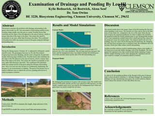
Top view of area of interest:
Methods
Used a Juno 3B GPS to measure the length, slope and area of the
area of interest.
Used WEPP to model the current runoff data and proposed data.
Discussion
The current model shows the steeper slope of the hill meeting the flat area
where ponding events occur. The erosion over time can be seen in the bare
areas of clay-loam mix, compared to the rest of the areas where the top
layer of grass has remained unaffected. In order to address this problem,
the proposed model has freshly planted grass in sod. Running both models
over 5 year simulations yielded much lower runoff and soil loss values for
the proposed versus the current model. The reduced runoff will solve the
ponding, since less water will be flowing into the pond area. By changing
the soil type from sod grass clay to sod grass loam, the infiltration rate will
increase, which also helps reduce erosion and ponding.
Another possible solution could be implementing a drain at the middle of
the basin area to provide further drainage with in the floodplain. We chose
against this approach since that would include further planning of pipes
and the campus draining system when changing the vegetation and soil
type could be a simpler yet extremely effective solution.
Conclusion
In order to fix the ponding problem in the flat part of the area of interest,
either a drain should be installed, or hillslope changed. By changing the
hillslope soil type and planting more grass, the runoff could be reduced,
which reduces the amount of water that affects the area.
References
1-Owino, Tom. 04/22/2018. BE 3220 Small Watershed Hydrology and
Sedimentology unpublished notes.
Acknowledgements
We would like to thank Dr. Owino and the Biosystems Engineering
Department for their guidance and expertise.