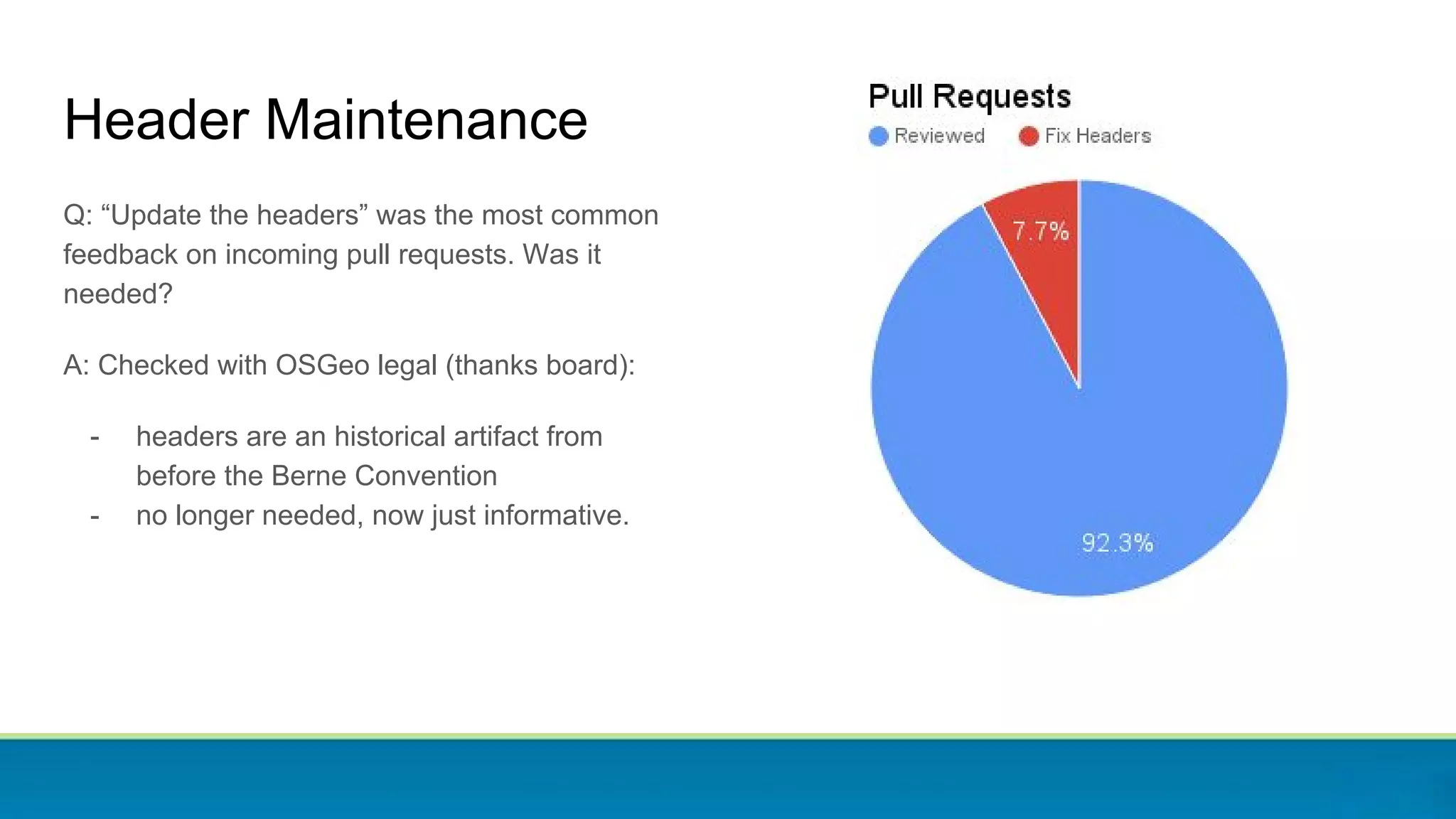
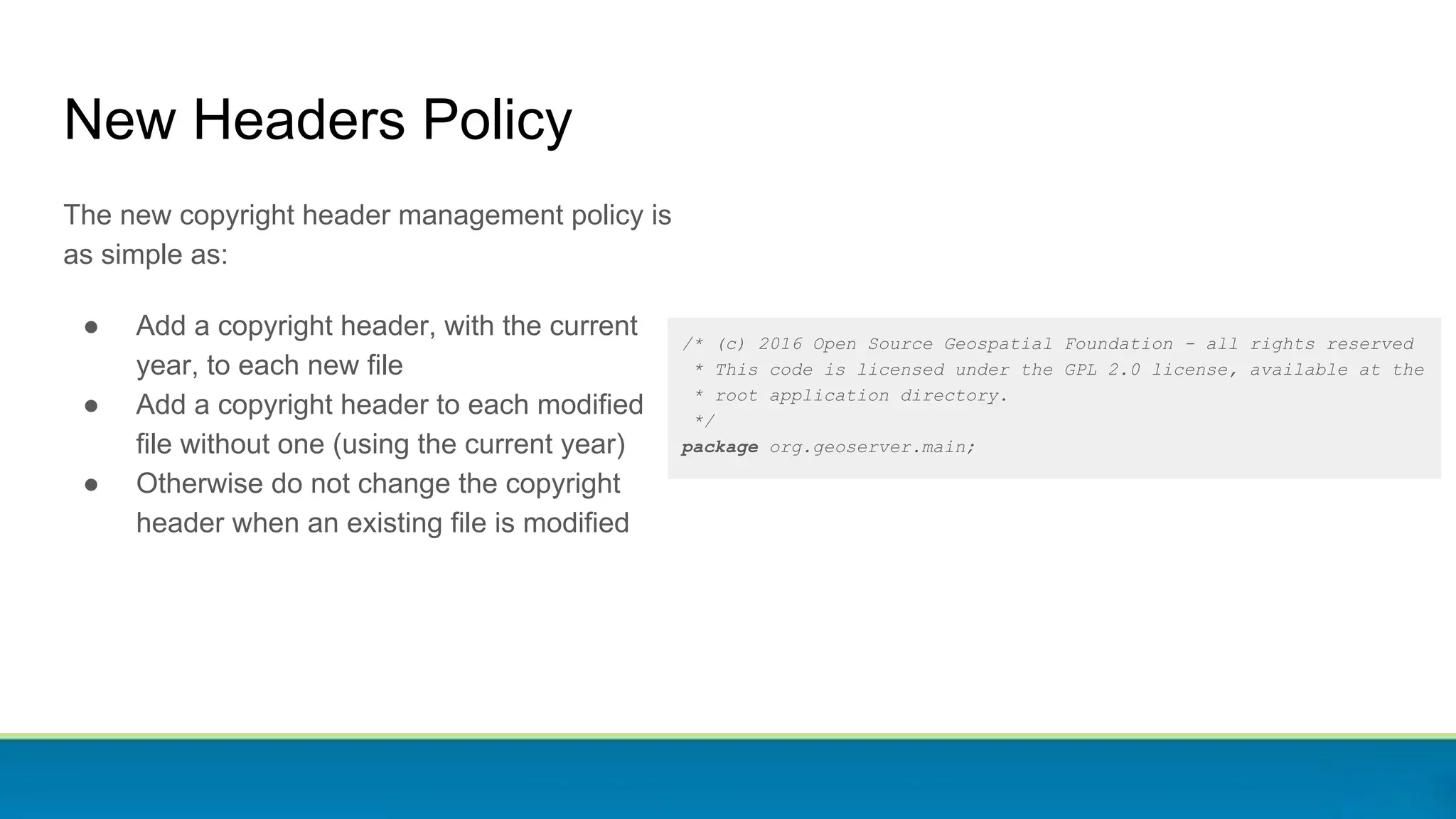
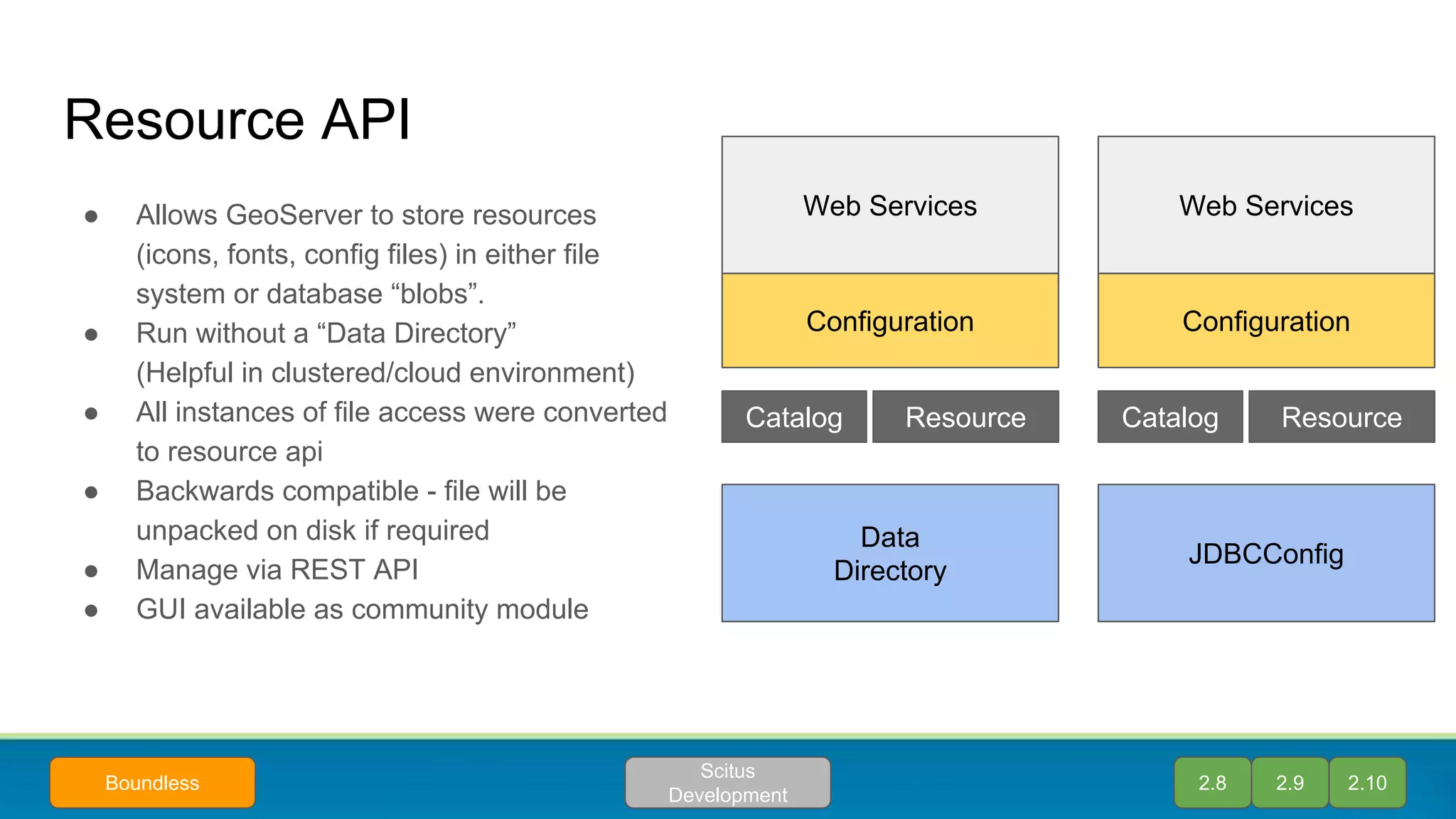
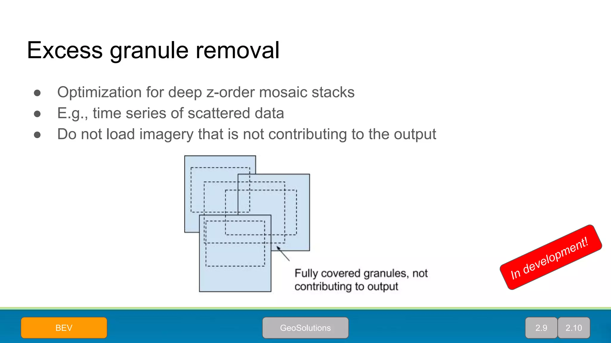
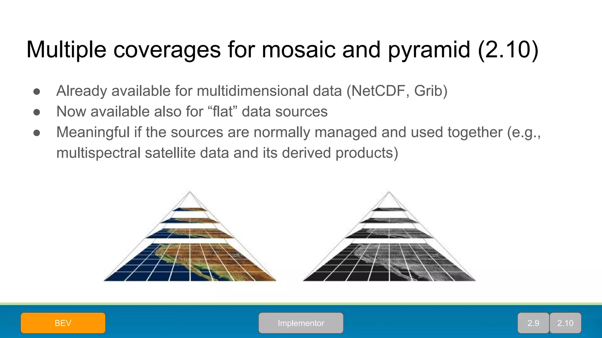
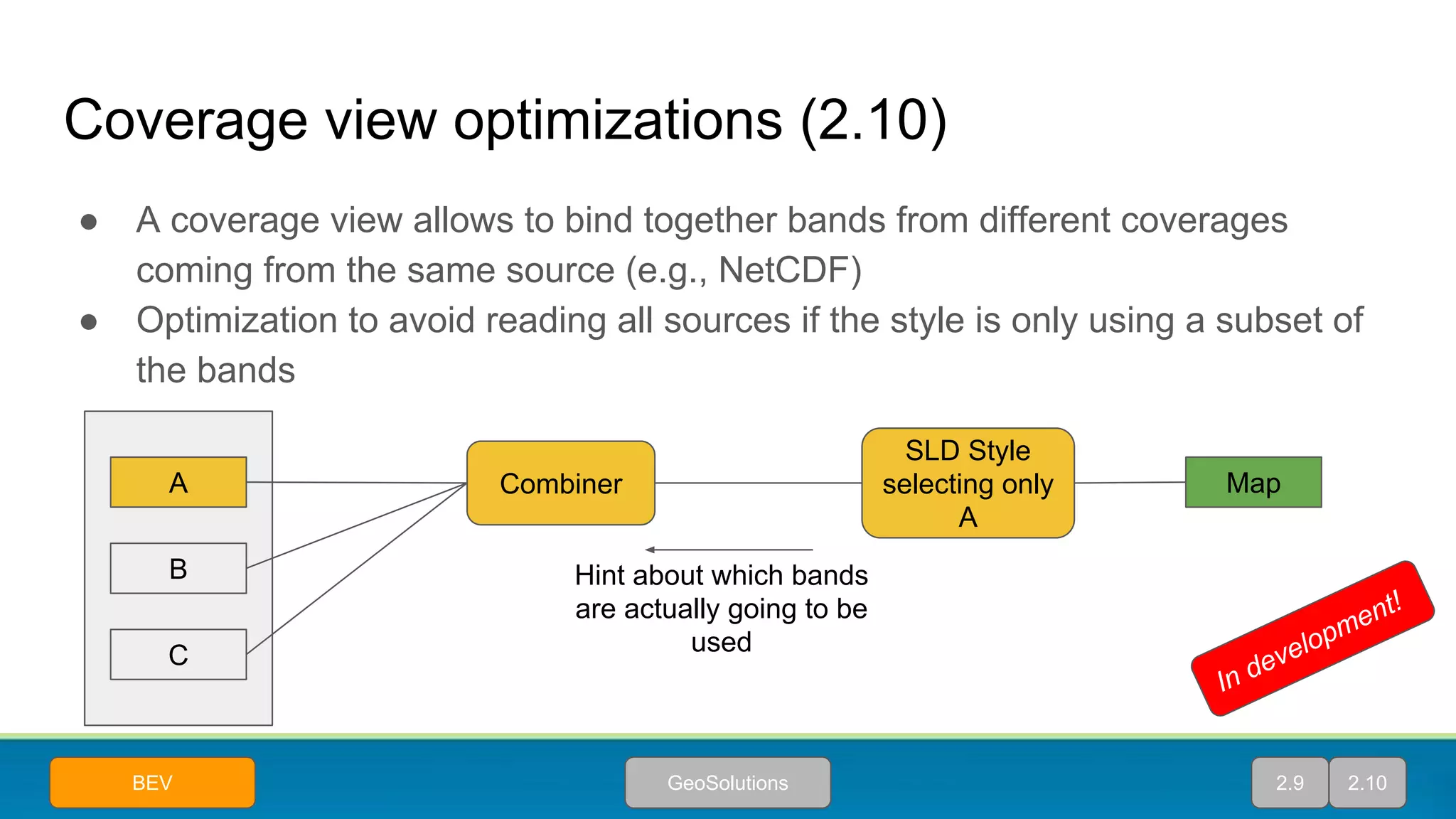
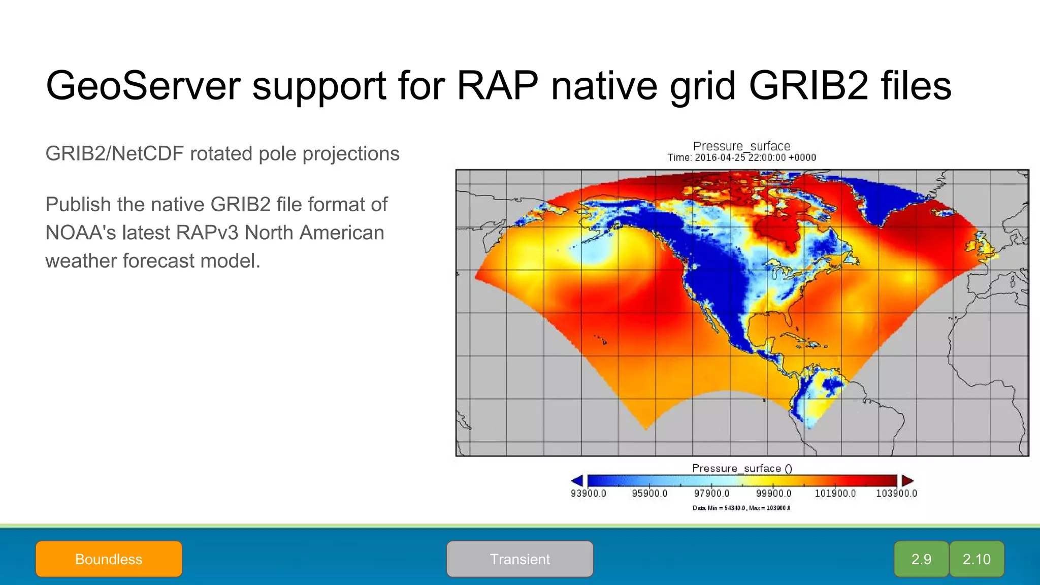
Downloaded 47 times


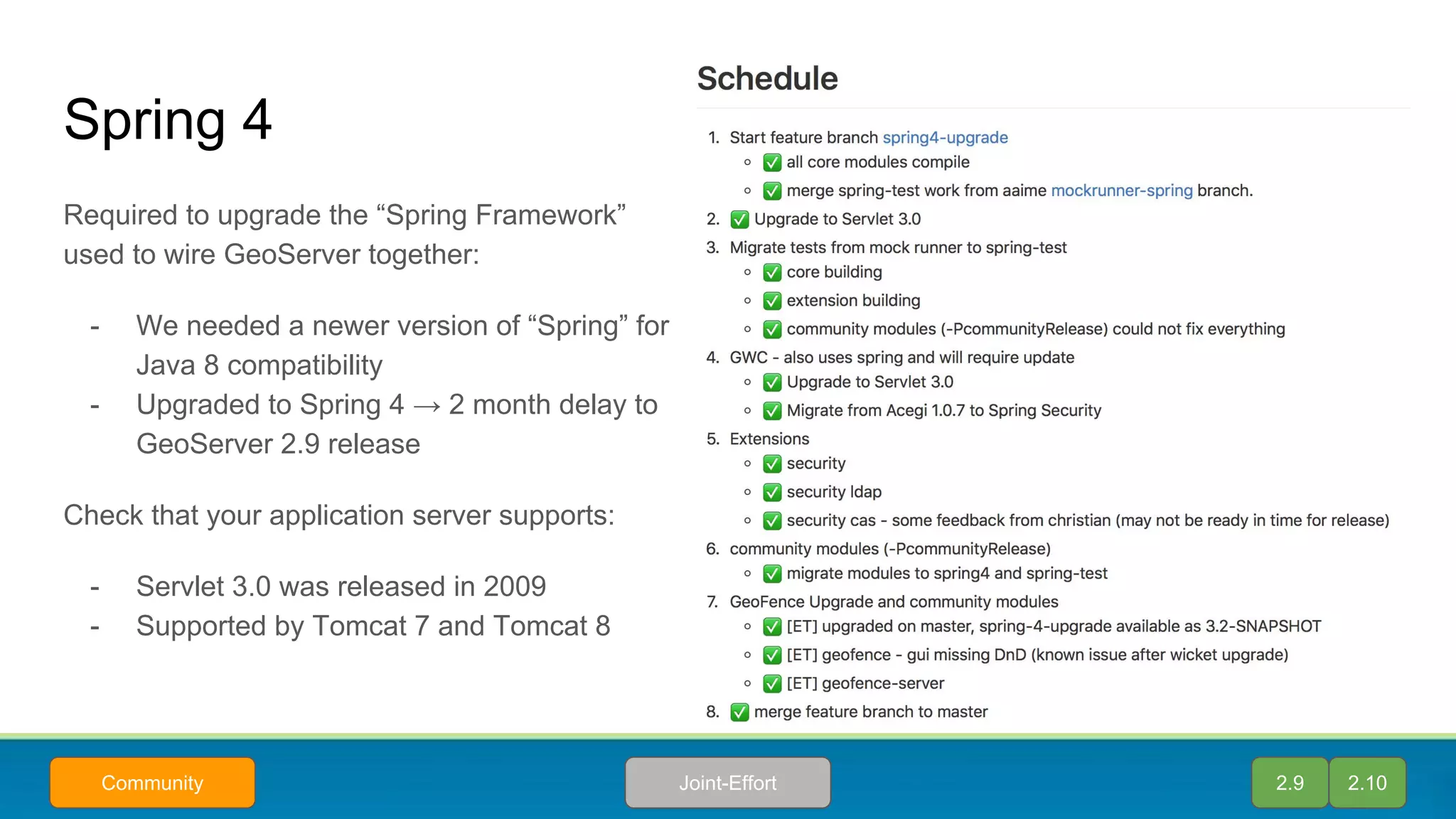

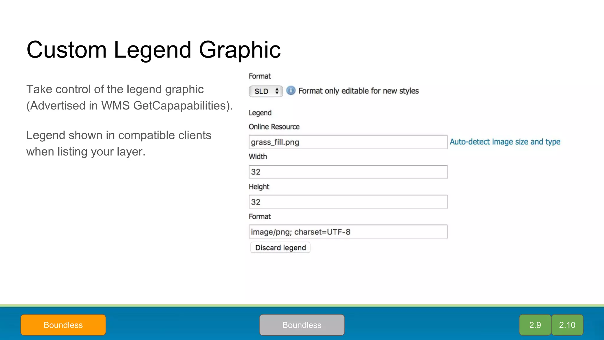
![New features for CSS (2.10)
● Rendering transformations supported (feature parity with SLD!)
● Rule nesting, helps with selector duplication and makes styles more readable
/* @title Levels */
* {
transform: ras:Contour(levels: 1100 1200 1300 1400 1500 1600 1700);
stroke: black;
z-index: 0;
}
/* @title Values */
[@scale < 3000] {
transform: ras:RasterAsPointCollection();
mark: symbol('square');
:mark {
size: 2;
fill: black;
}
label: [GRAY_INDEX];
label-anchor: 0 0.5;
label-offset: 5 0;
font-family: Arial;
font-fill: black;
z-index: 1;
}
Extract contours at the desired levels
When zoomed-in enough, extract point
values, display center with a mark, and
value on top of it
2.10Andrea Aime
In development!](https://image.slidesharecdn.com/stateofgeoserver-160830230811/75/State-of-GeoServer-36-2048.jpg)
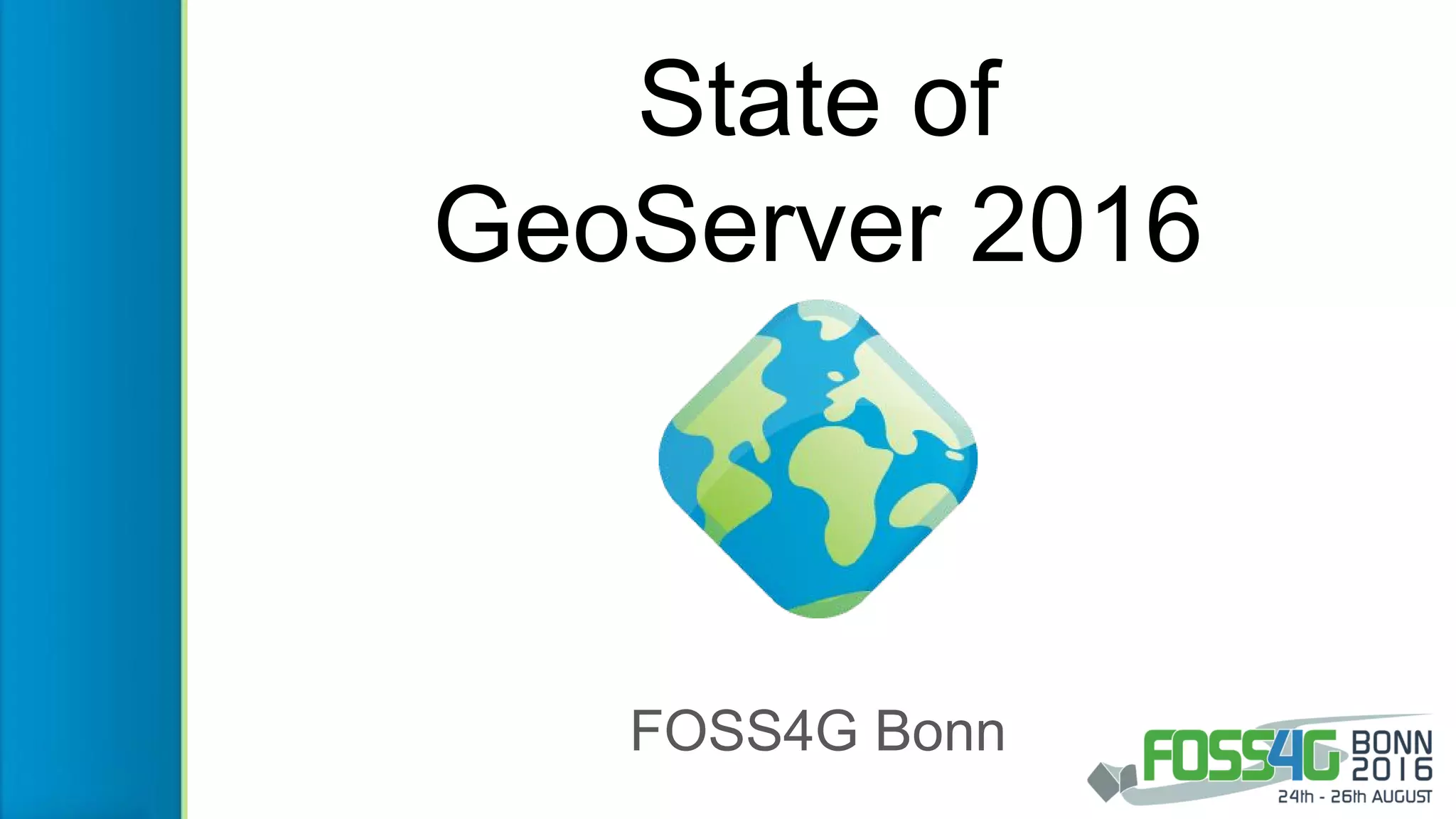
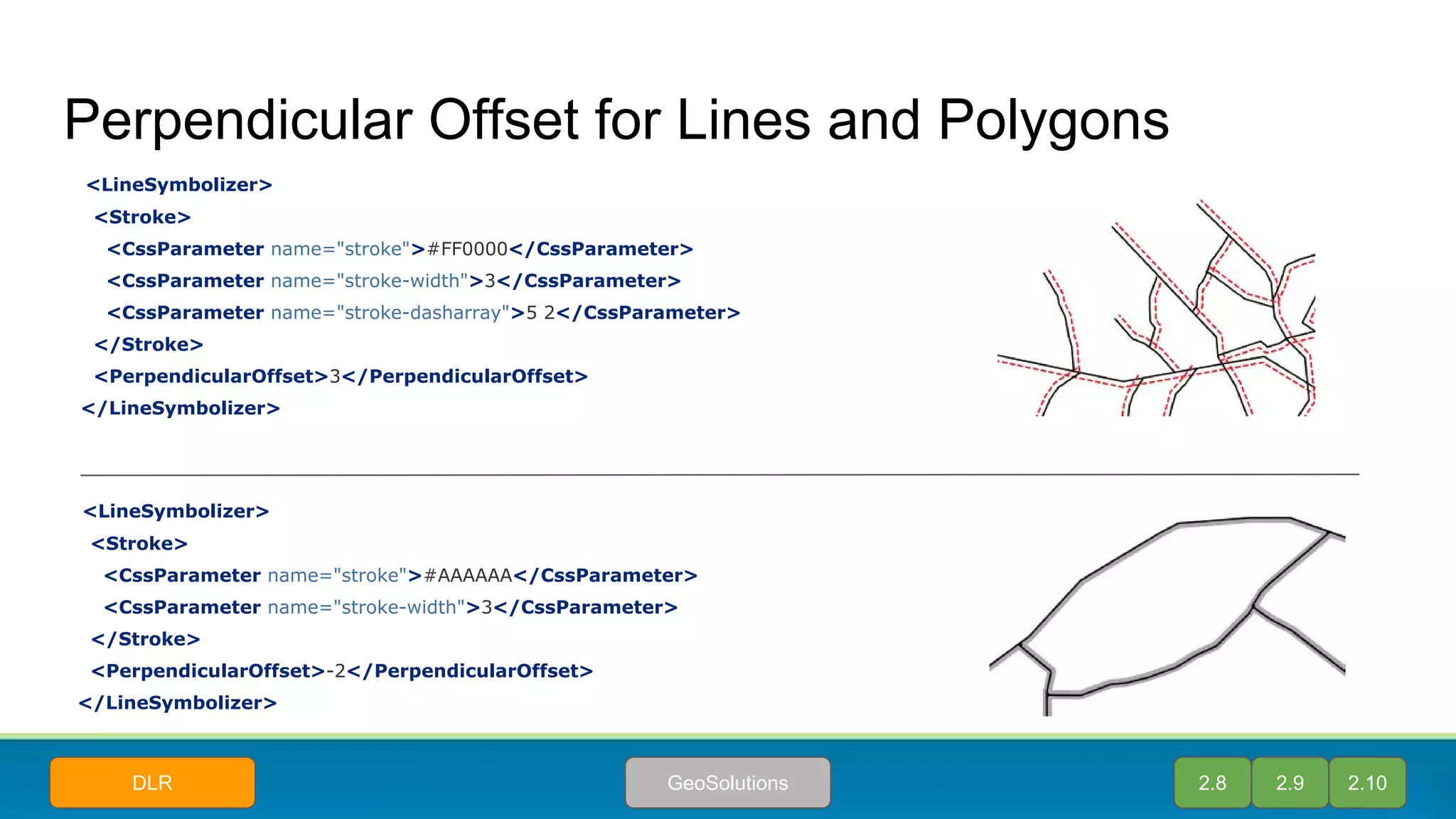
![YSLD community module
● Style Layer Descriptor represented in
YAML
○ Uses indentation rather than XML
○ Easier to read
○ More compact
○ More flexible syntax
○ Contains variables for reusable code
○ Compatible with SLD
● REST API can convert formats
○ Preview your existing styles as YSLD
using REST API
○ View the SLD representation of YSLD
2.9 2.10ImplementorCustomer
symbolizers:
- polygon:
stroke-color: 'blue'
stroke-width: 1
fill-color: '#7EB5D3'
- text:
label: ${name}
fill-color: 'black'
anchor: [0.5, 0.5]
x-maxDisplacement: 40
x-autoWrap: 70](https://image.slidesharecdn.com/stateofgeoserver-160830230811/75/State-of-GeoServer-37-2048.jpg)


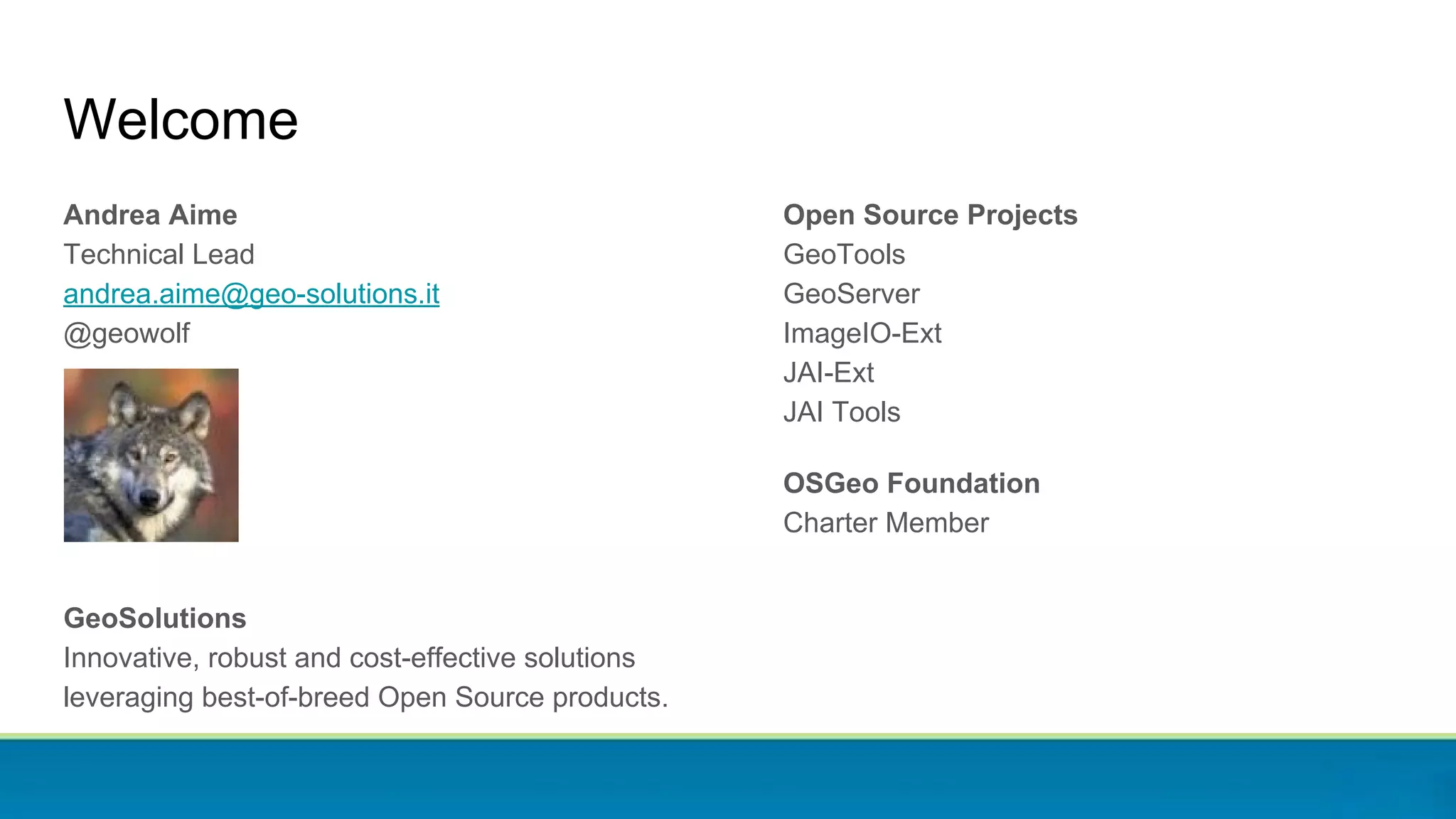
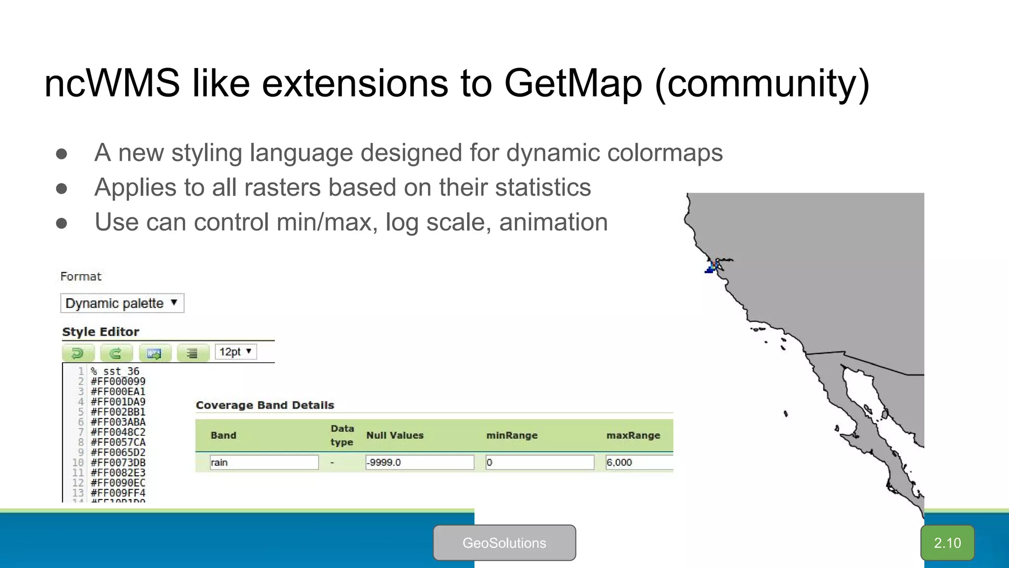
![Aggregation with group-by (2.9)
● The aggregation
process has been
extended with group-by
capabilities
● Quick way to power
custom charts on your
client side
{
"GroupByAttributes": [ "groupingAttribute" ],
"AggregationResults": [
[ "Class1", 18 ],
[ "Class2", 1 ],
[ "Class3", 3 ],
[ "Class4", 3 ]
],
"AggregationFunctions": [ "Count" ],
"AggregationAttribute": "countingAttribute"
}
2.8 2.9 2.10GeoSolutionsLiguria Digitale](https://image.slidesharecdn.com/stateofgeoserver-160830230811/75/State-of-GeoServer-54-2048.jpg)


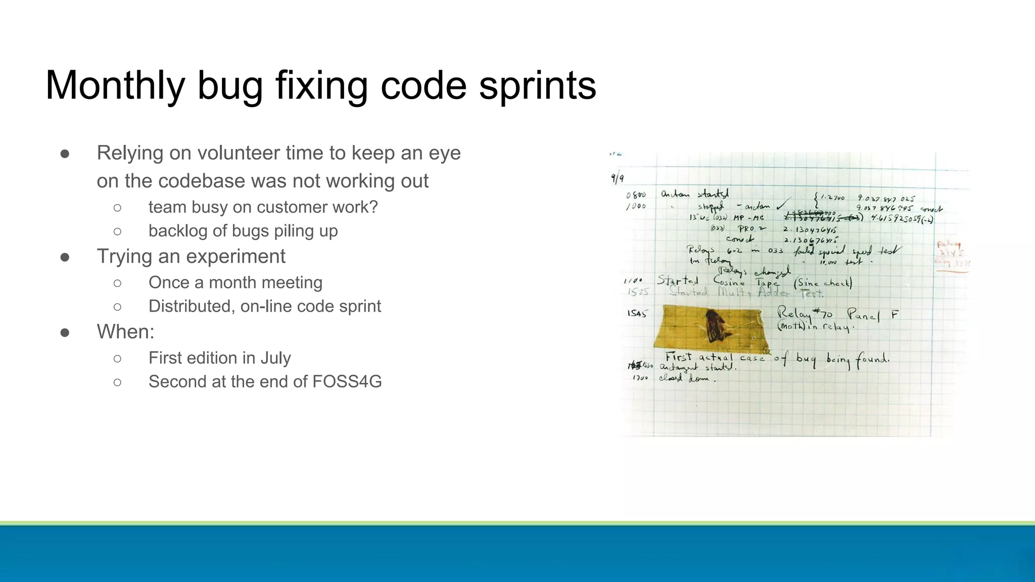
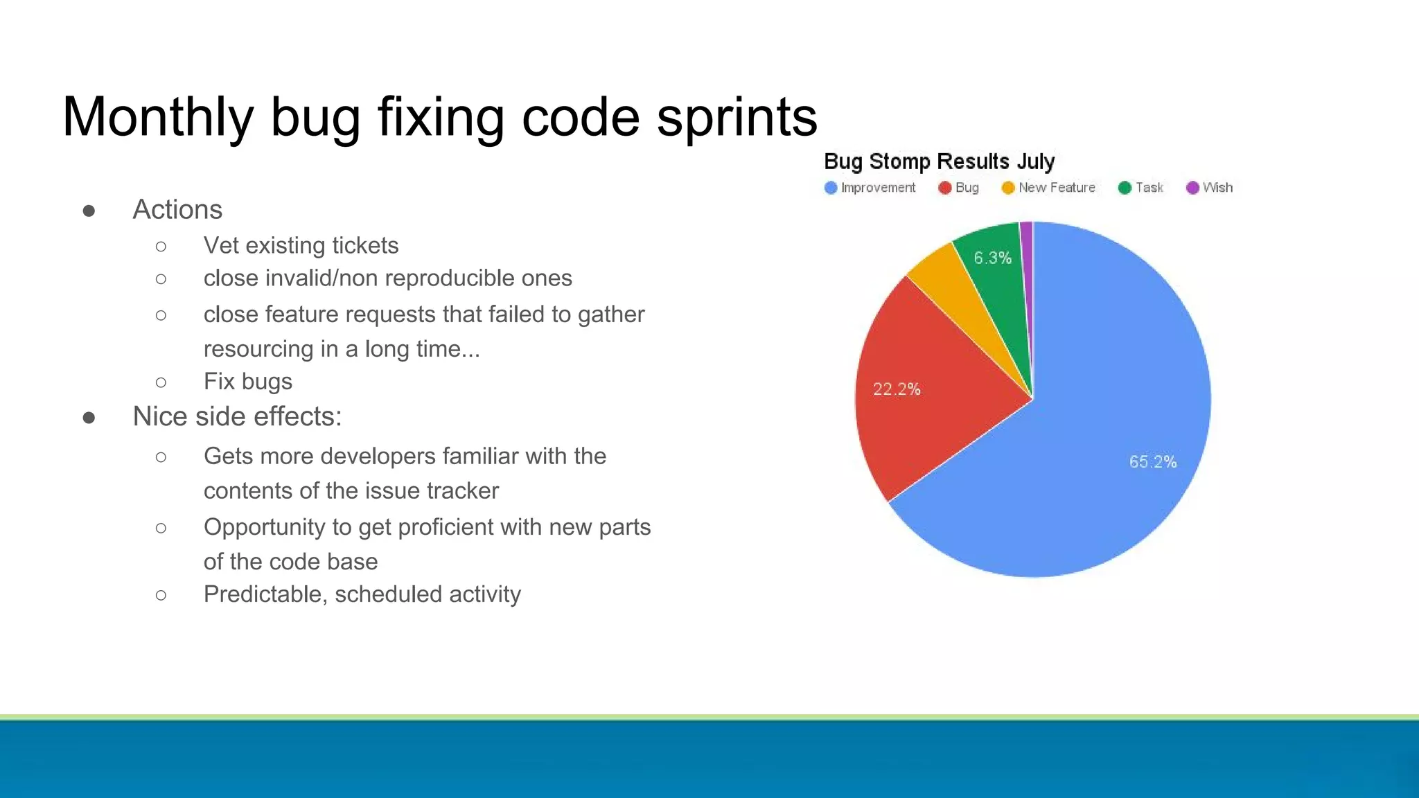
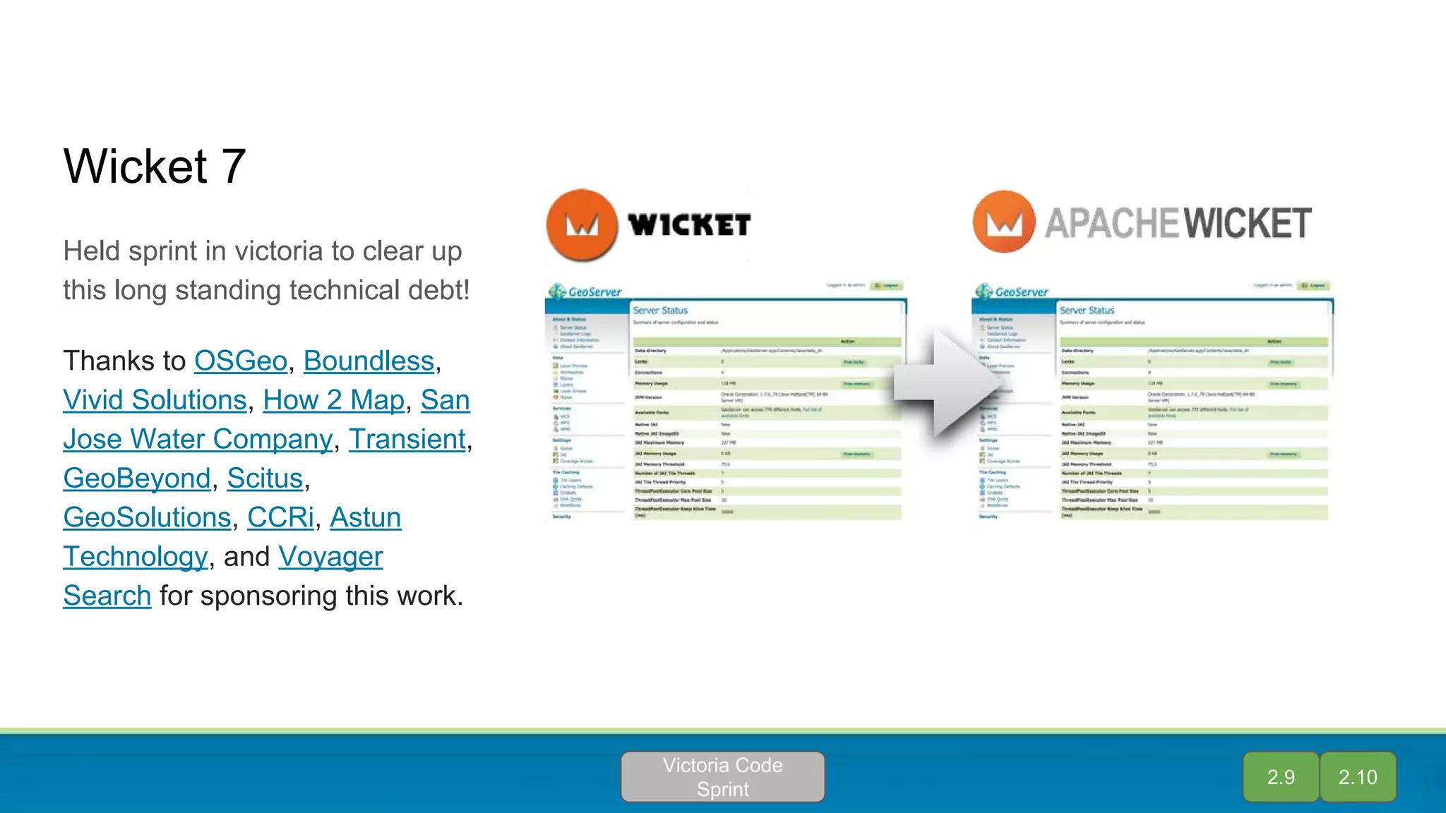
The document provides an overview of the Geoserver project presented at FOSS4G 2016, highlighting the team's contributions, version releases, and various technical advancements. Key features include improvements in resource management, enhanced support for heterogeneous mosaics, and the introduction of a community module for vector tiles. Additionally, it discusses the significance of monthly code sprints aimed at addressing technical debt and maintaining an active development community.