
Recommended
More Related Content
What's hot
What's hot (20)
Similar to India's Social Indicators: Deserts, Rivers, Climate & Agriculture
Similar to India's Social Indicators: Deserts, Rivers, Climate & Agriculture (20)
More from SudarshanSK
Recently uploaded
Recently uploaded (20)
India's Social Indicators: Deserts, Rivers, Climate & Agriculture
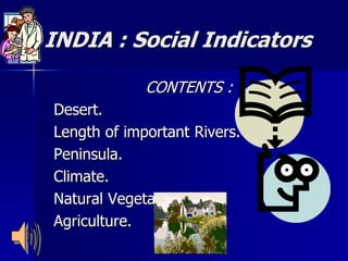
- 1. INDIA : Social Indicators CONTENTS : Desert. Length of important Rivers. Peninsula. Climate. Natural Vegetation. Agriculture.
- 2. Acknowledgement Information and pictorial illustrations to create this work have been drawn from class notes, prescribed text books and various internet resources. The author gratefully acknowledges the same. Any objections to the use of internet resources may please be indicated to suddurocks@yahoo.in so that the same can be removed from the illustrations used in this file. This presentation is created with the sole intention of benefitting a large number of student community. This may not be used for any commercial purpose.
- 3. D e s e r t • The Desert region is located in the western and north western part of the country. • It can be divided into parts like the little desert and great desert. • The great desert extends from the edge of the Rann of Kuchch beyond the Luni river northward. The whole of Rajasthan runs through this. • The little deserts extends from the Luni between Jaisalmer and Jodhpur up to northern wastes.
- 4. Lengths of important Rivers I N D U S 2900 Kms. B R A H M A P U T R A 2900 Kms. G A N G A 2510 Kms. G O D A V A R I 1450 Kms. N A R M A D A 1290 Kms. K R I S H N A 1290 Kms. M A H A N A D I 890 Kms. K A V E R I 760 Kms.
- 5. P e n i n s u l a Peninsula is marked by elevated landmass with height ranging from 460 to 1220m. The deccan and the southern part surrounded by water on three sides make the peninsula. It is flanked by eastern ghats on the east and western ghats on the west. Between the ghats and the seas lie the narrow coastal belts.
- 6. C l i m a t e India receives 86% of rain during the South West monsoons. North East monsoons is a very restricted one- experience in Tamil Nadu, Kerala and sometimes Andra Pradesh and Karnataka.
- 7. Natural Vegetation Evergreen Forests are found in areas with 200cm to 300cm rainfall. Dedicious Forests are found in places with lesser rainfall between 150 to 200cm, mean annual temperature between 24 to 28 degree Celsius. Dry Forests are found where rainfall is scanty between 75 to 100cm.
- 8. A g r i c u l t u r e India has two crop seasons : i) Kharif - Rice, Jowar, Bajra, Ragi, Maize, Cotton, Jute,…. Etc. ii) Rabi – Wheat, Barley, Peas, Rapeseed, Mustard, Gram,…. Etc.
- 9. Thank You !!! Compiled By : Sudarshan . S . K . Mail Your Feedback And Suggestions For Improvement To : suddurocks@yahoo.in