RAPID MAPPING
•
0 likes•1,427 views

Spot Image and Infoterra, subsidiaries of EADS Astrium, are launching the World’s first online service at www.express-maps.com to deliver detailed basemaps covering over three quarters of the Earth’s land surfaces. This unique service creates basemaps at a scale of 1:50 000, which can be delivered electronically to users.
![EXPRESSMaps presentation ,[object Object],[object Object],[object Object],[object Object],[object Object]](data:image/gif;base64,R0lGODlhAQABAIAAAAAAAP///yH5BAEAAAAALAAAAAABAAEAAAIBRAA7)
Recommended
More Related Content
What's hot
What's hot (20)
Viewers also liked
Viewers also liked (13)
Similar to RAPID MAPPING
Similar to RAPID MAPPING (20)
More from Spot Image
More from Spot Image (7)
Recently uploaded
Recently uploaded (20)
RAPID MAPPING
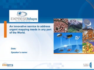
- 1. An innovative service to address urgent mapping needs in any part of the world Date: Speaker’s name:
- 11. Examples of maps performed (.pdf file) EXPRESSMaps presentation
- 12. Product Specification- Map legend EXPRESSMaps presentation
- 14. Product Specification – Map Naming convention EXPRESSMaps presentation
- 16. Example of map 1:50,000 (Muzaffarabad – Afghanistan) EXPRESSMaps presentation
- 17. .shp layers displayed individually or combined (in any GIS) EXPRESSMaps presentation Shadow Land Cover Contour lines Hydrographic network and roads
- 18. EXPRESSMaps presentation Maps performed over any type of landscape
- 19. EXPRESSMaps presentation Maps performed over any type of landscape
- 20. EXPRESSMaps presentation Maps performed over any type of landscape
- 21. EXPRESSMaps presentation Maps performed over any type of landscape
- 22. EXPRESSMaps presentation Maps performed over any type of landscape
- 24. Integration of kml raster file in Google Earth EXPRESSMaps presentation
- 25. EXPRESSMaps presentation Integration of kml raster file in Google Earth
- 26. Integration of kml raster file in Google Earth EXPRESSMaps presentation
- 27. Integration of kml raster file in Google Earth EXPRESSMaps presentation
- 29. EXPRESSMaps presentation Completeness/Accuracy /Confidence
- 30. EXPRESSMaps presentation Completeness/Accuracy /Confidence
- 31. EXPRESSMaps presentation Completeness/Accuracy /Confidence
- 32. EXPRESSMaps presentation Completeness/Accuracy /Confidence
- 33. Comparison Google Earth / Google Map / EXPRESSMaps EXPRESSMaps presentation Similar level of information… … but no possibility to download the data and have access to a wide range of formats for further use with your own tool (commercial or open-source software for display and analysis). Example over Gambia.
- 34. Comparison Google Earth / EXPRESSMaps EXPRESSMaps presentation Built-up dense Built-up dense Example of ‘’dense build-up areas’’ and ‘’visible features’’
- 41. EXPRESSMaps web-service: http://express-maps.com EXPRESSMaps presentation
Editor's Notes
- Penser à mettre à jour la couverture à partir su site www.express-maps.com si besoin
- DTED is a standard National Geospatial-Intelligence Agency (NGA) product that provides medium resolution, quantitative data in a digital format for military system applications
- Muzaffarabad is situated at the confluence of the Jhelum and Neelum rivers. The city is 138 kilometres from Rawalpindi and Islamabad and about 76 kilometres from Abbottabad. The city was the site of the epicentre of the 2005 Kashmir earthquake, which occurred on October 8, 2005 and had a magnitude of 7.6. The disaster destroyed 50% of the buildings in the city (including most of the official buildings) and is estimated to have killed up to 80,000 people in the Pakistani-controlled areas of Kashmir, alone.
- This area corresponds to a part of the border between Kingdom of Saudi Arabia and Yemen. The map sheet covers parts of the two countries. The city of Najran in the Northern part of the map is easily visible, in KSA. In the south, the border is not clearly visible. Landscape is made of rocky areas, with some sand parts and a lot of temporary rivers (wadi).
- Banjul (formerly Bathurst), officially the City of Banjul, is the capital of The Gambia, and located within the division of the same name. The population of the city proper is only 34,828, with the Greater Banjul Area, which includes the City of Banjul and the Kanifing Municipal Council, at a population of 357,238 (2003 census). It is located on St Mary's Island (Banjul Island) where the Gambia River enters the Atlantic Ocean. The island is connected to the mainland by passenger and vehicle ferries to the north and bridges to the south. The covered area is very flat, with an elevation always lower than 50m. Around the city, landscape melts cropland, forest and bush. All along the eastern part of the map, the mangrove delineates the shore of the Gambia river. The "historical" city of Banjul is located in the North East part of the map, just in front of the other shore of the river. The new city of Banjul is in the center of the map, connected to the International Airport.
- Aeronautical: All airports listed in the World Aeronautic DB (point -> Main Terminal or main building around). Built up areas: Populated areas also get special attention. The population layer comprises five classes, three for types of housing. Classes are distinguished according to housing density. Two additional classes cover industrial or trading zones in built-up areas. Large areas are represented by polygons, while points enable large buildings like warehouses, factories and so on to be quickly identified. Such landmarks prove very useful for determining where you are on a map. The remaining information on the maps results from trade-offs between source data characteristics, the level of detail expected at the chosen scale (1:50 000) and production time constraints. Many point features like bridges, dams, airports and ports are also mapped, to facilitate operational use on the ground.
- Elevation: Relief is represented by contours with a spacing of 50 metres and by shading. High and low points (roughly 80 on each map) extracted from the DEM are also shown. Such information related to the terrain topography allows a better and faster progress on the field. Visible Features: Any ground features clearly visible, which can be identified without any doubt. In contrary, the features is classified in ‘’Build up other points’’
- Roads: Two categories of roads or tracks are mapped: main routes and others. The distinction between the two is not based on technical criteria (road surface, number of lanes, etc.) but rather on their relative importance as a line of communication. So, the widest and most-used routes, and those linking the largest villages or towns, are classified as main routes . All other routes, from tracks to secondary roads, are classified as other routes . This unusual classification scheme is dictated by the need to extract information very quickly and by the fact that mapped landscapes and road network density may vary enormously. For example, if all tarmac roads were classified as main routes and all other roads as other routes, some maps would only show one category and therefore be of limited use. Likewise, this scheme is adapted to the many territories where the main routes are in fact dirt tracks. The EXPRESSMaps classification is therefore a functional one, highlighting main routes to help teams reach where they need to go as quickly and easily as possible.
- The remaining information on the maps results from trade-offs between source data characteristics, the level of detail expected at the chosen scale (1:50 000) and production time constraints. For example, land occupancy in other areas is rendered by 10 additional classes.