3D Visualisation with Blender & FME
•
2 likes•2,390 views

Using FME as part of a workflow to create models for use in Blender, an open source 3D modelling application. Includes lidar and raster analysis to create surfaces and textures used in visualisations and bespoke maps.

Recommended
Recommended
More Related Content
What's hot
What's hot (9)
More from Safe Software
More from Safe Software (20)
Recently uploaded
Recently uploaded (20)
3D Visualisation with Blender & FME
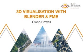
- 1. 3D VISUALISATION WITH BLENDER & FME Owen Powell
- 2. Owen Powell Senior Consultant, Arup Infrastructure Midlands, UK Spatial data analyst Certified FME Professional
- 5. £1.24bn revenue 12,800 people in 89 offices 14,000 projects across 146 countries Arnhem Central Station Arnhem, Netherlands
- 6. Sir Ove Arup, The Key Speech 1970 “Our work should only be interesting and rewarding. Only a job well done, as well as we can do it – and as well as it can be done – is that. We must therefore strive for quality in what we do and never be satisfied with second-rate.”
- 11. BLENDER Blender is a free and open source 3d modelling and animation package Supports common 3d formats and python scripting Node based materials and compositing – JUST LIKE WORKBENCH
- 19. TRADE ME High res topographic maps
- 21. HIGH RES CUSTOM MAPS 5GB of Shuttle Radar Topography Mission 30m (SRTM) data in WGS84 Separate images for each region with consistent colour gradient Single national composite image Ortho-rectified and georeferenced renders High res png with transparency for water courses and ocean CREATION OF
- 22. CLIP AND REPROJECT FROM WGS84 TO NEW ZEALAND NATIONAL GRID SCALE DATA RANGE TO FIT 16 BIT IMAGE MOUNT COOK * 17 WRITE REGION BOUNDING BOX TO OBJ
- 23. CREATE MASKS FOR COASTLINE AND WATERCOURSES
- 24. CREATE MASKS FOR COASTLINE AND WATERCOURSES
- 31. SITE DEVELOPMENT RENDERS *not a real site
- 42. 2m DTM 2m DSM
- 43. DTM DSM
- 45. FME MAKES LIFE IN A MULTIDISCIPLINARY ORGANISATION SIMPLE And accurate
- 46. THANK YOU! owenpowell.wordpress.com | owen.powell@arup.com