Tampa BSides - Chef's Tour of Microsoft Security Adoption Framework (SAF)
Paper & electronic charts lrg
1. Grunt Productions 2004
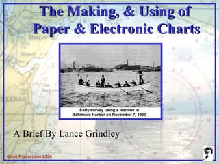
The Making, & Using ofThe Making, & Using of
Paper & Electronic ChartsPaper & Electronic Charts
A Brief By Lance Grindley
2. Grunt Productions 2004
The commercial mariner doesThe commercial mariner does
The recreational boater doesThe recreational boater does
And even the fishermanAnd even the fisherman
4. Grunt Productions 2004
All examples at the same line spacingAll examples at the same line spacing
1940 - 19801940 - 1980Pre-1940Pre-1940 1980 - Present1980 - Present
Soundings obtainedSoundings obtained
by hand lead-lineby hand lead-line
Soundings obtainedSoundings obtained
by single-beamby single-beam
echo sounderecho sounder
Multi-beam Side Scan Sonar
Soundings obtainedSoundings obtained
by side scan sonarby side scan sonar
and multi-beamand multi-beam
resulting in 100%resulting in 100%
bottom coveragebottom coverage
8. Grunt Productions 2004
Sounding Coverage
100m line spacing
50m between selected soundings
coverage to 1m curve
50m
100m
9. Grunt Productions 2004
VESSEL DRAFT
SOUND VELOCITY
CHART DATUM
WATER LEVEL (corrected to chart datum)
SETTLEMENT AND SQUAT OF VESSEL
GPS/DGPS POSITIONING
Anatomy of a SoundingAnatomy of a Sounding
10. Grunt Productions 2004
Nautical ChartNautical Chart
PhotogrammetryPhotogrammetry
BlueprintsBlueprints
SourceSource
Aids to NavigationAids to NavigationShorelineShoreline
ObstructionsObstructions
Chart Data SourcesChart Data Sources
WrecksWrecks
SoundingsSoundings
11. Grunt Productions 2004
SOUNDINGSSOUNDINGS
AIDS TO NAVIGATIONAIDS TO NAVIGATION
BRIDGE CLEARANCESBRIDGE CLEARANCES
LANDMARKSLANDMARKS
DEPTH CONTOURSDEPTH CONTOURS
DANGERSDANGERS
GEOGRAPHIC NAMESGEOGRAPHIC NAMES
Information on a ChartInformation on a Chart
12. Grunt Productions 2004
Raster Nautical ChartsRaster Nautical Charts
Scans of the Paper ChartsScans of the Paper Charts
Requires a computer onboardRequires a computer onboard
Do not meet the MCA carriageDo not meet the MCA carriage
requirementsrequirements
Very useful Navigation ToolVery useful Navigation Tool
13. Grunt Productions 2004
Basic Navigation ScreenBasic Navigation Screen
With Weather OverlayWith Weather Overlay With 3-d OverlayWith 3-d Overlay
Examples of RasterExamples of Raster
Nautical ChartNautical Chart
FunctionalityFunctionality
14. Grunt Productions 2004
Electronic Navigational ChartsElectronic Navigational Charts
Vector based navigational chartVector based navigational chart
A database of chart featuresA database of chart features
Compiled from largest scale sourceCompiled from largest scale source
BenefitsBenefits
Clutter is reducedClutter is reduced
Data base is created from sourceData base is created from source
Most important data created andMost important data created and
released firstreleased first
May be incrementally updatedMay be incrementally updated
15. Grunt Productions 2004
ENC >>>>>>>> vs.<<<<<<<< RasterENC >>>>>>>> vs.<<<<<<<< Raster
Normal View
Zoomed View
More “Pixelation”More “Pixelation”Less “Pixelation”Less “Pixelation”
27. Grunt Productions 2004
Do you think heDo you think he
knows what'sknows what's
coming aroundcoming around
the sides ?the sides ?
Editor's Notes
Commercial mariners are required to carry the latest edition by the MCA. Research and survey vessels also rely on charts.
Charts make cruising and sailing safer and more enjoyable for the recreational boater, particular on long trips away from their homeports
Even fishermen benefit from charts, marking their favorite fishing holes on them for easy return on the next trip
As you can see, charts have changed considerably through the years, from the early sketch type charts to the computer created and displayed charts of today.
This shows the evolution of sounding techniques over the years. Note that this illustrates the coverage that’s possible by the various technologies at the same line spacing. Prior to 1940 all soundings were obtained by hand lead-line, then echo sounders were used exclusively until 1980, when side-scan was used in conjunction with echo sounders. Multi-beam is the newest technology, arriving in the last five years.
The hydrographic software allows the user to plan the survey in the comfort of the office. It’s typically used to lay out the scheme of lines that will cover the survey area – usually 100m line spacing for a 10000 scale, 200m for a 20 and so forth. The graphic on the right shows the plan for a survey conducted last summer of a river.
This shows the on-line data acquisition system used on both the small boats and the ship. Soundings are plotting in real-time, the display includes a steering indicator to keep the helmsman online as well as, a boat icon showing the vessels location, as well as a user configurable navigation information section.
This shows the path a sounding takes, from acquisition to survey plot.
The upper left shows the graphic record from the echo sounder. The data which is logged to the computer, is then printed in the office or ships survey room, checked for errors and then plotted.
This shows a typical 10000 scale survey, with 100 meter line spacing, with a sounding selected every 50m along every line. Other significant soundings which fall between these selected soundings are added to the plot during processing.
This shows the numerous corrections that are applied to every sounding. They include:
The Chart is compiled from many data sources. In the case of shoreline, recent aerial photography, blueprints and as-built drawings, are the sources. Obstructions and Navaids are from recent surveys, mostly from Royal Navy survey teams, other government agencies and private survey companies
A navigation chart has a wealth of information on it, including:
Raster nautical charts are a recent development in the last ten years,
This shows some of the functionality of raster charts. A weather overlay option is available, which plots the current weather conditions, downloaded from the net, over the nautical chart. Another option is the 3-d overlay, which gives the mariner another perspective on things. It might also be handy for finding those favorite fishing holes.
The newest technology arriving on the scene is the Electronic Navigational Chart. It is initially aimed at commercial shipping.
ENC are created by digitizing the source shoreline and features. The more familiar raster charts are simply scans of the paper product. Because the ENC is vector based, there is little to none of the pixelation seen on raster charts. As seen in the normal view, ENC’s strive to reduce clutter.
Every feature on the ENC is attributed with a scrolling list of information pertinent to the feature. By clicking on the feature, a pick report pops up with the information, which may include navaid characteristics, depth information, names and descriptions.
A vessel’s draft can be set to display safe areas for navigation.
As I click through these slides, you can see how the safe zones reduce in size as the draft gets deeper.
This slide is showing vessel time on track. (clock time on computer) It also shows a navigation menu bar along the right side of the window.
This slide adds the boat frame. The size of the frame around the ship is user selectable. When the ship reaches the edge of the frame, the screen is redrawn to re-center around the ship, based on the value set in the upper left (in NM).
Shows predicted position of vessel based on course and speed, in this case 90 seconds ahead. 0.75 is distance in NM from center of screen to top of screen. Crosshair is the cursor.
Lights on and simplified navaids. Magnitude of light is indicated by circle size.
This shows track line set – with a user selected hatched area defining allowable safe limits to vary off course before an alarm would sound.
This shows range circles – at half mile increments. Text is on.
This shows a forward looking area, preset by the user, to search for charted dangers within the triangular area. An audible alarm sounds when something is in the area, in this case shallow water to starboard.
This shows the ship in the lock. The boat shape in this case was set to represent a 1000 footer.
Here’s a good example which shows the potential for error when creating ENC by just digitizing the chart. There’s a big difference between the charted shoreline and that seen on the aerial photograph.