SlideShare a Scribd company logo
1 of 61
Download to read offline
It is projected that sea levels will rise 2 feet by
mid-century and 6 feet by 2100. This new tideline
will transform our coast.
Sea Change: Boston examines the city’s
vulnerabilities to sea level rise and demonstrates
design strategies for resilience.
Curated by Sasaki Associates in partnership with
the Boston Architectural College, the City of Boston,
and The Boston Harbor Association, this exhibition
has become the framework for a larger conversation
regarding planning and design for resilience in the
Greater Boston area.
*Merriam-Webster Dictionary, 2014
sea change noun ( c. 1612 )
	 { see • cheynj }
:a marked change:transformation*
sea level rise
explained
Global sea levels have fluctuated for
thousands of years.
Tectonic conditions and climatic cycles have
caused vacilating ocean levels. But because of
current climate change, the rate of change has
accelerated dramatically.
There is general consensus among scientists
regarding the projections for global sea level rise;
however, glacial melt rates are still largely unknown.
If warming global temperatures continue to melt
our major glaciers, this will have an additional—and
catastrophic—impact on our coastlines beyond
current sea level rise projections.
Global sea levels are projected to rise
1–2 feet by 2050 and 3–6 feet by 2100.
Projections for sea level rise vary regionally due to
local geologic conditions. The Northeast is especially
vulnerable to sea level rise with observed rates 3-4
times higher than the global average. In addition
to the global projections, the warming of the Gulf
Stream could add 6–9 inches of sea level rise by
2100.
In Boston, sea level rise is already occuring. Over the
past century, the relative sea level rise in Boston has
been 12 inches. Of that total, 4 inches is due to land
subsidence.
9000 YEARS AGO 6000 YEARS AGO 3000 YEARS AGO
9,000 YEARS AGO 6,000 YEARS AGO 3,000 YEARS AGO
1630 18521795 1934 TODAY 2050 2100
1630 1795 1852 1934 TODAY 2050: 2 FT OF
SEA LEVEL RISE
2100: 6 FT OF
SEA LEVEL RISE
BOSTON HARBOR HAS EVOLVED SINCE THE ICE AGES
CAUSES OF SEA LEVEL RISE
Warming Waters Glacial Melting
Land Subsidence
If all the ice sheets
melted here, sea
levels would rise
ANTARCTICA
89 ft
If all the ice sheets
melted here, sea
levels would rise
GREENLAND
25 ft
MELTING ICE SHEETS ARE A LARGE CONTRIBUTOR TO Sea level rise
GLOBAL SEA LEVELS ARE
PROJECTED TO RISE 1—2 FEET
BY 2050 and 3—6 FEET BY 2100.
THE RESEARCH.
CAUSES AND PROJECTIONS
BOSTON
SOMERVILLE
CHELSEA
WINTHROP
QUINCY
HULL
EVERETT
REVERE
MILTON
CAMBRIDGE
2 ft sea level
rise in 2050
SEA LEVEL RISE PROJECTIONS
MapSources:SealevelriseprojectionsfortheregionarebasedoncontoursfromMassachusettsOfficeofGeographic
Informationand3DiTechnologies/SpectrumMappingLLCLiDARdataset(2002);SeaLevelRiseprojectionsforBostonare
basedoncontoursfromCityofBoston,BostonRedevelopmentAuthority,andSanbornMapCompanyLiDARdataset(2009).
north
1 mile
THE RESEARCH.
CAUSES AND PROJECTIONS
BOSTON
CAMBRIDGE
SOMERVILLE
CHELSEA
WINTHROP
QUINCY
HULL
EVERETT
REVERE
MILTON
6 ft sea level
rise in 2100
2 ft sea level
rise in 2050
SEA LEVEL RISE PROJECTIONS
MapSources:SealevelriseprojectionsfortheregionarebasedoncontoursfromMassachusettsOfficeofGeographic
Informationand3DiTechnologies/SpectrumMappingLLCLiDARdataset(2002);SeaLevelRiseprojectionsforBostonare
basedoncontoursfromCityofBoston,BostonRedevelopmentAuthority,andSanbornMapCompanyLiDARdataset(2009).
north
1 mile
THE PERFECT
STORM
The Boston region is no stranger
to devastating storms.
Although Boston is sheltered geographically
by Cape Cod and the Harbor Islands, the city
has experienced several major hurricanes and
Nor’easters. These storms bring severe winds,
massive amounts of precipitation, and extreme
storm surge which, combined, cause immense
damage. Due to rising sea levels and the increased
frequency and intensity of storms, Boston is more
vulnerable than ever.
Storm impacts will be intensified as sea
levels rise.
Due to climate change, storm events are predicted
to occur more frequently and with greater intensity.
When storms are coupled with elevated sea levels,
impacts will be exacerbated. If a major storm were
to hit Boston during high tide, the region could
experience impacts similar to those in New York
and New Jersey during Hurricane Sandy.
NORMAL TIDE
STORM SURGE
STORM TIDE
STORM SURGE WILL
INCREASE FLOOD IMPACT
low tide
with sea level risewith storm surge
with storm surge + sea level rise
high tide
astronomical high tide
CHARLES RIVER DAM
TIDE HEIGHT COULD BE THE DIFFERENCE
BETWEEN A STORM AND A DISASTER
flooding from a
major storm in 2100
BOSTON
CAMBRIDGE
SOMERVILLE
CHELSEA
WINTHROP
QUINCY
HULL
EVERETT REVERE
MILTON
flooding from a
major storm in 2050
SEA LEVEL RISE +
STORM SURGE PROJECTIONS
MapSources:SealevelriseprojectionsfortheregionarebasedoncontoursfromMassachusettsOfficeofGeographic
Informationand3DiTechnologies/SpectrumMappingLLCLiDARdataset(2002);SeaLevelRiseprojectionsforBostonare
basedoncontoursfromCityofBoston,BostonRedevelopmentAuthority,andSanbornMapCompanyLiDARdataset(2009).
north
1 mile
this is Where high tide could be during a storm in 2050
char l es
r i v er
cambridge
boston
b o st o n
har b o r
charlestown
winthrop
quincy
SEA LEVEL RISE +
STORM SURGE PROJECTIONS
Map Sources: Sea level rise projections for the region are based on contours from Massachusetts Office of Geographic Information and 3Di Technologies / Spectrum Mapping LLC LiDAR dataset (2002); Sea Level Rise projections for Boston are based on
contours from City of Boston, Boston Redevelopment Authority, and Sanborn Map Company LiDAR dataset (2009). Base image from Google Earth 2014
The Great Northeast Blizzard of 1978
Hurricane Nor’easter
The Great New England Hurricane of 1938
BOSTON HAS A HISTORY OF DEVASTATING STORMS
“Blizzard of 1978” on Flickr by That Hartford Guy
is licensed under CC BY-SA 2.0
Courtesy of the Boston Public Library,
Leslie Jones Collection
1885
1954EDNA
1869
1896
1869
1858
1894
1893
1924
1878
1960DONNA
1991BOB
1944
TH
E
G
REAT
ATLAN
TIC
H
UR
1879
1888
1969GERDA
1938THEGREATNE
BOSTON
1940 1950 1960 1970 1980 1990 2000 2010
WINDSPEED
1850
10
30
20
40
50
60
70
80
90
100
1860 1870 1880 1890 1900 1910 1920 1930
SANDY,CAT.3,$68billion
IRENE,CAT.3,$15billion
BOB,CAT.2,$2.5million
GLORIA,CAT.4,$900million
DONNA,CAT.5,$500million
DIANE,CAT.3,$832million
EDNA,CAT.3,$40million
CAROL,CAT.3,$460million
DOG,CAT.5,$3million
GREATATLANTIC,CAT.4,$100million
SEPTEMBERGALE,CAT.3,$N/A
Historic Hurricane Intensity & Damage in New England Most devastating hurricanes in New EnglandHurricanes hitting New Enlgand
GREATHURRICANEOF1938,CAT.5,$306million
MapSources:NationalOceanographicandAtmosphericAdministration(NOAA),AtlanticHurricaneDatabase(2013).
BOSTON HAS A HISTORY OF DEVASTATING STORMS
WHAT’S AT
RISK?
Our neighborhoods and cultural
icons are at risk.
Rising water levels and storm surge will hit close
to home, quite literally. Nearly 200,000 residents
live in homes at risk of flooding. Entire
neighborhoods like East Boston and Back Bay
are vulnerable—as are landmarks like Fenway
Park. Losing homes, neighborhoods, and cultural
assets will threaten our sense of security and our
unique identity—and impact tax revenue for the
cities of Metropolitan Boston.
Sea level rise will have a ripple effect
within and beyond Boston.
Sea level rise and storm-related flooding in the
Boston Metropolitan area will have an impact
well beyond the boundaries of the flood zone.
A major flood will place many key facilities,
infrastructure networks, and economies at risk.
The resulting impacts will ripple across multiple
scales from the city to the state, and even the
entire northeast region.
Massachusetts
New England
Boston
sea level rise will have a ripple
effect within and beyond boston
Flooding during a
major storm in 2050
Residential parcels
at risk
BOSTON
BROOKLINE
CAMBRIDGE
SOMERVILLE
CHELSEA
WINTHROP
QUINCY
HULL
EVERETT REVERE
MILTON
residential populations at risk
MapSources:Parcelsfortheregion:Municipalassessors,various(2013),compiled
byMassGIS.ParcelsforBoston:CityofBostonAssessorsOffice(2013).
north
1 mile
% residential
land
%
population
total population
& property value
123,620 residents
35,452 residents
4,215 residents
433 residents
14,035 residents
3,588 residents
5,077 residents
Boston 19 % 20 %
Cambridge 29 % 34 %
Chelsea 41 % 12 %
Hull 14 % 4 %
Quincy
17 % 15 %
Somerville
17 % 5 %
Winthrop
48 % 29 %
$2.02 billion
$2.90 billion
$170 million
$80 million
$1.42 billion
$390 million
$550 million
20% of boston and
34% of cambridge
residents are at risk
residential populations at risk
industrial, commercial, &
institutional properties at risk
Boston Convention &
Exhibition Center
UMass Boston
MIT
Conley Container
Terminal
Mystic Generating Station
Black Falcon
Terminal
Suffolk
Downs
Industrial
Commercial
Institutional
PARCELS at Risk
Flooding during a
major storm in 2050
MapSources:Parcelsfortheregion:Municipalassessors,various(2013),
compiledbyMassGIS.ParcelsforBoston:CityofBostonAssessorsOffice(2013).
BOSTON
BROOKLINE
CAMBRIDGE
SOMERVILLE
CHELSEA
WINTHROP
QUINCY
HULL
EVERETT REVERE
MILTON
north
1 mile
industrial, commercial, &
institutional properties at risk
Boston
%
commercial
land
%
industrial
land
$
assessed
value
Cambridge
Chelsea
Everett
Quincy
Somerville
Winthrop
$4.83 billion
$3.41 billion
$2.63 billion
$860 million
$240 million
$210 million
$420 million
$330 million
$170 million
$70 million
Less than $1 million
$40 million
$540 million
$100 million
50 % 72 %
44 % 61 %
81 % 93 %
79 % 87 %
41 % 66 %
49 % 63 %
90 % 52 %
$14 billion in property
value is at risk
Ted Williams Tunnel
Sumner Tunnel
North Station
South Station
Back Bay
Station
I-93
Morrisey Boulevard
Major roads
Subway
Rail
MBTA stations
Rail stations
Tunnel entrances
Transportation at RiskLogan
Airport
RedLine
BlueHillAve.Colum
bus
Ave.
Route
1
OrangeLine
OrangeLine
Needham
Line
Fitchburg Line
I-90
Lowell Line
I-93
I-93
I-93
Newburyport/
RockportLine
FairmountLineGreen Line
Memorial Dr.
Storrow Dr.
BlueLine
Silver
Line
Red
Line
Flooding during a
major storm in 2050
transit networks at risk
•	 11 TUNNEL ENTRANCES
•	 50 MBTA STATIONS
•	 7 MAJOR TRAIN STATIONS
MapSources:MajorRoads:MassachusettsDepartmentofTransportation(2012),accessedat
MassGIS;TrainLinesandStations:CentralTransportationPlanningStaff(2013),accessedat
MassGIS.
BOSTON
BROOKLINE
CAMBRIDGE
SOMERVILLE
CHELSEA
WINTHROP
QUINCY
HULL
EVERETT REVERE
MILTON
north
1 mile
Mass General Hospital
Boston Medical
Center
Conley Container
Terminal
Distrigas LNG Terminal
Logan
Airport Deer Island Wastewater
Treatment Plant
Mystic Generating Station
Police station
Power plant
Sub station
Other critical facility
Hospital
Facilities at Risk
Flooding during a
major storm in 2050
•	 8 POWER PLANTS
•	 6 FUEL TERMINALS
•	 9 HOSPITALS
MapSources:PoliceStations:MassachusettsEmergencyManagementAgency(2009);Hospitals:
MassachusettsDepartmentofPublicHealth(2009);PowerPlants:Municipalassessors,various
(2013);CityofBostonAssessorsOffice(2013)
BOSTON
BROOKLINE
CAMBRIDGE
SOMERVILLE
CHELSEA
WINTHROP
QUINCY
HULL
EVERETT REVERE
MILTON
critical systems at risk
north
1 mile
TOUGH
QUESTIONS
We need to weigh the costs and benefits
of all our options.
In the face of rising waters and increased storm-
related flooding, communities will have to decide
what to do with their flood-prone areas. Continually
repairing storm damages and providing services to
these vulnerable neighborhoods demands significant
government resources. For these areas, cities have
three major options to consider: keep water out,
adapt to live with water, or move to higher ground.
Unfortunately, there are no clear answers when it
comes to these options—they all have pros and
significant cons.
Storm barriers can be effective, but at a
great cost.
To protect the Boston Metropolitan Region from
increased storm flooding, one strategy is to construct
a storm barrier within Boston Harbor. Storm barriers
cannot protect the city from permanent sea level
rise, but they can be effective in protecting key areas
during a major storm. Unfortunately, storm barriers
can be expensive and time intensive, and can have
negative impacts on the local ecology. With both
significant pros and cons, building a barrier would
require a rigorous cost-benefit analysis.
1
Fortify
(Keep Water Out)
2
Adapt
(Live with Water)
3
Retreat
(move to higher ground)
what are the options?
retreat may be necessary for the
most vulnerable areas
CEDAR RAPIDS FLOOD RECOVERY PLAN
POST-SANDY FLOODPLAIN BUYOUT INITIATIVES IN NY & NJ
“BuyOutWanted”onFlickrbyMattGreenislicensedunderCCBY-NC-SA2.0©SasakiAssociates
what are alternative uses for
flood-prone neighborhoods?
2open space &
recreation
•	 Floodable parks
•	 Cultural amenities
3new economic
opportunities •	 Aquaculture
•	 Maritime industry
1ecological
function
•	 Increased habitat
•	 Wave attenuation
•	 Pollutant filtration
2
1
3
a storm barrier is
possible in boston
There are three options for a
storm barrier in Boston—each
has its pros and cons.
1
3
Outer Harbor Barrier
Potential Cost: $10 Billion
Design Components:
11,000 FT barrier + 7,500
FT barrier + ~70,000 FT of
shoreline reinforcement
Bonus: Roadway
connecting North Shore
and South Shore
Protects: All areas
protected in Options
1 and 2 + Quincy +
Hingham + Weymouth
Inner Harbor Barrier
Potential Cost: $2 Billion
Design Components:
3,000 FT barrier +
~50,000 FT of shoreline
reinforcement
Protects: Innovation
District, Downtown
Boston, Charlestown,
East Boston, Chelsea,
Everett, Cambridge
2
Harbor Island Barrier
Potential Cost: $8 Billion
Design Components:
5,000 FT barrier + 3,000
FT barrier + ~60,000 FT of
shoreline reinforcement
Bonus: Roadway
connecting North
Shore and South Shore
Protects: All from
Option 1 + Dorchester +
Winthrop
to dam or not to dam?
DESIGN
STRATEGIES
We need to design for rising seas
at multiple scales.
From floating apartment buildings to floodable
parks, designers and engineers around the world
are imagining and constructing resilient solutions
to rising sea levels. Flexability and adaptability are
at the core of resilient design. This thinking will
allow our buildings and infrastructure to bounce
back from a storm or adjust to rising tides.
Boston is home to several examples of resilient
design in anticipation of sea level rise, including the
Deer Island Waste Water Treatment Plant, Spaulding
Rehabilitation Hospital, and the Boston Architectural
College’s “green alley.”
But our city and region are still vulnerable.
The strategies and case studies exhibited here
illustrate an array of tangible solutions for how
the Boston region can protect its edge while
introducing greater vibrancy, connectivity, and
economic opportunities along the water. Layered
together, all of these strategies provide more
holistic opportunities for protection.
Living Shoreline Dune Restoration
Multi-Purpose Levee
Elevated BuildingDry Flood-Proofing Wet Flood-Proofing
Temporary Floodwall
Floating Building
Floodable Park
Absorbent StreetCanal Street
Revetment
CATALOG OF DESIGN STRATEGIES
Lowest
Cost
Longest
Lifespan
Highest Sea Level
Rise Effectiveness
Highest
Storm Surge
Protection
Shortest
Install
Time
Lowest
Cost
Longest
Lifespan
Highest Sea Level
Rise Effectiveness
Highest
Storm Surge
Protection
Shortest
Install
Time
Lowest
Cost
Longest
Lifespan
Highest Sea Level
Rise Effectiveness
Highest
Storm Surge
Protection
Shortest
Install
Time
Lowest
Cost
Longest
Lifespan
Highest Sea Level
Rise Effectiveness
Highest
Storm Surge
Protection
Shortest
Install
Time
Lowest
Cost
Longest
Lifespan
Highest Sea Level
Rise Effectiveness
Highest
Storm Surge
Protection
Shortest
Install
Time
Lowest
Cost
Longest
Lifespan
Highest Sea Level
Rise Effectiveness
Highest
Storm Surge
Protection
Shortest
Install
Time
Lowest
Cost
Longest
Lifespan
Highest Sea Level
Rise Effectiveness
Highest
Storm Surge
Protection
Shortest
Install
Time
Lowest
Cost
Longest
Lifespan
Highest Sea Level
Rise Effectiveness
Highest
Storm Surge
Protection
Shortest
Install
Time
Lowest
Cost
Longest
Lifespan
Highest Sea Level
Rise Effectiveness
Highest
Storm Surge
Protection
Shortest
Install
Time
Lowest
Cost
Longest
Lifespan
Highest
Storm Surge
Protection
Shortest
Install
Time
Lowest
Cost
Longest
Lifespan
Highest Sea Level
Rise Effectiveness
Highest
Storm Surge
Protection
Shortest
Install
Time
Lowest
Cost
Longest
Lifespan
Highest Sea Level
Rise Effectiveness
Highest
Storm Surge
Protection
Shortest
Install
Time
Lowest
Cost
Longest
Lifespan
Highest Sea Level
Rise Effectiveness
Highest
Storm Surge
Protection
Shortest
Install
Time
this is Where high tide could be during a storm in 2050
underground
cistern
living shoreline
Floating
building
living shoreline
Floodable Park
absorbent
street
storm surge
barrier
multi-Purpose
levee
absorbent
street
dry
Flood-
Proofing
elevated
building
Wet
Flood-
Proofing
dry
Flood-
Proofing
Floodable Park
Floating
building raised
bulkhead
temp
Floodwall
Floodable Park
dune
restoration
living shoreline
Potential location oF
Future design strategies
Floodable Park
char l es
r i v er
cambridge
boston
b o st o n
har b o r
charlestown
winthrop
quincy
We need to design for rising seas
at multiple scales
buildings
How can we build for rising tides?
Boston’s future architecture should build to
a new standard of flood protection and flood
accommodation. Existing buildings, including
historic residences and commercial properties,
will need to be retrofitted to keep water out.
New buildings will provide the opportunity to
take a different approach, built to adapt to
changing water levels.
Elevated
Building
Dry Flood-
Proofing
Wet Flood-
Proofing
Temporary
Floodwall
Floating
Building
FLOOD SCENARIO
BUILDING A NEW STANDARD IN BOSTON BUILDINGS
SETTING THE BAR:
Boston, Amsterdam, maasbommel, Brooklyn
Spaulding Rehabilitation Hospital Floating Houses, IJburg
Amphibious Homes Rebuild by Design, Coastal Commercial Resiliency
CreatedbyCooper,Robertson&PartnersandDewberryConsultants,LLC.
calloutcoloradjustedfromoriginal
“maasbommel037”onFlickrbyloesvaneck-verhoevenislicensed
underCCBY-SA2.0/saturationandskyadjustedfromoriginal
©LuukKramer|MarliesRohmerArchitectsandPlanners
©AntonGrassl/ESTO|Perkins+Will
public space
How can we adapt existing open spaces
to accommodate water?
Public space accounts for one third of land in Boston.
Rather than trying to keep water completely out,
the city can leverage this existing space by designing
areas that periodically accommodate flooding,
stormwater, and high tides. These public spaces
can be constructed to be absorbent or to withstand
submersion when flooding occurs. In dry or wet
conditions, they can serve as desirable amenities
to the city.
Underground
Cistern
Floodable
Park
Absorbent
Street
Canal
Street
MAKING ROOM FOR WATER IN THE CITY public space
SETTING THE BAR:
New Orleans, Rotterdam, SEoul, Portland
Cheonggyecheon Portland Green Streets
©EnvironmentalServices,Portland,Oregon
©EmilyOrpin
Watersquare Benthemplein
©pallesh+azarfane|WatersquareBenthempleinbyDEURBANISTEN
Client:CityofRotterdam,theNetherlands
The Greater New Orleans Urban Water Plan
“NewOrleansFlood”onFlickrbySteveSchaafislicensedunderCCBY-SA2.0
How can we adapt Boston’s coast to
rising seas?
Boston’s coast comprises public space, islands,
beaches, backyards, and industrial facilities.
The city has traditionally invested in armoring
its coastal edge using bulkheads, seawalls, and
revetments, but these inflexible structures make
it difficult for Boston to gradually adapt to rising
sea levels. Alternative edge conditions like
terraced public space, floating neighborhoods,
floodable open space, and absorbent parks are
more responsive to changing water levels—and
provide engaging community amenities.
coast
Living
Shoreline
Storm
Surge
Barrier
Dune
Restoration
Raised
Bulkhead
Multi-
Purpose
Levee
RETHINKING THE BOSTON HARBOR EDGE coast
SETTING THE BAR:
NEW YORK, ASBURY PARK, BALTIMORE
Rebuild by Design, Asbury Park Boardwalk + Dunes
HafenCity NYC Special Initiative for Rebuilding and Resiliency (SIRR)
Masonville Cove Urban Refuge
©StephaniePeters|MarylandEnvironmentalService
©SasakiAssociates
“HurricaneSandyBlackoutNewYorkSkyline”onFlickrbyDavidShankboneis
licensedunderCCBY2.0
“Hafencity”onFlickrbyEichentalislicensedunderCCBY-ND2.0
region
Sea level rise crosses political boundaries
—so should our plan.
Large-scale issues such as sea level rise call for
regional decision-making. The impacts of sea level
rise will be felt beyond Boston and other waterfront
cities. Individual actions and city-level plans may
not be enough to mitigate the worst effects.
Solutions that cross city boundaries may be needed,
which will require municipalities and agencies to
work together. A regional planning process can
be a forum that brings together political leaders,
scientists, economists, and the broader public to
discuss tough questions.
Sea level rise CROSSES POLITICAL
BOUNDARIES, SO SHOULD OUR PLAN
REASONS
TO THINK
regionally
Regional impactsEnhanced collaboration
and coordination; the
whole is more than the
sum of the parts
Complex issues and long
time frames
Cost effectiveness
Watershed and
landscape issues cross
city boundaries
Bring multiple
agencies and cities
together
Broadened public
participation in key
decisions
region
FOCUS ON
RESILIENCE IN THE
FACE OF RISING
SEA LEVELS AND
CLIMATE CHANGE
BROAD FOCUS ON
GROWTH, HOUSING,
TRANSPORTATION,
JOBS, AND THE
ENVIRONMENT
BOSTON’S
CURRENT
REGIONAL
PLAN:
20 year time frameSUSTAINABILITY
75+ YEAR TIME FRAME
BASED ON SEA LEVEL
RISE PROJECTIONS
RESILIENCE
ABILITY TO
CHANGE BASED ON
CONTEMPORARY
CONSIDERATIONS
DECISIONS MADE
DURING PLANNING
PROCESS
A PLAN THAT
ADDRESSES
SEA LEVEL
RISE SHOULD
INCLUDE:
THE TIME TO BE PROACTIVE IS NOW
what should the next generation of
planning look like in the boston region?
region
ENGAGING THE
COMMUNITY
Boston residents talk about sea level rise.
The Sea Change team conducted interviews across
the city to document the public voice and learn
about the public’s awareness of sea level rise. These
interviews are documented in a series of photos,
videos, and written essays.
“I HAVE BEEN
DOING THIS
MY WHOLE
LIFE. THE
INDUSTRY
HAS NEVER
BEEN MORE
vulnerable.”
FRANK PATANIA
Frank is a lifelong fisherman on
Boston’s Fish Pier. The seafood
industry has been part of his
family for generations. The water
defines Frank’s life. Through his
years working and living by the
coast, he has experienced storm
impacts, sea level rise, and fishing
regulation that make his industry
vulnerable. He understands the
importance of our connection
to the sea, and hopes for smart
development along the coast.
“WE WERE
HERE DURING
THE BLIZZARD
OF 1978. IT WAS
A MESS.”
SEBASTIAN AND
ROSE DI MARE
Sebastian and Rose are frequent
visitors to the Revere beachfront
and lived in the area during
the Blizzard of 1978. They view
the beach as a vital community
resource with historic and cultural
value. They have seen the beach
change from storm impacts over
the years, including a decline in
beachfront development and
investment. Sebastian and Rose
support making the beach more
resilient and encourage greater
community support for the area.
“PEOPLE NEED
RESPECT
FOR NATURE
AND THE
EARTH.”
MAURICE RIGAUD
On a sunny day, Maurice came
to the beach with his nephew
Julius to enjoy the good weather.
Maurice is a deep thinker with
tough questions about our
attempts to control nature. He
believes in the power of popular
consensus to bring about change,
but he said too many people are
out of touch and unaware. When
asked what we can do about our
city’s vulnerabilities, Maurice said,
“We can’t take care of our roads
let alone our beaches.”
academic
partnerships
The next generation of designers
are at the forefront of innovative design thinking.
Partnerships between academic institutions and professional
design firms have emerged as a productive model for tackling
challenging problems. Recently, the topic of resilient design
has become a subject of inquiry. With practitioners facilitating
academic exercises, the next generation can address these
design problems with both pragmatic sensitivity and creative
freedom.
Sasaki Summer Intern Charette
Sasaki’s annual internship charette is a two-week
workshop that focuses on a local issue. In June 2013, as
part of the Sea Change research initiative, the interns
focused specifically on sea level rise implications and
design solutions for South Boston. The group broke into
four teams that focused design projects on the diverse
economic, demographic, and ecologic impacts of sea
level rise.
designing for rising seas in south boston
BAC Fall Natural Systems Studio
During Fall 2013, the Natural Systems studio at the Boston
Architectural College built upon the Sasaki interns’ research
and designed resiliency strategies for East Boston. Over
the course of the semester, guest critics—including coastal
engineers, designers, and Boston Harbor experts—provided
insight and expertise. For the final project, the studio was
divided into two interdisciplinary design teams.
imagining east boston’s future
the exhibition
Sea Change: Boston has become a call to
action and a platform for partnerships.
Sea Change: Boston is intended to catalyze
conversations with a broader audience about the
tough questions and regional implications of sea level
rise. Throughout the process, Sasaki has cultivated
partnerships with the Boston Architectural College, the
City of Boston, and The Boston Harbor Association.
Partnering with District Hall also provided a unique
venue to reach a broad audience in the heart of one
of Boston’s most vulnerable districts.
the symposium
The symposium fostered a discussion about
the challenges of preparing for sea level rise.
As an extension of the Sea Change: Boston exhibition,
the symposium brought together designers, engineers,
city leaders, academics, and community members for
a day-long conversation about how to make Boston a
resilient city in the face of sea level rise.
Design Strategies:
Making Change Visible
		From floating apartment buildings to floodable
parks, designers and engineers around the
world are imagining and constructing resilient
solutions to rising sea levels. This panel
explores how resilient design strategies allow
Boston’s buildings and infrastructure to bounce
back from storms and adjust to rising tides.
		Tough Questions:
Should We Stay or Should We Go?
		In the face of rising waters and increased
storm-related flooding, communities will
have to decide what to do with their
flood-prone areas. Continually repairing storm
damages and providing services to these
vulnerable neighborhoods demands significant
government resources. This panel examines
case studies of flooded communities and
delves into the options Boston will have
to consider.
		Thinking Big:
The Regional Planning Approach
		The impacts of sea level rise will be felt beyond
Boston and other waterfront cities. Solutions
that cross city boundaries may be needed,
which will require municipalities and agencies
to work together. This panel analyzes how a
regional planning process in Boston can be a
forum that brings together political leaders,
scientists, economists, and the broader public
to discuss tough questions related to
changing tides.
Gina Ford (moderator)
SASAKI ASSOCIATES
Barbara Wilks
W ARCHITECTURE 
LANDSCAPE ARCHITECTURE
Walter Meyer
LOCAL OFFICE
LANDSCAPE ARCHITECTURE
Robert Nairn
BAIRD  ASSOCIATES
Hubert Murray
PARTNERS HEALTHCARE
Julie Wormser (moderator)
THE BOSTON HARBOR ASSOCIATION
Jason Hellendrung
SASAKI ASSOCIATES
Kristina Ford
COLUMBIA UNIVERSITY
Robert Culver
SASAKI ASSOCIATES
Jerold Kayden
HARVARD GRADUATE
SCHOOL OF DESIGN
Ted Landsmark (moderator)
BOSTON ARCHITECTURAL COLLEGE
Helen Lochhead
SYDNEY HARBOUR
FORESHORE AUTHORITY
James Miner
SASAKI ASSOCIATES
Robbin Peach
MASSACHUSETTS PORT AUTHORITY
Martin Pillsbury
METROPOLITAN AREA
PLANNING COUNCIL
PANELISTS PANELS
Sea Change: Boston, detailed overview

More Related Content

What's hot

Contemporary world architecture
Contemporary world architectureContemporary world architecture
Contemporary world architectureHi House
 
Lecture iv late modernism
Lecture iv late modernismLecture iv late modernism
Lecture iv late modernismHena Dutt
 
Lectures; theory of architecture iv arch 246 i
Lectures; theory of architecture iv arch 246 iLectures; theory of architecture iv arch 246 i
Lectures; theory of architecture iv arch 246 iahmed osman
 
THEORY: Art Deco
THEORY: Art DecoTHEORY: Art Deco
THEORY: Art DecoArchiEducPH
 
Daniel Burnham
Daniel BurnhamDaniel Burnham
Daniel BurnhamNotchuck68
 
Modern works of le corbusier and 5 poits of architecture
Modern works of le corbusier and 5 poits of architectureModern works of le corbusier and 5 poits of architecture
Modern works of le corbusier and 5 poits of architectureSheifali Aggarwal
 
Post-Modern Architecture and the architects involoved in it.
Post-Modern Architecture and the architects involoved in it.Post-Modern Architecture and the architects involoved in it.
Post-Modern Architecture and the architects involoved in it.Rohit Arora
 
Architect Frank-O-Ghery
Architect Frank-O-GheryArchitect Frank-O-Ghery
Architect Frank-O-GheryPRATHEEPAS
 
Asian Architecture: 8D House Case Study Paper
Asian Architecture: 8D House Case Study PaperAsian Architecture: 8D House Case Study Paper
Asian Architecture: 8D House Case Study Paperdouglasloon
 

What's hot (20)

Contemporary world architecture
Contemporary world architectureContemporary world architecture
Contemporary world architecture
 
Lecture iv late modernism
Lecture iv late modernismLecture iv late modernism
Lecture iv late modernism
 
CPAD UNIT 2.ppsx
CPAD UNIT 2.ppsxCPAD UNIT 2.ppsx
CPAD UNIT 2.ppsx
 
Lectures; theory of architecture iv arch 246 i
Lectures; theory of architecture iv arch 246 iLectures; theory of architecture iv arch 246 i
Lectures; theory of architecture iv arch 246 i
 
THEORY: Art Deco
THEORY: Art DecoTHEORY: Art Deco
THEORY: Art Deco
 
rem-koolhaas.ppt
rem-koolhaas.pptrem-koolhaas.ppt
rem-koolhaas.ppt
 
Richard neutra
Richard neutraRichard neutra
Richard neutra
 
Design process
Design processDesign process
Design process
 
THEORY OF DESIGN
THEORY OF DESIGN THEORY OF DESIGN
THEORY OF DESIGN
 
Blobitecture
BlobitectureBlobitecture
Blobitecture
 
Daniel Burnham
Daniel BurnhamDaniel Burnham
Daniel Burnham
 
Modern works of le corbusier and 5 poits of architecture
Modern works of le corbusier and 5 poits of architectureModern works of le corbusier and 5 poits of architecture
Modern works of le corbusier and 5 poits of architecture
 
Post-Modern Architecture and the architects involoved in it.
Post-Modern Architecture and the architects involoved in it.Post-Modern Architecture and the architects involoved in it.
Post-Modern Architecture and the architects involoved in it.
 
Architect Frank-O-Ghery
Architect Frank-O-GheryArchitect Frank-O-Ghery
Architect Frank-O-Ghery
 
Louis i kahn
Louis i kahnLouis i kahn
Louis i kahn
 
Steven holl
Steven hollSteven holl
Steven holl
 
Louis sullivan
Louis sullivanLouis sullivan
Louis sullivan
 
Rem koolhaas
Rem koolhaasRem koolhaas
Rem koolhaas
 
Joseph Paxton
Joseph PaxtonJoseph Paxton
Joseph Paxton
 
Asian Architecture: 8D House Case Study Paper
Asian Architecture: 8D House Case Study PaperAsian Architecture: 8D House Case Study Paper
Asian Architecture: 8D House Case Study Paper
 

Similar to Sea Change: Boston, detailed overview

Climate Ready Boston: Projection Consensus Summary
Climate Ready Boston: Projection Consensus Summary Climate Ready Boston: Projection Consensus Summary
Climate Ready Boston: Projection Consensus Summary Patrick Murray
 
Shoreline Change Maps and Projected Shoreline Change for the RI Shoreline_RIF...
Shoreline Change Maps and Projected Shoreline Change for the RI Shoreline_RIF...Shoreline Change Maps and Projected Shoreline Change for the RI Shoreline_RIF...
Shoreline Change Maps and Projected Shoreline Change for the RI Shoreline_RIF...RI_FMA
 
WJEC GCSE Geography Quick Tips Paper 2
WJEC GCSE Geography Quick Tips Paper 2WJEC GCSE Geography Quick Tips Paper 2
WJEC GCSE Geography Quick Tips Paper 2TonyCassidy
 
Floods of 2010: Examining Observed and Future Impacts of Increased Rainfall a...
Floods of 2010: Examining Observed and Future Impacts of Increased Rainfall a...Floods of 2010: Examining Observed and Future Impacts of Increased Rainfall a...
Floods of 2010: Examining Observed and Future Impacts of Increased Rainfall a...Rhode Island Emergency Management Agency
 
Retrofitting urban streams for resiliency, National Planning Conference, San ...
Retrofitting urban streams for resiliency, National Planning Conference, San ...Retrofitting urban streams for resiliency, National Planning Conference, San ...
Retrofitting urban streams for resiliency, National Planning Conference, San ...Cornell University
 
Sea level rise
Sea level riseSea level rise
Sea level riseRidaIshaq2
 
Land Subsidence Introduction Of all water that r.docx
Land Subsidence  Introduction  Of all water that r.docxLand Subsidence  Introduction  Of all water that r.docx
Land Subsidence Introduction Of all water that r.docxsmile790243
 
geography Cape '09 u1 p2 #6
geography Cape '09 u1 p2 #6geography Cape '09 u1 p2 #6
geography Cape '09 u1 p2 #6Liam Nabbal
 
Are we prepared for the next flood?
Are we prepared for the next flood?Are we prepared for the next flood?
Are we prepared for the next flood?Maureen Kenney
 
L8 Boscastle
L8  BoscastleL8  Boscastle
L8 Boscastletudorgeog
 
20150615 resilience presentation_noah.compressed (1)
20150615 resilience presentation_noah.compressed (1)20150615 resilience presentation_noah.compressed (1)
20150615 resilience presentation_noah.compressed (1)Paige McWhorter
 
Queensland flood, Australia
Queensland flood, AustraliaQueensland flood, Australia
Queensland flood, AustraliaWasif Jalal
 
Sea Level Change and Coastal Hazards in Washington
Sea Level Change and Coastal Hazards in WashingtonSea Level Change and Coastal Hazards in Washington
Sea Level Change and Coastal Hazards in WashingtonSheila Wilson
 
Furman multimedia presentation
Furman multimedia presentationFurman multimedia presentation
Furman multimedia presentationRandi Furman
 

Similar to Sea Change: Boston, detailed overview (20)

Climate Ready Boston: Projection Consensus Summary
Climate Ready Boston: Projection Consensus Summary Climate Ready Boston: Projection Consensus Summary
Climate Ready Boston: Projection Consensus Summary
 
Coastal subsidence
Coastal subsidenceCoastal subsidence
Coastal subsidence
 
Shoreline Change Maps and Projected Shoreline Change for the RI Shoreline_RIF...
Shoreline Change Maps and Projected Shoreline Change for the RI Shoreline_RIF...Shoreline Change Maps and Projected Shoreline Change for the RI Shoreline_RIF...
Shoreline Change Maps and Projected Shoreline Change for the RI Shoreline_RIF...
 
WJEC GCSE Geography Quick Tips Paper 2
WJEC GCSE Geography Quick Tips Paper 2WJEC GCSE Geography Quick Tips Paper 2
WJEC GCSE Geography Quick Tips Paper 2
 
Floods of 2010: Examining Observed and Future Impacts of Increased Rainfall a...
Floods of 2010: Examining Observed and Future Impacts of Increased Rainfall a...Floods of 2010: Examining Observed and Future Impacts of Increased Rainfall a...
Floods of 2010: Examining Observed and Future Impacts of Increased Rainfall a...
 
Retrofitting urban streams for resiliency, National Planning Conference, San ...
Retrofitting urban streams for resiliency, National Planning Conference, San ...Retrofitting urban streams for resiliency, National Planning Conference, San ...
Retrofitting urban streams for resiliency, National Planning Conference, San ...
 
Sea level rise
Sea level riseSea level rise
Sea level rise
 
Campus resiliency through community design
Campus resiliency through community designCampus resiliency through community design
Campus resiliency through community design
 
Global warming
Global warmingGlobal warming
Global warming
 
Land Subsidence Introduction Of all water that r.docx
Land Subsidence  Introduction  Of all water that r.docxLand Subsidence  Introduction  Of all water that r.docx
Land Subsidence Introduction Of all water that r.docx
 
geography Cape '09 u1 p2 #6
geography Cape '09 u1 p2 #6geography Cape '09 u1 p2 #6
geography Cape '09 u1 p2 #6
 
Are we prepared for the next flood?
Are we prepared for the next flood?Are we prepared for the next flood?
Are we prepared for the next flood?
 
Sea level rise science
Sea level rise scienceSea level rise science
Sea level rise science
 
L8 Boscastle
L8  BoscastleL8  Boscastle
L8 Boscastle
 
20150615 resilience presentation_noah.compressed (1)
20150615 resilience presentation_noah.compressed (1)20150615 resilience presentation_noah.compressed (1)
20150615 resilience presentation_noah.compressed (1)
 
Queensland flood, Australia
Queensland flood, AustraliaQueensland flood, Australia
Queensland flood, Australia
 
Sea Level Change and Coastal Hazards in Washington
Sea Level Change and Coastal Hazards in WashingtonSea Level Change and Coastal Hazards in Washington
Sea Level Change and Coastal Hazards in Washington
 
Rising seas
Rising seasRising seas
Rising seas
 
Boscastle flood summary
Boscastle flood summaryBoscastle flood summary
Boscastle flood summary
 
Furman multimedia presentation
Furman multimedia presentationFurman multimedia presentation
Furman multimedia presentation
 

More from Sasaki Associates

Sasaki Associates Guangyang Island Park
Sasaki Associates Guangyang Island ParkSasaki Associates Guangyang Island Park
Sasaki Associates Guangyang Island ParkSasaki Associates
 
Sasaki Associates: Retrospective Pinup Opening Event
Sasaki Associates: Retrospective Pinup Opening EventSasaki Associates: Retrospective Pinup Opening Event
Sasaki Associates: Retrospective Pinup Opening EventSasaki Associates
 
Sasaki Associates: Retrospective Pinup Opening Event
Sasaki Associates: Retrospective Pinup Opening EventSasaki Associates: Retrospective Pinup Opening Event
Sasaki Associates: Retrospective Pinup Opening EventSasaki Associates
 
Echelman Exhibit Closing Event
Echelman Exhibit Closing EventEchelman Exhibit Closing Event
Echelman Exhibit Closing EventSasaki Associates
 
Sasaki's Universiti Teknologi Petronas featured in WLA
Sasaki's Universiti Teknologi Petronas featured in WLASasaki's Universiti Teknologi Petronas featured in WLA
Sasaki's Universiti Teknologi Petronas featured in WLASasaki Associates
 
Sasaki's South Taihu Lake featured in WLA
Sasaki's South Taihu Lake featured in WLASasaki's South Taihu Lake featured in WLA
Sasaki's South Taihu Lake featured in WLASasaki Associates
 
6 Strategies for Living/Learning on Campus
6 Strategies for Living/Learning on Campus6 Strategies for Living/Learning on Campus
6 Strategies for Living/Learning on CampusSasaki Associates
 

More from Sasaki Associates (11)

Sasaki's Forest City in LAF
Sasaki's Forest City in LAFSasaki's Forest City in LAF
Sasaki's Forest City in LAF
 
Sasaki Projects in Shanghai
Sasaki Projects in ShanghaiSasaki Projects in Shanghai
Sasaki Projects in Shanghai
 
Sasaki Associates Guangyang Island Park
Sasaki Associates Guangyang Island ParkSasaki Associates Guangyang Island Park
Sasaki Associates Guangyang Island Park
 
Sasaki Associates: Retrospective Pinup Opening Event
Sasaki Associates: Retrospective Pinup Opening EventSasaki Associates: Retrospective Pinup Opening Event
Sasaki Associates: Retrospective Pinup Opening Event
 
Sasaki Associates: Retrospective Pinup Opening Event
Sasaki Associates: Retrospective Pinup Opening EventSasaki Associates: Retrospective Pinup Opening Event
Sasaki Associates: Retrospective Pinup Opening Event
 
On The Tarmac
On The TarmacOn The Tarmac
On The Tarmac
 
Echelman Exhibit Closing Event
Echelman Exhibit Closing EventEchelman Exhibit Closing Event
Echelman Exhibit Closing Event
 
Sasaki's Universiti Teknologi Petronas featured in WLA
Sasaki's Universiti Teknologi Petronas featured in WLASasaki's Universiti Teknologi Petronas featured in WLA
Sasaki's Universiti Teknologi Petronas featured in WLA
 
Sasaki's South Taihu Lake featured in WLA
Sasaki's South Taihu Lake featured in WLASasaki's South Taihu Lake featured in WLA
Sasaki's South Taihu Lake featured in WLA
 
IIDA fashion show slideshow
IIDA fashion show slideshowIIDA fashion show slideshow
IIDA fashion show slideshow
 
6 Strategies for Living/Learning on Campus
6 Strategies for Living/Learning on Campus6 Strategies for Living/Learning on Campus
6 Strategies for Living/Learning on Campus
 

Recently uploaded

Cheap Rate ➥8448380779 ▻Call Girls In Iffco Chowk Gurgaon
Cheap Rate ➥8448380779 ▻Call Girls In Iffco Chowk GurgaonCheap Rate ➥8448380779 ▻Call Girls In Iffco Chowk Gurgaon
Cheap Rate ➥8448380779 ▻Call Girls In Iffco Chowk GurgaonDelhi Call girls
 
(AISHA) Ambegaon Khurd Call Girls Just Call 7001035870 [ Cash on Delivery ] P...
(AISHA) Ambegaon Khurd Call Girls Just Call 7001035870 [ Cash on Delivery ] P...(AISHA) Ambegaon Khurd Call Girls Just Call 7001035870 [ Cash on Delivery ] P...
(AISHA) Ambegaon Khurd Call Girls Just Call 7001035870 [ Cash on Delivery ] P...ranjana rawat
 
SCRIP Lua HTTP PROGRACMACION PLC WECON CA
SCRIP Lua HTTP PROGRACMACION PLC  WECON CASCRIP Lua HTTP PROGRACMACION PLC  WECON CA
SCRIP Lua HTTP PROGRACMACION PLC WECON CANestorGamez6
 
AMBER GRAIN EMBROIDERY | Growing folklore elements | Root-based materials, w...
AMBER GRAIN EMBROIDERY | Growing folklore elements |  Root-based materials, w...AMBER GRAIN EMBROIDERY | Growing folklore elements |  Root-based materials, w...
AMBER GRAIN EMBROIDERY | Growing folklore elements | Root-based materials, w...BarusRa
 
VIP Call Girls Service Bhagyanagar Hyderabad Call +91-8250192130
VIP Call Girls Service Bhagyanagar Hyderabad Call +91-8250192130VIP Call Girls Service Bhagyanagar Hyderabad Call +91-8250192130
VIP Call Girls Service Bhagyanagar Hyderabad Call +91-8250192130Suhani Kapoor
 
Cheap Rate Call girls Malviya Nagar 9205541914 shot 1500 night
Cheap Rate Call girls Malviya Nagar 9205541914 shot 1500 nightCheap Rate Call girls Malviya Nagar 9205541914 shot 1500 night
Cheap Rate Call girls Malviya Nagar 9205541914 shot 1500 nightDelhi Call girls
 
VIP Call Girls Bhiwandi Ananya 8250192130 Independent Escort Service Bhiwandi
VIP Call Girls Bhiwandi Ananya 8250192130 Independent Escort Service BhiwandiVIP Call Girls Bhiwandi Ananya 8250192130 Independent Escort Service Bhiwandi
VIP Call Girls Bhiwandi Ananya 8250192130 Independent Escort Service BhiwandiSuhani Kapoor
 
Kurla Call Girls Pooja Nehwal📞 9892124323 ✅ Vashi Call Service Available Nea...
Kurla Call Girls Pooja Nehwal📞 9892124323 ✅  Vashi Call Service Available Nea...Kurla Call Girls Pooja Nehwal📞 9892124323 ✅  Vashi Call Service Available Nea...
Kurla Call Girls Pooja Nehwal📞 9892124323 ✅ Vashi Call Service Available Nea...Pooja Nehwal
 
Chapter 19_DDA_TOD Policy_First Draft 2012.pdf
Chapter 19_DDA_TOD Policy_First Draft 2012.pdfChapter 19_DDA_TOD Policy_First Draft 2012.pdf
Chapter 19_DDA_TOD Policy_First Draft 2012.pdfParomita Roy
 
DragonBall PowerPoint Template for demo.pptx
DragonBall PowerPoint Template for demo.pptxDragonBall PowerPoint Template for demo.pptx
DragonBall PowerPoint Template for demo.pptxmirandajeremy200221
 
Fashion trends before and after covid.pptx
Fashion trends before and after covid.pptxFashion trends before and after covid.pptx
Fashion trends before and after covid.pptxVanshNarang19
 
VIP Call Girl Amravati Aashi 8250192130 Independent Escort Service Amravati
VIP Call Girl Amravati Aashi 8250192130 Independent Escort Service AmravatiVIP Call Girl Amravati Aashi 8250192130 Independent Escort Service Amravati
VIP Call Girl Amravati Aashi 8250192130 Independent Escort Service AmravatiSuhani Kapoor
 
Best VIP Call Girls Noida Sector 47 Call Me: 8448380779
Best VIP Call Girls Noida Sector 47 Call Me: 8448380779Best VIP Call Girls Noida Sector 47 Call Me: 8448380779
Best VIP Call Girls Noida Sector 47 Call Me: 8448380779Delhi Call girls
 
Kala jadu for love marriage | Real amil baba | Famous amil baba | kala jadu n...
Kala jadu for love marriage | Real amil baba | Famous amil baba | kala jadu n...Kala jadu for love marriage | Real amil baba | Famous amil baba | kala jadu n...
Kala jadu for love marriage | Real amil baba | Famous amil baba | kala jadu n...babafaisel
 
Presentation.pptx about blender what is blender
Presentation.pptx about blender what is blenderPresentation.pptx about blender what is blender
Presentation.pptx about blender what is blenderUbaidurrehman997675
 
Peaches App development presentation deck
Peaches App development presentation deckPeaches App development presentation deck
Peaches App development presentation decktbatkhuu1
 

Recently uploaded (20)

Cheap Rate ➥8448380779 ▻Call Girls In Iffco Chowk Gurgaon
Cheap Rate ➥8448380779 ▻Call Girls In Iffco Chowk GurgaonCheap Rate ➥8448380779 ▻Call Girls In Iffco Chowk Gurgaon
Cheap Rate ➥8448380779 ▻Call Girls In Iffco Chowk Gurgaon
 
young call girls in Vivek Vihar🔝 9953056974 🔝 Delhi escort Service
young call girls in Vivek Vihar🔝 9953056974 🔝 Delhi escort Serviceyoung call girls in Vivek Vihar🔝 9953056974 🔝 Delhi escort Service
young call girls in Vivek Vihar🔝 9953056974 🔝 Delhi escort Service
 
B. Smith. (Architectural Portfolio.).pdf
B. Smith. (Architectural Portfolio.).pdfB. Smith. (Architectural Portfolio.).pdf
B. Smith. (Architectural Portfolio.).pdf
 
(AISHA) Ambegaon Khurd Call Girls Just Call 7001035870 [ Cash on Delivery ] P...
(AISHA) Ambegaon Khurd Call Girls Just Call 7001035870 [ Cash on Delivery ] P...(AISHA) Ambegaon Khurd Call Girls Just Call 7001035870 [ Cash on Delivery ] P...
(AISHA) Ambegaon Khurd Call Girls Just Call 7001035870 [ Cash on Delivery ] P...
 
escort service sasti (*~Call Girls in Prasad Nagar Metro❤️9953056974
escort service sasti (*~Call Girls in Prasad Nagar Metro❤️9953056974escort service sasti (*~Call Girls in Prasad Nagar Metro❤️9953056974
escort service sasti (*~Call Girls in Prasad Nagar Metro❤️9953056974
 
SCRIP Lua HTTP PROGRACMACION PLC WECON CA
SCRIP Lua HTTP PROGRACMACION PLC  WECON CASCRIP Lua HTTP PROGRACMACION PLC  WECON CA
SCRIP Lua HTTP PROGRACMACION PLC WECON CA
 
AMBER GRAIN EMBROIDERY | Growing folklore elements | Root-based materials, w...
AMBER GRAIN EMBROIDERY | Growing folklore elements |  Root-based materials, w...AMBER GRAIN EMBROIDERY | Growing folklore elements |  Root-based materials, w...
AMBER GRAIN EMBROIDERY | Growing folklore elements | Root-based materials, w...
 
VIP Call Girls Service Bhagyanagar Hyderabad Call +91-8250192130
VIP Call Girls Service Bhagyanagar Hyderabad Call +91-8250192130VIP Call Girls Service Bhagyanagar Hyderabad Call +91-8250192130
VIP Call Girls Service Bhagyanagar Hyderabad Call +91-8250192130
 
Cheap Rate Call girls Malviya Nagar 9205541914 shot 1500 night
Cheap Rate Call girls Malviya Nagar 9205541914 shot 1500 nightCheap Rate Call girls Malviya Nagar 9205541914 shot 1500 night
Cheap Rate Call girls Malviya Nagar 9205541914 shot 1500 night
 
VIP Call Girls Bhiwandi Ananya 8250192130 Independent Escort Service Bhiwandi
VIP Call Girls Bhiwandi Ananya 8250192130 Independent Escort Service BhiwandiVIP Call Girls Bhiwandi Ananya 8250192130 Independent Escort Service Bhiwandi
VIP Call Girls Bhiwandi Ananya 8250192130 Independent Escort Service Bhiwandi
 
Kurla Call Girls Pooja Nehwal📞 9892124323 ✅ Vashi Call Service Available Nea...
Kurla Call Girls Pooja Nehwal📞 9892124323 ✅  Vashi Call Service Available Nea...Kurla Call Girls Pooja Nehwal📞 9892124323 ✅  Vashi Call Service Available Nea...
Kurla Call Girls Pooja Nehwal📞 9892124323 ✅ Vashi Call Service Available Nea...
 
Chapter 19_DDA_TOD Policy_First Draft 2012.pdf
Chapter 19_DDA_TOD Policy_First Draft 2012.pdfChapter 19_DDA_TOD Policy_First Draft 2012.pdf
Chapter 19_DDA_TOD Policy_First Draft 2012.pdf
 
DragonBall PowerPoint Template for demo.pptx
DragonBall PowerPoint Template for demo.pptxDragonBall PowerPoint Template for demo.pptx
DragonBall PowerPoint Template for demo.pptx
 
Fashion trends before and after covid.pptx
Fashion trends before and after covid.pptxFashion trends before and after covid.pptx
Fashion trends before and after covid.pptx
 
VIP Call Girl Amravati Aashi 8250192130 Independent Escort Service Amravati
VIP Call Girl Amravati Aashi 8250192130 Independent Escort Service AmravatiVIP Call Girl Amravati Aashi 8250192130 Independent Escort Service Amravati
VIP Call Girl Amravati Aashi 8250192130 Independent Escort Service Amravati
 
Best VIP Call Girls Noida Sector 47 Call Me: 8448380779
Best VIP Call Girls Noida Sector 47 Call Me: 8448380779Best VIP Call Girls Noida Sector 47 Call Me: 8448380779
Best VIP Call Girls Noida Sector 47 Call Me: 8448380779
 
Kala jadu for love marriage | Real amil baba | Famous amil baba | kala jadu n...
Kala jadu for love marriage | Real amil baba | Famous amil baba | kala jadu n...Kala jadu for love marriage | Real amil baba | Famous amil baba | kala jadu n...
Kala jadu for love marriage | Real amil baba | Famous amil baba | kala jadu n...
 
Presentation.pptx about blender what is blender
Presentation.pptx about blender what is blenderPresentation.pptx about blender what is blender
Presentation.pptx about blender what is blender
 
Call Girls Service Mukherjee Nagar @9999965857 Delhi 🫦 No Advance VVIP 🍎 SER...
Call Girls Service Mukherjee Nagar @9999965857 Delhi 🫦 No Advance  VVIP 🍎 SER...Call Girls Service Mukherjee Nagar @9999965857 Delhi 🫦 No Advance  VVIP 🍎 SER...
Call Girls Service Mukherjee Nagar @9999965857 Delhi 🫦 No Advance VVIP 🍎 SER...
 
Peaches App development presentation deck
Peaches App development presentation deckPeaches App development presentation deck
Peaches App development presentation deck
 

Sea Change: Boston, detailed overview

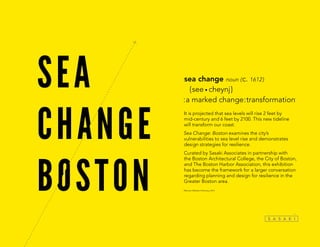
  • 1. It is projected that sea levels will rise 2 feet by mid-century and 6 feet by 2100. This new tideline will transform our coast. Sea Change: Boston examines the city’s vulnerabilities to sea level rise and demonstrates design strategies for resilience. Curated by Sasaki Associates in partnership with the Boston Architectural College, the City of Boston, and The Boston Harbor Association, this exhibition has become the framework for a larger conversation regarding planning and design for resilience in the Greater Boston area. *Merriam-Webster Dictionary, 2014 sea change noun ( c. 1612 ) { see • cheynj } :a marked change:transformation*
  • 2.
  • 3. sea level rise explained Global sea levels have fluctuated for thousands of years. Tectonic conditions and climatic cycles have caused vacilating ocean levels. But because of current climate change, the rate of change has accelerated dramatically. There is general consensus among scientists regarding the projections for global sea level rise; however, glacial melt rates are still largely unknown. If warming global temperatures continue to melt our major glaciers, this will have an additional—and catastrophic—impact on our coastlines beyond current sea level rise projections. Global sea levels are projected to rise 1–2 feet by 2050 and 3–6 feet by 2100. Projections for sea level rise vary regionally due to local geologic conditions. The Northeast is especially vulnerable to sea level rise with observed rates 3-4 times higher than the global average. In addition to the global projections, the warming of the Gulf Stream could add 6–9 inches of sea level rise by 2100. In Boston, sea level rise is already occuring. Over the past century, the relative sea level rise in Boston has been 12 inches. Of that total, 4 inches is due to land subsidence.
  • 4. 9000 YEARS AGO 6000 YEARS AGO 3000 YEARS AGO 9,000 YEARS AGO 6,000 YEARS AGO 3,000 YEARS AGO 1630 18521795 1934 TODAY 2050 2100 1630 1795 1852 1934 TODAY 2050: 2 FT OF SEA LEVEL RISE 2100: 6 FT OF SEA LEVEL RISE BOSTON HARBOR HAS EVOLVED SINCE THE ICE AGES
  • 5. CAUSES OF SEA LEVEL RISE Warming Waters Glacial Melting Land Subsidence
  • 6. If all the ice sheets melted here, sea levels would rise ANTARCTICA 89 ft If all the ice sheets melted here, sea levels would rise GREENLAND 25 ft MELTING ICE SHEETS ARE A LARGE CONTRIBUTOR TO Sea level rise
  • 7. GLOBAL SEA LEVELS ARE PROJECTED TO RISE 1—2 FEET BY 2050 and 3—6 FEET BY 2100.
  • 8. THE RESEARCH. CAUSES AND PROJECTIONS BOSTON SOMERVILLE CHELSEA WINTHROP QUINCY HULL EVERETT REVERE MILTON CAMBRIDGE 2 ft sea level rise in 2050 SEA LEVEL RISE PROJECTIONS MapSources:SealevelriseprojectionsfortheregionarebasedoncontoursfromMassachusettsOfficeofGeographic Informationand3DiTechnologies/SpectrumMappingLLCLiDARdataset(2002);SeaLevelRiseprojectionsforBostonare basedoncontoursfromCityofBoston,BostonRedevelopmentAuthority,andSanbornMapCompanyLiDARdataset(2009). north 1 mile
  • 9. THE RESEARCH. CAUSES AND PROJECTIONS BOSTON CAMBRIDGE SOMERVILLE CHELSEA WINTHROP QUINCY HULL EVERETT REVERE MILTON 6 ft sea level rise in 2100 2 ft sea level rise in 2050 SEA LEVEL RISE PROJECTIONS MapSources:SealevelriseprojectionsfortheregionarebasedoncontoursfromMassachusettsOfficeofGeographic Informationand3DiTechnologies/SpectrumMappingLLCLiDARdataset(2002);SeaLevelRiseprojectionsforBostonare basedoncontoursfromCityofBoston,BostonRedevelopmentAuthority,andSanbornMapCompanyLiDARdataset(2009). north 1 mile
  • 10. THE PERFECT STORM The Boston region is no stranger to devastating storms. Although Boston is sheltered geographically by Cape Cod and the Harbor Islands, the city has experienced several major hurricanes and Nor’easters. These storms bring severe winds, massive amounts of precipitation, and extreme storm surge which, combined, cause immense damage. Due to rising sea levels and the increased frequency and intensity of storms, Boston is more vulnerable than ever. Storm impacts will be intensified as sea levels rise. Due to climate change, storm events are predicted to occur more frequently and with greater intensity. When storms are coupled with elevated sea levels, impacts will be exacerbated. If a major storm were to hit Boston during high tide, the region could experience impacts similar to those in New York and New Jersey during Hurricane Sandy.
  • 11. NORMAL TIDE STORM SURGE STORM TIDE STORM SURGE WILL INCREASE FLOOD IMPACT
  • 12. low tide with sea level risewith storm surge with storm surge + sea level rise high tide astronomical high tide CHARLES RIVER DAM TIDE HEIGHT COULD BE THE DIFFERENCE BETWEEN A STORM AND A DISASTER
  • 13. flooding from a major storm in 2100 BOSTON CAMBRIDGE SOMERVILLE CHELSEA WINTHROP QUINCY HULL EVERETT REVERE MILTON flooding from a major storm in 2050 SEA LEVEL RISE + STORM SURGE PROJECTIONS MapSources:SealevelriseprojectionsfortheregionarebasedoncontoursfromMassachusettsOfficeofGeographic Informationand3DiTechnologies/SpectrumMappingLLCLiDARdataset(2002);SeaLevelRiseprojectionsforBostonare basedoncontoursfromCityofBoston,BostonRedevelopmentAuthority,andSanbornMapCompanyLiDARdataset(2009). north 1 mile
  • 14. this is Where high tide could be during a storm in 2050 char l es r i v er cambridge boston b o st o n har b o r charlestown winthrop quincy SEA LEVEL RISE + STORM SURGE PROJECTIONS Map Sources: Sea level rise projections for the region are based on contours from Massachusetts Office of Geographic Information and 3Di Technologies / Spectrum Mapping LLC LiDAR dataset (2002); Sea Level Rise projections for Boston are based on contours from City of Boston, Boston Redevelopment Authority, and Sanborn Map Company LiDAR dataset (2009). Base image from Google Earth 2014
  • 15. The Great Northeast Blizzard of 1978 Hurricane Nor’easter The Great New England Hurricane of 1938 BOSTON HAS A HISTORY OF DEVASTATING STORMS “Blizzard of 1978” on Flickr by That Hartford Guy is licensed under CC BY-SA 2.0 Courtesy of the Boston Public Library, Leslie Jones Collection
  • 16. 1885 1954EDNA 1869 1896 1869 1858 1894 1893 1924 1878 1960DONNA 1991BOB 1944 TH E G REAT ATLAN TIC H UR 1879 1888 1969GERDA 1938THEGREATNE BOSTON 1940 1950 1960 1970 1980 1990 2000 2010 WINDSPEED 1850 10 30 20 40 50 60 70 80 90 100 1860 1870 1880 1890 1900 1910 1920 1930 SANDY,CAT.3,$68billion IRENE,CAT.3,$15billion BOB,CAT.2,$2.5million GLORIA,CAT.4,$900million DONNA,CAT.5,$500million DIANE,CAT.3,$832million EDNA,CAT.3,$40million CAROL,CAT.3,$460million DOG,CAT.5,$3million GREATATLANTIC,CAT.4,$100million SEPTEMBERGALE,CAT.3,$N/A Historic Hurricane Intensity & Damage in New England Most devastating hurricanes in New EnglandHurricanes hitting New Enlgand GREATHURRICANEOF1938,CAT.5,$306million MapSources:NationalOceanographicandAtmosphericAdministration(NOAA),AtlanticHurricaneDatabase(2013). BOSTON HAS A HISTORY OF DEVASTATING STORMS
  • 17. WHAT’S AT RISK? Our neighborhoods and cultural icons are at risk. Rising water levels and storm surge will hit close to home, quite literally. Nearly 200,000 residents live in homes at risk of flooding. Entire neighborhoods like East Boston and Back Bay are vulnerable—as are landmarks like Fenway Park. Losing homes, neighborhoods, and cultural assets will threaten our sense of security and our unique identity—and impact tax revenue for the cities of Metropolitan Boston. Sea level rise will have a ripple effect within and beyond Boston. Sea level rise and storm-related flooding in the Boston Metropolitan area will have an impact well beyond the boundaries of the flood zone. A major flood will place many key facilities, infrastructure networks, and economies at risk. The resulting impacts will ripple across multiple scales from the city to the state, and even the entire northeast region.
  • 18. Massachusetts New England Boston sea level rise will have a ripple effect within and beyond boston
  • 19. Flooding during a major storm in 2050 Residential parcels at risk BOSTON BROOKLINE CAMBRIDGE SOMERVILLE CHELSEA WINTHROP QUINCY HULL EVERETT REVERE MILTON residential populations at risk MapSources:Parcelsfortheregion:Municipalassessors,various(2013),compiled byMassGIS.ParcelsforBoston:CityofBostonAssessorsOffice(2013). north 1 mile
  • 20. % residential land % population total population & property value 123,620 residents 35,452 residents 4,215 residents 433 residents 14,035 residents 3,588 residents 5,077 residents Boston 19 % 20 % Cambridge 29 % 34 % Chelsea 41 % 12 % Hull 14 % 4 % Quincy 17 % 15 % Somerville 17 % 5 % Winthrop 48 % 29 % $2.02 billion $2.90 billion $170 million $80 million $1.42 billion $390 million $550 million 20% of boston and 34% of cambridge residents are at risk residential populations at risk
  • 21. industrial, commercial, & institutional properties at risk Boston Convention & Exhibition Center UMass Boston MIT Conley Container Terminal Mystic Generating Station Black Falcon Terminal Suffolk Downs Industrial Commercial Institutional PARCELS at Risk Flooding during a major storm in 2050 MapSources:Parcelsfortheregion:Municipalassessors,various(2013), compiledbyMassGIS.ParcelsforBoston:CityofBostonAssessorsOffice(2013). BOSTON BROOKLINE CAMBRIDGE SOMERVILLE CHELSEA WINTHROP QUINCY HULL EVERETT REVERE MILTON north 1 mile
  • 22. industrial, commercial, & institutional properties at risk Boston % commercial land % industrial land $ assessed value Cambridge Chelsea Everett Quincy Somerville Winthrop $4.83 billion $3.41 billion $2.63 billion $860 million $240 million $210 million $420 million $330 million $170 million $70 million Less than $1 million $40 million $540 million $100 million 50 % 72 % 44 % 61 % 81 % 93 % 79 % 87 % 41 % 66 % 49 % 63 % 90 % 52 % $14 billion in property value is at risk
  • 23. Ted Williams Tunnel Sumner Tunnel North Station South Station Back Bay Station I-93 Morrisey Boulevard Major roads Subway Rail MBTA stations Rail stations Tunnel entrances Transportation at RiskLogan Airport RedLine BlueHillAve.Colum bus Ave. Route 1 OrangeLine OrangeLine Needham Line Fitchburg Line I-90 Lowell Line I-93 I-93 I-93 Newburyport/ RockportLine FairmountLineGreen Line Memorial Dr. Storrow Dr. BlueLine Silver Line Red Line Flooding during a major storm in 2050 transit networks at risk • 11 TUNNEL ENTRANCES • 50 MBTA STATIONS • 7 MAJOR TRAIN STATIONS MapSources:MajorRoads:MassachusettsDepartmentofTransportation(2012),accessedat MassGIS;TrainLinesandStations:CentralTransportationPlanningStaff(2013),accessedat MassGIS. BOSTON BROOKLINE CAMBRIDGE SOMERVILLE CHELSEA WINTHROP QUINCY HULL EVERETT REVERE MILTON north 1 mile
  • 24. Mass General Hospital Boston Medical Center Conley Container Terminal Distrigas LNG Terminal Logan Airport Deer Island Wastewater Treatment Plant Mystic Generating Station Police station Power plant Sub station Other critical facility Hospital Facilities at Risk Flooding during a major storm in 2050 • 8 POWER PLANTS • 6 FUEL TERMINALS • 9 HOSPITALS MapSources:PoliceStations:MassachusettsEmergencyManagementAgency(2009);Hospitals: MassachusettsDepartmentofPublicHealth(2009);PowerPlants:Municipalassessors,various (2013);CityofBostonAssessorsOffice(2013) BOSTON BROOKLINE CAMBRIDGE SOMERVILLE CHELSEA WINTHROP QUINCY HULL EVERETT REVERE MILTON critical systems at risk north 1 mile
  • 25. TOUGH QUESTIONS We need to weigh the costs and benefits of all our options. In the face of rising waters and increased storm- related flooding, communities will have to decide what to do with their flood-prone areas. Continually repairing storm damages and providing services to these vulnerable neighborhoods demands significant government resources. For these areas, cities have three major options to consider: keep water out, adapt to live with water, or move to higher ground. Unfortunately, there are no clear answers when it comes to these options—they all have pros and significant cons. Storm barriers can be effective, but at a great cost. To protect the Boston Metropolitan Region from increased storm flooding, one strategy is to construct a storm barrier within Boston Harbor. Storm barriers cannot protect the city from permanent sea level rise, but they can be effective in protecting key areas during a major storm. Unfortunately, storm barriers can be expensive and time intensive, and can have negative impacts on the local ecology. With both significant pros and cons, building a barrier would require a rigorous cost-benefit analysis.
  • 26. 1 Fortify (Keep Water Out) 2 Adapt (Live with Water) 3 Retreat (move to higher ground) what are the options?
  • 27. retreat may be necessary for the most vulnerable areas CEDAR RAPIDS FLOOD RECOVERY PLAN POST-SANDY FLOODPLAIN BUYOUT INITIATIVES IN NY & NJ “BuyOutWanted”onFlickrbyMattGreenislicensedunderCCBY-NC-SA2.0©SasakiAssociates
  • 28. what are alternative uses for flood-prone neighborhoods? 2open space & recreation • Floodable parks • Cultural amenities 3new economic opportunities • Aquaculture • Maritime industry 1ecological function • Increased habitat • Wave attenuation • Pollutant filtration
  • 29. 2 1 3 a storm barrier is possible in boston There are three options for a storm barrier in Boston—each has its pros and cons. 1 3 Outer Harbor Barrier Potential Cost: $10 Billion Design Components: 11,000 FT barrier + 7,500 FT barrier + ~70,000 FT of shoreline reinforcement Bonus: Roadway connecting North Shore and South Shore Protects: All areas protected in Options 1 and 2 + Quincy + Hingham + Weymouth Inner Harbor Barrier Potential Cost: $2 Billion Design Components: 3,000 FT barrier + ~50,000 FT of shoreline reinforcement Protects: Innovation District, Downtown Boston, Charlestown, East Boston, Chelsea, Everett, Cambridge 2 Harbor Island Barrier Potential Cost: $8 Billion Design Components: 5,000 FT barrier + 3,000 FT barrier + ~60,000 FT of shoreline reinforcement Bonus: Roadway connecting North Shore and South Shore Protects: All from Option 1 + Dorchester + Winthrop to dam or not to dam?
  • 30. DESIGN STRATEGIES We need to design for rising seas at multiple scales. From floating apartment buildings to floodable parks, designers and engineers around the world are imagining and constructing resilient solutions to rising sea levels. Flexability and adaptability are at the core of resilient design. This thinking will allow our buildings and infrastructure to bounce back from a storm or adjust to rising tides. Boston is home to several examples of resilient design in anticipation of sea level rise, including the Deer Island Waste Water Treatment Plant, Spaulding Rehabilitation Hospital, and the Boston Architectural College’s “green alley.” But our city and region are still vulnerable. The strategies and case studies exhibited here illustrate an array of tangible solutions for how the Boston region can protect its edge while introducing greater vibrancy, connectivity, and economic opportunities along the water. Layered together, all of these strategies provide more holistic opportunities for protection.
  • 31. Living Shoreline Dune Restoration Multi-Purpose Levee Elevated BuildingDry Flood-Proofing Wet Flood-Proofing Temporary Floodwall Floating Building Floodable Park Absorbent StreetCanal Street Revetment CATALOG OF DESIGN STRATEGIES Lowest Cost Longest Lifespan Highest Sea Level Rise Effectiveness Highest Storm Surge Protection Shortest Install Time Lowest Cost Longest Lifespan Highest Sea Level Rise Effectiveness Highest Storm Surge Protection Shortest Install Time Lowest Cost Longest Lifespan Highest Sea Level Rise Effectiveness Highest Storm Surge Protection Shortest Install Time Lowest Cost Longest Lifespan Highest Sea Level Rise Effectiveness Highest Storm Surge Protection Shortest Install Time Lowest Cost Longest Lifespan Highest Sea Level Rise Effectiveness Highest Storm Surge Protection Shortest Install Time Lowest Cost Longest Lifespan Highest Sea Level Rise Effectiveness Highest Storm Surge Protection Shortest Install Time Lowest Cost Longest Lifespan Highest Sea Level Rise Effectiveness Highest Storm Surge Protection Shortest Install Time Lowest Cost Longest Lifespan Highest Sea Level Rise Effectiveness Highest Storm Surge Protection Shortest Install Time Lowest Cost Longest Lifespan Highest Sea Level Rise Effectiveness Highest Storm Surge Protection Shortest Install Time Lowest Cost Longest Lifespan Highest Storm Surge Protection Shortest Install Time Lowest Cost Longest Lifespan Highest Sea Level Rise Effectiveness Highest Storm Surge Protection Shortest Install Time Lowest Cost Longest Lifespan Highest Sea Level Rise Effectiveness Highest Storm Surge Protection Shortest Install Time Lowest Cost Longest Lifespan Highest Sea Level Rise Effectiveness Highest Storm Surge Protection Shortest Install Time
  • 32. this is Where high tide could be during a storm in 2050 underground cistern living shoreline Floating building living shoreline Floodable Park absorbent street storm surge barrier multi-Purpose levee absorbent street dry Flood- Proofing elevated building Wet Flood- Proofing dry Flood- Proofing Floodable Park Floating building raised bulkhead temp Floodwall Floodable Park dune restoration living shoreline Potential location oF Future design strategies Floodable Park char l es r i v er cambridge boston b o st o n har b o r charlestown winthrop quincy We need to design for rising seas at multiple scales
  • 33. buildings How can we build for rising tides? Boston’s future architecture should build to a new standard of flood protection and flood accommodation. Existing buildings, including historic residences and commercial properties, will need to be retrofitted to keep water out. New buildings will provide the opportunity to take a different approach, built to adapt to changing water levels.
  • 35. SETTING THE BAR: Boston, Amsterdam, maasbommel, Brooklyn Spaulding Rehabilitation Hospital Floating Houses, IJburg Amphibious Homes Rebuild by Design, Coastal Commercial Resiliency CreatedbyCooper,Robertson&PartnersandDewberryConsultants,LLC. calloutcoloradjustedfromoriginal “maasbommel037”onFlickrbyloesvaneck-verhoevenislicensed underCCBY-SA2.0/saturationandskyadjustedfromoriginal ©LuukKramer|MarliesRohmerArchitectsandPlanners ©AntonGrassl/ESTO|Perkins+Will
  • 36. public space How can we adapt existing open spaces to accommodate water? Public space accounts for one third of land in Boston. Rather than trying to keep water completely out, the city can leverage this existing space by designing areas that periodically accommodate flooding, stormwater, and high tides. These public spaces can be constructed to be absorbent or to withstand submersion when flooding occurs. In dry or wet conditions, they can serve as desirable amenities to the city.
  • 38. SETTING THE BAR: New Orleans, Rotterdam, SEoul, Portland Cheonggyecheon Portland Green Streets ©EnvironmentalServices,Portland,Oregon ©EmilyOrpin Watersquare Benthemplein ©pallesh+azarfane|WatersquareBenthempleinbyDEURBANISTEN Client:CityofRotterdam,theNetherlands The Greater New Orleans Urban Water Plan “NewOrleansFlood”onFlickrbySteveSchaafislicensedunderCCBY-SA2.0
  • 39. How can we adapt Boston’s coast to rising seas? Boston’s coast comprises public space, islands, beaches, backyards, and industrial facilities. The city has traditionally invested in armoring its coastal edge using bulkheads, seawalls, and revetments, but these inflexible structures make it difficult for Boston to gradually adapt to rising sea levels. Alternative edge conditions like terraced public space, floating neighborhoods, floodable open space, and absorbent parks are more responsive to changing water levels—and provide engaging community amenities. coast
  • 41. SETTING THE BAR: NEW YORK, ASBURY PARK, BALTIMORE Rebuild by Design, Asbury Park Boardwalk + Dunes HafenCity NYC Special Initiative for Rebuilding and Resiliency (SIRR) Masonville Cove Urban Refuge ©StephaniePeters|MarylandEnvironmentalService ©SasakiAssociates “HurricaneSandyBlackoutNewYorkSkyline”onFlickrbyDavidShankboneis licensedunderCCBY2.0 “Hafencity”onFlickrbyEichentalislicensedunderCCBY-ND2.0
  • 42. region Sea level rise crosses political boundaries —so should our plan. Large-scale issues such as sea level rise call for regional decision-making. The impacts of sea level rise will be felt beyond Boston and other waterfront cities. Individual actions and city-level plans may not be enough to mitigate the worst effects. Solutions that cross city boundaries may be needed, which will require municipalities and agencies to work together. A regional planning process can be a forum that brings together political leaders, scientists, economists, and the broader public to discuss tough questions.
  • 43. Sea level rise CROSSES POLITICAL BOUNDARIES, SO SHOULD OUR PLAN REASONS TO THINK regionally Regional impactsEnhanced collaboration and coordination; the whole is more than the sum of the parts Complex issues and long time frames Cost effectiveness Watershed and landscape issues cross city boundaries Bring multiple agencies and cities together Broadened public participation in key decisions region
  • 44. FOCUS ON RESILIENCE IN THE FACE OF RISING SEA LEVELS AND CLIMATE CHANGE BROAD FOCUS ON GROWTH, HOUSING, TRANSPORTATION, JOBS, AND THE ENVIRONMENT BOSTON’S CURRENT REGIONAL PLAN: 20 year time frameSUSTAINABILITY 75+ YEAR TIME FRAME BASED ON SEA LEVEL RISE PROJECTIONS RESILIENCE ABILITY TO CHANGE BASED ON CONTEMPORARY CONSIDERATIONS DECISIONS MADE DURING PLANNING PROCESS A PLAN THAT ADDRESSES SEA LEVEL RISE SHOULD INCLUDE: THE TIME TO BE PROACTIVE IS NOW what should the next generation of planning look like in the boston region? region
  • 45. ENGAGING THE COMMUNITY Boston residents talk about sea level rise. The Sea Change team conducted interviews across the city to document the public voice and learn about the public’s awareness of sea level rise. These interviews are documented in a series of photos, videos, and written essays.
  • 46. “I HAVE BEEN DOING THIS MY WHOLE LIFE. THE INDUSTRY HAS NEVER BEEN MORE vulnerable.” FRANK PATANIA Frank is a lifelong fisherman on Boston’s Fish Pier. The seafood industry has been part of his family for generations. The water defines Frank’s life. Through his years working and living by the coast, he has experienced storm impacts, sea level rise, and fishing regulation that make his industry vulnerable. He understands the importance of our connection to the sea, and hopes for smart development along the coast.
  • 47. “WE WERE HERE DURING THE BLIZZARD OF 1978. IT WAS A MESS.” SEBASTIAN AND ROSE DI MARE Sebastian and Rose are frequent visitors to the Revere beachfront and lived in the area during the Blizzard of 1978. They view the beach as a vital community resource with historic and cultural value. They have seen the beach change from storm impacts over the years, including a decline in beachfront development and investment. Sebastian and Rose support making the beach more resilient and encourage greater community support for the area.
  • 48. “PEOPLE NEED RESPECT FOR NATURE AND THE EARTH.” MAURICE RIGAUD On a sunny day, Maurice came to the beach with his nephew Julius to enjoy the good weather. Maurice is a deep thinker with tough questions about our attempts to control nature. He believes in the power of popular consensus to bring about change, but he said too many people are out of touch and unaware. When asked what we can do about our city’s vulnerabilities, Maurice said, “We can’t take care of our roads let alone our beaches.”
  • 49. academic partnerships The next generation of designers are at the forefront of innovative design thinking. Partnerships between academic institutions and professional design firms have emerged as a productive model for tackling challenging problems. Recently, the topic of resilient design has become a subject of inquiry. With practitioners facilitating academic exercises, the next generation can address these design problems with both pragmatic sensitivity and creative freedom.
  • 50. Sasaki Summer Intern Charette Sasaki’s annual internship charette is a two-week workshop that focuses on a local issue. In June 2013, as part of the Sea Change research initiative, the interns focused specifically on sea level rise implications and design solutions for South Boston. The group broke into four teams that focused design projects on the diverse economic, demographic, and ecologic impacts of sea level rise. designing for rising seas in south boston
  • 51. BAC Fall Natural Systems Studio During Fall 2013, the Natural Systems studio at the Boston Architectural College built upon the Sasaki interns’ research and designed resiliency strategies for East Boston. Over the course of the semester, guest critics—including coastal engineers, designers, and Boston Harbor experts—provided insight and expertise. For the final project, the studio was divided into two interdisciplinary design teams. imagining east boston’s future
  • 52. the exhibition Sea Change: Boston has become a call to action and a platform for partnerships. Sea Change: Boston is intended to catalyze conversations with a broader audience about the tough questions and regional implications of sea level rise. Throughout the process, Sasaki has cultivated partnerships with the Boston Architectural College, the City of Boston, and The Boston Harbor Association. Partnering with District Hall also provided a unique venue to reach a broad audience in the heart of one of Boston’s most vulnerable districts.
  • 53.
  • 54.
  • 55.
  • 56.
  • 57.
  • 58.
  • 59. the symposium The symposium fostered a discussion about the challenges of preparing for sea level rise. As an extension of the Sea Change: Boston exhibition, the symposium brought together designers, engineers, city leaders, academics, and community members for a day-long conversation about how to make Boston a resilient city in the face of sea level rise.
  • 60. Design Strategies: Making Change Visible From floating apartment buildings to floodable parks, designers and engineers around the world are imagining and constructing resilient solutions to rising sea levels. This panel explores how resilient design strategies allow Boston’s buildings and infrastructure to bounce back from storms and adjust to rising tides. Tough Questions: Should We Stay or Should We Go? In the face of rising waters and increased storm-related flooding, communities will have to decide what to do with their flood-prone areas. Continually repairing storm damages and providing services to these vulnerable neighborhoods demands significant government resources. This panel examines case studies of flooded communities and delves into the options Boston will have to consider. Thinking Big: The Regional Planning Approach The impacts of sea level rise will be felt beyond Boston and other waterfront cities. Solutions that cross city boundaries may be needed, which will require municipalities and agencies to work together. This panel analyzes how a regional planning process in Boston can be a forum that brings together political leaders, scientists, economists, and the broader public to discuss tough questions related to changing tides. Gina Ford (moderator) SASAKI ASSOCIATES Barbara Wilks W ARCHITECTURE LANDSCAPE ARCHITECTURE Walter Meyer LOCAL OFFICE LANDSCAPE ARCHITECTURE Robert Nairn BAIRD ASSOCIATES Hubert Murray PARTNERS HEALTHCARE Julie Wormser (moderator) THE BOSTON HARBOR ASSOCIATION Jason Hellendrung SASAKI ASSOCIATES Kristina Ford COLUMBIA UNIVERSITY Robert Culver SASAKI ASSOCIATES Jerold Kayden HARVARD GRADUATE SCHOOL OF DESIGN Ted Landsmark (moderator) BOSTON ARCHITECTURAL COLLEGE Helen Lochhead SYDNEY HARBOUR FORESHORE AUTHORITY James Miner SASAKI ASSOCIATES Robbin Peach MASSACHUSETTS PORT AUTHORITY Martin Pillsbury METROPOLITAN AREA PLANNING COUNCIL PANELISTS PANELS