IUFRO species conservation china dec11
•Download as PPT, PDF•
1 like•789 views

Jalonen R, van Zonneveld M, Thomas E, Gaisberger H, Vinceti B, Hong LT, Loo J. 2012. Identifying tree populations for conservation action through geospatial analyses. In: Multinational and Transboundary Conservation of Valuable and Endangered Forest Tree Species. Asia and the Pacific Workshop, Guangzhou, China, 5-7 December 2011. IUFRO World Series 30, pp. 98-101 Read more about Bioversity International’s work on forest and tree genetic diversity: http://www.bioversityinternational.org/research-portfolio/forest-tree-genetic-diversity/

Recommended
Recommended
More Related Content
What's hot
What's hot (20)
Viewers also liked
Viewers also liked (6)
Similar to IUFRO species conservation china dec11
Similar to IUFRO species conservation china dec11 (20)
More from Bioversity International
More from Bioversity International (20)
Recently uploaded
Recently uploaded (20)
IUFRO species conservation china dec11
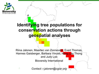
- 1. Identifying tree populations for conservation actions through geospatial analyses Riina Jalonen, Maarten van Zonneveld, Evert Thomas, Hannes Gaisberger, Barbara Vinceti, Hong Lay Thong and Judy Loo Bioversity International Contact: r.jalonen@cgiar.org
- 2. Spatial biodiversity analyses Can help to answer • Where are the most diverse or most unique resources and why? • Are they threatened by land use changes or climate change? • Where should action be taken to most efficiently conserve diversity or tap useful variation? • Visualization Data • Field studies • Existing records • Species distribution modeling can complement This presentation: Case studies about the uses of spatial analysis tools on tropical tree species
- 3. Freely available tools and datasets • DIVA-GIS software – www.diva-gis.org – Special features for analyzing biodiversity data – Free spatial data – Training manual (Scheldeman & van Zonneveld 2010) w ww.bioversityinternational.org/training/training_materials/gis_ma • The Global Biodiversity Information Facility (GBIF) – 312,669,756 species records (15 Nov 2011) – www.gbif.org • WORLDCLIM – Current, future and past climate data – www.worldclim.org
- 4. MAPFORGEN - Threat profiles • 100 useful tree species of Latin Fire risk America and the Caribbean (Jarvis et al. 2010) • Data from the GBIF, national systems, herbaria, literature, research groups… • Species distribution modeling • Comparison with threat maps • Individual threat profiles Accessibility – Main threats – Most threatened populations Oil and gas – Fragmentation Agriculture – Proportion of distribution area in protected areas Mining Climate change Invasive species Threat diagram for Annona cherimola
- 5. Pinus kesiya – climate change threats Predicted distribution (current) Predicted shifts in distribution (2050) (Species distribution modeling) Van Zonneveld et al. 2009
- 6. Cherimoya – Allelic diversity Southern Peru – high diversity Allelic richness (number of alleles) Cluster analysis Bolivia – low but distinctive diversity CHERLA 2009; van Zonneveld et al. 2012
- 7. Cherimoya – Reserve selection Principle of complementarity: Which combination of reserves best covers the overall diversity? Bolivia: low but distinctive diversity ranks high in selection CHERLA 2009; van Zonneveld et al. 2012
- 8. Asian tree species – Data availability Priority species of APFORGEN (Asia Pacific Forest Genetic Resources Programme) Species Specified Countries locations Chukrasia tabularis 17 7 Cambodia, China, India, Lao PDR, Malaysia, Thailand, Vietnam Dipterocarpus 22 7 Cambodia, Indonesia, India, Lao PDR, alatus Myanmar, Thailand, Vietnam Fagraea fragrans 55 7 Cambodia, India, Indonesia, Lao PDR, Malaysia, Thailand, Vietnam Hopea odorata 7 6 Cambodia, India, Indonesia, Lao PDR, Myanmar, Thailand Pterocarpus 99 5 Cambodia, Lao PDR, Myanmar, macrocarpus Thailand, Vietnam Tectona grandis 1 1 Philippines Data: GBIF
- 9. Asian tree species – Regional collaboration Dependency of the predicted distribution on the number of observations Fagraea fragrans used in the analysis. Data from one country only does not necessarily result in good prediction of species distribution even in that country itself. data from one country two countries three countries Data: GBIF, WORLDCLIM (Hijmans et al. 2005) Analyses: Maxent (Phillips et al. 2006)
Editor's Notes
- Tools and datasets Species diversity Threat analysis Species distribution modeling in future climates Intraspecific diversity Genetic structure Cluster analysis Reserve selection Asian tree species Data availability Role of regional collaboration
- Georeferenced observations or records of occurrence of the study species were obtained from national information systems and herbaria, literature, members of LAFORGEN, and the Global Biodiversity Information Facility (GBIF, www.gbif.org) which provides free and open access to hundreds of millions of biodiversity records. Observation points per species ranged between 21 and 6527. Potential distribution of each species was estimated by species distribution modeling. The distributions were then compared with protected areas, and with maps of short-term and long-term threats, including accessibility, conversion to agriculture, and fires (Jarvis et al ., 2010). Specific threat profiles were developed for each species.
- Data on the locations of 46 and 50 natural populations of P. kesiya and P. merkusii , respectively, was obtained from literature, seed collection and in situ conservation programmes, and the GBIF. Species distribution modeling can provide a rapid first assessment of the species occurrence in current and future climates. The results need to be compared e.g. with the suitability of soil types, plant community composition and competition in the predicted species distribution areas, connectedness of the existing populations, and provenance trials, to evaluate the validity of the predictions and the ability of the populations to survive under changing conditions (van Zonneveld et al . 2009; Pearson and Dawson 2003).
- Samples from more than 1200 cherimoya trees were collected from georeferenced stands in Ecuador, Peru and Bolivia. The samples were used for molecular analysis using microsatellite markers, and spatial analyses then conducted with DIVA-GIS (www.diva-gis.org). Preliminary results show the highest allelic richness (number of alleles) in the cherimoya populations in Southern Ecuador and Northern Peru. Geocluster analysis showed that populations in each country clearly differ from each other. Reserve networks for cherimoya were identified according to the principle of complementarity, i.e. by selecting a combination of reserves that best captures both the areas of highest diversity and those with possibly lower but unique diversity.
- Most diverse vs. unique populations, to combine highest possible number of alleles