Interpreting ‘Geographical Media’ using TPQEEL
•Download as PPSX, PDF•
1 like•2,468 views

Explaining the: TPQEEL Method: T (PQE) EL: Topic – Pattern – Quantification – Exception – Explanation – Linking Using an example to run through the ‘meaning’. Using HAMPTON BEACH as a more specific examples giving ‘example’ answers.

Recommended
More Related Content
What's hot
What's hot (20)
Similar to Interpreting ‘Geographical Media’ using TPQEEL
Similar to Interpreting ‘Geographical Media’ using TPQEEL (20)
More from Yaryalitsa
More from Yaryalitsa (20)
Recently uploaded
Recently uploaded (20)
Interpreting ‘Geographical Media’ using TPQEEL
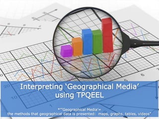
- 1. Interpreting ‘Geographical Media’ using TPQEEL *”’Geographical Media’= the methods that geographical data is presented: maps, graphs, tables, videos”
- 2. Linking Explanation Exception Quantification Topic Pattern Linking Sentence: This ‘sentence’ links back to, and allows you to summarize your interpretation of the Geographic Media being viewed. Explanation of the Geographic Media: What is the importance of the Geographic Media compiled and presented to you? Exception(s) to the rule: There are often instances (it is to be expected) where some ‘thing’ doesn’t fit the overall ‘pattern’ – identify it! Quantification of the ‘Geographic Media’: The addition of ‘numbers’. Specific numerical detail(s) and definition(s) to the ‘pattern(s)’ observed. Topic Sentence: A ‘sentence’ that states the main idea and/or reason for the existence of the specific Geographic Media. The General Pattern: At first view of a piece of Geographic Media, what stands out; what makes an impression?
- 3. By reading your TPQEEL, other people should be able to understand the data you are describing without needing to see the original Geographical Media i.e. map, graph, table. Geographers gather DATA (unorganized information) to help them analyse and understand the world around us. The ‘DATA IS ORGANIZED’ (into information) and is represented by various and appropriate ‘GEOGRAPHICAL MEDIA’: graphs, maps, tables. The VISUAL REPRESENTATION of data/information, serves two (2) purposes: • You can begin to PROCESS (understand) the data/information by categorizing and classifying it so that it is easier to understand. • The NEW REPRESENTATION can allow a clearer ANALYSIS of what the data/information is relaying. You are now able to GENERALIZE and see the ‘most important’ features of the data/information. This makes it easier to COMPARE and CONTRAST different aspects of the data/information and to draw CONCLUSIONS from these observations. COMPARE To see the similarity (between/amongst) CONTRAST To see the difference (between/amongst)
- 5. LOOK at the Geographic Media. OBSERVE its data. • BOLTSS? • What is ‘the data’ ‘informing us’ of? • What is ‘Climate Change’? • What is ‘Mortality’? • What do the colours mean?
- 6. 1: PATTERNS Make a PREDICTION about the GEOGRAPHIC MEDIA’s main idea or meaning. • Look at the TITLE. • Look at the LEGEND/KEY. • Look at the CONTENT. • IDENTITY any immediate PATTERNS. 2: IMPORTANT DATA/INFORMATION • What does the TITLE tell us? • What does the LEGEND/KEY tell us? • What do the NUMBERS tell us? • Highest/lowest? • Largest/smallest? • Is there anything similar/ different/ irregular? 3: INTERPRETATION • Consider what you already know about the topic. • What does this data/information tell you in relation to what you already know? • Why is this data/information important? • How do you interpret the data/information in relation to what you already know? • What conclusion can you make? 4: PLAN your response in accordance with: T.P.Q.E.E.L This can be done in DOT POINTS or a BRAINSTORM. TOPIC – PATTERN – QUANTIFICATION – EXCEPTION – EXPLANATION - LINKING
- 7. A ‘Topic Sentence’ is sometimes referred to as a ‘Focus Sentence’. A ‘Topic Sentence’ is usually the first sentence in a paragraph. A ‘Topic Sentence’ essentially tells the reader what the rest of the paragraph is about. All ‘sentences’ following the ‘Topic Sentence’ have to give more information about the ‘Topic Sentence’; state the FACTS it presents or describe it. Every ‘Topic Sentence’ will have a ‘Controlling Idea’. The ‘Controlling Idea’ shows the direction the paragraph will take. Examples: Topic Sentence: To be an effective Geographer requires certain characteristics. • The Topic: ‘To be an effective Geographer’ • The Controlling Idea: ‘requires certain characteristics’ Topic Sentence: There are many possible contributing factors to global warming. • The Topic: ‘Contributing factors to global warming’ • The Controlling Idea: ‘many possible reasons’ Topic Sentence: There are many reasons why pollution in Port Phillip Bay is at its worst. • The Topic: ‘Pollution in Port Phillip Bay is at its worse’ • The Controlling Idea: ‘many reasons’ Topic Sentence: A ‘sentence’ that states the main idea and/or reason for the existence of the specific Geographic Media.
- 8. Look at your ‘Geographic Media’. Overall, WHAT do you notice? ON A MAP It may be the predominant shade tone. ON A GRAPH It is likely to be the shape of the line, the height, colour, design of a particular bar. IN A TABLE It is likely to be the significantly higher or lower numbers in a category. It is this GENERAL PATTERN that you are describing initially. The colour ‘green’ is predominant on the map. What information is the colour ‘green’ relaying? • What relationship(s) do the other colours have to the colour green? • The colour ‘red’ is the least present. What similarities has ‘red’ with ‘green’? What differences has ‘red’ with ‘green’? The General Pattern: At first view of a piece of Geographic Media, what stands out; what makes an impression?
- 9. You have observed the GENERAL PATTERN of the Geographical Media. The colour ‘green’ is predominant on the map. Now interpret the GENERAL PATTERN with quantifying data i.e. ‘numerical’ qualifiers. Quantification of the ‘Geographic Media’: The addition of ‘numbers’. Specific numerical detail(s) and definition(s) to the ‘pattern(s)’ observed.
- 10. What seems to be DIFFERENT from the GENERAL PATTERN? What doesn’t seem to FIT? Why doesn’t it FIT? An EXCEPTION is something that is ‘excluded’ (not included) from a ‘general statement/ observation’ as it doesn’t seem to follow the rule. Stating the EXCEPTION(S) allows you and others to ask more specific questions and draw conclusions later. Be specific about the EXCEPTION. Describe where it STARTS and where it ENDS. If there really is NO SINGLE piece of data that stands out, then simply write/say: ‘There is no exception to this trend.’ Be sure, be careful, because more often than not there is an anomaly/irregularity about the DATA. Exception(s) to the rule: There are often instances (it is to be expected) where some ‘thing’ doesn’t fit the overall ‘pattern’ – identify it!
- 11. Why is the DATA/INFORMATION important? What does the DATA/INFORMATION tell us via the GEOGRAPHICAL MEDIA? If there was an ORIGINAL QUESTION or TASK…. How does the DATA/INFORMATION answer the ORIGINAL QUESTIONS or TASK? EXPLAIN - what you are being asked – ANSWER - the ‘Why’ reason(s) or ‘How’ reason(s) – (there might me ONE reason or SEVERAL reasons; answer each individually and clearly) CONCLUDE - Having presented the ‘Why(s)/How(s)’ state your o Opinion, o General observation Explanation of the Geographic Media: What is the importance of the Geographic Media compiled and presented to you?
- 12. This should summarise your interpretation/suggestion of the DATA/INFORMATION and LINK it to the ORIGINAL QUESTION / GEOGRAPHICAL MEDIA / QUERY. Linking Sentence: This ‘sentence’ links back to, and allows you to summarize your interpretation of the Geographic Media being viewed.
- 13. Geographical Terminology that you can use when describing a PATTERN: increase, decrease, gradual, rapid, trend, inverse, minor, major, steady, fluctuate, plateau, even, uneven, dense, sparse, concentrated and like. ALWAYS: Refer to the TITLE of the Geographic Media that you are describing. Geographical Terminology that you can use when QUANTIFYING: On graphs/tables: use the units of measurement: degrees, Celsius, metres, dollars, euro, percentages, etc On a Map: hemispheres, continents, regions, directions, bodies of water, names of countries, etc Geographical Terminology that you can use when stating an EXCEPTION: • Be specific about the exception. • Use data/information from the graph/map/table to precisely describe the anomaly/irregularity. ALWAYS: Refer to the TITLE of the Geographic Media that you are describing.
- 14. What is a 'Topic Sentence'? Poster: Climate Change Hurts: Fabrica Copy and paste into URL (Data Analysis: Word Sheet): vanweringh9.wikispaces.com/file/view/Data+analysisPQE.doc