SlideShare a Scribd company logo
1 of 14
Israel & the Palestine Territories


GIS Tutorial by Benjamin Hennig
For the MSc in Social and Spatial Inequalities at the University of Sheffield
Module GEO6016 Data, Visualisation and GIS | http://sasi.group.shef.ac.uk/
The following tutorial will talk you through the main steps
necessary to create a basic grid-based population cartogram for
a selected area.
The main data preparation is done using ESRI ArcMap, the
cartogram transformation is performed in ScapeToad which uses
a simplified approach of Gastner/Newmans density equalising
cartogram algorithm.
For technical details and further reading see:
Hennig, B.D., Pritchard, J., Ramsden, M., and Dorling, D. (2010).
Remapping the World’s Population. Visualizing data using
cartograms. ArcUser 2010 (1), 66-69.
Article as PDF at http://www.viewsoftheworld.net/?p=701
Data
Population
• Gridded Population of the World
  (GPWv3, http://sedac.ciesin.columbia.edu/gpw/)
   provided as raster image worldpop2015.img

Country Shapes
• ESRI Sample Data or
   provided as vector data world.shp
• Global Administrative Boundaries (http://gadm.org/)
• ...
GIS works I
Preparing the area of interest: Extracting features
         Open world.shp
         Select Israel and the Palestine Territories
         via the selection menu (or the tools bar)
         Right-click the world layer and choose the
         Data – Export data option to create a new layer
         with the selected polygons
GIS works II
Preparing the grid: Creating a 2.5‘‘ fishnet
                   ArcToolbox:
                    Data Management Tools
                    Feature Class
                    Create Fishnet
GIS works II
Preparing the grid: Creating a 2.5‘‘ fishnet
                   ArcToolbox:
                    Data Management Tools
                    Feature Class
                    Create Fishnet
                   Converting grid lines to polygons
                   (ArcToolbox  Data Management Tools
                    Features  Feature to Polygon)
It should work…but it doesn’t?


                            Check the extent –
                            Is it what you want?
GIS works IV
Adding and adjusting basedata:
• population raster (worldpop2015.img)
• ArcToolbox:  Data Management Tools  Raster  Raster Processing  Clip)
GIS works IV
Adding and adjusting basedata:
• population raster (worldpop2015.img)
• ArcToolbox:  Data Management Tools  Raster  Raster Processing  Clip)

Converting the population raster:
                    ArcToolbox:
                     Conversion Tools
                     From Raster
                     Raster to Point
GIS works V
Assigning population values to grid:
                  ArcToolbox:
                   Analysis Tools
                   Overlay
                   Spatial Join
GIS works VI
Cutting out the area of interest:
                   ArcToolbox:
                    Analysis Tools
                    Overlay
                    Intersect
Creating the cartogram using ScapeToad
1, 2, 3 – as easy as that!
…well done 


        http://www.worldpopulationatlas.org

More Related Content

What's hot

Detecting Buildings in AHN2 LiDAR data with ArcGIS - Grontmij
Detecting Buildings in AHN2 LiDAR data with ArcGIS - GrontmijDetecting Buildings in AHN2 LiDAR data with ArcGIS - Grontmij
Detecting Buildings in AHN2 LiDAR data with ArcGIS - GrontmijXander Bakker
 
Field Data Collecting, Processing and Sharing: Using web Service Technologies
Field Data Collecting, Processing and Sharing: Using web Service TechnologiesField Data Collecting, Processing and Sharing: Using web Service Technologies
Field Data Collecting, Processing and Sharing: Using web Service TechnologiesNiroshan Sanjaya
 
CKANへの空間情報機能拡張実装の試み
CKANへの空間情報機能拡張実装の試みCKANへの空間情報機能拡張実装の試み
CKANへの空間情報機能拡張実装の試みYoichi Kayama
 
MapInfo Professional Discover3D 2014 - Features
MapInfo Professional Discover3D 2014 - FeaturesMapInfo Professional Discover3D 2014 - Features
MapInfo Professional Discover3D 2014 - FeaturesPrakher Hajela Saxena
 
All the New Cool Stuff in QGIS 2.0
All the New Cool Stuff in QGIS 2.0All the New Cool Stuff in QGIS 2.0
All the New Cool Stuff in QGIS 2.0Nathan Woodrow
 
OpenCube Workshop at eGov2015 & ePart2015 dual conference
OpenCube Workshop at eGov2015 & ePart2015 dual conferenceOpenCube Workshop at eGov2015 & ePart2015 dual conference
OpenCube Workshop at eGov2015 & ePart2015 dual conferenceEvangelos Kalampokis
 
HEC-RAS LiDAR Cross Sections With Microstation SS3 V8i
HEC-RAS LiDAR Cross Sections With Microstation SS3 V8iHEC-RAS LiDAR Cross Sections With Microstation SS3 V8i
HEC-RAS LiDAR Cross Sections With Microstation SS3 V8iChristopher L Chatfield, P.E.
 
Creating and Utilizing Linked Open Statistical Data for the Development of Ad...
Creating and Utilizing Linked Open Statistical Data for the Development of Ad...Creating and Utilizing Linked Open Statistical Data for the Development of Ad...
Creating and Utilizing Linked Open Statistical Data for the Development of Ad...Evangelos Kalampokis
 
Exploration and 3D GIS Software - MapInfo Professional Discover3D 2015
Exploration and 3D GIS Software - MapInfo Professional Discover3D 2015Exploration and 3D GIS Software - MapInfo Professional Discover3D 2015
Exploration and 3D GIS Software - MapInfo Professional Discover3D 2015Prakher Hajela Saxena
 
Processing Rasters from Satellites, Drones, & More
Processing Rasters from Satellites, Drones, & MoreProcessing Rasters from Satellites, Drones, & More
Processing Rasters from Satellites, Drones, & MoreSafe Software
 
CouchDB Day NYC 2017: Using Geospatial Data in Cloudant & CouchDB
CouchDB Day NYC 2017: Using Geospatial Data in Cloudant & CouchDBCouchDB Day NYC 2017: Using Geospatial Data in Cloudant & CouchDB
CouchDB Day NYC 2017: Using Geospatial Data in Cloudant & CouchDBIBM Cloud Data Services
 
nCOVID-19 pivot-and-fan map
nCOVID-19 pivot-and-fan mapnCOVID-19 pivot-and-fan map
nCOVID-19 pivot-and-fan mapAndrew Zolnai
 
MapInfo Professional 12.5 and Discover3D 2014 - A brief overview
MapInfo Professional 12.5 and Discover3D 2014 - A brief overviewMapInfo Professional 12.5 and Discover3D 2014 - A brief overview
MapInfo Professional 12.5 and Discover3D 2014 - A brief overviewPrakher Hajela Saxena
 
Processing Landsat 8 Multi-Spectral Images with GRASS Tools & the potential o...
Processing Landsat 8 Multi-Spectral Images with GRASS Tools & the potential o...Processing Landsat 8 Multi-Spectral Images with GRASS Tools & the potential o...
Processing Landsat 8 Multi-Spectral Images with GRASS Tools & the potential o...Shaun Lewis
 
R spatial presentation
R spatial presentationR spatial presentation
R spatial presentationTodd Barr
 

What's hot (20)

Detecting Buildings in AHN2 LiDAR data with ArcGIS - Grontmij
Detecting Buildings in AHN2 LiDAR data with ArcGIS - GrontmijDetecting Buildings in AHN2 LiDAR data with ArcGIS - Grontmij
Detecting Buildings in AHN2 LiDAR data with ArcGIS - Grontmij
 
Field Data Collecting, Processing and Sharing: Using web Service Technologies
Field Data Collecting, Processing and Sharing: Using web Service TechnologiesField Data Collecting, Processing and Sharing: Using web Service Technologies
Field Data Collecting, Processing and Sharing: Using web Service Technologies
 
CKANへの空間情報機能拡張実装の試み
CKANへの空間情報機能拡張実装の試みCKANへの空間情報機能拡張実装の試み
CKANへの空間情報機能拡張実装の試み
 
MapInfo Professional Discover3D 2014 - Features
MapInfo Professional Discover3D 2014 - FeaturesMapInfo Professional Discover3D 2014 - Features
MapInfo Professional Discover3D 2014 - Features
 
All the New Cool Stuff in QGIS 2.0
All the New Cool Stuff in QGIS 2.0All the New Cool Stuff in QGIS 2.0
All the New Cool Stuff in QGIS 2.0
 
OpenCube Workshop at eGov2015 & ePart2015 dual conference
OpenCube Workshop at eGov2015 & ePart2015 dual conferenceOpenCube Workshop at eGov2015 & ePart2015 dual conference
OpenCube Workshop at eGov2015 & ePart2015 dual conference
 
Mapinfo 2014
Mapinfo 2014Mapinfo 2014
Mapinfo 2014
 
CONNECTING BENTLEY AND ESRI TERRAIN DATA
CONNECTING BENTLEY AND ESRI TERRAIN DATA CONNECTING BENTLEY AND ESRI TERRAIN DATA
CONNECTING BENTLEY AND ESRI TERRAIN DATA
 
HEC-RAS LiDAR Cross Sections With Microstation SS3 V8i
HEC-RAS LiDAR Cross Sections With Microstation SS3 V8iHEC-RAS LiDAR Cross Sections With Microstation SS3 V8i
HEC-RAS LiDAR Cross Sections With Microstation SS3 V8i
 
Creating and Utilizing Linked Open Statistical Data for the Development of Ad...
Creating and Utilizing Linked Open Statistical Data for the Development of Ad...Creating and Utilizing Linked Open Statistical Data for the Development of Ad...
Creating and Utilizing Linked Open Statistical Data for the Development of Ad...
 
Exploration and 3D GIS Software - MapInfo Professional Discover3D 2015
Exploration and 3D GIS Software - MapInfo Professional Discover3D 2015Exploration and 3D GIS Software - MapInfo Professional Discover3D 2015
Exploration and 3D GIS Software - MapInfo Professional Discover3D 2015
 
Processing Rasters from Satellites, Drones, & More
Processing Rasters from Satellites, Drones, & MoreProcessing Rasters from Satellites, Drones, & More
Processing Rasters from Satellites, Drones, & More
 
CouchDB Day NYC 2017: Using Geospatial Data in Cloudant & CouchDB
CouchDB Day NYC 2017: Using Geospatial Data in Cloudant & CouchDBCouchDB Day NYC 2017: Using Geospatial Data in Cloudant & CouchDB
CouchDB Day NYC 2017: Using Geospatial Data in Cloudant & CouchDB
 
nCOVID-19 pivot-and-fan map
nCOVID-19 pivot-and-fan mapnCOVID-19 pivot-and-fan map
nCOVID-19 pivot-and-fan map
 
MapInfo Professional 12.5 and Discover3D 2014 - A brief overview
MapInfo Professional 12.5 and Discover3D 2014 - A brief overviewMapInfo Professional 12.5 and Discover3D 2014 - A brief overview
MapInfo Professional 12.5 and Discover3D 2014 - A brief overview
 
Processing Landsat 8 Multi-Spectral Images with GRASS Tools & the potential o...
Processing Landsat 8 Multi-Spectral Images with GRASS Tools & the potential o...Processing Landsat 8 Multi-Spectral Images with GRASS Tools & the potential o...
Processing Landsat 8 Multi-Spectral Images with GRASS Tools & the potential o...
 
EU 2015 (SP) - FME pelo mundo - casos de sucesso
EU 2015 (SP) - FME pelo mundo - casos de sucessoEU 2015 (SP) - FME pelo mundo - casos de sucesso
EU 2015 (SP) - FME pelo mundo - casos de sucesso
 
EU 2015 (RJ) - FME pelo mundo - casos de sucesso
EU 2015 (RJ) - FME pelo mundo - casos de sucessoEU 2015 (RJ) - FME pelo mundo - casos de sucesso
EU 2015 (RJ) - FME pelo mundo - casos de sucesso
 
R spatial presentation
R spatial presentationR spatial presentation
R spatial presentation
 
GIS Modeling
GIS ModelingGIS Modeling
GIS Modeling
 

Viewers also liked

Pictograms & Cartograms
Pictograms & CartogramsPictograms & Cartograms
Pictograms & CartogramsRosna Davis
 
Users of accounting information
Users of accounting informationUsers of accounting information
Users of accounting informationPulkit Bordia
 
You Got Skills #3: Types of Maps
You Got Skills #3: Types of MapsYou Got Skills #3: Types of Maps
You Got Skills #3: Types of Mapsmaggiedesmond
 
ER model to Relational model mapping
ER model to Relational model mappingER model to Relational model mapping
ER model to Relational model mappingShubham Saini
 
Different Types of Maps
Different Types of MapsDifferent Types of Maps
Different Types of Mapscpbrown10
 
Types of Maps
Types of MapsTypes of Maps
Types of Mapsitutor
 
What is a map- Introduction to Map Skills Presentation
What is a map- Introduction to Map Skills PresentationWhat is a map- Introduction to Map Skills Presentation
What is a map- Introduction to Map Skills Presentationesample458
 
Geography: Different Kinds Of Maps
Geography: Different Kinds Of MapsGeography: Different Kinds Of Maps
Geography: Different Kinds Of MapsDan Klumper
 
Interpreting charts and graphs
Interpreting charts and graphsInterpreting charts and graphs
Interpreting charts and graphslesliejohnson441
 
ER DIAGRAM TO RELATIONAL SCHEMA MAPPING
ER DIAGRAM TO RELATIONAL SCHEMA MAPPING ER DIAGRAM TO RELATIONAL SCHEMA MAPPING
ER DIAGRAM TO RELATIONAL SCHEMA MAPPING ARADHYAYANA
 
Creating a Website Sitemap
Creating a Website SitemapCreating a Website Sitemap
Creating a Website SitemapJeannie Melinz
 

Viewers also liked (16)

Pictograms & Cartograms
Pictograms & CartogramsPictograms & Cartograms
Pictograms & Cartograms
 
MIND-MAPPING
MIND-MAPPINGMIND-MAPPING
MIND-MAPPING
 
Users of accounting information
Users of accounting informationUsers of accounting information
Users of accounting information
 
You Got Skills #3: Types of Maps
You Got Skills #3: Types of MapsYou Got Skills #3: Types of Maps
You Got Skills #3: Types of Maps
 
ER model to Relational model mapping
ER model to Relational model mappingER model to Relational model mapping
ER model to Relational model mapping
 
Map Reading
Map ReadingMap Reading
Map Reading
 
Map & a diagram (1)
Map & a diagram (1)Map & a diagram (1)
Map & a diagram (1)
 
Map Parts
Map PartsMap Parts
Map Parts
 
Different Types of Maps
Different Types of MapsDifferent Types of Maps
Different Types of Maps
 
Types of Maps
Types of MapsTypes of Maps
Types of Maps
 
What is a map- Introduction to Map Skills Presentation
What is a map- Introduction to Map Skills PresentationWhat is a map- Introduction to Map Skills Presentation
What is a map- Introduction to Map Skills Presentation
 
Geography: Different Kinds Of Maps
Geography: Different Kinds Of MapsGeography: Different Kinds Of Maps
Geography: Different Kinds Of Maps
 
Graphic communication
Graphic communicationGraphic communication
Graphic communication
 
Interpreting charts and graphs
Interpreting charts and graphsInterpreting charts and graphs
Interpreting charts and graphs
 
ER DIAGRAM TO RELATIONAL SCHEMA MAPPING
ER DIAGRAM TO RELATIONAL SCHEMA MAPPING ER DIAGRAM TO RELATIONAL SCHEMA MAPPING
ER DIAGRAM TO RELATIONAL SCHEMA MAPPING
 
Creating a Website Sitemap
Creating a Website SitemapCreating a Website Sitemap
Creating a Website Sitemap
 

Similar to Creating gridded cartograms: Israel and the Palestine Territories

GIS and QGIS training notes
GIS and QGIS training notesGIS and QGIS training notes
GIS and QGIS training notesArnold Kilaini
 
Giving MongoDB a Way to Play with the GIS Community
Giving MongoDB a Way to Play with the GIS CommunityGiving MongoDB a Way to Play with the GIS Community
Giving MongoDB a Way to Play with the GIS CommunityMongoDB
 
Nycct GIS_primer tutorial
Nycct  GIS_primer tutorialNycct  GIS_primer tutorial
Nycct GIS_primer tutorialNYCCTfab
 
RS and GIS TW- 1&2.pdf
RS and GIS TW- 1&2.pdfRS and GIS TW- 1&2.pdf
RS and GIS TW- 1&2.pdfSatishKhadse3
 
Introduction of super map gis 10i(2020) (1)
Introduction of super map gis 10i(2020) (1)Introduction of super map gis 10i(2020) (1)
Introduction of super map gis 10i(2020) (1)GeoMedeelel
 
Brewing the Ultimate Data Fusion
Brewing the Ultimate Data FusionBrewing the Ultimate Data Fusion
Brewing the Ultimate Data FusionSafe Software
 
Systematic Approch to a GIS
Systematic Approch to a GISSystematic Approch to a GIS
Systematic Approch to a GISElizabeth Runkle
 
Gis+tutorial+1+basic+workbook
Gis+tutorial+1+basic+workbookGis+tutorial+1+basic+workbook
Gis+tutorial+1+basic+workbookClara Advn
 
Where2.0Now - Finding the heat in Thematic Maps
Where2.0Now - Finding the heat in Thematic MapsWhere2.0Now - Finding the heat in Thematic Maps
Where2.0Now - Finding the heat in Thematic MapsJohn Fagan
 
GIS 2.0 and Neogeography
GIS 2.0 and NeogeographyGIS 2.0 and Neogeography
GIS 2.0 and NeogeographyJoshua Campbell
 
Better Mapping II - Sourcing good data
Better Mapping II - Sourcing good dataBetter Mapping II - Sourcing good data
Better Mapping II - Sourcing good dataSteve Chilton
 
rworldmap: A New R package for Mapping Global Data
rworldmap: A New R package for Mapping Global Datarworldmap: A New R package for Mapping Global Data
rworldmap: A New R package for Mapping Global DataDr. Volkan OBAN
 
ILWIS 3.0 SUMMARY PRESENTATION
ILWIS 3.0 SUMMARY PRESENTATIONILWIS 3.0 SUMMARY PRESENTATION
ILWIS 3.0 SUMMARY PRESENTATIONmusadoto
 
What is Geography Information Systems (GIS)
What is Geography Information Systems (GIS)What is Geography Information Systems (GIS)
What is Geography Information Systems (GIS)John Lanser
 
GIS_Whirlwind_Tour.ppt
GIS_Whirlwind_Tour.pptGIS_Whirlwind_Tour.ppt
GIS_Whirlwind_Tour.pptFatima891926
 
GIS_Whirlwind_Tour.ppt
GIS_Whirlwind_Tour.pptGIS_Whirlwind_Tour.ppt
GIS_Whirlwind_Tour.pptsafayetmim1
 
GIS_Whirlwind_Tour.ppt
GIS_Whirlwind_Tour.pptGIS_Whirlwind_Tour.ppt
GIS_Whirlwind_Tour.pptvikramvsu
 

Similar to Creating gridded cartograms: Israel and the Palestine Territories (20)

GIS and QGIS training notes
GIS and QGIS training notesGIS and QGIS training notes
GIS and QGIS training notes
 
Giving MongoDB a Way to Play with the GIS Community
Giving MongoDB a Way to Play with the GIS CommunityGiving MongoDB a Way to Play with the GIS Community
Giving MongoDB a Way to Play with the GIS Community
 
Nycct GIS_primer tutorial
Nycct  GIS_primer tutorialNycct  GIS_primer tutorial
Nycct GIS_primer tutorial
 
RS and GIS TW- 1&2.pdf
RS and GIS TW- 1&2.pdfRS and GIS TW- 1&2.pdf
RS and GIS TW- 1&2.pdf
 
Introduction of super map gis 10i(2020) (1)
Introduction of super map gis 10i(2020) (1)Introduction of super map gis 10i(2020) (1)
Introduction of super map gis 10i(2020) (1)
 
Brewing the Ultimate Data Fusion
Brewing the Ultimate Data FusionBrewing the Ultimate Data Fusion
Brewing the Ultimate Data Fusion
 
Systematic Approch to a GIS
Systematic Approch to a GISSystematic Approch to a GIS
Systematic Approch to a GIS
 
Gis+tutorial+1+basic+workbook
Gis+tutorial+1+basic+workbookGis+tutorial+1+basic+workbook
Gis+tutorial+1+basic+workbook
 
Where2.0Now - Finding the heat in Thematic Maps
Where2.0Now - Finding the heat in Thematic MapsWhere2.0Now - Finding the heat in Thematic Maps
Where2.0Now - Finding the heat in Thematic Maps
 
GIS 2.0 and Neogeography
GIS 2.0 and NeogeographyGIS 2.0 and Neogeography
GIS 2.0 and Neogeography
 
Better Mapping II - Sourcing good data
Better Mapping II - Sourcing good dataBetter Mapping II - Sourcing good data
Better Mapping II - Sourcing good data
 
rworldmap: A New R package for Mapping Global Data
rworldmap: A New R package for Mapping Global Datarworldmap: A New R package for Mapping Global Data
rworldmap: A New R package for Mapping Global Data
 
Geoprocessing
GeoprocessingGeoprocessing
Geoprocessing
 
Addressing dm-cloud
Addressing dm-cloudAddressing dm-cloud
Addressing dm-cloud
 
1 mapreduce-fest
1 mapreduce-fest1 mapreduce-fest
1 mapreduce-fest
 
ILWIS 3.0 SUMMARY PRESENTATION
ILWIS 3.0 SUMMARY PRESENTATIONILWIS 3.0 SUMMARY PRESENTATION
ILWIS 3.0 SUMMARY PRESENTATION
 
What is Geography Information Systems (GIS)
What is Geography Information Systems (GIS)What is Geography Information Systems (GIS)
What is Geography Information Systems (GIS)
 
GIS_Whirlwind_Tour.ppt
GIS_Whirlwind_Tour.pptGIS_Whirlwind_Tour.ppt
GIS_Whirlwind_Tour.ppt
 
GIS_Whirlwind_Tour.ppt
GIS_Whirlwind_Tour.pptGIS_Whirlwind_Tour.ppt
GIS_Whirlwind_Tour.ppt
 
GIS_Whirlwind_Tour.ppt
GIS_Whirlwind_Tour.pptGIS_Whirlwind_Tour.ppt
GIS_Whirlwind_Tour.ppt
 

More from Benjamin Hennig

Worldmapper: The Relaunch
Worldmapper: The RelaunchWorldmapper: The Relaunch
Worldmapper: The RelaunchBenjamin Hennig
 
Inequalities in Higher Education / Ungleichheiten in der Hochschulbildung
Inequalities in Higher Education / Ungleichheiten in der HochschulbildungInequalities in Higher Education / Ungleichheiten in der Hochschulbildung
Inequalities in Higher Education / Ungleichheiten in der HochschulbildungBenjamin Hennig
 
Geographic perspectives: The role of spatial thinking and geovisualisation in...
Geographic perspectives: The role of spatial thinking and geovisualisation in...Geographic perspectives: The role of spatial thinking and geovisualisation in...
Geographic perspectives: The role of spatial thinking and geovisualisation in...Benjamin Hennig
 
Beyond fire and ice: Mapping Iceland in the 21st Century
Beyond fire and ice: Mapping Iceland in the 21st CenturyBeyond fire and ice: Mapping Iceland in the 21st Century
Beyond fire and ice: Mapping Iceland in the 21st CenturyBenjamin Hennig
 
A new Social Atlas of Europe
A new Social Atlas of EuropeA new Social Atlas of Europe
A new Social Atlas of EuropeBenjamin Hennig
 
The Power of Maps: A Cartographic Journey along the World's Borders
The Power of Maps: A Cartographic Journey along the World's BordersThe Power of Maps: A Cartographic Journey along the World's Borders
The Power of Maps: A Cartographic Journey along the World's BordersBenjamin Hennig
 
“Calling Abidjan” - estimating population distribution through analysis of mo...
“Calling Abidjan” - estimating population distribution through analysis of mo...“Calling Abidjan” - estimating population distribution through analysis of mo...
“Calling Abidjan” - estimating population distribution through analysis of mo...Benjamin Hennig
 
Unequal Worlds - 100% Equality?
Unequal Worlds - 100% Equality?Unequal Worlds - 100% Equality?
Unequal Worlds - 100% Equality?Benjamin Hennig
 
Hyperspectral remote sensing and analysis of intertidal zones: A contribution...
Hyperspectral remote sensing and analysis of intertidal zones: A contribution...Hyperspectral remote sensing and analysis of intertidal zones: A contribution...
Hyperspectral remote sensing and analysis of intertidal zones: A contribution...Benjamin Hennig
 
New Geographies of China
New Geographies of ChinaNew Geographies of China
New Geographies of ChinaBenjamin Hennig
 
Inequality and Sustainability
Inequality and SustainabilityInequality and Sustainability
Inequality and SustainabilityBenjamin Hennig
 
The Social Atlas of Europe
The Social Atlas of EuropeThe Social Atlas of Europe
The Social Atlas of EuropeBenjamin Hennig
 
Visualization of Satellite Data Availability : TerraSAR-X and TanDEM-X Runni...
Visualization of Satellite Data Availability: TerraSAR-X and TanDEM-X Runni...Visualization of Satellite Data Availability: TerraSAR-X and TanDEM-X Runni...
Visualization of Satellite Data Availability : TerraSAR-X and TanDEM-X Runni...Benjamin Hennig
 
Mapping Perspectives of Changing China
Mapping Perspectives of Changing ChinaMapping Perspectives of Changing China
Mapping Perspectives of Changing ChinaBenjamin Hennig
 
Data driven storytelling: The impact of visualisation on teaching and research
Data driven storytelling: The impact of visualisation on teaching and researchData driven storytelling: The impact of visualisation on teaching and research
Data driven storytelling: The impact of visualisation on teaching and researchBenjamin Hennig
 
Where the wild spaces are: Visualising wilderness
Where the wild spaces are: Visualising wildernessWhere the wild spaces are: Visualising wilderness
Where the wild spaces are: Visualising wildernessBenjamin Hennig
 
Into the big wide open: Think (twice) before you map!
Into the big wide open: Think (twice) before you map!Into the big wide open: Think (twice) before you map!
Into the big wide open: Think (twice) before you map!Benjamin Hennig
 
One Planet, Many Worlds: Visualising the social and physical environment of h...
One Planet, Many Worlds: Visualising the social and physical environment of h...One Planet, Many Worlds: Visualising the social and physical environment of h...
One Planet, Many Worlds: Visualising the social and physical environment of h...Benjamin Hennig
 
Changing views of a changing planet
Changing views of a changing planetChanging views of a changing planet
Changing views of a changing planetBenjamin Hennig
 

More from Benjamin Hennig (20)

Worldmapper: The Relaunch
Worldmapper: The RelaunchWorldmapper: The Relaunch
Worldmapper: The Relaunch
 
Inequalities in Higher Education / Ungleichheiten in der Hochschulbildung
Inequalities in Higher Education / Ungleichheiten in der HochschulbildungInequalities in Higher Education / Ungleichheiten in der Hochschulbildung
Inequalities in Higher Education / Ungleichheiten in der Hochschulbildung
 
Geographic perspectives: The role of spatial thinking and geovisualisation in...
Geographic perspectives: The role of spatial thinking and geovisualisation in...Geographic perspectives: The role of spatial thinking and geovisualisation in...
Geographic perspectives: The role of spatial thinking and geovisualisation in...
 
Beyond fire and ice: Mapping Iceland in the 21st Century
Beyond fire and ice: Mapping Iceland in the 21st CenturyBeyond fire and ice: Mapping Iceland in the 21st Century
Beyond fire and ice: Mapping Iceland in the 21st Century
 
A new Social Atlas of Europe
A new Social Atlas of EuropeA new Social Atlas of Europe
A new Social Atlas of Europe
 
The Power of Maps: A Cartographic Journey along the World's Borders
The Power of Maps: A Cartographic Journey along the World's BordersThe Power of Maps: A Cartographic Journey along the World's Borders
The Power of Maps: A Cartographic Journey along the World's Borders
 
“Calling Abidjan” - estimating population distribution through analysis of mo...
“Calling Abidjan” - estimating population distribution through analysis of mo...“Calling Abidjan” - estimating population distribution through analysis of mo...
“Calling Abidjan” - estimating population distribution through analysis of mo...
 
Unequal Worlds - 100% Equality?
Unequal Worlds - 100% Equality?Unequal Worlds - 100% Equality?
Unequal Worlds - 100% Equality?
 
Hyperspectral remote sensing and analysis of intertidal zones: A contribution...
Hyperspectral remote sensing and analysis of intertidal zones: A contribution...Hyperspectral remote sensing and analysis of intertidal zones: A contribution...
Hyperspectral remote sensing and analysis of intertidal zones: A contribution...
 
New Geographies of China
New Geographies of ChinaNew Geographies of China
New Geographies of China
 
Inequality and Sustainability
Inequality and SustainabilityInequality and Sustainability
Inequality and Sustainability
 
The Social Atlas of Europe
The Social Atlas of EuropeThe Social Atlas of Europe
The Social Atlas of Europe
 
Visualization of Satellite Data Availability : TerraSAR-X and TanDEM-X Runni...
Visualization of Satellite Data Availability: TerraSAR-X and TanDEM-X Runni...Visualization of Satellite Data Availability: TerraSAR-X and TanDEM-X Runni...
Visualization of Satellite Data Availability : TerraSAR-X and TanDEM-X Runni...
 
Mapping Perspectives of Changing China
Mapping Perspectives of Changing ChinaMapping Perspectives of Changing China
Mapping Perspectives of Changing China
 
Londonmapper
LondonmapperLondonmapper
Londonmapper
 
Data driven storytelling: The impact of visualisation on teaching and research
Data driven storytelling: The impact of visualisation on teaching and researchData driven storytelling: The impact of visualisation on teaching and research
Data driven storytelling: The impact of visualisation on teaching and research
 
Where the wild spaces are: Visualising wilderness
Where the wild spaces are: Visualising wildernessWhere the wild spaces are: Visualising wilderness
Where the wild spaces are: Visualising wilderness
 
Into the big wide open: Think (twice) before you map!
Into the big wide open: Think (twice) before you map!Into the big wide open: Think (twice) before you map!
Into the big wide open: Think (twice) before you map!
 
One Planet, Many Worlds: Visualising the social and physical environment of h...
One Planet, Many Worlds: Visualising the social and physical environment of h...One Planet, Many Worlds: Visualising the social and physical environment of h...
One Planet, Many Worlds: Visualising the social and physical environment of h...
 
Changing views of a changing planet
Changing views of a changing planetChanging views of a changing planet
Changing views of a changing planet
 

Recently uploaded

Interdisciplinary_Insights_Data_Collection_Methods.pptx
Interdisciplinary_Insights_Data_Collection_Methods.pptxInterdisciplinary_Insights_Data_Collection_Methods.pptx
Interdisciplinary_Insights_Data_Collection_Methods.pptxPooja Bhuva
 
Basic Civil Engineering first year Notes- Chapter 4 Building.pptx
Basic Civil Engineering first year Notes- Chapter 4 Building.pptxBasic Civil Engineering first year Notes- Chapter 4 Building.pptx
Basic Civil Engineering first year Notes- Chapter 4 Building.pptxDenish Jangid
 
Sensory_Experience_and_Emotional_Resonance_in_Gabriel_Okaras_The_Piano_and_Th...
Sensory_Experience_and_Emotional_Resonance_in_Gabriel_Okaras_The_Piano_and_Th...Sensory_Experience_and_Emotional_Resonance_in_Gabriel_Okaras_The_Piano_and_Th...
Sensory_Experience_and_Emotional_Resonance_in_Gabriel_Okaras_The_Piano_and_Th...Pooja Bhuva
 
Food safety_Challenges food safety laboratories_.pdf
Food safety_Challenges food safety laboratories_.pdfFood safety_Challenges food safety laboratories_.pdf
Food safety_Challenges food safety laboratories_.pdfSherif Taha
 
80 ĐỀ THI THỬ TUYỂN SINH TIẾNG ANH VÀO 10 SỞ GD – ĐT THÀNH PHỐ HỒ CHÍ MINH NĂ...
80 ĐỀ THI THỬ TUYỂN SINH TIẾNG ANH VÀO 10 SỞ GD – ĐT THÀNH PHỐ HỒ CHÍ MINH NĂ...80 ĐỀ THI THỬ TUYỂN SINH TIẾNG ANH VÀO 10 SỞ GD – ĐT THÀNH PHỐ HỒ CHÍ MINH NĂ...
80 ĐỀ THI THỬ TUYỂN SINH TIẾNG ANH VÀO 10 SỞ GD – ĐT THÀNH PHỐ HỒ CHÍ MINH NĂ...Nguyen Thanh Tu Collection
 
FSB Advising Checklist - Orientation 2024
FSB Advising Checklist - Orientation 2024FSB Advising Checklist - Orientation 2024
FSB Advising Checklist - Orientation 2024Elizabeth Walsh
 
2024-NATIONAL-LEARNING-CAMP-AND-OTHER.pptx
2024-NATIONAL-LEARNING-CAMP-AND-OTHER.pptx2024-NATIONAL-LEARNING-CAMP-AND-OTHER.pptx
2024-NATIONAL-LEARNING-CAMP-AND-OTHER.pptxMaritesTamaniVerdade
 
Jual Obat Aborsi Hongkong ( Asli No.1 ) 085657271886 Obat Penggugur Kandungan...
Jual Obat Aborsi Hongkong ( Asli No.1 ) 085657271886 Obat Penggugur Kandungan...Jual Obat Aborsi Hongkong ( Asli No.1 ) 085657271886 Obat Penggugur Kandungan...
Jual Obat Aborsi Hongkong ( Asli No.1 ) 085657271886 Obat Penggugur Kandungan...ZurliaSoop
 
Plant propagation: Sexual and Asexual propapagation.pptx
Plant propagation: Sexual and Asexual propapagation.pptxPlant propagation: Sexual and Asexual propapagation.pptx
Plant propagation: Sexual and Asexual propapagation.pptxUmeshTimilsina1
 
Exploring_the_Narrative_Style_of_Amitav_Ghoshs_Gun_Island.pptx
Exploring_the_Narrative_Style_of_Amitav_Ghoshs_Gun_Island.pptxExploring_the_Narrative_Style_of_Amitav_Ghoshs_Gun_Island.pptx
Exploring_the_Narrative_Style_of_Amitav_Ghoshs_Gun_Island.pptxPooja Bhuva
 
The basics of sentences session 3pptx.pptx
The basics of sentences session 3pptx.pptxThe basics of sentences session 3pptx.pptx
The basics of sentences session 3pptx.pptxheathfieldcps1
 
Wellbeing inclusion and digital dystopias.pptx
Wellbeing inclusion and digital dystopias.pptxWellbeing inclusion and digital dystopias.pptx
Wellbeing inclusion and digital dystopias.pptxJisc
 
How to Create and Manage Wizard in Odoo 17
How to Create and Manage Wizard in Odoo 17How to Create and Manage Wizard in Odoo 17
How to Create and Manage Wizard in Odoo 17Celine George
 
On_Translating_a_Tamil_Poem_by_A_K_Ramanujan.pptx
On_Translating_a_Tamil_Poem_by_A_K_Ramanujan.pptxOn_Translating_a_Tamil_Poem_by_A_K_Ramanujan.pptx
On_Translating_a_Tamil_Poem_by_A_K_Ramanujan.pptxPooja Bhuva
 
Micro-Scholarship, What it is, How can it help me.pdf
Micro-Scholarship, What it is, How can it help me.pdfMicro-Scholarship, What it is, How can it help me.pdf
Micro-Scholarship, What it is, How can it help me.pdfPoh-Sun Goh
 
How to Add New Custom Addons Path in Odoo 17
How to Add New Custom Addons Path in Odoo 17How to Add New Custom Addons Path in Odoo 17
How to Add New Custom Addons Path in Odoo 17Celine George
 
TỔNG ÔN TẬP THI VÀO LỚP 10 MÔN TIẾNG ANH NĂM HỌC 2023 - 2024 CÓ ĐÁP ÁN (NGỮ Â...
TỔNG ÔN TẬP THI VÀO LỚP 10 MÔN TIẾNG ANH NĂM HỌC 2023 - 2024 CÓ ĐÁP ÁN (NGỮ Â...TỔNG ÔN TẬP THI VÀO LỚP 10 MÔN TIẾNG ANH NĂM HỌC 2023 - 2024 CÓ ĐÁP ÁN (NGỮ Â...
TỔNG ÔN TẬP THI VÀO LỚP 10 MÔN TIẾNG ANH NĂM HỌC 2023 - 2024 CÓ ĐÁP ÁN (NGỮ Â...Nguyen Thanh Tu Collection
 
ICT Role in 21st Century Education & its Challenges.pptx
ICT Role in 21st Century Education & its Challenges.pptxICT Role in 21st Century Education & its Challenges.pptx
ICT Role in 21st Century Education & its Challenges.pptxAreebaZafar22
 
UGC NET Paper 1 Mathematical Reasoning & Aptitude.pdf
UGC NET Paper 1 Mathematical Reasoning & Aptitude.pdfUGC NET Paper 1 Mathematical Reasoning & Aptitude.pdf
UGC NET Paper 1 Mathematical Reasoning & Aptitude.pdfNirmal Dwivedi
 

Recently uploaded (20)

Interdisciplinary_Insights_Data_Collection_Methods.pptx
Interdisciplinary_Insights_Data_Collection_Methods.pptxInterdisciplinary_Insights_Data_Collection_Methods.pptx
Interdisciplinary_Insights_Data_Collection_Methods.pptx
 
Basic Civil Engineering first year Notes- Chapter 4 Building.pptx
Basic Civil Engineering first year Notes- Chapter 4 Building.pptxBasic Civil Engineering first year Notes- Chapter 4 Building.pptx
Basic Civil Engineering first year Notes- Chapter 4 Building.pptx
 
Sensory_Experience_and_Emotional_Resonance_in_Gabriel_Okaras_The_Piano_and_Th...
Sensory_Experience_and_Emotional_Resonance_in_Gabriel_Okaras_The_Piano_and_Th...Sensory_Experience_and_Emotional_Resonance_in_Gabriel_Okaras_The_Piano_and_Th...
Sensory_Experience_and_Emotional_Resonance_in_Gabriel_Okaras_The_Piano_and_Th...
 
Food safety_Challenges food safety laboratories_.pdf
Food safety_Challenges food safety laboratories_.pdfFood safety_Challenges food safety laboratories_.pdf
Food safety_Challenges food safety laboratories_.pdf
 
80 ĐỀ THI THỬ TUYỂN SINH TIẾNG ANH VÀO 10 SỞ GD – ĐT THÀNH PHỐ HỒ CHÍ MINH NĂ...
80 ĐỀ THI THỬ TUYỂN SINH TIẾNG ANH VÀO 10 SỞ GD – ĐT THÀNH PHỐ HỒ CHÍ MINH NĂ...80 ĐỀ THI THỬ TUYỂN SINH TIẾNG ANH VÀO 10 SỞ GD – ĐT THÀNH PHỐ HỒ CHÍ MINH NĂ...
80 ĐỀ THI THỬ TUYỂN SINH TIẾNG ANH VÀO 10 SỞ GD – ĐT THÀNH PHỐ HỒ CHÍ MINH NĂ...
 
FSB Advising Checklist - Orientation 2024
FSB Advising Checklist - Orientation 2024FSB Advising Checklist - Orientation 2024
FSB Advising Checklist - Orientation 2024
 
2024-NATIONAL-LEARNING-CAMP-AND-OTHER.pptx
2024-NATIONAL-LEARNING-CAMP-AND-OTHER.pptx2024-NATIONAL-LEARNING-CAMP-AND-OTHER.pptx
2024-NATIONAL-LEARNING-CAMP-AND-OTHER.pptx
 
Jual Obat Aborsi Hongkong ( Asli No.1 ) 085657271886 Obat Penggugur Kandungan...
Jual Obat Aborsi Hongkong ( Asli No.1 ) 085657271886 Obat Penggugur Kandungan...Jual Obat Aborsi Hongkong ( Asli No.1 ) 085657271886 Obat Penggugur Kandungan...
Jual Obat Aborsi Hongkong ( Asli No.1 ) 085657271886 Obat Penggugur Kandungan...
 
Plant propagation: Sexual and Asexual propapagation.pptx
Plant propagation: Sexual and Asexual propapagation.pptxPlant propagation: Sexual and Asexual propapagation.pptx
Plant propagation: Sexual and Asexual propapagation.pptx
 
Exploring_the_Narrative_Style_of_Amitav_Ghoshs_Gun_Island.pptx
Exploring_the_Narrative_Style_of_Amitav_Ghoshs_Gun_Island.pptxExploring_the_Narrative_Style_of_Amitav_Ghoshs_Gun_Island.pptx
Exploring_the_Narrative_Style_of_Amitav_Ghoshs_Gun_Island.pptx
 
The basics of sentences session 3pptx.pptx
The basics of sentences session 3pptx.pptxThe basics of sentences session 3pptx.pptx
The basics of sentences session 3pptx.pptx
 
Wellbeing inclusion and digital dystopias.pptx
Wellbeing inclusion and digital dystopias.pptxWellbeing inclusion and digital dystopias.pptx
Wellbeing inclusion and digital dystopias.pptx
 
Mehran University Newsletter Vol-X, Issue-I, 2024
Mehran University Newsletter Vol-X, Issue-I, 2024Mehran University Newsletter Vol-X, Issue-I, 2024
Mehran University Newsletter Vol-X, Issue-I, 2024
 
How to Create and Manage Wizard in Odoo 17
How to Create and Manage Wizard in Odoo 17How to Create and Manage Wizard in Odoo 17
How to Create and Manage Wizard in Odoo 17
 
On_Translating_a_Tamil_Poem_by_A_K_Ramanujan.pptx
On_Translating_a_Tamil_Poem_by_A_K_Ramanujan.pptxOn_Translating_a_Tamil_Poem_by_A_K_Ramanujan.pptx
On_Translating_a_Tamil_Poem_by_A_K_Ramanujan.pptx
 
Micro-Scholarship, What it is, How can it help me.pdf
Micro-Scholarship, What it is, How can it help me.pdfMicro-Scholarship, What it is, How can it help me.pdf
Micro-Scholarship, What it is, How can it help me.pdf
 
How to Add New Custom Addons Path in Odoo 17
How to Add New Custom Addons Path in Odoo 17How to Add New Custom Addons Path in Odoo 17
How to Add New Custom Addons Path in Odoo 17
 
TỔNG ÔN TẬP THI VÀO LỚP 10 MÔN TIẾNG ANH NĂM HỌC 2023 - 2024 CÓ ĐÁP ÁN (NGỮ Â...
TỔNG ÔN TẬP THI VÀO LỚP 10 MÔN TIẾNG ANH NĂM HỌC 2023 - 2024 CÓ ĐÁP ÁN (NGỮ Â...TỔNG ÔN TẬP THI VÀO LỚP 10 MÔN TIẾNG ANH NĂM HỌC 2023 - 2024 CÓ ĐÁP ÁN (NGỮ Â...
TỔNG ÔN TẬP THI VÀO LỚP 10 MÔN TIẾNG ANH NĂM HỌC 2023 - 2024 CÓ ĐÁP ÁN (NGỮ Â...
 
ICT Role in 21st Century Education & its Challenges.pptx
ICT Role in 21st Century Education & its Challenges.pptxICT Role in 21st Century Education & its Challenges.pptx
ICT Role in 21st Century Education & its Challenges.pptx
 
UGC NET Paper 1 Mathematical Reasoning & Aptitude.pdf
UGC NET Paper 1 Mathematical Reasoning & Aptitude.pdfUGC NET Paper 1 Mathematical Reasoning & Aptitude.pdf
UGC NET Paper 1 Mathematical Reasoning & Aptitude.pdf
 

Creating gridded cartograms: Israel and the Palestine Territories

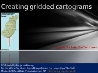
  • 1. Israel & the Palestine Territories GIS Tutorial by Benjamin Hennig For the MSc in Social and Spatial Inequalities at the University of Sheffield Module GEO6016 Data, Visualisation and GIS | http://sasi.group.shef.ac.uk/
  • 2. The following tutorial will talk you through the main steps necessary to create a basic grid-based population cartogram for a selected area. The main data preparation is done using ESRI ArcMap, the cartogram transformation is performed in ScapeToad which uses a simplified approach of Gastner/Newmans density equalising cartogram algorithm. For technical details and further reading see: Hennig, B.D., Pritchard, J., Ramsden, M., and Dorling, D. (2010). Remapping the World’s Population. Visualizing data using cartograms. ArcUser 2010 (1), 66-69. Article as PDF at http://www.viewsoftheworld.net/?p=701
  • 3. Data Population • Gridded Population of the World (GPWv3, http://sedac.ciesin.columbia.edu/gpw/)  provided as raster image worldpop2015.img Country Shapes • ESRI Sample Data or  provided as vector data world.shp • Global Administrative Boundaries (http://gadm.org/) • ...
  • 4. GIS works I Preparing the area of interest: Extracting features Open world.shp Select Israel and the Palestine Territories via the selection menu (or the tools bar) Right-click the world layer and choose the Data – Export data option to create a new layer with the selected polygons
  • 5. GIS works II Preparing the grid: Creating a 2.5‘‘ fishnet ArcToolbox:  Data Management Tools  Feature Class  Create Fishnet
  • 6. GIS works II Preparing the grid: Creating a 2.5‘‘ fishnet ArcToolbox:  Data Management Tools  Feature Class  Create Fishnet Converting grid lines to polygons (ArcToolbox  Data Management Tools  Features  Feature to Polygon)
  • 7. It should work…but it doesn’t? Check the extent – Is it what you want?
  • 8. GIS works IV Adding and adjusting basedata: • population raster (worldpop2015.img) • ArcToolbox:  Data Management Tools  Raster  Raster Processing  Clip)
  • 9. GIS works IV Adding and adjusting basedata: • population raster (worldpop2015.img) • ArcToolbox:  Data Management Tools  Raster  Raster Processing  Clip) Converting the population raster: ArcToolbox:  Conversion Tools  From Raster  Raster to Point
  • 10. GIS works V Assigning population values to grid: ArcToolbox:  Analysis Tools  Overlay  Spatial Join
  • 11. GIS works VI Cutting out the area of interest: ArcToolbox:  Analysis Tools  Overlay  Intersect
  • 12. Creating the cartogram using ScapeToad
  • 13. 1, 2, 3 – as easy as that!
  • 14. …well done  http://www.worldpopulationatlas.org