2. Module-V
• Canals: Types of canals,
Alignment of canals. Definition
of gross command area,
cultural command area,
intensity of irrigation, time
factor, crop factor, unlined and
lined canals, standard sections,
design of canals by Lacey's and
Kennedy's method.
• Reservoirs: Definition,
investigation for reservoir site,
storage zones, determination
of storage capacity using mass
curves, economical height of
dam.
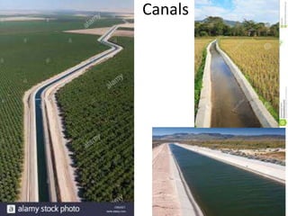
3. A canal is an artificial channel, generally trapezoidal in
shape, constructed on the ground to carry water to
the fields either from a river or tank or reservoir.
4. Types of canals
1. Classification based on the nature of source of supply: In this method canals may be classified as
a) Permanent canals
b) Inundation canals
2. Classification based on the function of the canal: Here the canals may be classified as
a) Feeder canals
b) Carrier canals
c) Navigation canals
d) Power canals
3. Classification based on the discharge and its relative importance in a given network of canals: On this
basis an irrigation canal system consists of
a) Main canal
b) Branch canal
c) Major distributory
d) Minor distributory
e) Water course or Field channel
4. Classification based on Canal alignment: On the basis of canal alignment, the canals are classified as
a) Ridge canal or watershed canal
b) Contour canal
c) Side slope canal
5. 5. Classification based on the financial output: On the basis of the financial output
/revenue from the canals, the canals are called as
a) Productive canals
b) Protective canals
6. Classification based on the soil through which they are constructed: On the above
basis the canals are classified as
a) Alluvial canals
b) Non-alluvial canals.
7. Classification based on lining being provided or not: On the above basis the canals
are classified as
a) Unlined canals
b) Lined canals
6. Types of canals
1. Classification based on the nature of source of supply: In this
method canals may be classified as
a) Permanent canals
b) Inundation canals
A permanent canal is one which draws water from a permanent source
of supply. It is provided with permanent regulation and distribution
works.
An inundation canal is one which draws water from a river when the
water level in the river is high or the river is in floods. These canals
are not provided with any regulatory works.
7. 2. Classification based on the function of the canal: Here
the canals may be classified as
a) Feeder canals
b) Carrier canals
c) Navigation canals
d) Power canals
A feeder canal is constructed for the purpose of supplying
water to two or more canals only but not directly
irrigating the fields.
A carrier canal carries water for irrigating the fields and
also feeds other canals for their needs.
A canal serving the purpose of in-land navigation is called
a navigation canal.
A power canal supplies water to a hydro electric power
generation plant for generation of electrical power.
8. 3. Classification based on the discharge and its relative importance in a
given network of canals: On this basis an irrigation canal system
consists of
a) Main canal
b) Branch canal
c) Major distributory
d) Minor distributory
e) Water course or Field channel
A main canal is the principal canal in a network of irrigation canals. It directly takes off from a
river, reservoir or a feeder canal.
Branch canals take off from a main canal on either side at regular intervals. They carry a
discharge of about 5 cumec and are not usually used to directly irrigate the fields.
A major distributory takes off a branch canal or a main canal. It has a discharge capacity of 0.25
to 5 cumec. They are used for direct irrigation and also to feed minor distributaries.
Minor distributaries are canals taking off from the branch canals and major distributaries. They
carry a discharge less than 0.25 cumec. These canals supply water to field channels.
A water course or field channel takes off from either a major or minor distributory or a branch
canal also. These are constructed and maintained by the cultivators/farmers.
9. 4. Classification based on Canal alignment: On the basis of canal alignment, the
canals are classified as
a) Ridge canal or watershed canal
b) Contour canal
c) Side slope canal
A Ridge canal or watershed canal is one which runs along the ridge or watershed line.
It can irrigate the fields on both sides.
A contour canal is one which is aligned nearly parallel to the contours of the
country/area.
A Side slope canal is one which is aligned at right angles to the contour of the
country/area. It is a canal running between a ridge and a valley.
11. 5. Classification based on the financial output: On
the basis of the financial output /revenue from the
canals, the canals are called as
a) Productive canals
b) Protective canals
A productive canal is one which is fully developed and
earns enough revenue for its running and
maintenance and also recovers the cost of its initial
investment.
Protective canals are those constructed at times of
famine to provide relief and employment to the
people of the area.
12. 6. Classification based on the soil through which they
are constructed: On the above basis the canals are
classified as
a) Alluvial canals
b) Non-alluvial canals.
Canals constructed in alluvial soils are known as
alluvial canals. Alluvial soils are found in the Indo-
Gangetic plains of North India. The alluvial soils can
be easily scoured and deposited by water.
Canals constructed through hard soils or disintegrated
rocks are called non-alluvial canals. Such soils are
usually found in Central and South India.
13. 7. Classification based on lining being provided or not:
On the above basis the canals are classified as
a) Unlined canals
b) Lined canals
An unlined canal is one which the bed and banks of the
canal are made up of natural soil through which it is
constructed. A protective lining of impervious material
is not provided. The velocity of flow is kept low such
that bed and banks are not scoured.
A lined canal is one which is provide with a lining of
impervious material on its banks and beds, to prevent
the seepage of water and also scouring of banks and
bed. Higher velocity for water can be permitted in lined
canals and hence cross sectional area can be reduced.
14. Gross command area: It is the total area can be
commanded or irrigated by a canal system.
Culturable command area: Gross command area may
also contain villages, ponds, barren lands, alkaline lands etc.,
and such areas are turned as unculturable area. The
remaining area on which crops can be grown satisfactory is
known as culturable command area.
15. In aligning an irrigation canal, the following points must be
considered
1. An irrigation canal should be aligned in such a way that maximum area is irrigated
with least length of canal.
2. Cross drainage works should be avoided as far as possible, such that the cost is
reduced.
3. The off taking point of the canal from the source should be on a ridge, such that the
canal must run as a ridge canal and irrigate lands on both sides.
4. Sharp curves in canals must be avoided.
5. In hilly areas, when it is not possible to construct ridge canals, the canal must be
made to run as a contour canal.
6. The canal should be aligned such that the ideal length of the canal is minimum.
7. The alignment should be such that heavy cutting or heavy filling are avoided. If
possible balanced depth of cutting and filling is achieved.
8. It should not be aligned in rocky and cracked strata.
9. The alignment should avoid villages, roads, places of worship and other obligatory
points.
17. Definitions
Gross command area: It is the total area can be
commanded or irrigated by a canal system.
Culturable command area: Gross command area may
also contain villages, ponds, barren lands, alkaline
lands etc., and such areas are turned as
unculturable area. The remaining area on which
crops can be grown satisfactorily is known as
culturable command area.
Culturable cultivated area : It is the area in which
crop is grown at a particular time or crop season.
Culturable uncultivated area : It is the area in which
crop is not grown in a particular time or crop
season.
18. Intensity of irrigation : The percentage of culturable
command area proposed to be irrigated during either a
crop season or during a year.
Ex : If CCA of an irrigation field is 120ha, out of which 90ha of
the land is cultivated during Kharif season and 60ha during
Rabi season.
Intensity of irrigation during Kharif season = (90/120)x100
= 75%
Intensity of irrigation during Rabi season = (60/120)x100
= 50%
19. RESERVOIR
A reservoir is a large, artificial lake created by
constructing a dam across a river
The various purposes served by a multipurpose
reservoir include (i) irrigation (ii) municipal
and industrial water supply, (iii) flood control
(iv) hydropower, (v) navigation, (vi) recreation,
(vii) development of fish and wild life, (viii) soil
conservation (ix) pollution control
20. Investigations for Reservoir
1. Engineering surveys
Engineering surveys are conducted for the dam, the reservoir and other associated works.
Generally, the topographic survey of the area is carried out and the contour plan is
prepared.
2. Geological investigation
Geological investigations of the dam and reservoir site are done for the following
purposes.
(i) Suitability of foundation for the dam.
(ii) Water tightness of the reservoir basin
(iii) Location of the quarry sites for the construction materials.
3. Hydrologic investigations
Hydrological investigations are conducted for the following purposes :
(i) To study the runoff pattern and to estimate yield.
(ii) To determine the maximum discharge at the site.
22. Different reservoir levels
Full reservoir level (FRL)
The full reservoir level (FRL) is the highest water level to which the water surface will
rise during normal operating conditions.
Maximum water level (MWL)
The maximum water level is the maximum level to which the water surface will rise
when the design flood passes over the spillway.
Minimum pool level
The minimum pool level is the lowest level up to which the water is withdrawn from
the reservoir under ordinary conditions.
Different storage zones
1. Surcharge storage
2. Useful storage
3. Dead storage
4. Bank storage
5. Valley storage
23. Different storage zones
1. Surcharge storage : The surcharge storage is the volume of water stored above the full
reservoir level upto the maximum water level.
2. Useful storage: The volume of water stored between the full reservoir level (FRL) and the
minimum pool level is called the useful storage.
3. Dead storage: The volume of water held below the minimum pool level is called the dead
storage.
4. Bank storage: If the banks of the reservoir are porous, some water is temporarily stored by
them when the reservoir is full. The stored water in banks later drains into the reservoir
when the water level in the reservoir falls.
5. Valley storage: The volume of water held by the natural river channel in its valley upto the
top of its banks before the construction of a reservoir is called the valley storage.
24. 1.The rainfall hyetograph is drawn between
a. rainfall intensity and time
b. cumulative rainfall and time
c. rainfall intensity and cumulative rainfall
d. rainfall depth and area
25. 2. The rainfall mass curve shows the variation of
a. Rainfall intensity with cumulative rainfall
b. Cumulative rainfall with time
c. Rainfall excess with time
d. Rainfall intensity with time
26. 3. Double mass curve technique is used
a. To prepare the rainfall hyetograph from the
rainfall mass curve
b. To prepare the rainfall mass curve from the
rainfall hyetograph
c. To check the consistency of record at a
suspected rain gauge station
d. In developing isohyetal maps
27. 4. An isohyet is a line joining points of
a. Equal rainfall excess
b. Equal rainfall intensity
c. Equal storm duration
d. Equal rainfall depth
28. 5. The science which deals with occurrence,
distribution and circulation of water is called
a. Hydrography
b. Hydrology
c. Hydraulics
d. Hydrometry
29. 6. The science which deals with the surface
stream is known as
a. Cryology
b. Geomorphology
c. Limnology
d. Potamology
30. 7. Hydrograph is drawn between
a. rainfall intensity and time
b. cumulative rainfall and time
c. rainfall intensity and cumulative rainfall
d. Discharge and time
31. 8. Lift irrigation is flow
1. By gravity
2. From lower level to higher level
3. By percolation
4. Through sprinkler heads
32. 9. Rabi season starts from
1. 1st October to 31st March
2. 1st September to 30th April
3. 1st October to 30th April
4. 1st April to 30th September
33. 10. Ridge canal is also called
1. Watershed canal
2. Contour canal
3. Side slope canal
4. None of the above