This document provides a bibliography for a professional journey reflection project. It includes 15 links to photos on Flickr from locations like Centennial College and a playground. It also lists personal pictures taken at three daycares with parental permission, and images from websites like Animoto and Slideshare. The photos depict topics relevant to education, childcare, teamwork, and accessible sanitation facilities.
The document provides instructions for students at Colegio Bennett to create a virtual booklet about natural resources. It lists several online programs and tutorials that can be used to create the booklet. Students are asked to choose one program to create their booklet. The booklet should include five parts: an introduction to natural resources, sections on water, soil, and energy resources, and a proposal part created using Comic Life about solving a problem related to natural resource use. Students are provided with additional details on what information should be included in each part such as descriptions of resource usage and conservation.
This document provides information about resources for learning and enjoying technology including websites for moodle, manuals, social bookmarking, chat platforms, and projects. It also mentions tools like JClic and Cho Oyu as well as information about who they are as a community and comparing different technology approaches. Photos are included as visual representations of learning, enjoying, and community.
This document introduces the topic of geometry and polygons. It asks the reader what they know about geometry and polygons. It then prompts the reader to look at several images on Flickr and identify the different shapes they see, classifying them as polygons or non-polygons. Finally, it asks the reader to create their own presentation identifying polygons they find in the real world.
This document introduces the topic of geometry and polygons. It asks the reader what they know about polygons and encourages them to look at images online to identify different polygons in the real world. The reader is then asked to classify the shapes they found as either polygons or non-polygons. Finally, the document instructs the reader to create their own presentation identifying additional polygons they see in the real world and attributing any image sources.
Banish Your Inner Critic: Amplify Your Impact - Mind The Product SF 2019Denise Jacobs
The Inner Critic is the main source of our biggest blocks to perform at our best. Fortunately, there are simple and effective ways to banish the inner critic in order to do our best work as contributors, collaborators, and leaders.
First, you’ll discover the three mental power tools that you already possess to stop the inner critic in its tracks. Then you’ll learn methods for dealing with the fear of being judged and criticized, how to transform highly critical self-talk into that of approval and encouragement, and ways to feel like your ideas are good enough and stop committing “ideacide.”
By the end, you’ll have a roadmap of how to get unstuck, do your best work, and channel your creativity as a force for positive change in the world.
Findability in the Flow: Discovery through LinkingMark Matienzo
The document discusses how linking and discoverability through links can help archives and other cultural heritage institutions be found online. It emphasizes that users exchange links for information, influence, and goodwill, so institutions should look for backlinks to their resources and follow links to other related resources to improve discovery. Providing open APIs and embedding resources can also help drive traffic and discovery through sites like Wikipedia.
This document provides a list of references and resources for geography teaching, including websites, blogs, books, and videos. The resources cover topics like mapping, earth science, climate change, and classroom tools. It also provides contact information for the author and offers to share additional resources through email.
This document contains a collection of links to photos and videos hosted on Flickr and YouTube. There are links to travel, landscape, and scenic photos from various locations around the world. The links are from different photographers and do not seem to be focused on a particular topic or event.
Gives ESL students in Spain a brief look at Chicago and Atlanta. The teacher may comment on the simliaries and differences the lifestyles are in Spain an the U.S.
At the end of the slide are 2 pictures of bedrooms. Students should try to describe the furniture within the room and where it is located.
Slides from a talk with pre-service Sr. Years teachers at Brandon University on February 24, 2010; 2 days before the end of their final class before graduation.
This document contains a list of links to various media resources on the internet, including YouTube videos and Flickr photos. The links are not accompanied by descriptions and seem to be randomly ordered without an apparent connecting theme between the resources. The document serves as an index of external media links but provides no other context or information.
Jan Senderek - Building Mobile First: Eeve - Geomob May 2011GeomobLDN
The document announces a quarterly meetup for geo and mobile developers called Geomob LDN that was held on May 15, 2011. It provides information on upcoming speakers Jan Senderek from Eeve and details on the next meetup scheduled for September 15, 2011. Additional related events are also promoted.
This document discusses robots and the process of building a basic robot. It notes that over 1 million industrial robots are currently in use, nearly half of which are located in Japan. The first robot ever made was an artificial bird. The document then outlines the steps taken to build a simple robot out of a plastic bottle, including decorating the bottle, adding a motor, and testing it until it worked after several attempts. It closes by listing some sources of information about robots.
The document announces a quarterly meetup for geo and mobile developers called Geomob LDN taking place on May 15, 2011. It provides an agenda with speakers from companies like Microsoft, CASA, and Eeve. It also mentions the meetup location will be at the Jeremy Bentham Pub after the talks and provides details on the next meetup in September 2011.
As an entrepreneur and a creative, you need ways to work better so that you can create more, but what do you do when you hit a seemingly insurmountable mental wall? You need to get unblocked: to bust through that barrier to allow creativity to flow. Beware: this presentation challenges the standard norms around concentration, focus, productivity, and may change how you work…for the better.
Geocaching is a treasure hunting game where participants use GPS devices to locate hidden containers called geocaches around the world. It started in 2000 when the first geocache was hidden in Oregon and the coordinates were posted online. Now there are over 700,000 active geocaches hidden in over 200 countries. Geocaching involves navigating to given coordinates to find waterproof containers that contain a logbook for recording finds and sometimes small trinkets that can be traded. The goal is to discover new places while enjoying outdoor recreation and building an online community.
Empowering Student Learners with GPS - FETC2015abaralt
This document discusses using GPS and geocaching to enhance student learning through an activity called "educaching". Educaching involves teacher-led scavenger hunts where students use GPS devices to locate caches containing educational materials. Some benefits of educaching include promoting hands-on learning, collaboration, and engaging multiple subjects. Examples provided demonstrate how caches can be used to teach concepts in areas like math, geography, science, music, and language arts. Resources for educators interested in implementing educaching are also listed.
The document discusses using GPS and geocaching in education. It defines key terms like GPS, geocaching, educaching, travel bugs, and provides examples of how they can be incorporated into lessons across subjects. Some examples given include using travel bugs and geocaching to teach geography, research foreign currencies in math, answer science questions by finding caches, and using photos from caches for writing prompts. Resources for educators interested in implementing GPS and geocaching activities are also listed.
Here are some suggestions for having a successful day of geocaching:
- Wear comfortable, weather-appropriate clothing like a long-sleeve shirt, hat, long pants, and sturdy shoes suited for hiking. Bring bug spray.
- Bring essentials like water, snacks, a map of the area, a cell phone for emergencies, and a GPS unit with extra batteries or a charger.
- Consider bringing a walking stick for uneven terrain. Staying hydrated and fueled is important for enjoying your day outdoors. Proper clothing and footwear will help you navigate various terrains in search of caches. Preparing with the key essentials can make geocaching a fun, safe adventure
This document provides an overview of geocaching and how GPS technology enables the treasure hunting game. It explains that geocaching began in 2000 when the first cache was hidden using GPS coordinates. It then defines key geocaching terms and outlines the basic elements of locating and interacting with caches, which typically involve using a GPS receiver to find hidden containers. The document also provides guidance on geocaching etiquette and considerations for hiding one's own cache.
GPS and geocaching can provide educational benefits for students. Geocaching involves using a GPS unit to hide and seek containers called geocaches around the world. Teachers have used geocaching to help students learn skills like map reading, problem solving, and data collection. Some lesson ideas include having students find geocaches containing math problems to solve or clues to collect for a mystery. Geocaching can integrate subjects like geometry, science, and history into outdoor lessons while promoting teamwork, critical thinking, and engagement with technology.
The document discusses the educational potential of geotagging and geocaching using handheld devices. It defines geotagging as adding location metadata like coordinates to media like images. Geocaching is described as an outdoor treasure hunting game where people use GPS to hide and find containers around the world. The document proposes some ways these technologies could be used for educational purposes, such as managing fieldwork images, developing geocaching materials to teach others, and assigning travel bugs to follow long distances.
Geocaching involves using a GPS device to locate hidden containers called caches around the world. There are over 1.3 million active geocaches globally. Geocaching promotes environmental stewardship and getting outdoors for people of all ages. Different types of caches include traditional caches which can vary in size and location, multicaches which involve finding multiple stages, virtual caches viewed online, puzzle caches requiring solving clues, webcam caches possibly watched remotely, and Earth caches linking to educational information about locations.
Slides from a presentation in support of a workshop for math teachers at the SUM (Saskatchewan Understands Math) Conference in Saskatoon, SK; May 2011.
This document provides an introduction to GPS (Global Positioning System) and geocaching. It explains that GPS uses 24 satellites and a receiver unit to determine accurate locations. Geocaching is described as a high-tech treasure hunt that uses GPS to hide and find containers anywhere in the world. The document gives instructions on how to find geocaches using a website and GPS unit. It provides examples of how geocaching can be used for educational purposes in schools.
Presentaton to JISC 2011 conference, Liverpool as part of this recorded session on open content. Facilitated by Amber Thomas, JISC.
Other presentations in this set http://www.jisc.ac.uk/events/2011/03/jisc11/programme/3opencontent.aspx
Recording of parts of conference - this was the last recorded session http://www.jisc.ac.uk/events/2011/03/jisc11/virtualgoodybag.aspx
The document summarizes the 7 habits of highly effective people as described by Stephen Covey. It lists each of the 7 habits accompanied by an image from Flickr to illustrate each habit. The habits are: 1) Proactivity 2) Begin with the end in mind 3) Put first things first 4) Think win-win 5) Seek first to understand, then to be understood 6) Synergize 7) Sharpen the saw. The document gives credit to Covey's book as the source of the 7 habits and acknowledges the Flickr photographers who contributed the illustrative images.
The document describes Landsat 9 outreach efforts in Lompoc, California that took place after the satellite's launch. It details three acts: Act I involved a summer camp for students, Act II included launch events, and Act III focused on sustaining engagement beyond launch through geocaching activities, an adventure lab, and a Landsat wall mural. The geocaching activities included 9 themed caches around Lompoc and a geo tour that received over 1700 logs and 400 favorite points from geocachers. The adventure lab involved 15 locations along the Santa Ynez River describing how Landsat data helps with natural resource management. Special thanks were given to the many partners involved in the outreach efforts.
This document provides background information on geocaching and examples of classroom activities that utilize geocaching and GPS technology. It discusses what geocaching is and different types of caches. It then describes several classroom activities across various subjects that get students outside using GPS devices to locate coordinates and complete tasks. These activities engage students in history, science, language arts and support developing skills outlined in the Big6 model of information problem-solving. The document also provides many online resources for teachers interested in incorporating geocaching into lessons.
This document provides an agenda and overview of a presentation on geocaching. It discusses what geocaching is, how it works using GPS receivers, different types of caches, and examples of how some organizations manage geocaching on their lands. The presentation covers the basics of using a GPS receiver to locate caches, geocaching etiquette and rules, and concludes by thanking attendees and inviting them to participate in geocaching activities later in the day.
GeoCaching is an outdoor adventure game where players use GPS devices to find hidden containers called geocaches that have been placed at specific locations shared on the internet. Players log their finds online, and the geocache containers usually contain items for trading and a logbook to sign. The goal is to reach the cache location, find the hidden container, and trade or log the find. It involves using GPS coordinates, optional supplies, and exploring both the journey to the location and challenge of finding the cache.
Slides from a presentation in support of a workshop for grades 5-12 math teachers at Charlottesville City Schools in Charlottesville, VA; 18 August 2010.
The document discusses geocaching, which is a treasure hunt where people use GPS devices to find containers hidden by other geocachers around the world. It explains that GPS uses 24 satellites to triangulate a user's location within 6 feet. Typical GPS devices for geocaching cost around $100. Geocachers register on geocaching.com to get coordinates of hidden caches, which are containers used to hold logbooks and sometimes trade items. Users can search for nearby caches and download the waypoints to find them using clues. Geocaching has educational applications and can be connected to different school subjects.
The document discusses fair use and copyright in the context of digital learning. It outlines goals of gaining knowledge about how copyright and fair use apply, developing confidence sharing information with colleagues, and recognizing how media literacy depends on copyrighted materials. It provides examples of how students use copyrighted materials creatively and academically through activities like digital storytelling and remixing. While technology makes it easy to use and share such content, copyright owners assert their rights in ways that can discourage use. The document advocates replacing outdated copyright knowledge with an accurate understanding of fair use and exemptions, and balancing the rights of owners and users.
This document lists the top 10 errors made by University of Michigan students when using Noodletools. It provides brief explanations and advice for each error, focusing on proper annotation, citation of PDFs, inappropriate citation of book sections, failure to use available help resources, incorrect use of URLs, pagination issues, author name formatting, missing or incorrect publication information, capitalization of titles and names, and selecting the wrong citation type. Students are advised to carefully examine their sources and utilize the help features within Noodletools to avoid these common mistakes.
While copyright & fair use can be confusing to navigate you CAN use copyrighted material in your creative work! This introduction to the Code of Best Practices in Fair Use for Media Literacy Education will explain fair use, reduce copyright confusion and share helpful ideas regarding how to teach your students and staff about copyright & fair use.
<a>http://sigms.iste.wikispaces.net/Copyright+Clarity</a>
NoodleTools is an online tool that helps students take notes, organize sources, and create citations and bibliographies. It allows students to take three-part notes that link quotes to their sources. Students can organize their notes and sources into projects. The tool also provides outlines and allows dragging and dropping notes to create different organization structures. NoodleTools aims to help students stay organized while researching and writing papers in order to spend more time thinking critically about their topics.
NoodleTools is an online tool that allows students to create citations, bibliographies, and annotated bibliographies in MLA format. It guides students through adding sources to their bibliography by providing drop-down menus and help text for each field. Students can organize their research notes, create outlines, and add annotations. Teachers can provide feedback on student bibliographies and works cited lists through the tool.
While copyright & fair use can be confusing to navigate you CAN use copyrighted material in your creative work! This introduction to the Code of Best Practices in Fair Use for Media Literacy Education will explain fair use, reduce copyright confusion and share helpful ideas regarding how to teach your students and staff about copyright & fair use.
Additional Resources
http://ning.peteandc.org/page/copyright-clarity-fair-use
Session designed to develop knowledge of the distinctions between fair use, creative commons, and other types of licenses so attendees will understand how to evaluate the use of a copyrighted work to determine whether it is appropriate for teachers and students to claim fair use, use Creative Commons licenses, ask
permission, or purchase a license.
Participants will also learn some specific
activities that can be used to teach K-12
students about their social responsibility
and ethical use of information.
This document provides tips for evaluating the reliability and credibility of internet resources. It suggests checking the URL for indicators of an individual author, looking at who publishes the site and whether the domain matches the publisher, and scanning the page for details about the author, sources cited, external links, date of last update, and purpose of the site. The document encourages applying these techniques of evaluation to sample websites listed at the provided URLs.
The document provides instructions for uploading a presentation to SlideShare and embedding the presentation on a Ning page. It directs the user to go to SlideShare, fill in information, follow upload directions, check the status as the file converts, and then find and paste the embed code into the text box on their Ning page.
This document provides strategies for improving PowerPoint presentations based on advice from David Jakes and Ken Rodoff. It suggests that presenters should not just read their slides and should instead add their own commentary and insights. Presenters are advised to use visuals like images to communicate their message rather than just decorate slides. Examples of improved slide decks are provided that showcase using images and visual storytelling over just text. Tips are offered on finding open license images that can be legally used.
Its A Ning Thing Evolution of Collaborative Practices in a 1:1 HSKristin Hokanson
This document discusses the evolution of collaborative practices in a 1:1 high school where each student has their own laptop. It outlines how the school constructed a Ning site to facilitate more collaborative teaching and learning. Key features of the Ning include forums, blogs, and RSS feeds. The document suggests the 1:1 environment and use of these tools will support best practices and enable new possibilities for students.
This document discusses copyright confusion and the future of intellectual property in the remix generation. It notes that copyright law aims to promote creativity, innovation and the spread of knowledge, but balances the rights of owners and users. Teachers often cope with copyright confusion by avoiding using copyrighted works or hyper-complying with rules. The document argues it is time to replace old knowledge with accurate knowledge about fair use, public domain, and Creative Commons works. It provides examples of fair use analysis and concludes by suggesting we teach kids to reason critically about copyrighted materials.
This lesson was designed to help students re-think their senior graduation project presentations. Many of the ideas and samples included were inspired by presentations by David Jakes and Ken Rodoff's presentations attended at NECC, and NCTE
---------
ORIGINAL PRESENTATIONS/ INSPIRATION
http://www.slideshare.net/000036hs
http://www.jakesonline.org/tenstrategies.html
and used / modified with permission for the purpose of giving students good models for how to turn their powerpoints into powerful presentations.
This document discusses copyright and intellectual property issues related to remix culture and how younger generations understand and interact with copyrighted works. It notes that U.S. copyright law was originally intended to promote creativity and innovation but that modern copyright law may be stifling these goals. The document examines kids' understanding of concepts like fair use, public domain, and Creative Commons licenses. It argues that mashups and remixes can be educational for students and that copyright law is challenging current models of online sharing and creativity. Examples of educational institutions tackling these issues are also presented.
This document discusses bringing global learning to local communities through networking online while taking action locally. It poses questions about professional development, online identity, collaboration, decision making, building connections, perspectives, and future directions for combining global and local engagement in learning. Links to Flickr photos provide visual representations on these topics. The overall message is about using online networks to connect with others globally while implementing learning in one's local community.
The document discusses media literacy and fair use guidelines for educators. It explains that negotiated agreements between media companies and educational groups have created confusing guidelines for educators around copyright and fair use. However, these guidelines are not actual law. The document advocates that educators understand and exercise their rights to fair use under the US Copyright Act and promotes a Code of Best Practices in Fair Use to provide clarity on how educators can appropriately use copyrighted materials.
Workshop on ways to use web2.0 to connect your students to the world
http://theconnectedclassroom.wikispaces.com/BU_Fall_Teacher_Conf
Video on slide 5 available at http://theconnectedclassroom.org
full day hands on workshop on using imovie08...
Links & handouts
http://theconnectedclassroom.wikispaces.com/imovie08_workshop
please note, slides did not upload correctly so I needed to upload as a pdf, please contact me if you would like a copy of this slideshow.
The document provides an overview of effective search strategies for finding information on the internet:
- The internet consists of billions of web pages both publicly accessible and within private networks. Search engines only index a fraction of available pages.
- Key strategies for effective searching include choosing appropriate keywords, selecting the right search tools, and evaluating the reliability of information found.
- Much information is contained in the "deep web" of databases not accessible to search engines, requiring use of specialized search sites.
- Users should carefully evaluate websites for authority, credibility, accuracy, and potential biases before fully relying on information. Looking at the URL, domain, author credentials, and outside reviews can help assess reliability.
This presentation includes basic of PCOS their pathology and treatment and also Ayurveda correlation of PCOS and Ayurvedic line of treatment mentioned in classics.
A workshop hosted by the South African Journal of Science aimed at postgraduate students and early career researchers with little or no experience in writing and publishing journal articles.
A review of the growth of the Israel Genealogy Research Association Database Collection for the last 12 months. Our collection is now passed the 3 million mark and still growing. See which archives have contributed the most. See the different types of records we have, and which years have had records added. You can also see what we have for the future.
Exploiting Artificial Intelligence for Empowering Researchers and Faculty, In...Dr. Vinod Kumar Kanvaria
Exploiting Artificial Intelligence for Empowering Researchers and Faculty,
International FDP on Fundamentals of Research in Social Sciences
at Integral University, Lucknow, 06.06.2024
By Dr. Vinod Kumar Kanvaria
Strategies for Effective Upskilling is a presentation by Chinwendu Peace in a Your Skill Boost Masterclass organisation by the Excellence Foundation for South Sudan on 08th and 09th June 2024 from 1 PM to 3 PM on each day.
ISO/IEC 27001, ISO/IEC 42001, and GDPR: Best Practices for Implementation and...PECB
Denis is a dynamic and results-driven Chief Information Officer (CIO) with a distinguished career spanning information systems analysis and technical project management. With a proven track record of spearheading the design and delivery of cutting-edge Information Management solutions, he has consistently elevated business operations, streamlined reporting functions, and maximized process efficiency.
Certified as an ISO/IEC 27001: Information Security Management Systems (ISMS) Lead Implementer, Data Protection Officer, and Cyber Risks Analyst, Denis brings a heightened focus on data security, privacy, and cyber resilience to every endeavor.
His expertise extends across a diverse spectrum of reporting, database, and web development applications, underpinned by an exceptional grasp of data storage and virtualization technologies. His proficiency in application testing, database administration, and data cleansing ensures seamless execution of complex projects.
What sets Denis apart is his comprehensive understanding of Business and Systems Analysis technologies, honed through involvement in all phases of the Software Development Lifecycle (SDLC). From meticulous requirements gathering to precise analysis, innovative design, rigorous development, thorough testing, and successful implementation, he has consistently delivered exceptional results.
Throughout his career, he has taken on multifaceted roles, from leading technical project management teams to owning solutions that drive operational excellence. His conscientious and proactive approach is unwavering, whether he is working independently or collaboratively within a team. His ability to connect with colleagues on a personal level underscores his commitment to fostering a harmonious and productive workplace environment.
Date: May 29, 2024
Tags: Information Security, ISO/IEC 27001, ISO/IEC 42001, Artificial Intelligence, GDPR
-------------------------------------------------------------------------------
Find out more about ISO training and certification services
Training: ISO/IEC 27001 Information Security Management System - EN | PECB
ISO/IEC 42001 Artificial Intelligence Management System - EN | PECB
General Data Protection Regulation (GDPR) - Training Courses - EN | PECB
Webinars: https://pecb.com/webinars
Article: https://pecb.com/article
-------------------------------------------------------------------------------
For more information about PECB:
Website: https://pecb.com/
LinkedIn: https://www.linkedin.com/company/pecb/
Facebook: https://www.facebook.com/PECBInternational/
Slideshare: http://www.slideshare.net/PECBCERTIFICATION
हिंदी वर्णमाला पीपीटी, hindi alphabet PPT presentation, hindi varnamala PPT, Hindi Varnamala pdf, हिंदी स्वर, हिंदी व्यंजन, sikhiye hindi varnmala, dr. mulla adam ali, hindi language and literature, hindi alphabet with drawing, hindi alphabet pdf, hindi varnamala for childrens, hindi language, hindi varnamala practice for kids, https://www.drmullaadamali.com
Walmart Business+ and Spark Good for Nonprofits.pdfTechSoup
"Learn about all the ways Walmart supports nonprofit organizations.
You will hear from Liz Willett, the Head of Nonprofits, and hear about what Walmart is doing to help nonprofits, including Walmart Business and Spark Good. Walmart Business+ is a new offer for nonprofits that offers discounts and also streamlines nonprofits order and expense tracking, saving time and money.
The webinar may also give some examples on how nonprofits can best leverage Walmart Business+.
The event will cover the following::
Walmart Business + (https://business.walmart.com/plus) is a new shopping experience for nonprofits, schools, and local business customers that connects an exclusive online shopping experience to stores. Benefits include free delivery and shipping, a 'Spend Analytics” feature, special discounts, deals and tax-exempt shopping.
Special TechSoup offer for a free 180 days membership, and up to $150 in discounts on eligible orders.
Spark Good (walmart.com/sparkgood) is a charitable platform that enables nonprofits to receive donations directly from customers and associates.
Answers about how you can do more with Walmart!"
This presentation was provided by Steph Pollock of The American Psychological Association’s Journals Program, and Damita Snow, of The American Society of Civil Engineers (ASCE), for the initial session of NISO's 2024 Training Series "DEIA in the Scholarly Landscape." Session One: 'Setting Expectations: a DEIA Primer,' was held June 6, 2024.
LAND USE LAND COVER AND NDVI OF MIRZAPUR DISTRICT, UPRAHUL
This Dissertation explores the particular circumstances of Mirzapur, a region located in the
core of India. Mirzapur, with its varied terrains and abundant biodiversity, offers an optimal
environment for investigating the changes in vegetation cover dynamics. Our study utilizes
advanced technologies such as GIS (Geographic Information Systems) and Remote sensing to
analyze the transformations that have taken place over the course of a decade.
The complex relationship between human activities and the environment has been the focus
of extensive research and worry. As the global community grapples with swift urbanization,
population expansion, and economic progress, the effects on natural ecosystems are becoming
more evident. A crucial element of this impact is the alteration of vegetation cover, which plays a
significant role in maintaining the ecological equilibrium of our planet.Land serves as the foundation for all human activities and provides the necessary materials for
these activities. As the most crucial natural resource, its utilization by humans results in different
'Land uses,' which are determined by both human activities and the physical characteristics of the
land.
The utilization of land is impacted by human needs and environmental factors. In countries
like India, rapid population growth and the emphasis on extensive resource exploitation can lead
to significant land degradation, adversely affecting the region's land cover.
Therefore, human intervention has significantly influenced land use patterns over many
centuries, evolving its structure over time and space. In the present era, these changes have
accelerated due to factors such as agriculture and urbanization. Information regarding land use and
cover is essential for various planning and management tasks related to the Earth's surface,
providing crucial environmental data for scientific, resource management, policy purposes, and
diverse human activities.
Accurate understanding of land use and cover is imperative for the development planning
of any area. Consequently, a wide range of professionals, including earth system scientists, land
and water managers, and urban planners, are interested in obtaining data on land use and cover
changes, conversion trends, and other related patterns. The spatial dimensions of land use and
cover support policymakers and scientists in making well-informed decisions, as alterations in
these patterns indicate shifts in economic and social conditions. Monitoring such changes with the
help of Advanced technologies like Remote Sensing and Geographic Information Systems is
crucial for coordinated efforts across different administrative levels. Advanced technologies like
Remote Sensing and Geographic Information Systems
9
Changes in vegetation cover refer to variations in the distribution, composition, and overall
structure of plant communities across different temporal and spatial scales. These changes can
occur natural.
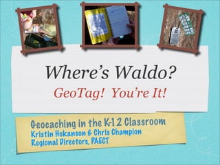
1. Where’s Waldo?
GeoTag! You’re It!
ach ing in t h e K-12 C la s s ro om
Geoc
K ri st in H ok a n so n & C h ri s C h am pi on
Reg io n a l D irec to rs, PAECT
2. What You’ll Learn Today
What is a GPS? How does it work? What’s a
Geocache?
OK, this is fun, but how does it work in school?
Geocaching in School
Geotagging and Global Information Systems
SURPRISE Grant Opportunity
3. What is
GPS?
(Geocachers correctly
call this a GPSr, or
GPS receiver)
http://flickr.com/photos/gravitystorm/2189744333/
5. How does it work?
24 USAF Satellites
Atomic clocks
Einstein (no joke)
Compare the time received
Geometry: trilateration
3 or more satellites needed
(3-D trilateration)
05012511/
s/aburt/3
/flickr.com/photo
http:/
8. Where in the world am I?
Latitude
40.290602
Longitude:
-76.66984
http://www.batchgeocode.com/lookup/
9. What is a Geocache?
http://flickr.com/photos/
d0/119081245/
Container hidden -
owner recorded the
GPS location
Simplest: a container
with a logbook
Larger: room for
“trade” items
10. Sample Cache #1
Brownstone Ghost
Train Car No. 3
paved walking trail
about 1/2 way up the
hill
train theme (photos
and music on
website)
http://www.freesound.org/samplesViewSingle.php?id=36180
11. Sample Cache #2
Ant’s Cache
next to soccer fields
open area, not too
many hiding spots
satellite view hints to
location
06550557/
/18
dysonofrobert
m/photos/ran
ickr.co
http://fl
12. Sample Cache #3
McKaig’s Scenic
Simion
Located in a park
adjacent to Roberts
Elementary School
(King of Prussia)
*You can create a cache
at your school without
having it listed on
Geocaching .org
14. Hiding a Cache
“Official” or just for
you/your students
use?
Container & Log
Permission?
Geocaching Label
Urban vs. Forested
Triple-Cache Container Set @ http://shop.groundspeak.com/
15. a FEW
Educational Benefits
Reading latitude and Cross-curricular
longitude connections
Map skills Math
Using a compass Science
Research Physical
Literature
16. Creating a Geo-Lesson
Resources Already Out There:
Dr. Alice Christie's GPS and Geocaching Guide for
Educators ( www.alicechristie.org )
EduCaching: A GPS-based Curriculum for Teachers
( www.educaching.org )
Londonderry School, Harrisburg
( www.thelondonderryschool.org )
GroundSpeak Forums - GPS in Education
18. Theme Caches
Create caches that
explore numeracy.
(User: Geometry)
Participate in projects
that help students
39°S 64°W
collaborate with
others around the
world (Degree
Confluence Project)
http://www.confluence.org/confluence.php?visitid=15746
19. Theme Caches
Create a cache that
explores issues in
environmental
education. (The Evil
Green Menace!)
Create a cache that
explores health
issues. (Heart to
Heart)
20. Cache In, Trash Out!
A “selling point” when
placing a cache in a
local or state park
CITO Events are held
regularly
Many Earth Day
http://www.geocaching.com/CITO/
events (April 22)
21. Travel Bugs
“Trackable” Item on
Geocaching.com
Visitors to a cache grab
the Travel Bug and move
it along to another cache
Your travel bug is logged
each time it’s grabbed and
each time it’s placed in a
new cache
25. How do I get started?
Build an account on
www.geocaching.com
Search by city, zip code,
state, driving route, etc.
(I usually search by zip
code.)
Record the latitude and
longitude coordinates
and read the hints!
28. What is geotagging?
Geotagging, Data usually consists
sometimes referred to of latitude and
as Geocoding, is the longitude coordinates,
process of adding though it can also
geographical include altitude and
identification place names.
metadata to various
media such as
websites, RSS feeds,
or images.
http://en.wikipedia.org/wiki/Geotagging
32. Other Resources
Talk to other GeoCachers
http://belardi.wikispaces.com/Geocaching
Discovery Educator Network: Geocaching day
March: Check DEN Blogs for more info
http://keystones.wikispaces.com/geocaching
34. Wanna give it a try?
Geocaching.com Demonstration
Geocaching Seminars
35. Wanna give it a try?
Geocaching.com Demonstration
Geocaching Seminars
June 19: MCIU
36. Wanna give it a try?
Geocaching.com Demonstration
Geocaching Seminars
June 19: MCIU
June 23: Lincoln IU
37. Wanna give it a try?
Geocaching.com Demonstration
Geocaching Seminars
June 19: MCIU
June 23: Lincoln IU
July 7: IU 1
38. Wanna give it a try?
Geocaching.com Demonstration
Geocaching Seminars
June 19: MCIU
June 23: Lincoln IU
July 7: IU 1
July 14: NW TriCounty
IU 5
39. Wanna give it a try?
Geocaching.com Demonstration
Geocaching Seminars
June 19: MCIU
July 14: NEIU (19)
June 23: Lincoln IU
July 7: IU 1
July 14: NW TriCounty
IU 5
40. Wanna give it a try?
Geocaching.com Demonstration
Geocaching Seminars
June 19: MCIU
July 14: NEIU (19)
June 23: Lincoln IU
July 15: Blast IU (17)
July 7: IU 1
July 14: NW TriCounty
IU 5
41. Wanna give it a try?
Geocaching.com Demonstration
Geocaching Seminars
June 19: MCIU
July 14: NEIU (19)
June 23: Lincoln IU
July 15: Blast IU (17)
July 7: IU 1
July 17th: Allegheny IU
July 14: NW TriCounty
IU 5
42. Wanna give it a try?
Geocaching.com Demonstration
Geocaching Seminars
June 19: MCIU
July 14: NEIU (19)
June 23: Lincoln IU
July 15: Blast IU (17)
July 7: IU 1
July 17th: Allegheny IU
July 14: NW TriCounty
July 21st Schuylkill IU
IU 5
43. Grant Opportunities
Trainings are a Keystone / PAECT Sponsored Event
Free for Keystones
Free for PAECT members http://paect.org
$4,000 in GeoCaching Grant revealed at each
training.
PAgeocaching@gmail.com