Download to read offline


![This really is the end! Thanks to my team Mina Jahanshahi Luong Tran and [email_address]](https://image.slidesharecdn.com/walis2009-12921911963109-phpapp01/75/Walis-2009-30-2048.jpg)

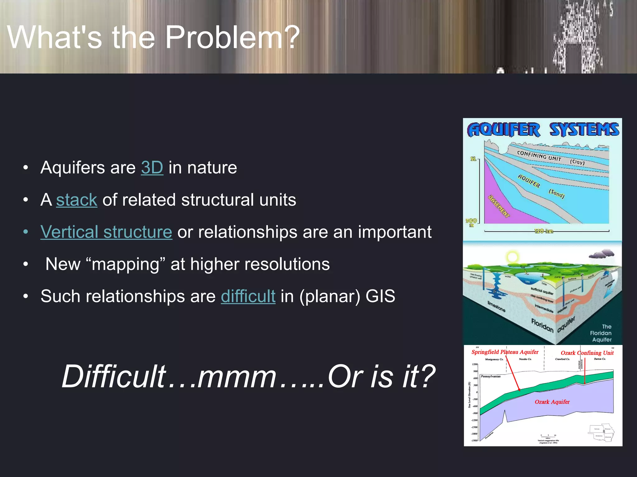
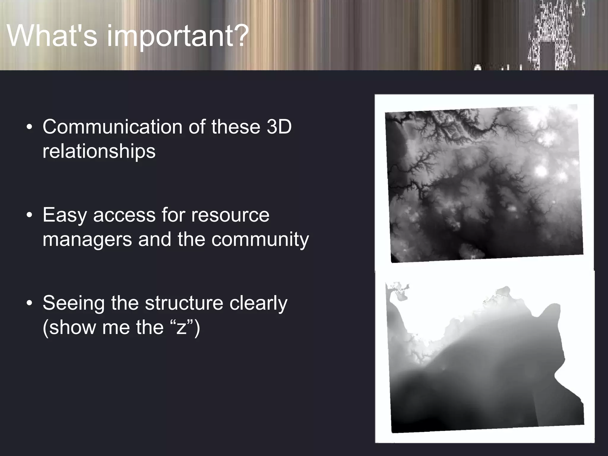
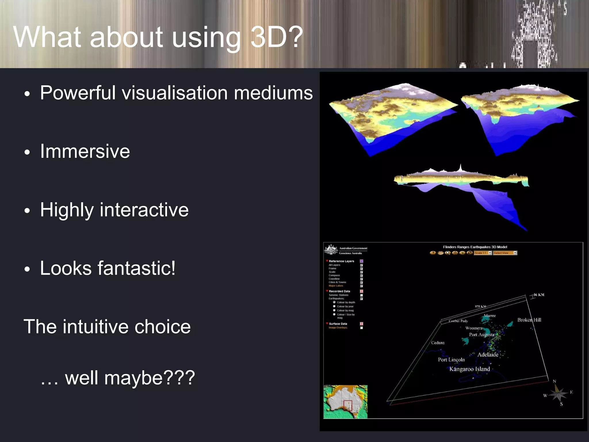
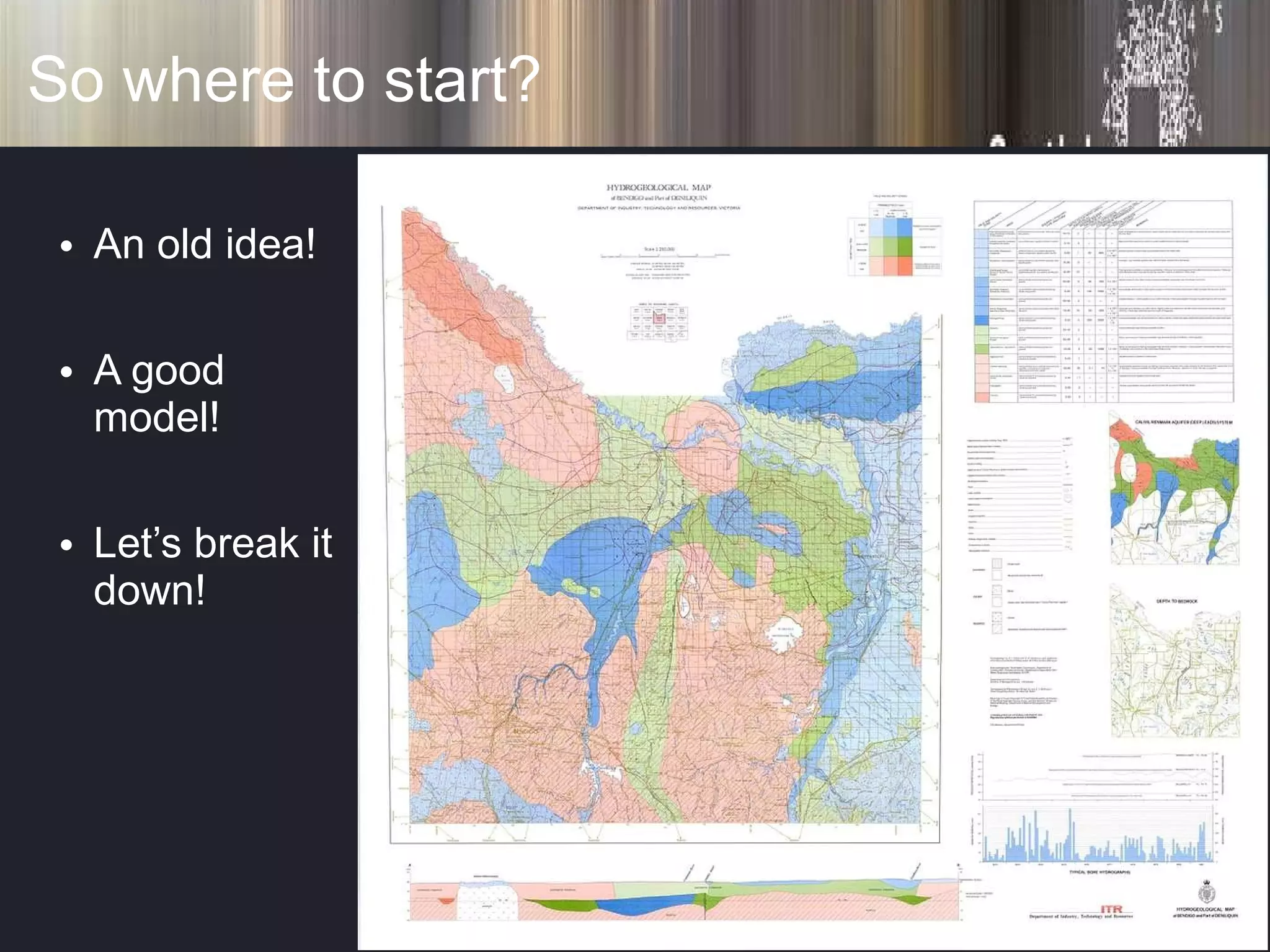
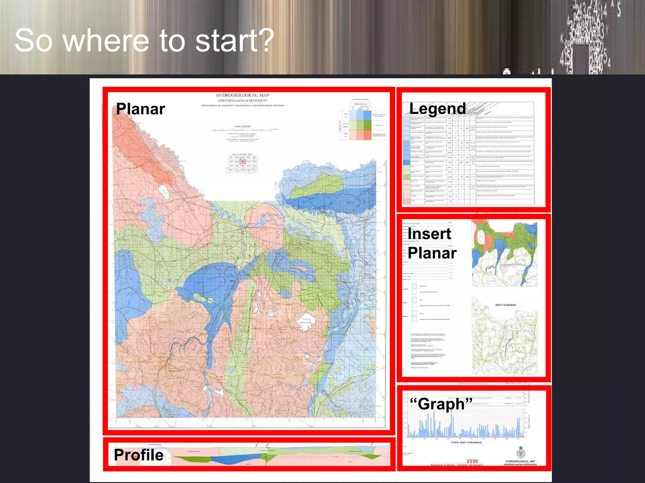
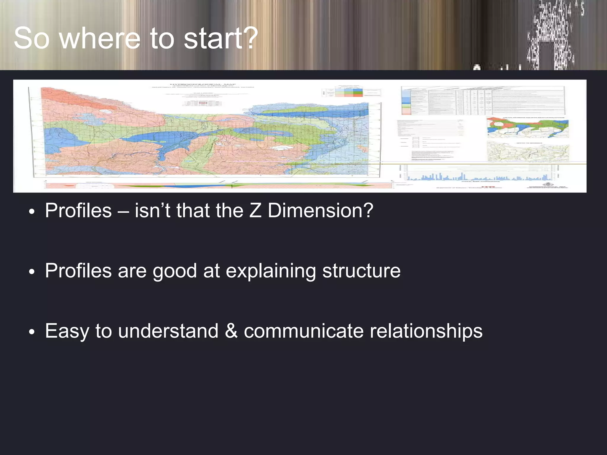
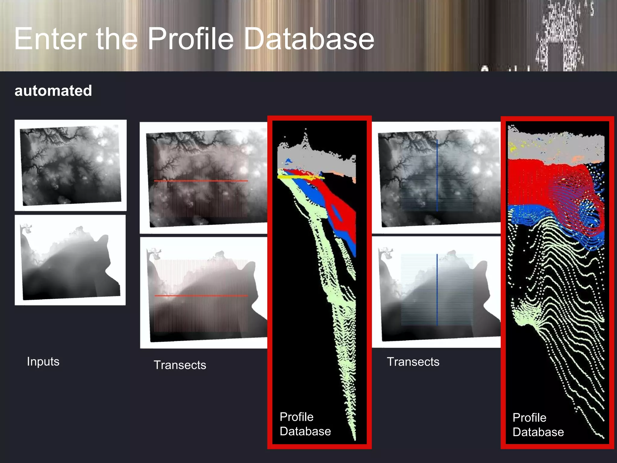
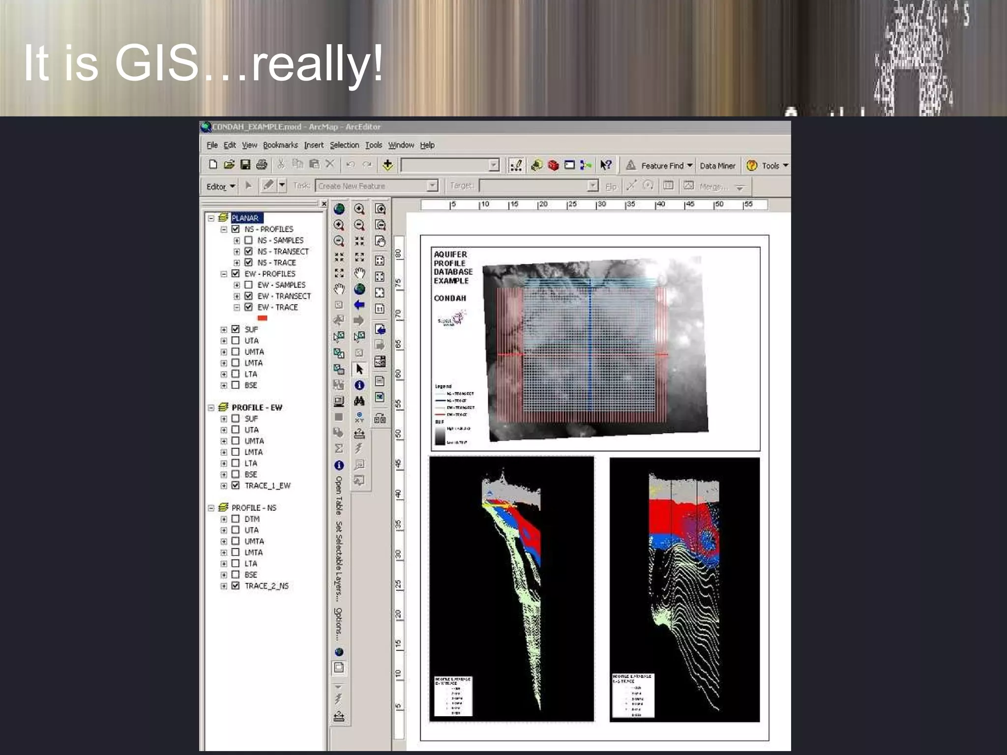
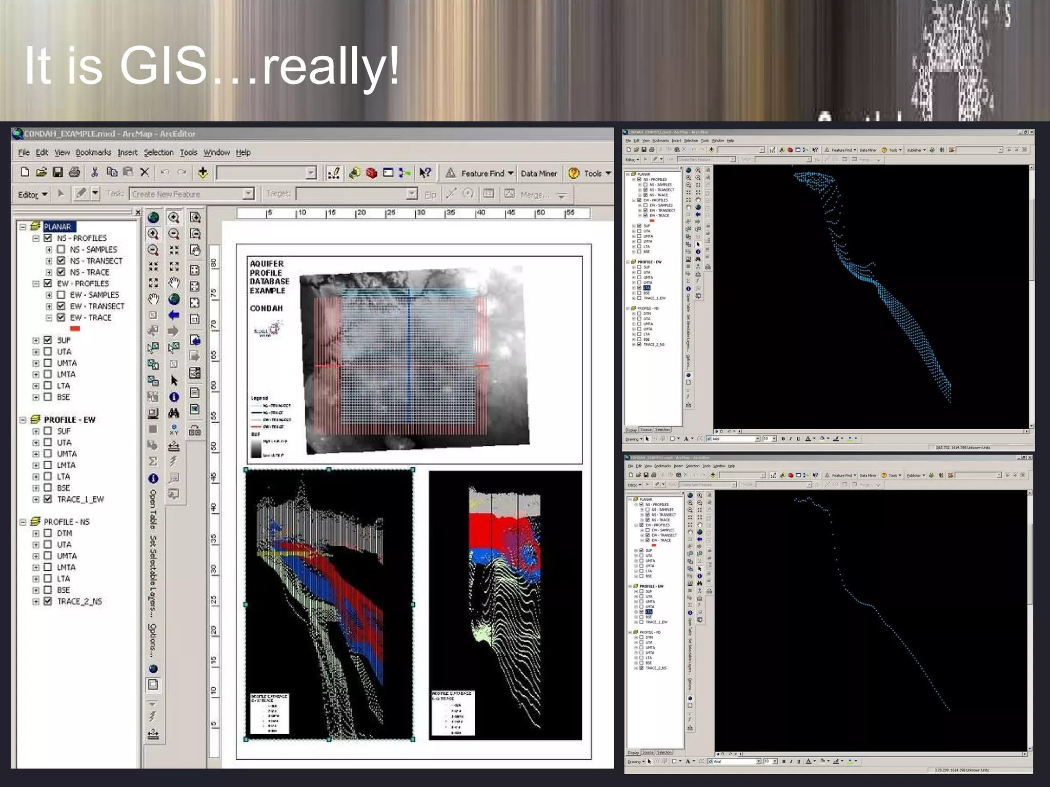
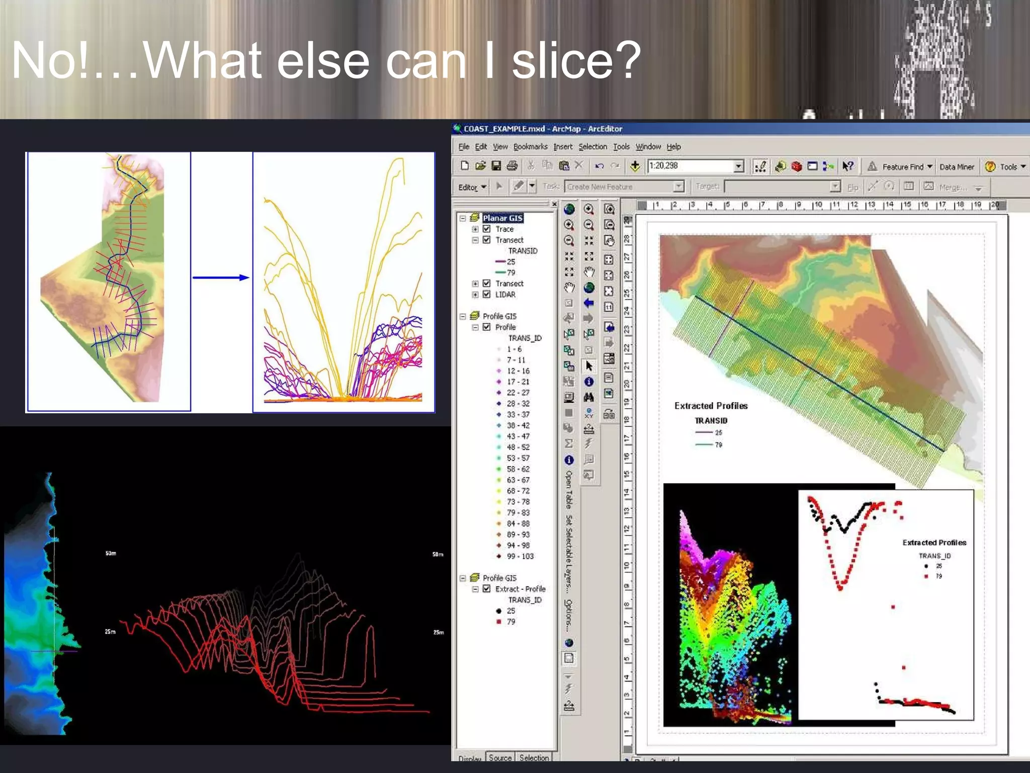
The document discusses using profile databases to visualize and communicate 3D relationships in aquifers. It proposes creating multiple cross-sectional profiles from planar GIS surfaces to represent the vertical, or Z, dimension. These profiles could be automatically constructed and linked to the planar data in a standard GIS without additional software. This would allow groundwater managers and the public to easily see and understand the 3D structural relationships important for management.


