Cma 2009 M Pelikan 3 D Groundwater
•
1 like•309 views

3D Groundwater Management - case studies: 1. 3D Visualisation using VRML 2. Profile GIS - introducing rthe Profile Database as a aquifer information solution

Recommended
More Related Content
Viewers also liked
Viewers also liked (20)
Similar to Cma 2009 M Pelikan 3 D Groundwater
Similar to Cma 2009 M Pelikan 3 D Groundwater (20)
Cma 2009 M Pelikan 3 D Groundwater
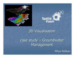
- 1. 3D Visualisation case study – Groundwater Management Milos Pelikan
- 2. How to you communicate complex 3D concepts to non-GIS policy makers?
- 3. Example – Groundwater Management Units Issue Groundwater management units are 3D by nature Groundwater management is the management of volumes not areas Standard GIS is 2D Policy makers are not GIS technicians 3D GIS is complex and not widely available
- 4. Solution – web-based 3D schematic 3D Groundwater Management Visualisation: Web-based Solution – VRML, HTML and Java Script Schematic approach Integrated with external information http://www.spatialvision.com.au/groundwater/
- 5. Solution – web-based 3D schematic Linked DSE 2D Groundwater Information SV 3D Groundwater Schematic
- 6. Solution – web-based 3D solution Web-based Solution – VRML, HTML and Java Script
- 7. Solution – 3D schematic approach
- 8. Solution – external information links
- 9. Solution – external information links
- 10. Lessons learnt 3D can be used to successfully communicate complex ideas “Reality” is not always the optimal solution Simplification Integration creates a dynamic product Conversion from GIS format to 3D format is still a work in progress
- 11. Example – Aquifer Profile Databases Issue Aquifer relationships are 3D by nature Aquifer configuration is fundamental to management Standard GIS shows a planar viewpoint Standard profiles a not geographic or require specialty software
- 12. Solution – profile GIS Profile GIS: GIS spaces based on a transect across the standard planar view Replace x-coordinate ,y-coordinate with distance, depth Seed multiple attributes to remapped sample points enabling profile query
- 13. Solution – profile GIS = transects Solution based on classic Hydrogeological mapping Planar map (standard GIS) Profile map (transect – representative diagrams not spatial)
- 14. Solution – profile GIS (transects) Create sample points on transect using GIS functions Seed thematic information to points Add x,y coordinates
- 15. Solution – profile GIS (getting vertical) depth Distance along transect
- 16. Solution – profile GIS (getting vertical) sample points re-mapped to profile space in separate data frame Vertical & horizontal exaggeration Sample points (profile) can be symbolised by attributes using standard GIS
- 17. Solution – profile GIS (the result)
- 18. Summary – profile GIS
- 19. Lessons learnt • map-based approach • gis-based approach • time-consuming • automatable • one-off • integrated