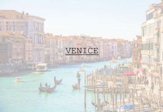
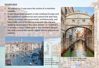
VENICE
INTRODUCTION
• A city in northeastern Italy sited on a group
of 118 small islands
• Separated by canals and linked by bridges.
• Venice is a small city located on the
Venetian Lagoon in the Adriatic Sea.
• Venice is renowned for the beauty of its
setting, its architecture and its artworks.
• The city in its entirety is listed as a World
Heritage Site, along with its lagoon.
• Venice is located in a region of
northeastern Italy called Veneto. Other
cities in this region include Padua, Verona,
Chioggia, Vicenza, Belluno, and Rovigo.
• Venice has played an important role in the
history of symphonic and operatic music.
• Population of venice is 51,298.
• The city in its entirety is listed as a World
Heritage Site, along with its lagoon.
• It is best known for the many waterways
which criss-cross through it.
CLIMATE
Venice has a Humid subtropical climate (Cfa),
with cool winters and very warm summers.
ORIGIN
• The original population of Venice
consisted of refugees from Roman cities
near Venice such as Padua, Aquileia,
Treviso, Altino and Concordia (modern
Portogruaro) and from the undefended
countryside.
• Some late Roman sources reveal the
existence of fishermen on the islands in
the original marshy lagoons.
• There is evidence for a settlement in 600
CE, and this grew, having its own bishopric
by the end of the 7th century.
• The settlement soon had an outside ruler,
an official appointed by the Byzantine
empire, which clung onto a part of Italy
from a base in Ravenna.
• In 751, when the Lombards conquered
Ravenna, the Byzantine dux became a
Venetian Doge, appointed by the
merchant families who had emerged in
the town.
The History of Venice – From the Lombards to the fall of the Venetian
Republic
Murano Italy. Venice Italy
FIGURE GROUND MAP OF VENICE
GEOGRAPHY-
The historical city is divided into six areas or "sestiere" (while the whole comune (municipality) is
divided into 6 boroughs of which one is composed of all 6 sestiere).
• CANNAREGIO- entry point for most visitors to Venice .
• CASTELLO- industrial hub.
• DORSODURO- settlement founded by fishermen .
• SAN MARCO- home of the political and the judicial centers.
• SAN POLO- has market stalls, small shops, and local bars. Traditionally, this was a commercial
center for bankers and brokers.
• SANTA CROCE-named after the church of Santa Croce. Traversed by the grand canal.
LAGOONS
• The Venetian Lagoon is the enclosed
bay of the Adriatic Sea in which the
city of Venice is situated.
• Italy’s largest lagoon (550 km2).
• Venice Lagoon was inhabited from the
most ancient times, but it was only
during and after the fall of the Roman
Empire in the West that many people,
coming from the Venetian mainland,
settled in a large number enough to
found the city of Venice.
• However, the most part of the
inhabitants of Venice, as well as its
economic core, its airport and its
harbor, stand on the western border of
the lagoon, around the former towns
of Mestre and Marghera.
SIGNIFICANCE
• An island city, it was once the centre of a maritime
republic.
• It was the greatest seaport in late medieval Europe and
the continent’s commercial and cultural link with Asia.
• Venice is unique environmentally, architecturally, and
historically, and in its days as a republic the city was
styled la serenissima (“the most serene” or “sublime”).
• It remains a major Italian port in the northern Adriatic
Sea and is one of the world’s oldest tourist and cultural
centres.
FIG: Gondolas
participating in a
historical regatta on the
Grand Canal, Venice.
FIG; Venice : Bridge of Sighs
Bridge of Sighs, Venice.
EARLYVENICE
• The city's location was originally a marshy area
with many sandbanks.
• The Lagoon was exploited for commercial
trading during the Roman Empire and was also a
holiday resort for noblemen.
• The original city of Venice was destroyed by
several invasions until eventually a small strip of
coast remained of the area and hub of the city
was relocated there.
• Most people went out on horses, so bridges in
Venice were originally built without steps.
• To solve the problem of clean water, rainwater
was gathered by the pilele, white stone stripes
that run along the walls of the city.
• Rain was also collected in wells dug into the
sandbanks of Venice and subterranean cisterns.
• When rain water was not enough, Venetians
collected water from the Brenta River.
• Little remains of early Venice as the architecture
was almost entirely made of wood. A map of early Venice (the City of Venice)
THE MIDDLE AGES AND RENAISSANCE
• In the 9th century Venice developed into a city-state
and a major commercial
empire.
• Due to its position at the Adriatic Sea, a center of naval
power and commercial commerce, the city flourished
and became a trade center and main hub of
negotiations between Western Europe, the Middle
East, and Asia.
• The arrival of the architects Jacapo Sansovino and
Michele Sanmichele in the mid 1500s brought the
Renaissance to Venice after the Sack of Rome in 1527.
• Before this time, the architecture of Venice had more
in common with the Byzantine style because of its
strong trading ties with Constantinople.
• Venice saw a decline in the 16th century.
• Many buildings were made in the classical style
with columns, tall facades, ornamentation, and
symmetry.
• Churches were also built in this style, which was a
strong contrast to the flamboyant churches most
usually associated with this time period. Modern architecture in Venice has a sober style
URBAN PATTERNS
• It incorporates a mix of transportation
modes including pedestrian paths, a rail
station, ports, and internal water
navigation, e.g. the canals.
• Venice is an urban pattern ‘frozen in time’
because of historical conservation efforts
during the 20th century.
• Venice is ‘frozen’ into its deformed grid
layout which indicates a well-defined and
easily-understood neighborhood pattern in
Venice.
• Block sizes appear larger and more
geometrically regular at the outer edges of
the island and smaller towards the center
of the island.
• Longer, straighter streets.
• suburban street network pattern where
very long edge-to-edge, super grid streets
are geometrically determined by the
cardinal directions and interstitial streets
tend to be shorter by comparison.
CITYPLANNING(DURING 15TH CENTURY)
• City is surrounded by water forces.
• People engage their surroundings differently
than in a city where people are isolated from
the general population, car do not exist in a
Venetian City.
• Therefore, people have alternate means of
moving through the city .
• Most locals funnel through Venice through
means of walking, immersing themselves in the
city and the culture.
1200’
• Venice form as a metropolis.
• Doge vitale divides the capital into six districts
with 3 on each side of the grand canal.
• The canal formed the central artery of the city.
1500’
• First signs of renaissance design and cultural
planning ideas are somewhat visible.
• Expansion occurs primarily to the north and west
giudecca island were reclaimed and urbanized.
CITYDEVELOPMENTPLANS
1700’
• Churches and palaces were built and
decorated.
• Vanetian classicism persisted under the
palladian tradition.
• Most notable expansion occur on the
guidecca and arsenale.
1900’
• Numerous extensions of industry and living are
made to the east and west.
• 1846 a 3.2km railroad bridge over the ventian
lagoon between mestre and venice was opened.
• Santa lucia station and piazziale roma were
established on the east.
STREET MAP OF VENICE
1500 intersections/square mile.

Venice- urban development

  • 1.
  • 2.
    INTRODUCTION • A cityin northeastern Italy sited on a group of 118 small islands • Separated by canals and linked by bridges. • Venice is a small city located on the Venetian Lagoon in the Adriatic Sea. • Venice is renowned for the beauty of its setting, its architecture and its artworks. • The city in its entirety is listed as a World Heritage Site, along with its lagoon. • Venice is located in a region of northeastern Italy called Veneto. Other cities in this region include Padua, Verona, Chioggia, Vicenza, Belluno, and Rovigo. • Venice has played an important role in the history of symphonic and operatic music. • Population of venice is 51,298. • The city in its entirety is listed as a World Heritage Site, along with its lagoon. • It is best known for the many waterways which criss-cross through it. CLIMATE Venice has a Humid subtropical climate (Cfa), with cool winters and very warm summers.
  • 3.
    ORIGIN • The originalpopulation of Venice consisted of refugees from Roman cities near Venice such as Padua, Aquileia, Treviso, Altino and Concordia (modern Portogruaro) and from the undefended countryside. • Some late Roman sources reveal the existence of fishermen on the islands in the original marshy lagoons. • There is evidence for a settlement in 600 CE, and this grew, having its own bishopric by the end of the 7th century. • The settlement soon had an outside ruler, an official appointed by the Byzantine empire, which clung onto a part of Italy from a base in Ravenna. • In 751, when the Lombards conquered Ravenna, the Byzantine dux became a Venetian Doge, appointed by the merchant families who had emerged in the town. The History of Venice – From the Lombards to the fall of the Venetian Republic Murano Italy. Venice Italy
  • 4.
  • 5.
    GEOGRAPHY- The historical cityis divided into six areas or "sestiere" (while the whole comune (municipality) is divided into 6 boroughs of which one is composed of all 6 sestiere). • CANNAREGIO- entry point for most visitors to Venice . • CASTELLO- industrial hub. • DORSODURO- settlement founded by fishermen . • SAN MARCO- home of the political and the judicial centers. • SAN POLO- has market stalls, small shops, and local bars. Traditionally, this was a commercial center for bankers and brokers. • SANTA CROCE-named after the church of Santa Croce. Traversed by the grand canal.
  • 6.
    LAGOONS • The VenetianLagoon is the enclosed bay of the Adriatic Sea in which the city of Venice is situated. • Italy’s largest lagoon (550 km2). • Venice Lagoon was inhabited from the most ancient times, but it was only during and after the fall of the Roman Empire in the West that many people, coming from the Venetian mainland, settled in a large number enough to found the city of Venice. • However, the most part of the inhabitants of Venice, as well as its economic core, its airport and its harbor, stand on the western border of the lagoon, around the former towns of Mestre and Marghera.
  • 7.
    SIGNIFICANCE • An islandcity, it was once the centre of a maritime republic. • It was the greatest seaport in late medieval Europe and the continent’s commercial and cultural link with Asia. • Venice is unique environmentally, architecturally, and historically, and in its days as a republic the city was styled la serenissima (“the most serene” or “sublime”). • It remains a major Italian port in the northern Adriatic Sea and is one of the world’s oldest tourist and cultural centres. FIG: Gondolas participating in a historical regatta on the Grand Canal, Venice. FIG; Venice : Bridge of Sighs Bridge of Sighs, Venice.
  • 8.
    EARLYVENICE • The city'slocation was originally a marshy area with many sandbanks. • The Lagoon was exploited for commercial trading during the Roman Empire and was also a holiday resort for noblemen. • The original city of Venice was destroyed by several invasions until eventually a small strip of coast remained of the area and hub of the city was relocated there. • Most people went out on horses, so bridges in Venice were originally built without steps. • To solve the problem of clean water, rainwater was gathered by the pilele, white stone stripes that run along the walls of the city. • Rain was also collected in wells dug into the sandbanks of Venice and subterranean cisterns. • When rain water was not enough, Venetians collected water from the Brenta River. • Little remains of early Venice as the architecture was almost entirely made of wood. A map of early Venice (the City of Venice)
  • 9.
    THE MIDDLE AGESAND RENAISSANCE • In the 9th century Venice developed into a city-state and a major commercial empire. • Due to its position at the Adriatic Sea, a center of naval power and commercial commerce, the city flourished and became a trade center and main hub of negotiations between Western Europe, the Middle East, and Asia. • The arrival of the architects Jacapo Sansovino and Michele Sanmichele in the mid 1500s brought the Renaissance to Venice after the Sack of Rome in 1527. • Before this time, the architecture of Venice had more in common with the Byzantine style because of its strong trading ties with Constantinople. • Venice saw a decline in the 16th century. • Many buildings were made in the classical style with columns, tall facades, ornamentation, and symmetry. • Churches were also built in this style, which was a strong contrast to the flamboyant churches most usually associated with this time period. Modern architecture in Venice has a sober style
  • 10.
    URBAN PATTERNS • Itincorporates a mix of transportation modes including pedestrian paths, a rail station, ports, and internal water navigation, e.g. the canals. • Venice is an urban pattern ‘frozen in time’ because of historical conservation efforts during the 20th century. • Venice is ‘frozen’ into its deformed grid layout which indicates a well-defined and easily-understood neighborhood pattern in Venice. • Block sizes appear larger and more geometrically regular at the outer edges of the island and smaller towards the center of the island. • Longer, straighter streets. • suburban street network pattern where very long edge-to-edge, super grid streets are geometrically determined by the cardinal directions and interstitial streets tend to be shorter by comparison.
  • 11.
    CITYPLANNING(DURING 15TH CENTURY) •City is surrounded by water forces. • People engage their surroundings differently than in a city where people are isolated from the general population, car do not exist in a Venetian City. • Therefore, people have alternate means of moving through the city . • Most locals funnel through Venice through means of walking, immersing themselves in the city and the culture.
  • 12.
    1200’ • Venice formas a metropolis. • Doge vitale divides the capital into six districts with 3 on each side of the grand canal. • The canal formed the central artery of the city. 1500’ • First signs of renaissance design and cultural planning ideas are somewhat visible. • Expansion occurs primarily to the north and west giudecca island were reclaimed and urbanized. CITYDEVELOPMENTPLANS
  • 13.
    1700’ • Churches andpalaces were built and decorated. • Vanetian classicism persisted under the palladian tradition. • Most notable expansion occur on the guidecca and arsenale. 1900’ • Numerous extensions of industry and living are made to the east and west. • 1846 a 3.2km railroad bridge over the ventian lagoon between mestre and venice was opened. • Santa lucia station and piazziale roma were established on the east.
  • 14.
    STREET MAP OFVENICE 1500 intersections/square mile.