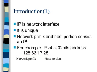
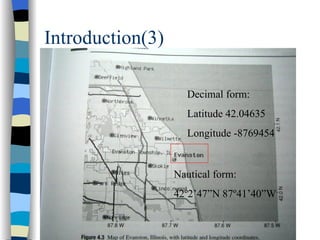
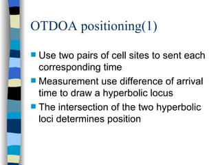
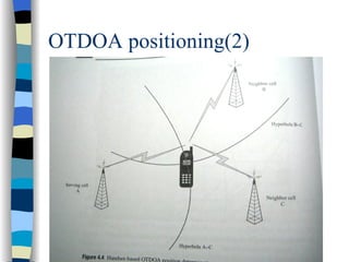
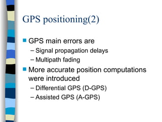
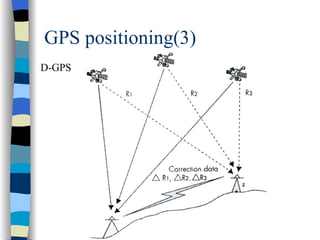
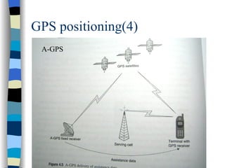
User mobility and Location management Present: Chen Jen
Outline Introduction IP and mobility Location determination Location data access
Introduction Maintain an IP connection when roaming between network Describe handset-based and network-base to determine mobile user location. Location track approaches.
Outline Introduction IP and mobility Location determination Location data access
IP and mobility Introduction Mobile IP packet routing Agent discovery and registration
Introduction(1) IP is network interface It is unique Network prefix and host portion consist an IP For example: IPv4  is 32bits address 128.32.17.25  Network prefix Host portion
Introduction(2) New version is IPv6 It is 128bits Mobile operators are strong advocate the IPv6
IP and mobility Introduction Mobile IP packet routing Agent discovery and registration
Mobile IP packet routing
IP and mobility Introduction Mobile IP packet routing Agent discovery and registration
Agent discovery and registration Mobile terminal need listen “ agent advertisements ” If no hear any things,it can issue “ agent solicitation ” If no response, it can be assigned internet address by DHCP
Agent discovery and registration IPv4 need foreign agent IPv6 no need foreign agent Terminal run “ duplicate address detection ” algorithm to be assigned address
Outline Introduction IP and mobility Location determination Location data access
Location determination Introduction Handset-based position determination Network-based position determination
Introduction(1) Geocode includes Latitude Longitude Altitude Geocodes can be expressed Decimal form Nautical form
Introduction(2)
Introduction(3) Nautical form: 42 º2’47”N 87º41’40”W Decimal form: Latitude 42.04635 Longitude -8769454
Introduction(4) Three wireless location technologies for 3G network Cell-ID-based method Observed Time Difference of Arrival (OTDOA) Assisted Global Positioning System  (A-GPS)
Location determination Introduction Handset-based position determination Network-based position determination
Handset-based position determination Use mobile terminal to compute position OTDOA positioning GPS positioning
OTDOA positioning(1) Use two pairs of cell sites to sent each corresponding time Measurement use difference of arrival time to draw a hyperbolic locus The intersection of the two hyperbolic loci determines position
OTDOA positioning(2)
Handset-based position determination Use mobile terminal to compute position OTDOA positioning GPS positioning
GPS positioning(1) A satellite navigation system Total of 24 GPS satellites Only need four GPS satellites to compute position Galileo will own 27 operational satellites in 2008
GPS positioning(2) GPS main errors are Signal propagation delays Multipath fading More accurate position computations were introduced Differential GPS (D-GPS) Assisted GPS (A-GPS)
GPS positioning(3) D-GPS
GPS positioning(4) A-GPS
Location determination Introduction Handset-based position determination Network-based position determination
Network-based position determination(1) No require upgrades Cell sites need special equipment Cell identification(cell-ID) is most basic and inaccurate Accuracy of cell-ID is about 150 meters in urban area 30 kilometers in rural areas
Network-based position determination(2) Network-based OTDOA discriminate Location Measurement Units (LMUs) Location Service Center (LSC) LMUs record time of arrival of radio signals LSC compute the LMUs hyperbolic locus and intersectional point
Network-based position determination(3)
Outline Introduction IP and mobility Location determination Location data access
Location data access (1) Standard location immediate service Emergency location immediate service Standard location reporting service Emergency location reporting service Triggered location reporting service
Location data access (2) POI =Point of interest

User mobility and location management