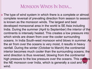
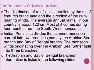
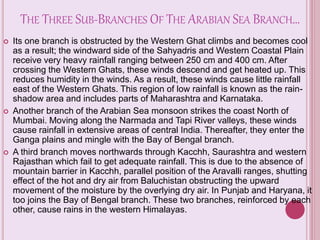
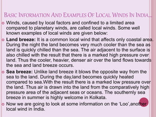
The presentation shows how relative humidity affects other ecological parameters in meteorology. This also shows the relationship between and among the ecological parameters in meteorology
The climate of a region is ultimately determined by the radiation energy of the sun, and its distribution and temporal fluctuations. The long-term state of the atmosphere is a function of a variety of interacting elements. They are: Solar radiation, Air masses, Pressure systems (and cyclone belts),Ocean Currents, and topography.
hey there!
this is a presentation covering important cities of Andhra Pradesh.....but only pics!
it's a great ppt if ur teacher wants a simple but effective
go on, grab it!
like,comment,download,and share!!!
P.S sorry no presenter notes available!
AP govt has launched India's first Medical Manufacturing park in Vizag called AMTZ - Andhra Med Tech Zone.
AP govt released investors brochure...
Any business owners looking at emerging business opportunities on medical manufacturing space, can look at this park...
Images either my own photos, stock images I have purchased or obtained from free sources except as follows...
4, 5 World Federation of Occupational Therapists
13, 15 Leeds Metropolitan University Occupational Therapy students
Infrastructure in Andhra Pradesh, Industries in Andhra Pradesh, GSDPBruce Clay India
Andhra Pradesh is located in the Southern peninsula of India and has a coast line of 974 km. The state has well-developed social, physical and industrial infrastructure and virtual connectivity, has good power, airport, IT and port infrastructure.
About proposedcapital :
Regional authority :APCRDA
Area :7068 sq.km
It comprises of 58 mandals in guntur (29) and krishna (29)districts.
It has a man power of 50 lakh people
Its plan was devoloped by singapore agencies(surbana jurang internaional)
Historical importance of Amaravati:
The recorded history of Amaravati and nearby Dharanikota dates to 2nd century BC.
It was the capital of Satavahanas who ruled from 2nd century BC to 3rd century BC.
Art historians regard the Amaravati art as one of the three major styles or schools of ancient Indian art.
The Government Museum at Egmore (Madras Museum) and British Museum, London
host the "Amaravati Gallery".
Buddhist stupa was built during
the reign ofAshoka in 200 BC,
was carved with panels that tells
the story of Buddha.
Advantages of Amaravati:
Easily accesible from all parts of state.
Three ways of transportations can be devoloped.
It has tourism aspect also.
the government had 10,929 acres of land in Amaravati mandal, 6,000 acres in Tadikonda and 16,000 acres in Achampet.
Proposed projects In amaravati:
Urban amaravati was divided into 8 zones:
Nandigama corridor: pharmaceutical,
biotech industries
plastic packaging units
Gudivada :Agro-based,
green industries
logistic hub
Transportation planning:
There is a proposal of devoloping an international Airport in mangalagiri in a area of 5000 acres.
A high speed train project is accepted by central government as a substitute in the place of metro project.
Ring road has been planed to connect the core capital with vij and guntur cities
Water ways in krishna canal for Trade.
Infra devolopement planning:
the infra structures are planning to made amaravati as one of the most beautifull and biggest city in the globe.
It is estimated the population of capital region will increase from 5.8 million to 50 million by 2050
The 24*7 current and water to be provided
Health,food,employment and other basic needs are promised
Problem faced by government:
Land acquistion:
farmers felt that the government was trying to bulldoze its way through the green fields of the farmers in a bid to promote real estate in the name of ‘capital development
The region has 85 percent small and marginal farmers and also has women entrepreneurs who earn Rs.200-700 per day.
Compromising meausures by govt:
"Pooling" of land for the capital would begin tomorrow as a “majority" of 22,405 farmers in 29 villages
Clearing therir debts in banks upto 1.5 lakh in single installment
under the package, farmers will get compensation per acre share of devoloped area
Ocean notes: a comprehensive study on different ocean zones including intert...Robin Seamon
a comprehensive study on different ocean zones including intertidal, euphotic, disphotic, and aphotic zones, mentioning global warming & climate change, currents, energy flows, with video links
With this power point children can learn more about transports.
If you want more information you can visit our blog http://thetransportsforchildren.blogspot.com.es/
Class IX - Climate
This lesson throws light upon the details of lesson climate, of CBSE board.
This ppt can be used to revise the lesson in a better manner.
it has details on coriolis force, ferrel's law, monsoon winds
UNDERSTANDING WHAT GREEN WASHING IS!.pdfJulietMogola
Many companies today use green washing to lure the public into thinking they are conserving the environment but in real sense they are doing more harm. There have been such several cases from very big companies here in Kenya and also globally. This ranges from various sectors from manufacturing and goes to consumer products. Educating people on greenwashing will enable people to make better choices based on their analysis and not on what they see on marketing sites.
Characterization and the Kinetics of drying at the drying oven and with micro...Open Access Research Paper
The objective of this work is to contribute to valorization de Nephelium lappaceum by the characterization of kinetics of drying of seeds of Nephelium lappaceum. The seeds were dehydrated until a constant mass respectively in a drying oven and a microwawe oven. The temperatures and the powers of drying are respectively: 50, 60 and 70°C and 140, 280 and 420 W. The results show that the curves of drying of seeds of Nephelium lappaceum do not present a phase of constant kinetics. The coefficients of diffusion vary between 2.09.10-8 to 2.98. 10-8m-2/s in the interval of 50°C at 70°C and between 4.83×10-07 at 9.04×10-07 m-8/s for the powers going of 140 W with 420 W the relation between Arrhenius and a value of energy of activation of 16.49 kJ. mol-1 expressed the effect of the temperature on effective diffusivity.
Natural farming @ Dr. Siddhartha S. Jena.pptxsidjena70
A brief about organic farming/ Natural farming/ Zero budget natural farming/ Subash Palekar Natural farming which keeps us and environment safe and healthy. Next gen Agricultural practices of chemical free farming.
"Understanding the Carbon Cycle: Processes, Human Impacts, and Strategies for...MMariSelvam4
The carbon cycle is a critical component of Earth's environmental system, governing the movement and transformation of carbon through various reservoirs, including the atmosphere, oceans, soil, and living organisms. This complex cycle involves several key processes such as photosynthesis, respiration, decomposition, and carbon sequestration, each contributing to the regulation of carbon levels on the planet.
Human activities, particularly fossil fuel combustion and deforestation, have significantly altered the natural carbon cycle, leading to increased atmospheric carbon dioxide concentrations and driving climate change. Understanding the intricacies of the carbon cycle is essential for assessing the impacts of these changes and developing effective mitigation strategies.
By studying the carbon cycle, scientists can identify carbon sources and sinks, measure carbon fluxes, and predict future trends. This knowledge is crucial for crafting policies aimed at reducing carbon emissions, enhancing carbon storage, and promoting sustainable practices. The carbon cycle's interplay with climate systems, ecosystems, and human activities underscores its importance in maintaining a stable and healthy planet.
In-depth exploration of the carbon cycle reveals the delicate balance required to sustain life and the urgent need to address anthropogenic influences. Through research, education, and policy, we can work towards restoring equilibrium in the carbon cycle and ensuring a sustainable future for generations to come.
1. INDIAN WINDS AND MONSOONS!!
A PowerPoint presentation
to know more about our
country’s winds and
monsoons…
2. FIRST,LET US KNOW ABOUT INDIAN
WINDS…
The winds at the surface may be classified into
four main types, i.e.(1) the planetary winds, (2)
the monsoon winds, (3) cyclones and
anticyclones (4) local winds.
Today, we shall speak about the local winds and
monsoon winds of India.
3.
4. MONSOON WINDS IN INDIA…
The type of wind system in which there is a complete or almost
complete reversal of prevailing direction from season to season
is known as the monsoon winds. The largest and best
developed monsoonal area in the world is SE Asia including
India. During the summer (April to September) the interior of the
continents is intensely heated. This creates a low pressure into
which winds are drawn from over the cooler surrounding
oceans. In India South-west monsoon wind blows in summer. As
the air from over the oceans is very moist, it results in heavy
rainfall. During the winter (October to March) the continental
interior becomes much cooler than the surrounding oceans; the
wind direction is thus reversed, blowing from the continental
high pressure to the low pressure over the oceans. This creates
the NE monsoon over India, which is generally a cool and dry
wind.
5.
6. THE DISTRIBUTION OF RAINFALL IN INDIA…
The distribution of rainfall is controlled by the relief
features of the land and the direction of the rain-
bearing winds. The average annual rainfall in our
country is about 120 cm.Most of it comes during
four months from the South-West monsoons.
Indian Peninsula divides the summer monsoon
current into two branches,namely the Arabian Sea
branch and Bay of Bengal branch. The monsoon
winds originating over the Arabian Sea further split
into three branches.
The Arabian and Bay of Bengal branches’
information is listed in the following slides.
7. THE THREE SUB-BRANCHES OF THE ARABIAN SEA BRANCH…
Its one branch is obstructed by the Western Ghat climbs and becomes cool
as a result; the windward side of the Sahyadris and Western Coastal Plain
receive very heavy rainfall ranging between 250 cm and 400 cm. After
crossing the Western Ghats, these winds descend and get heated up. This
reduces humidity in the winds. As a result, these winds cause little rainfall
east of the Western Ghats. This region of low rainfall is known as the rain-
shadow area and includes parts of Maharashtra and Karnataka.
Another branch of the Arabian Sea monsoon strikes the coast North of
Mumbai. Moving along the Narmada and Tapi River valleys, these winds
cause rainfall in extensive areas of central India. Thereafter, they enter the
Ganga plains and mingle with the Bay of Bengal branch.
A third branch moves northwards through Kacchh, Saurashtra and western
Rajasthan which fail to get adequate rainfall. This is due to the absence of
mountain barrier in Kacchh, parallel position of the Aravalli ranges, shutting
effect of the hot and dry air from Baluchistan obstructing the upward
movement of the moisture by the overlying dry air. In Punjab and Haryana, it
too joins the Bay of Bengal branch. These two branches, reinforced by each
other, cause rains in the western Himalayas.
8. THE BAY OF BENGAL BRANCH…
The Bay of Bengal branch strikes the coast of Myanmar and part of
South-East Bangladesh. But the Arakan Hills along the coast of
Myanmar deflect a big portion of this branch towards the Indian
subcontinent. From here, this branch splits into two under the
influence of the Himalayas and the thermal low in North-West India.
Its one branch moves westward along the Ganga plains reaching as
far as the Punjab plains. The other branch moves up the Brahmaputra
valley in the North and the North-East, causing widespread rains. Its
sub-branch strikes the Garo and Khasi hills of
Meghalaya.Mawsynram, located on the crest of Khasi hills, receives
the highest average annual rainfall (1141 cm) in the world. The Tamil
Nadu coast remains dry during this season.
There are two factors responsible for Tamil Nadu remaining dry:-
i. The Tamil Nadu coast is situated parallel to the Bay of Bengal
branch.
ii. It lies in the rain shadow area of the Arabian Sea branch of the
South-West.
9. THE DISTRIBUTIONAL PATTERN OF RAINFALL IN INDIA…
In general, the distributional pattern of rainfall shows
two main trends:-
i. It steadily declines towards the West and the North-
West from the Bengal and Orissa coasts.
ii. From the West and the East coasts, it exhibits
declining trends towards the interior parts of the
Peninsula.
The general direction of winds in this season is from
South-West to North-East in the major part of the
country. However due to the presence of the Himalaya,
these are south-easterly and easterly in the North-East
and Ganga Plain.
12. BASIC INFORMATION AND EXAMPLES OF LOCAL WINDS IN INDIA…
Winds, caused by local factors and confined to a limited area
compared to planetary winds, are called local winds. Some well
known examples of local winds are given below:
Land breeze: It is a common local wind that affects only coastal area.
During the night the land becomes very much cooler than the sea as
land is quickly chilled than the sea. The air adjacent to the surface is
also chilled with the result that there is a marked high pressure over
land. Thus the cooler, heavier, denser air over the land flows towards
the sea and land breeze occurs.
Sea breeze: Unlike land breeze it blows the opposite way from the
sea to the land. During the day,land becomes quickly heated
compared to sea.With the result there is a marked low pressure over
the land. Thus air is drawn into the land from the comparatively high
pressure area of the adjacent seas or oceans. The southernly sea
breeze in summer is highly welcome in Kolkata.
Now we are going to look at some information on the ‘Loo’,another
local wind in India.
13.
14. KNOW ABOUT THE LOCAL WIND ‘LOO’…
The Loo is a strong, hot and dry summer
afternoon wind from the west which blows over
the western Indo-Gangetic Plain region of North
India and Pakistan. It is especially strong in the
months of May and June. Due to its very high
temperatures (45 °C–50 °C ), exposure to it
often leads to fatal heatstrokes.
Since it causes extremely low humidity and high
temperatures, the Loo also has a severe drying
effect on vegetation leading to widespread
browning in the areas affected by it during the
months of May and June.