Download as PPSX, PPTX

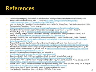
![State Land Use Law
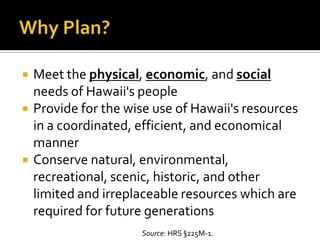
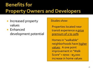
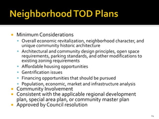
Purpose
“preserve, protect and encourage
the development of the lands in the
State for those uses to which they
are best suited for the public
welfare[.]” See L. 1961, c 187, § 1.
Implementation Mechanisms
5-Year Boundary Review
District Boundary Amendments
ImportantAgricultural Lands
Designation
State Special Use Permits
Hawaii Revised Statutes
Chapter 205 (1961)
U
5%
C
48%
A
47%
R
0%](https://image.slidesharecdn.com/todpresentationaw041713-130426230925-phpapp01/85/Hot-Topics-Transit-Oriented-Development-6-320.jpg)


This presentation by the Director of the State of Hawaii Office of Planning provides an overview of transit-oriented development (TOD) definitions, examples, and planning efforts in Hawaii. It discusses key state policies that guide planning, including the Hawaii State Planning Act, State Land Use Law, and Coastal Zone Management Act. The presentation defines TOD, outlines its benefits, and reviews TOD examples from other cities. It also summarizes ongoing TOD planning efforts at the city and state level, including development of neighborhood TOD plans. Challenges to implementing TOD in Hawaii are noted.