Download to read offline
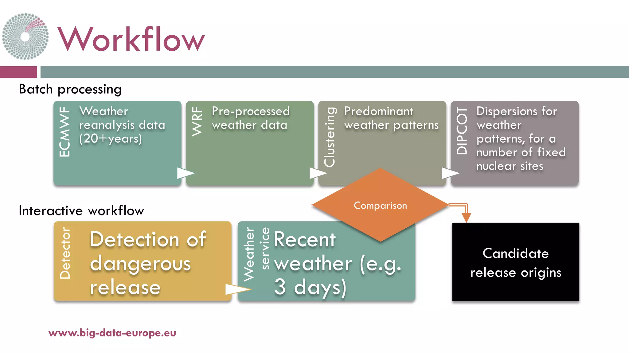
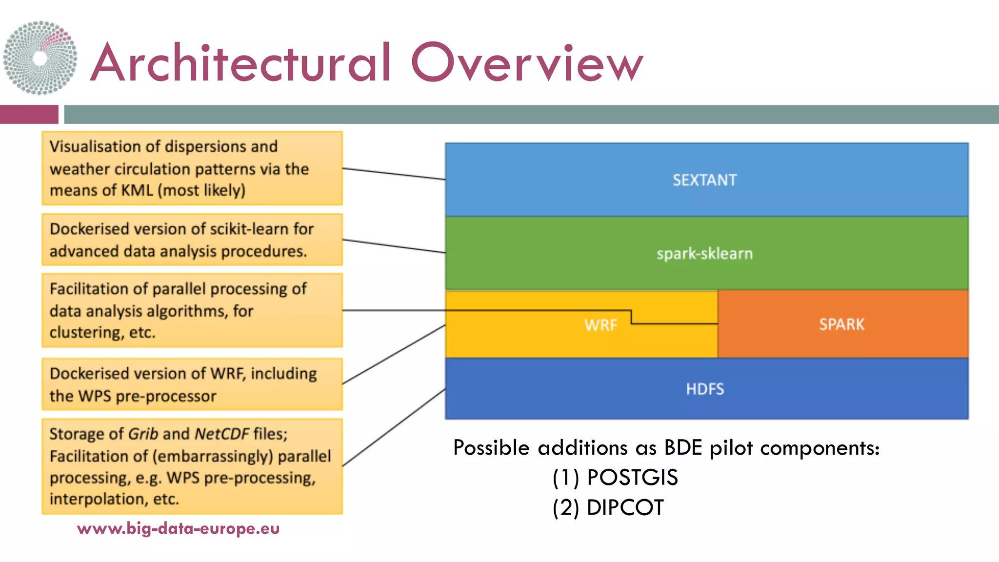


The document outlines the methodology and goals of the BDE 2nd SC5 pilot project 'Demokritos', which focuses on computational modeling of atmospheric dispersion of hazardous pollutants. It discusses the integration of big data tools to efficiently estimate pollutant sources during emergencies, particularly in cases of nuclear accidents, by utilizing meteorological data and dispersion models. The project aims to create a framework that allows for pre-calculation and storage of various dispersion scenarios to rapidly identify emission sources when necessary.


