SlideShare a Scribd company logo
ADO: a prototype of African Drought Observatory for
drought monitoring and forecasting
Climate Risk Management Unit
European Commission - Joint Research Centre (JRC)
Institute for Environment and Sustainability (IES)
Luana Valentini, Paulo Barbosa, Diego Magni
2
ADO TEAM
Part of the European Drought Observatory’s team
European Commission
Joint Research Centre
Institute for Environment and Sustainability
Climate Risk Management unit
D. MagniL. ValentiniP. Barbosa
A. De Jager
J. Vogt
C. Lavaysse
G. Naumann
H. Carrão
C. Cammalleri
F. Micale
3
EDO
SCADO
DEWFORA
http://edo.jrc.ec.europa.eu
DROUGHT
MONITORING
AND FORECAST
4
ECMWF
GPCC
FAO
MODIS
EC-JRC
ADO
Data model
5
6
SPI – Standardized Precipitation Index
The standardized precipitation index was selected as a
meteorological drought indicator. SPI is a transformation of the
accumulated precipitation amount over a specific time period
(typically 3, 6, and 12 months, denoted as SPI-3, SPI-6, and SPI-12,
respectively) into a normal distribution of mean zero and standard
deviation 1.
The SPI is a measure of incoming precipitation deficiency, and
many additional factors determine the severity of drought that
ensues, if any (Lloyd-Hughes, 2013).
7
Seasonal Forecast
Seasonal forecasting is an essential component of an early drought
forecasting system that can provide advance warning and alleviate drought
impacts.
The ECMWF seasonal forecast system (System 4, hereafter S4) is used: a
dynamical forecast system based on an atmospheric–ocean coupled model, which
has been operational at ECMWF since 2011. S4 generates 51 ensemble members in
real time, with 30 years (1981–2010) of back integrations (hindcasts) with 15
ensemble members and 6 months of lead time.
The extension of the SPI from the monitoring period, i.e. past (can also be
interpreted as initial conditions), to the seasonal forecast range is performed by
merging the seasonal forecasts of precipitation with the monitoring product. The
merging of the two products is basically a concatenation of the monitoring with the
seasonal forecast of precipitation. SPI calculations are performed globally for each
1°× 1°grid cell.
8
Seasonal Forecast
Probability Forecast: probability to have wet,
normal or dry conditions for SPI using GPCC data as
monitoring product merged with ECMWF S4
seasonal forecast model. When all the three
probabilities are below 50% we consider that the
forecast is uncertain. ECMWF seasonal forecasts
System 4, based on an atmosphere-ocean coupled
model, were used for the drought forecasting.
SPI of the Ensemble Mean: SPI values computed with
GPCC data as monitoring product merged with ECMWF S4
ensemble mean for the forecasted months.
9
fAPAR Anomaly
Droughts affect the vegetation canopy and specifically its capacity to
intercept solar radiation. By consequence, fAPAR and fAPAR Anomaly have
been proposed as a drought indicators (Gobron et al. 2005 and 2007).
ADO uses MODIS fAPAR standard product (MOD15A2) to derive (Brown and
Meyer, 1961; Myneni et al., 2000) fAPAR anomalies and related maps every
10 days, with a baseline from March 2000 to December 2014.
δ = standard deviation
System architecture
10
vector
data
raster
data
Data stores
FAO WMS
Mapfile configuration
JRC
WMS
.shp
Oracle tables
.png
.tiff
11
Monitoring
GPCC Precipitation
ECMWF Precipitation,
Soil Moisture and
Temperature
MODIS fAPAR
anomaly
JRC Drought
Vulnerability, Risk and
Hazard
Background
information
(JRC, FAO)
http://edo.jrc.ec.europa.eu/ado/ado.html
12
Forecast
ECMWF Seasonal
Forecast –
SPI Probability (%)
ECMWF Seasonal
Forecast –
SPI of the Ensemble
Mean
13
Layer tree – context menu
Layer tree – forecast
starting date
of forecast
select
timescale
select month
of forecast
Time series
select
location
select
indicator
select
time
visualize or
plot data
16
Map Viewer toolbar
17
Map Viewer functions - identify
Monitoring
Forecast
18
Drought news on map
filter on drought
related news
GeoRSS
http://emm.newsbrief.eu
19
Drought news web page
20
EDO Map Viewer ADO-style refreshed
EDO
European Drought
Observatory
Implemented since 2008
First Map Viewer based
on PHP MapScript
21
ADO as a template for implementing GDO
GDO, Global Drought Observatory, a Drought Alert System for DG Echo
Implementation started in Spring 2015
It aims to present
red-yellow-green
flags of drought risks
that
occur world-wide and
related web tools
to list, make graphs
and analyze such
events
at country level
22
Additional functions available in EDO and GDO (1)
The new Map Viewers of EDO and GDO have been implemented taking ADO
as a template.
But due to their specific needs, they come with some additional tools that are
not enabled in ADO.
Layer tree
 Three-level hierarchy (group  subgroup  layer)
 Multi-theme layers: selection of current theme from contextual menu
 Change layer classification and legend from contextual menu
 Trigger layer visualization in Google Earth from contextual menu
Toolbar
 Toggle Geographical Lat Lon Grid
 Link to Compare Layers (four-map interface to check different indicators
and dates in one go)
 More Zoom To and Go To options
 Toggle highlighted features
23
Additional functions available in EDO and GDO (2)
Identify and similar
 Alternative layout for Identify results
 Additional graphs and analysis pop-ups triggered from Identify results
Time series
 Link to Unified Graph Creator (tool to make graphs of more indicators
simultaneously)
Alert tools (GDO, under implementation)
 List of current drought risk alerts synchronized with the current map
extent
 Panel to present a selected drought alert in detail
 Tool to deep the analysis of a drought alert at country level
24
Conclusions
• The map viewer integrates drought monitoring and seasonal
forecasting related information in an innovative approach for Africa.
• The system can be considered as a pre-operational prototype, with a
variety of tools and drought related products that are accessible to end
users and stakeholders interested in drought information in Africa.
• The new interface of ADO appears more visual attractive and more
fast for end user than the previous one developed for EDO. Because of
this and of its lighter structure, it has been adopted to refresh the EDO
Map Viewer.
• Also the implementation of GDO as a Drought Alert System for DG
Echo has started taking ADO as a template for its web mapping
functionalities.

More Related Content

What's hot

Nichols, Meredith_Validation of Precipitation and Lightning Observations
Nichols, Meredith_Validation of Precipitation and Lightning ObservationsNichols, Meredith_Validation of Precipitation and Lightning Observations
Nichols, Meredith_Validation of Precipitation and Lightning ObservationsMeredith Nichols
 
Nuclear emergency response and Big Data technologies
Nuclear emergency response and Big Data technologiesNuclear emergency response and Big Data technologies
Nuclear emergency response and Big Data technologies
BigData_Europe
 
14a Conferenza Nazionale di Statistica
14a Conferenza Nazionale di Statistica14a Conferenza Nazionale di Statistica
14a Conferenza Nazionale di Statistica
Istituto nazionale di statistica
 
Sources of climate data ma
Sources of climate data maSources of climate data ma
Sources of climate data ma
Mukhtar Ahmed
 
The physics background of the BDE SC5 pilot cases
The physics background of the BDE SC5 pilot casesThe physics background of the BDE SC5 pilot cases
The physics background of the BDE SC5 pilot cases
BigData_Europe
 
Concept Plan for a GIS-based Fire Monitoring & Prediction System
Concept Plan for a GIS-based Fire Monitoring & Prediction SystemConcept Plan for a GIS-based Fire Monitoring & Prediction System
Concept Plan for a GIS-based Fire Monitoring & Prediction SystemGlobalEnvironmentCentre
 
(Big) data for env. monitoring, public health and verifiable risk assessment-...
(Big) data for env. monitoring, public health and verifiable risk assessment-...(Big) data for env. monitoring, public health and verifiable risk assessment-...
(Big) data for env. monitoring, public health and verifiable risk assessment-...
BigData_Europe
 
BigDataEurope 1st SC5 Workshop Big Data in ECMWF by Ioannis Mallas
BigDataEurope 1st SC5 Workshop Big Data in ECMWF by Ioannis MallasBigDataEurope 1st SC5 Workshop Big Data in ECMWF by Ioannis Mallas
BigDataEurope 1st SC5 Workshop Big Data in ECMWF by Ioannis Mallas
BigData_Europe
 
EMERGENCIES Paris & EMERGENCIES Mediterranean
EMERGENCIES Paris & EMERGENCIES MediterraneanEMERGENCIES Paris & EMERGENCIES Mediterranean
EMERGENCIES Paris & EMERGENCIES Mediterranean
BigData_Europe
 
The Role of SC5 in the BDE Project
The Role of SC5 in the BDE ProjectThe Role of SC5 in the BDE Project
The Role of SC5 in the BDE Project
BigData_Europe
 
Second SC5 Pilot: Identifying the Release Location of a Substance
Second SC5 Pilot: Identifying the Release Location of a SubstanceSecond SC5 Pilot: Identifying the Release Location of a Substance
Second SC5 Pilot: Identifying the Release Location of a Substance
BigData_Europe
 
SitkaCaseStudy_CHaMP_031816_FNL
SitkaCaseStudy_CHaMP_031816_FNLSitkaCaseStudy_CHaMP_031816_FNL
SitkaCaseStudy_CHaMP_031816_FNLdkinpdx
 
Second SC5 pilot identifying the release location of a substance
Second SC5 pilot identifying the release location of a substanceSecond SC5 pilot identifying the release location of a substance
Second SC5 pilot identifying the release location of a substance
BigData_Europe
 
2 1 xie_solar_2016_pv_systems
2 1 xie_solar_2016_pv_systems2 1 xie_solar_2016_pv_systems
PERICLES Preserving space data
PERICLES Preserving space dataPERICLES Preserving space data
PERICLES Preserving space data
PERICLES_FP7
 
Mapping Oil & Gas Data – A Focus on the FracTracker Mobile App
Mapping Oil & Gas Data – A Focus on the FracTracker Mobile AppMapping Oil & Gas Data – A Focus on the FracTracker Mobile App
Mapping Oil & Gas Data – A Focus on the FracTracker Mobile App
HalttheHarm
 
System for Land-Based Emissions Estimation in Kenya
System for Land-Based Emissions Estimation in KenyaSystem for Land-Based Emissions Estimation in Kenya
System for Land-Based Emissions Estimation in Kenya
ipcc-media
 
IReact for climate change: predictive mapping
IReact for climate change: predictive mappingIReact for climate change: predictive mapping
IReact for climate change: predictive mapping
Speck&Tech
 

What's hot (20)

Nichols, Meredith_Validation of Precipitation and Lightning Observations
Nichols, Meredith_Validation of Precipitation and Lightning ObservationsNichols, Meredith_Validation of Precipitation and Lightning Observations
Nichols, Meredith_Validation of Precipitation and Lightning Observations
 
Nuclear emergency response and Big Data technologies
Nuclear emergency response and Big Data technologiesNuclear emergency response and Big Data technologies
Nuclear emergency response and Big Data technologies
 
14a Conferenza Nazionale di Statistica
14a Conferenza Nazionale di Statistica14a Conferenza Nazionale di Statistica
14a Conferenza Nazionale di Statistica
 
7 satida mistelbauer
7 satida mistelbauer7 satida mistelbauer
7 satida mistelbauer
 
Sources of climate data ma
Sources of climate data maSources of climate data ma
Sources of climate data ma
 
The physics background of the BDE SC5 pilot cases
The physics background of the BDE SC5 pilot casesThe physics background of the BDE SC5 pilot cases
The physics background of the BDE SC5 pilot cases
 
Concept Plan for a GIS-based Fire Monitoring & Prediction System
Concept Plan for a GIS-based Fire Monitoring & Prediction SystemConcept Plan for a GIS-based Fire Monitoring & Prediction System
Concept Plan for a GIS-based Fire Monitoring & Prediction System
 
(Big) data for env. monitoring, public health and verifiable risk assessment-...
(Big) data for env. monitoring, public health and verifiable risk assessment-...(Big) data for env. monitoring, public health and verifiable risk assessment-...
(Big) data for env. monitoring, public health and verifiable risk assessment-...
 
Presentation Kazapua
Presentation KazapuaPresentation Kazapua
Presentation Kazapua
 
BigDataEurope 1st SC5 Workshop Big Data in ECMWF by Ioannis Mallas
BigDataEurope 1st SC5 Workshop Big Data in ECMWF by Ioannis MallasBigDataEurope 1st SC5 Workshop Big Data in ECMWF by Ioannis Mallas
BigDataEurope 1st SC5 Workshop Big Data in ECMWF by Ioannis Mallas
 
EMERGENCIES Paris & EMERGENCIES Mediterranean
EMERGENCIES Paris & EMERGENCIES MediterraneanEMERGENCIES Paris & EMERGENCIES Mediterranean
EMERGENCIES Paris & EMERGENCIES Mediterranean
 
The Role of SC5 in the BDE Project
The Role of SC5 in the BDE ProjectThe Role of SC5 in the BDE Project
The Role of SC5 in the BDE Project
 
Second SC5 Pilot: Identifying the Release Location of a Substance
Second SC5 Pilot: Identifying the Release Location of a SubstanceSecond SC5 Pilot: Identifying the Release Location of a Substance
Second SC5 Pilot: Identifying the Release Location of a Substance
 
SitkaCaseStudy_CHaMP_031816_FNL
SitkaCaseStudy_CHaMP_031816_FNLSitkaCaseStudy_CHaMP_031816_FNL
SitkaCaseStudy_CHaMP_031816_FNL
 
Second SC5 pilot identifying the release location of a substance
Second SC5 pilot identifying the release location of a substanceSecond SC5 pilot identifying the release location of a substance
Second SC5 pilot identifying the release location of a substance
 
2 1 xie_solar_2016_pv_systems
2 1 xie_solar_2016_pv_systems2 1 xie_solar_2016_pv_systems
2 1 xie_solar_2016_pv_systems
 
PERICLES Preserving space data
PERICLES Preserving space dataPERICLES Preserving space data
PERICLES Preserving space data
 
Mapping Oil & Gas Data – A Focus on the FracTracker Mobile App
Mapping Oil & Gas Data – A Focus on the FracTracker Mobile AppMapping Oil & Gas Data – A Focus on the FracTracker Mobile App
Mapping Oil & Gas Data – A Focus on the FracTracker Mobile App
 
System for Land-Based Emissions Estimation in Kenya
System for Land-Based Emissions Estimation in KenyaSystem for Land-Based Emissions Estimation in Kenya
System for Land-Based Emissions Estimation in Kenya
 
IReact for climate change: predictive mapping
IReact for climate change: predictive mappingIReact for climate change: predictive mapping
IReact for climate change: predictive mapping
 

Viewers also liked

CAMS GA Communication activities
CAMS GA Communication activitiesCAMS GA Communication activities
CAMS GA Communication activities
Copernicus ECMWF
 
AHP fundamentals
AHP fundamentalsAHP fundamentals
AHP fundamentals
mgarciamelon
 
Drought indices
Drought indicesDrought indices
Drought indices
usmanigujjar
 
DROUGHT ANALYSIS
DROUGHT ANALYSISDROUGHT ANALYSIS
DROUGHT ANALYSISAkash KP
 
Drought In Bangladesh
Drought In BangladeshDrought In Bangladesh
Drought In Bangladesh
Taslima Nasrin
 
WMO Drought Activities and Regional Perspectives by Jose Camacho, Scientific ...
WMO Drought Activities and Regional Perspectives by Jose Camacho, Scientific ...WMO Drought Activities and Regional Perspectives by Jose Camacho, Scientific ...
WMO Drought Activities and Regional Perspectives by Jose Camacho, Scientific ...
Global Water Partnership Central and Eastern Europe
 
PPT on drought in india
PPT on drought in indiaPPT on drought in india
PPT on drought in india
Rahul Jaiswal
 
Drought
DroughtDrought
Drought
Shanty Singh
 

Viewers also liked (9)

CAMS GA Communication activities
CAMS GA Communication activitiesCAMS GA Communication activities
CAMS GA Communication activities
 
AHP fundamentals
AHP fundamentalsAHP fundamentals
AHP fundamentals
 
Drought indices
Drought indicesDrought indices
Drought indices
 
DROUGHT ANALYSIS
DROUGHT ANALYSISDROUGHT ANALYSIS
DROUGHT ANALYSIS
 
drought project
drought projectdrought project
drought project
 
Drought In Bangladesh
Drought In BangladeshDrought In Bangladesh
Drought In Bangladesh
 
WMO Drought Activities and Regional Perspectives by Jose Camacho, Scientific ...
WMO Drought Activities and Regional Perspectives by Jose Camacho, Scientific ...WMO Drought Activities and Regional Perspectives by Jose Camacho, Scientific ...
WMO Drought Activities and Regional Perspectives by Jose Camacho, Scientific ...
 
PPT on drought in india
PPT on drought in indiaPPT on drought in india
PPT on drought in india
 
Drought
DroughtDrought
Drought
 

Similar to ADOpresentation.lv20150714

Joint GWP CEE/DMCSEE training: Drought management by Gregor Gregorič and Andr...
Joint GWP CEE/DMCSEE training: Drought management by Gregor Gregorič and Andr...Joint GWP CEE/DMCSEE training: Drought management by Gregor Gregorič and Andr...
Joint GWP CEE/DMCSEE training: Drought management by Gregor Gregorič and Andr...
Global Water Partnership Central and Eastern Europe
 
EENA 2018 - Weather-related emergencies
EENA 2018 - Weather-related emergencies EENA 2018 - Weather-related emergencies
EENA 2018 - Weather-related emergencies
EENA (European Emergency Number Association)
 
Francois Delobel: FAO-MOSAICC: The FAO modelling system to support decision-m...
Francois Delobel: FAO-MOSAICC: The FAO modelling system to support decision-m...Francois Delobel: FAO-MOSAICC: The FAO modelling system to support decision-m...
Francois Delobel: FAO-MOSAICC: The FAO modelling system to support decision-m...AfricaAdapt
 
IRJET- Future Generation of Multi Daily Rainfall Time Series for Hydrolog...
IRJET-  	  Future Generation of Multi Daily Rainfall Time Series for Hydrolog...IRJET-  	  Future Generation of Multi Daily Rainfall Time Series for Hydrolog...
IRJET- Future Generation of Multi Daily Rainfall Time Series for Hydrolog...
IRJET Journal
 
Presentation of Four Centennial-long Global Gridded Datasets of the Standardi...
Presentation of Four Centennial-long Global Gridded Datasets of the Standardi...Presentation of Four Centennial-long Global Gridded Datasets of the Standardi...
Presentation of Four Centennial-long Global Gridded Datasets of the Standardi...
Agriculture Journal IJOEAR
 
TU2.L10 - NEXT-GENERATION GLOBAL PRECIPITATION PRODUCTS AND THEIR APPLICATIONS
TU2.L10 - NEXT-GENERATION GLOBAL PRECIPITATION PRODUCTS AND THEIR APPLICATIONSTU2.L10 - NEXT-GENERATION GLOBAL PRECIPITATION PRODUCTS AND THEIR APPLICATIONS
TU2.L10 - NEXT-GENERATION GLOBAL PRECIPITATION PRODUCTS AND THEIR APPLICATIONSgrssieee
 
Joint GWP CEE/DMCSEE training: From monitoring to end users - introduction by...
Joint GWP CEE/DMCSEE training: From monitoring to end users - introduction by...Joint GWP CEE/DMCSEE training: From monitoring to end users - introduction by...
Joint GWP CEE/DMCSEE training: From monitoring to end users - introduction by...
Global Water Partnership Central and Eastern Europe
 
Francisco J. Doblas-Big Data y cambio climático
Francisco J. Doblas-Big Data y cambio climáticoFrancisco J. Doblas-Big Data y cambio climático
Francisco J. Doblas-Big Data y cambio climático
Fundación Ramón Areces
 
The Role of DAta for Climate Monitoring and Prediction
The Role of DAta for Climate Monitoring and PredictionThe Role of DAta for Climate Monitoring and Prediction
The Role of DAta for Climate Monitoring and Prediction
NAP Events
 
Challenges in global flood hazard mapping
Challenges in global flood hazard mappingChallenges in global flood hazard mapping
Challenges in global flood hazard mapping
IRJET Journal
 
IUKWC Workshop Nov16: Developing Hydro-climatic Services for Water Security –...
IUKWC Workshop Nov16: Developing Hydro-climatic Services for Water Security –...IUKWC Workshop Nov16: Developing Hydro-climatic Services for Water Security –...
IUKWC Workshop Nov16: Developing Hydro-climatic Services for Water Security –...
India UK Water Centre (IUKWC)
 
SEVT_BiDS_proceedings
SEVT_BiDS_proceedingsSEVT_BiDS_proceedings
SEVT_BiDS_proceedingsIryna Rozum
 
Advanced weather forecasting for RES applications: Smart4RES developments tow...
Advanced weather forecasting for RES applications: Smart4RES developments tow...Advanced weather forecasting for RES applications: Smart4RES developments tow...
Advanced weather forecasting for RES applications: Smart4RES developments tow...
Leonardo ENERGY
 
Overview of Drought Indicators and their application in the context of a Drou...
Overview of Drought Indicators and their application in the context of a Drou...Overview of Drought Indicators and their application in the context of a Drou...
Overview of Drought Indicators and their application in the context of a Drou...
NENAwaterscarcity
 
E-shape climate showcase
E-shape climate showcaseE-shape climate showcase
E-shape climate showcase
Mikko Strahlendorff
 
Meterological Technology International, Nov 2010
Meterological Technology International, Nov 2010Meterological Technology International, Nov 2010
Meterological Technology International, Nov 2010
laurajairam
 
Module 10 - Section 4: ICTs for understanding and monitoring the environment ...
Module 10 - Section 4: ICTs for understanding and monitoring the environment ...Module 10 - Section 4: ICTs for understanding and monitoring the environment ...
Module 10 - Section 4: ICTs for understanding and monitoring the environment ...
Richard Labelle
 
Ott, Lesley: Low latency flux and concentration datasets in support of greenh...
Ott, Lesley: Low latency flux and concentration datasets in support of greenh...Ott, Lesley: Low latency flux and concentration datasets in support of greenh...
Ott, Lesley: Low latency flux and concentration datasets in support of greenh...
Integrated Carbon Observation System (ICOS)
 
Copernicus Status
Copernicus Status Copernicus Status
Copernicus Status
The European GNSS Agency (GSA)
 

Similar to ADOpresentation.lv20150714 (20)

Joint GWP CEE/DMCSEE training: Drought management by Gregor Gregorič and Andr...
Joint GWP CEE/DMCSEE training: Drought management by Gregor Gregorič and Andr...Joint GWP CEE/DMCSEE training: Drought management by Gregor Gregorič and Andr...
Joint GWP CEE/DMCSEE training: Drought management by Gregor Gregorič and Andr...
 
EENA 2018 - Weather-related emergencies
EENA 2018 - Weather-related emergencies EENA 2018 - Weather-related emergencies
EENA 2018 - Weather-related emergencies
 
Francois Delobel: FAO-MOSAICC: The FAO modelling system to support decision-m...
Francois Delobel: FAO-MOSAICC: The FAO modelling system to support decision-m...Francois Delobel: FAO-MOSAICC: The FAO modelling system to support decision-m...
Francois Delobel: FAO-MOSAICC: The FAO modelling system to support decision-m...
 
IRJET- Future Generation of Multi Daily Rainfall Time Series for Hydrolog...
IRJET-  	  Future Generation of Multi Daily Rainfall Time Series for Hydrolog...IRJET-  	  Future Generation of Multi Daily Rainfall Time Series for Hydrolog...
IRJET- Future Generation of Multi Daily Rainfall Time Series for Hydrolog...
 
Presentation of Four Centennial-long Global Gridded Datasets of the Standardi...
Presentation of Four Centennial-long Global Gridded Datasets of the Standardi...Presentation of Four Centennial-long Global Gridded Datasets of the Standardi...
Presentation of Four Centennial-long Global Gridded Datasets of the Standardi...
 
TU2.L10 - NEXT-GENERATION GLOBAL PRECIPITATION PRODUCTS AND THEIR APPLICATIONS
TU2.L10 - NEXT-GENERATION GLOBAL PRECIPITATION PRODUCTS AND THEIR APPLICATIONSTU2.L10 - NEXT-GENERATION GLOBAL PRECIPITATION PRODUCTS AND THEIR APPLICATIONS
TU2.L10 - NEXT-GENERATION GLOBAL PRECIPITATION PRODUCTS AND THEIR APPLICATIONS
 
Joint GWP CEE/DMCSEE training: From monitoring to end users - introduction by...
Joint GWP CEE/DMCSEE training: From monitoring to end users - introduction by...Joint GWP CEE/DMCSEE training: From monitoring to end users - introduction by...
Joint GWP CEE/DMCSEE training: From monitoring to end users - introduction by...
 
Francisco J. Doblas-Big Data y cambio climático
Francisco J. Doblas-Big Data y cambio climáticoFrancisco J. Doblas-Big Data y cambio climático
Francisco J. Doblas-Big Data y cambio climático
 
Forest fire danger
Forest fire dangerForest fire danger
Forest fire danger
 
The Role of DAta for Climate Monitoring and Prediction
The Role of DAta for Climate Monitoring and PredictionThe Role of DAta for Climate Monitoring and Prediction
The Role of DAta for Climate Monitoring and Prediction
 
Challenges in global flood hazard mapping
Challenges in global flood hazard mappingChallenges in global flood hazard mapping
Challenges in global flood hazard mapping
 
IUKWC Workshop Nov16: Developing Hydro-climatic Services for Water Security –...
IUKWC Workshop Nov16: Developing Hydro-climatic Services for Water Security –...IUKWC Workshop Nov16: Developing Hydro-climatic Services for Water Security –...
IUKWC Workshop Nov16: Developing Hydro-climatic Services for Water Security –...
 
SEVT_BiDS_proceedings
SEVT_BiDS_proceedingsSEVT_BiDS_proceedings
SEVT_BiDS_proceedings
 
Advanced weather forecasting for RES applications: Smart4RES developments tow...
Advanced weather forecasting for RES applications: Smart4RES developments tow...Advanced weather forecasting for RES applications: Smart4RES developments tow...
Advanced weather forecasting for RES applications: Smart4RES developments tow...
 
Overview of Drought Indicators and their application in the context of a Drou...
Overview of Drought Indicators and their application in the context of a Drou...Overview of Drought Indicators and their application in the context of a Drou...
Overview of Drought Indicators and their application in the context of a Drou...
 
E-shape climate showcase
E-shape climate showcaseE-shape climate showcase
E-shape climate showcase
 
Meterological Technology International, Nov 2010
Meterological Technology International, Nov 2010Meterological Technology International, Nov 2010
Meterological Technology International, Nov 2010
 
Module 10 - Section 4: ICTs for understanding and monitoring the environment ...
Module 10 - Section 4: ICTs for understanding and monitoring the environment ...Module 10 - Section 4: ICTs for understanding and monitoring the environment ...
Module 10 - Section 4: ICTs for understanding and monitoring the environment ...
 
Ott, Lesley: Low latency flux and concentration datasets in support of greenh...
Ott, Lesley: Low latency flux and concentration datasets in support of greenh...Ott, Lesley: Low latency flux and concentration datasets in support of greenh...
Ott, Lesley: Low latency flux and concentration datasets in support of greenh...
 
Copernicus Status
Copernicus Status Copernicus Status
Copernicus Status
 

ADOpresentation.lv20150714

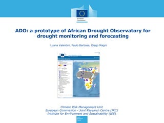
  • 1. ADO: a prototype of African Drought Observatory for drought monitoring and forecasting Climate Risk Management Unit European Commission - Joint Research Centre (JRC) Institute for Environment and Sustainability (IES) Luana Valentini, Paulo Barbosa, Diego Magni
  • 2. 2 ADO TEAM Part of the European Drought Observatory’s team European Commission Joint Research Centre Institute for Environment and Sustainability Climate Risk Management unit D. MagniL. ValentiniP. Barbosa A. De Jager J. Vogt C. Lavaysse G. Naumann H. Carrão C. Cammalleri F. Micale
  • 6. 6 SPI – Standardized Precipitation Index The standardized precipitation index was selected as a meteorological drought indicator. SPI is a transformation of the accumulated precipitation amount over a specific time period (typically 3, 6, and 12 months, denoted as SPI-3, SPI-6, and SPI-12, respectively) into a normal distribution of mean zero and standard deviation 1. The SPI is a measure of incoming precipitation deficiency, and many additional factors determine the severity of drought that ensues, if any (Lloyd-Hughes, 2013).
  • 7. 7 Seasonal Forecast Seasonal forecasting is an essential component of an early drought forecasting system that can provide advance warning and alleviate drought impacts. The ECMWF seasonal forecast system (System 4, hereafter S4) is used: a dynamical forecast system based on an atmospheric–ocean coupled model, which has been operational at ECMWF since 2011. S4 generates 51 ensemble members in real time, with 30 years (1981–2010) of back integrations (hindcasts) with 15 ensemble members and 6 months of lead time. The extension of the SPI from the monitoring period, i.e. past (can also be interpreted as initial conditions), to the seasonal forecast range is performed by merging the seasonal forecasts of precipitation with the monitoring product. The merging of the two products is basically a concatenation of the monitoring with the seasonal forecast of precipitation. SPI calculations are performed globally for each 1°× 1°grid cell.
  • 8. 8 Seasonal Forecast Probability Forecast: probability to have wet, normal or dry conditions for SPI using GPCC data as monitoring product merged with ECMWF S4 seasonal forecast model. When all the three probabilities are below 50% we consider that the forecast is uncertain. ECMWF seasonal forecasts System 4, based on an atmosphere-ocean coupled model, were used for the drought forecasting. SPI of the Ensemble Mean: SPI values computed with GPCC data as monitoring product merged with ECMWF S4 ensemble mean for the forecasted months.
  • 9. 9 fAPAR Anomaly Droughts affect the vegetation canopy and specifically its capacity to intercept solar radiation. By consequence, fAPAR and fAPAR Anomaly have been proposed as a drought indicators (Gobron et al. 2005 and 2007). ADO uses MODIS fAPAR standard product (MOD15A2) to derive (Brown and Meyer, 1961; Myneni et al., 2000) fAPAR anomalies and related maps every 10 days, with a baseline from March 2000 to December 2014. δ = standard deviation
  • 10. System architecture 10 vector data raster data Data stores FAO WMS Mapfile configuration JRC WMS .shp Oracle tables .png .tiff
  • 11. 11 Monitoring GPCC Precipitation ECMWF Precipitation, Soil Moisture and Temperature MODIS fAPAR anomaly JRC Drought Vulnerability, Risk and Hazard Background information (JRC, FAO) http://edo.jrc.ec.europa.eu/ado/ado.html
  • 12. 12 Forecast ECMWF Seasonal Forecast – SPI Probability (%) ECMWF Seasonal Forecast – SPI of the Ensemble Mean
  • 13. 13 Layer tree – context menu
  • 14. Layer tree – forecast starting date of forecast select timescale select month of forecast
  • 17. 17 Map Viewer functions - identify Monitoring Forecast
  • 18. 18 Drought news on map filter on drought related news GeoRSS http://emm.newsbrief.eu
  • 20. 20 EDO Map Viewer ADO-style refreshed EDO European Drought Observatory Implemented since 2008 First Map Viewer based on PHP MapScript
  • 21. 21 ADO as a template for implementing GDO GDO, Global Drought Observatory, a Drought Alert System for DG Echo Implementation started in Spring 2015 It aims to present red-yellow-green flags of drought risks that occur world-wide and related web tools to list, make graphs and analyze such events at country level
  • 22. 22 Additional functions available in EDO and GDO (1) The new Map Viewers of EDO and GDO have been implemented taking ADO as a template. But due to their specific needs, they come with some additional tools that are not enabled in ADO. Layer tree  Three-level hierarchy (group  subgroup  layer)  Multi-theme layers: selection of current theme from contextual menu  Change layer classification and legend from contextual menu  Trigger layer visualization in Google Earth from contextual menu Toolbar  Toggle Geographical Lat Lon Grid  Link to Compare Layers (four-map interface to check different indicators and dates in one go)  More Zoom To and Go To options  Toggle highlighted features
  • 23. 23 Additional functions available in EDO and GDO (2) Identify and similar  Alternative layout for Identify results  Additional graphs and analysis pop-ups triggered from Identify results Time series  Link to Unified Graph Creator (tool to make graphs of more indicators simultaneously) Alert tools (GDO, under implementation)  List of current drought risk alerts synchronized with the current map extent  Panel to present a selected drought alert in detail  Tool to deep the analysis of a drought alert at country level
  • 24. 24 Conclusions • The map viewer integrates drought monitoring and seasonal forecasting related information in an innovative approach for Africa. • The system can be considered as a pre-operational prototype, with a variety of tools and drought related products that are accessible to end users and stakeholders interested in drought information in Africa. • The new interface of ADO appears more visual attractive and more fast for end user than the previous one developed for EDO. Because of this and of its lighter structure, it has been adopted to refresh the EDO Map Viewer. • Also the implementation of GDO as a Drought Alert System for DG Echo has started taking ADO as a template for its web mapping functionalities.